 1.5Km
1.5Km
Note
 100m
150m
200m
250m
500m
1.1Km
2.5Km
2.9Km
3.1Km
100m
150m
200m
250m
500m
1.1Km
2.5Km
2.9Km
3.1Km
1.5Km
3.6Km
3.7Km
6.1Km
6.1Km
6.1Km
6.1Km
6.1Km
6.5Km
8.1Km
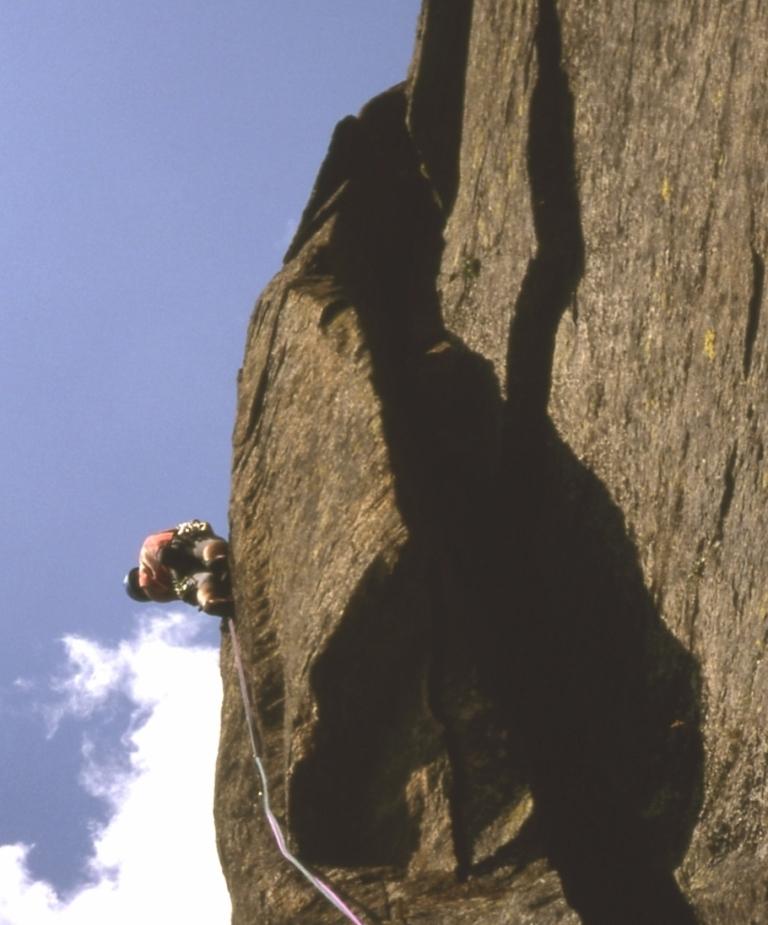
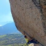
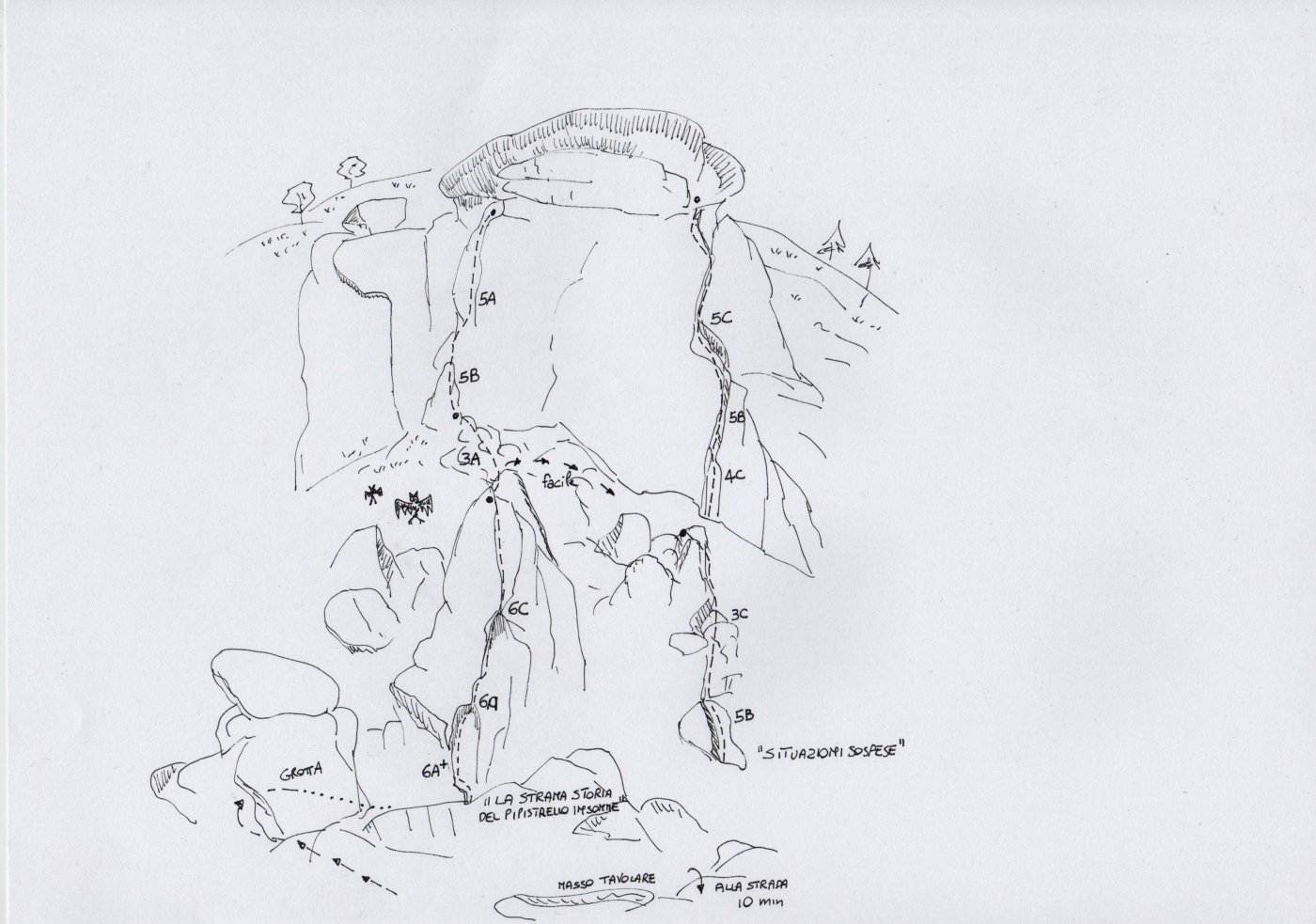
Due tiri con uscita off-width, situati a sinistra della via "Sulle spalle dell'orco".
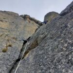
Attenzione a una grossa scaglia affilata poco stabile che non si è riusciti a rimuovere sulla seconda lunghezza.
Soste tutte da attrezzare, in posto non è stato lasciato nulla.
Friend fino al n°4-5 e 6 bd
Avvicinamento
Attenzione a una grossa scaglia affilata poco stabile che non si è riusciti a rimuovere sulla seconda lunghezza.
Soste tutte da attrezzare, in posto non è stato lasciato nulla.
Friend fino al n°4-5 e 6 bd
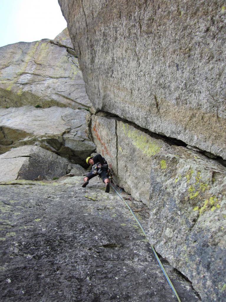
da frazione Pialpetta di Groscavallo seguire la strada asfaltata fino alla borgata Rivotti 1450 m (4 km), parcheggiando senza intralciare il passaggio. Dalle ultime case seguire il sentiero con segnavia bianco-rossi che passa vicino a un ripetitore e poi sale tra betulle e faggi, fino a innestresi nella sterrata proveniente da Rivotti. Seguire la strada lasciando il bacino dell'Alpetta ed entrando in quello del Sagnasse, delimitato sulla sponda dx idrografica dalla Costa di Pra longis. I Torrioni sono di qui visibilissimi. Dopo una "S" della carrareccia, individuare a bordo strada un ometto e abbandonarla per prati e vaccinieto, passando tra grandi e interessanti blocchi rocciosi (molti passaggi saliti ma non segnalati). Seguire degli ometti e attraversare il caotico ammasso di blocchi, guadagnando lo zoccolo detritico alla base dei Torrioni. Non salirlo seguendo gli ometti per l'attacco delle vie tracciate sulle pareti principali, ma piegare a destra in direzione degli affioramneti minori, incontrando un primo settore con fessure propedeutiche (varie possibilità dal 4c al 5c con discesa a piedi.) salire in direzione dell'affioramneto principale su ripido prato e guadagnare l'attacco della via
in corrispondenza di un camino inclinato ostruito da un blocco.
Descrizione
in corrispondenza di un camino inclinato ostruito da un blocco.
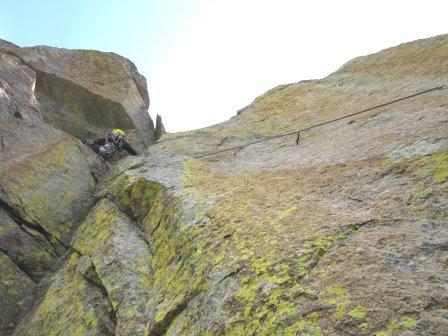
L1: 5c, diedro inclinato, fessura e placca
L2: 6a+, fessura camino ostica
Discesa a piedi
- Cartografia:
- Alta Valle dell'Orco - Escursionista e Monti editori
Nelle vicinanze Mappa
Itinerari
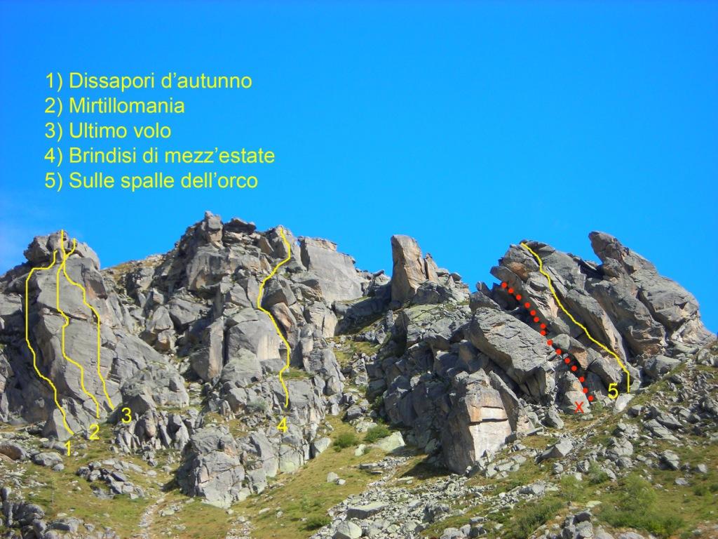
06/01/2015 TO, Groscavallo 6a, 6a obbl. Sud-Est
Prà Longis (Torrioni di) – New Life
 100m
100m
28/06/2025 TO, Groscavallo 7a, 6b obbl. Sud
Prà Longis (Torrioni di) – Mirtillomania
 150m
150m
26/09/2010 TO, Groscavallo 6b, 5c obbl. Nord
Prà Longis (Torrioni di) – Satelliti Sulle spalle dell’orco
 200m
200m
12/07/2020 TO, Groscavallo 5c, 5c obbl. Sud
Prà Longis (Torrioni di) – Zucchero e Mirtilli
 250m
250m
08/08/2012 TO, Groscavallo 6b, 6a obbl. Sud-Ovest
Prà Longis (Torrioni di) – Dissapori d’Autunno
 500m
500m
23/05/2026 TO, Groscavallo 7c+, 6b obbl., a1 Sud-Est
Pianou-Sagnasse, Masso del Pilonetto – Sagnasse’s Dream
 1.1Km
1.1Km
17/09/2023 TO, Groscavallo 6a+, 5c obbl., a2 Sud-Ovest
Prà Longis (Torrioni di) – Brindisi di Mezza Estate
 2.5Km
2.5Km
30/09/2017 TO, Groscavallo 3, 6b obbl. Nord-Ovest
Ceresin (Bec) – On the Way to Julia
2.6Km
15/07/2015 TO, Groscavallo 6c, 6a obbl. Sud
Prà Longis (Torrioni di), Wile Coyote – La Strana Storia dell’Insonne Pipistrello
 2.9Km
2.9Km
04/11/2013 TO, Groscavallo 6b+, 6a obbl., a2 Nord
Gran Bernardè (Monte) Parete OSO – Profetiche idiozie
 3.1Km
3.1Km
Servizi
1.5Km
3.6Km
Setugrino Albergo
Groscavallo
3.7Km
Daviso Rifugio
Groscavallo
6.1Km
Chalet del lago Albergo
Ceresole Reale
6.1Km
Sport Albergo
Ceresole Reale
6.1Km
Tre Levanne Albergo
Ceresole Reale
6.1Km
Lo stambecco Ristorante
Ceresole Reale
6.1Km
Bianchetti Ristorante
Ceresole Reale
6.5Km
Lu Sciale Rifugio
Groscavallo
8.1Km