1.6Km
1.6Km
Note
 50m
50m
50m
1.7Km
1.7Km
1.7Km
1.7Km
2.2Km
2.3Km
50m
50m
50m
1.7Km
1.7Km
1.7Km
1.7Km
2.2Km
2.3Km
1.6Km
1.7Km
2.1Km
2.3Km
2.3Km
2.6Km
3.3Km
3.5Km
3.6Km
3.6Km
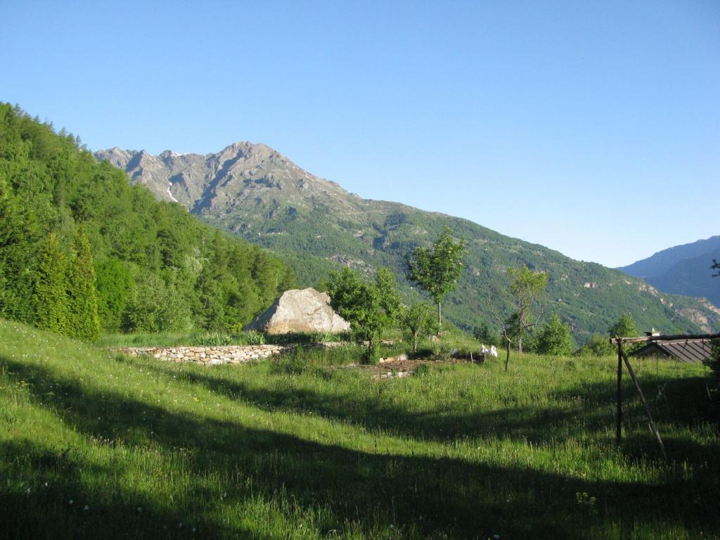
L’escursione proposta prevede la salita all’alpeggio Pianello, posto poco sotto la dorsale che va dal Gregorio alla Bonze, nel versante dx org del fondovalle VdA, passando da S.M. Maddalena e rientrando da Feipiano.
Escursione porta a visitare borghi e alpeggi quasi tutti ben ristrutturati e posti su pianori panoramici, percorrendo tratti di belle mulattiere, tratti di sterrato, sentieri ben tracciati e solo in qualche punto occorre porre un minimo di attenzione per seguire il percorso ottimale.
Buono il dislivello complessivo 1400m, buono lo sviluppo sui 15-16Km, tempo medio 7-8h; ottimi i panorami.
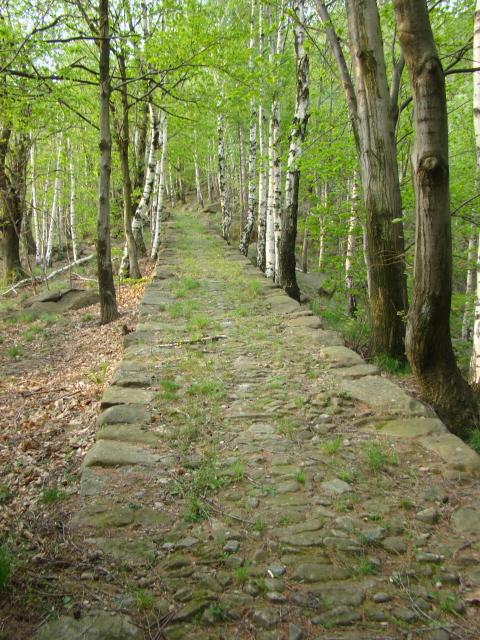
Anello caratterizzato da un primo tratto di percorso escursionistico su bella mulattiera lastricata (tracciato della corsa Tavagnasco - S.M. Maddalena ai Piani), il tratto intermedio su sentiero nel bosco, una lunga salita e traverso su poderale, rientro su tratto di sentiero e successivamente su una lunga e ben conservata mulattiera.
Avvicinamento
Escursione porta a visitare borghi e alpeggi quasi tutti ben ristrutturati e posti su pianori panoramici, percorrendo tratti di belle mulattiere, tratti di sterrato, sentieri ben tracciati e solo in qualche punto occorre porre un minimo di attenzione per seguire il percorso ottimale.
Buono il dislivello complessivo 1400m, buono lo sviluppo sui 15-16Km, tempo medio 7-8h; ottimi i panorami.
Anello caratterizzato da un primo tratto di percorso escursionistico su bella mulattiera lastricata (tracciato della corsa Tavagnasco - S.M. Maddalena ai Piani), il tratto intermedio su sentiero nel bosco, una lunga salita e traverso su poderale, rientro su tratto di sentiero e successivamente su una lunga e ben conservata mulattiera.
Per la statale si raggiunge Settimo Vittone si svolta per Tavagnasco; si passa il sottopasso dell’autostrada e si può parcheggiare nei pressi del pannello illustrativo della corsa podistica. Per evitare 150 m di dislivello si può seguire in macchina in salita per via Ailaro fino alla chiesa di San Bernardo (ampio parcheggio).
Descrizione
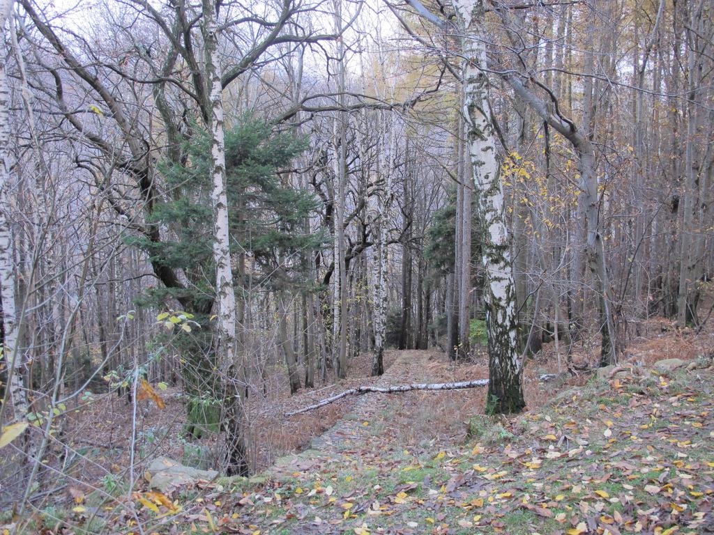
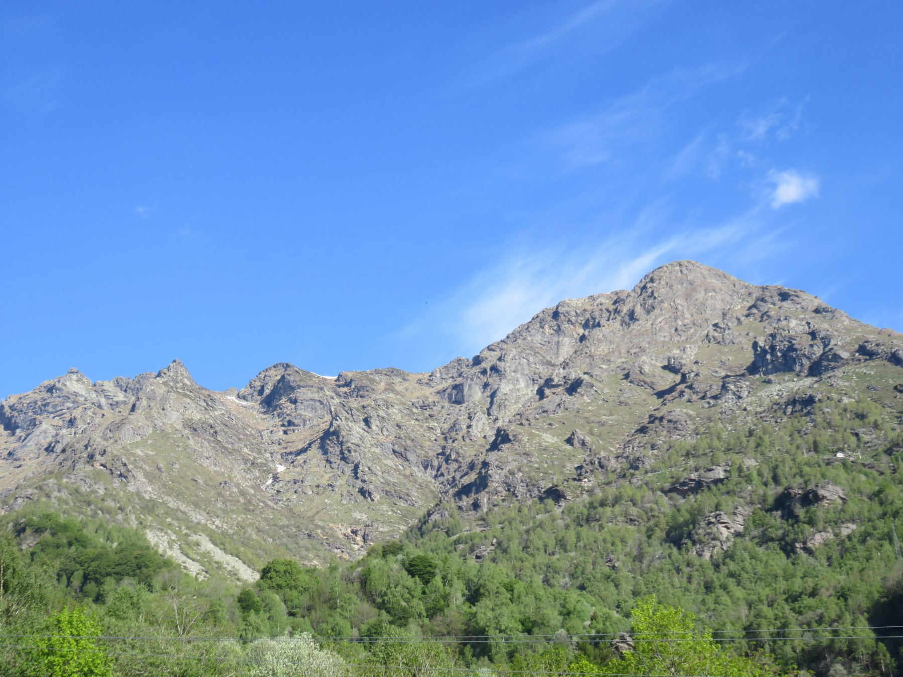
Si sale su strada per via Ailaro mantenendo sempre la direzione di salita sino trovare (a sx) il primo tratto di mulattiera B2 e di li a poco si raggiunge la chiesa di San Bernardo 409m dove si procede sulla mulattiera che parte sul lato dx della chiesa (trascurando il ponticello da cui si giungerà al ritorno del percorso) sotto alla struttura della vasca d’acqua con segnavia b/r (e frecce bianche a terra – segnavia della corsa) salendo attraverso il bosco di betulle sino ad attraversare un paio di volte la strada e giungere nei pressi della miniera 715m dove occorre salire per il ripido sentiero a ampi gradoni che la percorre lasciandola a dx.
Superato questo tratto termina la mulattiera e si procede su sentiero ben evidente sino ad uscire dal bosco in località Piavonetto 870m dove bisogna lasciare le case sulla sx e individuare il sentiero che prosegue in salita (se si seguono alcuni segni b/r portano a superare le case sulla dx e salire la strada dove occorrerà giunti alla seconda cura a sx 960m abbandonare la strada per passare oltre le due belle baite ristrutturate e riprendere il sentiero nel bosco).
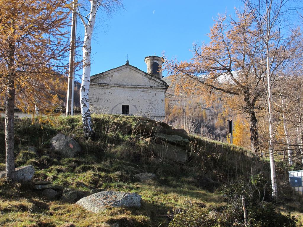
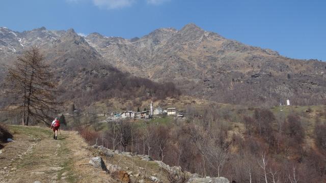
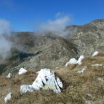
Si giunge comunque a Oviglio 1037m e successivamente Usseglio 1097m (seguire le frecce bianche a terra) e dopo un breve tratto su strada si raggiunge la chiesa di S.M. Maddalena 1337m (dove finisce il percorso della corsa). Si risale il prato (a dx o sx si arriva comunque ad una stalla (in prefabbricato) dove occorre proseguire e superata di poco si risale a sx sullo sterrato (trascurando il proseguimento dritto) e con un lungo tratto ad ampie svolte si giunge a quota 1681m dove si deve procedere a dx dir nord (trascurando la salita a sx dir sud che porta alla Grangia Reali). Si percorre ora un ampio traverso aperto e panoramico che porta all’Alpe Pianello 1709m e alla elevazione rocciosa 1714m posta sulla dx dello sterrato (buon punto per una pausa e meta della escursione).
Ridiscesi dalla elevazione si procede a dx (sempre dir nord) e su tracce si arriva Barzino inf 1605m gruppo tre baite in linea più una scostata a dx, più sotto al roccione (dall’alpe Pianello si potrebbe seguire ancora lo sterrato che fa un percorso di poco più ampio e porta comunque alle baite Barzino inf 1605m).
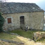
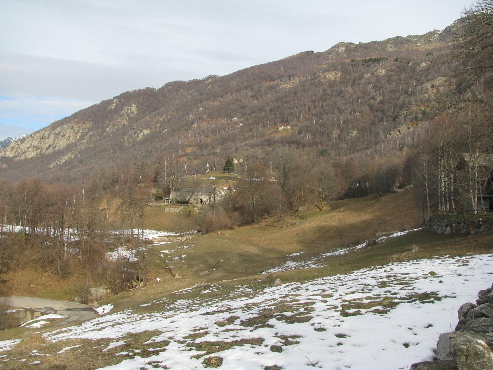
Raggiunta la baita più isolata si scende su lieve traccia (tacche blu) che diviene ben presto sentiero a raggiungere una baita a 1515m, che si supera tenendosi alla dx, e raggiunta quella a 1465m, si passa alla dx e si prosegue ora nel bosco sino a raggiungere la strada sottostante 1390m; percorrendone un breve tratto si raggiunge un pendio con due baite una poco sopra dell’altra, alpeggio Letola 1400m la più bassa è ottimamente ristrutturata (bella meridiane e bello anche il barbecue) superate le quali (sul lato opposta da dove si arriva) si trova il sentiero che entra nel bosco e scende velocemente alla regione Feipiano 1175m (belle case ristrutturate notevoli i camini, anche se in chiave moderna).
Superato il gruppo di case proseguendo sulla strada, tenendo la sx, all’ultima baita a quota 1126m si riprende a dx il sentiero che ben presto diviene mulattiera (B2) ampia e con pendenza marcata, (un capolavoro) senza incertezze (tagliando quattro o cinque volte lo sterrato) ci porterà a raggiungere il ponticello a quota 409m al piazzale della chiesa di San Bernardo dove si richiude l’anello e si rientra a Tavagnasco all’auto.
- Cartografia:
- Carta della Valle Dora Baltea Canavesana n.02 1/20000 ed:MUedizioni
Nelle vicinanze Mappa
Itinerari
24/03/2012 TO, Tavagnasco D+ 1400 m EE Est
Scalaro (Frazione) da Tavagnasco, anello per la Sbianca
 50m
50m
27/11/2018 TO, Tavagnasco D+ 1200 m EE Nord-Est
Colme (le) e Monte Cavallaria da Tavagnasco
 50m
50m
13/05/2011 TO, Tavagnasco D+ 1710 m E Sud-Est
Biolley (Cima) o Drosit da Tavagnasco, anello per Punta di Pian dei Francesi e Punta del Pianello
 50m
50m
20/09/2025 TO, Quincinetto D+ 1850 m EE Est
Vallone (Cima del) da Quincinetto, anello
 1.7Km
1.7Km
25/04/2024 TO, Quincinetto D+ 582 m E Nord-Est
Santa Maria da Quincinetto
 1.7Km
1.7Km
05/07/2020 TO, Quincinetto D+ 2000 m EE Sud-Est
Renon (Bec) da Quincinetto per Scalaro
 1.7Km
1.7Km
01/07/2018 TO, Quincinetto D+ 2400 m EE/F Tutte
Bonze (Cima) da Quincinetto, anello per Cima Vallone, Punta Cavalcurt, Cima Battaglia
1.7Km
11/11/2023 TO, Quincinetto D+ 1150 m E Nord-Est
Scalaro (Frazione) da Quincinetto
 1.7Km
1.7Km
11/05/2025 TO, Settimo Vittone D+ 900 m E Sud
Guarda (Monte) da Settimo Vittone, anello per Cesnola, Chiaverina, Valcauda
 2.2Km
2.2Km
22/03/2014 TO, Settimo Vittone D+ 1000 m EE Sud
Cassie (Monte delle) da Settimo Vittone
 2.3Km
2.3Km
Servizi
1.6Km
1.7Km
5inchetr3eut (ex La Quiete) Ristorante
Quincinetto
2.1Km
Tripoli Albergo
Settimo Vittone
2.3Km
La sosta Ristorante
Settimo Vittone
2.3Km
La conca verde Ristorante
Settimo Vittone
2.6Km
Santa Maria Ristorante
Quincinetto
3.3Km
Vertical Rock Ristorante
Settimo Vittone
3.5Km
Merenda Sinoira Ristorante
Settimo Vittone
3.6Km
Il ponte Bar
Quassolo
3.6Km