5.1Km
5.1Km

Note
 600m
4.5Km
4.5Km
4.6Km
5.4Km
5.5Km
5.5Km
5.5Km
5.7Km
5.7Km
600m
4.5Km
4.5Km
4.6Km
5.4Km
5.5Km
5.5Km
5.5Km
5.7Km
5.7Km
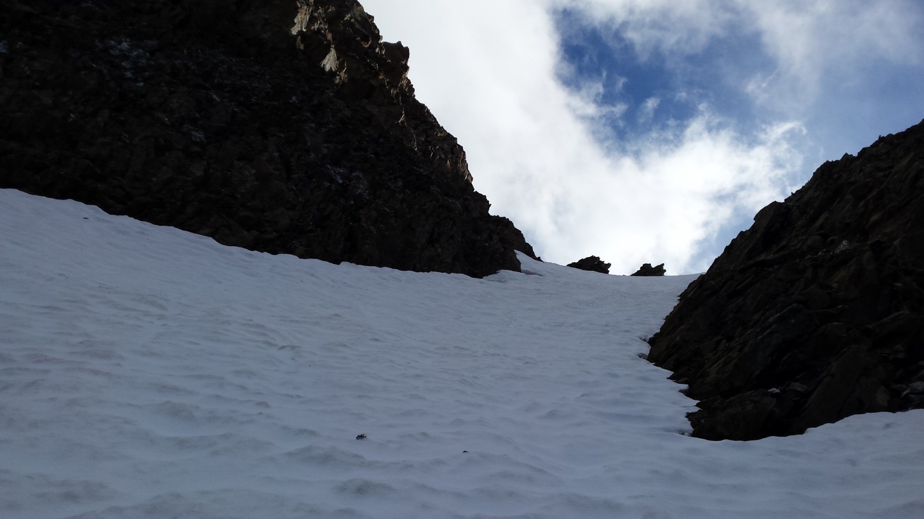
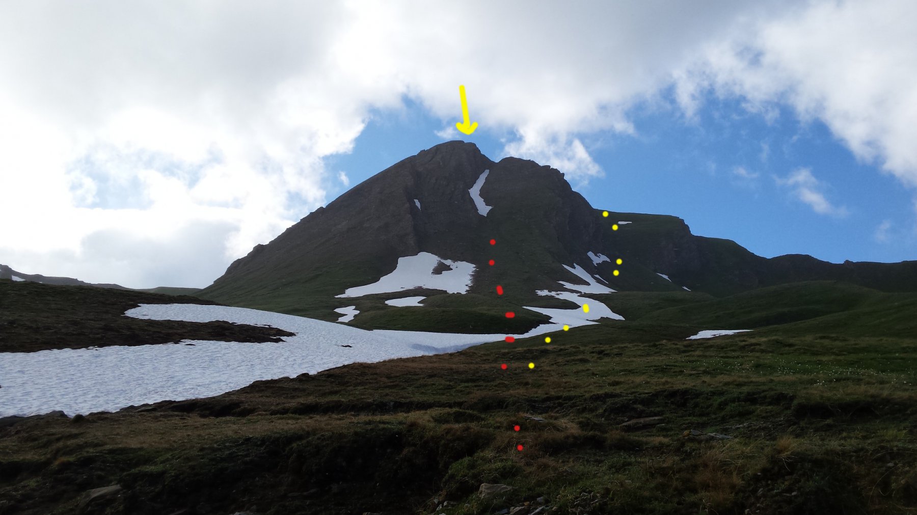
Percorso in cui la massima difficoltà (il canale) va intrapreso con prudenza ...anche in condizioni asciutte a causa della ripidità , il fondo erboso e scivoloso e una lieve esposizione (possono risultare utili i ramponi).
Avvicinamento
In direzione del Piccolo S. Bernardo, poco prima dell'abitato di Pont Serrand, svoltare a destra e su strada asfaltata x tre km fino a divieto.(alpe Orgere)
Descrizione
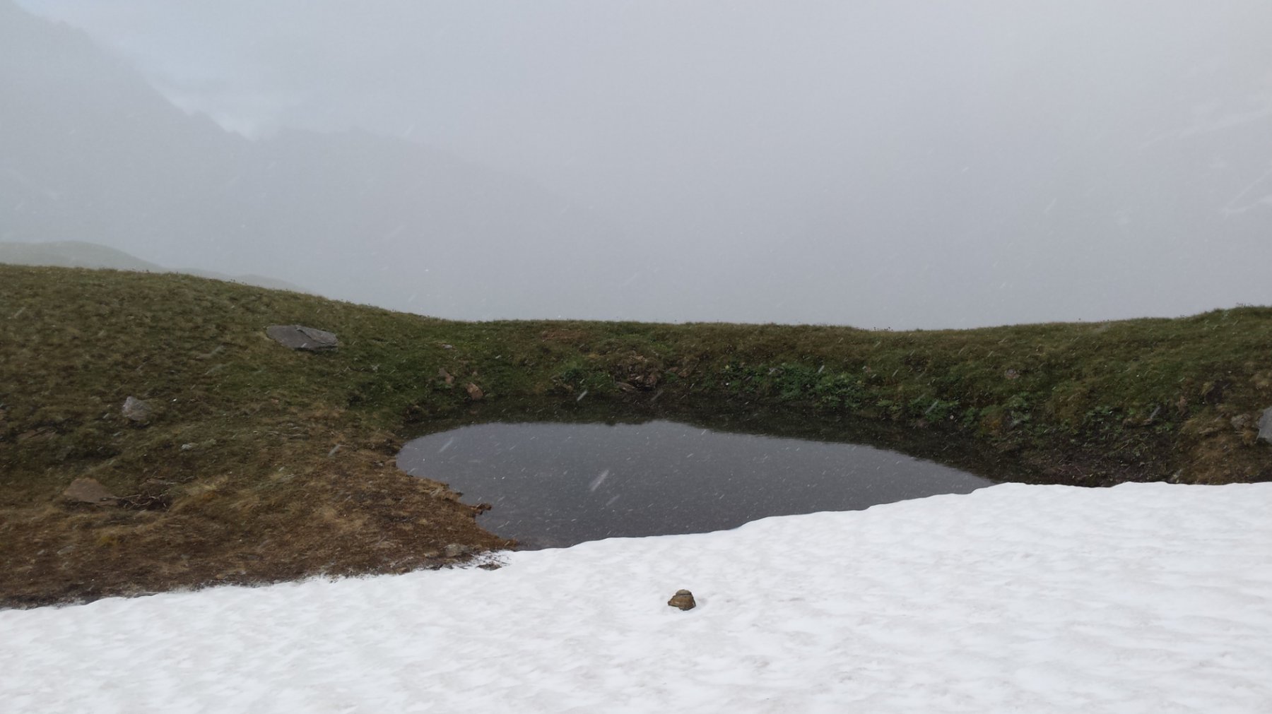
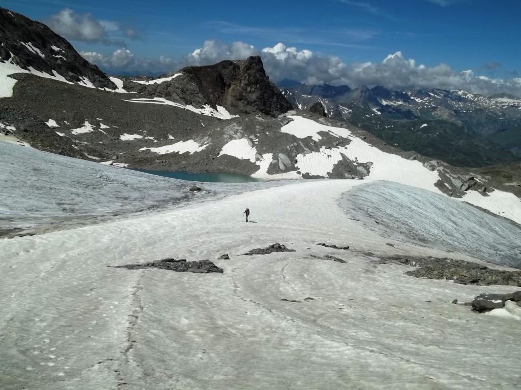
Su Strada sterrata inoltrarsi nel lungo vallone di Chavannes .
Giunti ad un bivio, salire a destra e dopo due ampi tornanti si perviene all’alpe di Chavannes di sopra (2421 m). Salire ora i pascoli soprastanti con direzione nord, puntando alla cima già ben visibile.
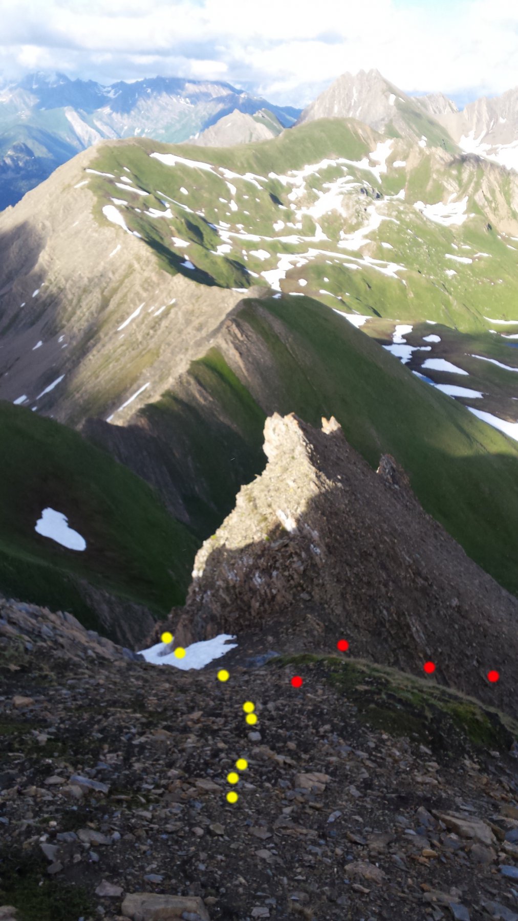
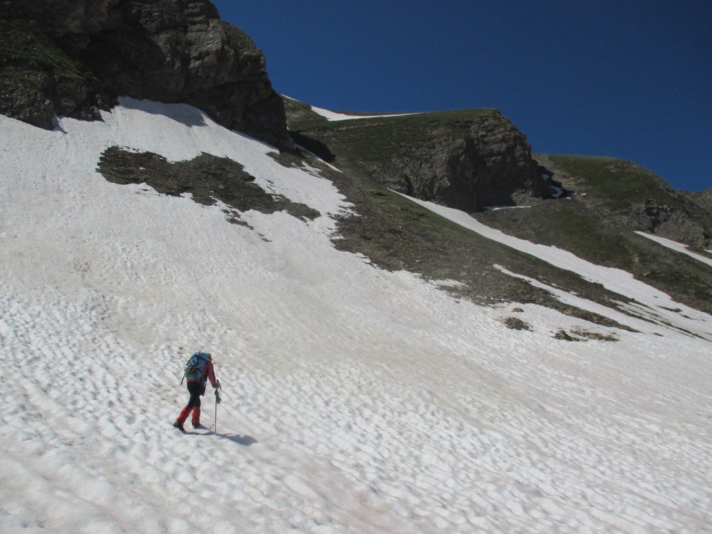
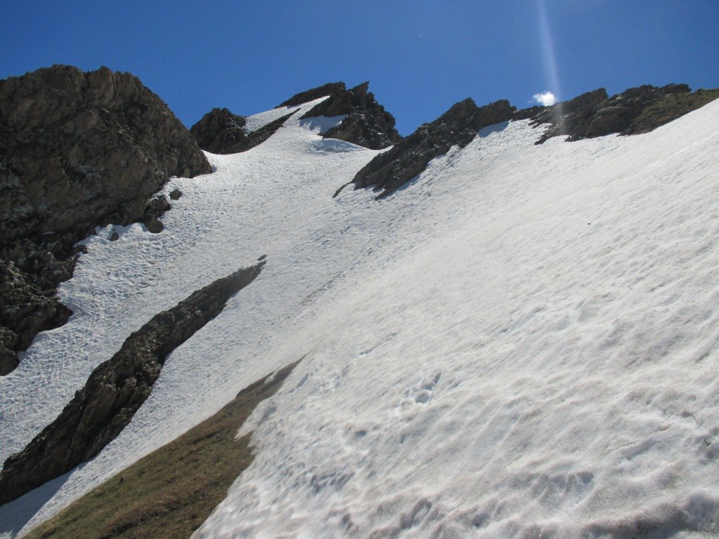
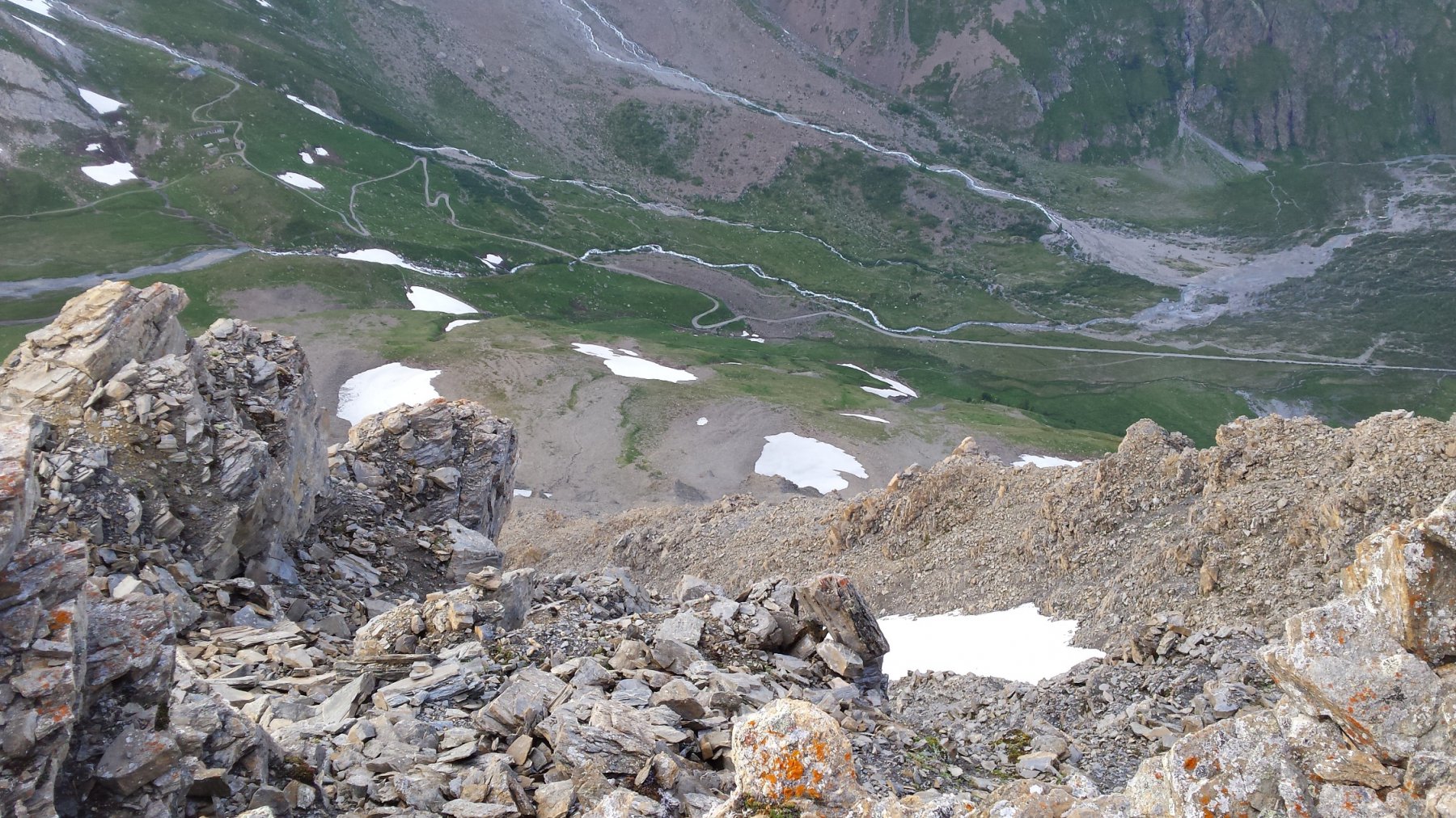
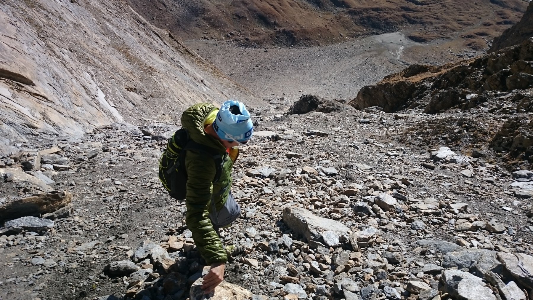
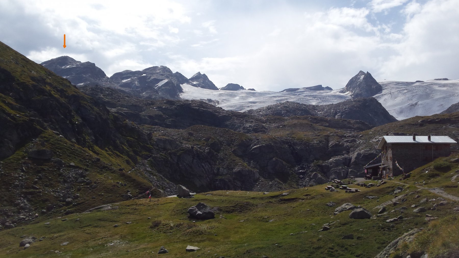
Dopo una serie di avvallamenti si arriva sotto la montagna e si inizia a salire sfruttando un cono detritico / erboso ripido. Il canale si impenna ulteriormente e diventa piu stretto e vicino alle rocce. In prossimità di una fascia rocciosa si passa sul fianco destro e sempre con tratto ripido si punta alla cresta est.
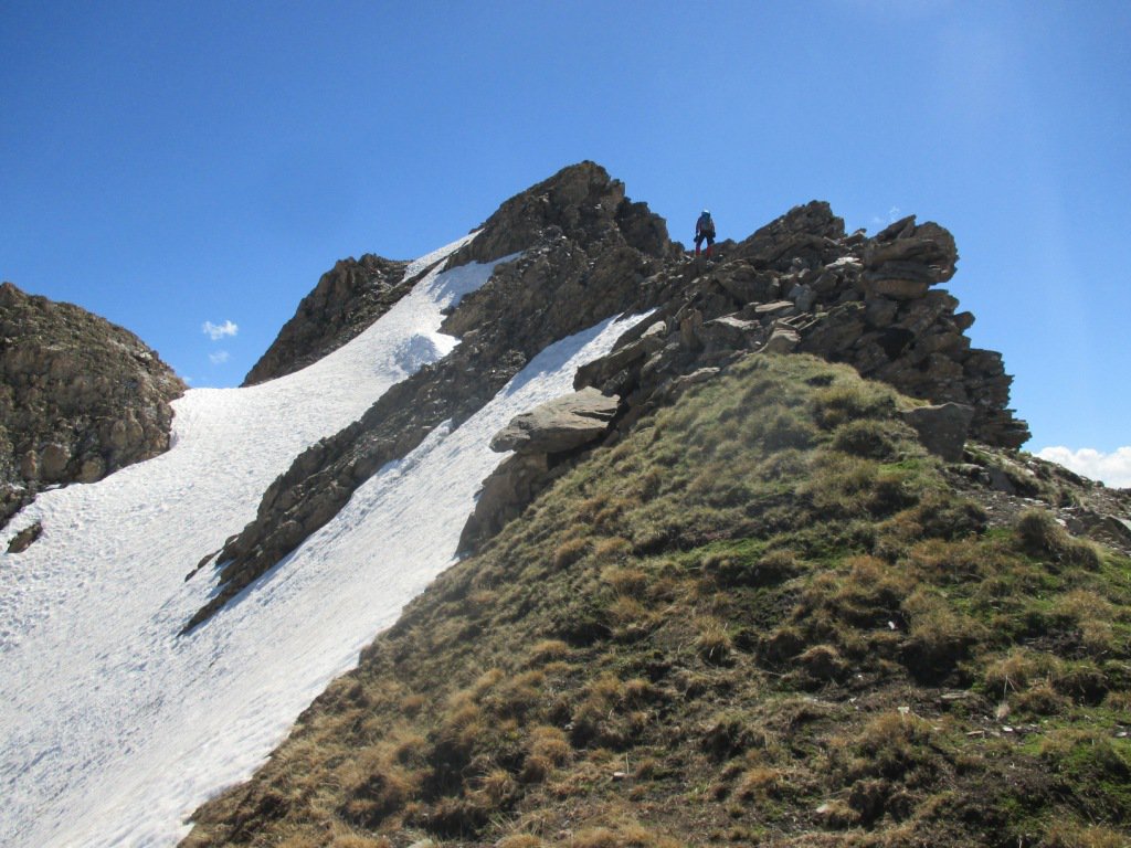
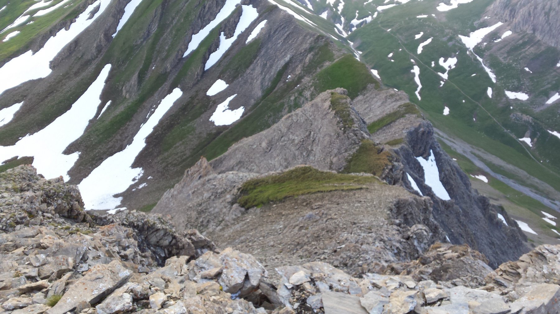
Usciti in cresta con facili passaggi si punta verso ovest a sinistra e dopo breve tratto di rocce instabili si arriva in vetta.
- Cartografia:
- Carta Kompass 1 : 50000 N° 85
Nelle vicinanze Mappa
Itinerari
26/06/2021 AO, La Thuile D+ 1352 m PD+ Sud-Est
Berrio Blanc (Monte) Pendio/Canale SE da Monquet
 600m
600m
06/08/2024 AO, La Thuile D+ 1700 m PD- Tutte
Grand Assaly Via Normale da La Joux
 4.5Km
4.5Km
28/07/2024 AO, La Thuile D+ 2000 m F Nord
Rutor (Testa del) Via Normale da La Joux per il Rifugio Deffejes
 4.5Km
4.5Km
19/08/2016 AO, La Thuile D+ 937 m F Varie
Veys (Aiguille des) da Lago Verney, per i Ghiacciai di Hermite e Arguerey
 4.6Km
4.6Km
16/08/2023 AO, La Thuile D+ 1800 m F+ Varie
Paramont (Mont) Via Normale da la Joux
 5.4Km
5.4Km
21/08/2025 AO, La Thuile D+ 1750 m F Nord-Ovest
Paramont (Becca Bianca del) Via Normale da La Joux per il Rifugio Deffeyes
 5.5Km
5.5Km
24/09/2023 AO, La Thuile D+ 1650 m F Nord-Est
Chenal (Punta) da la Joux per il Rifugio Deffeyes
 5.5Km
5.5Km
09/08/2011 AO, La Thuile D+ 1800 m PD- Nord-Ovest
Flambeau per il versante Nord-Ovest
 5.5Km
5.5Km
14/08/2025 AO, La Thuile D+ 1580 m F Varie
Paramont (Testa del) da La Joux per il Rifugio Deffeyes
 5.7Km
5.7Km
21/07/2019 AO, La Thuile D+ 2000 m PD Varie
Doravidi (Monte, Punta Nord) e Flambeau traversata sud/nord
 5.7Km
5.7Km