 2.5Km
2.5Km
Note
 450m
3Km
3.1Km
3.1Km
4Km
4Km
4Km
4Km
450m
3Km
3.1Km
3.1Km
4Km
4Km
4Km
4Km
2.5Km
2.8Km
4.8Km
5.4Km
5.4Km
5.5Km
6.7Km
7.9Km
7.9Km
8Km
Cima di Nonassa 2323 m
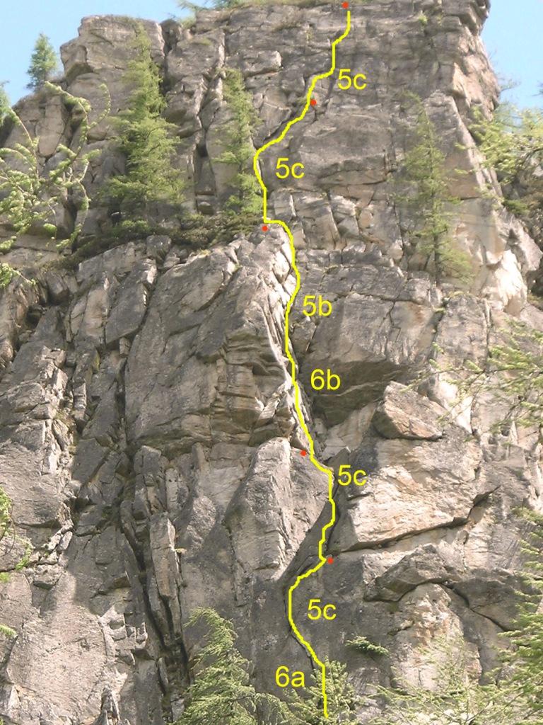
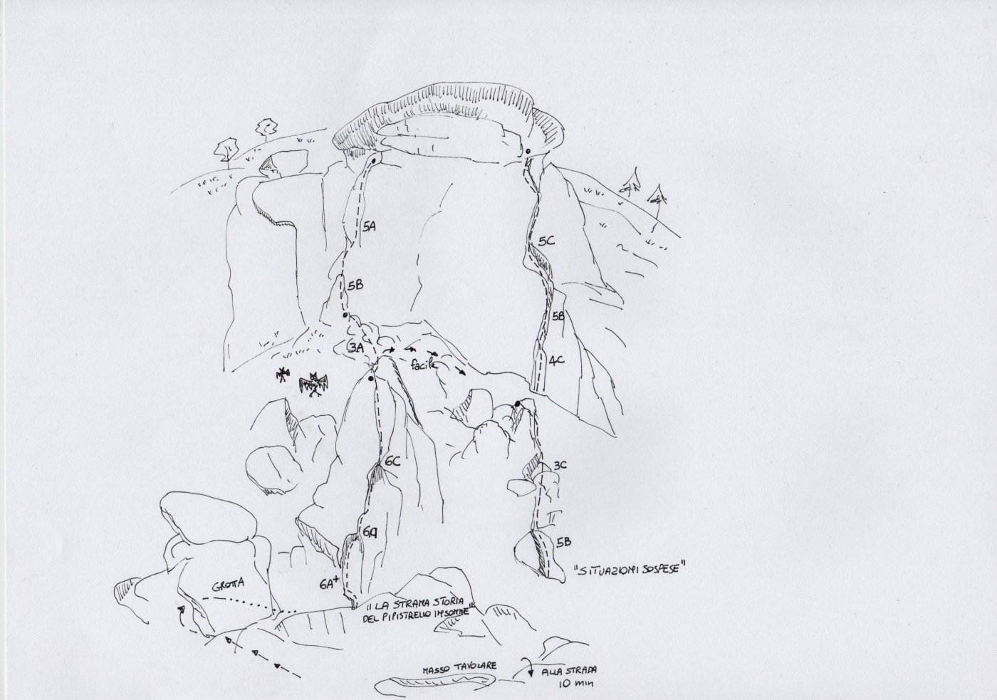
Seconda linea su questa struttura, con alcuni tiri veramente belli, ma con roccia purtroppo un pò da pulire
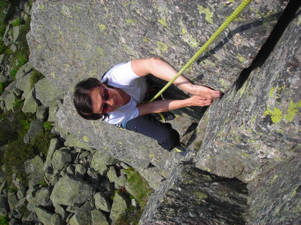
Avvicinamento
Seconda linea su questa struttura, con alcuni tiri veramente belli, ma con roccia purtroppo un pò da pulire
.
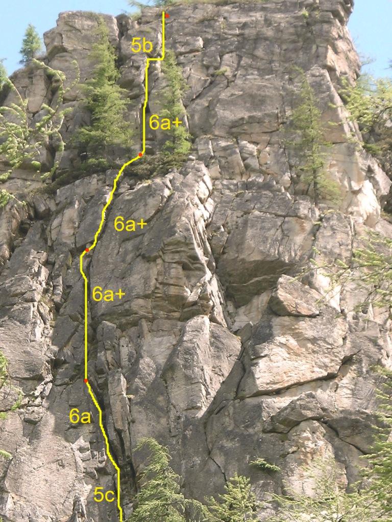
Descrizione
L1: camino iniziale faticoso 5c, poi diedro 6a
L2:fessure larghe e poi strozzatura 6a+
L3: dulfer in continuità 6a+
L4: diedro e lame 6a
- Cartografia:
- IGC serie Monti 103
Nelle vicinanze Mappa
Itinerari
27/05/2010 TO, Groscavallo 6b, 6a obbl. Nord-Ovest
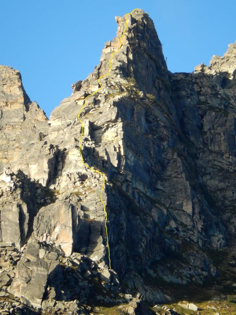
Nonassa (Cima di), sperone NO – Via del Trad-imento
 450m
450m
30/09/2017 TO, Groscavallo 3, 6b obbl. Nord-Ovest
Ceresin (Bec) – On the Way to Julia
1.7Km
17/09/2023 TO, Groscavallo 6a+, 5c obbl., a2 Sud-Ovest
Prà Longis (Torrioni di) – Brindisi di Mezza Estate
 3Km
3Km
15/07/2015 TO, Groscavallo 6c, 6a obbl. Sud
Prà Longis (Torrioni di), Wile Coyote – La Strana Storia dell’Insonne Pipistrello
 3.1Km
3.1Km
14/11/2015 TO, Groscavallo 7a, 6a obbl. Ovest
Mezzodì (Bec di), Torrione di Iride 2130 m – Sperone Ovest
 3.1Km
3.1Km
12/08/2011 TO, Groscavallo 6a+, 6a+ obbl. Sud-Est
Prà Longis (Torrioni di) – Satelliti Il raglio delle giubbe rosse
3.9Km
06/01/2015 TO, Groscavallo 6a, 6a obbl. Sud-Est
Prà Longis (Torrioni di) – New Life
 4Km
4Km
16/10/2025 TO, Groscavallo 7a+, 6a+ obbl. Nord-Ovest
Mea (Bec di) – La Roccia dei Padri
 4Km
4Km
12/07/2020 TO, Groscavallo 5c, 5c obbl. Sud
Prà Longis (Torrioni di) – Zucchero e Mirtilli
 4Km
4Km
28/06/2025 TO, Groscavallo 7a, 6b obbl. Sud
Prà Longis (Torrioni di) – Mirtillomania
 4Km
4Km
Servizi
2.5Km
2.8Km
Setugrino Albergo
Groscavallo
4.8Km
Lu Sciale Rifugio
Groscavallo
5.4Km
Maronero Ristorante
Ala di Stura
5.4Km
corbassera Ristorante
Ala di Stura
5.5Km
Daviso Rifugio
Groscavallo
6.7Km
Il Corvo Reale Ristorante
Chialamberto
7.9Km
Camussot Albergo
Balme
7.9Km
Les Montagnards Albergo
Balme
8Km