 3.5Km
3.5Km
Avvicinamento
 50m
3.2Km
8.2Km
8.2Km
8.2Km
12.5Km
50m
3.2Km
8.2Km
8.2Km
8.2Km
12.5Km
.
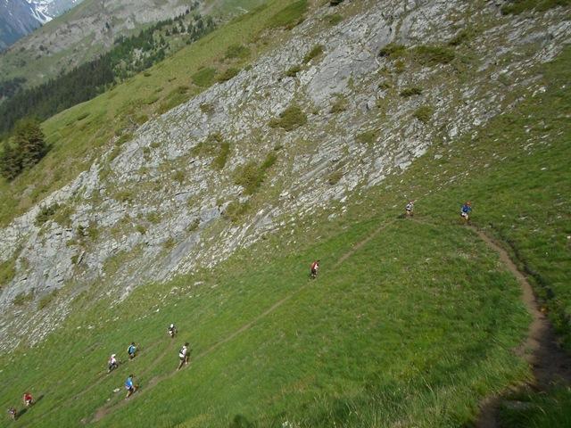
Descrizione
20 km – 1230 dislivello
Morgex verso Dailley con strada sterrata della collina per prendere sentiero direzione nord per alp. liconi,qui traversare verso capanna chambave e prendere sentiero in direzione sud verso piginiere poi cheverel, remondey e morgex
50 km – 3670 dislivello
Morgex – Monte Liconi – Courmayeur – Colle Arp – La thuile – Petosan – Morgex
100 km – 5600 dislivello
MORGEX -PRE SAINT DIDIER–ARPY–COLLE CROCE–RIF.DEFFEYES–LA THUILE–COLLE DELL’ARP–COURMAYEUR–COLLE LICONY–PLANAVAL–PT.FETITA–MORGEX
- Cartografia:
- 50.000 N.BIANCO KOMPAS
Nelle vicinanze Mappa
Itinerari
07/06/2025 AO, Morgex D+ 3200 m Tutte
Licony trail
 50m
50m
21/08/2022 AO, La Salle D+ 3000 m Nord-Est
Passo Alto, Planaval, Crosatie, (Colli) da Chabodey, anello
 3.2Km
3.2Km
11/10/2025 AO, Courmayeur D+ 1400 m Nord
Tronche (Testa della) Arrancabirra di Courmayeur
 8.2Km
8.2Km
12/09/2025 AO, Courmayeur D+ 10000 m Tutte
Tor Des Glaciers
8.2Km
01/09/2020 AO, Courmayeur D+ 10000 m Tutte
Tor des Geants
 8.2Km
8.2Km
10/07/2010 AO, Courmayeur D+ 5100 m Tutte
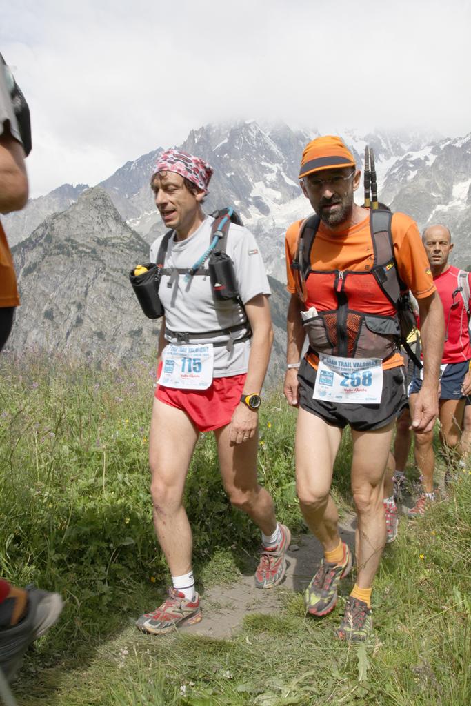
GTV Gran Trail Valdigne
 8.2Km
8.2Km
28/06/2020 AO, Courmayeur D+ 2350 m Varie
Crammont (Mont) da Dolonne, giro
8.6Km
17/01/2009 AO, Courmayeur D+ 180 m Varie
Lavachey Winter Eco Trail da Planpincieux
10Km
20/08/2014 AO, La Thuile D+ 1200 m Nord
Deffeyes Albert (Rifugio) da la Thuile
10.5Km
05/07/2015 AO, La Thuile D+ 800 m Sud
Chavannes (Col de) da Porassey per il Vallon de Chavannes
 12.5Km