750m
750m
Note
 200m
200m
200m
300m
350m
550m
550m
600m
1.1Km
1.7Km
200m
200m
200m
300m
350m
550m
550m
600m
1.1Km
1.7Km
750m
750m
1.2Km
3.2Km
3.9Km
4.1Km
4.1Km
5.2Km
5.4Km
6.9Km
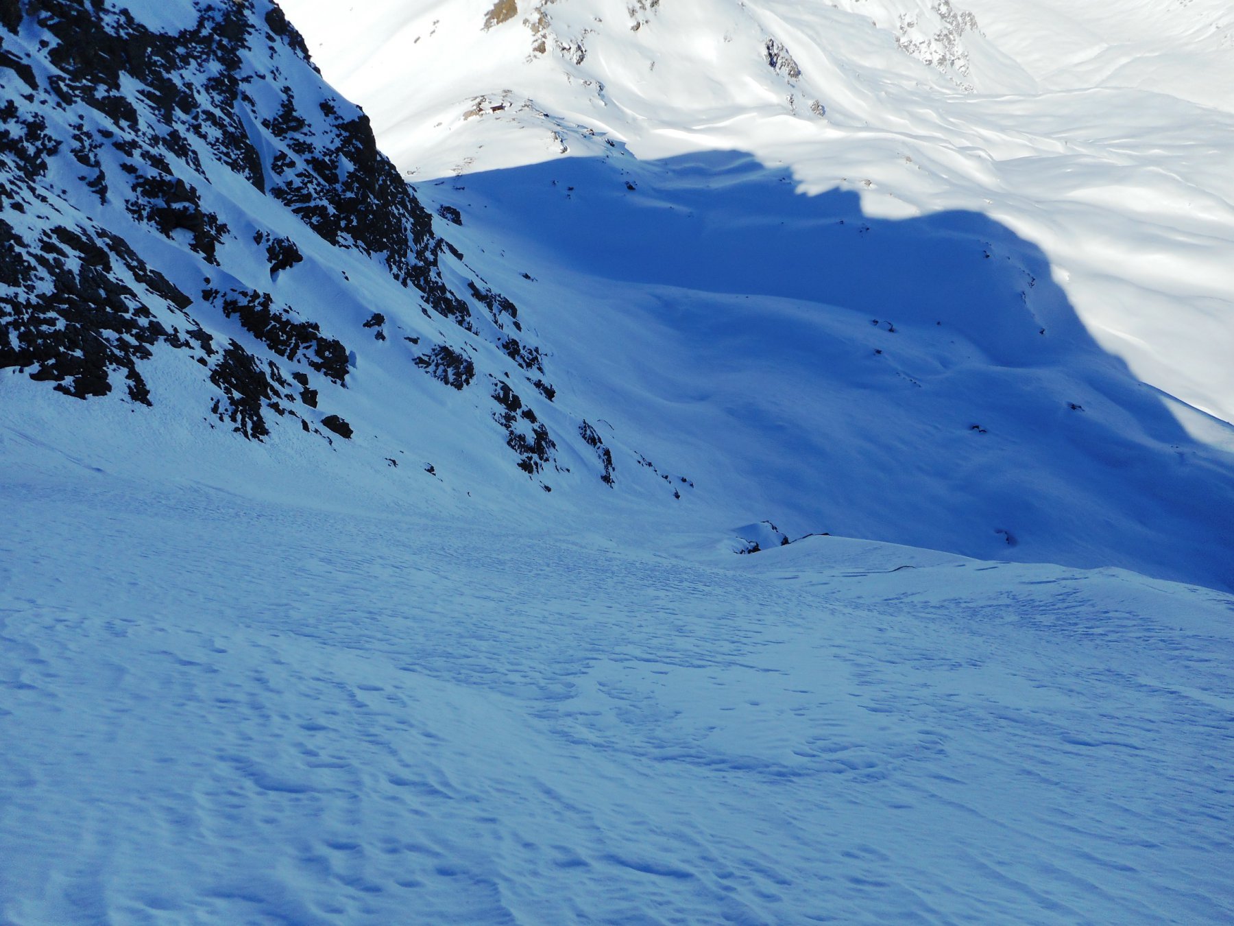
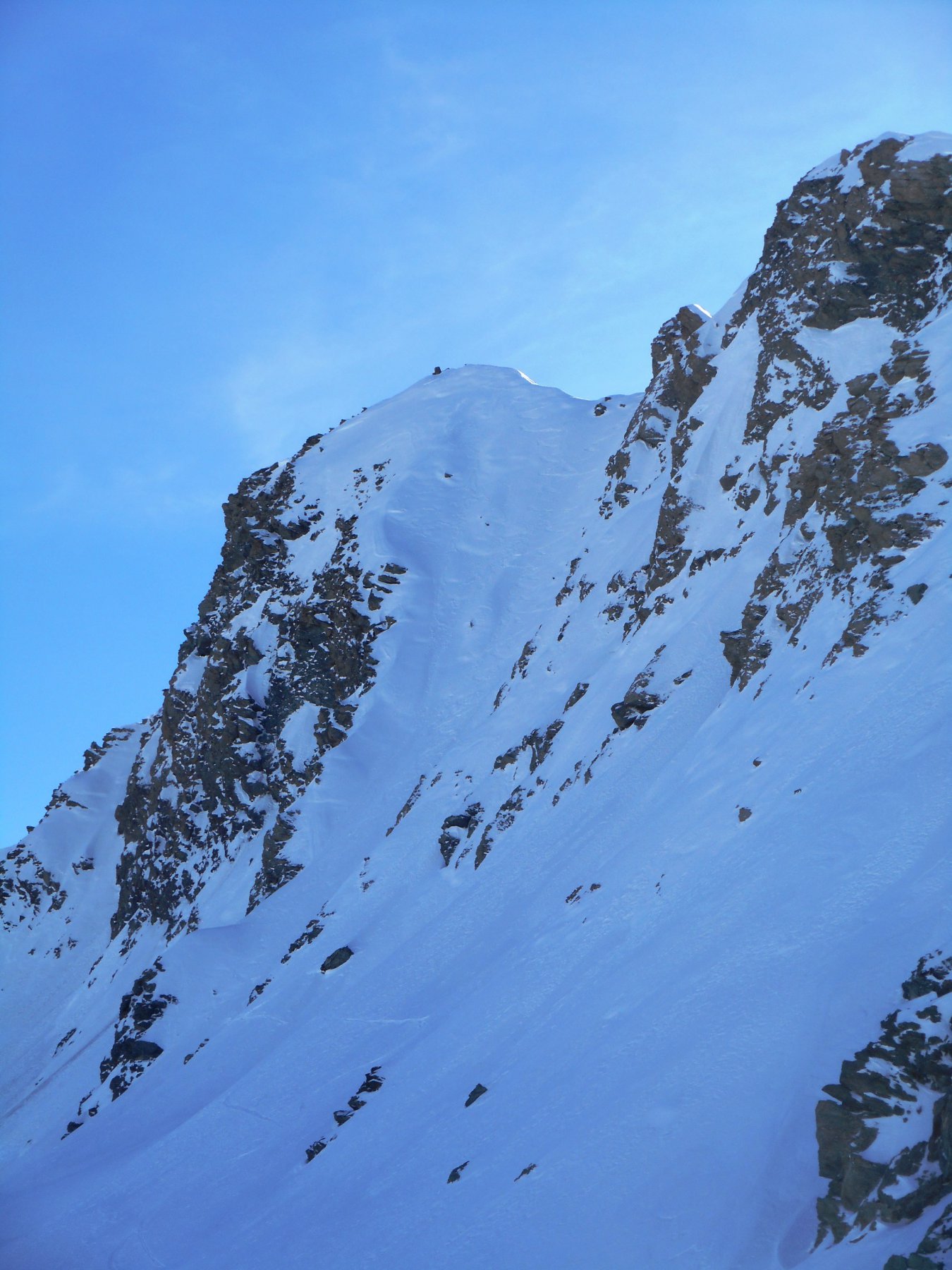
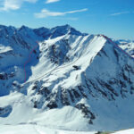
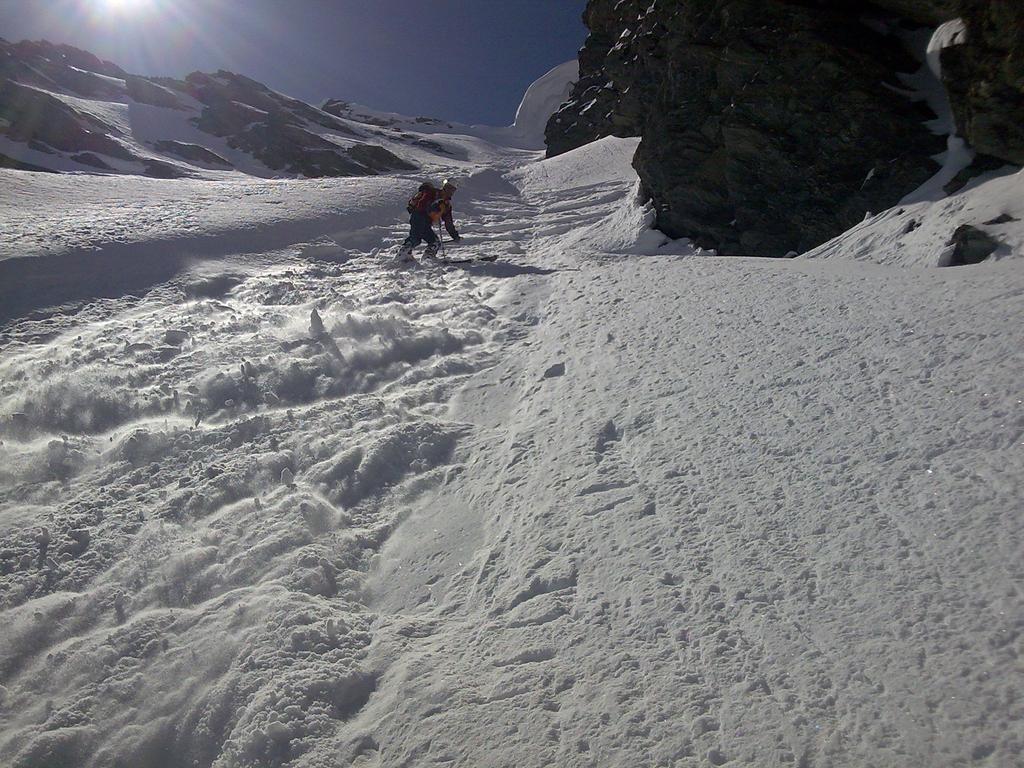
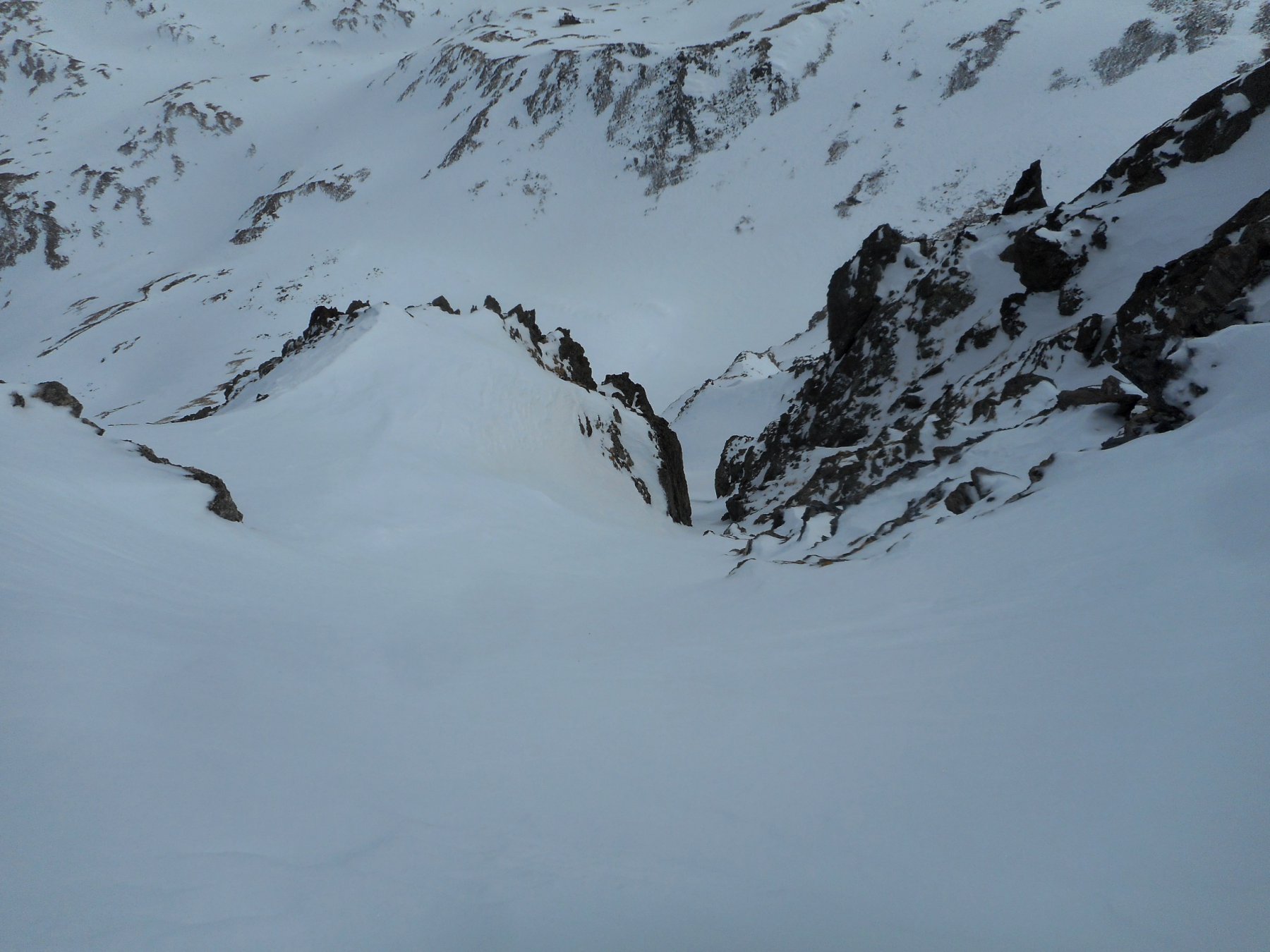
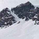
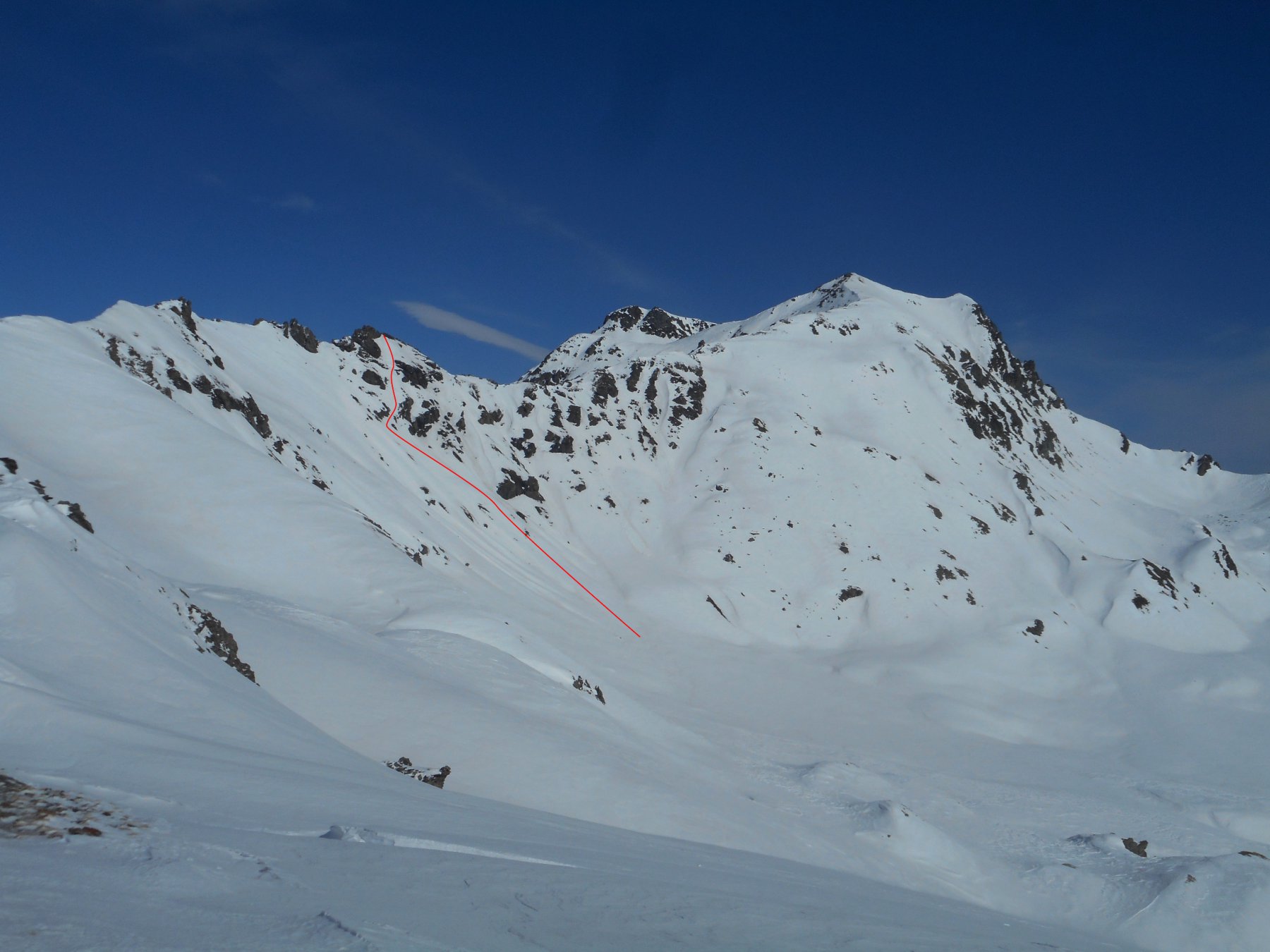
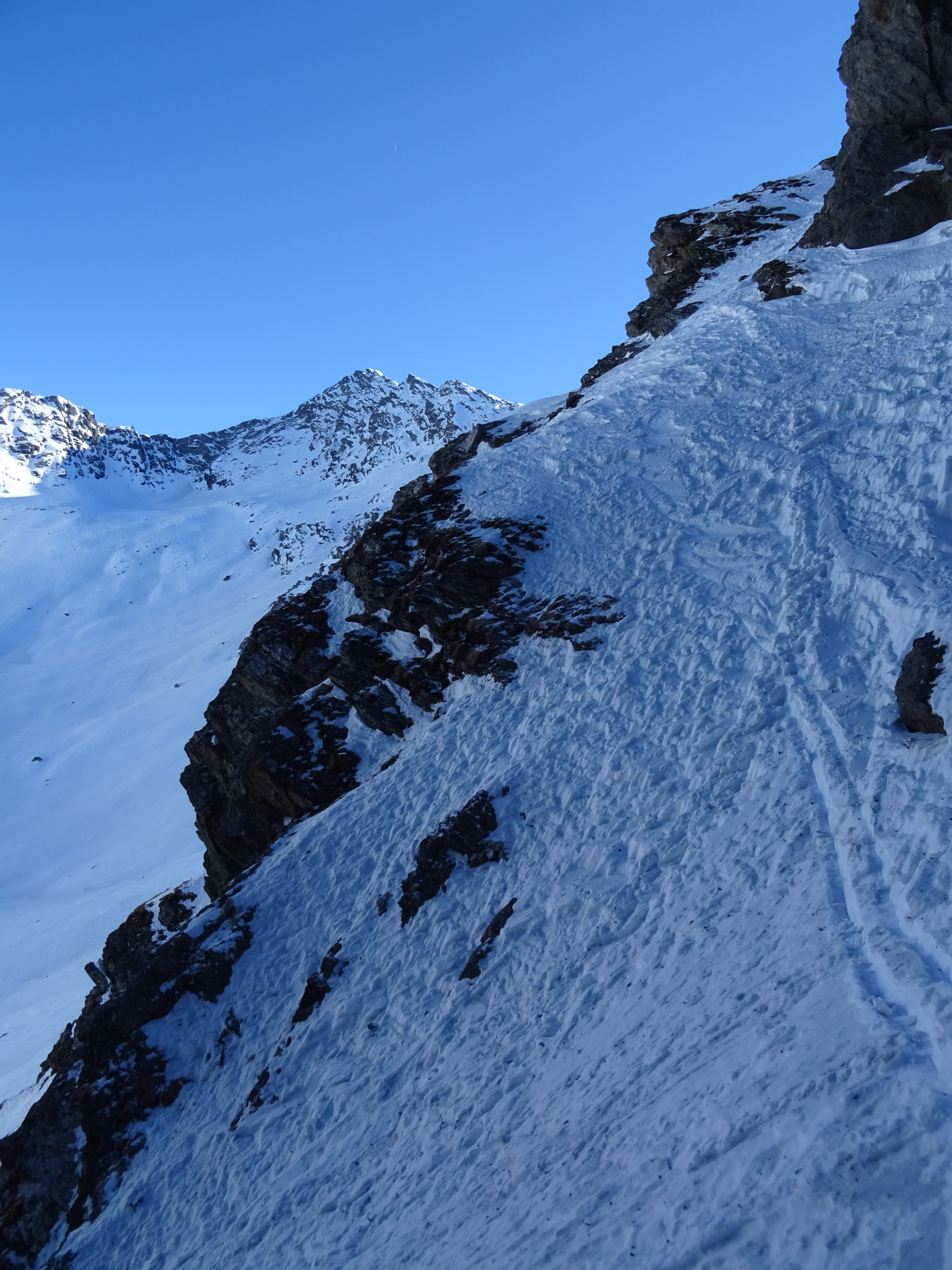
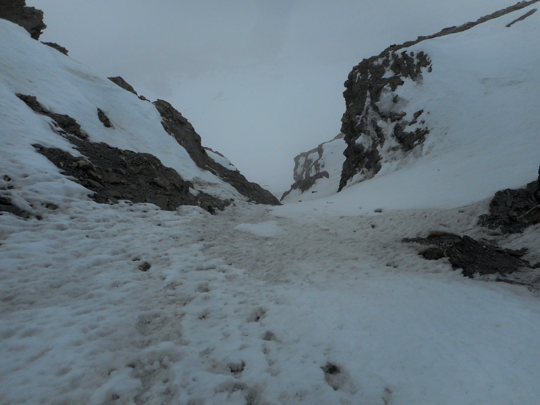
Breve canale di 150m che parte subito sotto la cima del Bric Ghinivert, pendenze intorno ai 40° (possibili brevi tratti a 45°).
Attenzione a possibili (e frequenti) accumuli da vento.
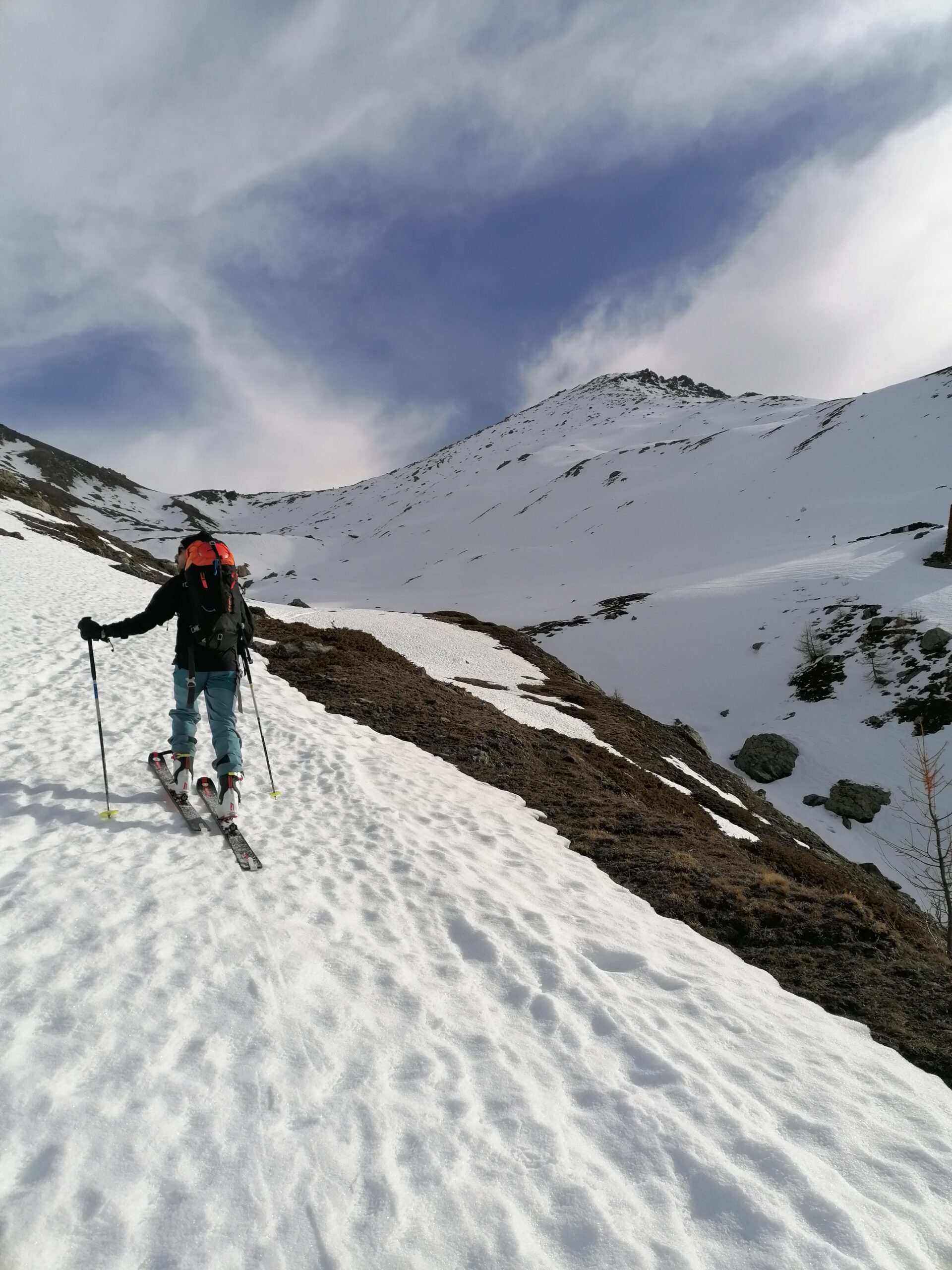
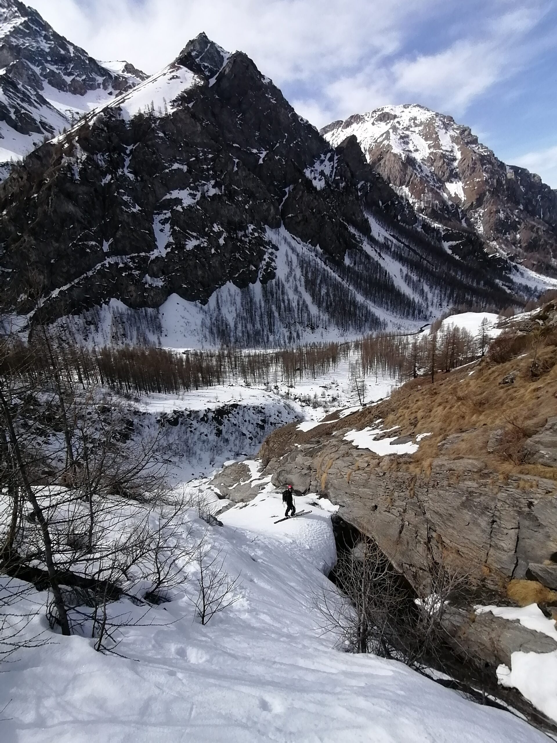
Avvicinamento
Attenzione a possibili (e frequenti) accumuli da vento.
Risalire la val Troncea seguendo la pista da fondo e salire in cima al Ghinivert dall'itinerario della normale scialpinistica che passa dal rifugio Troncea e dalla località Angolo (BS).
Volendo risalire il canale, per controllare le condizioni della neve, conviene all'Angolo seguire per il colle del Beth e di lì traversare fino all'attacco del canale.
Descrizione
Volendo risalire il canale, per controllare le condizioni della neve, conviene all'Angolo seguire per il colle del Beth e di lì traversare fino all'attacco del canale.
Calzati gli sci subito sotto la cima del Ghinivert, si scende in traverso discendente verso sx il plateau sommitale, fino ad infilarsi nel canale N, che si segue senza possibilità di errore. Onde evitare una ripellata al colle del Beth conviene non scendere la conoide ma appena finisce il canale vero e proprio si traversa a sx verso il colle del Beth.
- Bibliografia:
- Ripido!
Nelle vicinanze Mappa
Itinerari
28/02/2021 TO, Pragelato D+ 1800 m II, 4.2, E2 Varie
Ruetas (Monte) Diretta Parete Est
 200m
200m
24/05/2025 TO, Pragelato D+ 1228 m 4.3, E2 Nord-Ovest
Barifreddo (Monte) Canale NO
 200m
200m
02/04/2018 TO, Pragelato D+ 1480 m II, 4.2, E2 Est
Gran Miuls (Monte) Canale Est
 200m
200m
18/02/2024 TO, Pragelato D+ 1350 m I, 4.1, E1 Nord
Fauri Nord (Punta) Canale NNE
 300m
300m
24/02/2017 TO, Pragelato D+ 1430 m 4.2, E2 Sud
Vallonetto (Punta) Pendio S
 350m
350m
15/02/2025 TO, Pragelato D+ 1580 m III, 4.3, E4 Est
Pignerol (Monte) Canalino SE (l’Eiclapeuiro) dalla Val Troncea
 550m
550m
05/02/2022 TO, Pragelato D+ 1381 m III, 4.2, E3 Nord-Est
Appenna (Monte) Parete Nord
 550m
550m
08/03/2025 TO, Pragelato D+ 1321 m I, 3.3, E2 Sud-Ovest
Ruetas (Monte) scivolo SO
 600m
600m
01/04/2018 TO, Pragelato D+ 915 m I, 4.1, E1 Sud
Aigle (Pitre de l’) Canalino S/SE
 1.1Km
1.1Km
25/03/2025 TO, Pragelato D+ 1000 m I, 3.3, E1 Est
Fraiteve (Monte) Canalino Est
 1.7Km
1.7Km
Servizi
750m
750m
Al Mulino Ristorante
Pragelato
1.2Km
Mulino di Laval Rifugio
Pragelato
3.2Km
Refugium – ex. Rif. Belotte Rifugio
Pragelato
3.9Km
Casa degli Escartons Alex Berton B&B
Pragelato
4.1Km
Casa Alpina Rifugio
Pragelato
4.1Km
Passet Ristorante
Pragelato
5.2Km
Troncea Rifugio
Pragelato
5.4Km
L’itialette Ristorante
Pragelato
6.9Km