6.1Km
6.1Km
Note
Storico
 50m
50m
50m
1.9Km
4.1Km
5.4Km
7.3Km
7.3Km
7.3Km
50m
50m
50m
1.9Km
4.1Km
5.4Km
7.3Km
7.3Km
7.3Km
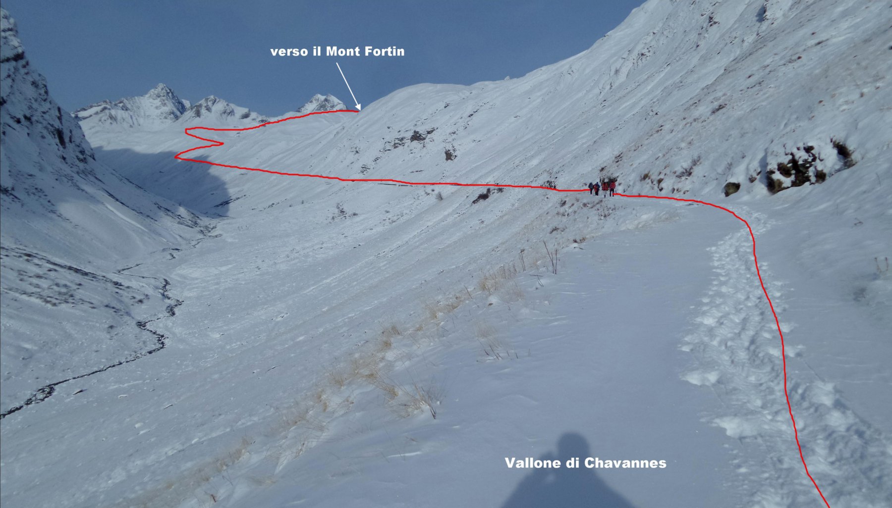
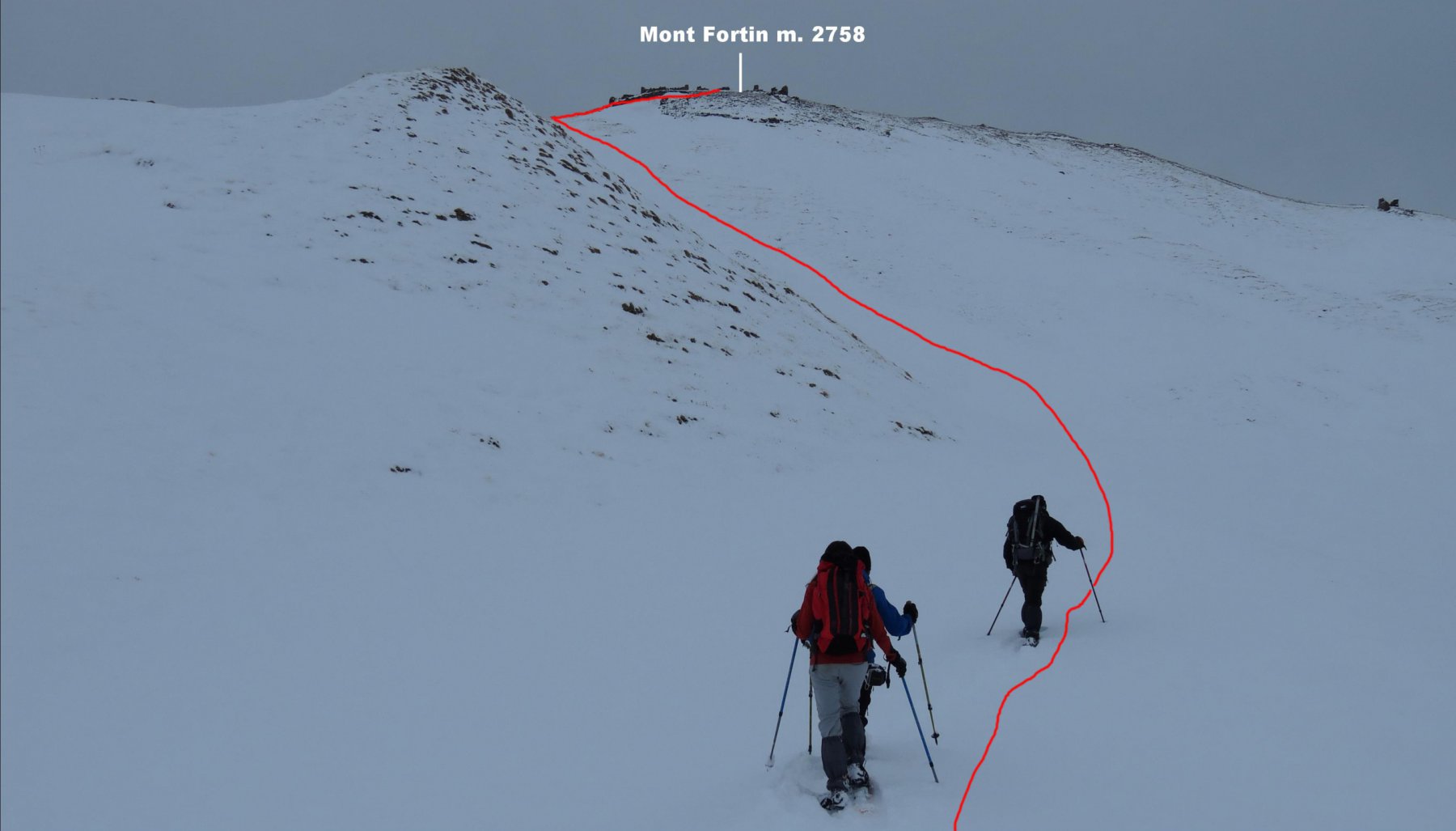
Il Mont Fortin è situato sulla cresta spartiacque tra il Vallone di Chavannes e la Val Veny. Si tratta di una montagna di facile accesso e adatta anche per gruppi o per chi inizia a muoversi con le ciaspole ai piedi. Presenta un itinerario che si svolge in gran parte lungo una strada poderale che risale il lungo Vallone di Chavannes e poi su pendii ampi e poco inclinati dagli alpeggi di Chavannes alla cima, a parche pochi tratti è un itinerario sicuro e al riparo da rischi. La parte di percorso che si snoda lungo la poderale portrebbe risultare un po’ monotona ma è compensata dal piacevole contesto ambientale dove ci si muove, e dagli scorci panoramici sempre più ampi man mano che si prende quota. E’ un percorso abbastanza lungo (circa 11 km) e richiede un buon allenamento, richiede buone condizioni di visibiltà nella parte superiore in mancanza di tracce esistenti. Il periodo migliore per salire il Fortin va da dicembre a marzo.
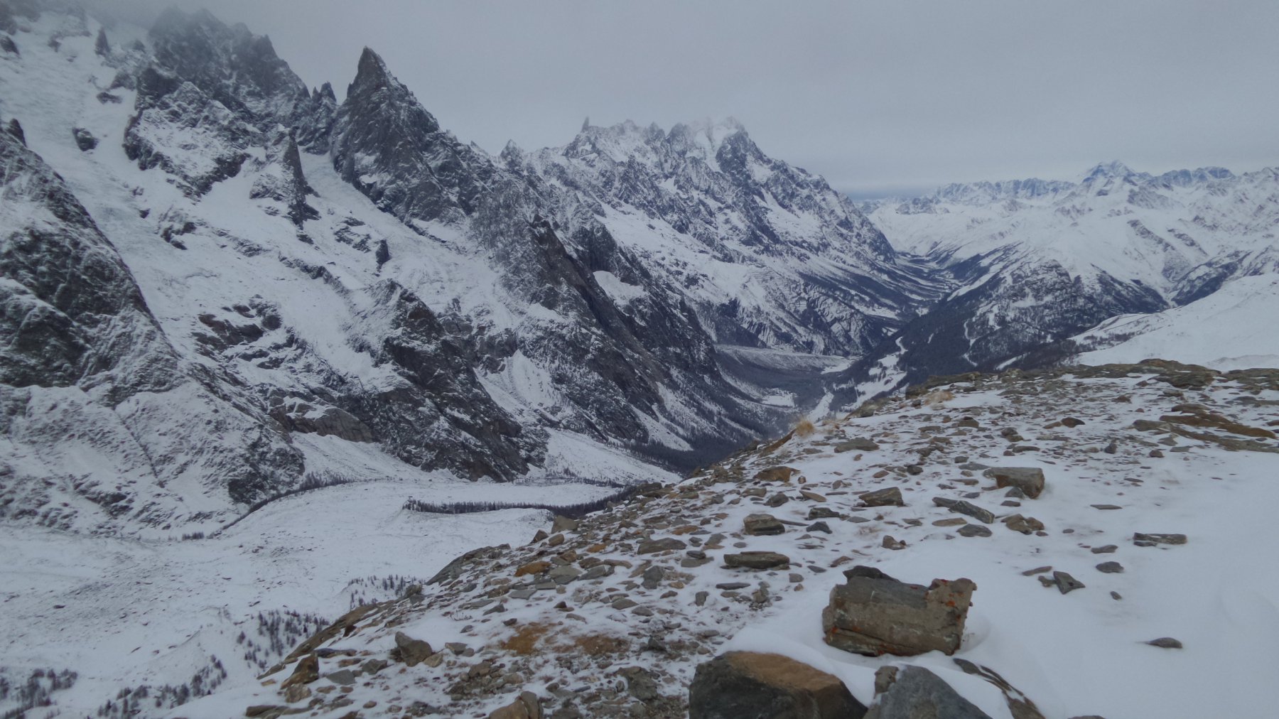
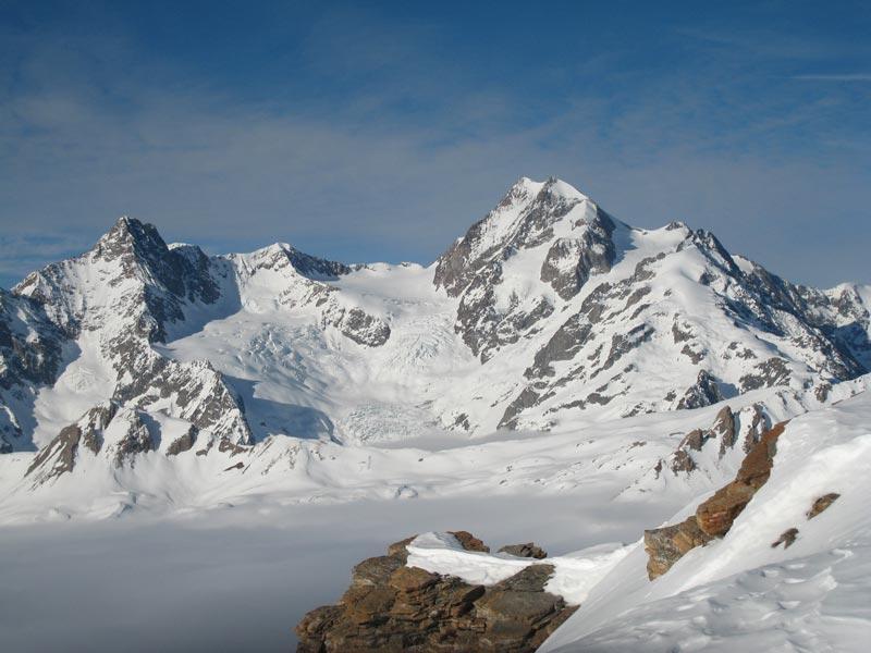
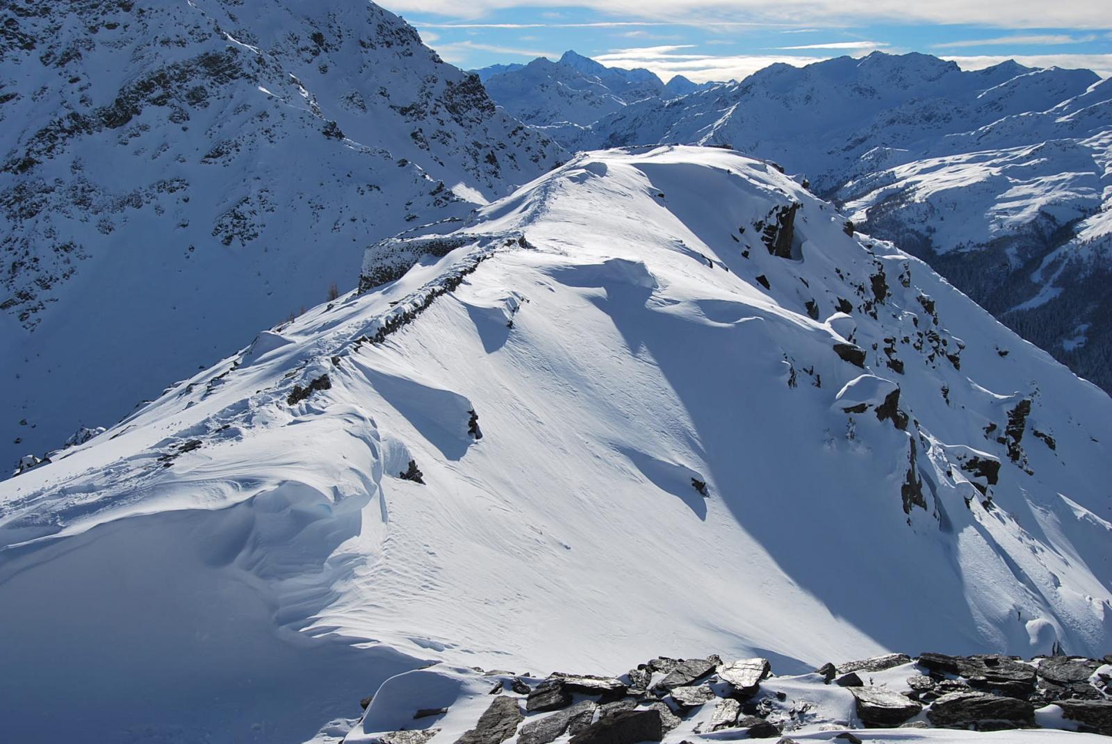
La cima del Mont Fortin è anche un eccellente punto panoramico sul vicinissimo Gruppo del Monte Bianco, con un colpo d’occhio spettacolare dal settore che va dall’Aiguille des Glaciers alle Grandes Jorasses. Sulla vetta del Mont Fortin sono visibili i ruderi di antiche fortificazioni.
Avvicinamento
La cima del Mont Fortin è anche un eccellente punto panoramico sul vicinissimo Gruppo del Monte Bianco, con un colpo d’occhio spettacolare dal settore che va dall’Aiguille des Glaciers alle Grandes Jorasses. Sulla vetta del Mont Fortin sono visibili i ruderi di antiche fortificazioni.
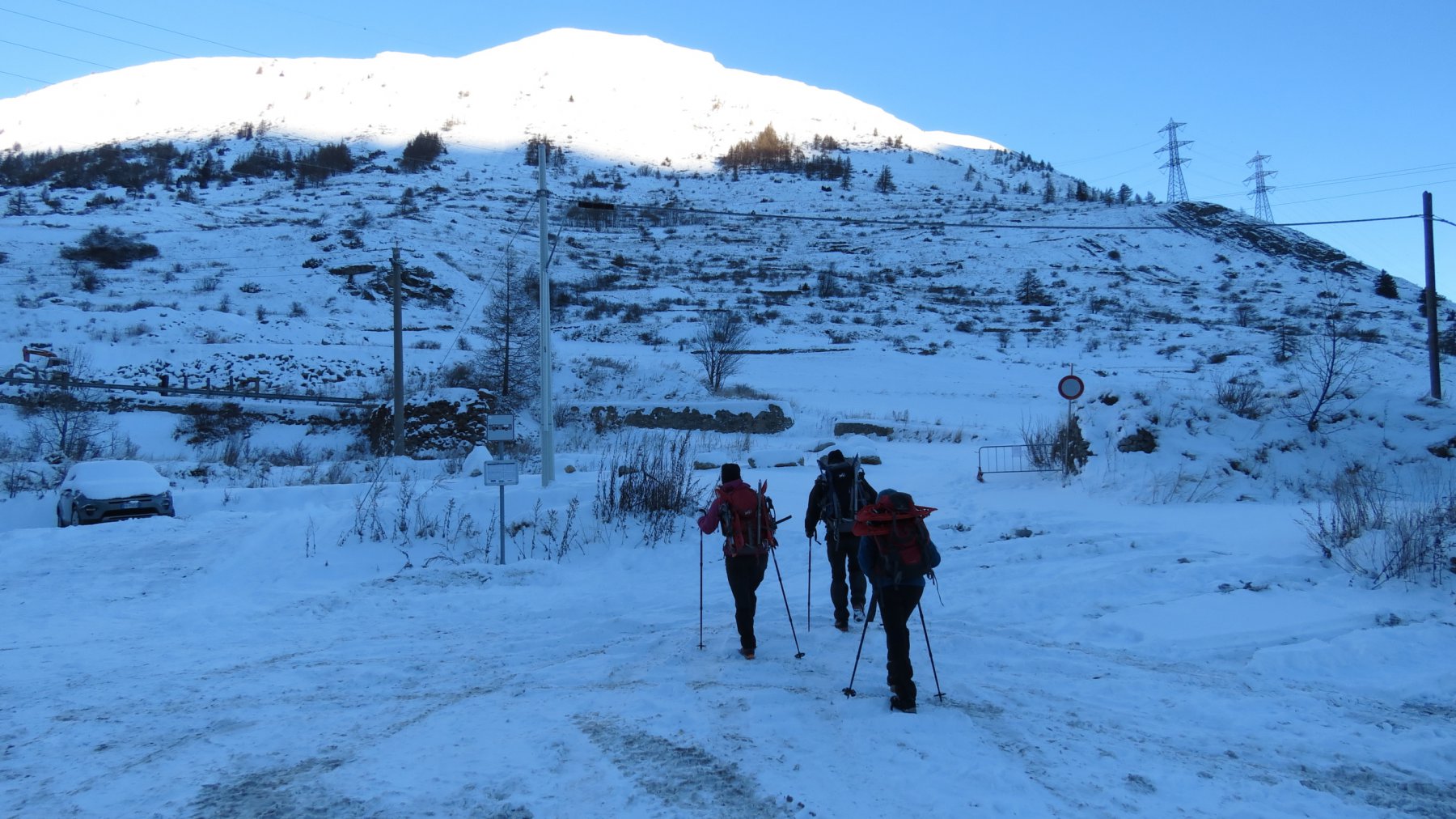
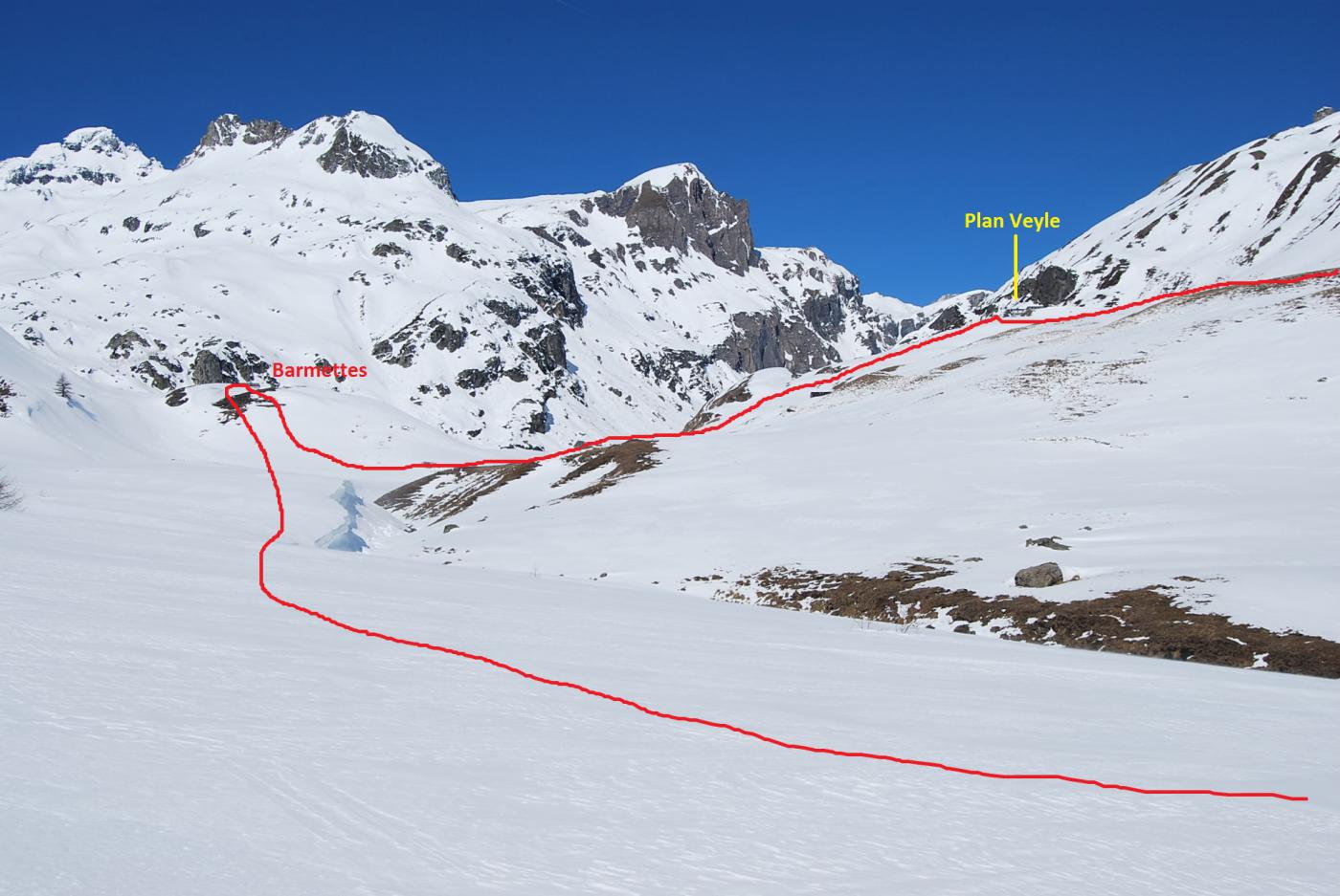
Si esce dall’autostrada A5 Torino-Aosta allo svincolo di Morgex, dove va seguita la direzione per Courmayeur, lungo la SS26 fino a raggiungere Pré Saint Didier. Qui si tralascia la statale diretta a Courmayeur e si svolta a sinistra, verso La Thuile. Giunti alla stazione sciistica si prosegue per il Colle del Piccolo San Bernardo arrivando fino a Pont Serrand 1642 m dove si può parcheggiare in un parcheggio poco prima del paese oppure ai bordi della strada (19 km da Morgex).
Descrizione
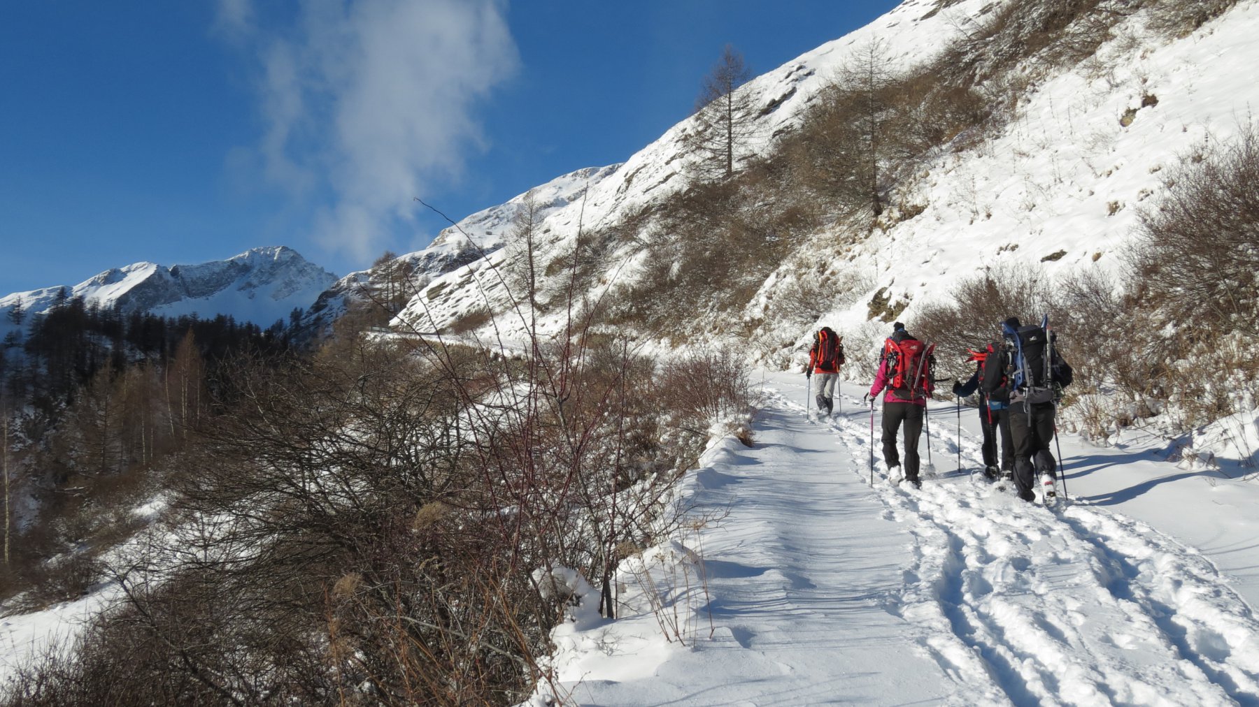
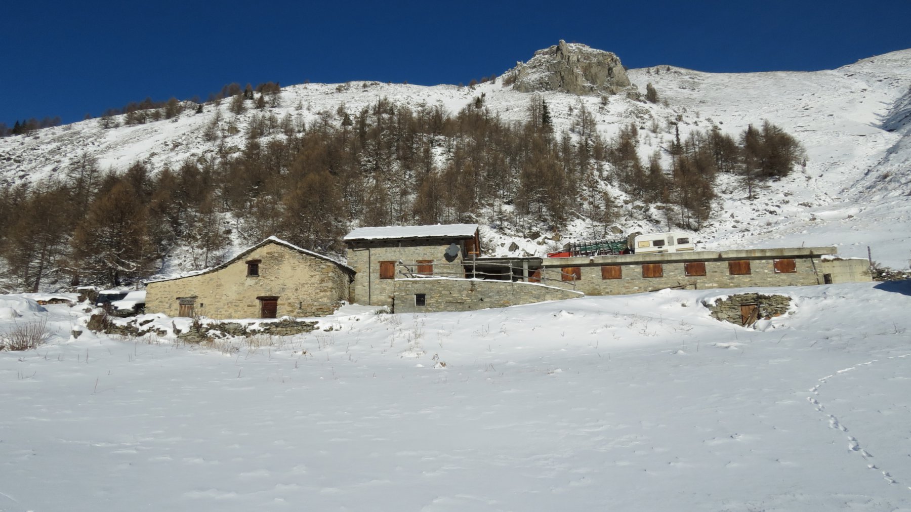
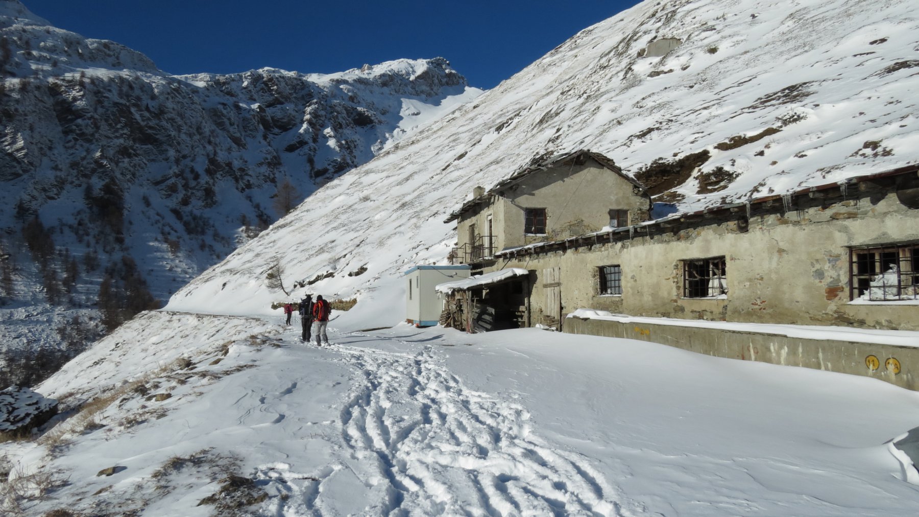
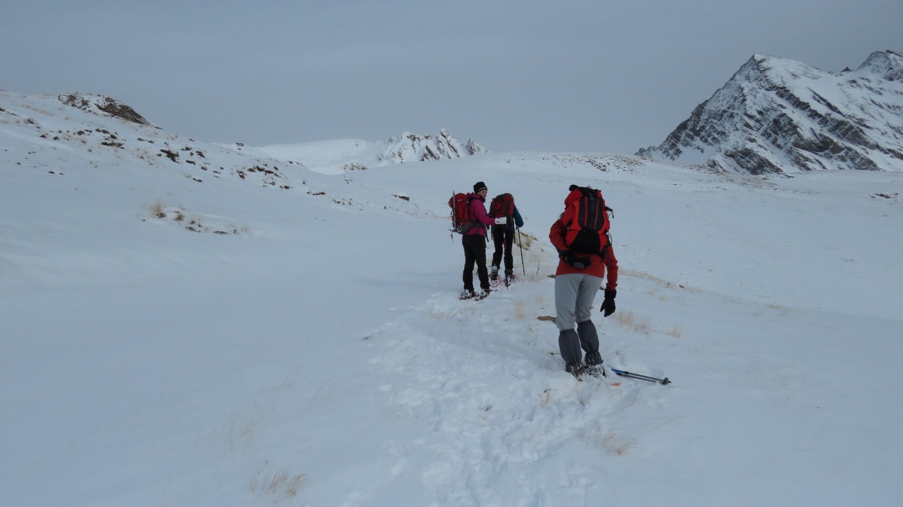
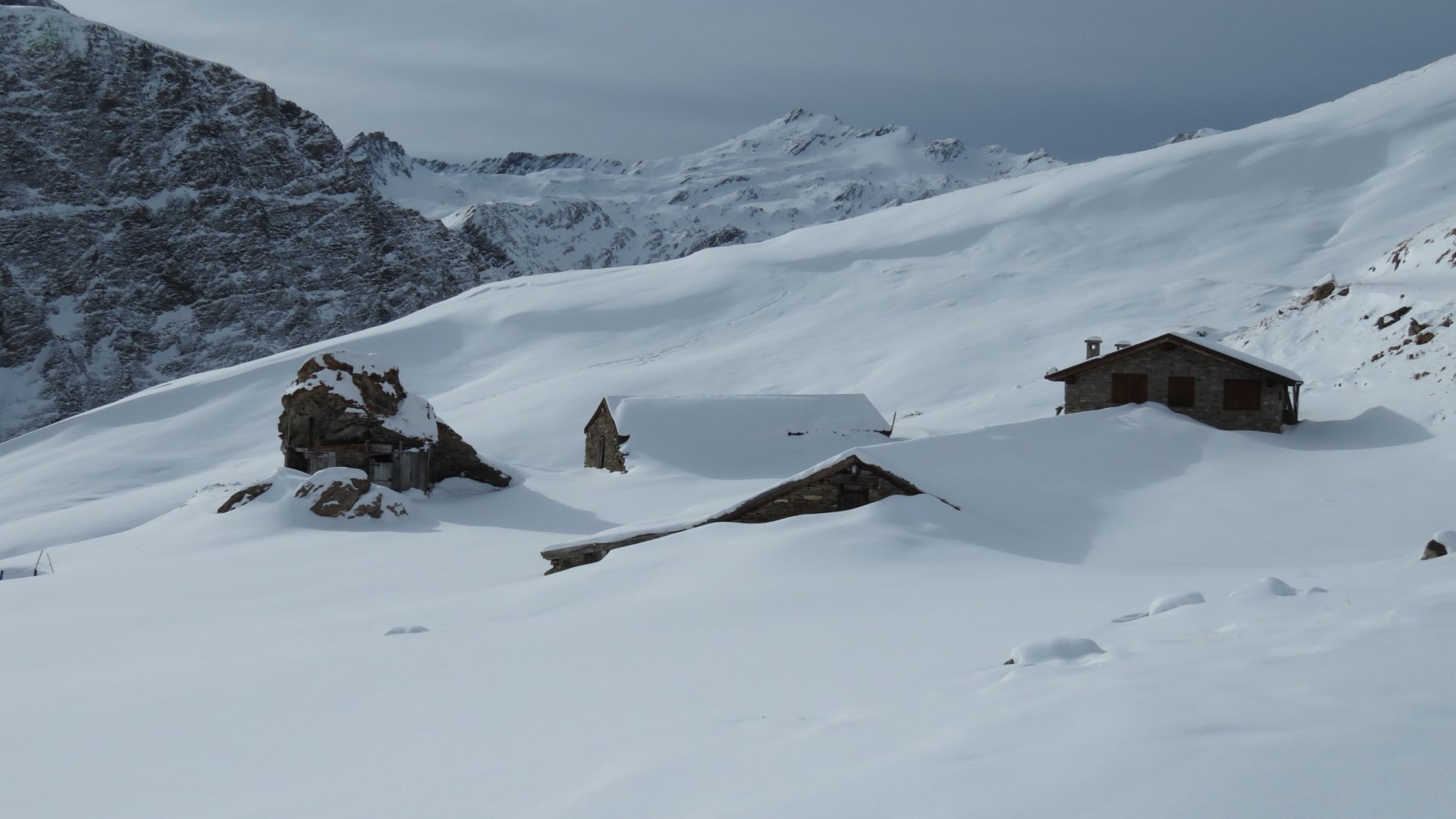
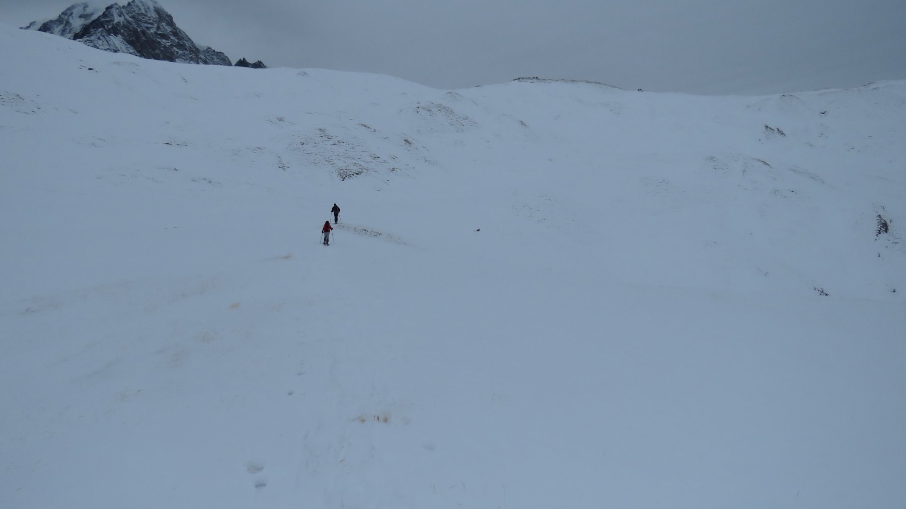
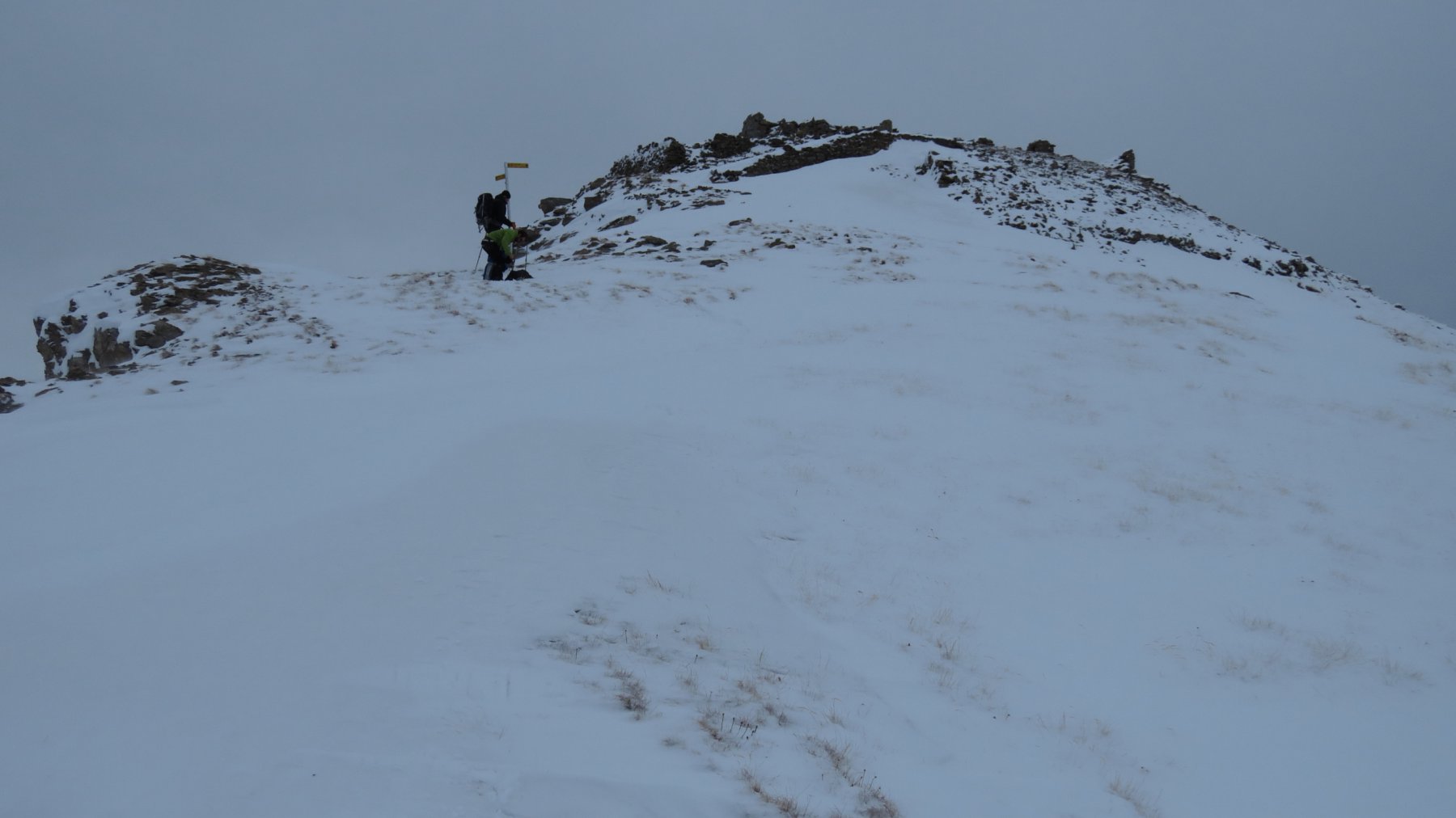
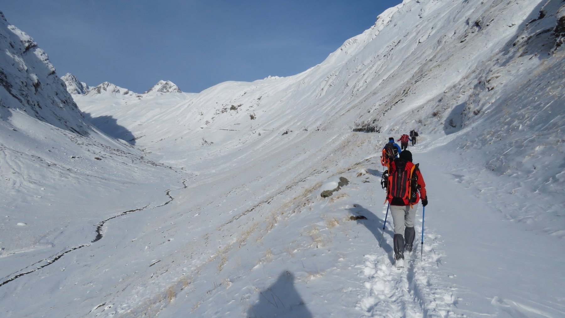
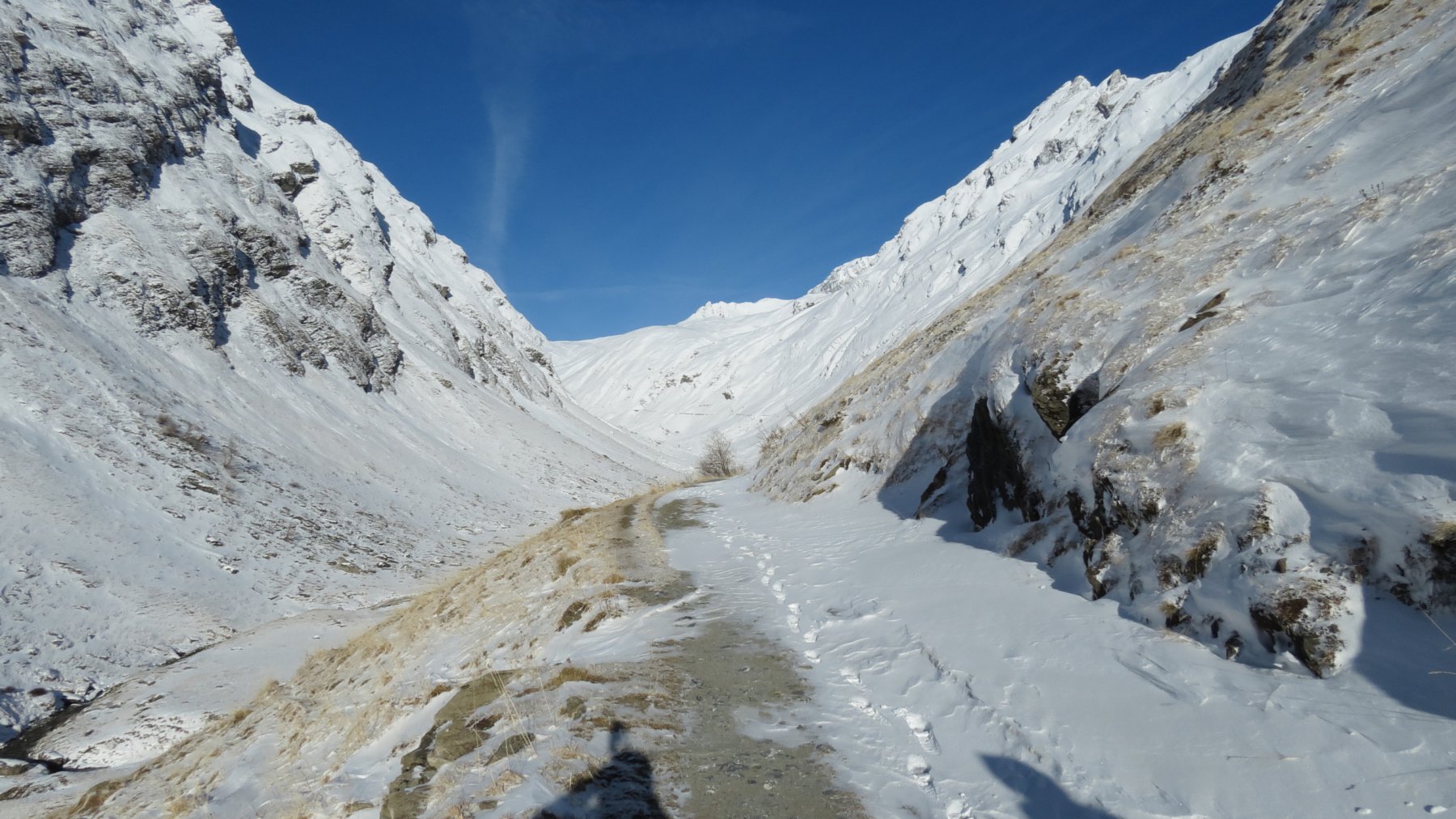
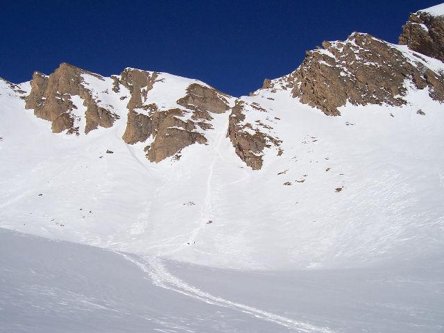
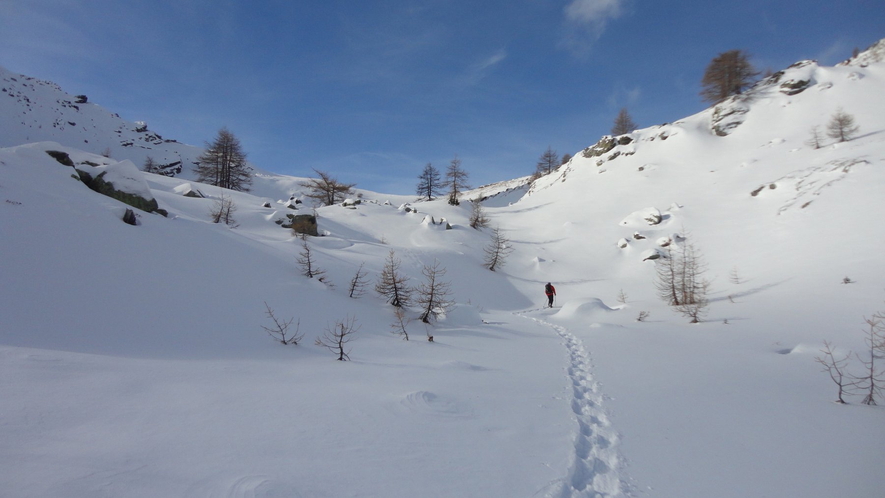
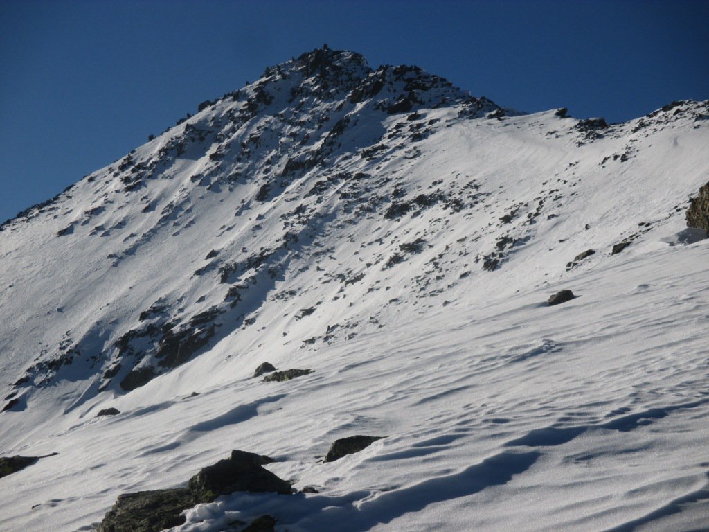
Dal parcheggio di Pont Serrand, si torna indietro lungo la strada principale per pochi metri fino ad bivio dove ha inizio una strada poderale (normalmente chiusa al traffico privato), qui sono presenti alcuni cartelli segnaletici (il nostro riferimento sono i segnavia n. 11 e Alta Via n. 2 per il Col des Chavannes). Si inizia a seguire la stradina che oltrepassa in moderata salita la base del versante Sud del Mont Belleface meridionale, passando nei pressi dell’Alpeggio Cretaz-Jean 1880 m posto all’imbocco del Vallone di Orgères. Trascurate le eventuali tracce che si inoltrano a destra in detto vallone verso il Col d’Orgère, si prosegue sul tracciato della poderale, superando in successione gli alpeggi Orgères 1896 m e Porassey 1907 m posti sul versante meridionale del Monte Comb Varin. Ora la poderale volge a destra entrando nell’ampio Vallone di Chavannes, che va risalito seguendo il percorso della stradina, con alcune possibili scorciatoie per tagliare alcuni tornanti. Si supera l’Alpeggio Berrio Blanc Inferiore 2128 m e poi volgendo nuovamente a sinistra si raggiunge un ampio pianoro dove si trovano gli Alpeggi Chavannes di Sopra 2420 m. Qui occorre abbandonare la poderale (segnavia n. 11B e palina segnaletica) volgendo decisamente a destra, salendo il valloncello per dossi e avvallamenti, piegando gradualmente a sinistra, si risale un pendio moderatamente ripido che porta nella conca terminale sotto la cima del Mont Fortin, lasciati a destra i pendii che portano alla Pointe des Chavannes si punta con percorso evidente ad un colletto (Col du Baracon 2714 m) superando un ultimo facile pendio sulla sinistra. Dal colle si segue l’ampia dorsale che il breve conduce alla vetta del Mont Fortin, sulla cui cima si trovano resti di fortificazioni ormai diroccate e inagibili. Nessuna croce, ma un piccolo ometto e un semplice cartello indicatore per segnalare la cima.
In discesa va seguito a ritroso il medesimo percorso di salita.
La cima del Mont Fortin è anche un eccellente punto panoramico sul vicinissimo Gruppo del Monte Bianco, con un colpo d’occhio spettacolare dal settore che va dall’Aiguille des Glaciers alle Grandes Jorasses. Sulla vetta del Mont Fortin sono visibili i ruderi di antiche fortificazioni.
- Cartografia:
- IGC foglio 107 - Monte Bianco, Courmayeur, La Thuile - scala 1:25000
Nelle vicinanze Mappa
Itinerari
19/12/2015 AO, La Thuile D+ 1084 m BR Sud-Ovest
Tormotta o Tormottaz da Pont Serrand per il Lago Verney
50m
31/12/2007 AO, La Thuile D+ 1097 m BR Sud
Orgère (Col d’) da Pont Serrand
 50m
50m
02/01/2008 AO, La Thuile D+ 1187 m MR Sud-Est
Combe Varin (Monte) da Pont Serrand
 50m
50m
13/12/2020 AO, La Thuile D+ 589 m MR Nord-Ovest
Piccolo San Bernardo (Colle del) da Pont Serrand
 50m
50m
06/04/2015 AO, La Thuile D+ 638 m MR Varie
Plan Veyle, Chantè, Barmettes (Alpeggi) da La Thuile, anello
 1.9Km
1.9Km
16/03/2013 AO, Pré-Saint-Didier D+ 1261 m MR Varie
Arp (Col d’) da la Balme per il Vallone di Youla
 4.1Km
4.1Km
02/06/2009 AO, La Thuile D+ 978 m BR Sud-Est
Miravidi (Monte) dal Lago Verney
 5.4Km
5.4Km
26/04/2024 AO, Morgex D+ 559 m BR Nord-Est
Croce (Punta e Colle) dal Colle San Carlo per il Lago d’Arpy
 7.3Km
7.3Km
20/11/2016 AO, La Thuile D+ 508 m MR Sud-Est
Croce (Colle della) dal Colle San Carlo per il Lago d’Arpy
 7.3Km
7.3Km
31/12/2016 AO, La Thuile D+ 1200 m BRA, PD- Nord
Lussè (Monte) dal Colle San Carlo
 7.3Km
7.3Km