2Km
2Km
Avvicinamento
 2Km
2Km
2.1Km
2.2Km
2.7Km
3.1Km
3.7Km
4Km
2Km
2Km
2.1Km
2.2Km
2.7Km
3.1Km
3.7Km
4Km
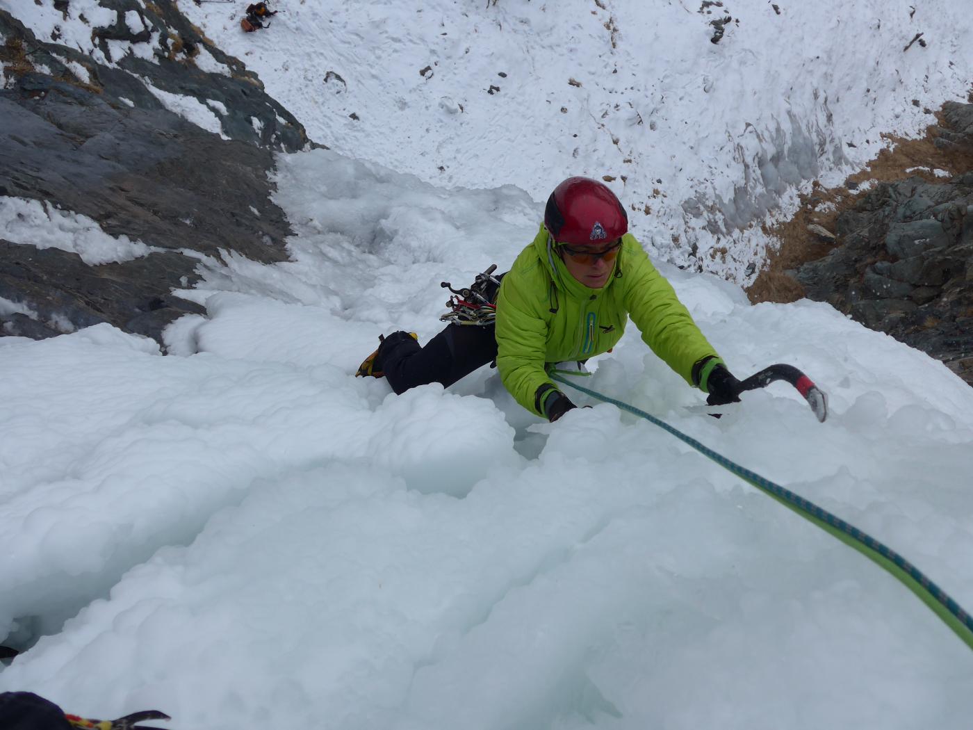
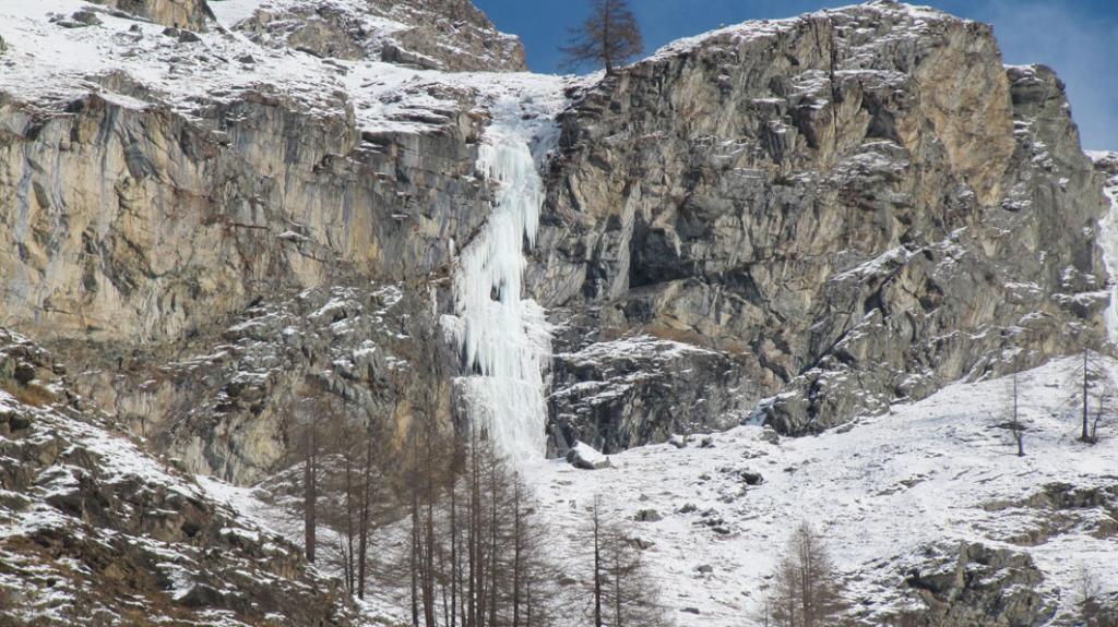
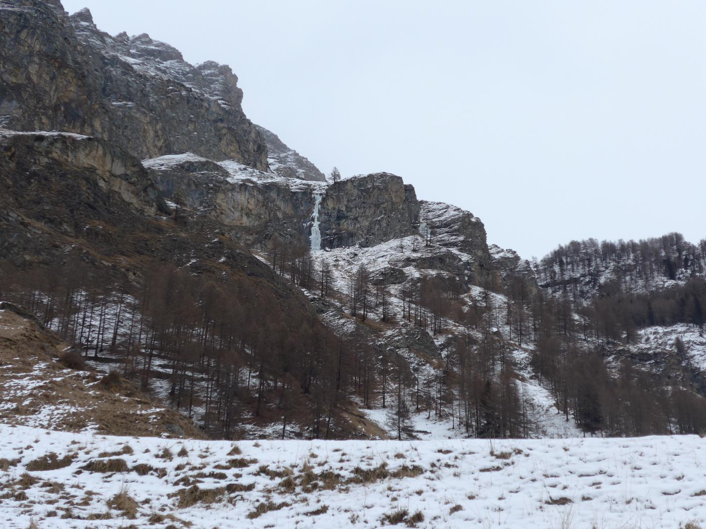
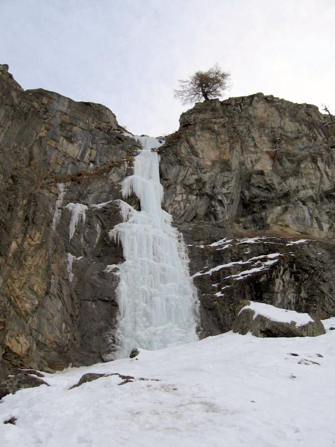
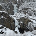
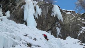
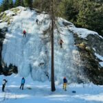
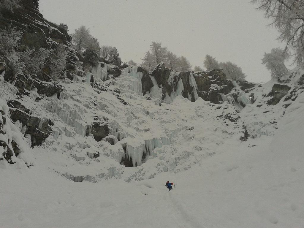
La cascata è ben visibile dal parcheggio di Tignet. Risalire lungo i prati, con percorso non obbligato, fino ad arrivare alla base della cascata.
Descrizione
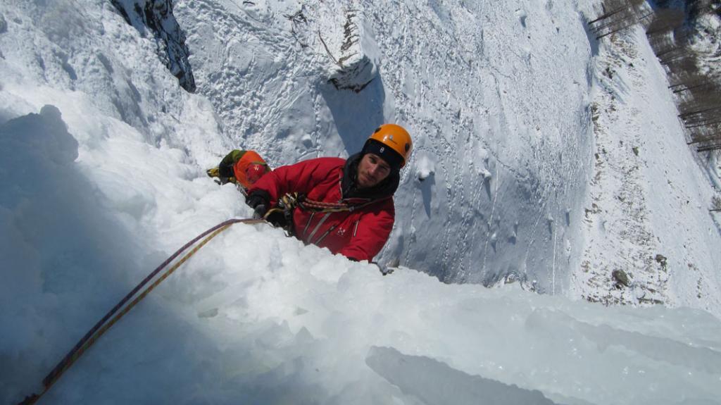
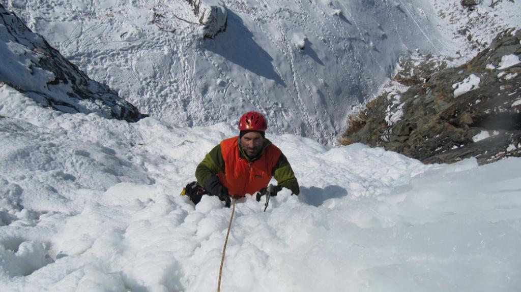
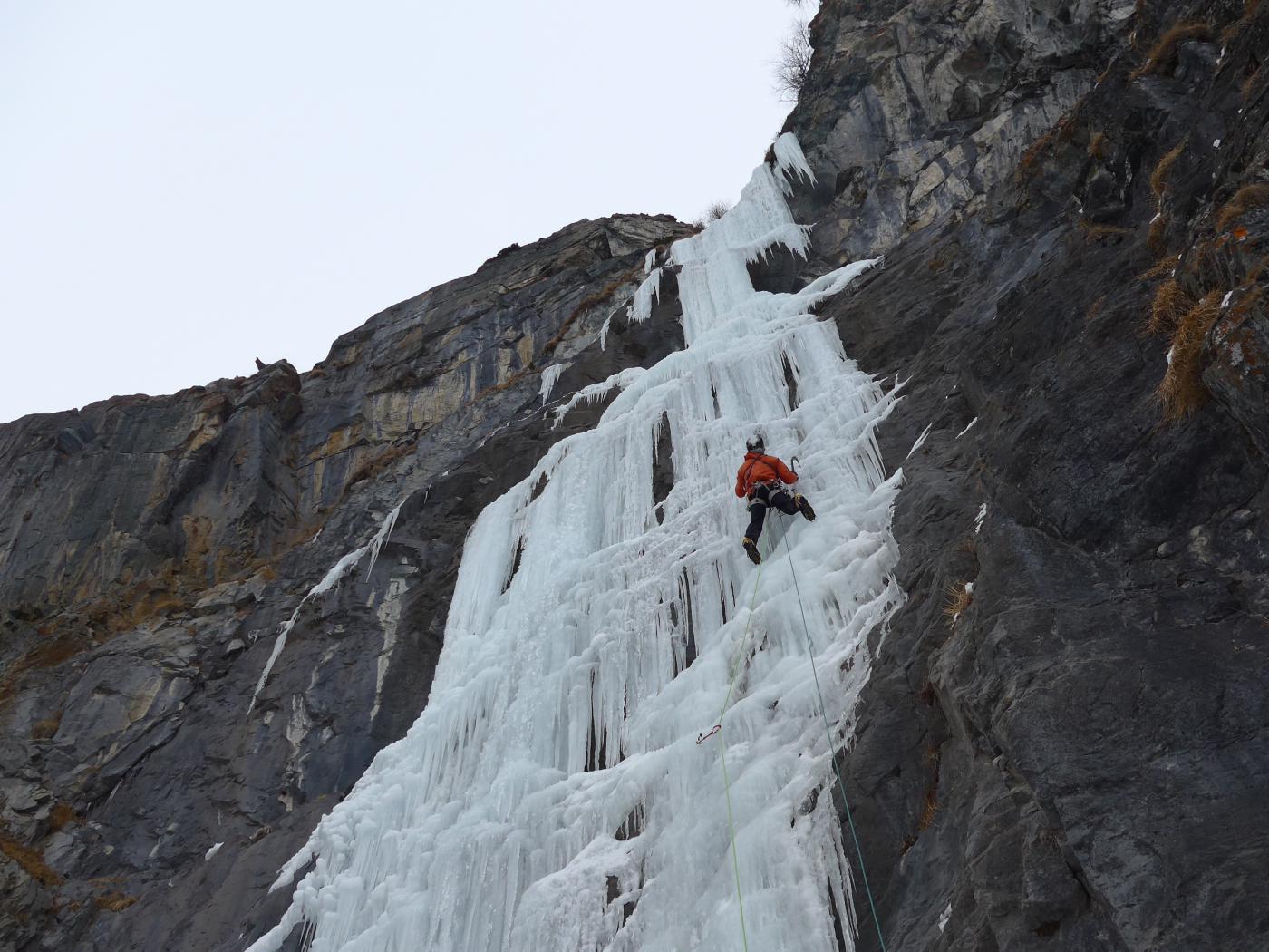
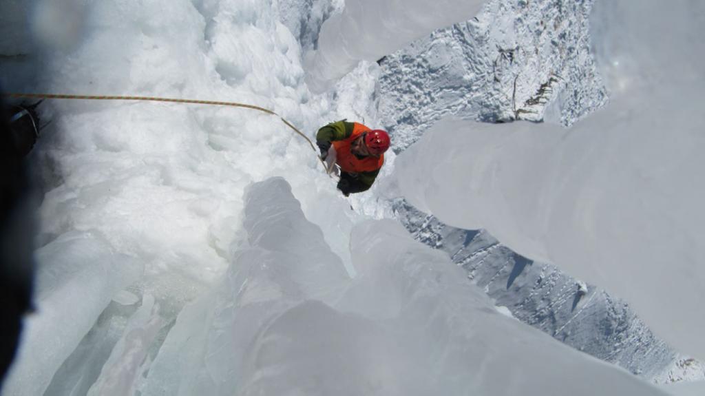
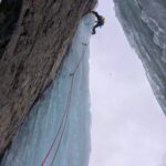
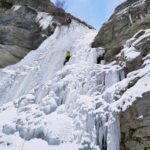
L1: 30m. attaccare il muro ghiacciato fino ad arrivare alla candela, dietro la quale si trova la sosta (2 vecchi chiodi).
L2: 40m. uscire dalla nicchia con i primi metri in traverso; salire 2 muretti verticali che portano al termine delle difficoltà. Un bel diagonale porta alla fine della cascata dove vi è un grande larice per la doppia. abbiamo lasciato un cordone nuovo. doppia 60m fino a terra.
- Bibliografia:
- Matteo Giglio - Effimeri Barbagli - 2014 Tipografia Valdostana
Nelle vicinanze Mappa
Itinerari
07/02/2026 AO, Valsavarenche 200 m III, 5+ Varie
Valsavarenche – Trip in the Night (Cascata)
 2Km
2Km
08/02/2026 AO, Valsavarenche 200 m III, 6 Ovest
Valsavarenche – Trip in the Light (Cascata), variante
 2Km
2Km
09/01/2026 AO, Valsavarenche 90 m III, 6, M7 Sud-Ovest
Valsavarenche – Le Fantôme du Bricolage (Cascata)
2Km
01/03/2026 AO, Valsavarenche 150 m II, 3+ Ovest
Valsavarenche – Rovenaud (Cascata di)
 2.1Km
2.1Km
26/12/2010 AO, Valsavarenche 100 m II, 4+ Ovest
Valsavarenche – Il Fantasma di Ghiaccio (Cascata)
 2.2Km
2.2Km
25/02/2026 AO, Valsavarenche 25 m I, 4 Nord
Valsavarenche – Eaux Rousses (Falesia di ghiaccio)
 2.7Km
2.7Km
09/01/2015 AO, Valsavarenche 350 m II, 2 Est
Valsavarenche – Nampio (Cascata del)
2.8Km
13/02/2022 AO, Valsavarenche 60 m I, 3+, M7 Est
Valsavarenche – Valsabeach (Cascata)
 3.1Km
3.1Km
13/02/2019 AO, Valsavarenche 90 m II, 4 Ovest
Valsavarenche – Rovenaud (Placche di, Cascata)
 3.7Km
3.7Km
21/12/2025 AO, Valsavarenche 200 m II, 2 Ovest
Valsavarenche – Grand Clapey (Cascata di)
 4Km
4Km