 700m
700m
Note
 50m
1.1Km
1.1Km
1.1Km
1.1Km
1.4Km
1.4Km
1.4Km
2.6Km
50m
1.1Km
1.1Km
1.1Km
1.1Km
1.4Km
1.4Km
1.4Km
2.6Km
700m
1.1Km
1.4Km
1.6Km
2.8Km
3.4Km
3.4Km
3.7Km
3.9Km
4.9Km
È possibile partire in alternativa da Carema o Torredaniele con percorsi che differiscono nella parte bassa.
Ci sono alcuni passi di I e II sulla cresta Ovest del M. Roux.
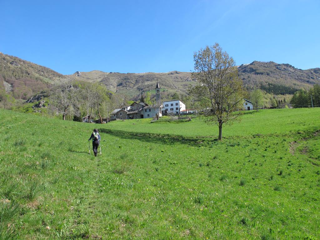
Avvicinamento
Ci sono alcuni passi di I e II sulla cresta Ovest del M. Roux.
.
Descrizione
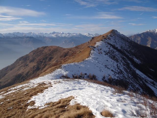
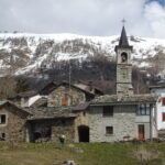
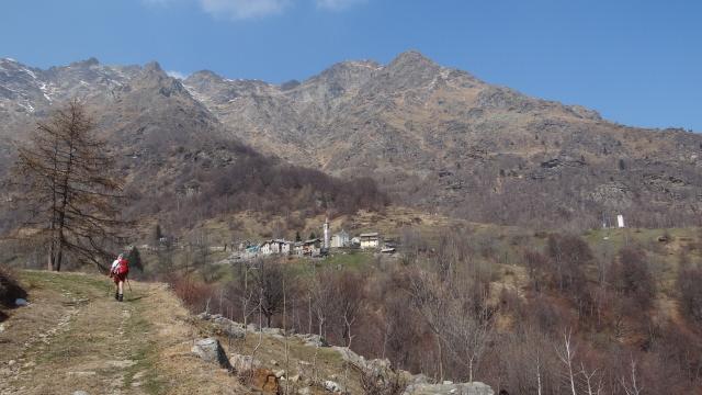
Da Airale si segue il sentiero 841a che porta ai ruderi del castello di Castruzzone. Scendere leggermente in una conca cupa, poi continuare fino a raggiungere la strada che da Carema porta al Maletto. La mulattiera sempre molto ampia (ormai 841), taglia numerose volte la strada, poi raggiunge Maletto. Si prosegue in falsopiano in direzione Est e verso l’Agnerezzo e senza necessariamente raggiungerlo si prosegue sul sentiero 841 fino a raggiungere il Colle dei Giassit. Si segue ora la cresta Ovest del Monte Roux con percorso a tratti esposto e passaggi di I (un paio di passi di II). Con un ultimo tratto molto ripido si raggiunge la croce di vetta. Si prosegue sulla facile e panoramica cresta fino in vetta al Bechit (non esiste sentiero per gli ultimissimi metri fino in vetta).
Discesa:
Si torna fino al colletto che precede il M. Roux e si segue il percorso attrezzato in discesa esposta ma senza particolari difficoltà. Non necessita attrezzatura per chi è abituato a percorsi con esposizione. Si prosegue quindi su sentiero fino al Colle delle Lace e da qui con lungo traverso discendente fino al Colle dei Giassit, per poi ripercorrere il percorso fatto all’andata o una della tante possibili varianti di rientro ad Airale.
- Cartografia:
- Valle Dora Baltea Canavesa n.02 ed:MU Edizioni o Dora Baltea Canavesana n.16 ed: L’Escursionista e Monti
- Bibliografia:
- Guida dei Monti d'Italia Alpi Biellesi e Valsesiane
Nelle vicinanze Mappa
Itinerari
18/03/2023 TO, Carema D+ 1200 m E Sud-Ovest
Maletto (Alpe) da Airale, anello per Trovinasse
 50m
50m
11/11/2023 TO, Quincinetto D+ 1150 m E Nord-Est
Scalaro (Frazione) da Quincinetto
 1.1Km
1.1Km
01/07/2018 TO, Quincinetto D+ 2400 m EE/F Tutte
Bonze (Cima) da Quincinetto, anello per Cima Vallone, Punta Cavalcurt, Cima Battaglia
1.1Km
20/09/2025 TO, Quincinetto D+ 1850 m EE Est
Vallone (Cima del) da Quincinetto, anello
 1.1Km
1.1Km
05/07/2020 TO, Quincinetto D+ 2000 m EE Sud-Est
Renon (Bec) da Quincinetto per Scalaro
 1.1Km
1.1Km
25/04/2024 TO, Quincinetto D+ 582 m E Nord-Est
Santa Maria da Quincinetto
 1.1Km
1.1Km
12/08/2023 TO, Settimo Vittone D+ 1700 m E Sud-Ovest
Nona (Bec di) e Punta Cressa da Senge, anello per Maletto
 1.4Km
1.4Km
01/01/2024 TO, Carema D+ 1644 m EE Varie
Nona (Bec di) da Carema
 1.4Km
1.4Km
26/03/2025 TO, Carema D+ 1100 m EE Ovest
Maletto (Alpe) da Carema, anello
 1.4Km
1.4Km
24/03/2012 TO, Tavagnasco D+ 1400 m EE Est
Scalaro (Frazione) da Tavagnasco, anello per la Sbianca
 2.6Km
2.6Km
Servizi
700m
1.1Km
5inchetr3eut (ex La Quiete) Ristorante
Quincinetto
1.4Km
Da Marino Ristorante
Quincinetto
1.6Km
Fantasy Ristorante
Carema
2.8Km
Santa Maria Ristorante
Quincinetto
3.4Km
La sosta Ristorante
Settimo Vittone
3.4Km
La conca verde Ristorante
Settimo Vittone
3.7Km
Merenda Sinoira Ristorante
Settimo Vittone
3.9Km
Peru Ristorante
Settimo Vittone
4.9Km