1.3Km
1.3Km
Note
Storico
 50m
50m
50m
1.3Km
3.5Km
4.2Km
4.3Km
4.3Km
4.3Km
50m
50m
50m
1.3Km
3.5Km
4.2Km
4.3Km
4.3Km
4.3Km
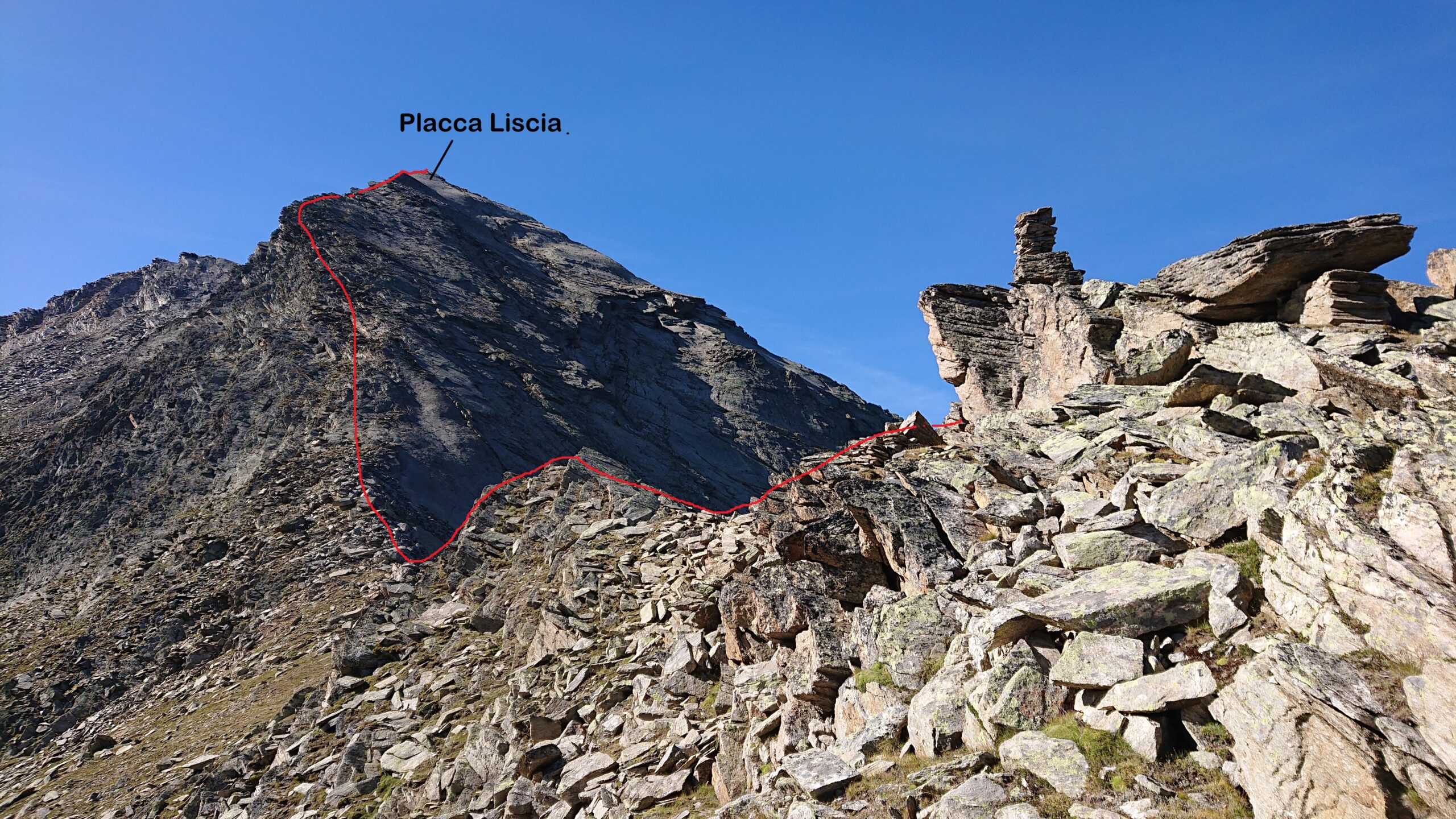
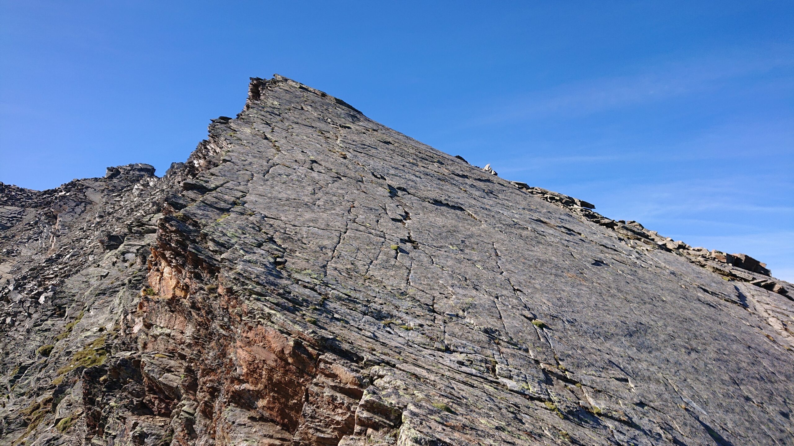
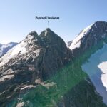
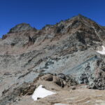
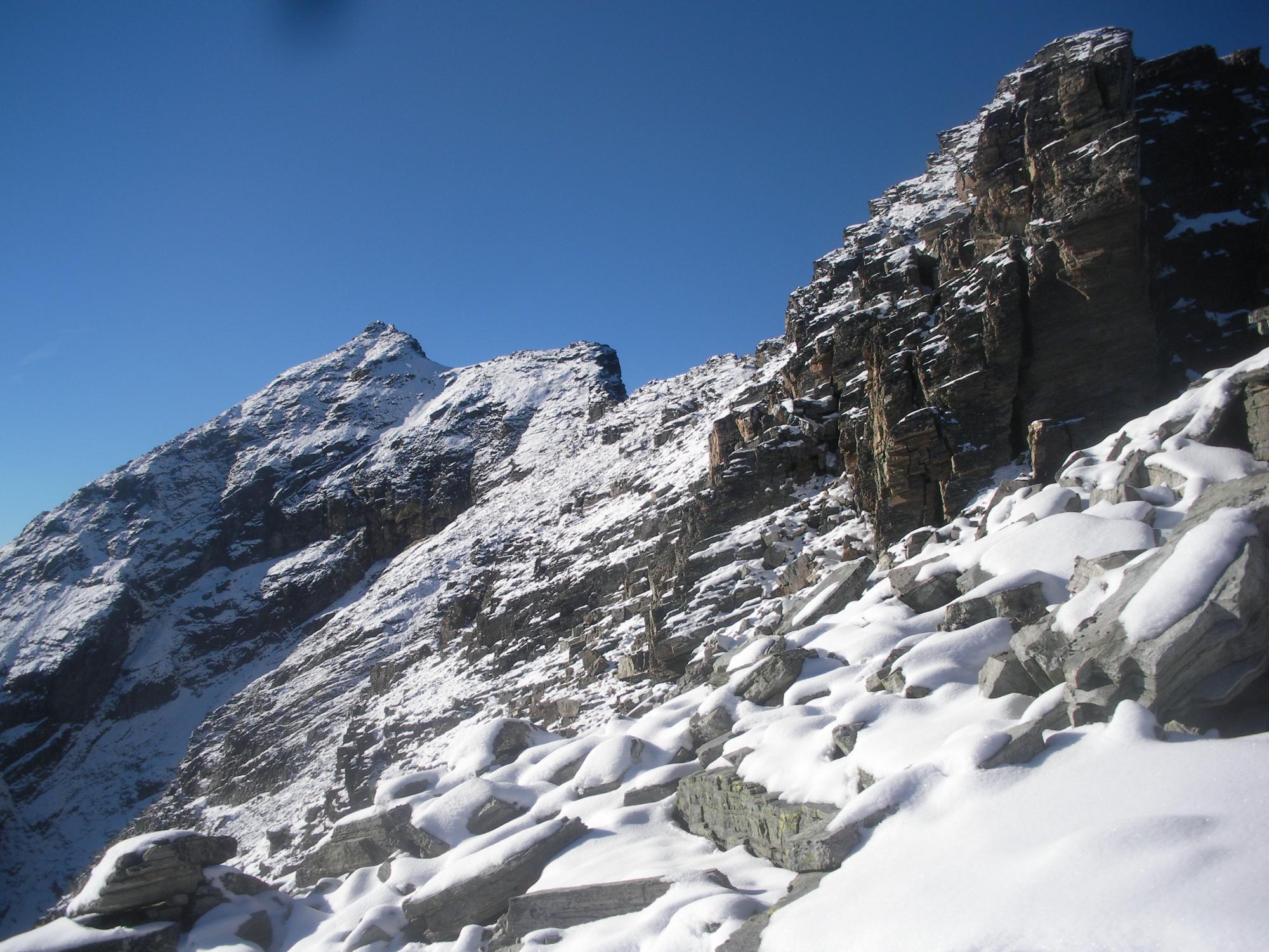
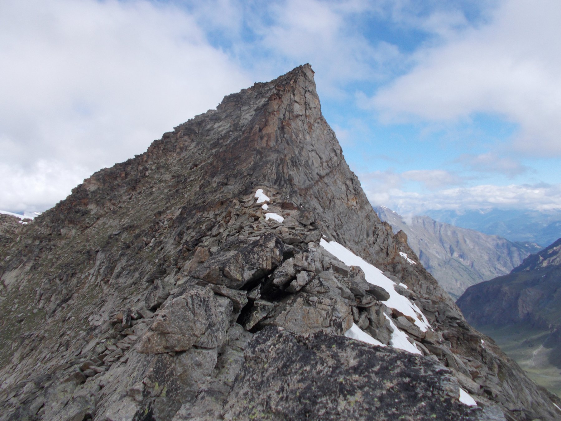
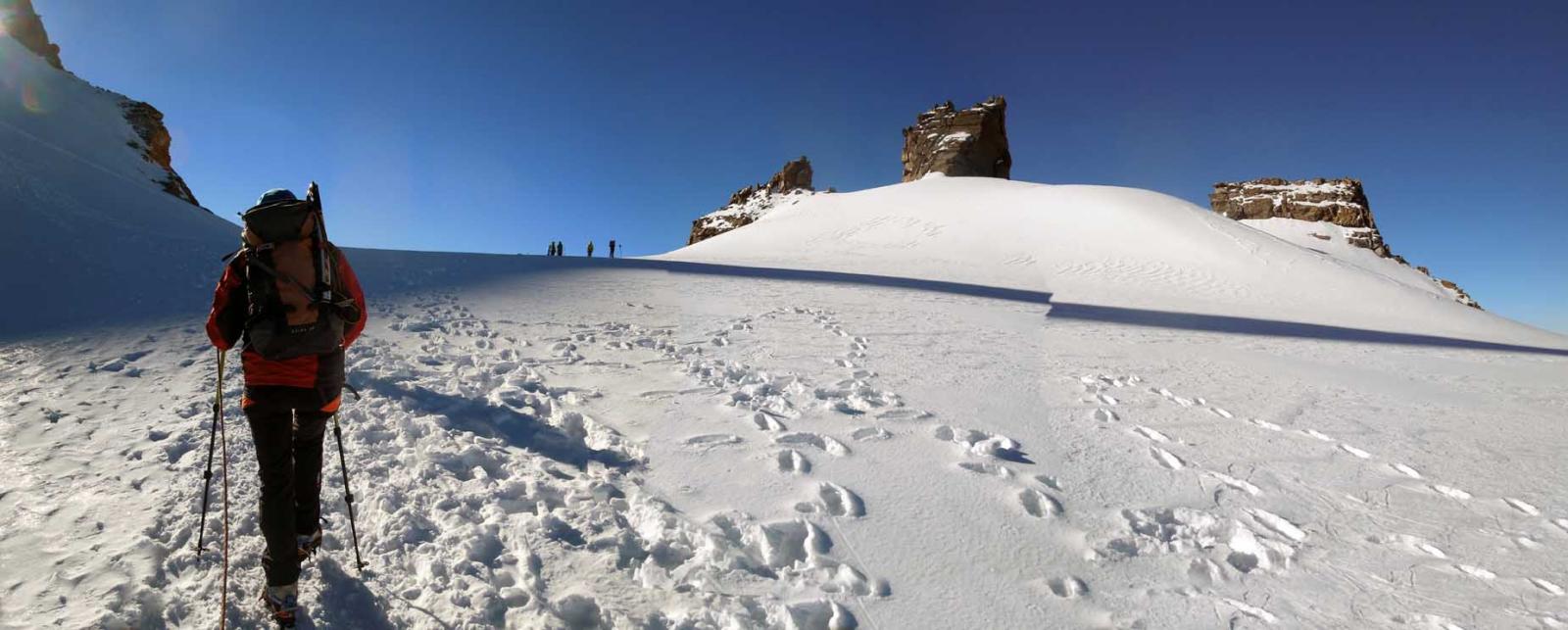
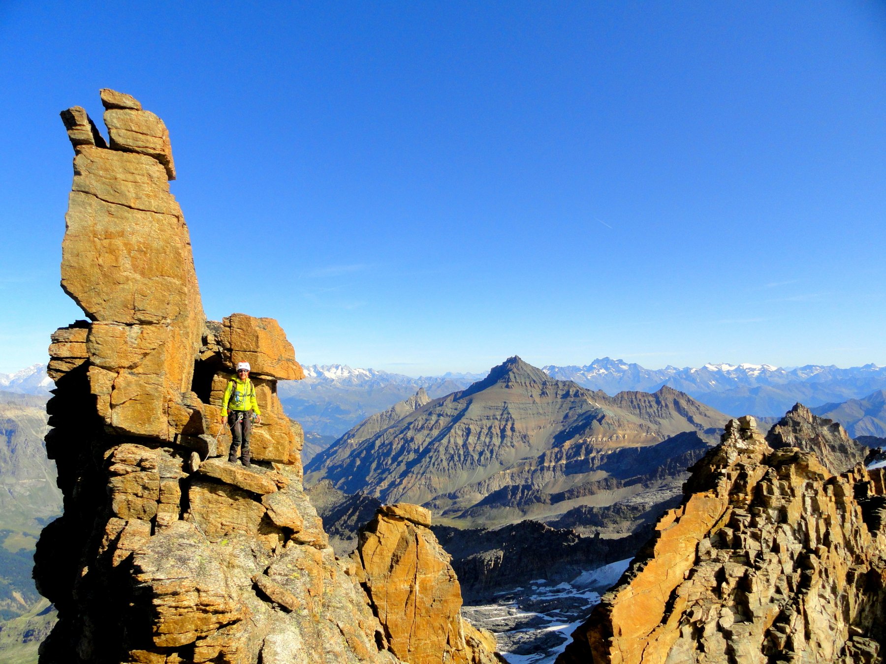
Vetta con notevole panorama sulla catena del Gran Paradiso versante nord. Cresta con buona roccia rimanendo sul filo dove però le difficoltà aumentano. I tratti più impegnativi (max III°) sono comunque aggirabili sul lato sinistro salendo (EST) con passi di I°/II°.
Avvicinamento
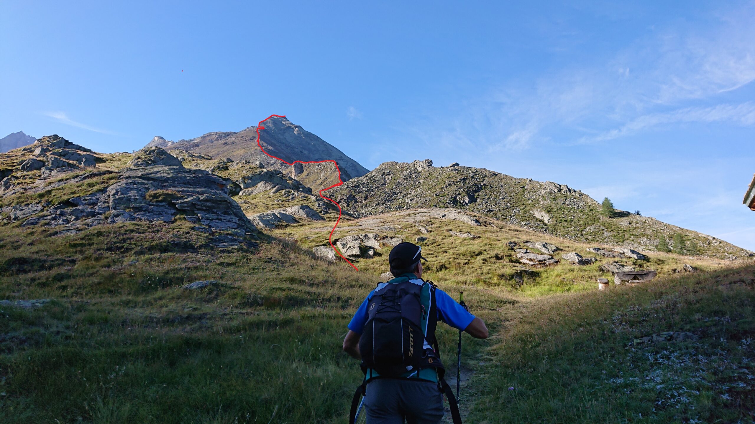
Raggiungere la frazione di Tignet nella Valsavarenche
Descrizione
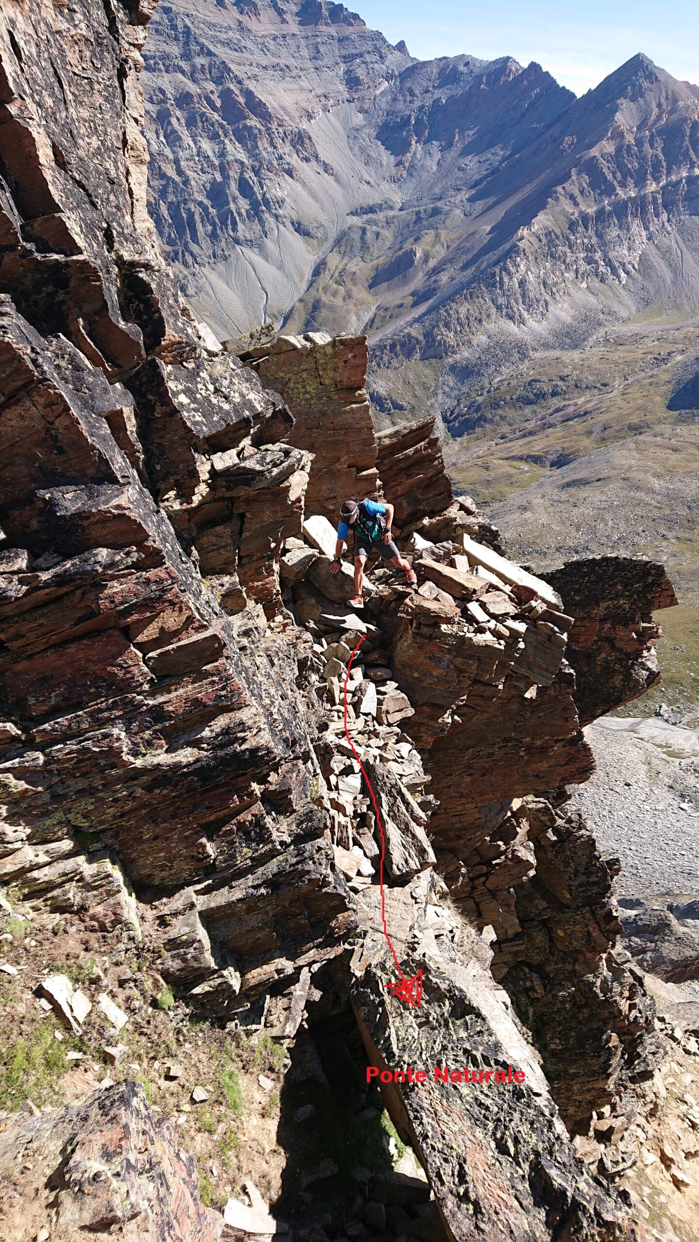
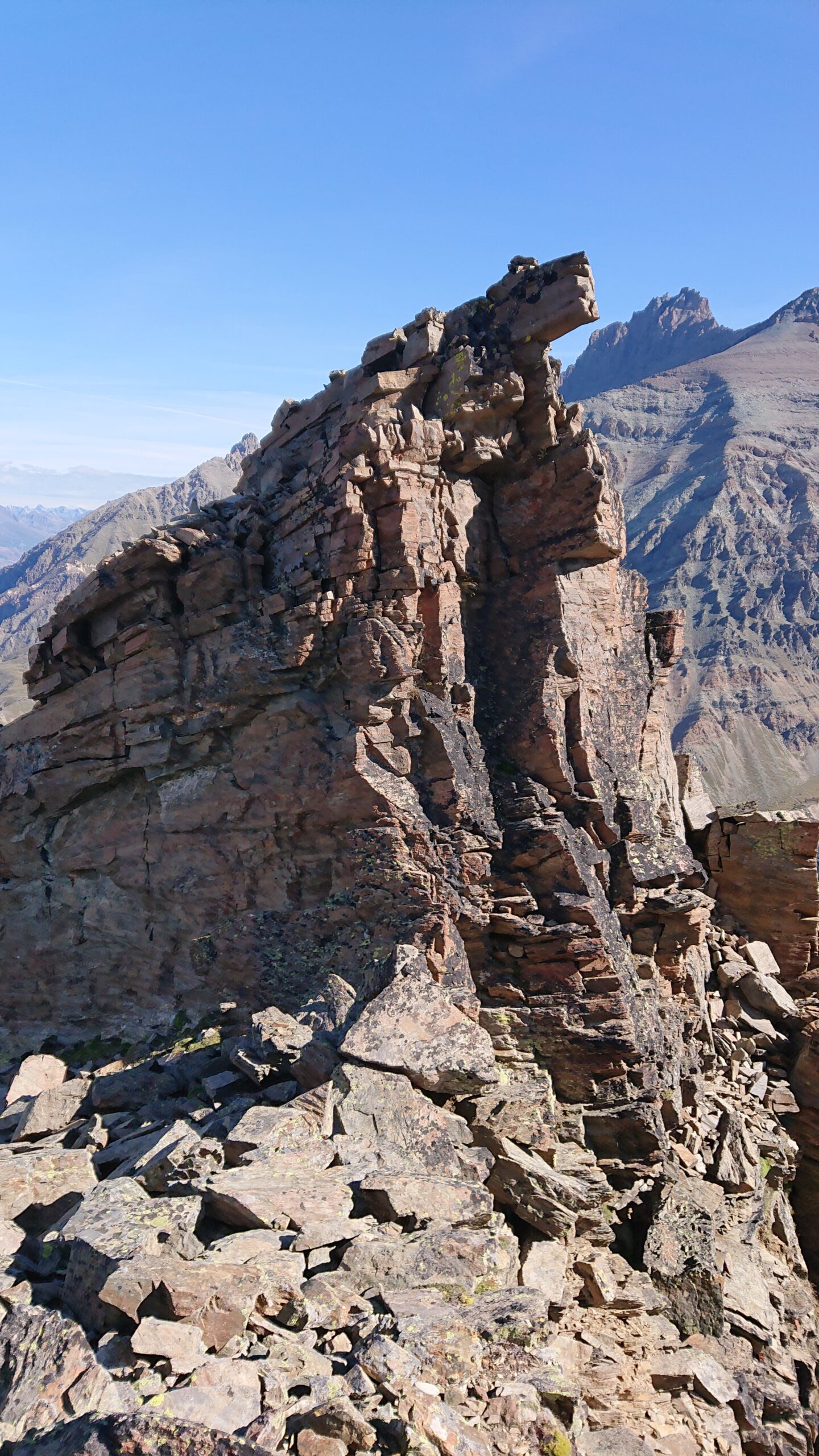
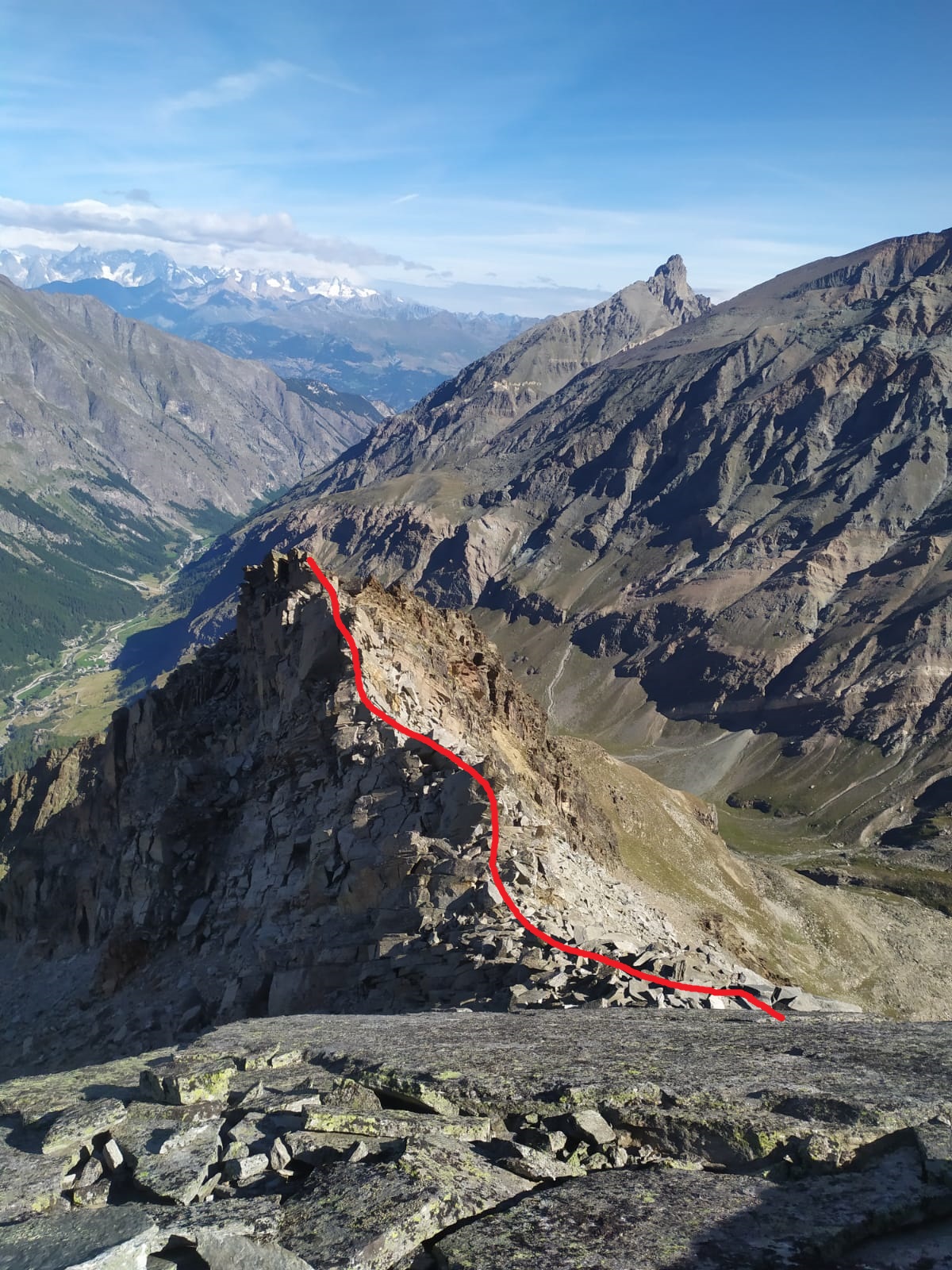
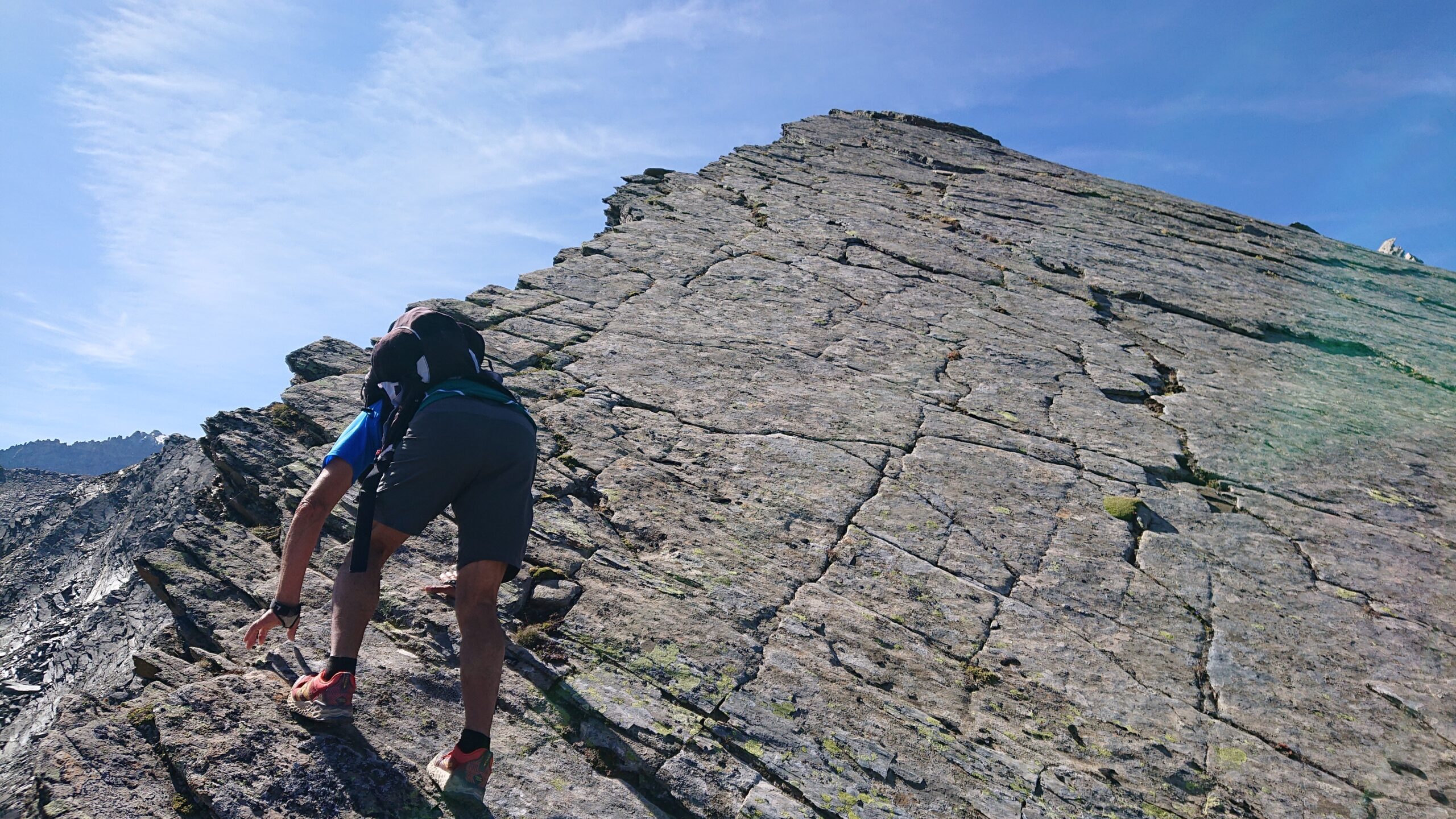
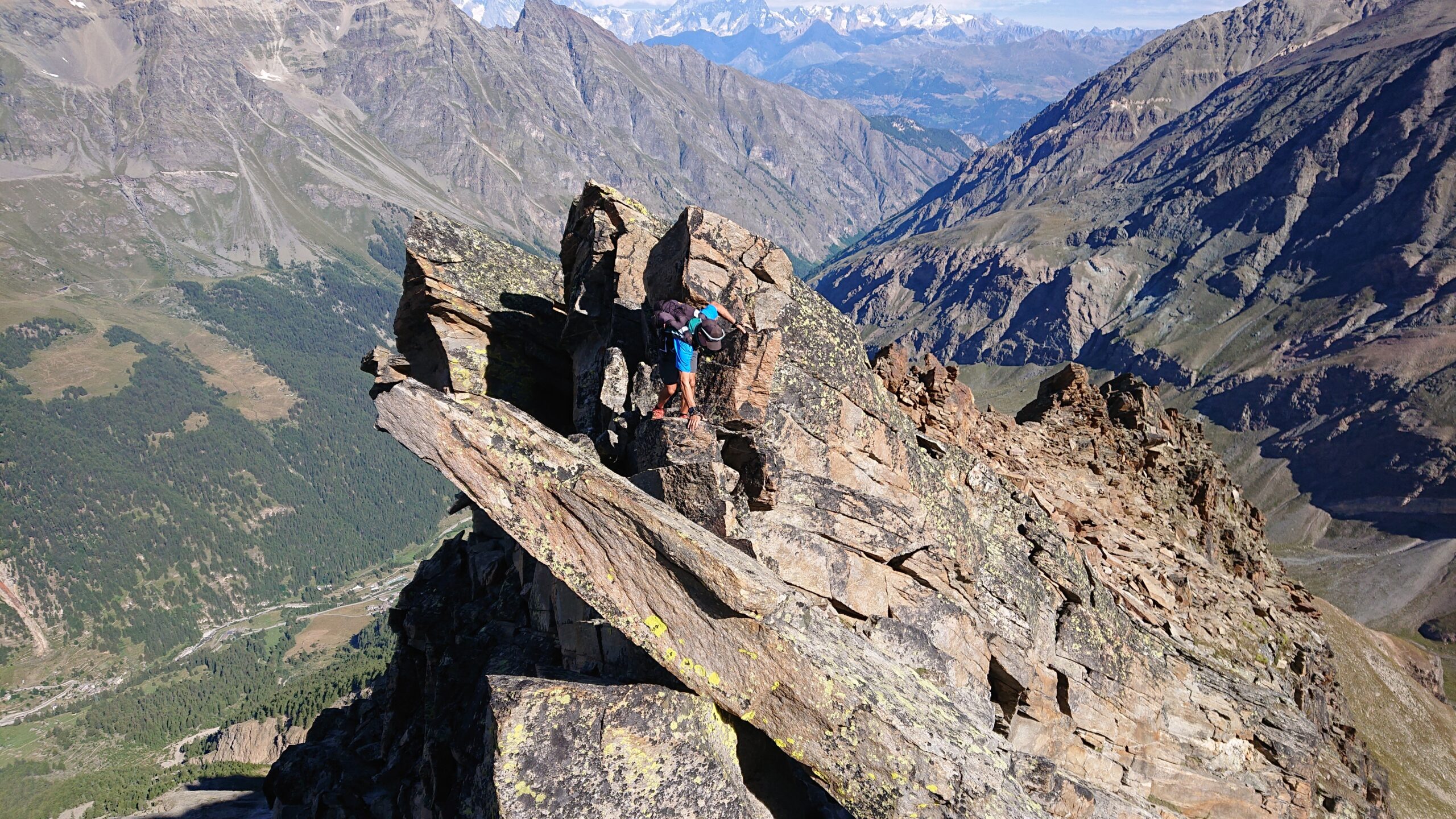
Raggiungere il casotto di Levionaz Inferiore salendo dalla frazione di Tignet (più ripido e diretto) oppure da Eau Rousse (più lungo e pianeggiante). Dal casotto abbandonare il sentiero e prendere la lunga cresta nord della vetta. Si alternano tratti erbosi a tratti rocciosi senza incontrare difficoltà degne di nota. Dove la cresta spiana, si raggiungono una serie di puntine (una con grosso omone chiamate “Costa della Tsò”) e poi scavalcate queste si scende ad un colletto. Da qui la cresta si impenna e diventa più impegnativa, direi sul I° continuo sino a raggiungere una placca liscia dove l’unico passaggio con qualche appiglio si trova esattamente sul filo (III°), esiste comunque la possibilità di aggirare l’ostacolo sul lato sinistro per cenge esposte. Superato questo ostacolo si procede in cresta (II°/III°) o volendo trovare difficoltà minori sempre sul lato sinistro. Sino ad incontrare un dentino che richiederebbe una doppia per scendere (presumo un IV°), si aggira pure questo a sinistra sempre su cenge esposte passando un caratteristico ponticello naturale (enorme sasso di traverso nel canale). Da qui si procede in cresta con sempre la possibilità di aggirare a sinistra (in cresta ottima roccia) per poi raggiungere l’aerea vetta poco dopo.
DISCESA: per itinerario di salita, volendo dalla puntina con grande omino si può scendere la cresta NE raggiungendo un altro grosso omino e poi con lungo traverso verso nord su pendii erbosi ripidi si raggiunge il sentiero nel vallone sottostante che riporta al casotto di Levionaz. (attenzione la discesa diretta nel vallone è interrotta da una fasci rocciosa che credo non percorribile)
Prima ascensione nota di C.Bianco il 1° agosto 1935 da solo
Nelle vicinanze Mappa
Itinerari
24/08/2025 AO, Valsavarenche D+ 2305 m AD- Ovest
Grivola (la) parete ovest dalla Punta Bianca
 50m
50m
24/06/2025 AO, Valsavarenche D+ 1800 m PD+ Ovest
Levionaz (Punta di) traversata Creste NO – SE
 50m
50m
22/07/2025 AO, Valsavarenche D+ 2200 m F+ Sud-Ovest
Bianca della Grivola (Punta) da Tignet
 50m
50m
18/10/2014 AO, Valsavarenche D+ 2100 m PD+ Est
Bianca di Bioula (Punta) da Degioz per il Passo di Lorguibet e la cresta Nord
 1.3Km
1.3Km
04/07/2015 AO, Valsavarenche D+ 1750 m PD Ovest
Favret (Mont) da Rovenaud per il versante ovest
 3.5Km
3.5Km
15/07/2026 AO, Valsavarenche D+ 1700 m AD Sud-Ovest
Money (Punta), Torre e Piramide del Gran Neyron da Pravieux, per la cresta SE e traversata
 4.2Km
4.2Km
22/08/2024 AO, Valsavarenche D+ 1879 m D Nord-Ovest
Gran Paradiso, Parete Nord-Ovest – sperone 3882 m
 4.3Km
4.3Km
14/06/2026 AO, Valsavarenche D+ 2250 m PD- Nord-Ovest
Gran Paradiso da Pravieux per il Rifugio Chabod
 4.3Km
4.3Km
26/06/2011 AO, Valsavarenche D+ 2050 m AD- Nord
Vaccarone (Punta) da Pravieux per il Rifugio Chabod
4.3Km
23/06/2026 AO, Valsavarenche D+ 2300 m D Varie
Gran Paradiso dal Colle di Montandayne per il Piccolo Paradiso e la cresta Nord
 4.3Km
4.3Km