2Km
2Km
Note
 50m
50m
50m
50m
1.6Km
1.6Km
2.6Km
3.5Km
6.3Km
6.3Km
50m
50m
50m
50m
1.6Km
1.6Km
2.6Km
3.5Km
6.3Km
6.3Km
2Km
2.1Km
2.8Km
3.1Km
3.1Km
3.2Km
4Km
4.5Km
6.1Km
6.2Km
Salita che permette di visitare uno o più valloni poco frequentati e molto suggestivi, con diverse varianti possibili. Consigliata anche in autunno vista la quota non elevata.
Dalla Capanna si può salire a piedi alla cima del Monte Ciabertas (2748 m) seguendo tracce di sentiero segnalate con vernice blu.
Avvicinamento
Dalla Capanna si può salire a piedi alla cima del Monte Ciabertas (2748 m) seguendo tracce di sentiero segnalate con vernice blu.
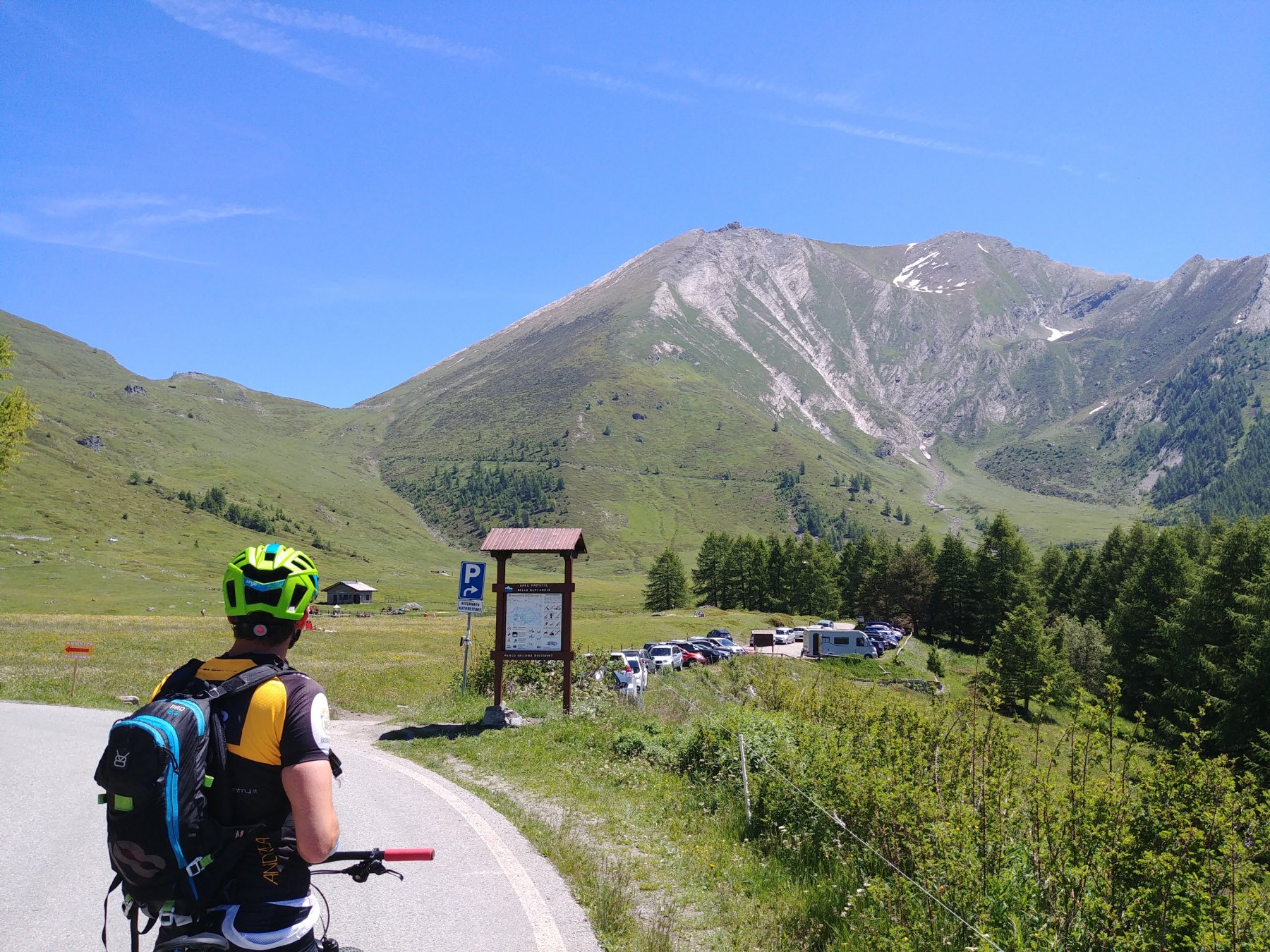
Pinerolo - Perosa Argentina - Pourrieres - Parcheggio del Ciclista
Descrizione
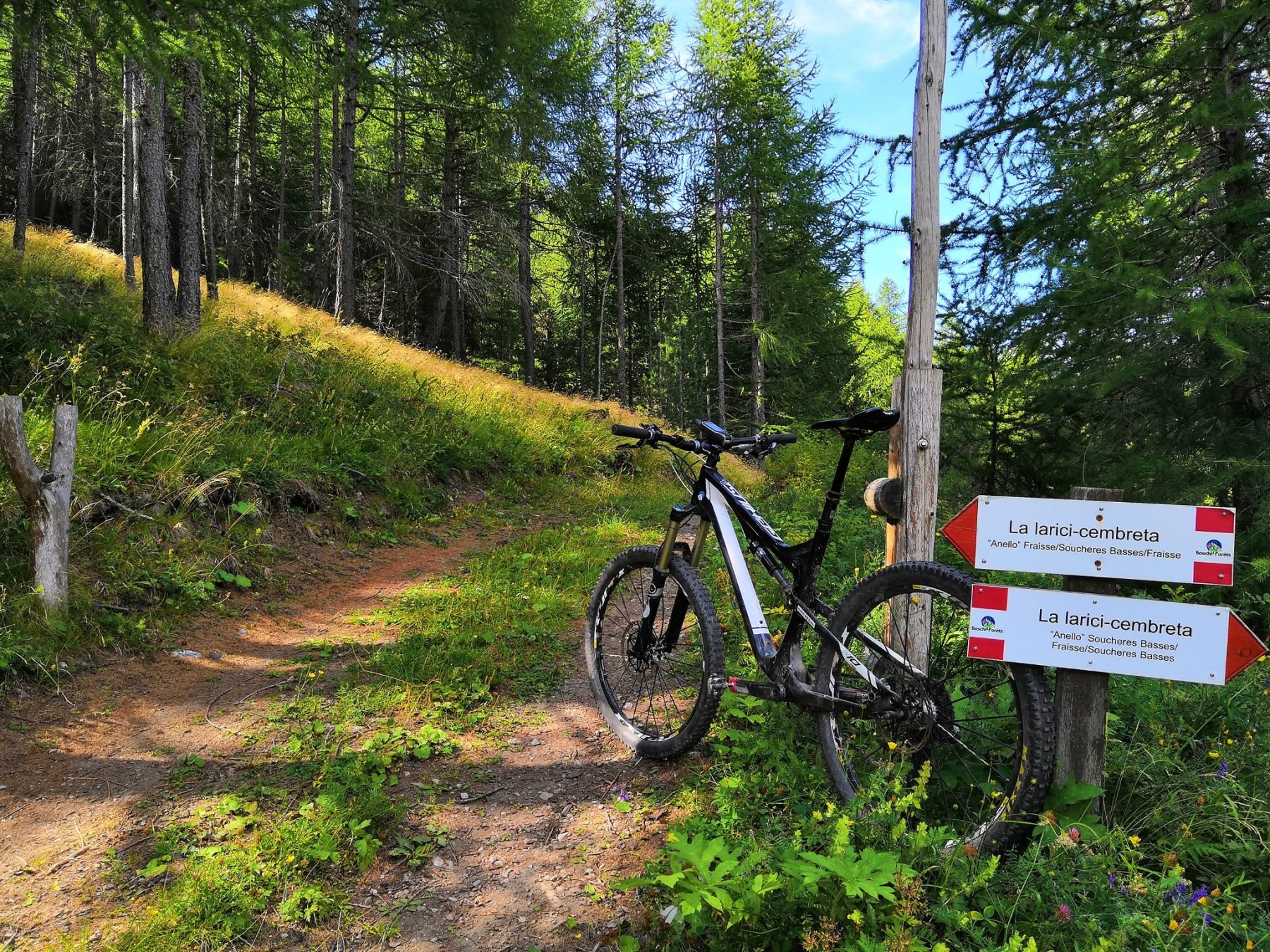
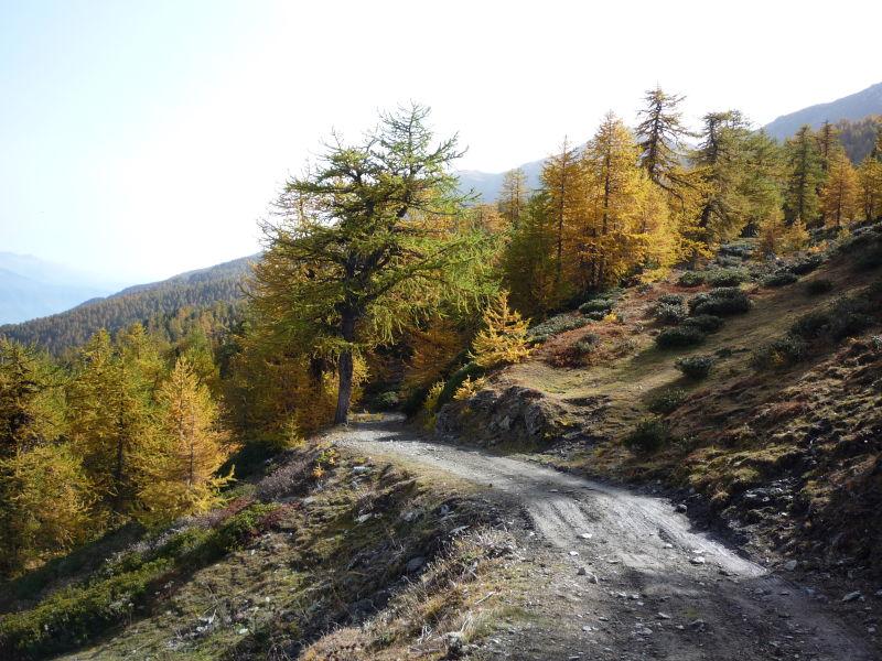
Si parte da Pourrieres scendendo dalla statale al bacino, si prosegue in direzione Fraisse facendo attenzione a superare il torrente Chisone grazie ad un guado in pietra e si giunge ad una bacheca con indicazioni per l’anello “larici-cembreta”, proseguiamo la salita che con diversi tornanti sempre ben pedalabili ci fa guadagnare quota fino ad arrivare ad un tornante a destra dove sono presenti una sbarra in legno e altri cartelli che segnalano il percorso.
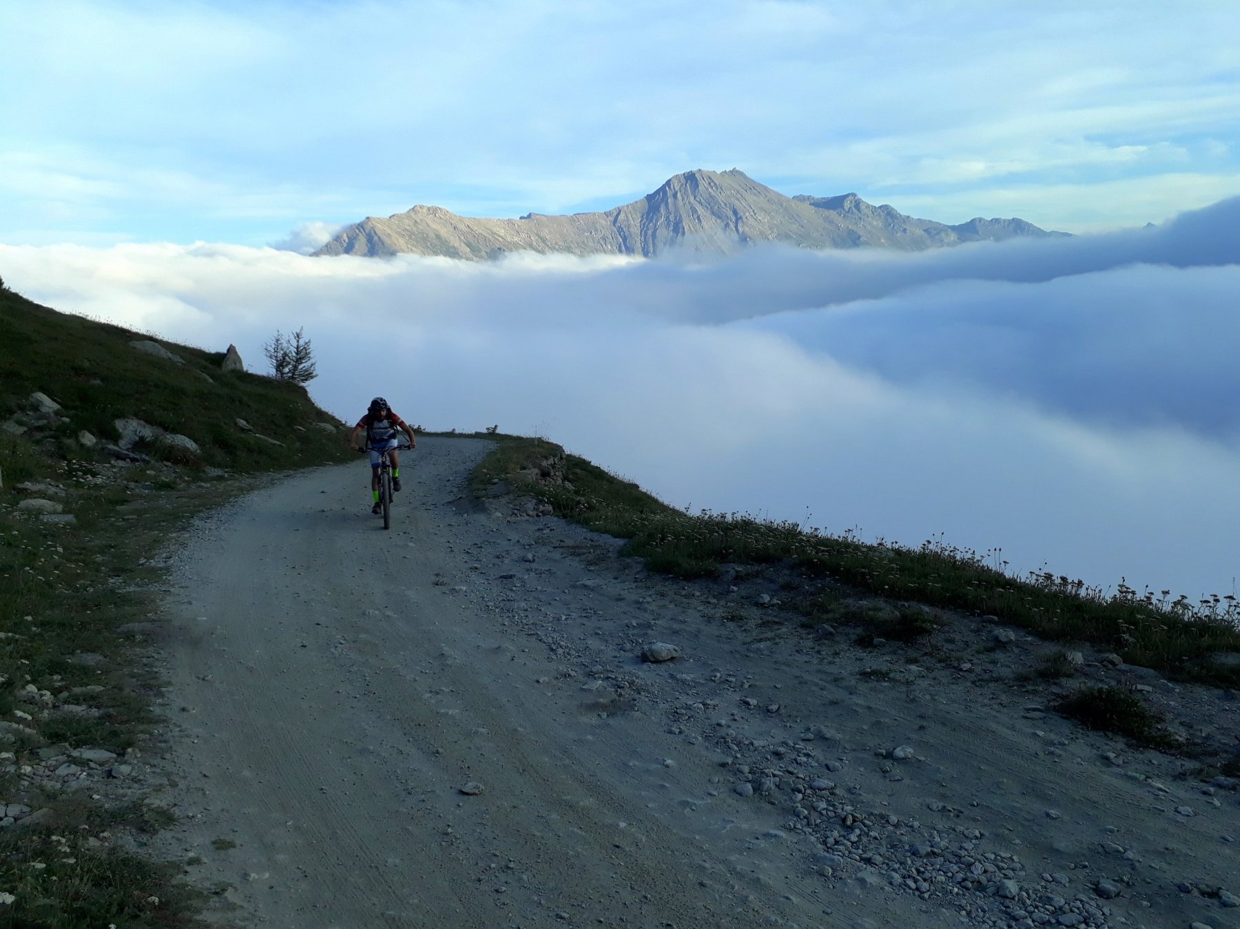
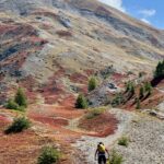
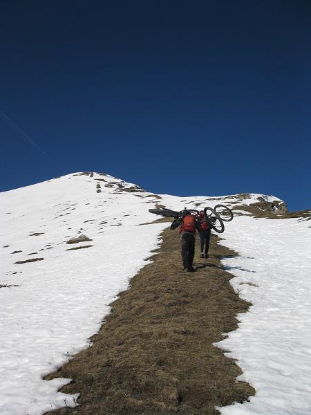
Superiamo la sbarra e affrontiamo un tratto rettilineo che ci porta a quota 1750 m dove a causa delle pendenze esagerate siamo costretti a scendere dalla bici (qualcuno molto allenato potrebbe anche farcela a salire, nel caso sarebbe un’ottima salita di allenamento) e portarla come meglio riusciamo fino a circa 2000 m. dove si ricomincia a pedalare sempre su pendenze sostenute e fondo non regolare.
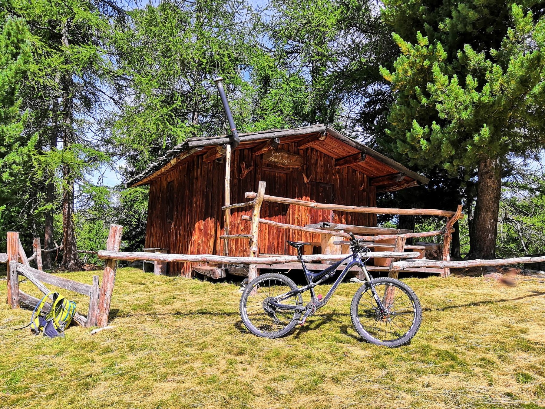
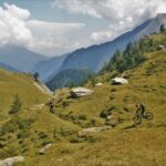
Seguiamo la strada fino a intravedere il bellissimo vallone che scende dall’Albergian – Ciabertas, a questo punto la strada si porta verso sinistra e con un’ultima rampa raggiunge la Capanna Ambrogio, bella baita ristrutturata. Vicino alla baita è presente una fontana (Fontana Zalaveja) che però non sempre ha acqua.
Per la discesa ci sono parecchie possibilità, la parte sentieristica è da verificare ma parlando con altri escursionisti e leggendo precedenti relazioni pare siano tutti praticabili. Ovviamente si può ridiscendere dalla strada di salita che per fondo e pendenza resta comunque già di per se impegnativa.
Dalla fontana parte un sentiero indicato anche sulle Fraternali descritto così nel 2018:”dopo un primo pezzo molto bello la traccia risulta un po coperta dalla vegetazione rigogliosa ma si segue abbastanza facilmente fino ad incrociare la sterrata che scende a Fraisse da cui sempre per sentiero prima e sterrata poi si rientra al punto di partenza” ovviamente relazione escursionistica quindi da verificare fattibilità in MTB.
Altra alternativa è quella di ripercorrere alcuni metri della strada di salita facendo molta attenzione a rintracciare un sentiero che parte a sinistra scendendo con segni blu, questo sentiero è la continuazione dell’anello “larici-cembreta” e con sali scendi e mezzacosta porta poco sotto la fontana di Pra da Cro, fontana situata un centinaio di metri di dislivello sotto la bergeria di Pradamont che si può eventualmente raggiungere per poi scendere su Pragelato. Anche questo sentiero è da verificare con la MTB.
- Cartografia:
- Fraternali n°2 Alta Valle Susa Alta Val Chisone
Nelle vicinanze Mappa
Itinerari
24/06/2026 TO, Usseaux D+ 1200 m MC, BC, S1 Sud
Assietta (Testa dell’) da Pourrieres, giro per il Col Lauson
 50m
50m
25/06/2026 TO, Usseaux D+ 1600 m BC, OC+, S3 Varie
Ciantiplagna (Cima) e Colle dell’Assietta da Pourrieres per il Colle delle Finestre, discesa per il vallone di Cerogne
 50m
50m
23/06/2019 TO, Usseaux D+ 1350 m OC, TC, S2 Sud
Assietta (Testa dell’) da Pourrieres, giro con discesa nel Vallone di Cerogne
 50m
50m
26/06/2021 TO, Usseaux D+ 1600 m MC+, BC+, S3 Varie
Ciantiplagna (Cima) e Testa dell’Assietta da Pourrieres, giro per il Colle Finestre, discesa GTA
 50m
50m
27/07/2023 TO, Usseaux D+ 1180 m BC, OC, S3 Sud
Gran Costa (Monte) da Balboutet, giro
 1.6Km
1.6Km
27/05/2026 TO, Fenestrelle D+ 1400 m MC+, MC, S0 Varie
Ciantiplagna (Cima) e Testa dell’Assietta da Balboutet, giro per il Colle dell’Assietta
 1.6Km
1.6Km
11/07/2026 TO, Usseaux D+ 1700 m BC, BC+, S2 Varie
Albergian (Colle dell’) da Laux, giro Val Troncea – Val Chisone per il Colle del Pis
 2.6Km
2.6Km
06/01/2015 TO, Usseaux D+ 1300 m MC+, BC+, S2 Sud-Ovest
Pintas (Monte) da Usseaux, giro per il Colle delle Finestre
 3.5Km
3.5Km
21/09/2025 TO, Chiomonte D+ 1139 m BC, BC+, S2 Nord
Gran Serin (Punta del) da Frais
 6.3Km
6.3Km
07/08/2024 TO, Chiomonte D+ 1359 m BC, BC, S1 Varie
Ciantiplagna (Cima) da Frais per il Gran Serin
 6.3Km
6.3Km
Servizi
2Km
2.1Km
Edelweiss Ristorante
Usseaux
2.8Km
Souvenir Rifugio
Usseaux
3.1Km
Pian dell’alpe Rifugio
Usseaux
3.1Km
Cheese Bar Ristorante
Usseaux
3.2Km
La Placette Ristorante
Usseaux
4Km
Lago delle Rane Rifugio
Usseaux
4.5Km
1898 Ristorante
Soucheres-basses
6.1Km
Meizon Blanco Ristorante
Fenestrelle
6.2Km