2.9Km
2.9Km

Note
Storico
 50m
100m
250m
1.1Km
1.1Km
1.1Km
1.1Km
1.1Km
1.1Km
1.1Km
50m
100m
250m
1.1Km
1.1Km
1.1Km
1.1Km
1.1Km
1.1Km
1.1Km
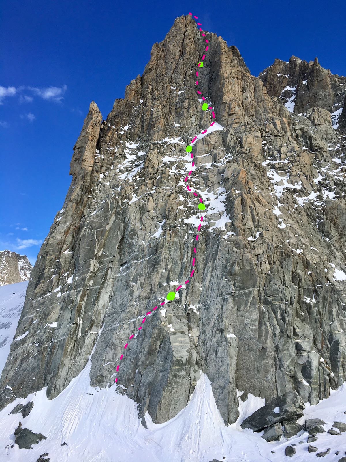
Materiale necessario: Friend fino al blu bd, serie nuts, 2 corde da 50m
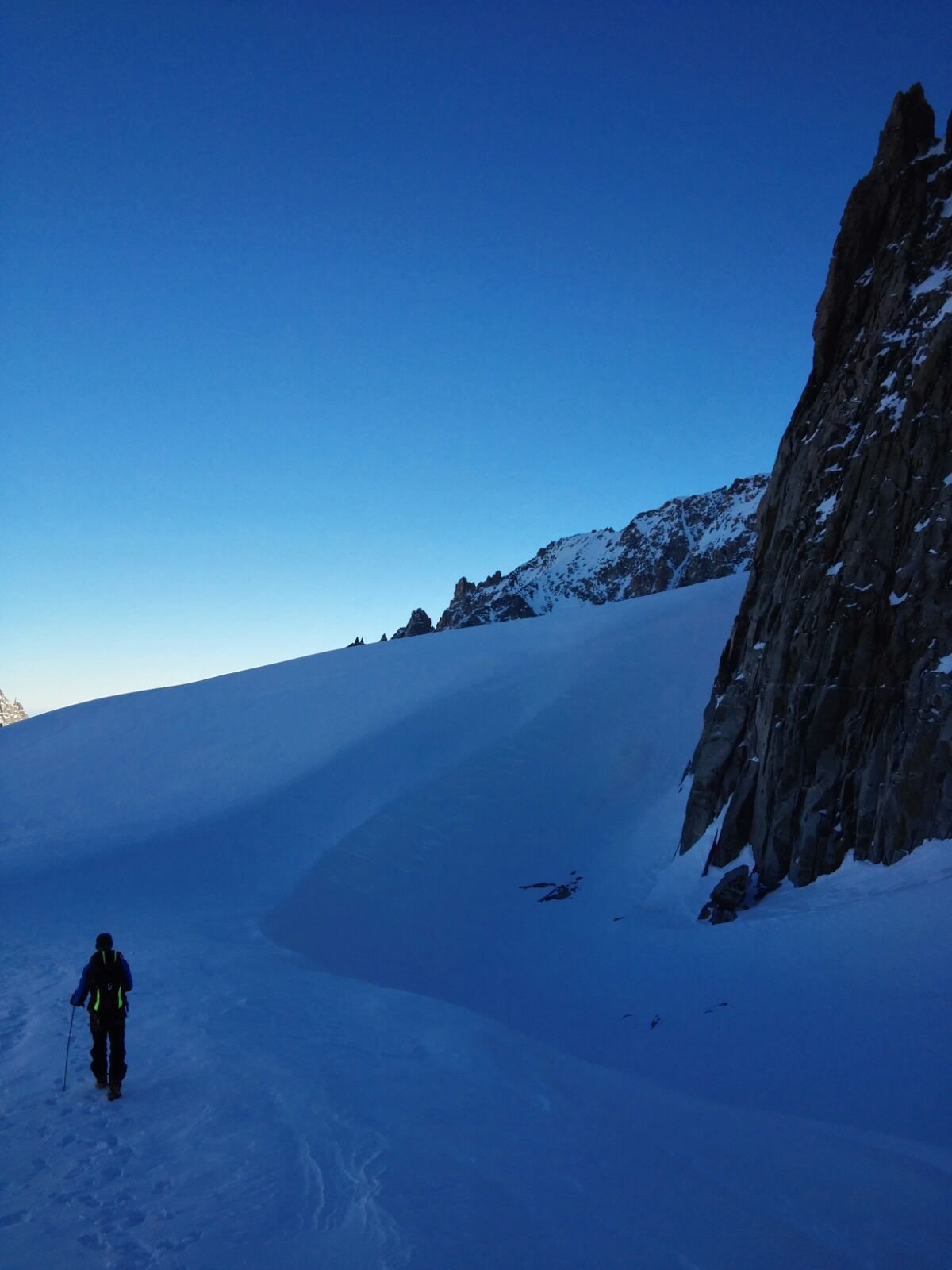
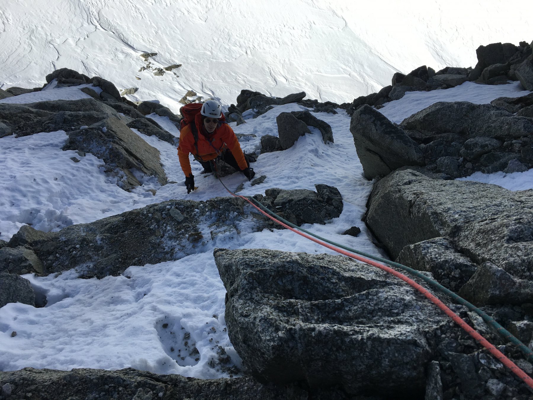
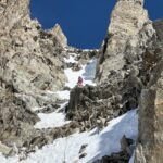
Avvicinamento
Dal Rifugio Torino leggermente in discesa , lungo la traccia che porta al Dente e al colle di Marbree , fino al punto in cui la traccia comincia a salire.
La parete si trova sulla destra 15 min dal rifugio.
Descrizione
La parete si trova sulla destra 15 min dal rifugio.
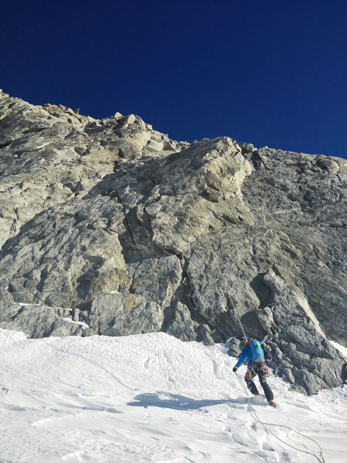
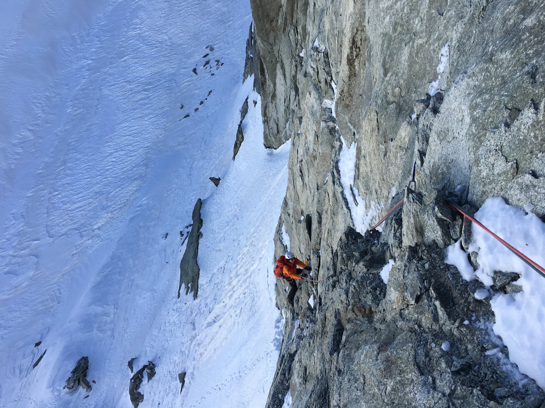
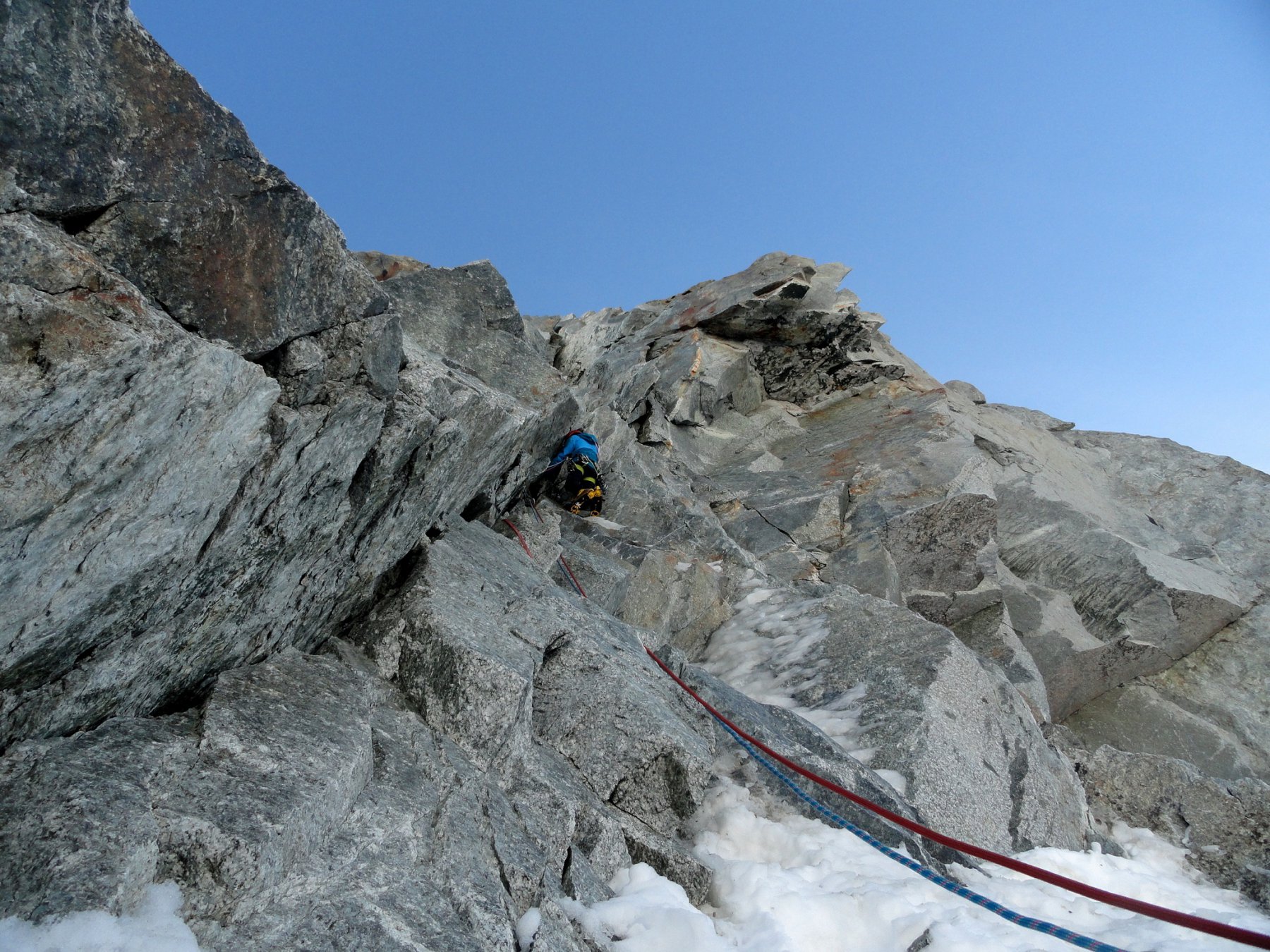
L1 40m M5 esile diedrino ghiacciato ad arco verso dx 2 chiodi con cordini in posto , sosta sul terrazzino
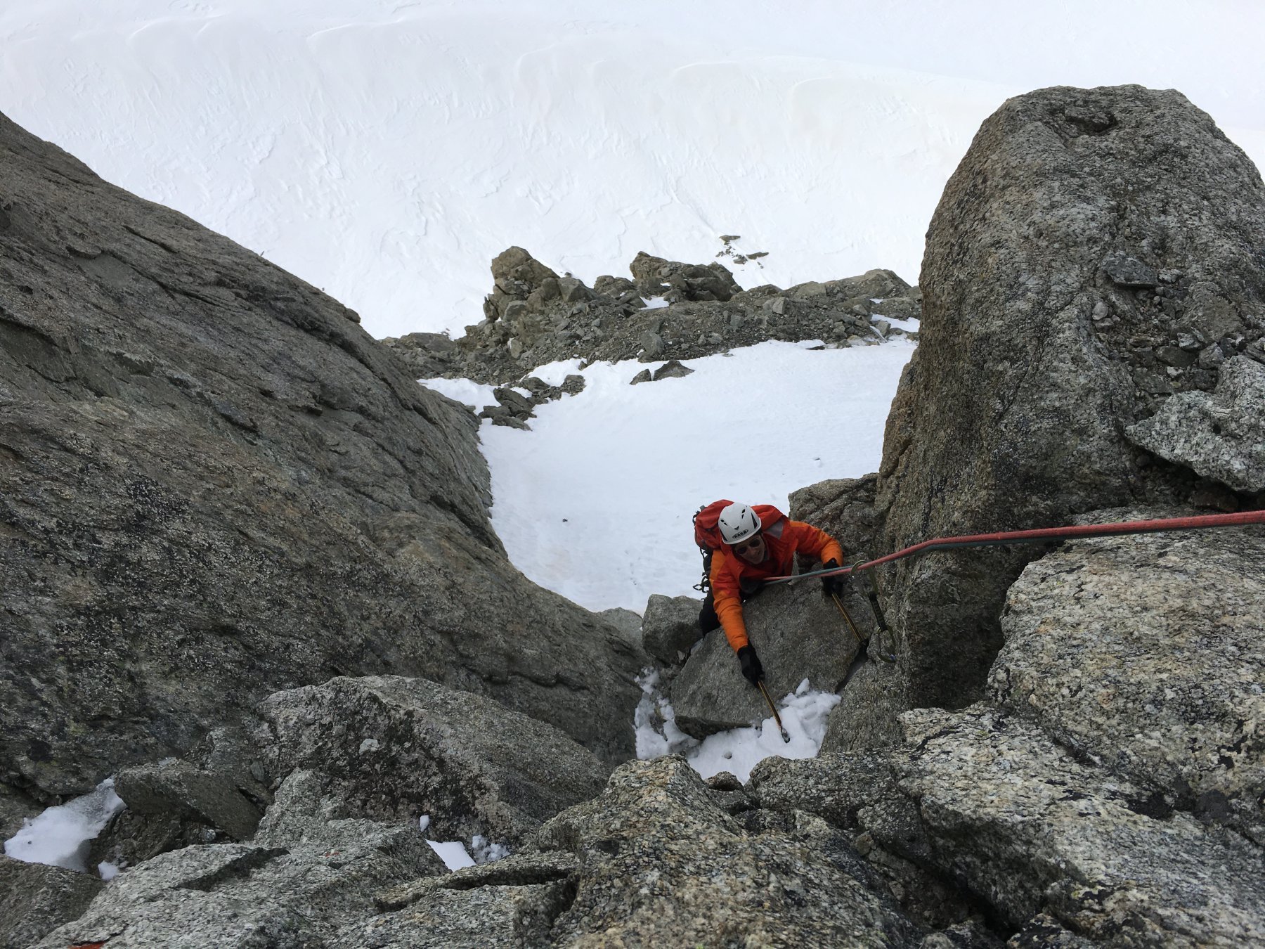
L2 45m 4b attraversare a dx 7/8 m e salire il diedro , sosta su spuntone
L3 45m 50* sosta nella strozzatura a sinistra
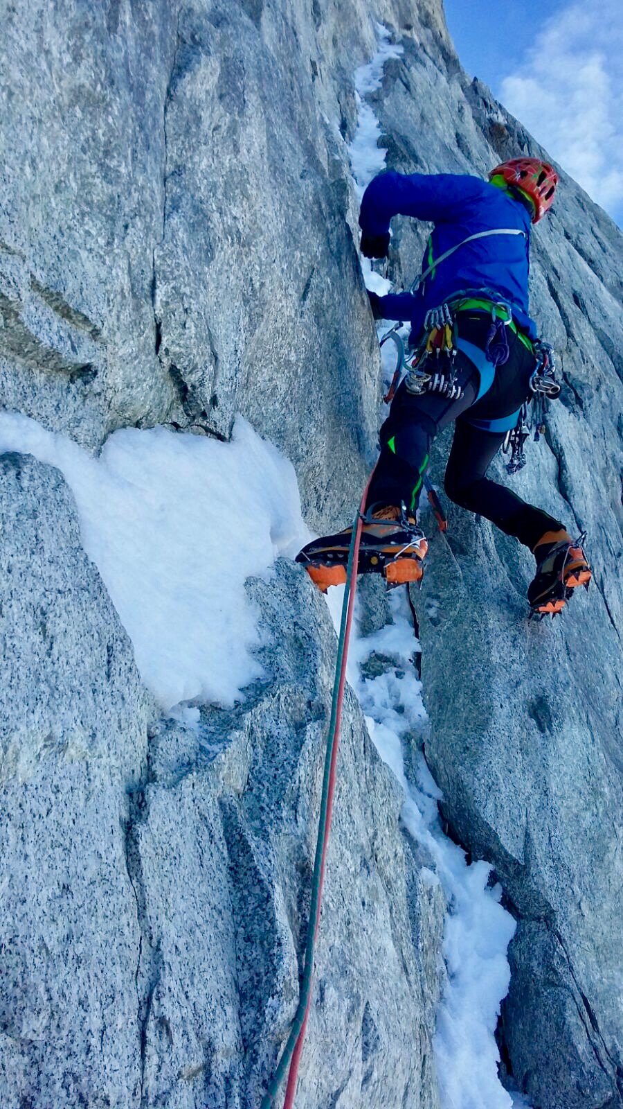
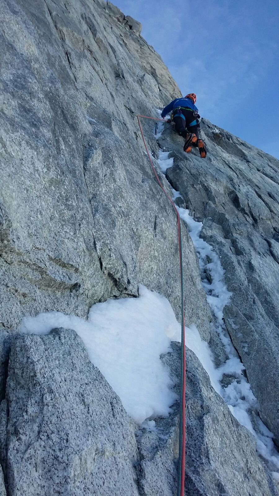
L4 45m 50*/60 4b verso dx sul pendio di neve e salire la goulotte/canale sosta a sx
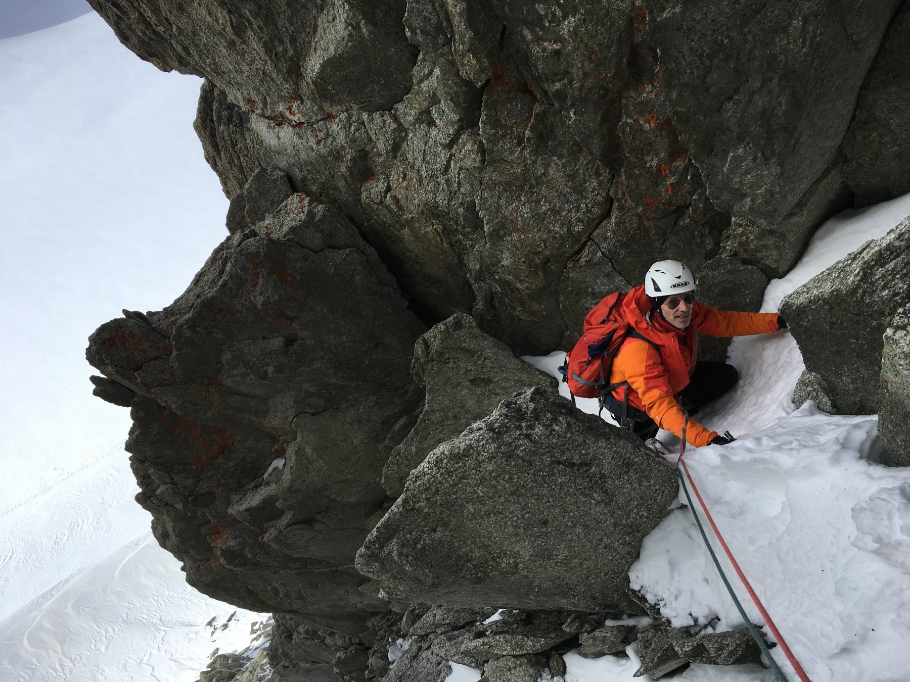
L5 40m 50* 4a dritti nel canale sosta 6/7m sotto lo strapiombetto finale
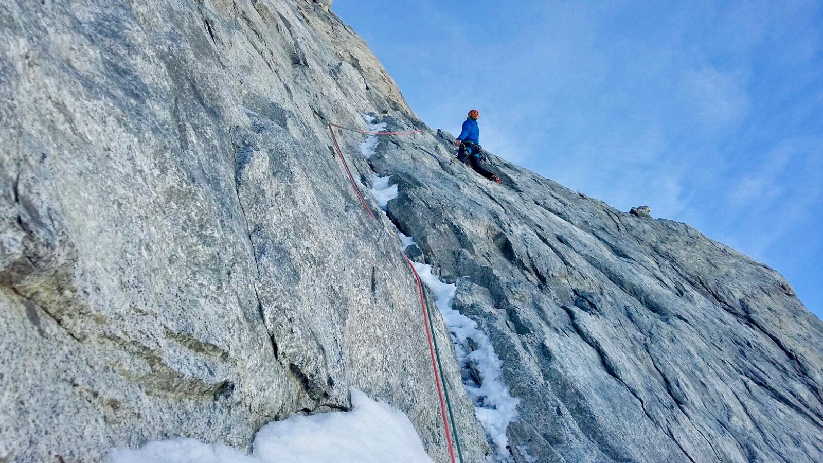
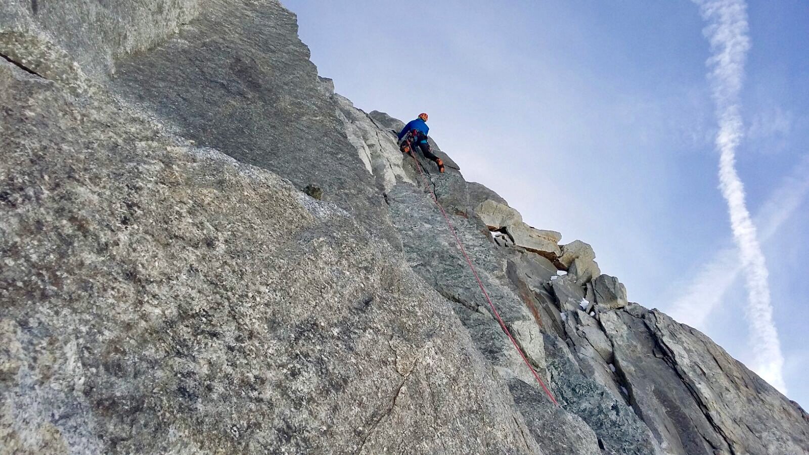
L6 40m 5b superamento di un tratto aggettante , più impressionante che duro , seguite poi gli spit della via Plat fino in cima
Discesa in doppia dalla via attrezzate
Prima salita il 31/10/2016 di Ezio Marlier , Alberto Corbella
La via porta i cognomi di Gerard e Joël amici persi al Cervino nel 2016
La via porta i cognomi di Gerard e Joël amici persi al Cervino nel 2016
Nelle vicinanze Mappa
Itinerari
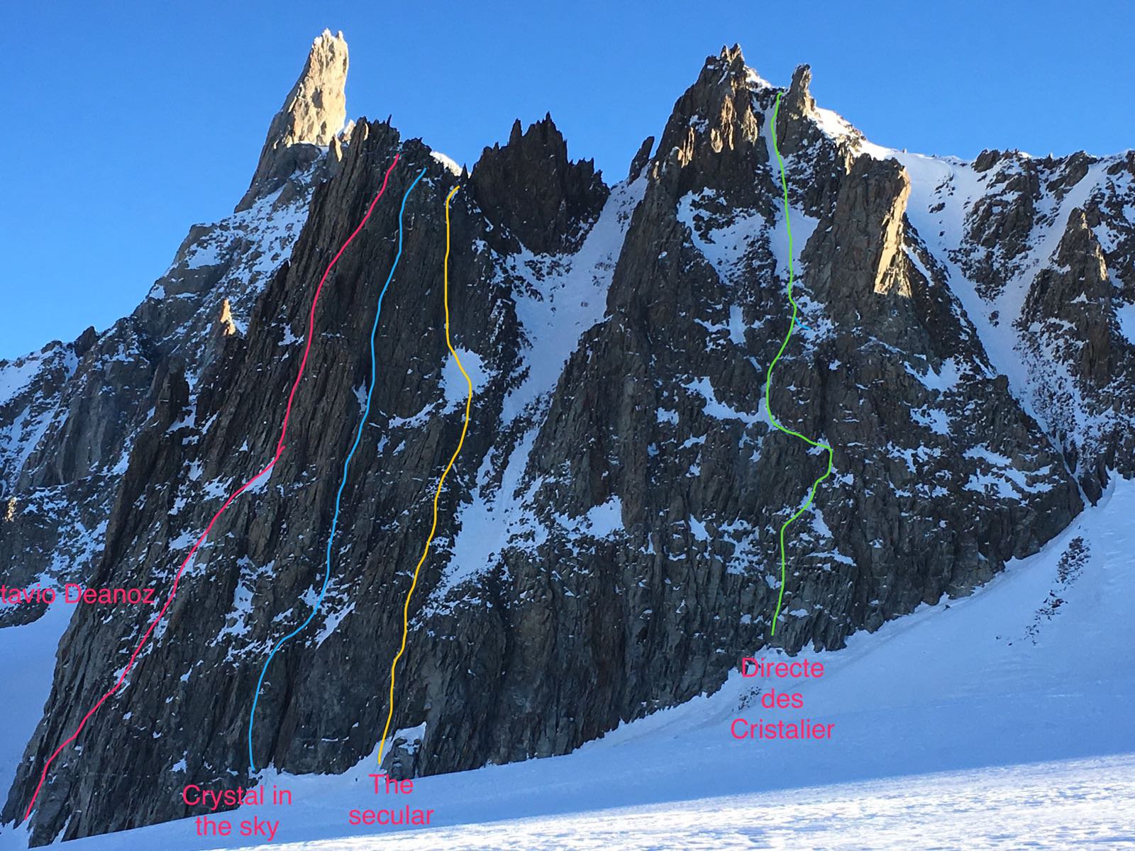
04/12/2016 AO, Courmayeur D+ 250 m ED- Nord
Marbrées (Aiguilles) – Crystal in the Sky
 50m
50m
08/12/2016 AO, Courmayeur D+ 230 m TD+ Nord-Ovest
Marbrées (Aiguilles) – The Secular
 100m
100m
28/03/2026 AO, Courmayeur D+ 250 m D+ Nord
Marbrées (Aiguilles) – Directe des Cristalliers
 250m
250m
17/06/2026 AO, Courmayeur D+ 800 m D+ Sud
Tacul (Mont Blanc du) – Aiguille du Diable Traversata dal Rifugio Torino
 1.1Km
1.1Km
13/04/2019 AO, Courmayeur D+ 700 m PD+ Nord-Est
Tour Ronde Via Normale per il Colle Freshfield
 1.1Km
1.1Km
10/04/2025 AO, Courmayeur D+ 200 m TD+ Nord
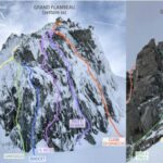
Grand Flambeau, settore Cuori di Ghiaccio – Koala Pirla
 1.1Km
1.1Km
21/02/2023 AO, Courmayeur D+ 212 m F Sud-Est
Toules (Aiguille des) Via Normale
 1.1Km
1.1Km
11/07/2025 AO, Courmayeur D+ 900 m AD Varie
Rochefort (Aiguille e Dome de) Cresta di Rochefort
 1.1Km
1.1Km
18/06/2026 AO, Courmayeur D+ 1300 m D Sud-Est
Maudit (Mont) Cresta Kuffner
 1.1Km
1.1Km
11/07/2016 AO, Courmayeur D+ 900 m PD+ Sud-Ovest
Tour Ronde Cresta SO dal Col du Trident
 1.1Km
1.1Km