2.9Km
2.9Km

Note
 50m
1.5Km
4.8Km
7.4Km
7.5Km
14.6Km
15.4Km
50m
1.5Km
4.8Km
7.4Km
7.5Km
14.6Km
15.4Km
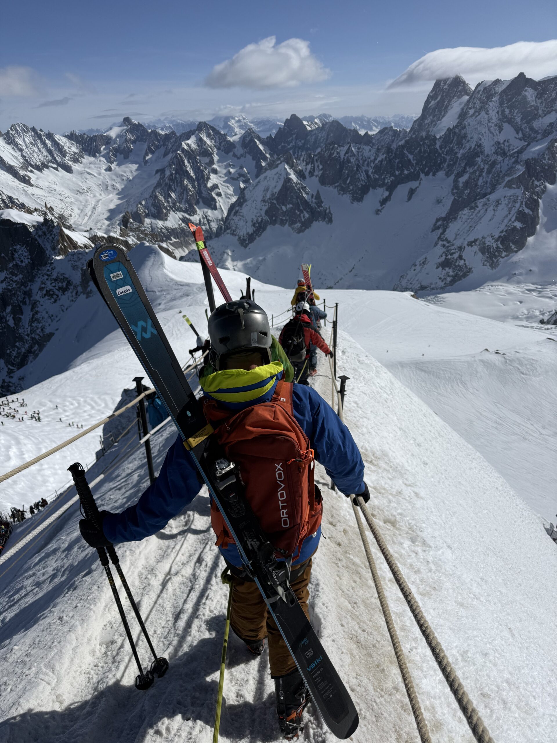
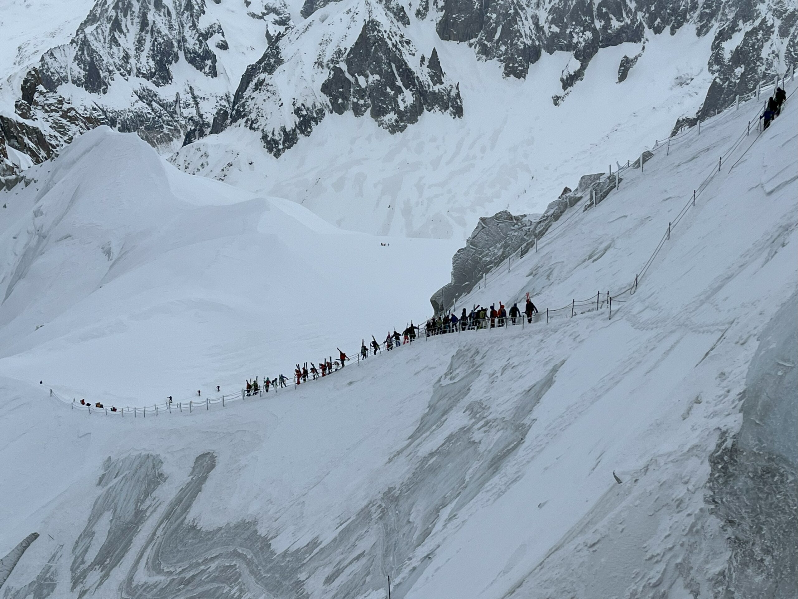
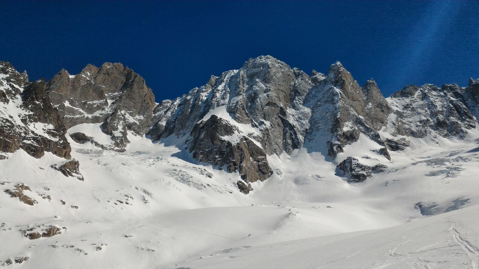
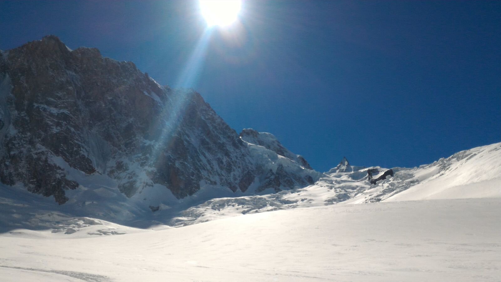
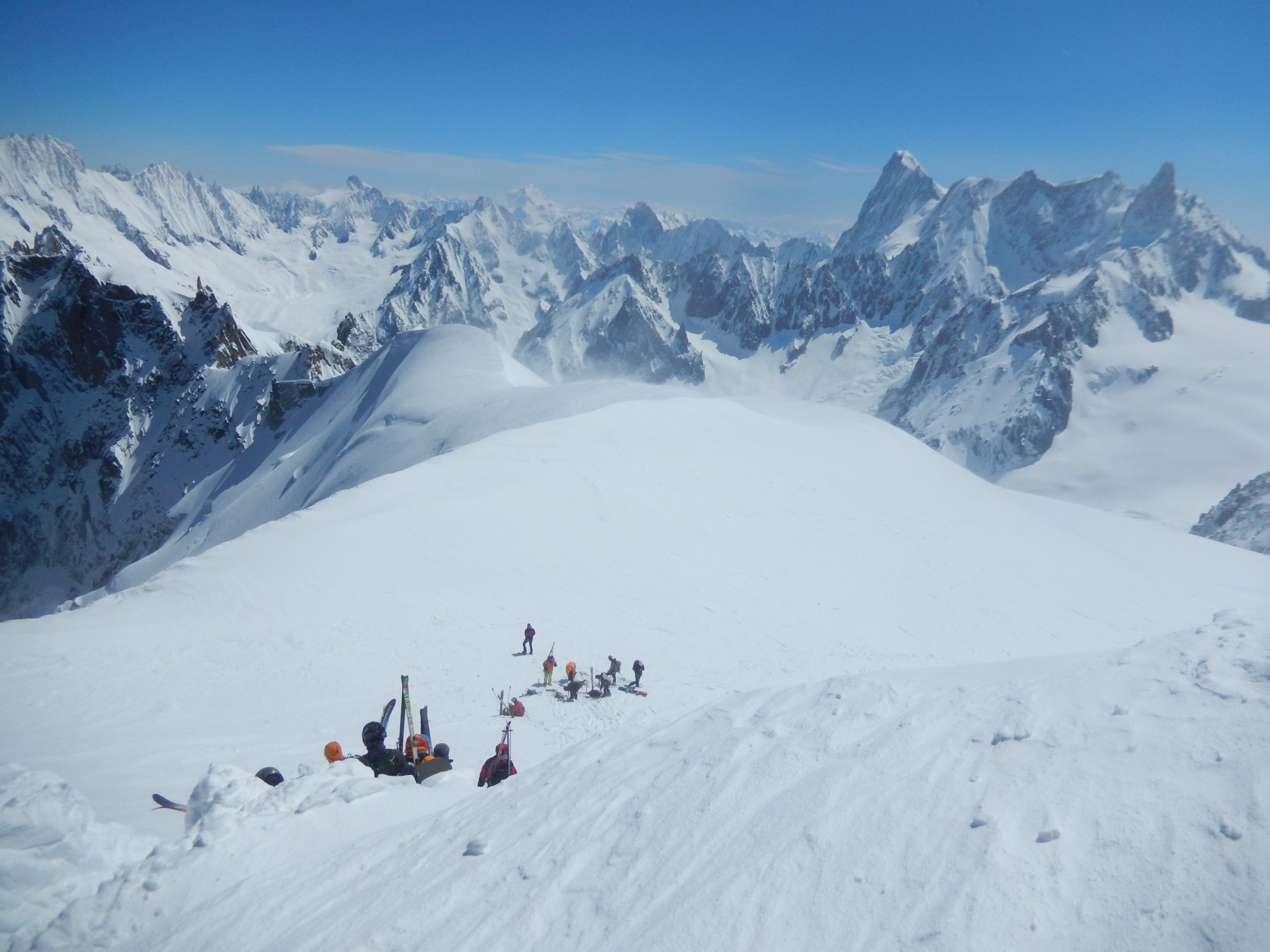
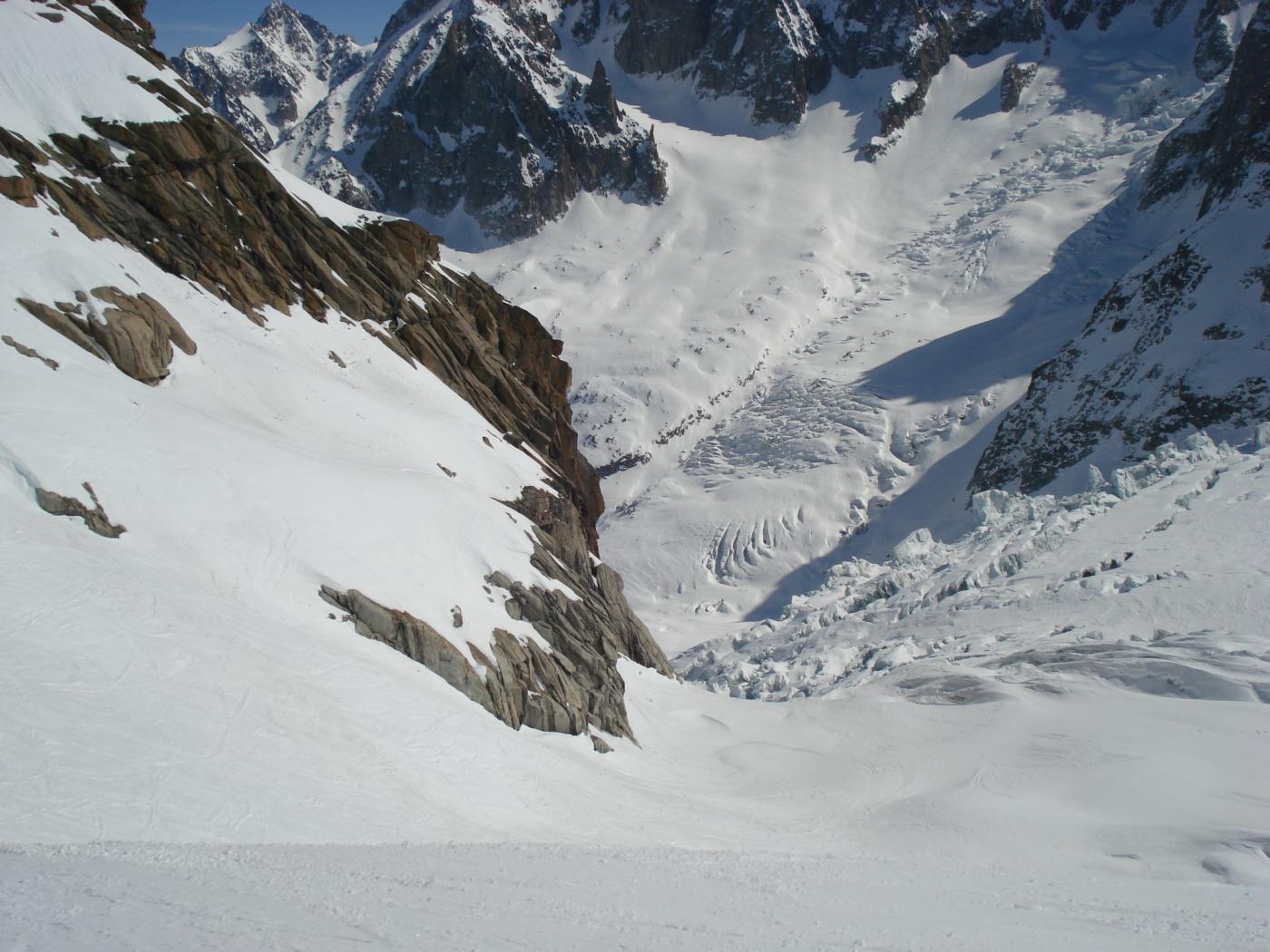
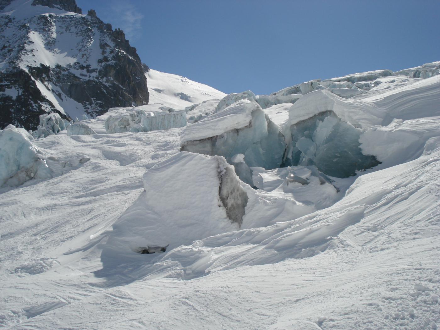
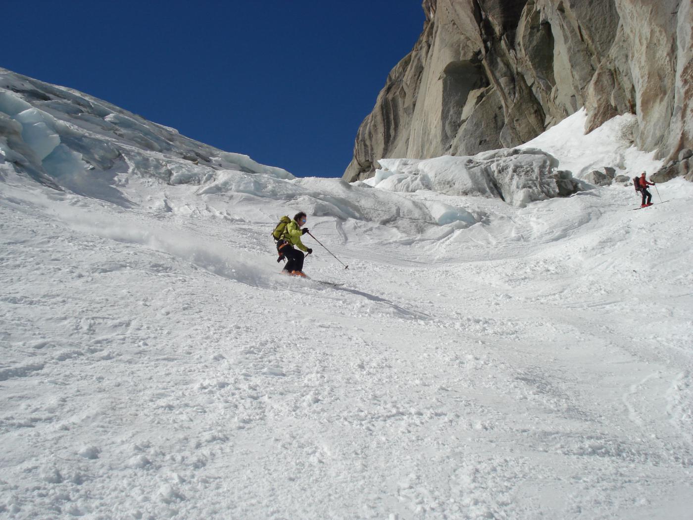
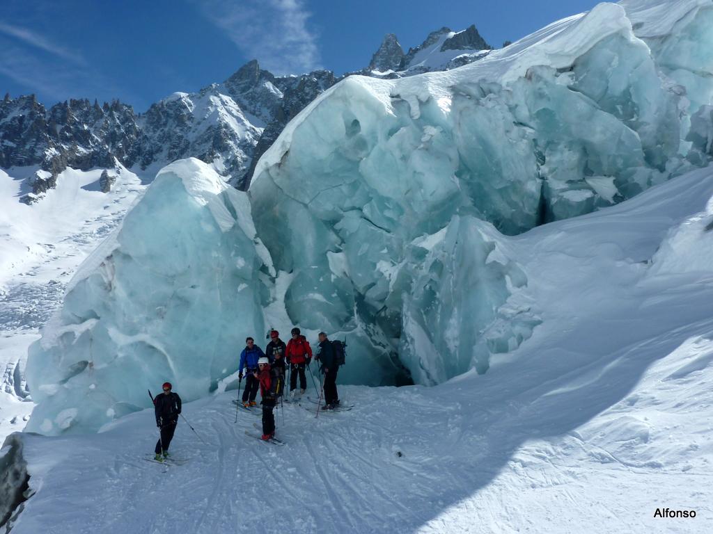
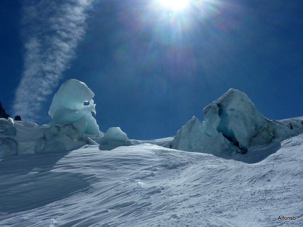
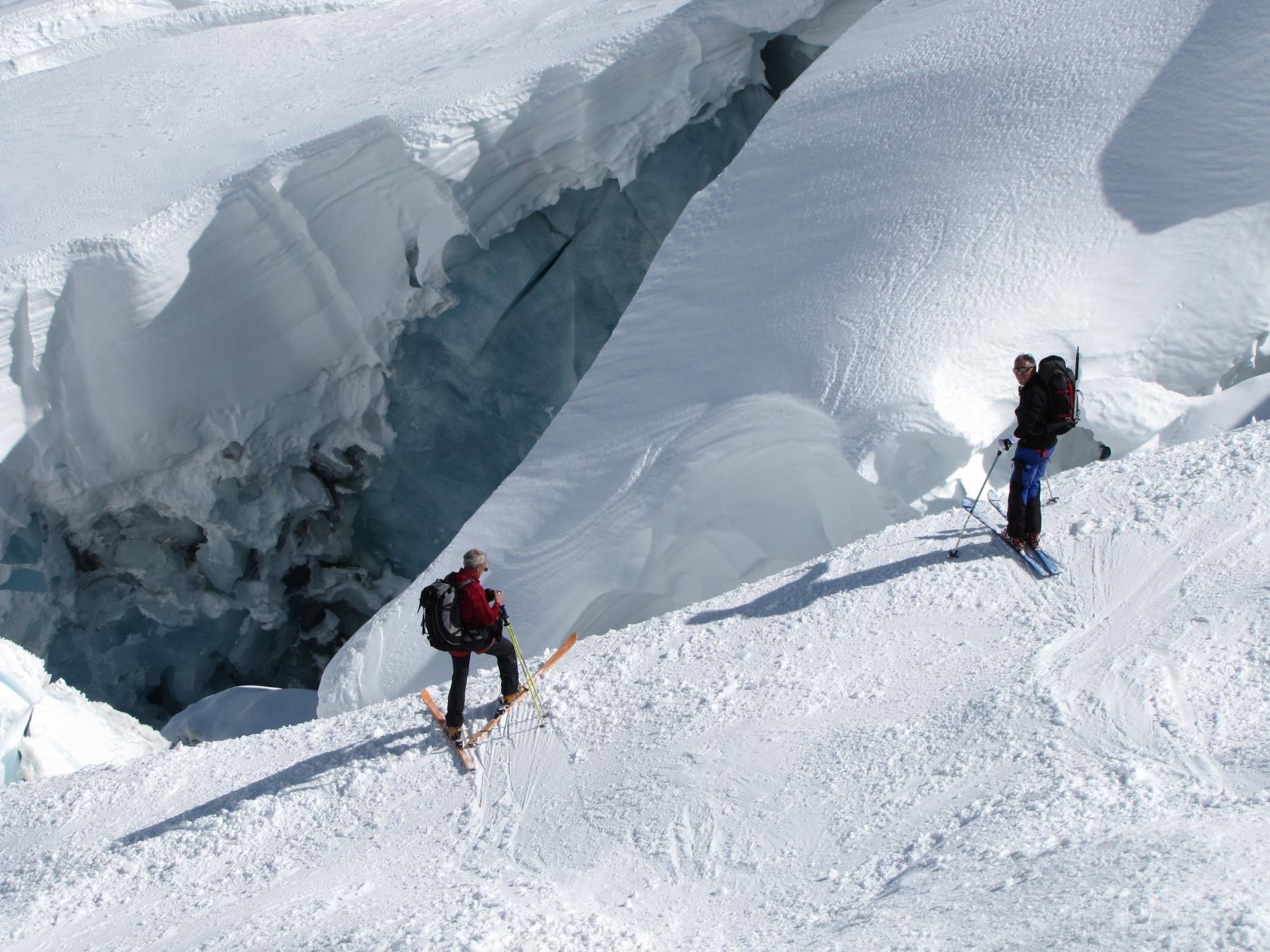
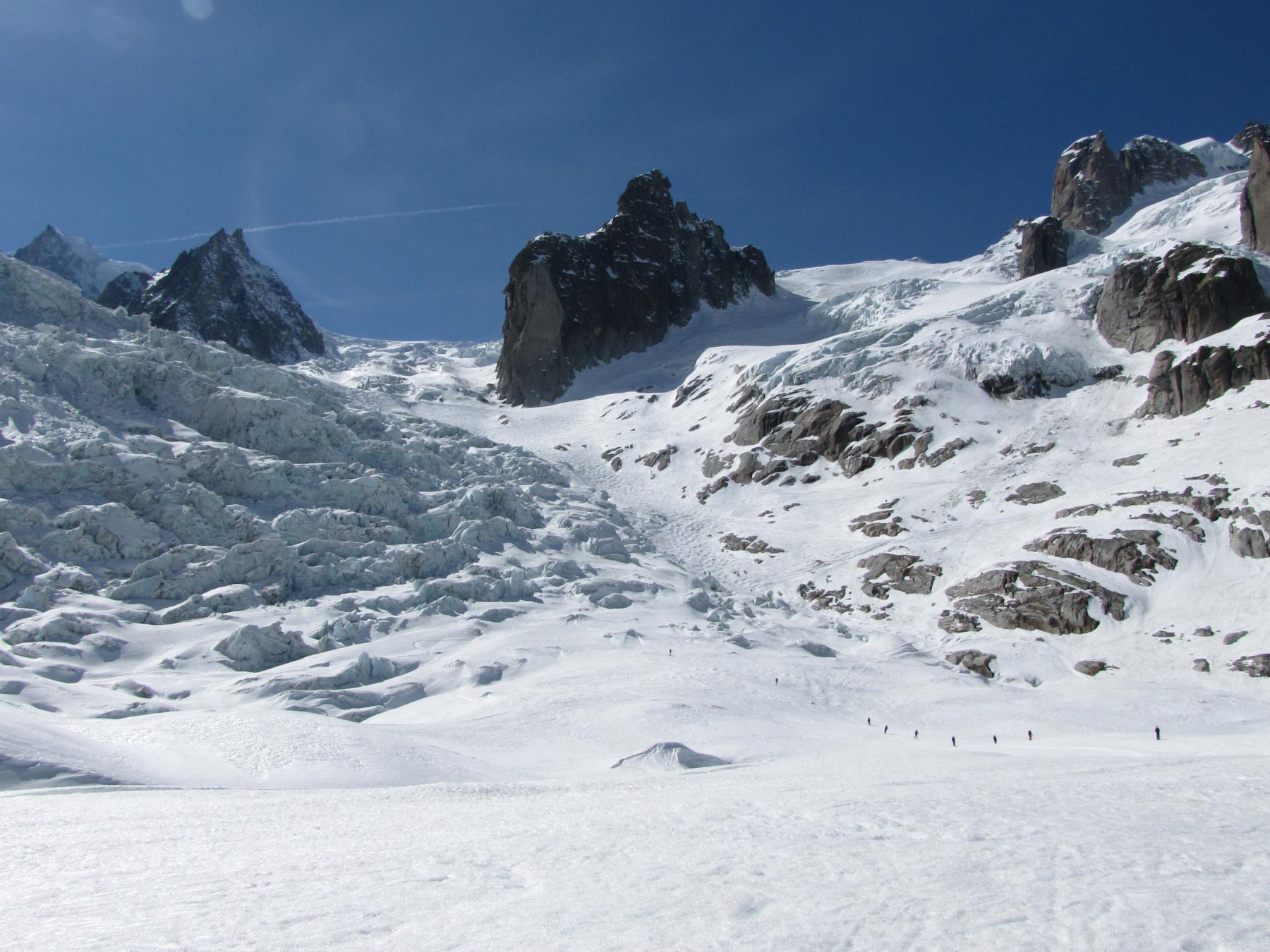
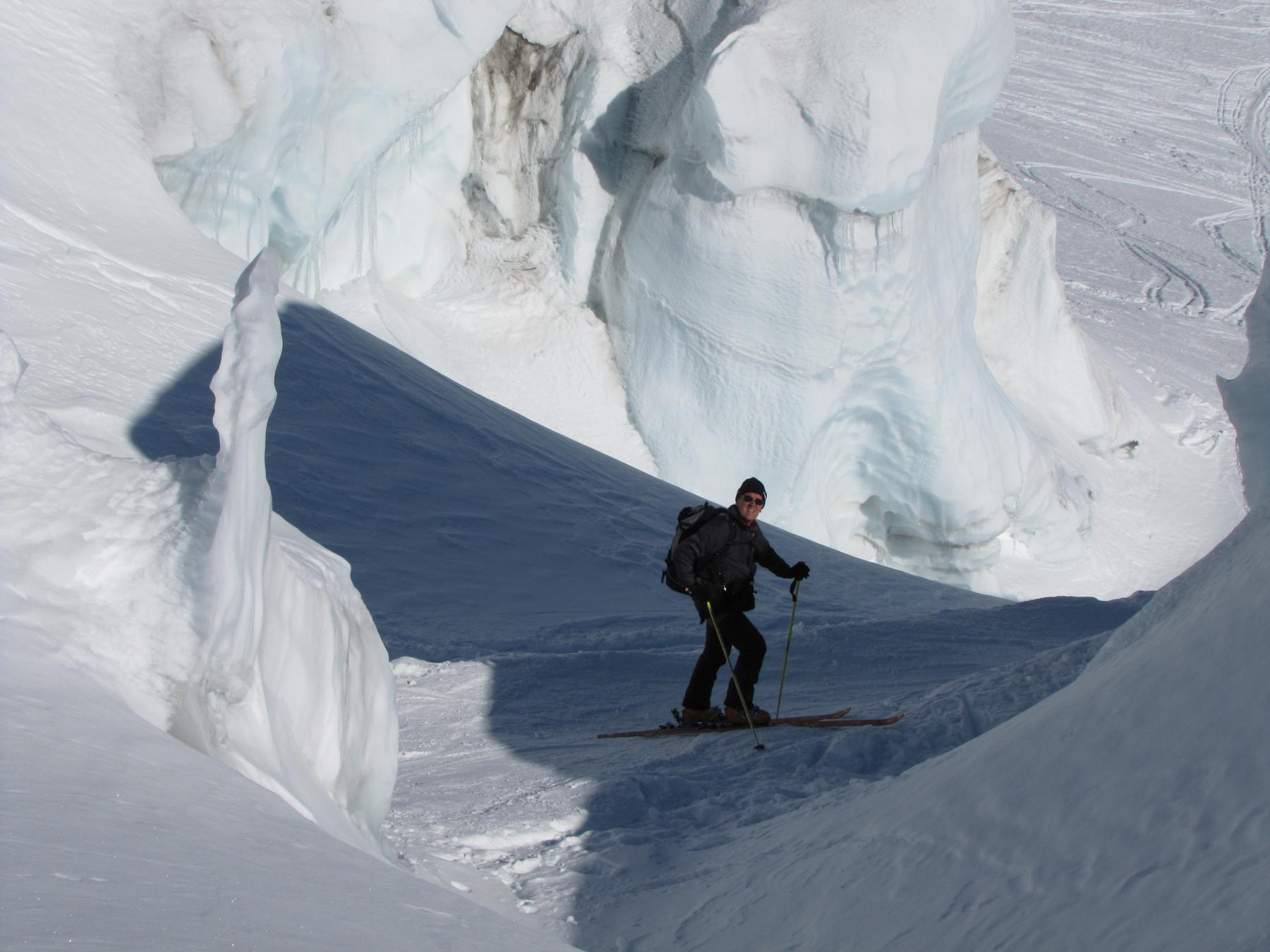
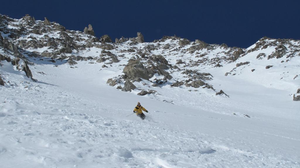
Percorso fuori pista su ghiacciaio in alta montagna, che, con modesto dislivello in salita, consente di unire la discesa italiana a quella francese della Mer de glacé. Occorre essere adeguatamente preparati ed equipaggiati, se non accompagnati da guide. Impegnarlo soltanto in presenza di ottime condizioni meteo, restando strettamente sul tracciato battuto: presenza di crepacci insidiosi, non soltanto all'altezza della seraccata del Requin.
Avvicinamento
,
Descrizione
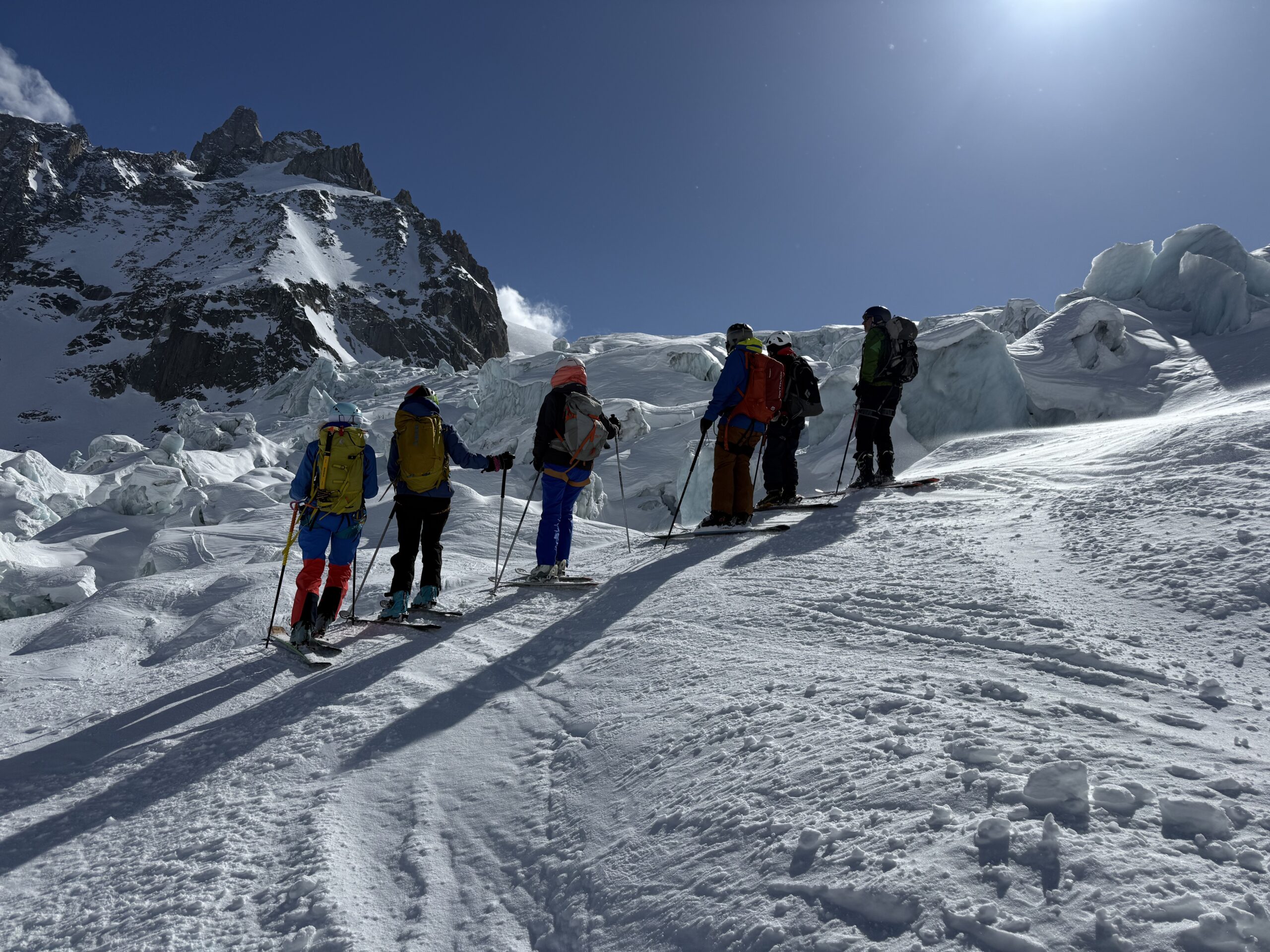
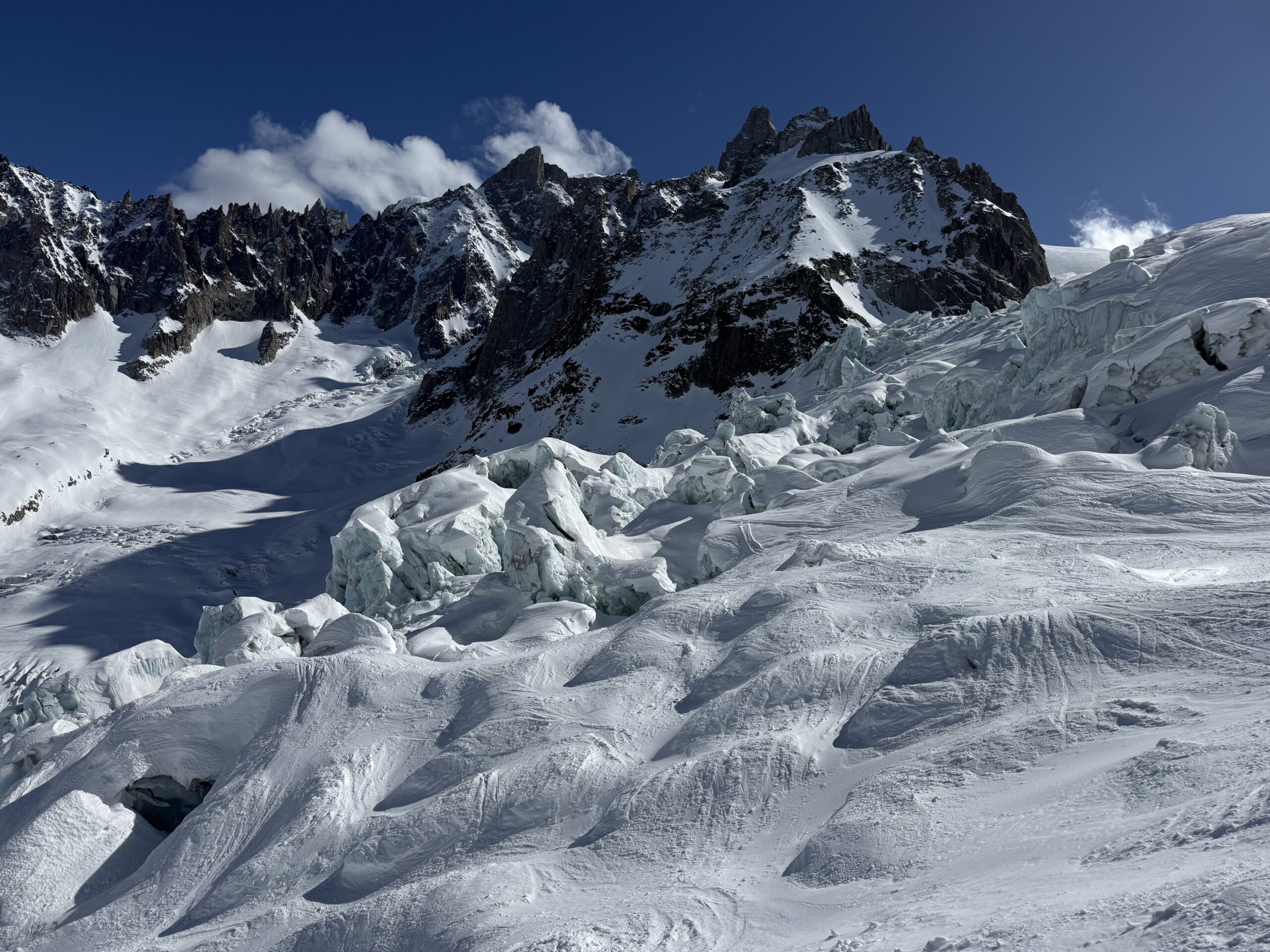
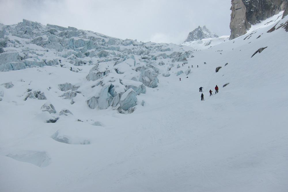
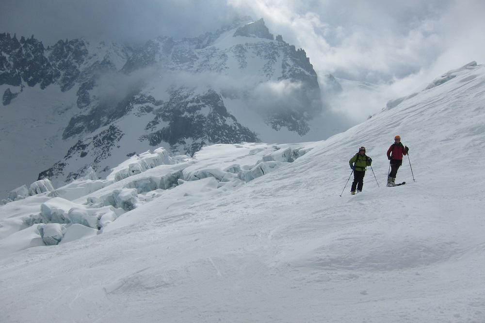
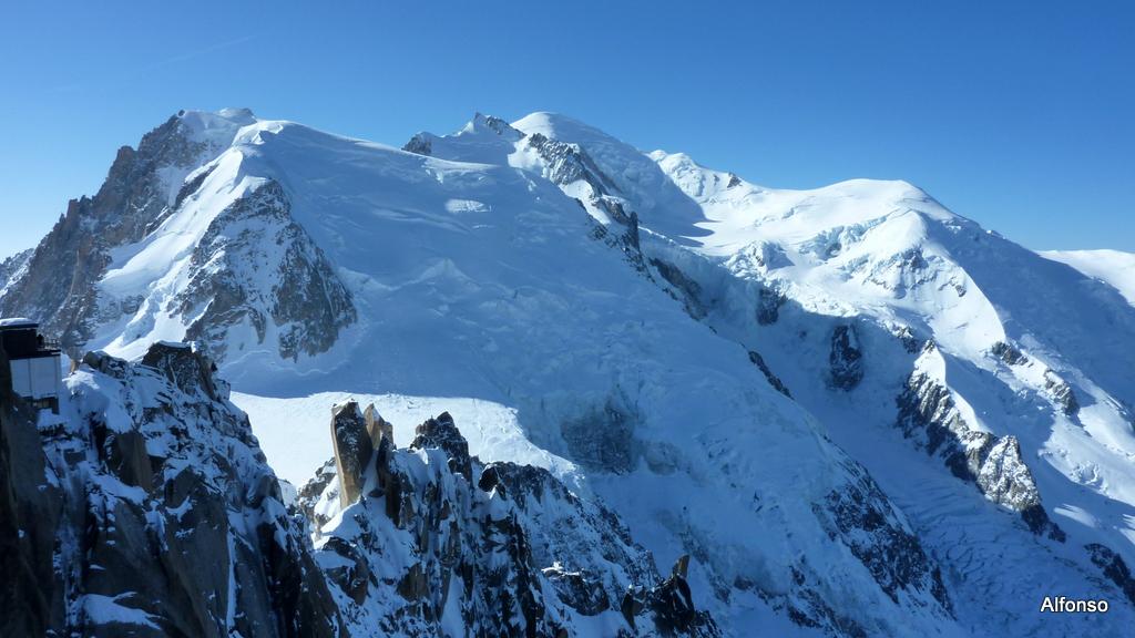
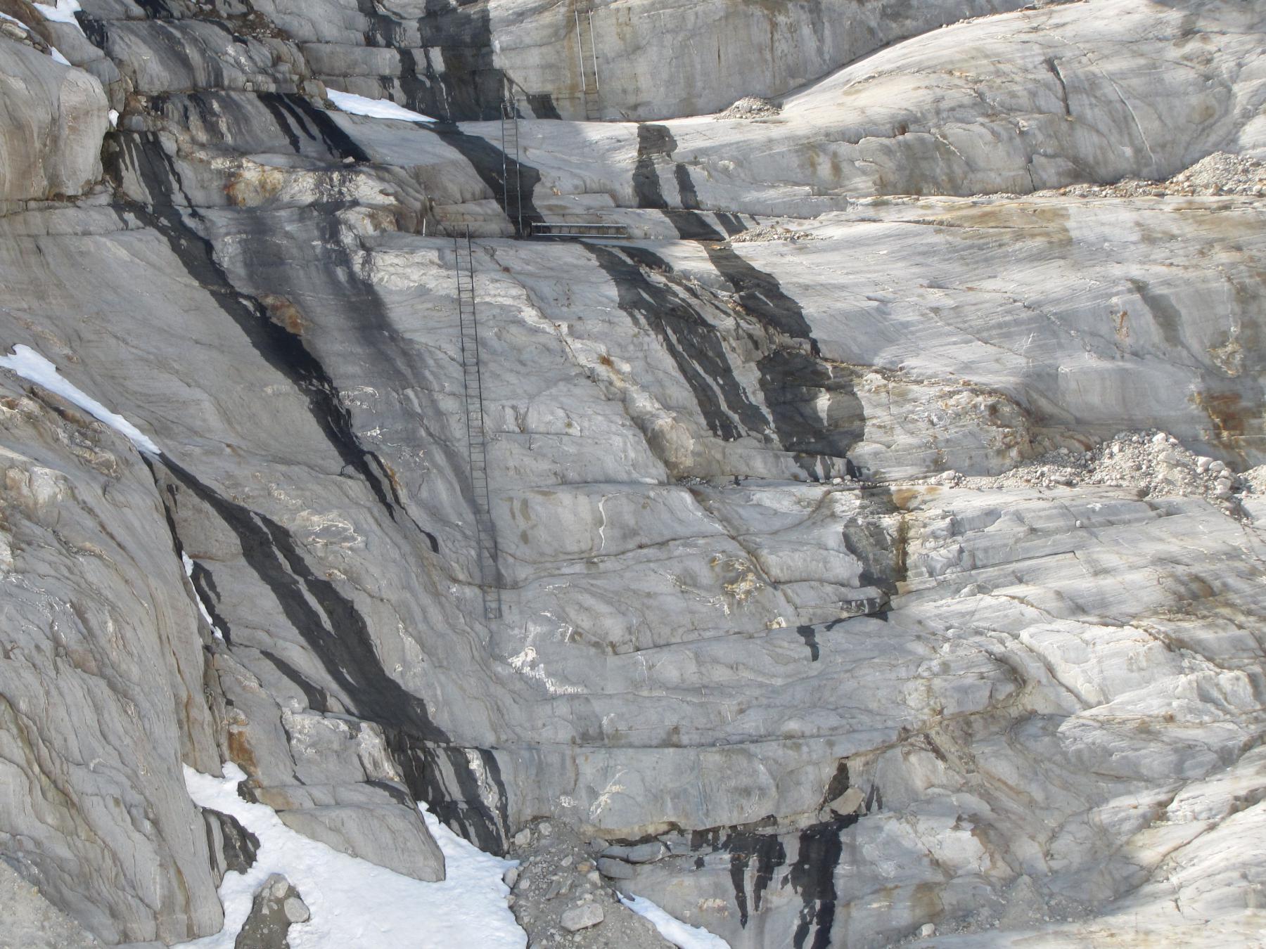
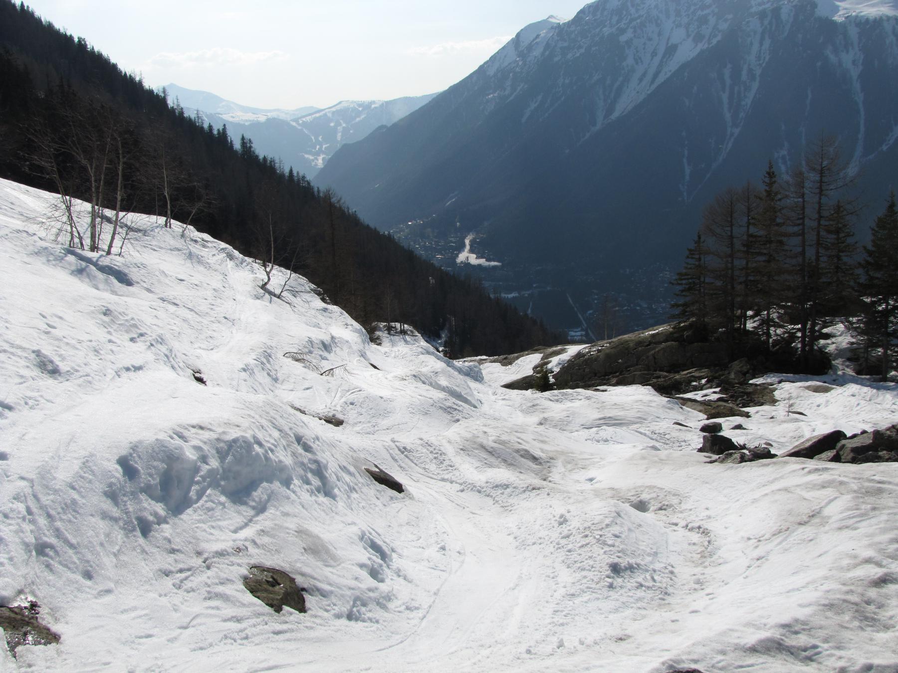
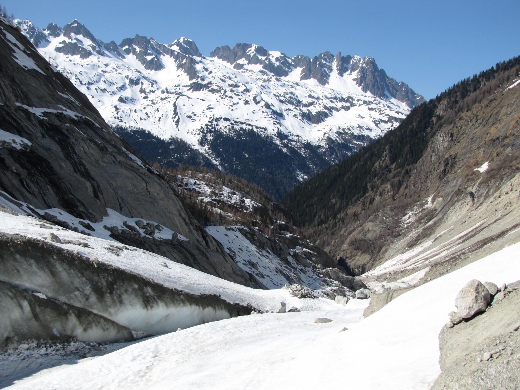
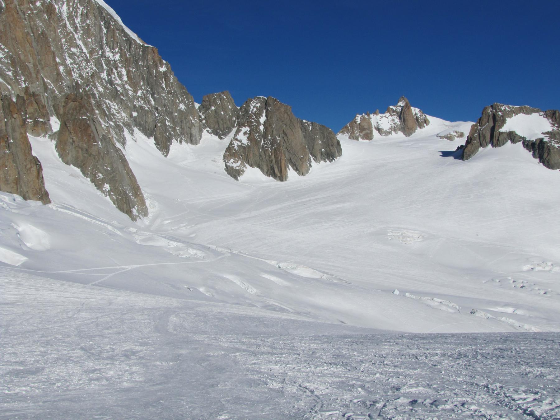
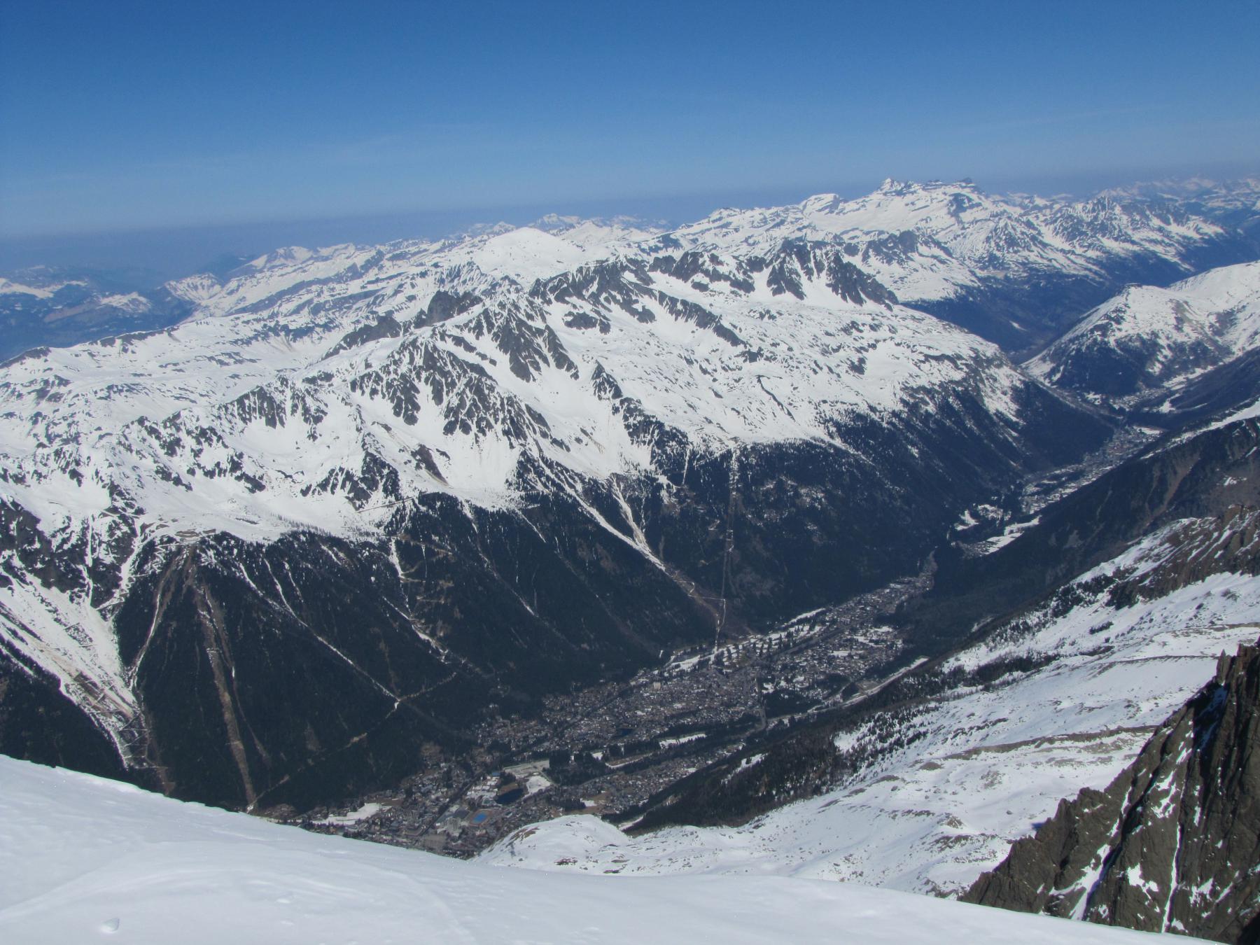
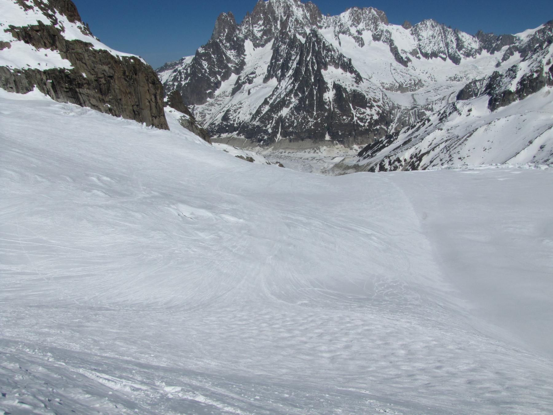
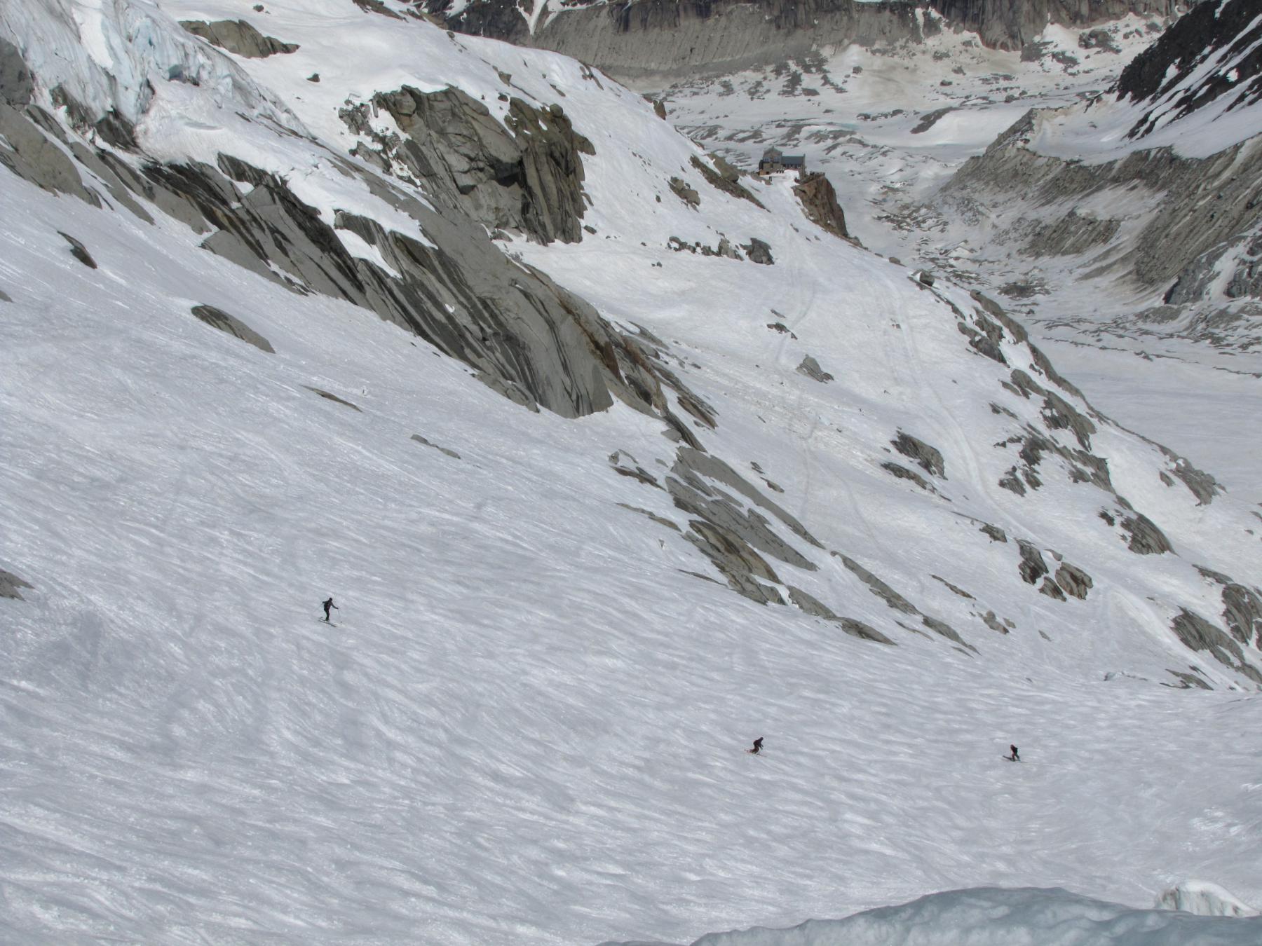
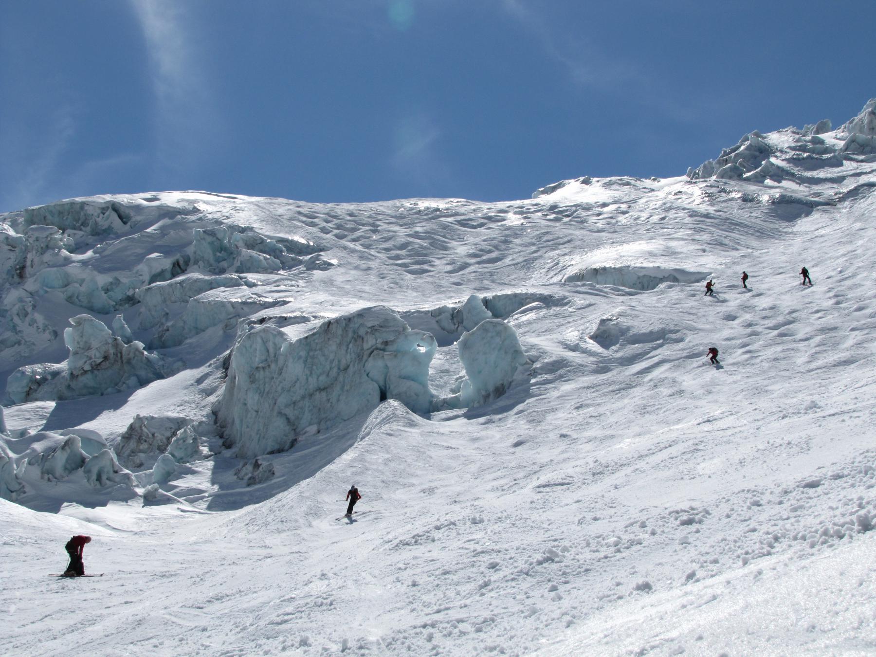
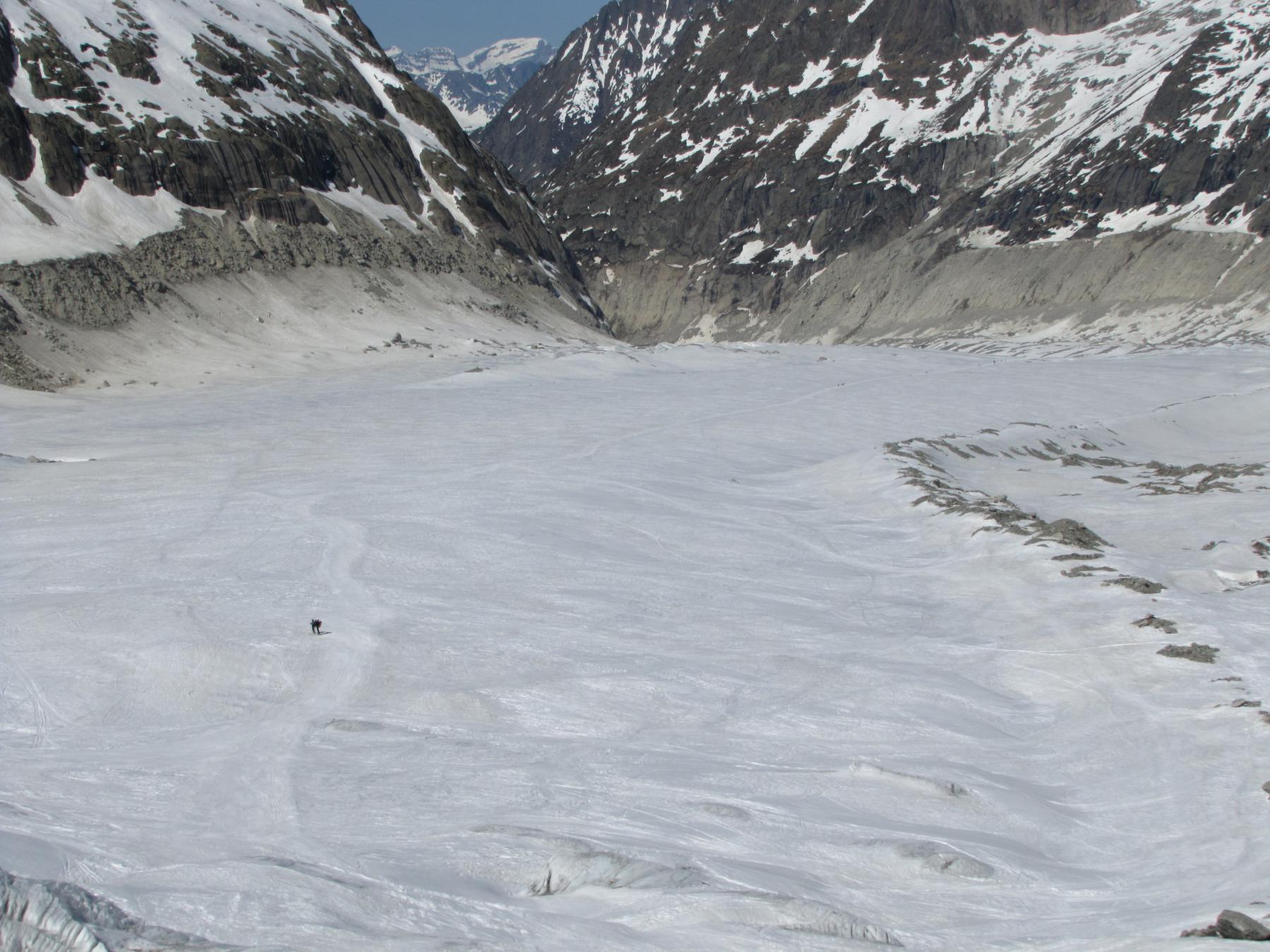
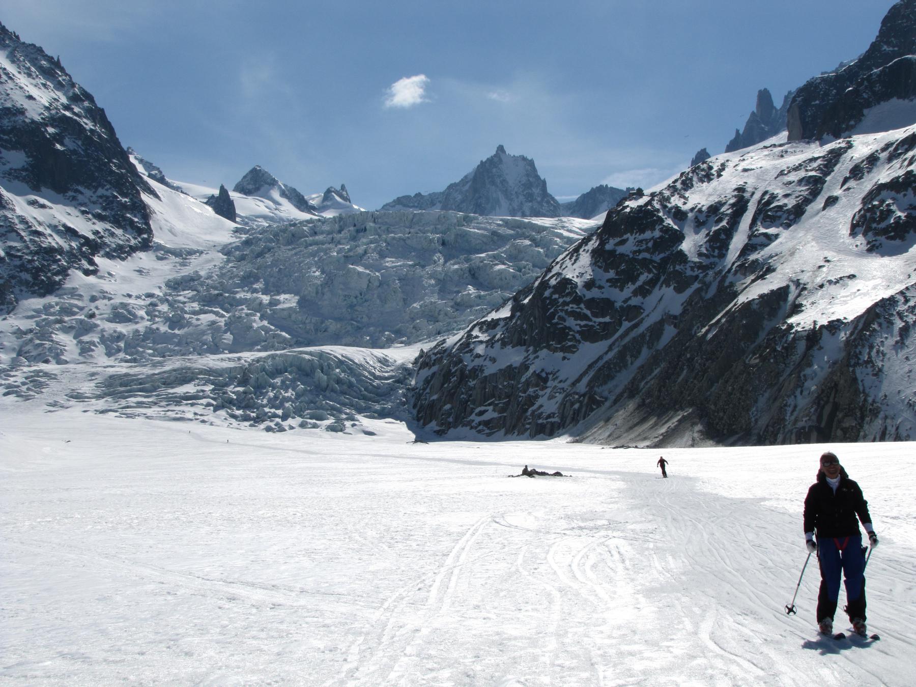
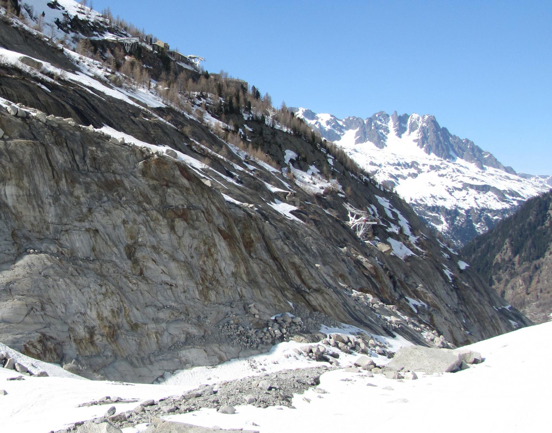
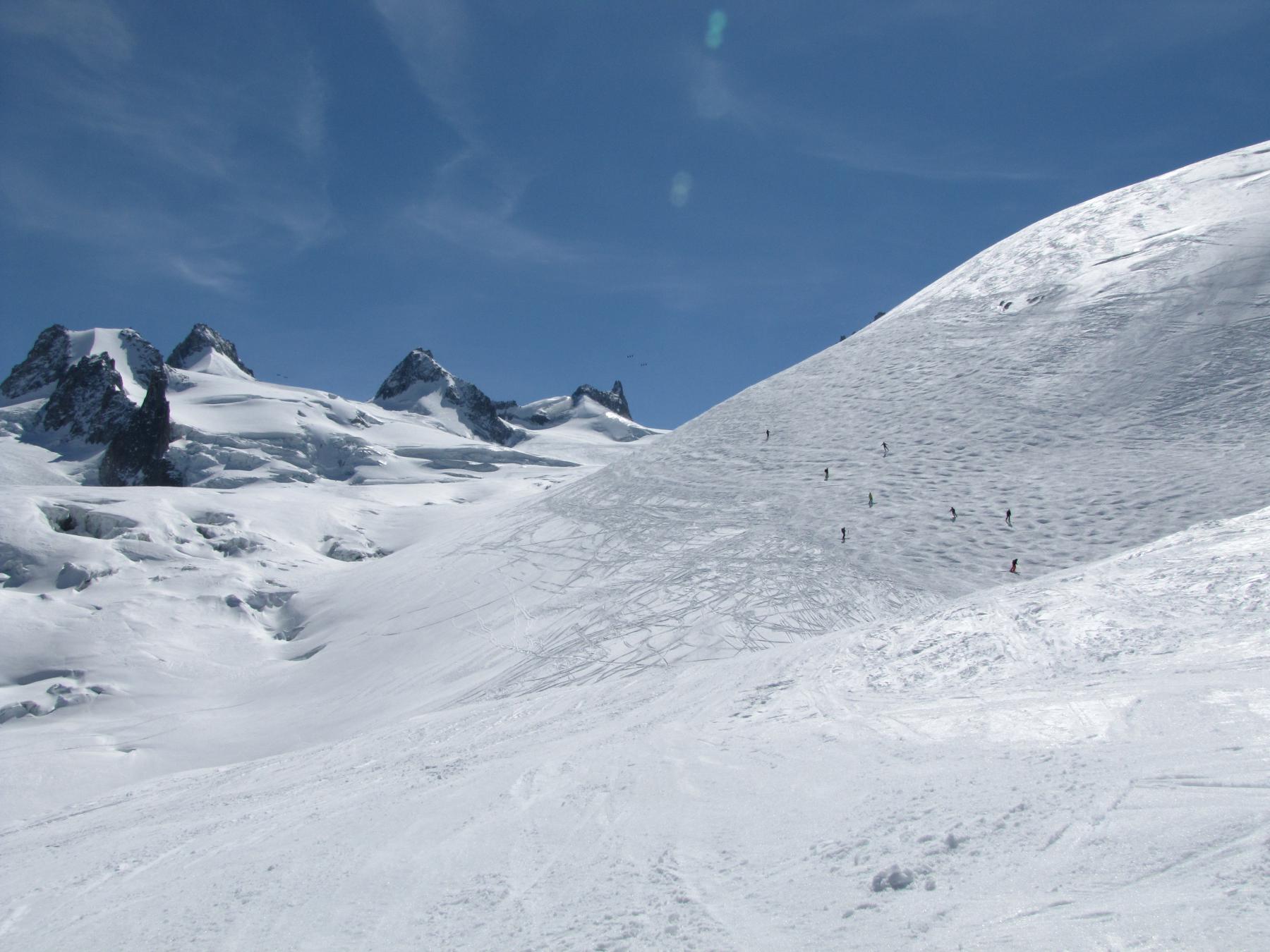
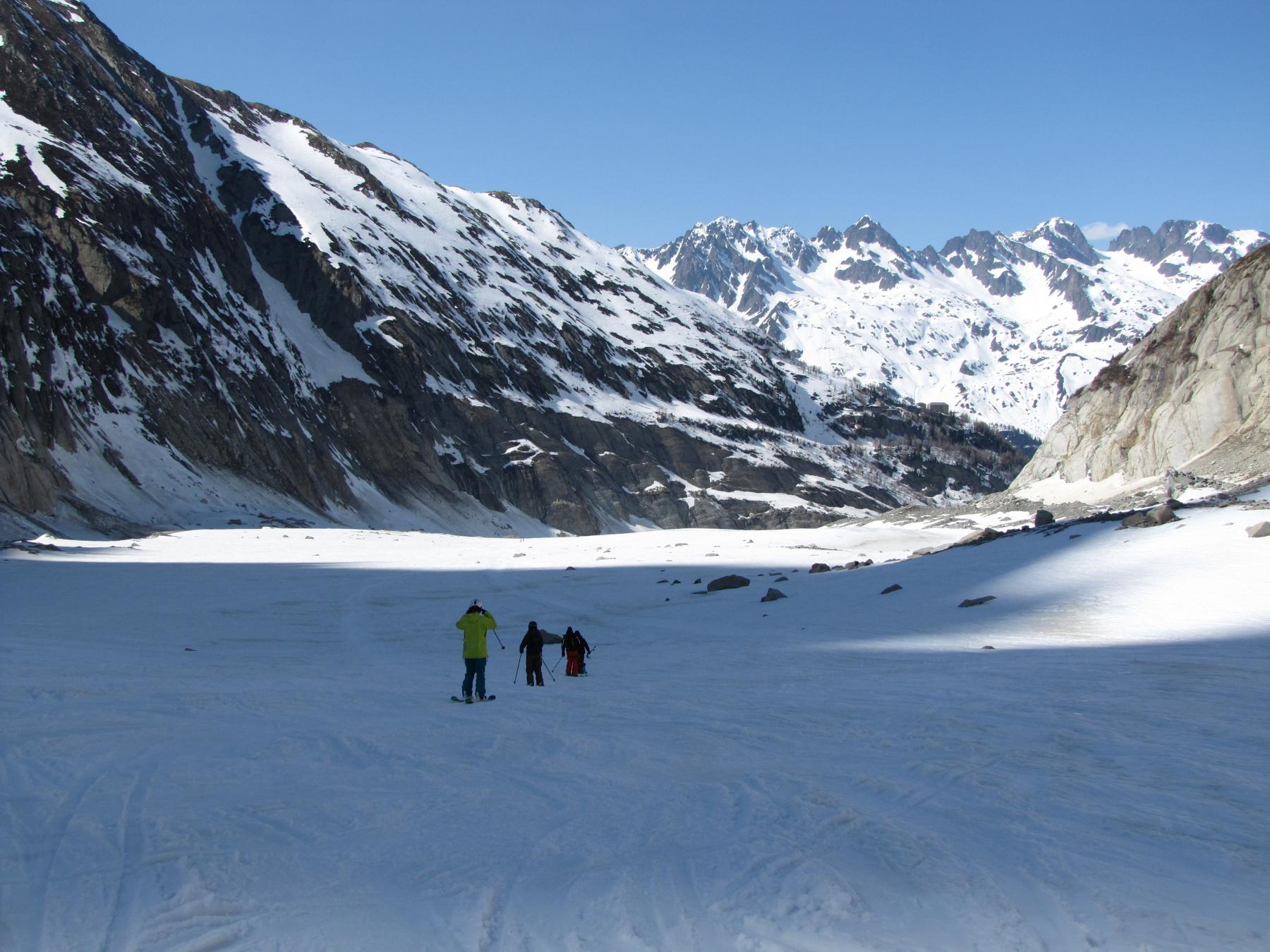
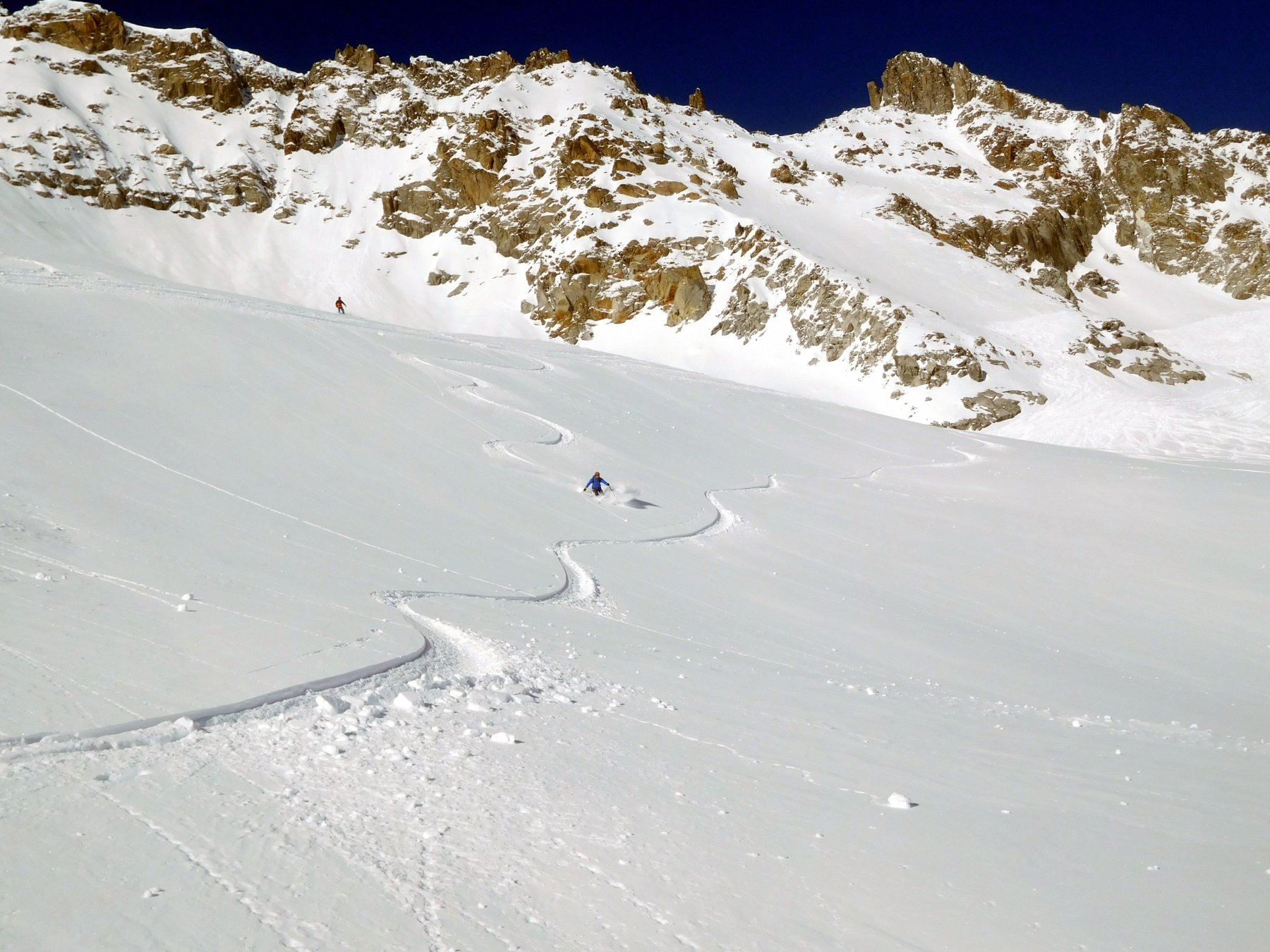
La discesa è quella della classica Mer de glace, con difficoltà sciistica pari ad una pista “rossa”, ma fuori pista, non segnalata, non securizzata, senza scappatoie, con il maggior problema tecnico nel passaggio della seraccata all’altezza del Rif.du Requin situato a 2515m. Dopo la lunga facile scivolata nella parte bassa sotto la salle à manger, alla fine del ghiaccio, negli ultimi anni, col regresso dello stesso, uscite possibili a seconda delle condizioni: -1) a 1820m risalita a sx sulle placche con grossi segni bianchi, alle ripide scalette fino ai 1900 m del sentiero di Montenvers -2)utilizzare gli ovetti per Montenvers -3) continuare in discesa nella forra fino a circa 1540m, da dove a sx un sentiero risale ai Rocher des Mottets 1602m.
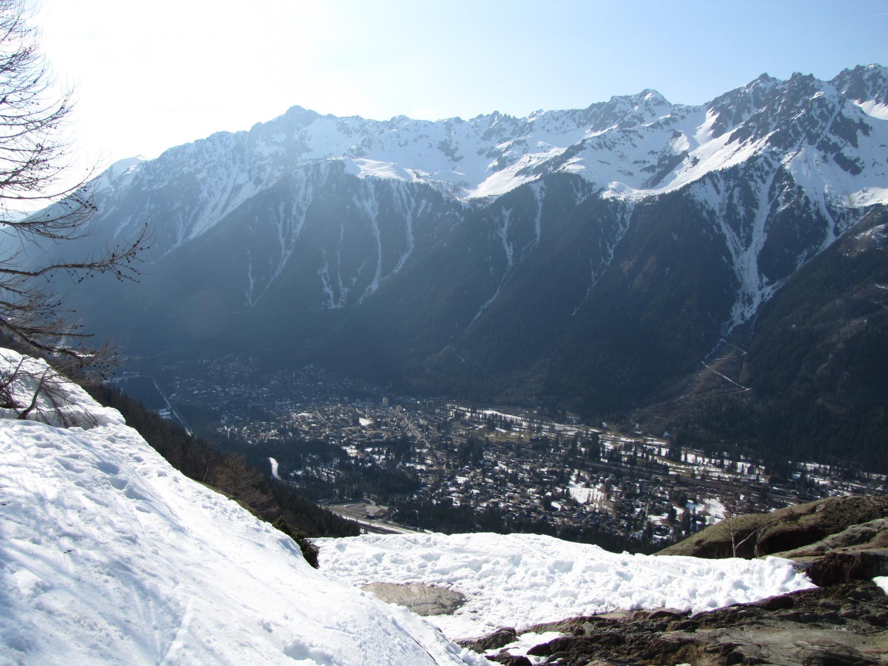
Da Montenvers si scende con cremagliera oppure con sentiero, tracciatissimo; dai Mottets il percorso di discesa a Chamonix segue una mulattiera. A Chamonix, nei pressi della stazione ferroviaria, gli autobus per Courmayeur.
Variante:
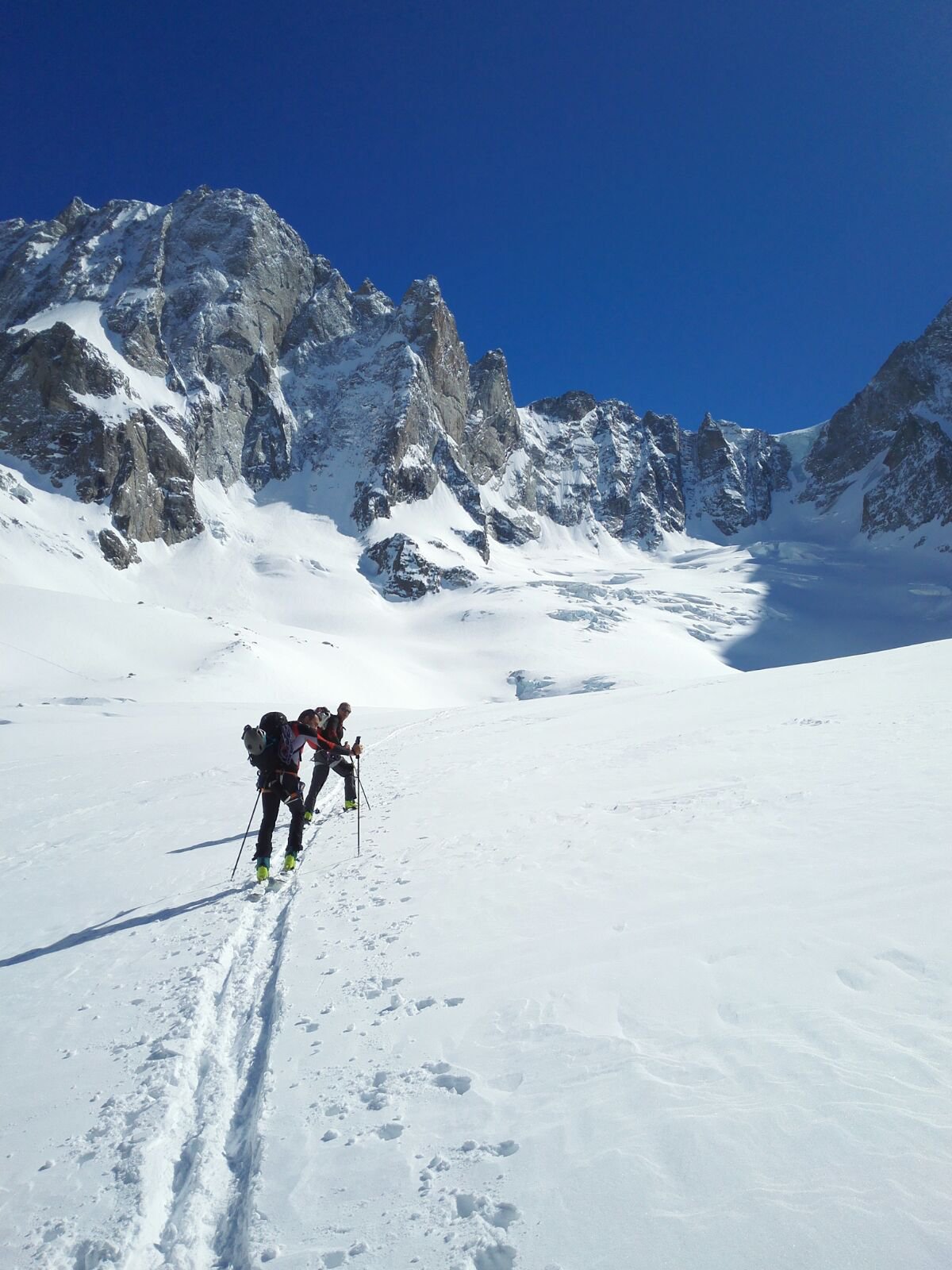
Se si ha voglia anche di usare le pelli di foca è possibile salire dal lato Italiano e di qui raggiungere l’Aiguille du Midi con la classica traversata ‘estiva’.
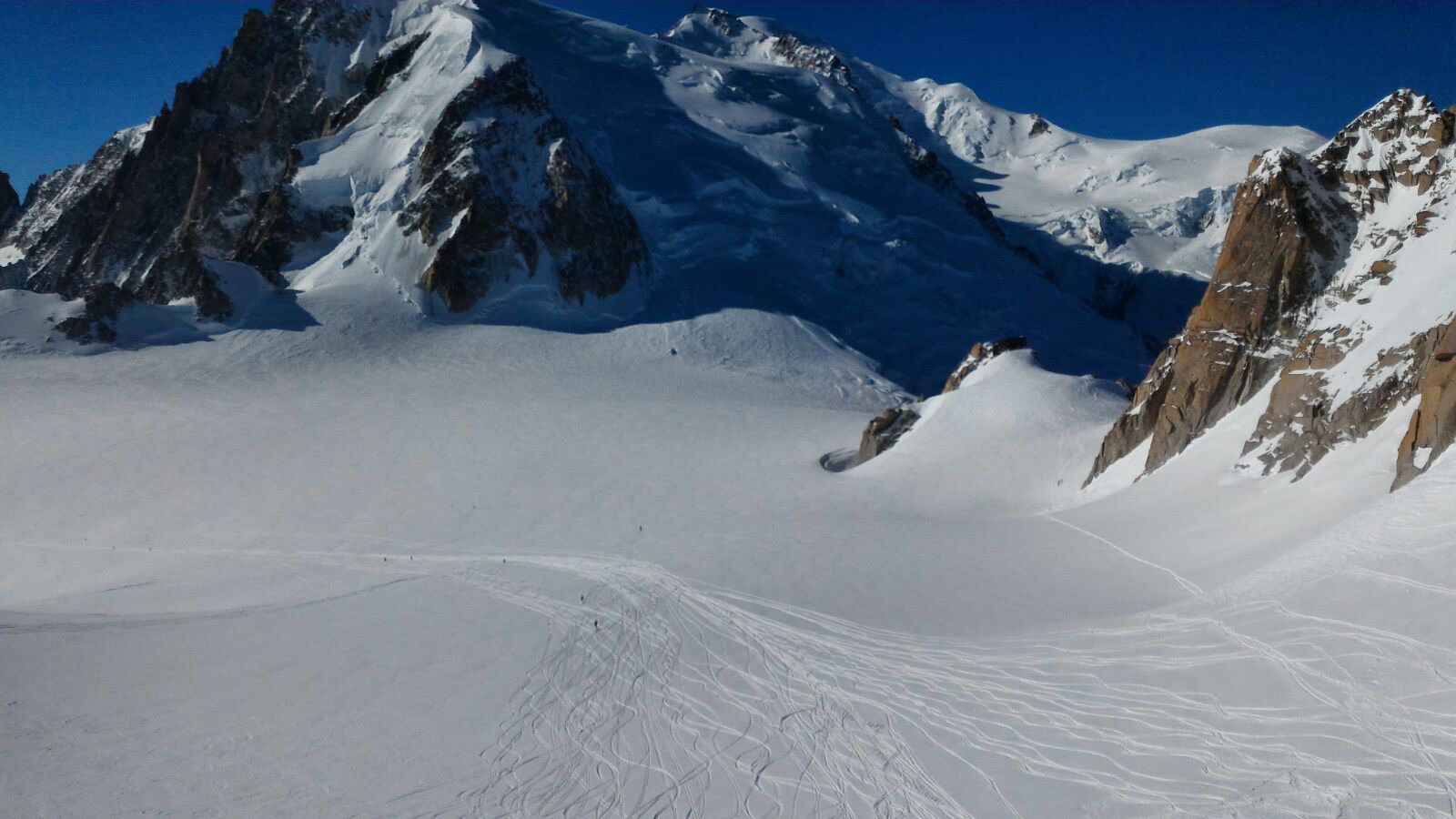
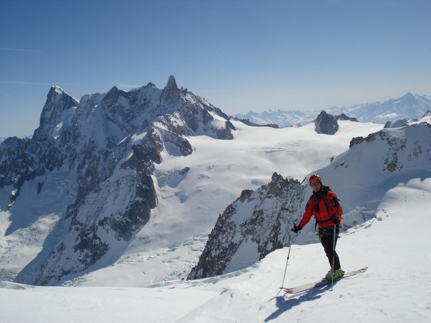
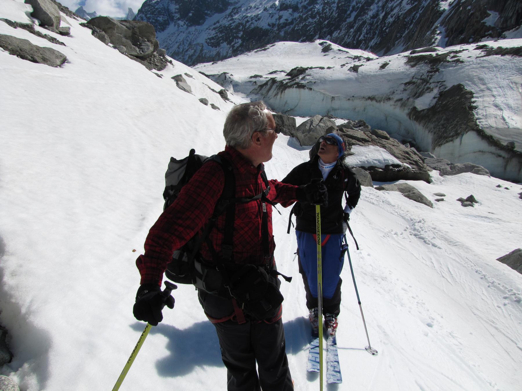
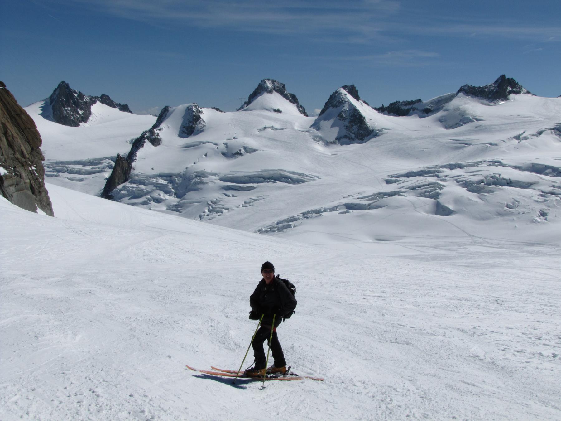
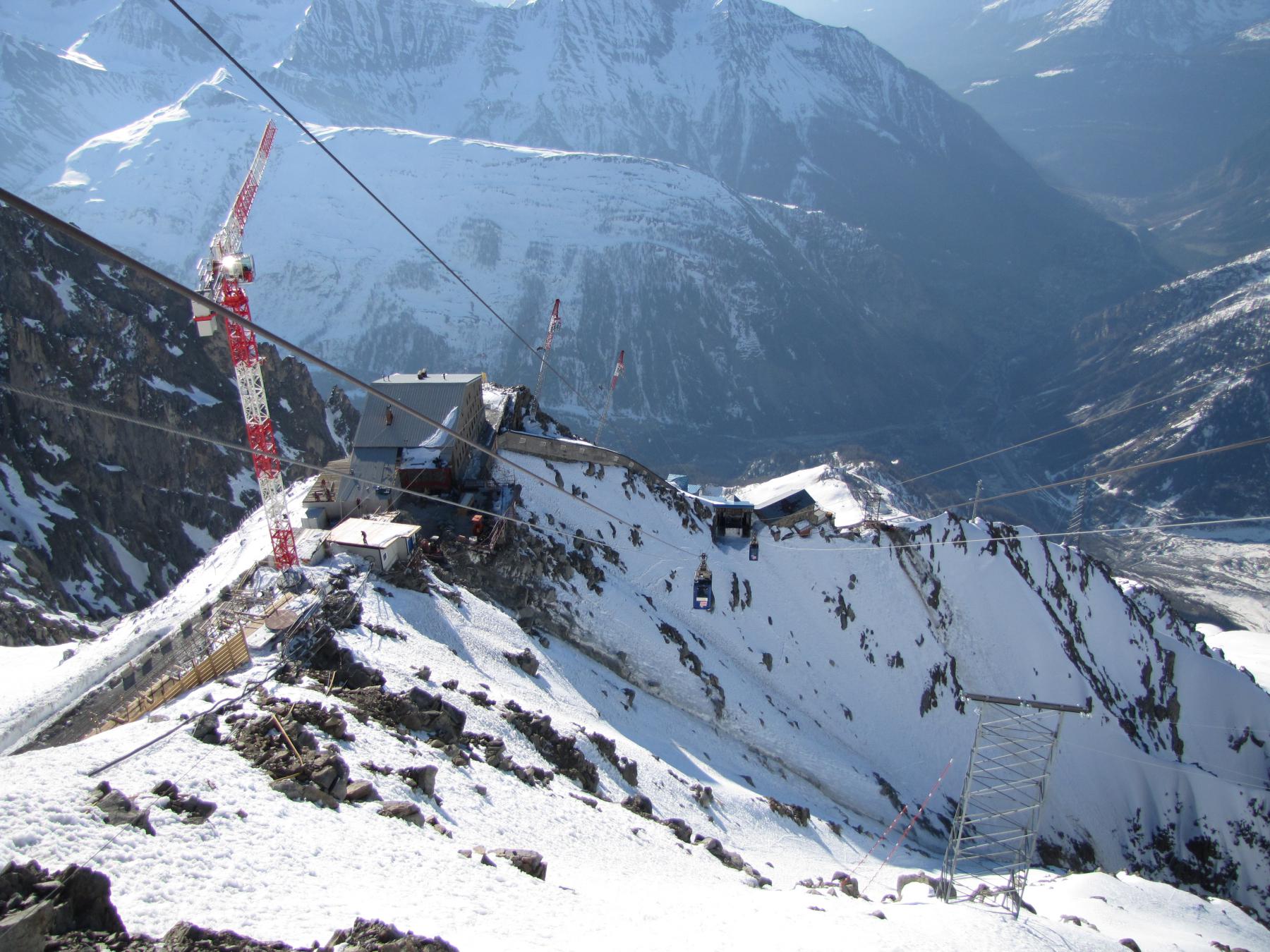
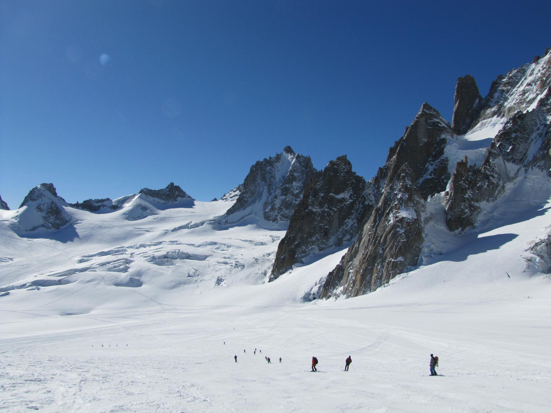
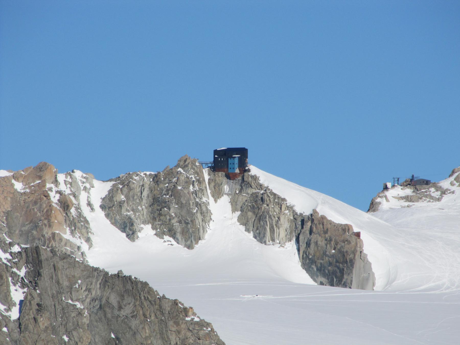
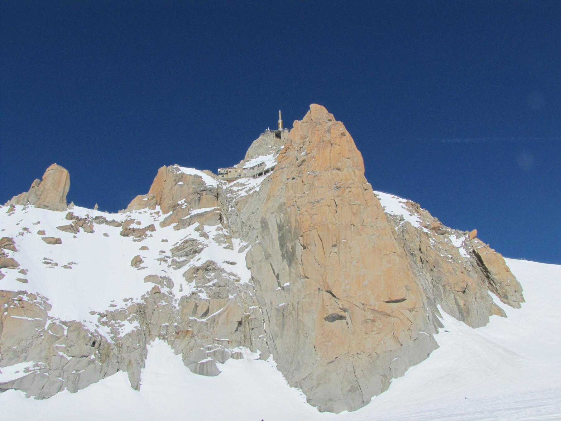
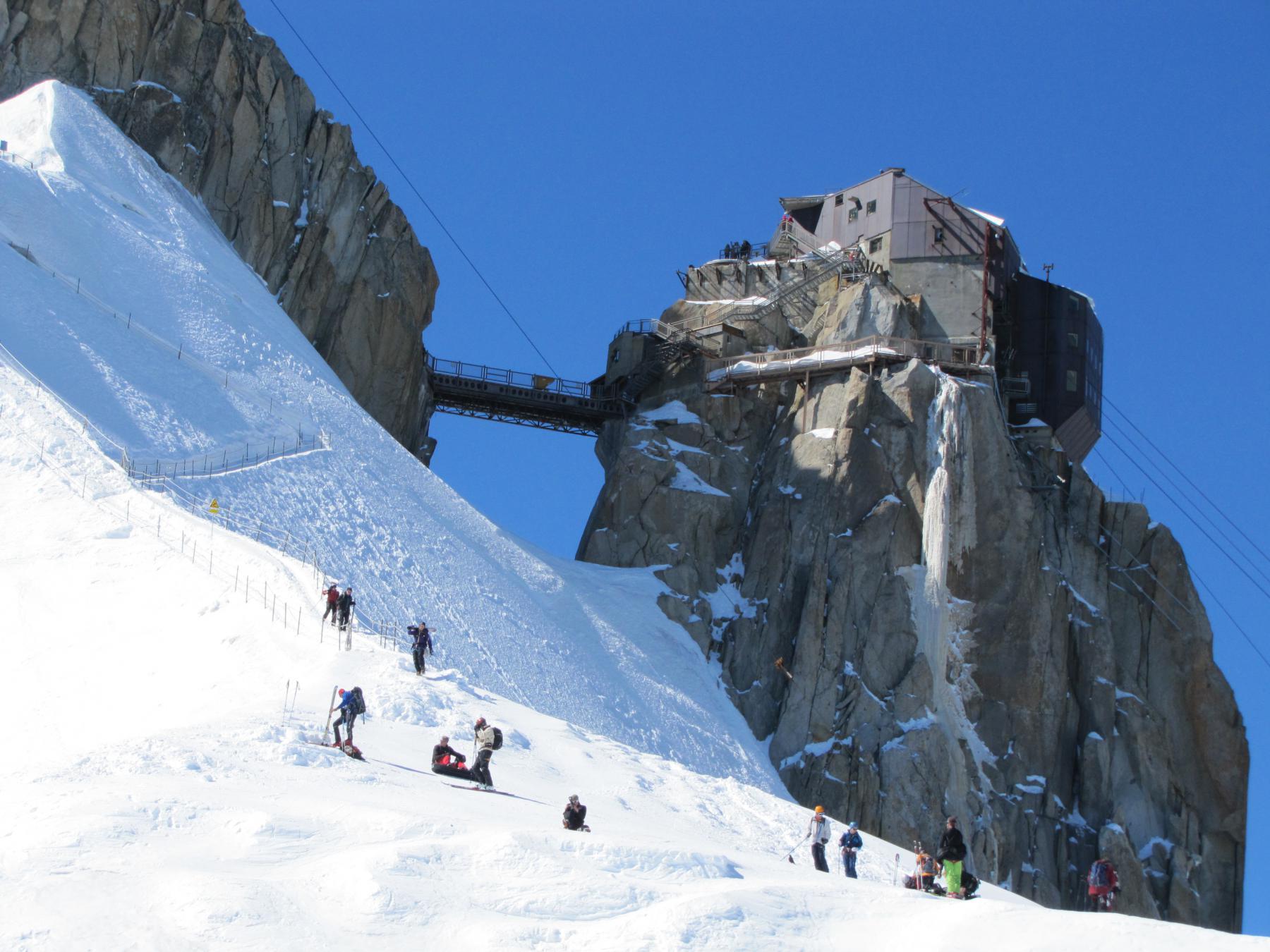
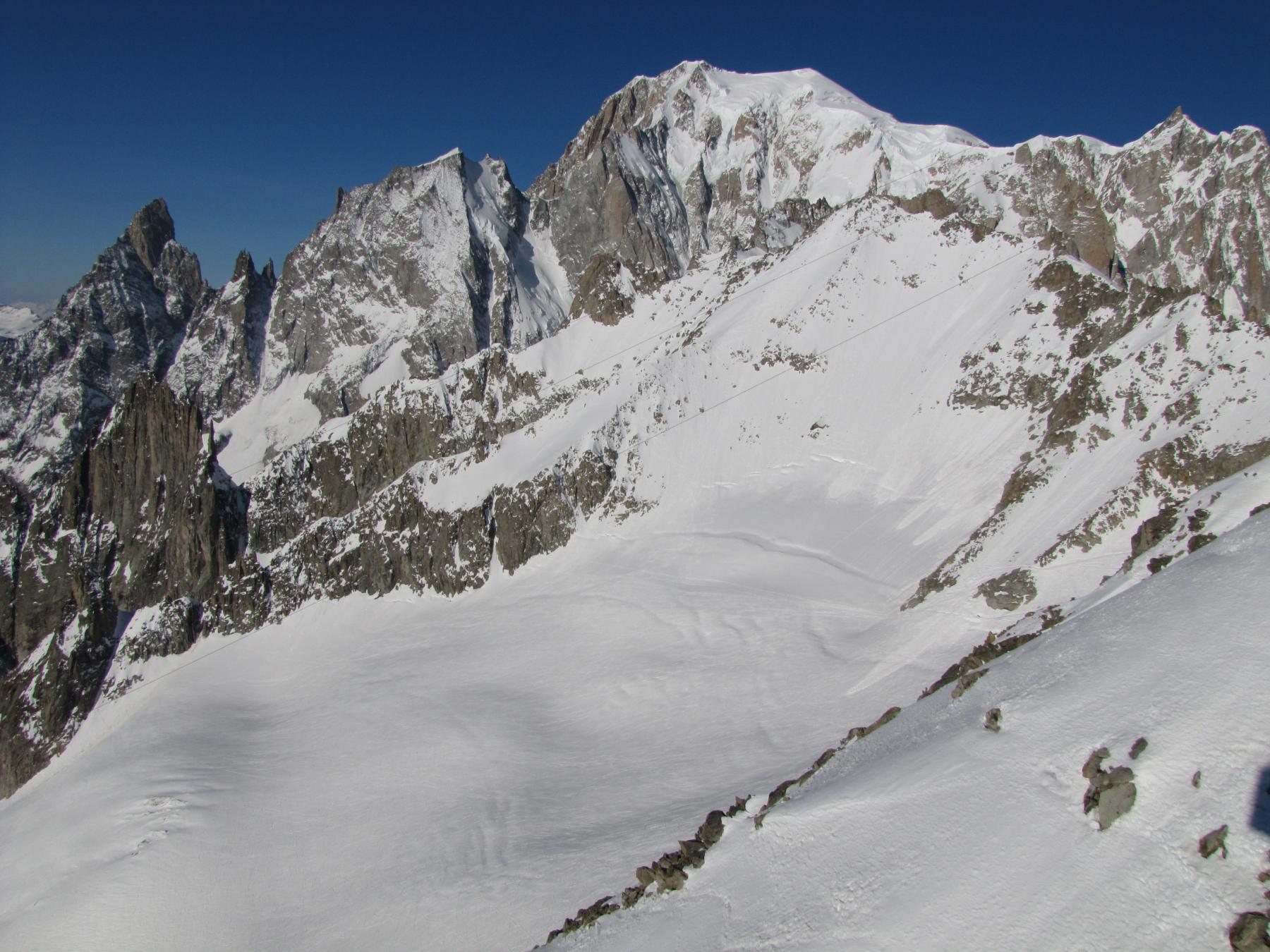
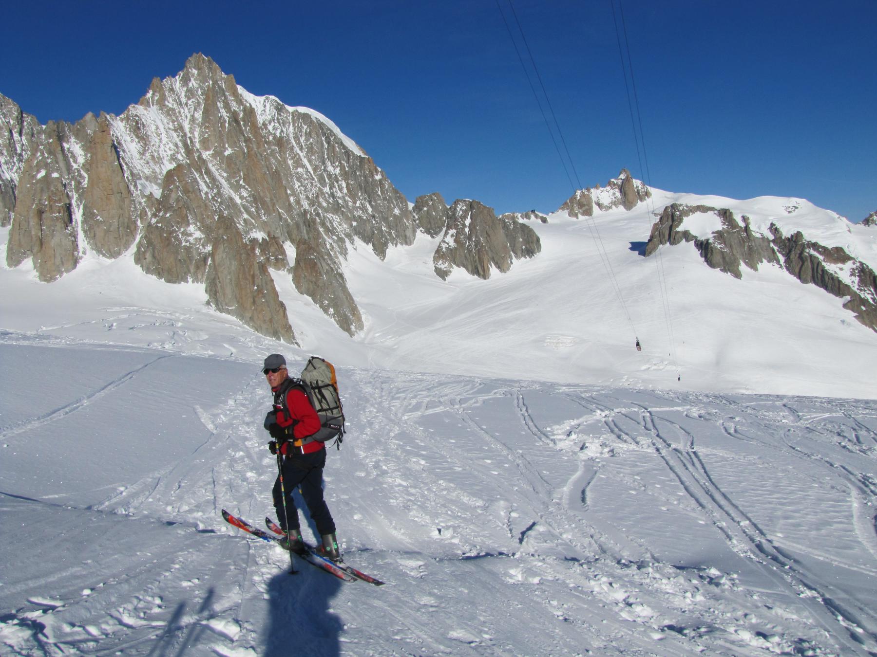
Usciti da Punta Helbronner si va a N spingendo pochi metri in salita al col Flambeaux, sotto il pilone sospeso dei cavi per l’Aiguille du midi, si scende per circa 400m disl. fino al centro della valle glaciale della Mer de glacé a circa 3060m, incrociando le tracce degli sciatori che provengono dall’Aiguille du midi. Si mettono le pelli e si risale, cercando il percorso battuto, prima ad Ovest, girando poi nuovamente a Nord. Si sale per quanto possibile fin sotto l’Aiguille, fino a circa 3680m nei pressi del punto dove chi scende dalla funivia francese, alla fine della Z, calza gli sci.
- Cartografia:
- Kompass 1:50000 Massiccio del M.Bianco - IGN France 1:25000 n. 232 Massif du Mont Blanc
Nelle vicinanze Mappa
Itinerari
19/03/2026 AO, Courmayeur D+ 2200 m 3.1, E1 Nord
Vallèe Blanche da Punta Helbronner
 50m
50m
15/01/2022 AO, Courmayeur D+ 2100 m 4.1, E2 Varie
Marbrées
 1.5Km
1.5Km
15/01/2022 AO, Courmayeur D+ 1200 m 3.3, E1 Sud
Toula (Colle Est di) ghiacciaio del Toula
 4.8Km
4.8Km
02/12/2019 AO, Courmayeur D+ 1250 m 3.2, E1 Nord
Dolonne (Canale di)
 7.4Km
7.4Km
28/01/2014 AO, Courmayeur D+ 1500 m 3.2, - Varie
Courmayeur Vallone d’Arp – Dolonne
 7.5Km
7.5Km
03/03/2014 AO, Courmayeur D+ 1000 m 3.1, E1 Nord
Courmayeur Canali dei Vesses
8.5Km
03/01/2012 AO, La Thuile D+ 400 m 3.3, - Sud
La Thuile Bella Valletta
 14.6Km
25/01/2025 AO, La Thuile D+ 950 m 3.3, E3 Nord
La Thuile – Canale del Lelio
14.6Km
12/03/2012 Haute-Savoie, Chamonix-Mont-Blanc D+ 1400 m 3.3, E1 Nord-Est
Gran Montets Vari
 15.4Km
18/02/2017 AO, La Thuile 3.3, E1 Varie
La Thuile – Fuoripista zona Belvedere
18.8Km