 1.2Km
1.2Km


Note
Storico
 50m
50m
50m
1.3Km
1.8Km
4.2Km
4.2Km
4.2Km
4.2Km
50m
50m
50m
1.3Km
1.8Km
4.2Km
4.2Km
4.2Km
4.2Km
1.2Km
1.2Km
1.2Km
1.3Km
2.2Km
2.8Km
7.6Km
8.5Km
8.7Km
8.7Km
salita in un vallone poco frequentato, a fianco di quello più conosciuto che da pian benot culmina al colle delle lance. itinerario ben segnato ed evidente fino al pian lunella, in estate l'attraversamento di 2 boschetti di ontani può creare qualche difficoltà. il passaggio chiave per accedere alla parte superiore del vallone (passaggio obbligato a 2080 m, chiamato conca del forno è segnato con minio rosso. la cresta nord della rocca del forno, dal colletto 2540 m alla vetta presenta passaggi quasi costanti di I alcuni con esposizione. dalla vetta si può raggiungere la vicina punta cruvin ovest scendendo alla forcella 2690 m e risalendo la sua cresta ovest.
Avvicinamento
torino, lanzo,superato l'abitato di usseglio bivio a sinistra per perinera -pian benot, superato l'abitato di perinera dopo 4 tornanti e circa 2,5 km parcheggiare l'auto ad andriera al margine di un vasto prato.
Descrizione
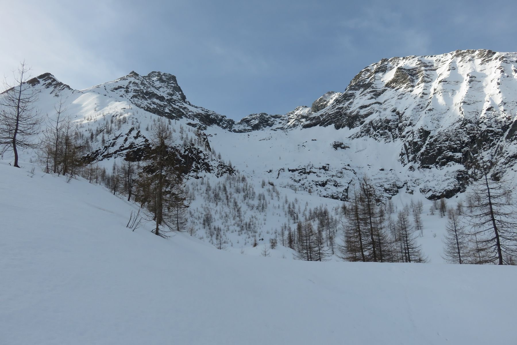
da andriera si attraversa il vasto prato in direzione sud, raggiungendo la visibile traccia che risale il pendio,dopo alcuni minuti si supera una costruzione/acquedotto risalendo poi nel bosco con ripidi tornanti alternati a radure. verso 1800 m si esce su terreno aperto incrociando il sentiero proveniente da perinera/traversette (40’), proseguendo si attraversa un ruscelletto , il sentiero svolta a destra e raggiunge un altopiano erboso al cui centro scorre il rio lunella (55’).
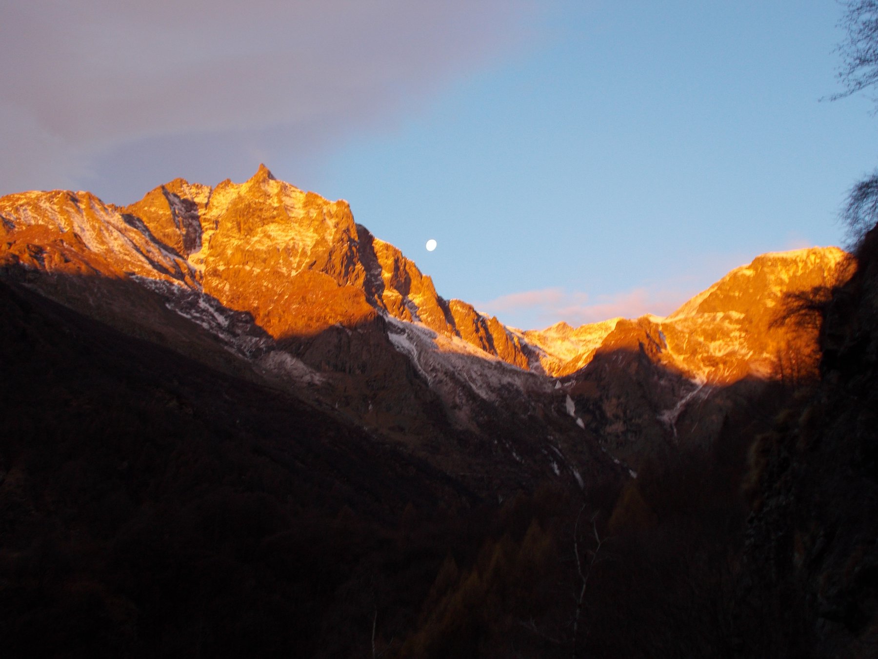
qui si scorgono da sinistra verso destra punta lunella. punta cruvin, punta cruvin ovest, rocca del forno e punta della forcola.
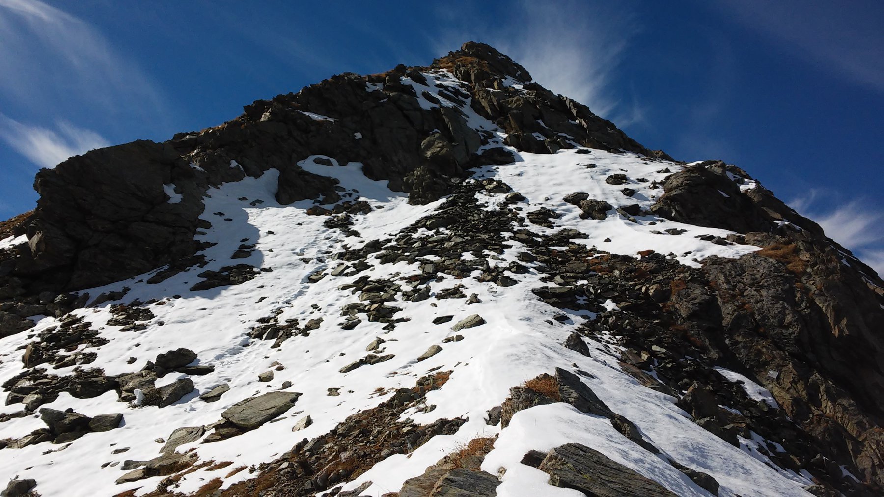
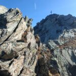
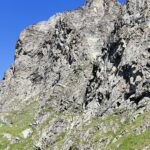
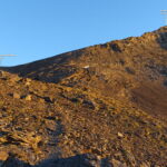
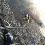
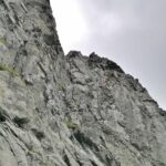
si tiene la destra idrografica del rio, seguendo il sentiero più basso (quello a sx porta alla cresta della lunella) che prosegue diritto e si infila in un boschetto di ontani. dopo circa 15’ si esce su terreno aperto, il sentiero svolta a sx e rimane alto sopra al pian lunella, poi si perde verso i 2000 m. puntare verso il letto del torrente quasi sempre asciutto(nevai ad inizio stagione)salendo sul ripido pendio della sua dx idrografica. giunti ad una quota di circa 2080 m si raggiunge il passaggio chiave per accedere alla parte superiore del vallone (1h30’). Vi è un grosso ometto e si svolta a destra in un altro boschetto di ontani. tutta la traccia è segnata con minio rosso. dopo circa 10 minuti si esce nella parte superiore del vallone su terreno pulito. attenzione in discesa!! tenere la parte destra della conca fino a reperire i segni rossi e gli ometti, tutto il resto del pendio strapiomba con salti di roccia!!!.si prosegue per il centro del vallone raggiungendo alcuni laghetti a quota 2300 m in ambiente molto severo (2h15’). si punta ora a dx verso la visibile cresta nord della rocca del forno e precisamente al colletto 2540 m a sinistra di una gobba rocciosa. il colletto a dx della gobba serve per salire la punta della forcola. salita disagevole per i detriti, puntare contro le rocce e poi traversare a sinistra in diagonale sino al colletto (3 ore). da qui bella vista su punta nonna e nonnetta con dietro il rocciamelone. si risale la cresta nord, che richiede quasi sempre l’uso delle mani ma senza passaggi obbligati. nell’ultimo tratto superiore si congiunge con la cresta ovest che sale dal colle della muià, si volge a sx sul sottile filo e si raggiunge la vetta 2722 m .(totale 3h30’). Per la punta cruvin ovest scendere l’erbosa cresta est sino a dove forma uno spuntone rivolto verso la val di susa. pochi metri prima calarsi per un canalino roccioso sino alla forcella tra le 2 punte 2690 m (circa 20’). risalire la cresta ovest della cruvin mantenendosi dal lato valle di susa ed in circa 10’ toccare la sommità 2712 m.
ritorno per la via di salita.
zona poco frequentata, molte di queste cime nel tratto lunella /grand'uja sono quasi sconosciute. nel secolo scorso il vallone lunella era frequentato da minatori che estraevano l'amianto. dalle due vette straordinario panorama circolare simile a quello della lunella con rocciamelone, rosa,ciamarella, bessanese,barre des ecrins, monviso e molte altre.
- Cartografia:
- Fraternali 1:25000 n.8 Valli di Lanzo
Nelle vicinanze Mappa
Itinerari
11/10/2015 TO, Usseglio D+ 1122 m F Nord
Cruvin (Punta) o Cruin da Andriera per la Comba del Forno e il versante Est
 50m
50m
31/05/2024 TO, Usseglio D+ 1250 m PD Nord-Ovest
Lunella (Punta) Canale NO
 50m
50m
10/11/2024 TO, Usseglio D+ 1204 m F Varie
Lunella (Punta) da Andriera per la Cresta Nord da Cima Lusera
 50m
50m
13/09/2024 TO, Usseglio D+ 1666 m PD Sud
Barale (Punta) traversata per il passo del Canalone Rosso e la Colla degli Ortetti
 1.3Km
1.3Km
17/07/2025 TO, Usseglio D+ 1815 m F Sud
Ovarda (Torre d’) da Chiaberto
 1.8Km
1.8Km
09/11/2024 TO, Usseglio D+ 1000 m F+ Sud-Ovest
Forcola (Punta della) Crestone SO
 4.2Km
4.2Km
21/05/2016 TO, Usseglio D+ 1955 m AD Nord
Lera Orientale (Monte) Parete Nord
4.2Km
10/09/2023 TO, Usseglio D+ 2050 m F+ Varie
Croce Rossa (Punta) Cresta S/SE dal Vallone d’Arnas
 4.2Km
4.2Km
25/10/2021 TO, Usseglio D+ 1200 m D Est
Gurgiun (Cresta dei) – La tua Incoscenza, la mia Follia
 4.2Km
4.2Km
03/08/2025 TO, Usseglio D+ 1318 m PD Sud-Ovest
Corna (Punta) Via Normale dal Vallone d’Arnas
 4.2Km
4.2Km
Servizi
1.2Km
1.2Km
Luigi Cibrario Rifugio
Usseglio
1.2Km
Grand’Usselio Albergo
Usseglio
1.3Km
Il bivacco Ristorante
Usseglio
2.2Km
Nej e Solei Ristorante
Usseglio
2.8Km
Il Caminetto Ristorante
Usseglio
7.6Km
Vulpot Rifugio
Usseglio
8.5Km
Val Servin Ristorante
Balme
8.7Km
Les Montagnards Albergo
Balme
8.7Km

