 2.7Km
2.7Km
Note
 200m
200m
500m
1.2Km
1.2Km
1.5Km
1.5Km
1.5Km
1.5Km
1.5Km
200m
200m
500m
1.2Km
1.2Km
1.5Km
1.5Km
1.5Km
1.5Km
1.5Km
2.7Km
5Km
5Km
5Km
5Km
6.4Km
8Km
8.5Km
8.5Km
9.8Km
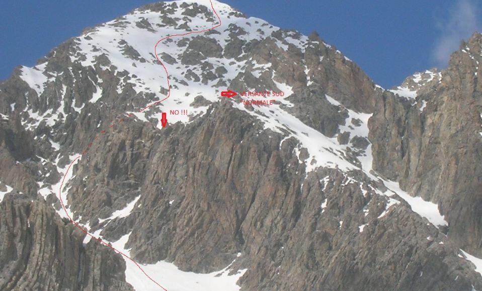
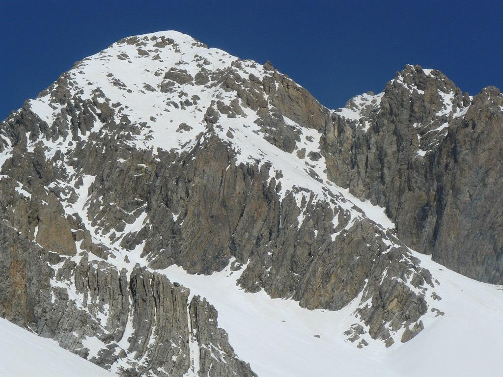
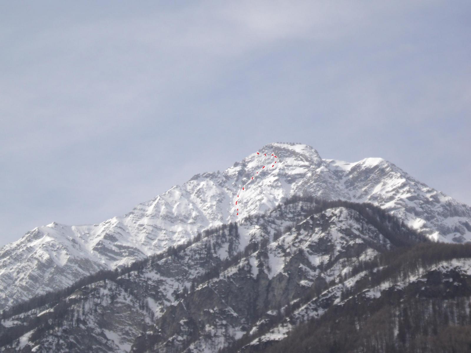
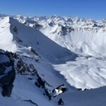
Variante che consente, a metà parete, di raggiungere una selletta a dx (faccia a valle) esattamente all'altezza ma dalla parte opposta della sella dell'itinerario classico del versante sud. Nata per puro caso (forse anche già scesa) in quanto dovevamo scendere il versante S-O ma la neve dura e svalangata ci hanno fatto propendere per questo versante. Non avendo nè foto nè bene idea quale discesa fosse, ci siamo buttati giù per la parete. L'intuito ci ha fatto andare a dx, per uno splendido, estetico e fortunoso canalino siamo arrivati al gran pendio..
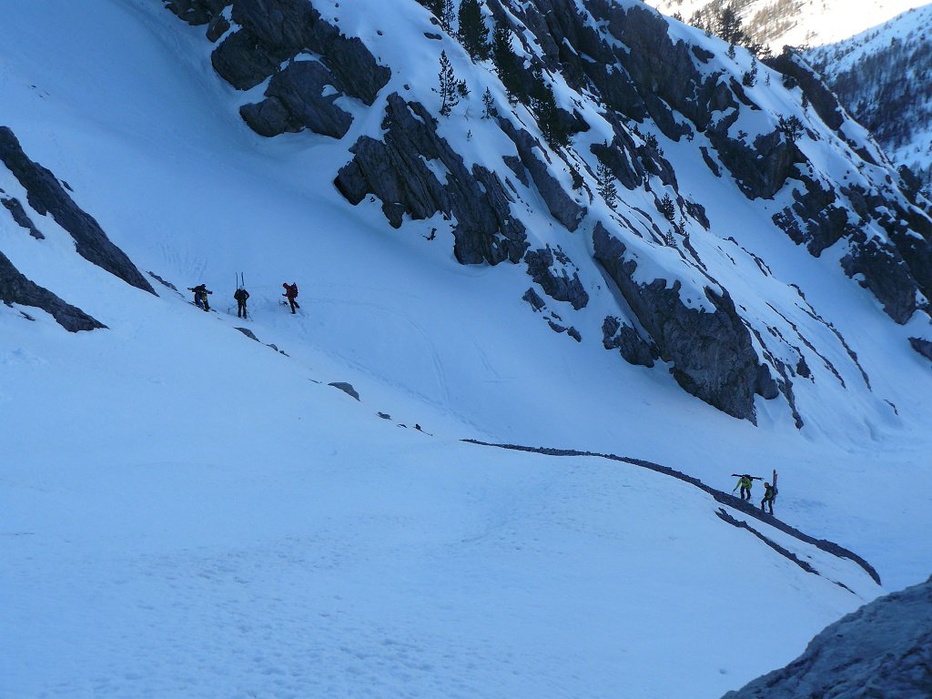
Avvicinamento
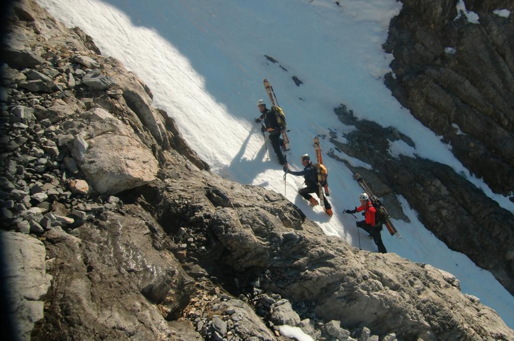
Come quello del "versante Sud", oppure dalla normale oppure da dove volete, l'importante è arrivare in punta.
Descrizione
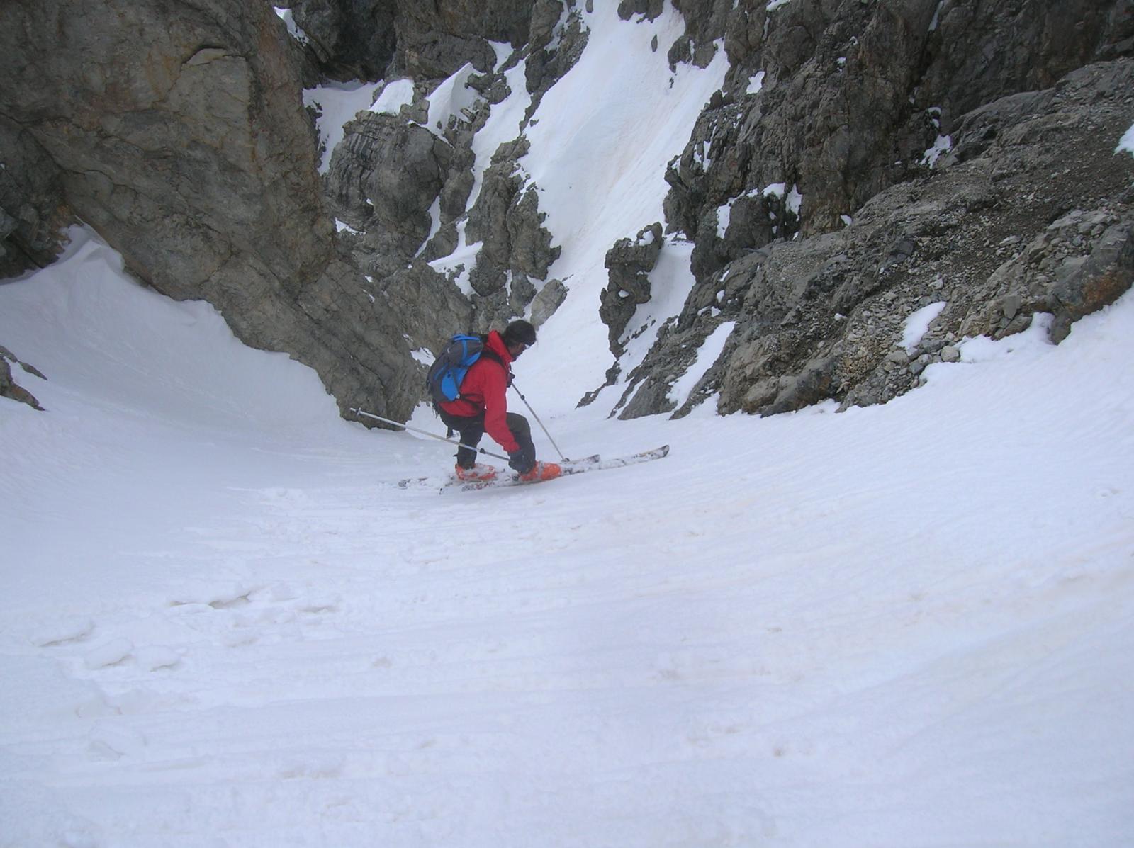
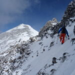
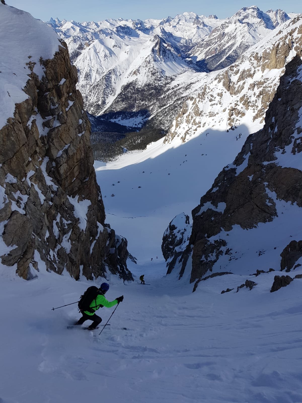
Punta – diretti per il versante sud (dalla parte diametralmente opposta di dove arriva la normale – sulla parete sono presenti pali in legno) – giù pressapoco diretti per circa 250-300 m . Quando sembra naturale seguire un canale che porta in una forra (salto!), lì c’è il bivio: a sx selletta (piccolo palo) che mena sul pendio della via classica, a dx selletta che scende sul ripidissimo canalino (45-50 gradi per qualche metro)che poi attenua la pendenza fino al gran pendio sottostante.
- Cartografia:
- IGC numero 1
Nelle vicinanze Mappa
Itinerari
26/03/2016 TO, Claviere D+ 1350 m III, 5.1, E4 Sud
Chaberton (Monte) Parete S
 200m
200m
16/05/2010 TO, Claviere D+ 1261 m 4.2, E4 Ovest
Chaberton (Monte) Versante O – Canale Diretto
 200m
200m
17/02/2024 TO, Claviere D+ 1380 m 4.3, E3 Sud-Est
Chaberton (Monte) Versante Sud-Est
 500m
500m
09/04/2022 Hautes-Alpes, Montgenèvre D+ 1900 m II, 4.2, E1 Nord-Ovest
Chalanche Ronde (Pointe de) Couloir NO
 1.2Km
1.2Km
25/04/2018 Hautes-Alpes, Montgenèvre D+ 1300 m I, 4.2, E2 Nord-Est
Chaberton (Monte) Canale NE
 1.2Km
1.2Km
15/03/2014 Hautes-Alpes, Montgenèvre D+ 1280 m IV, 5.2, E4 Est
Chaberton (Monte) Parete Est
 1.5Km
1.5Km
06/03/2025 Hautes-Alpes, Montgenèvre D+ 1350 m II, 4.3, E3 Sud-Ovest
Rochers Charniers (Pointe des) Canale Sud-Ovest
 1.5Km
1.5Km
04/01/2020 Hautes-Alpes, Montgenèvre D+ 1650 m I, 4.1, E1 Varie
Chalanche Ronde (Pointe des) da Montgenevre, anello per il pas du Curè e il Col des Trois Frère Mineurs
 1.5Km
1.5Km
05/04/2014 Hautes-Alpes, Montgenèvre D+ 1336 m III, 4.3, E3 Sud
Chaberton (Monte) Parete S/SO – Combinazione Vincente
 1.5Km
1.5Km
25/02/2012 Hautes-Alpes, Montgenèvre D+ 1059 m II, 4.1, E2 Ovest
Portiola (Pointe de la) versante O/SO
 1.5Km
1.5Km
Servizi
2.7Km
5Km
Casa Cesana Bar
Cesana Torinese
5Km
L’Ibarus Rifugio
Cesana Torinese
5Km
Piergiorgio Frassati B&B
Cesana Torinese
5Km
Ottima Scelta Ristorante
Cesana Torinese
6.4Km
La vachette Bar
Montgenèvre
8Km
Centro Ristorante
Cesana Torinese
8.5Km
Terre Rouge Rifugio
Cervières
8.5Km
La Fontana del Thures Rifugio
Cesana Torinese
9.8Km

