 3.2Km
3.2Km
Note
Storico
 1.5Km
2Km
6.4Km
10.1Km
10.5Km
13.7Km
13.7Km
13.8Km
1.5Km
2Km
6.4Km
10.1Km
10.5Km
13.7Km
13.7Km
13.8Km
3.2Km
4.1Km
4.2Km
7.8Km
7.9Km
8.5Km
8.7Km
8.9Km
9.1Km
9.4Km
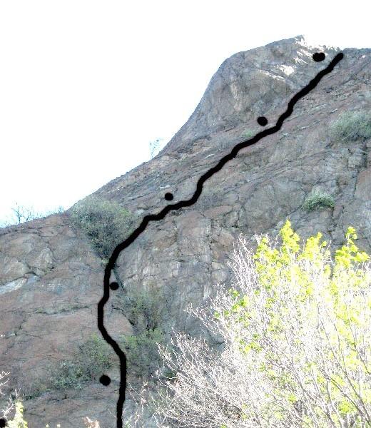
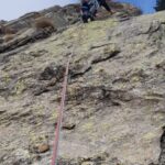
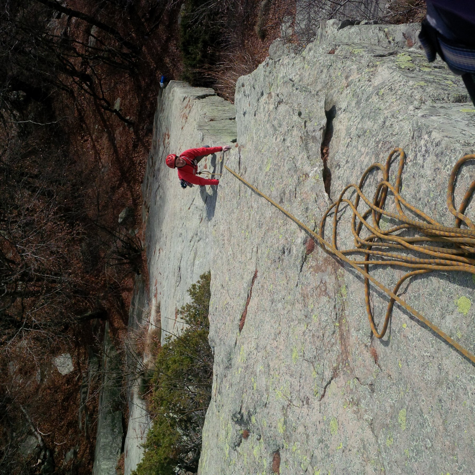
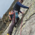
Certamente una parete dimenticata quella che dalle gole della Dora sale con belle placche rosse fino alla Monjovetta.
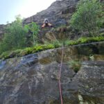
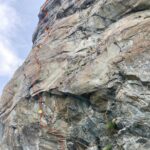
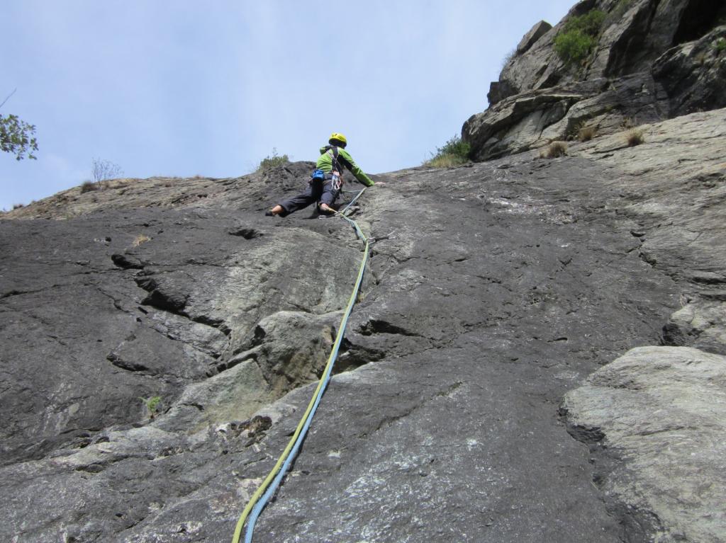
La parete alta circa 120 metri, con belle placche rosse, è più verticale di quel che sembra, la via è sporca di terra e vegetazione, è tutta attrezzata a fix inox molto ravvicinati, per le sei lunghezze al massimo di 25 metri, la difficoltà obbligatoria non passa il 5a, necessari nove rinvii, friends inutili, soste da collegare.
Equipaggiamento: normale da arrampicata, 9 rinvii, fettucce per collegare i fix delle soste
Avvicinamento
La parete alta circa 120 metri, con belle placche rosse, è più verticale di quel che sembra, la via è sporca di terra e vegetazione, è tutta attrezzata a fix inox molto ravvicinati, per le sei lunghezze al massimo di 25 metri, la difficoltà obbligatoria non passa il 5a, necessari nove rinvii, friends inutili, soste da collegare.
Equipaggiamento: normale da arrampicata, 9 rinvii, fettucce per collegare i fix delle soste
Per raggiungerla bisogna parcheggiare all' inizio dell' abitato di Saint Vincent scendendo dietro alla fabbrica rossa, tra un autolavaggio, e un' area ecologica parcheggio alla partenza di una sterrata, da lì traversare verso una casa di pietra e portarsi dietro la fabbrica rossa passando vicino a paline gialle del metanodotto, scendere la cresta con bolli rossi fino ad un palo elettrico di cemento, entrare nel bosco e continuare a scendere fino ad una strada, passare un ponte poi passare sotto la ferrovia e sotto all' autostrada, seguire una strada sterrata fin dopo una galleria della ferrovia, la via di Capaferita parte poco sopra la galleria del treno (scritta alla partenza). Ore 0,30
Descrizione
- L1: 5c, 6a.
- L2: 6a.
- L3: 5a.
- L4: 6a, 5a, 4c.
- L5: 5a, 4a.
- L6: 6a
Raggiunta la cima con percorso evidente in 10 minuti si ritorna alla macchina.
La via è stata aperta dal basso il 15 aprile 2008 da Maura Ramella Paia, Roby Detomati con la guida alpina Gianni Lanza.
Nelle vicinanze Mappa
Itinerari
29/10/2024 AO, Montjovet 6a, 5c obbl. Est
Montjovet (Gola di) – Vecchio Cuore Granata
 1.5Km
1.5Km
01/06/2025 AO, 7a, 6b+ obbl. Nord-Est
Pilier Rhodo – Wonder Crack
 2Km
2Km
20/07/2022 AO, Pontey 5c, 5a obbl. Nord
Pontey (Sperone di)
 6.4Km
6.4Km
26/04/2008 AO, Brusson 6a+, 6a+ obbl. Sud-Est
Extrepieraz – La Placca+Traversomania
7.2Km
02/07/2008 AO, Pontey 6a, 5c obbl. Nord
Ruvic (Mont), quota 2464 – Via dei Vili
8.7Km
24/10/2020 AO, Verrès 6a, 5b obbl. Sud
Verres (Speroni di) – Li Mortacci
 10.1Km
19/10/2016 AO, Arnad 6a, 5c obbl. Sud
Verres, Placche dello Scorpione – Scorpione Rosso
 10.5Km
19/04/2024 AO, Hône 6a, 5c obbl. Sud
Oriana (Placche di), settore sinistro – Barbara & Barbara
 13.7Km
12/06/2022 AO, Hône 4, 4 obbl. Sud
Oriana (Placche di) – Nuove Emozioni
 13.7Km
04/05/2024 AO, Hône 6b, 6a obbl. Sud
Oriana (Placche di), settore sinistro – Barbara & Barbara variante Secondo Vincenzo
 13.8Km
Servizi
3.2Km
4.1Km
Nigra Albergo
Montjovet
4.2Km
Da Vincenzo Ristorante
Montjovet
7.8Km
Ramet Ristorante
Challand-Saint-Victor
7.9Km
Laghetto Albergo
Brusson
8.5Km
Le petit monde Ristorante
Ayas
8.7Km
Le Coin des Melezes B&B
Brusson
8.9Km
Lavesè Ristorante
Saint-denis
9.1Km
Lo scoiattolo Ristorante
La Magdeleine
9.4Km