 2.6Km
2.6Km

Note
Storico
 50m
50m
50m
450m
1.1Km
1.6Km
1.6Km
1.6Km
1.6Km
50m
50m
50m
450m
1.1Km
1.6Km
1.6Km
1.6Km
1.6Km
gita che evita le piste svolgendosi dapprima del bosco Sestrieres sotto lo Janus e poi, dopo aver incrociato bar e seggiovia per solo 200m, si svolge fuori pista fra gli ultimi alberi e l'aperto vallone sotto lo Chenaillet. Possibile aumentare il dislivello partendo dal tornante della National 94 quando incrocia la Durance (larga fontana tipica).
Avvicinamento
park vs Briancon vicino a Golf e "teleski de la
Durance".
Descrizione
Durance".
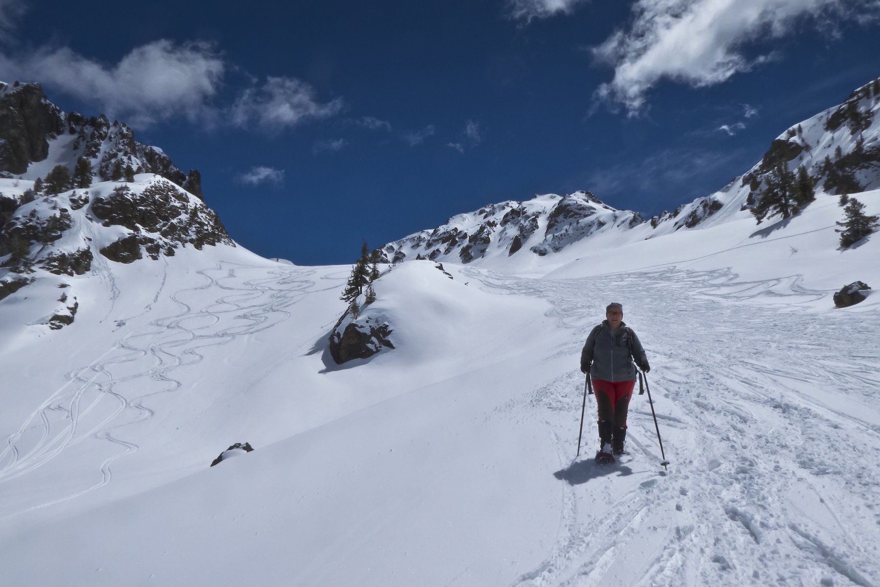
attraversare prati pista e skilift DUrance entrando subito nel bosco, tenersi a dx dello skilift e poi entrare nel valloncello evidente con cartelli indicatori Mont Janus (dir S). quando a q2040 sbuca vicino alle piste, evitarle alzandosi ripidamente a dx (dir SO) per 50m di quota, quindi piegare a sin in lievissima discesa puntando alla grande seggiovia. tenersi sul bordo sin della pista (rete rossa) e prima del Bar andare a dx nel bosco, dirigendosi legg. a sn (SO) vs grossa casa a q2150 sotto laghetto recintato. qui parte spesso una pista pattuta per le ciaspole che sale proprio al colle. andare dir SSE per ampi pendii superanto un poco visibile lago con gabbiotto di cemento q2200 e puntare decisamente al colle che si trova appena a destra dello Chenaillet.
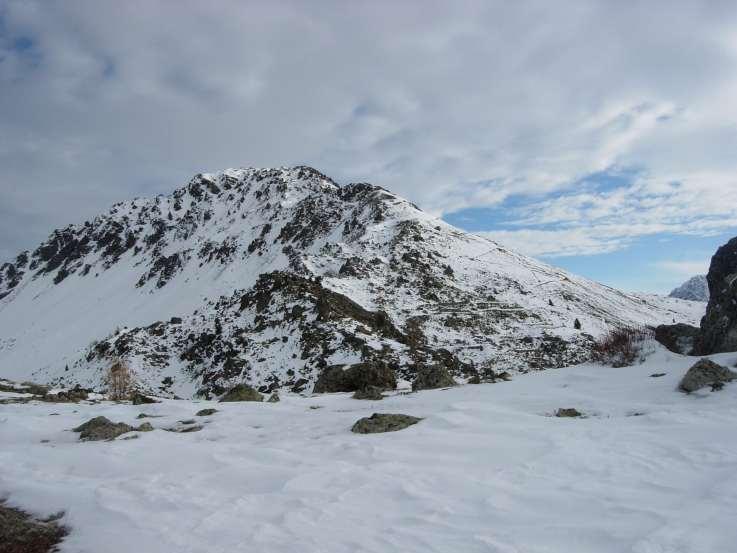
casa des Douaniers (doganieri) appena sotto il colle versante Cervieres. Nota bene: per colle Gondran si intende a volte quello fra il Sommet des Anges e lo Janus: questo e' molto più a Est: fra Sommet Anges e Chenaillet!
- Cartografia:
- IGN 1:25000 Briancon
Nelle vicinanze Mappa
Itinerari
01/03/2019 Hautes-Alpes, Montgenèvre D+ 655 m MR Nord-Est
Anges (Sommet des), Fort du Gondran da Montgenèvre
 50m
50m
15/10/2016 Hautes-Alpes, Montgenèvre D+ 800 m BR Varie
Chenaillet (le) da Montgenevre
 50m
50m
04/01/2025 Hautes-Alpes, Montgenèvre D+ 750 m MR Varie
Janus (le) da Montgenèvre
 50m
50m
13/01/2024 Hautes-Alpes, Montgenèvre D+ 330 m MR Sud
Diseur (Rocher) da Montgenèvre
 450m
450m
27/12/2018 Hautes-Alpes, Montgenèvre D+ 700 m MR Sud
Thibaud (Serre) da Montgenevre
 1.1Km
1.1Km
02/12/2009 Hautes-Alpes, Montgenèvre D+ 600 m MR Nord
Sarailles (Col) da Montgenevre
1.1Km
07/05/2017 Hautes-Alpes, Montgenèvre D+ 740 m MR Tutte
Verde (Colletto) da Montgenèvre
 1.6Km
1.6Km
22/04/2025 Hautes-Alpes, Montgenèvre D+ 792 m BR Nord
Gimont (Mont) o Grand Charvia da Montgenevre per la Valle dei Mandarini
 1.6Km
1.6Km
08/04/2017 Hautes-Alpes, Montgenèvre D+ 790 m MR Sud-Est
Petit Chalvet (le) da Montgenevre
 1.6Km
1.6Km
18/11/2012 Hautes-Alpes, Montgenèvre D+ 750 m BR Nord-Ovest
Plane (Monte la) da Montgenevre
 1.6Km
1.6Km
