4Km
4Km

Note
 50m
50m
50m
2.6Km
2.6Km
2.6Km
3.1Km
3.1Km
3.1Km
50m
50m
50m
2.6Km
2.6Km
2.6Km
3.1Km
3.1Km
3.1Km
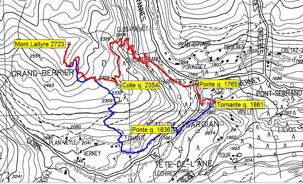
EE dal ponte di Arpettes alla punta e ritorno al colle q. 2354
Avvicinamento
.
Descrizione
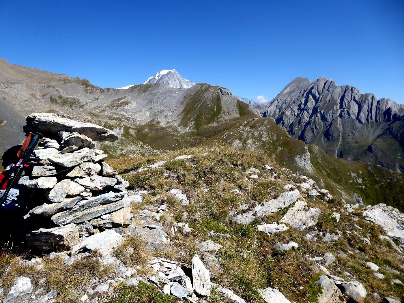
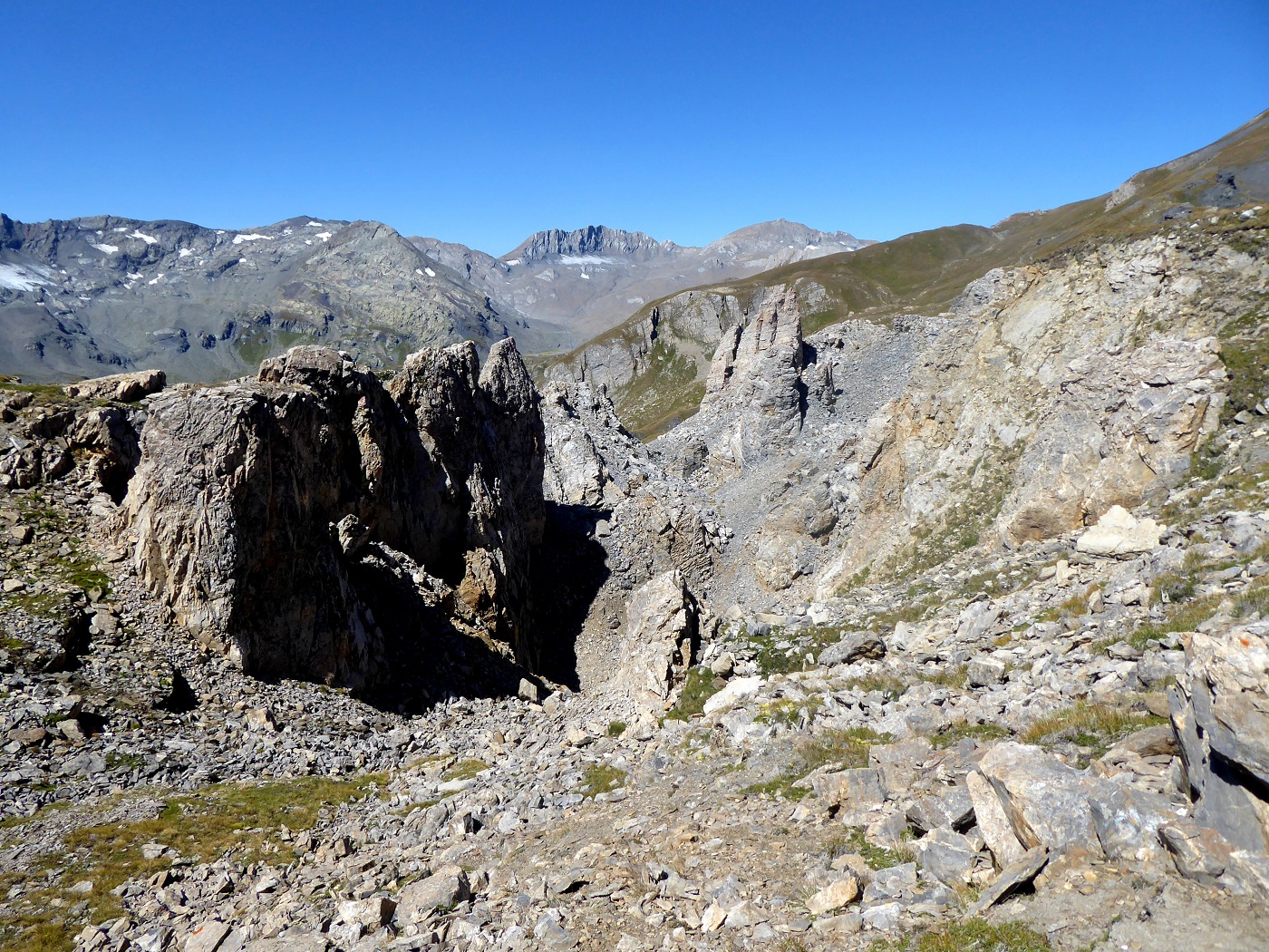
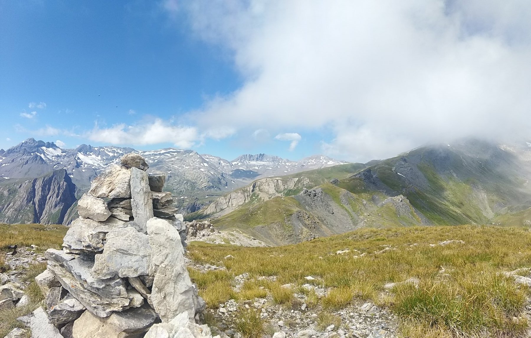
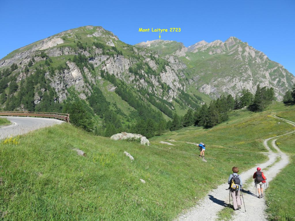
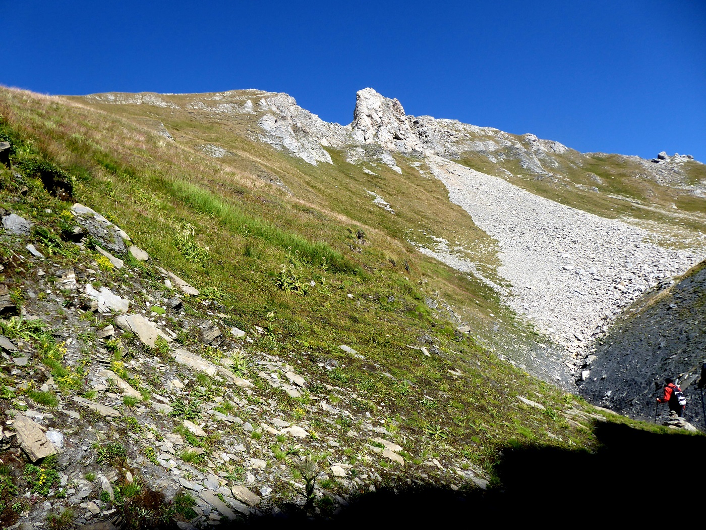
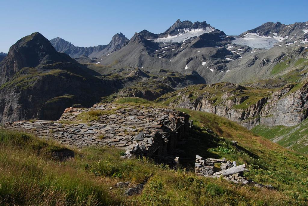
Dal tornante q. 1861m (1810m su l’Escursionista) si scende fin sul ponte di Arpettes 1765 (segnavia 10A), da qui si sale con la bella mulattiera militare (purtroppo franata in alcuni tratti e esposta a caduta massi, attenzione con terreno bagnato) fino al colle q. 2354m a Sud-Est del Mont Laityre, poco dopo l’arrivo di una vecchia funivia militare (rudere). Dal colle il sentiero 10A riportato sulla cartina è praticamente scomparso: si attraversa per prati in direzione Ovest fin nei pressi della profonda spaccatura del terreno (da Nord a Sud) a q. 2480 circa, da questo punto si può risalire sul fondo della spaccatura (spesso innevata, presenti alcuni ometti) o risalendo il bordo Est fino al termine della spaccatura a q. 2560 circa, ci si porta quindi sulla dorsale Sud-Sud/Ovest del Mont Laityre (anche qui presenti alcuni ometti) e per prati e sfasciumi si raggiunge la panoramica punta a q. 2723m.
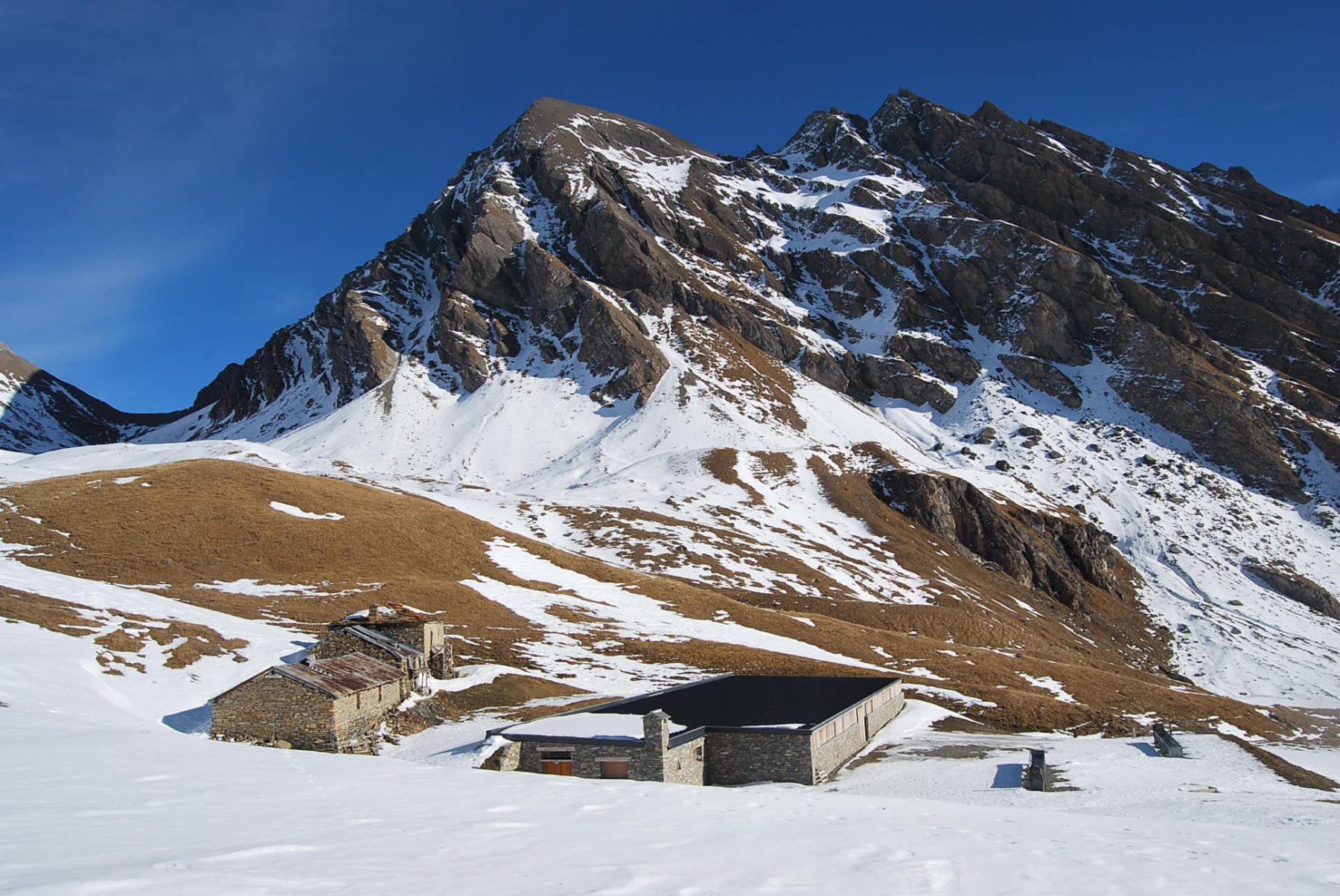
Dalla punta si ritorna al colle q. 2354m (o per prati si può scendere a valle del colle), quindi col sentiero 10B (o tagliandone l’ampio arco) fino all’alpe Chantè 1992 e poi con il sentiero n°10, passando per il ponte q. 1836m, si ritorna la tornante q. 1861.
- Cartografia:
- L'Escursionista n.2, 1/25.000
Nelle vicinanze Mappa
Itinerari
18/10/2025 AO, La Thuile D+ 1400 m EE Varie
Fornet (Punta) da Pont Serrand, anello
 50m
50m
08/08/2025 AO, La Thuile D+ 1220 m EE Sud
Ouille (Mont) da Pont Serrand per il versante sud
 50m
50m
21/08/2020 AO, La Thuile D+ 1021 m EE Varie
Breuil (Col du) da Pont Serrand, anello
 50m
50m
27/06/2015 AO, La Thuile D+ 1100 m E Sud
Orgère (Col d’) da Pont Serrand
 2.6Km
2.6Km
29/06/2016 AO, La Thuile D+ 1328 m EE/F Sud-Est
Lechaud (Punta) da Pont Serrand per il Col de Chavannes
 2.6Km
2.6Km
09/07/2026 AO, La Thuile D+ 900 m E Est
Fortin (Mont) da Pont Serrand per il Col des Chavannes
 2.6Km
2.6Km
18/08/2025 AO, La Thuile D+ 1050 m EE Varie
Veys (Aiguille) dal Lago Verney
 3.1Km
3.1Km
29/06/2026 AO, La Thuile D+ 1200 m EE/F Sud-Est
Miravidi (Monte) e Punta dei Ghiacciai dal Lago Verney
 3.1Km
3.1Km
01/09/2006 AO, La Thuile D+ 980 m EE Sud
Fornet (Punta) dal Lago Verney
3.1Km
30/08/2025 AO, La Thuile D+ 800 m E Varie
Bassa Serra (Colle di) dal Lago Verney
 3.1Km
3.1Km