6.2Km
6.2Km
Note
Storico
 0m
0m
0m
50m
50m
50m
50m
50m
50m
0m
0m
0m
50m
50m
50m
50m
50m
50m
Traversata splendida, solitaria (eccetto il Rainetto il fine settimana, sconsigliabile), divertente e varia con viste incantatrici verso il Bianco, lato sud-ovest. La discesa è delicata e richiede la dovuta attenzione.
Avvicinamento
.
Descrizione
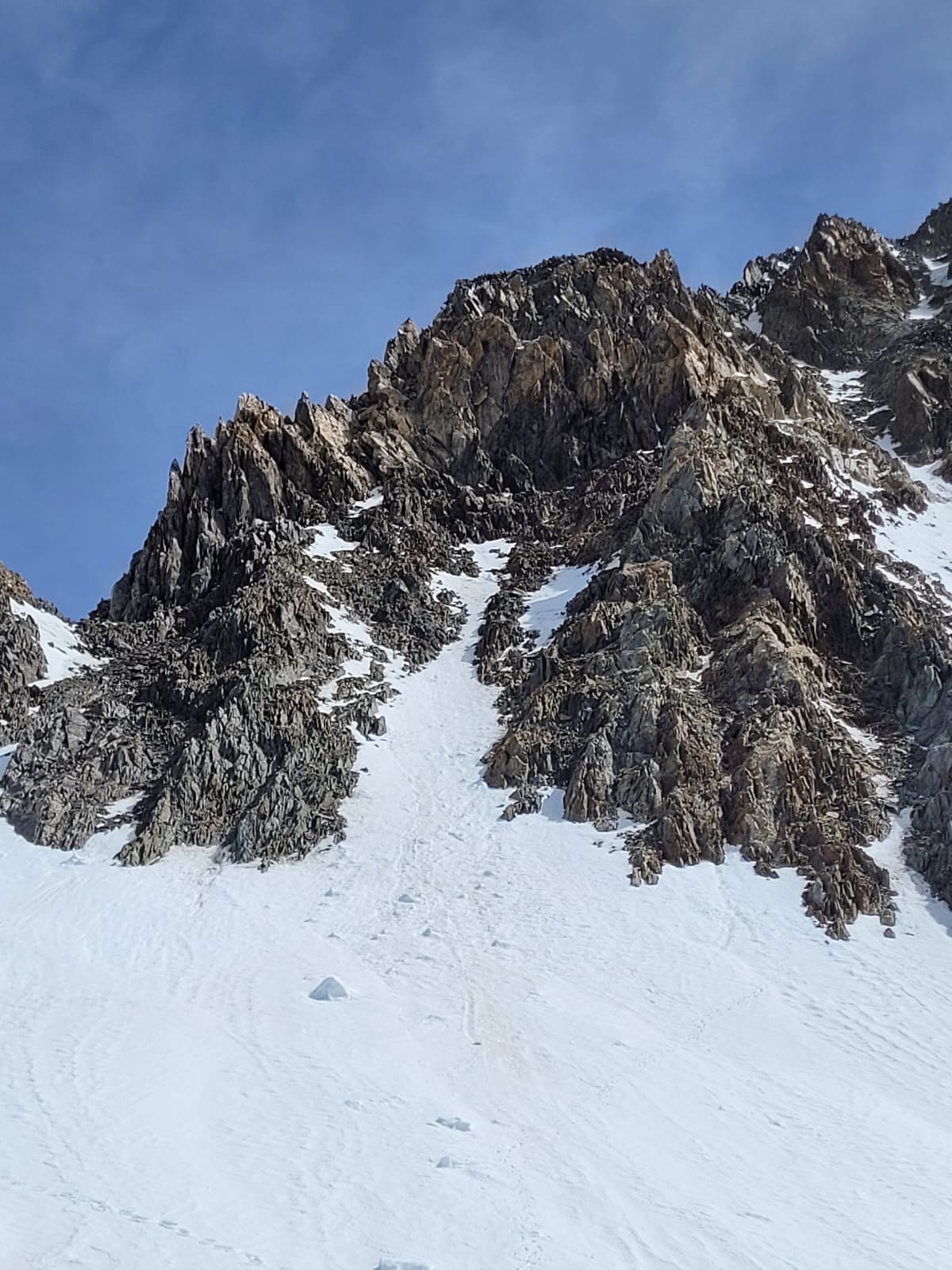
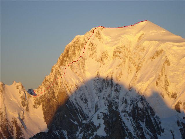
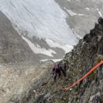
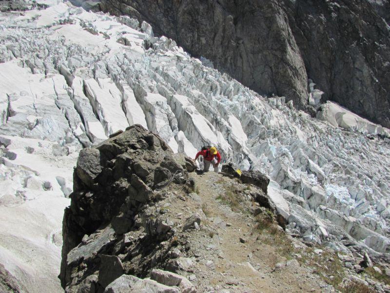
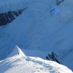
Dal bivacco Rainetto si risale il pendio nevoso del Petit Mont Blanc e, giunti all’inizio della parte rocciosa sommitale, un ometto sulla sx indica l’accesso al gh. del Petit M.Blanc. Si perdono circa 100m, scendendo tra sfasciumi (infido, ometti e 2 corde fisse: una scende direttamente pochi metri sopra la terminale lungo un canalino, mentre l’altra più a destra scendendo è più verticale). Si risale il gh. fino alla spalla della Trelatete (crepacci) a circa 3.600m, facendo una curva verso dx. Allargando un pò a destra si inizia a risalire il pendio, inizialmente appoggiato, in seguito con un centinaio di metri a 45°max. [PD+ , condizioni variabili, exposé]
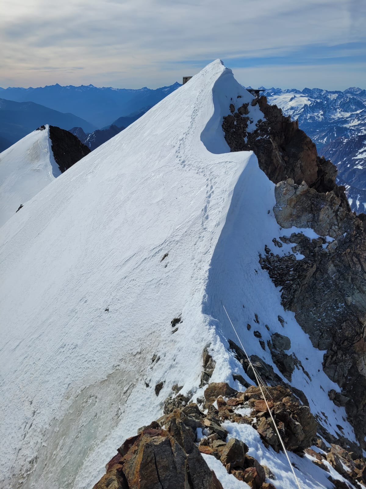
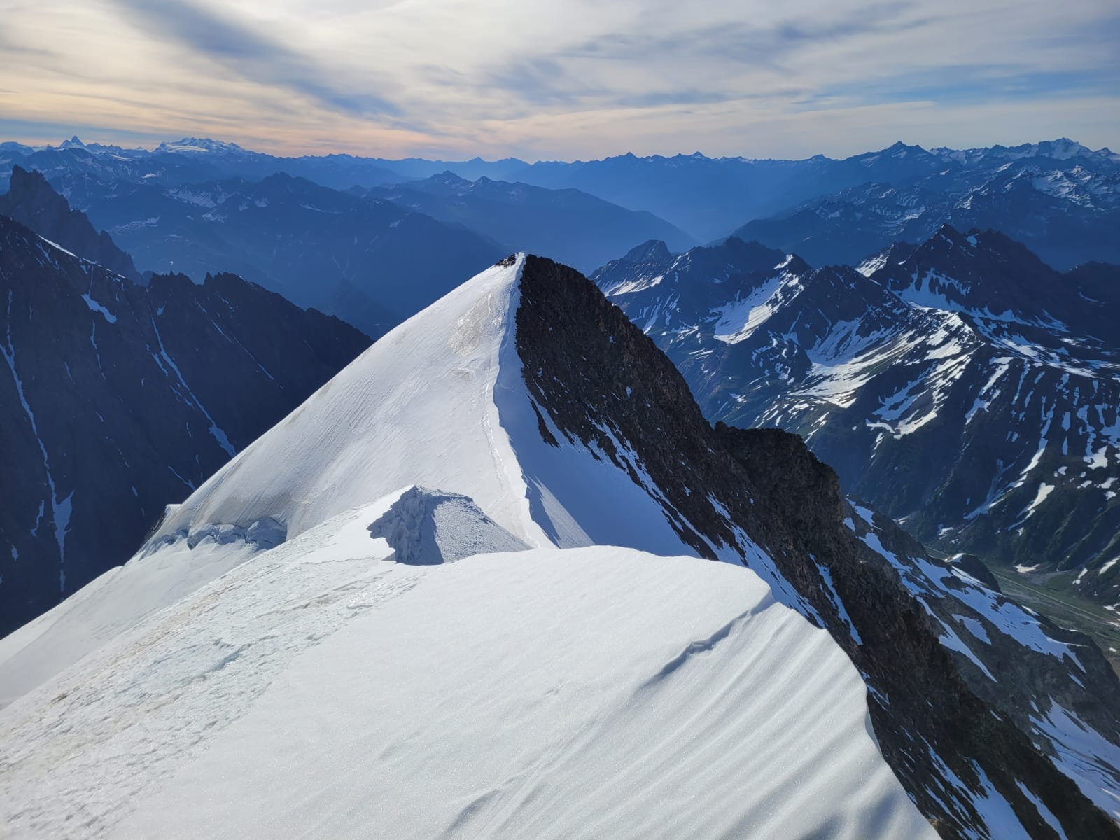
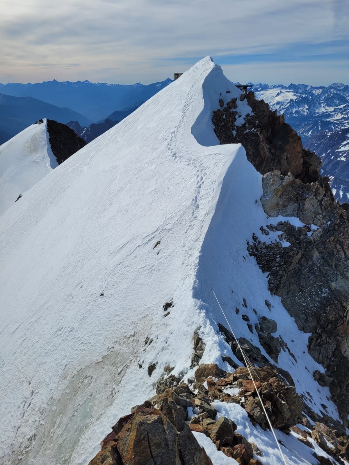
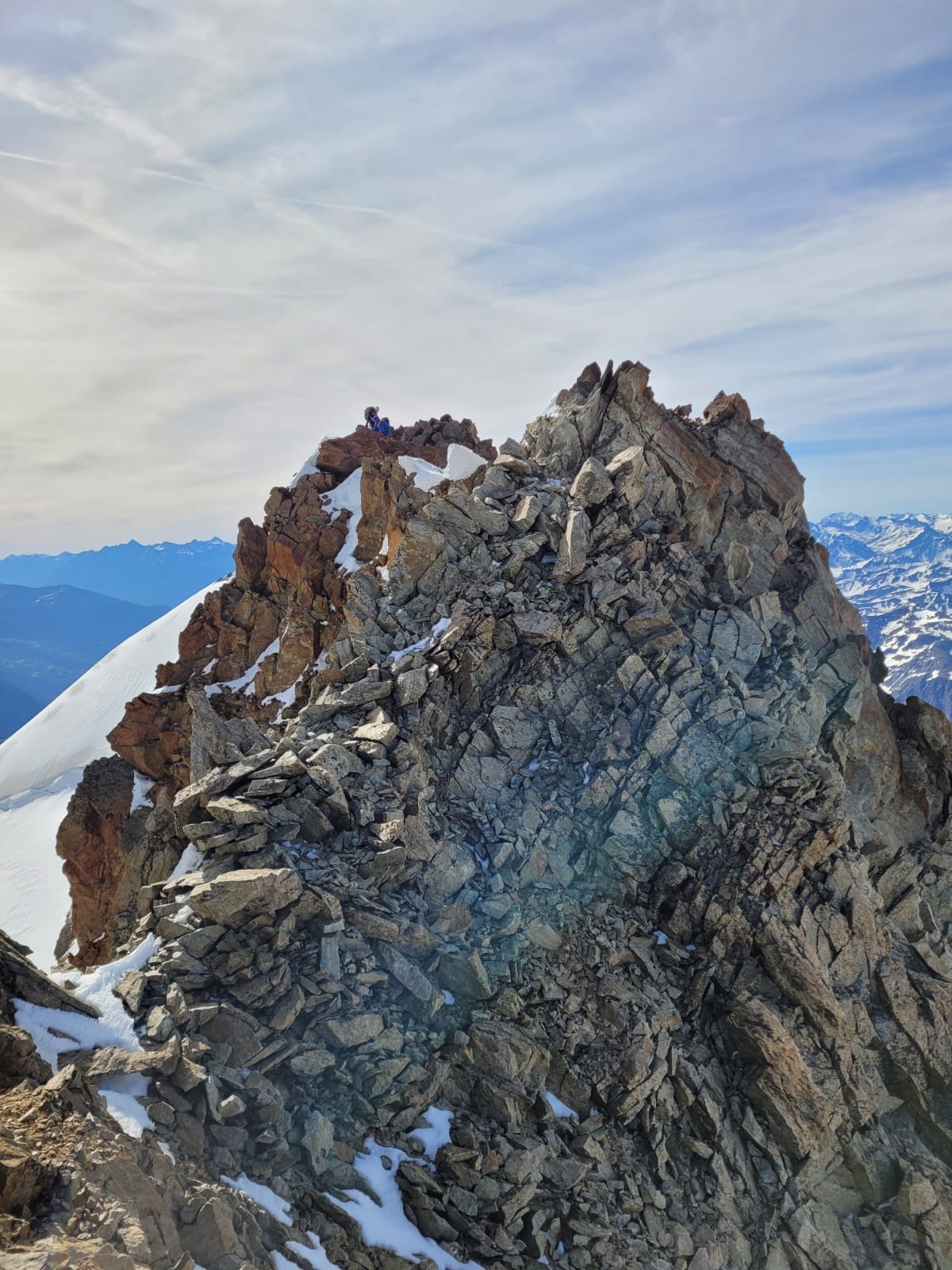
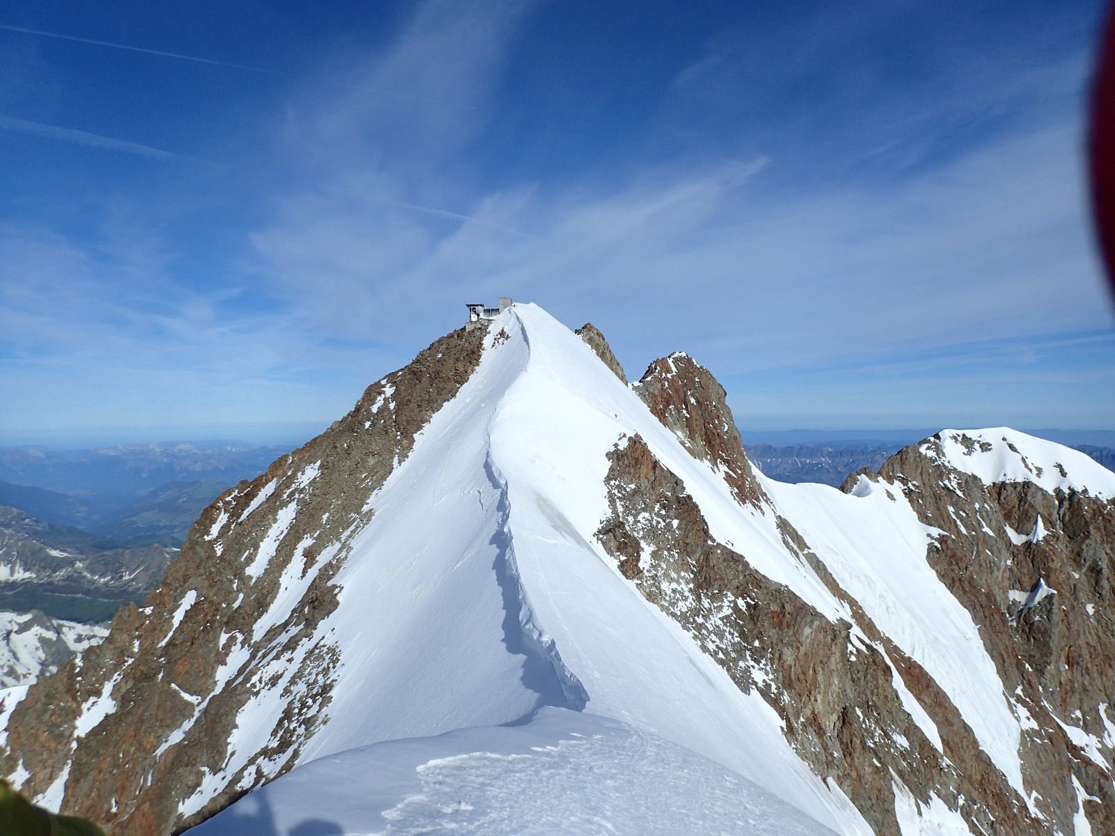
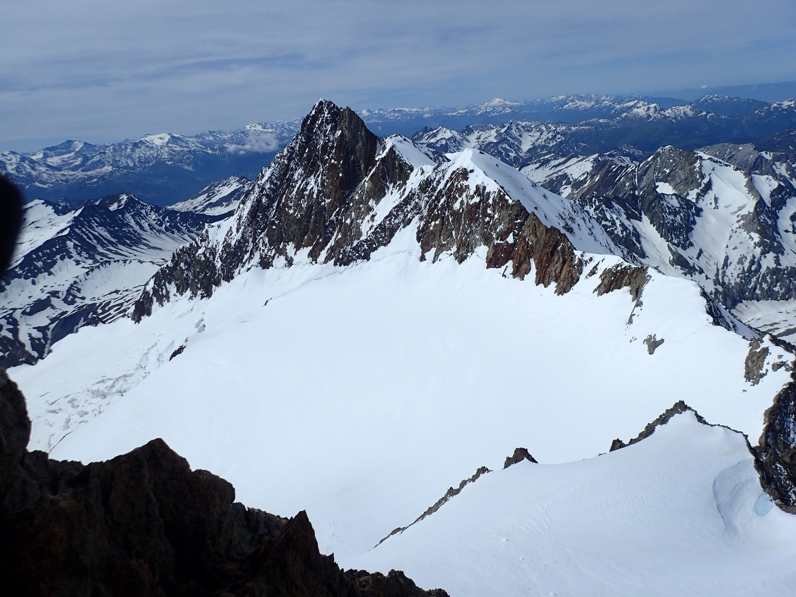
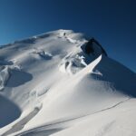
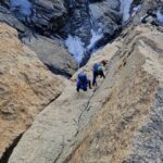
Si perviene così alla Trelatete orientale 3.895m (dal Rainetto 3-4 h) e si segue la cresta nevosa (cornici) che dopo qualche roccetta porta alla punta Meridionale (15′). Con un bel passaggio in cresta aerea e altre roccette (II°) si giunge infine alla punta Centrale (3.917m, 15′).
La discesa verso il colle della Trelatete (cresta sud-ovest) avviene dapprima per rocce rotte, poi aggirando facilmente i risalti iniziali sfruttando ripide lingue di neve. In seguito con semplici aggiramenti sulla dx fino a portarsi sul nevaio che conduce all’ampia sella quotata 3.660. [PD+ , rocce mobili]
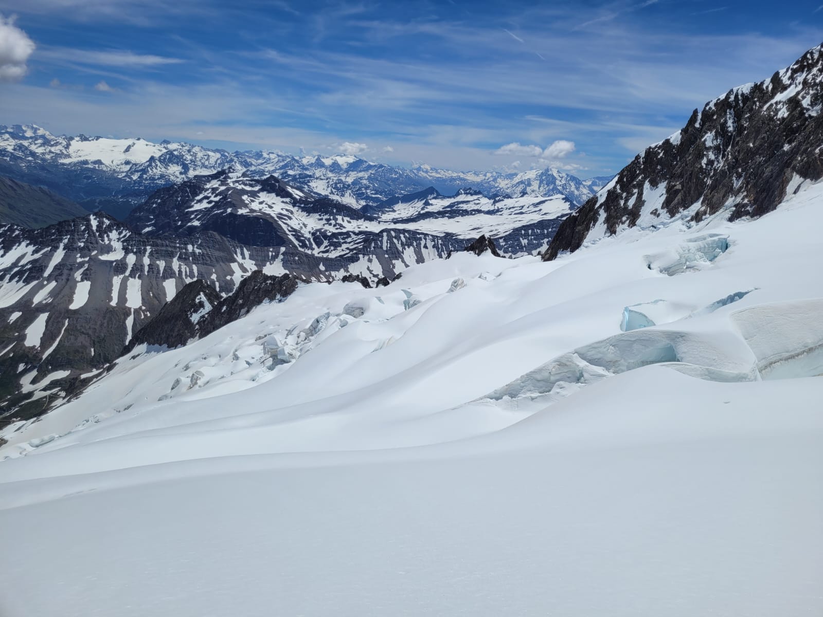
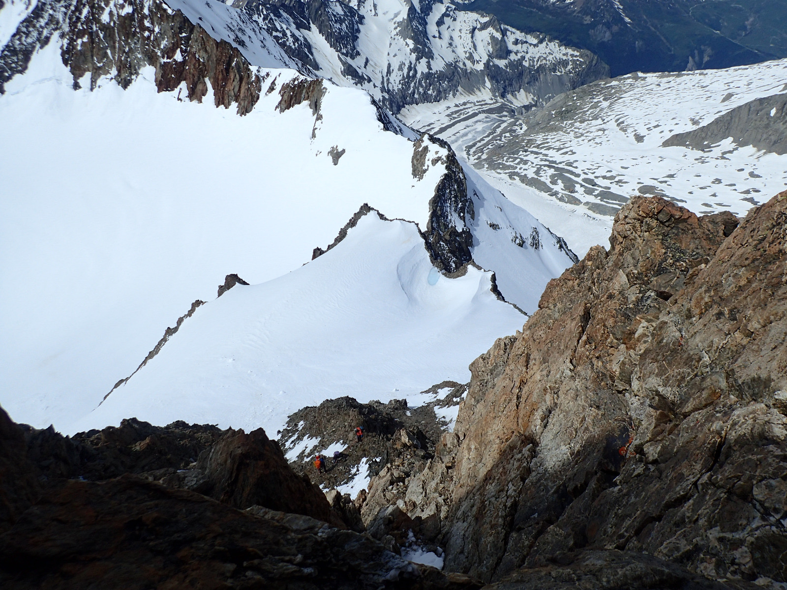
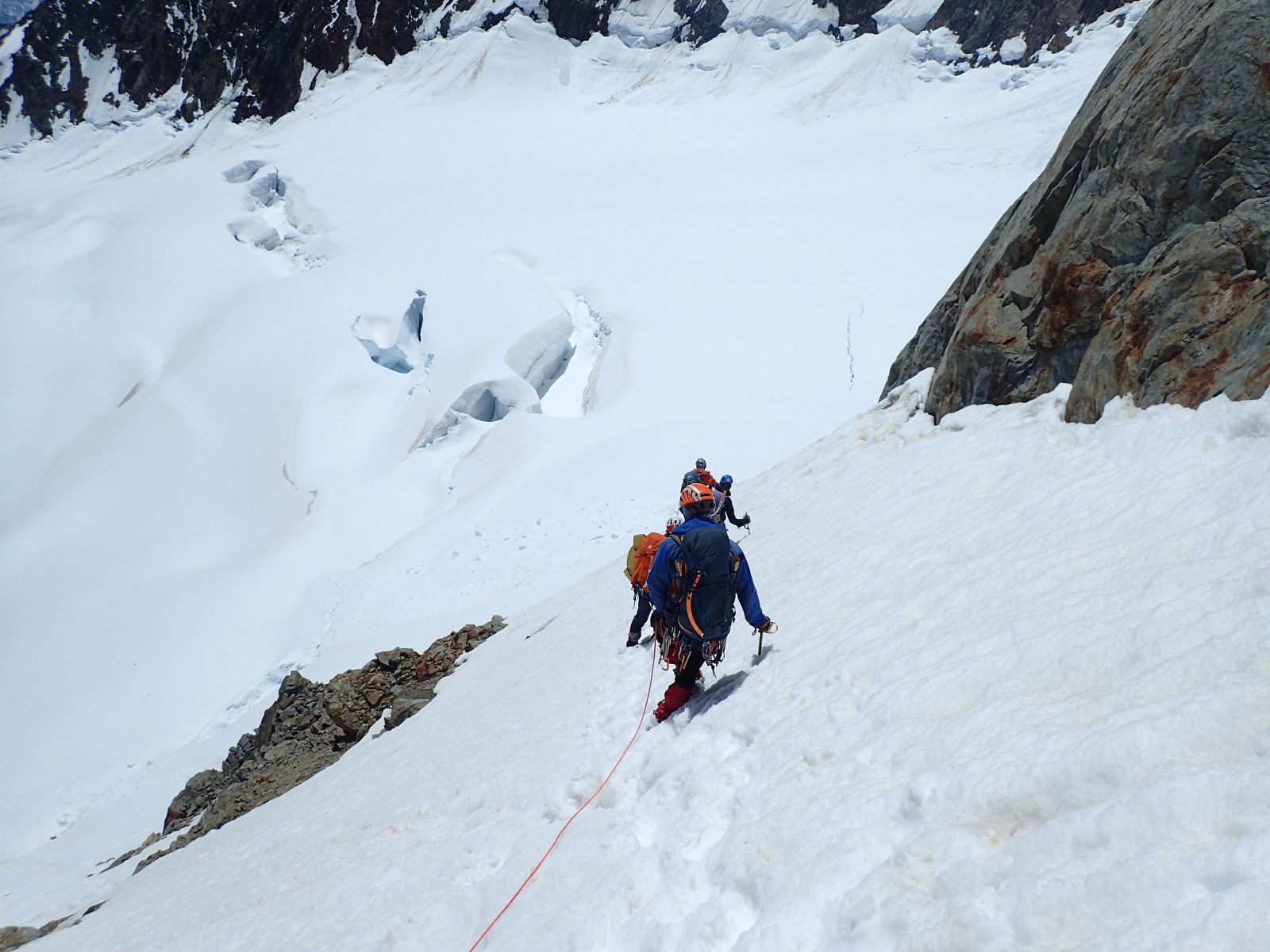
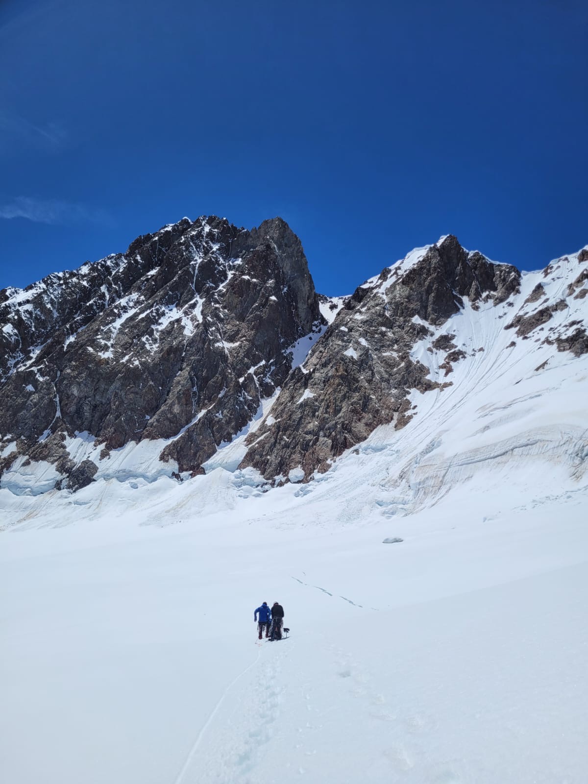
Da qui è possibile continuare la cresta fino al colle Trelatete con aggiramenti a sx, oppure (più veloce ma con rischio di qualche scarica di pietre da sopra) dal largo pendio nevoso che porta al bacino sup. del gh. di Lex Blanche a circa 3.400. Lo si attraversa mantenendo la quota per portarsi alla barra che divide i due bacini glaciali. Buscaini qui indica una “cravatta” di neve da prendere sempre intorno ai 3.400m che permette agevolmente il passaggio. In realtà arrivando dall’alto non è così semplice individuare il punto d’accesso migliore.
Ci sono alcune possibilità da valutare secondo le condizioni con l’incognita della crepaccia terminale del bacino inferiore del gh. di Lex Blanche.
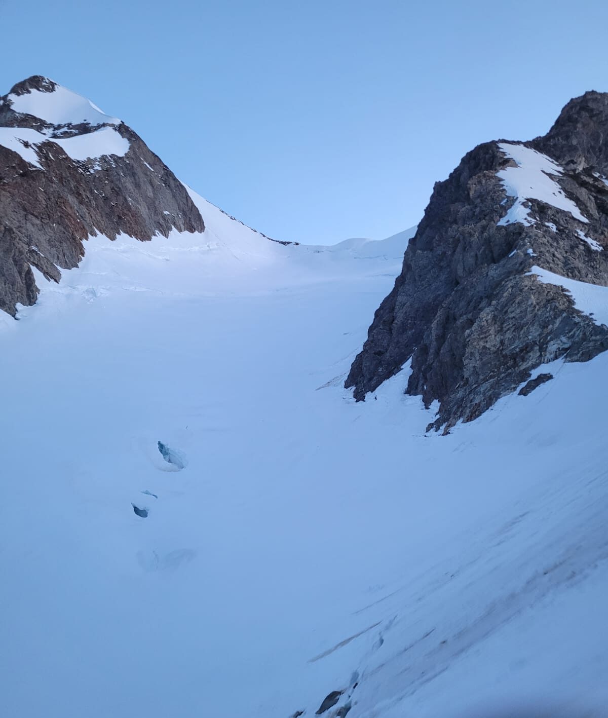
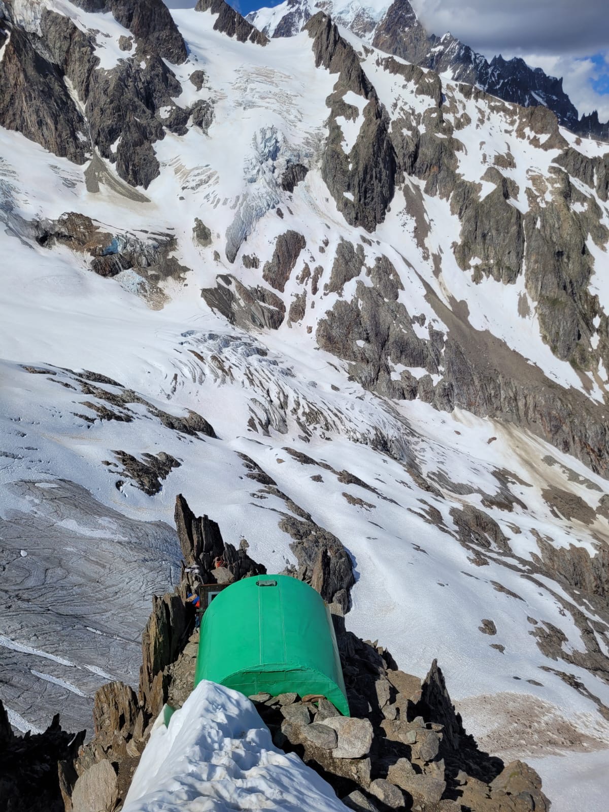
Forse la soluzione migliore è quella scelta da noi (e da altri: trovati un paio di ometti e un cordino per calata sopra la crepaccia), cioè scendere da quota 3.400 circa, a seconda delle condizioni per neve (40° max in alcuni punti) o rocce rotte e sfasciume, puntando al punto del ghiacciaio più accessibile. Si perdono così circa 150-200m e si mette piede nuovamente sul ghiacciaio. Puntare all’innesto della cresta che arriva dal bivacco Hess con il ghiacciaio (a circa 3.100m, evidente) cercando di allargare verso la parete sud-est dell’Aig. del Glaciers costeggiandola per evitare la zona centrale molto crepacciata.
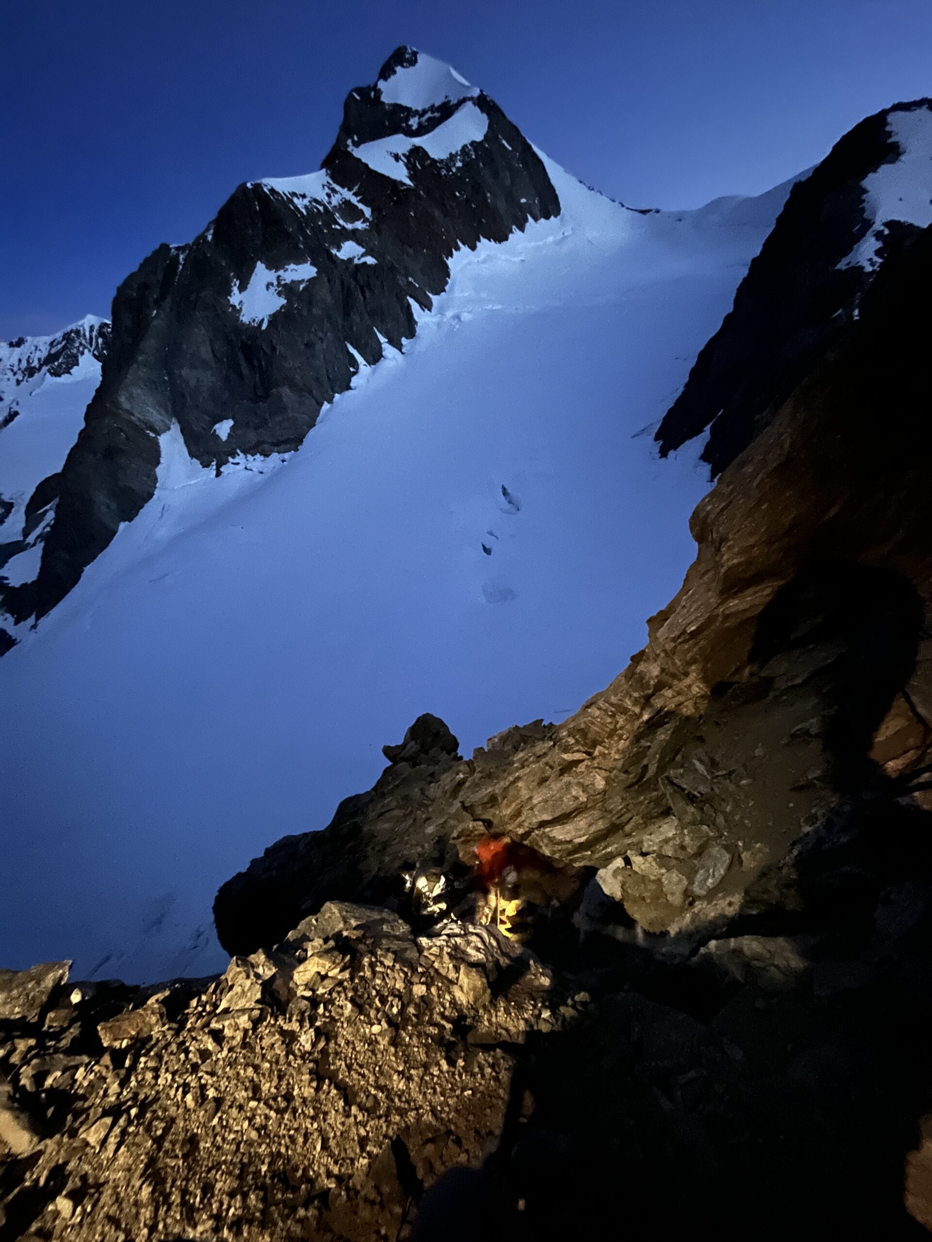
Si segue la cresta tenendosi sempre a dx del filo [II° con passi esposti] e incontrando vari ometti si arriva finalmente all’incredibile bivacco Hess. Da lì sentiero fino all’Elisabetta e giù al Combal.
Molto interessante la traversata completa fino all'Aiguille des Glaciers, su creste nevose e roccette non difficili ma aeree, ed un' ultima parte su roccia (II-III). Discesa o verso la Francia o rientro dal col de la Seigne(!).
- Bibliografia:
- Guida CAI-TCI
Nelle vicinanze Mappa
Itinerari
29/08/2021 AO, Courmayeur D+ 3237 m D+ Sud
Bianco (Monte) Cresta dell’Innominata
 0m
0m
21/06/2026 AO, Courmayeur D+ 3110 m AD- Varie
Bianco (Monte) Via Normale Italiana o Via Ratti dal Rifugio Gonella
 0m
0m
26/07/1998 AO, Courmayeur D+ 1457 m F Varie
Lechaud (Punta) da La Visaille per il Colle di Chavannes ed il versante Est
 0m
0m
02/04/2021 AO, Cormayeur D+ 950 m ED Sud-Est
Bianco (Monte) Hypercouloir du Brouillard
50m
21/08/2013 AO, Courmayeur D+ 3200 m D+ Sud-Est
Bianco (Monte) Cresta di Peuterey dal Col Eccles
 50m
50m
24/08/2025 AO, Courmayeur D+ 1400 m PD- Sud
Estellette (Aiguille d’) da La Visaille
 50m
50m
18/08/2021 AO, Courmayeur D+ 1300 m F+ Sud
Gonella Francesco (Rifugio) al Dome da La Visaille
 50m
50m
09/08/2024 AO, Courmayeur D+ 3400 m ED- Sud-Est
Bianco (Monte) Pilone Centrale Freney – Via classica
 50m
50m
02/07/2021 AO, Courmayeur D+ 400 m TD+ Sud-Est
Brouillard (Pilastro Rosso del) – Via Bonatti-Oggioni
 50m
50m
12/08/2021 AO, Courmayeur D+ 2600 m AD Est
Bionnassay (Aiguille de) Cresta Est
 50m
50m