 2Km
2Km
Note
 6.6Km
8Km
9.7Km
10.4Km
11Km
12.2Km
6.6Km
8Km
9.7Km
10.4Km
11Km
12.2Km
2Km
2.1Km
3.6Km
3.9Km
3.9Km
5.9Km
7.8Km
7.9Km
8Km
9.6Km
Lunghezza 54 km
Avvicinamento
.
Descrizione
Ad Oulx imboccare la strada asfaltata per il Cotolivier.
Raggiunta la frazione di Vazon, la strada diventa sterrata.
La si percorre fino in punta alla cappella Madonna del Cotolivier,(12km). Spalle alla chiesetta si percorrono 200 m di sentiero sulla cresta spartiacque con Beaulard. Ci si butta giù a dx per prati e pineta fino ad incontrare tracce di mulattiera che conduce alla frazione Chateau Beaulard.
Attraversare il ponte, girare a destrax ed entrare nelle frazione, passare vicino alla fontana ed usciti dalla frazione medesima percorrere poche centinaia di metri della strada asfaltata fino al primo tornante. Ivi imboccare lo sterrato a sinistra) che porta al Rifugio Guid Rey (palina indicatrice). Si perviene dopo durissime salite e strappi al Rifugio, dal quale si scende la prima balza della vecchia pista di sci e appena imboccato nuovamente lo sterrato di salita si incontra sulla sinistra la palina indicatrice del sentiero che scende a Beaulard.
Con amena discesa su sentiero in pineta si giunge alle prime case di Beaulard. (fontana vicino al ponte sotto la chiesa). Scendere ora per l’unica strada asfaltata per 500 m e imboccare a sinistra la strada sempre asfaltata che porta alla frazione Puy dopo 3 km. Entrare nell’abitato e passare vicino alla fontana ed anche alla successiva ottagonale fino ad uscire sempre su sterrato dal nucleo di case. Seguire ore il lunghissimo sterrato con indicazione Colomion, che con lunghi traversi e moltissimi tornanti porta ai 2054 m dalla cima Colomion).
Ora ritornare indietro sullo stesso sterrato fino al Puy, e lungo la bella sterrata con alcuni saliscendi si prosegue per diversi km nel bosco, sino a ritrovare la strada asfaltata del Cotolivier, e quindi in discesa in breve ad Oulx.
Nelle vicinanze Mappa
Itinerari
05/05/2012 TO, Oulx D+ 1035 m Sud-Est
Madonna del Cotolivier (Cappella) da Oulx
50m
02/09/2024 TO, Sauze d'Oulx D+ 900 m Tutte
Assietta (Testa dell’) da Monfol
6.2Km
06/07/2019 TO, Cesana Torinese D+ 2000 m Tutte
Chaberton (Monte) da Fenils, anello ITINERARIO NON PERCORRIBILE
 6.6Km
6.6Km
31/05/2005 TO, Cesana Torinese D+ 880 m Sud-Est
Aigliere (Rocca d’) da Fenils
6.6Km
19/08/2024 TO, Oulx D+ 1000 m Nord
Rey Guido (Rifugio) da Beaulard per il vertical
 8Km
8Km
01/08/2010 TO, Cesana Torinese D+ 3256 m Varie
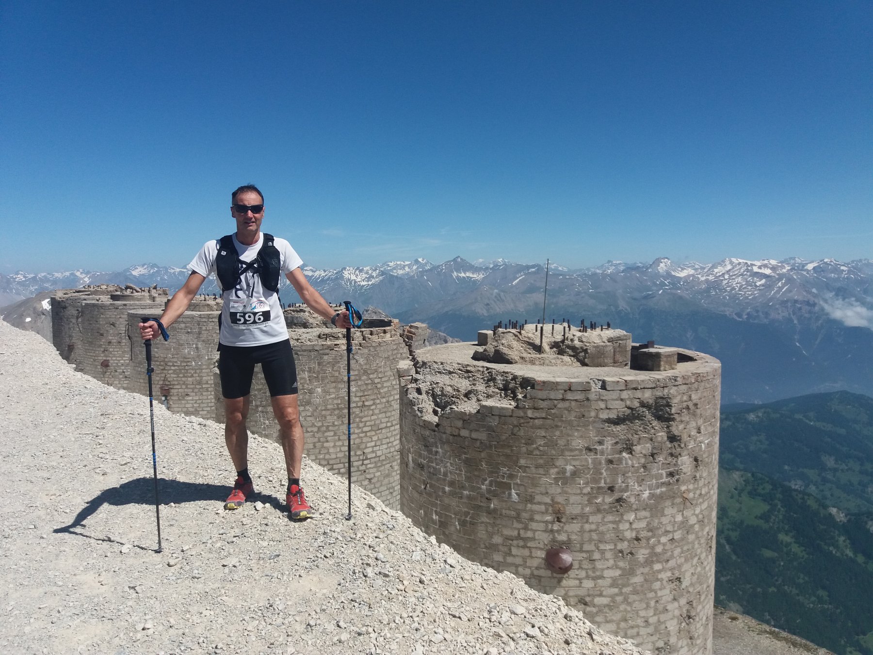
Chaberton (Monte) Marathon Trail des Fortes ITINERARIO NON PERCORRIBILE
 9.7Km
9.7Km
26/07/2015 TO, Sestriere D+ 750 m Tutte
Fraiteve (Monte) da Sestriere
9.9Km
05/10/2014 TO, Sestriere D+ 1600 m Varie
Sies (Monte) da Sestriere 3 Funivie Skyrace
 10.4Km
11/10/2014 TO, Pragelato D+ 820 m Nord-Est
Aigle (Pitre de l’) da Villardamond, anello
 11Km
11Km
10/12/2015 TO, Pragelato D+ 400 m Varie
Troncea (Rifugio) da Pattemouche
 12.2Km
Servizi
2Km
2.1Km
La Chardouse Rifugio
Oulx
3.6Km
L’Cantun B&B
Sauze D'oulx
3.9Km
orto del frate Ristorante
Sauze d'Oulx
3.9Km
paddy mc ginty Ristorante
Sauze d'Oulx
5.9Km
L’Eitabl Ristorante
Oulx
7.8Km
Dell’Orsa Bar
Oulx
7.9Km
Il Covo di nord ovest Ristorante
Salbertrand
8Km
Guido Rey Rifugio
Oulx
9.6Km

