650m
650m

Note
Storico
 50m
50m
50m
50m
50m
50m
50m
50m
50m
50m
50m
50m
50m
50m
50m
50m
50m
50m
50m
50m
650m
700m
1.2Km
2.6Km
2.6Km
2.6Km
3.4Km
7.9Km
8.5Km
9.6Km
Grandioso itinerario ad anello di ghiacciai tra Valle d'Aosta e Svizzera (Vallese) della durata di 2 giorni e mezzo.
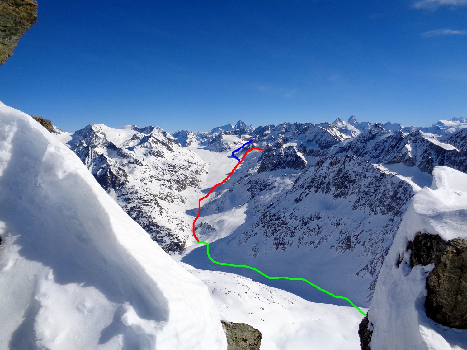
Si salgono due cime importanti, il Mont Gelè e l' Aouille Tseucca; si scavalca un passaggio tra il bacino di Otemma e la Valpelline ripido su entrambi i versanti, con la discesa che è tra l'OSA e lo sci-ripido, seppur breve. Tale passaggio è stato battezzato Epaule Albert Morin, spalla della Becca d'Oren Ovest quotata 3351. Si percorrono molti ghiacciai tra cui quello di Otemma, che sembra quasi un viaggio himalayano.
Ci sono 4 salite, rispettivamente al Mont Gelè, via Crete Seche (pernottamento al rifugio) di 1900 m totali di dsl, confluenza Glacier de Crete Seche 2450 m - Bivacco della Sengla 3180 m (altro pernottamento), Aouille Tseucca 400 m, confluenza Glacier de Blanchen con Otemma 2890 m - Epaule Albert Morin 3351. Le discesa sono Mont Gelè 3519 m - confluenza Glacier de Crete Seche 2450 m, Aouille Tseucca 3554 m - confluenza Glacier de Blanchen con Otemma 2890 m, Epaule Albert Morin 3351 - Prarayer Diga di Place Moulin 1980 per il Glacier d'Oren Ovest.
Avvicinamento
Si salgono due cime importanti, il Mont Gelè e l' Aouille Tseucca; si scavalca un passaggio tra il bacino di Otemma e la Valpelline ripido su entrambi i versanti, con la discesa che è tra l'OSA e lo sci-ripido, seppur breve. Tale passaggio è stato battezzato Epaule Albert Morin, spalla della Becca d'Oren Ovest quotata 3351. Si percorrono molti ghiacciai tra cui quello di Otemma, che sembra quasi un viaggio himalayano.
Ci sono 4 salite, rispettivamente al Mont Gelè, via Crete Seche (pernottamento al rifugio) di 1900 m totali di dsl, confluenza Glacier de Crete Seche 2450 m - Bivacco della Sengla 3180 m (altro pernottamento), Aouille Tseucca 400 m, confluenza Glacier de Blanchen con Otemma 2890 m - Epaule Albert Morin 3351. Le discesa sono Mont Gelè 3519 m - confluenza Glacier de Crete Seche 2450 m, Aouille Tseucca 3554 m - confluenza Glacier de Blanchen con Otemma 2890 m, Epaule Albert Morin 3351 - Prarayer Diga di Place Moulin 1980 per il Glacier d'Oren Ovest.
Aosta - Valpelline - Bionaz - fraz. Ru
Descrizione
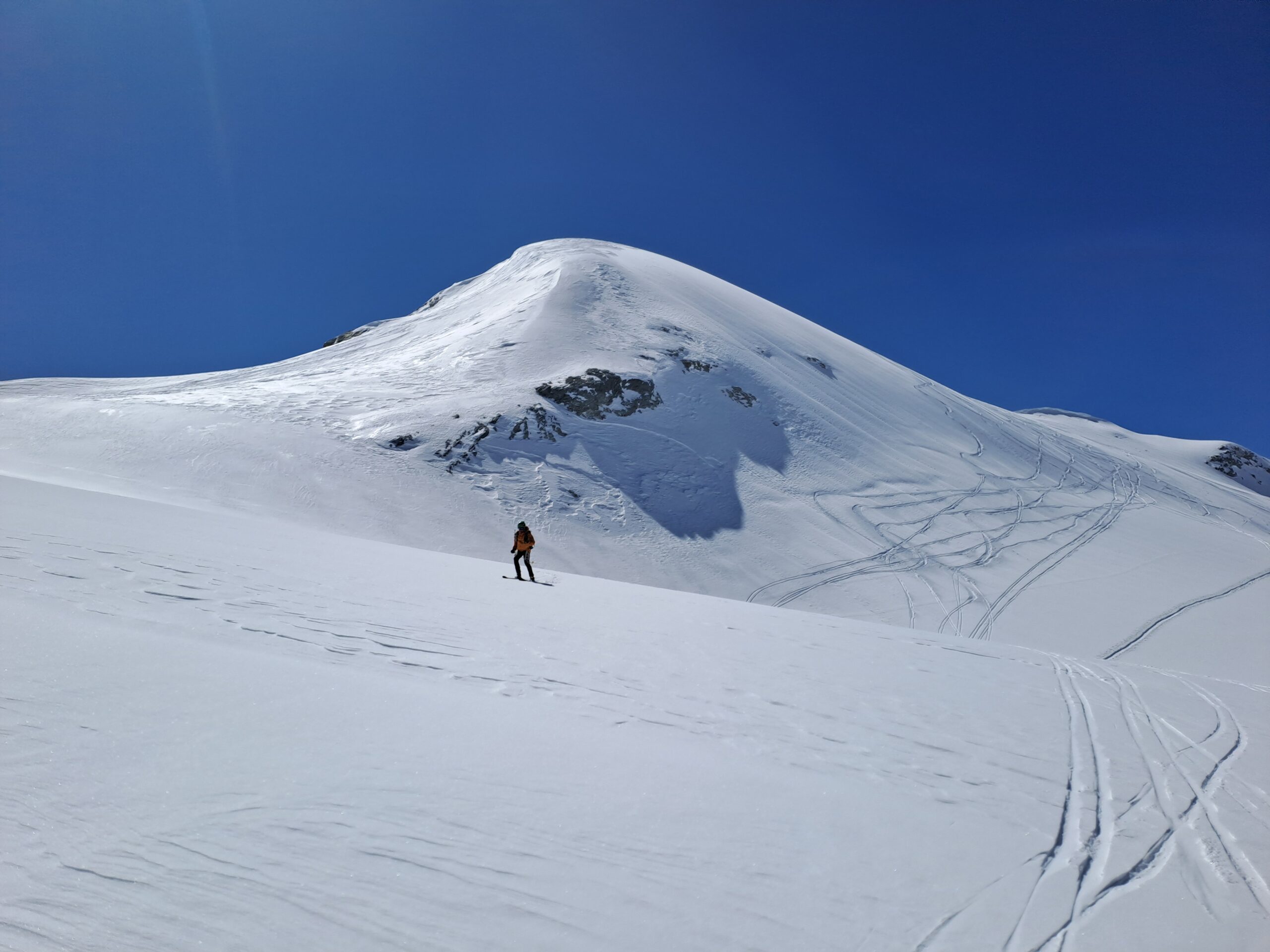
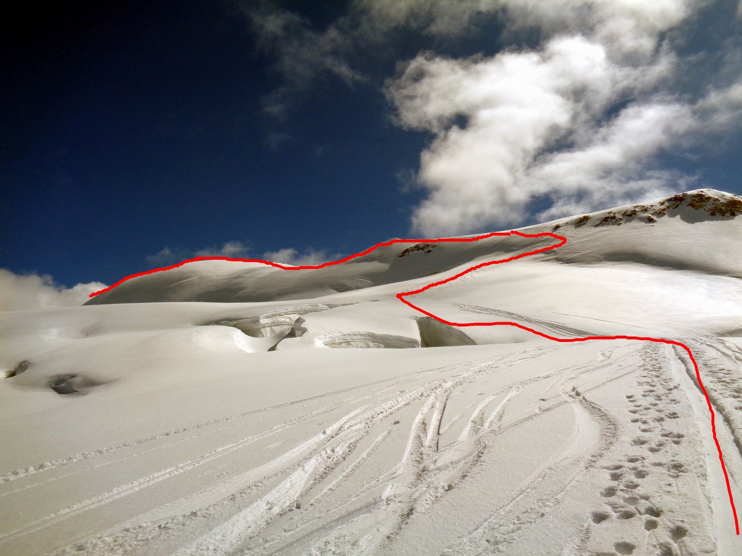
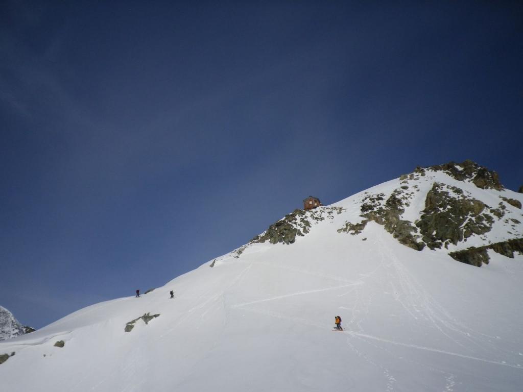
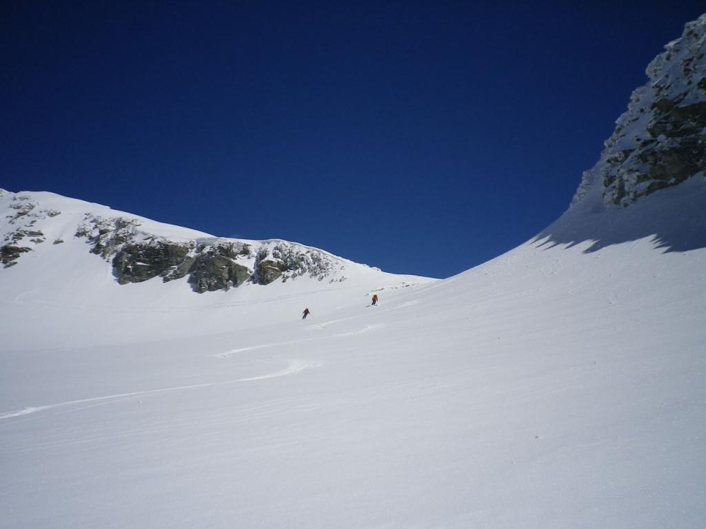
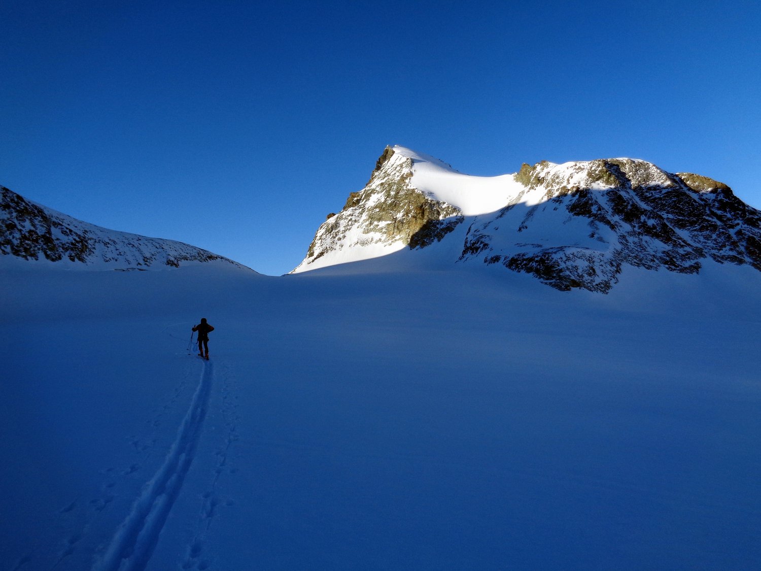
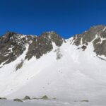
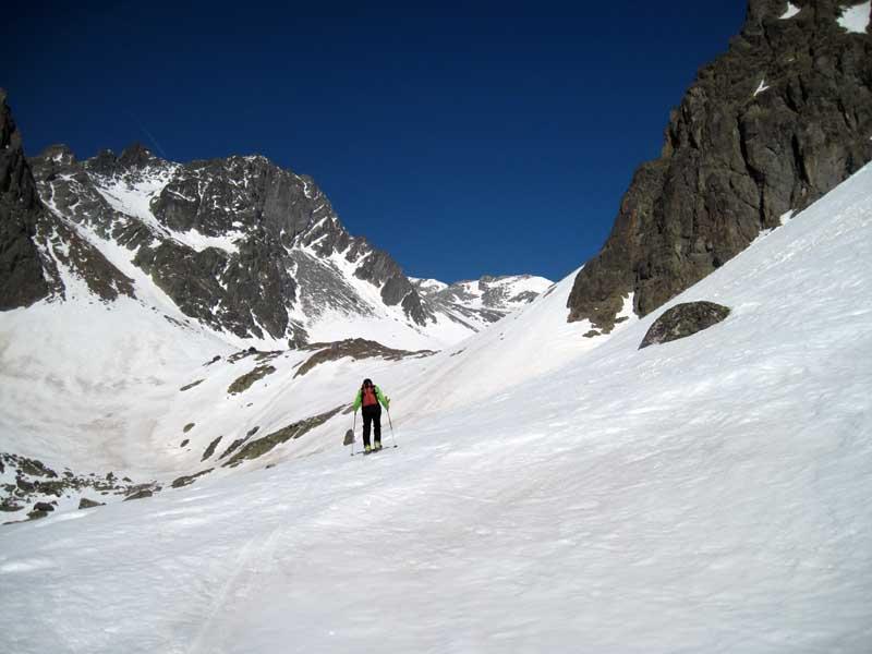
Salita al Mont Gelè lungo l’it. classico da Crete Seche. Si scende a 3200 lungo l’it. di salita, quindi si punta al Col de Crete Seche 3061 m. Si scende l’ omonimo ghiacciaio sul versante Svizzero, primo tratto ripido, pendio a 30°, si raggiunge il fondo del vallone fino ai ripiani a 2450 m.
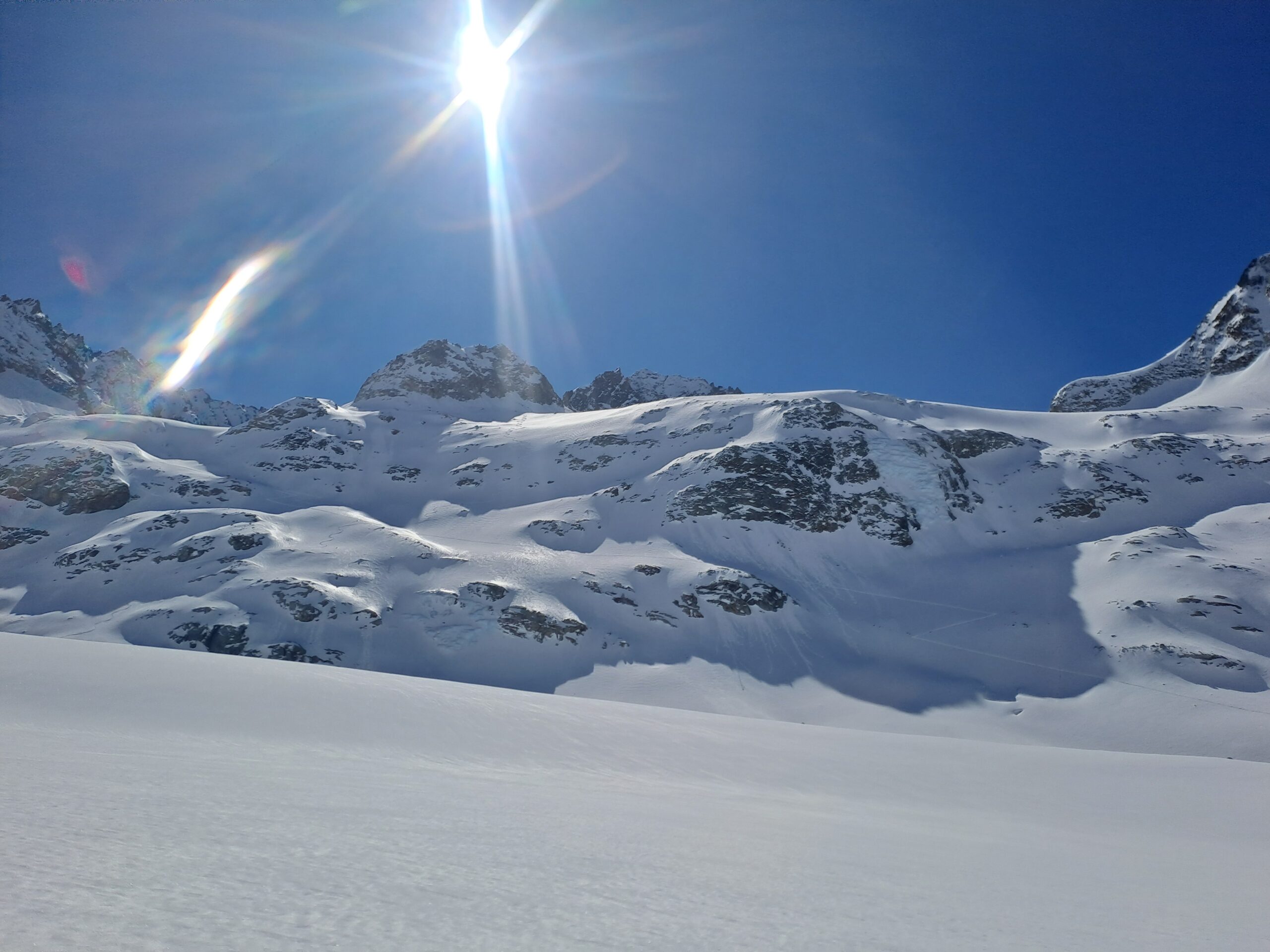
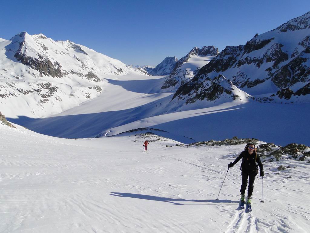
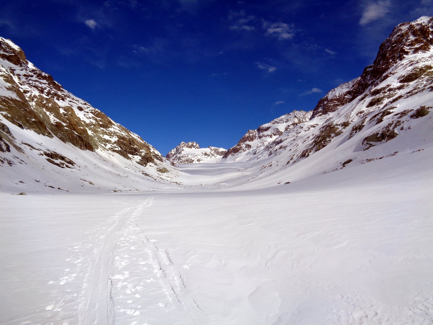
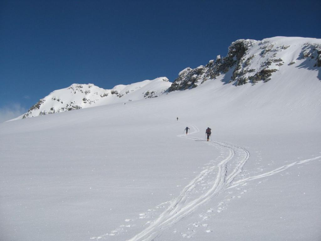
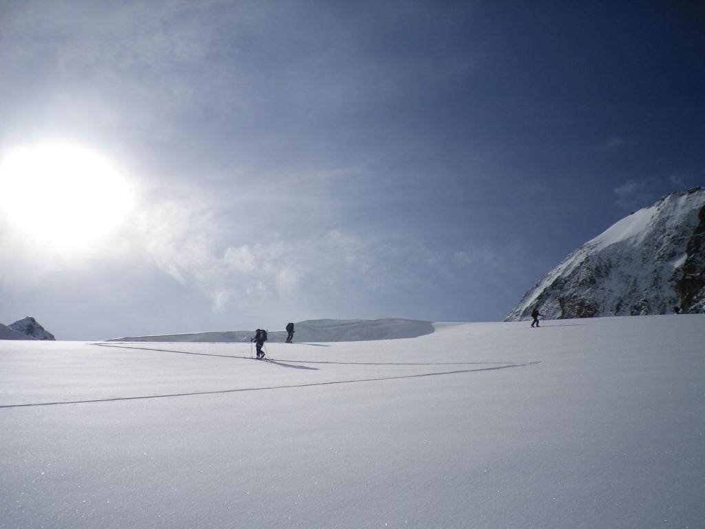
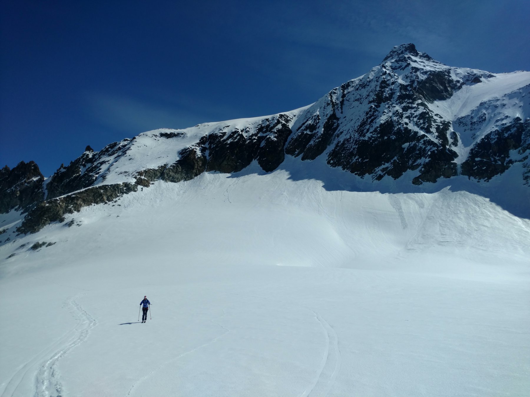
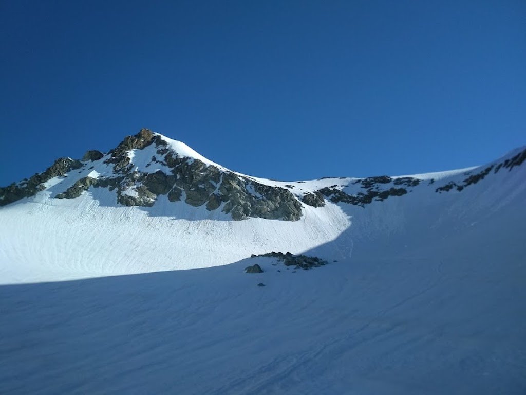
Dai ripiani si procede alti sul ghiacciaio di Otemma utilizzando una serie di rilievi morenici. Questo tratto è semplice ma richiede neve assolutamente sicura. Si mette piede sul ghiacciaio di Otemma a 2650-2700 m c.
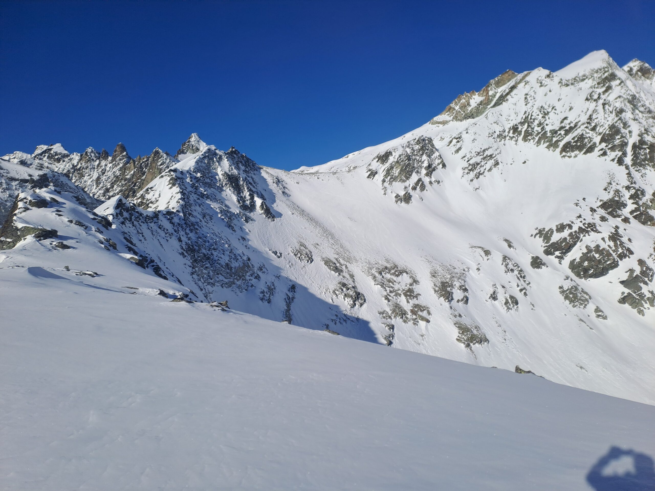
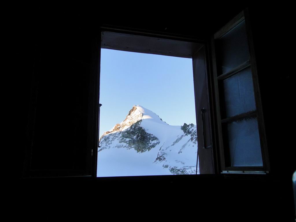
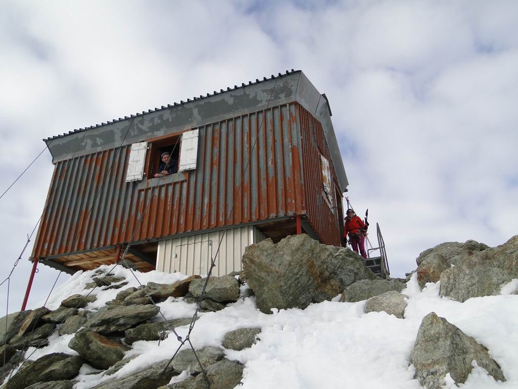
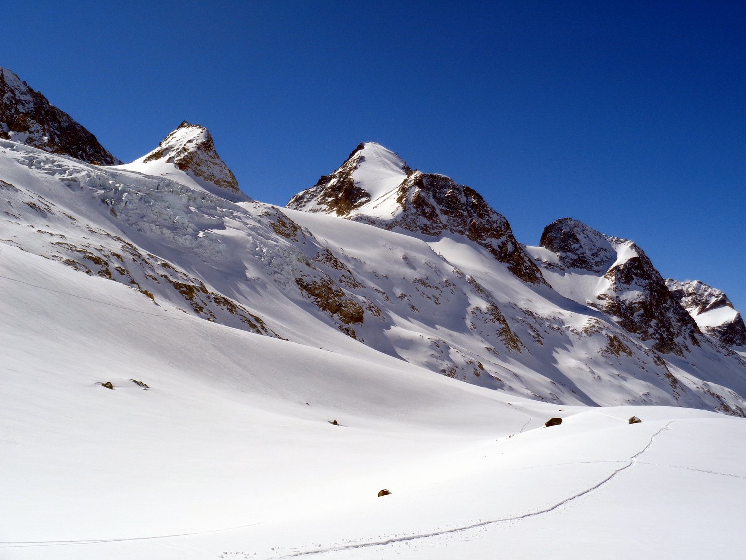
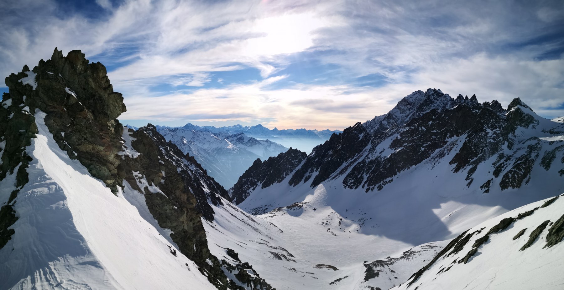
Si risale il ghiacciaio sino alla confluenza con il Glacier de Blanchen; aggirata una barra di seracchi, si sale il vallone glaciale sino al vasto circo glaciale Sengla-Blanchen, al cui margine, nei pressi di un caratteristico rilievo, è sito il confortevole Bivacco della Sengla, nido d’aquila a 3180 m.
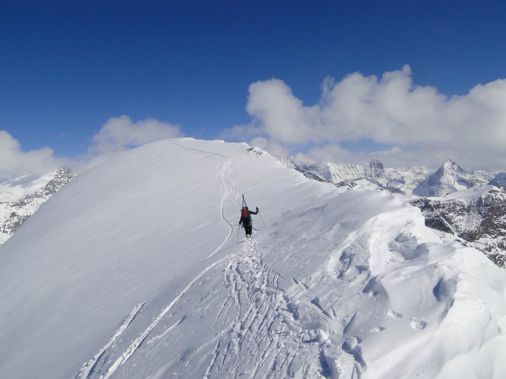
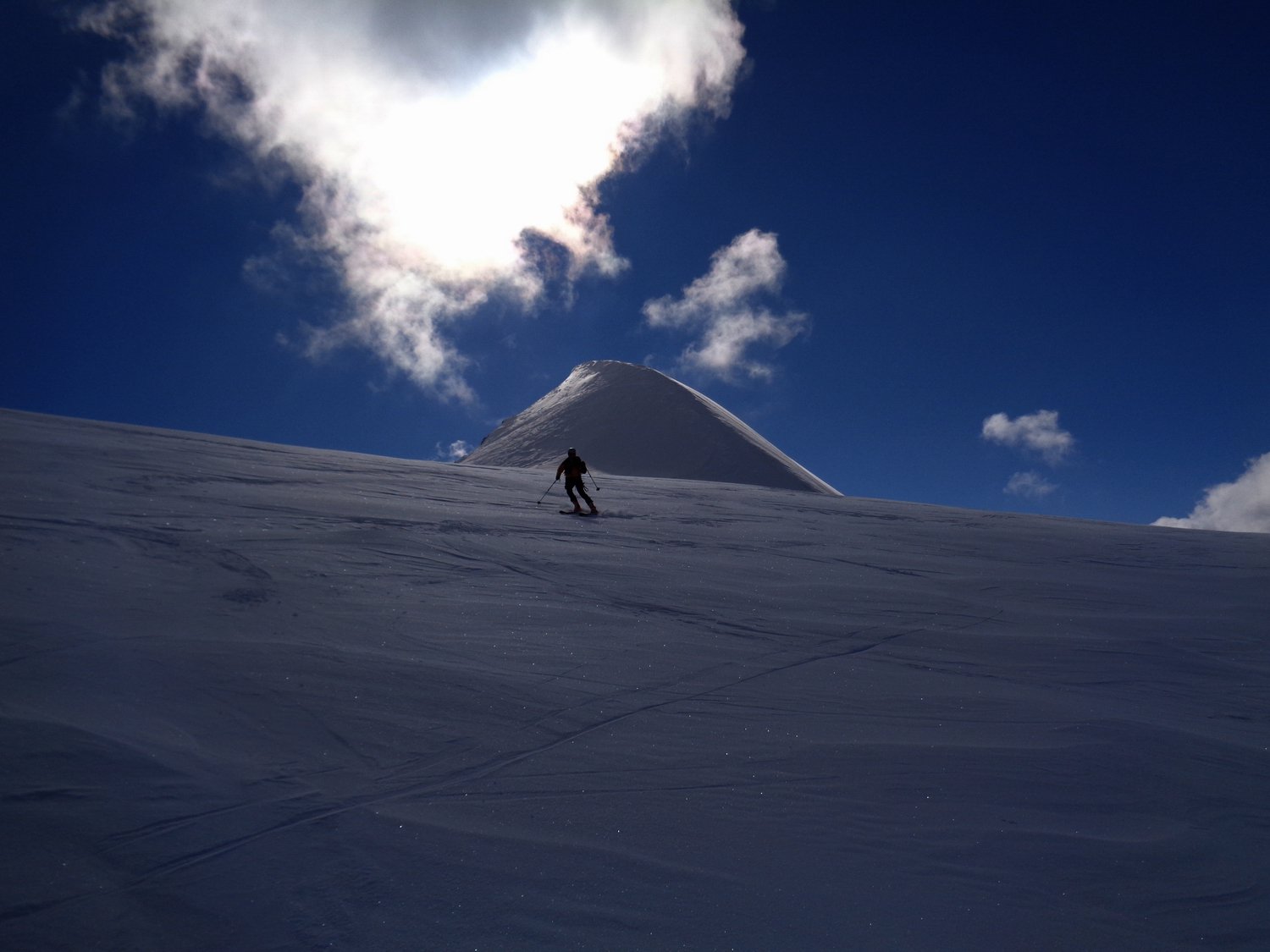
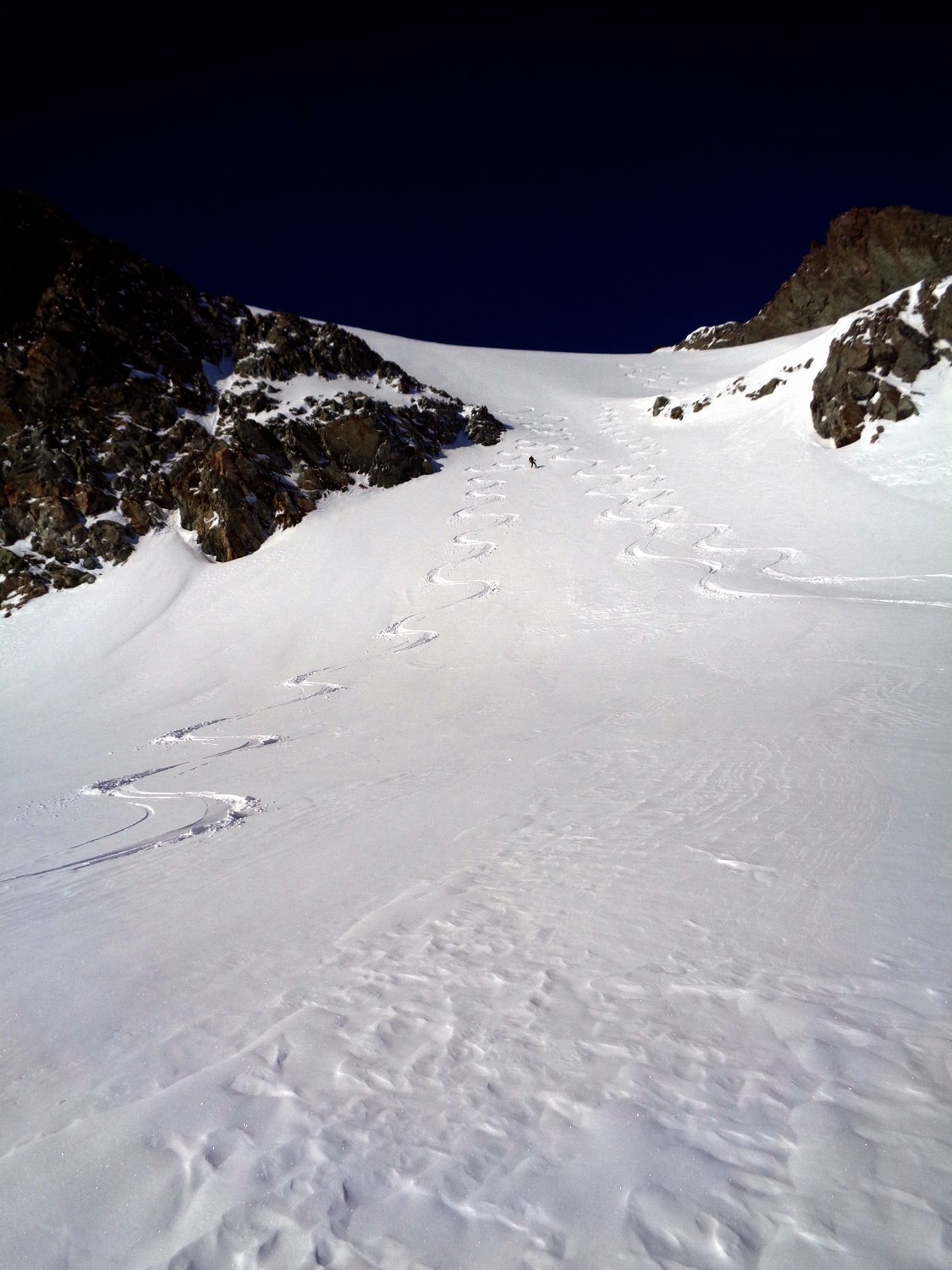
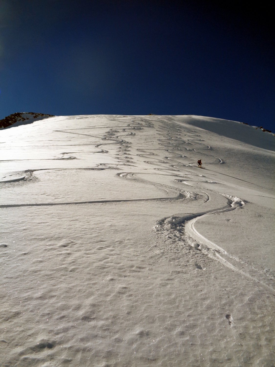
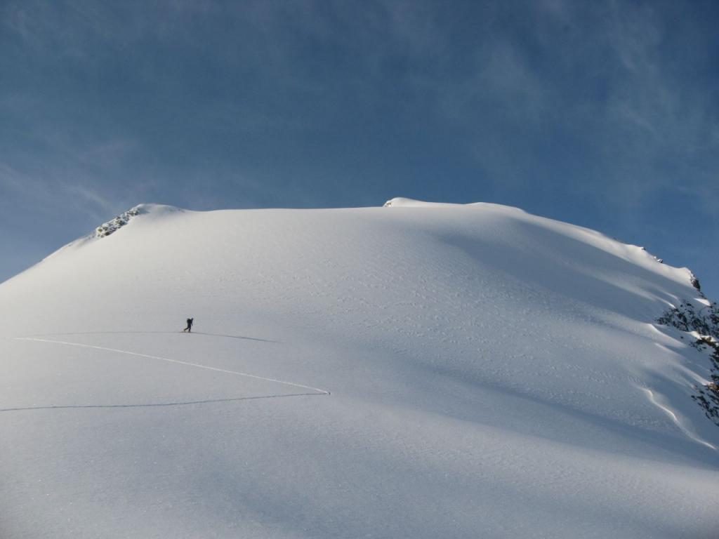
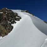
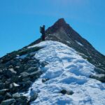
Dal bivacco si scende al colletto sottostante e si mette piede nel Glacier de l’Aouille, portandosi sotto il canale che scende dall’ evidente spalla dell’ Aouille Tseucca, si sale il canale o direttamente o sfruttando più comodi pendii sulla destra e salendo poi direttamente il tratto più ripido. Raggiunta la bella spalla nevosa si continua sullo splendido ed estetico pendio nord arrivando con gli sci in vetta.
Si scende lungo il percorso di salita fino al colletto sottostante il bivacco, si continua sul percorso di salita sino alla confluenza Blanchen-Otemma.
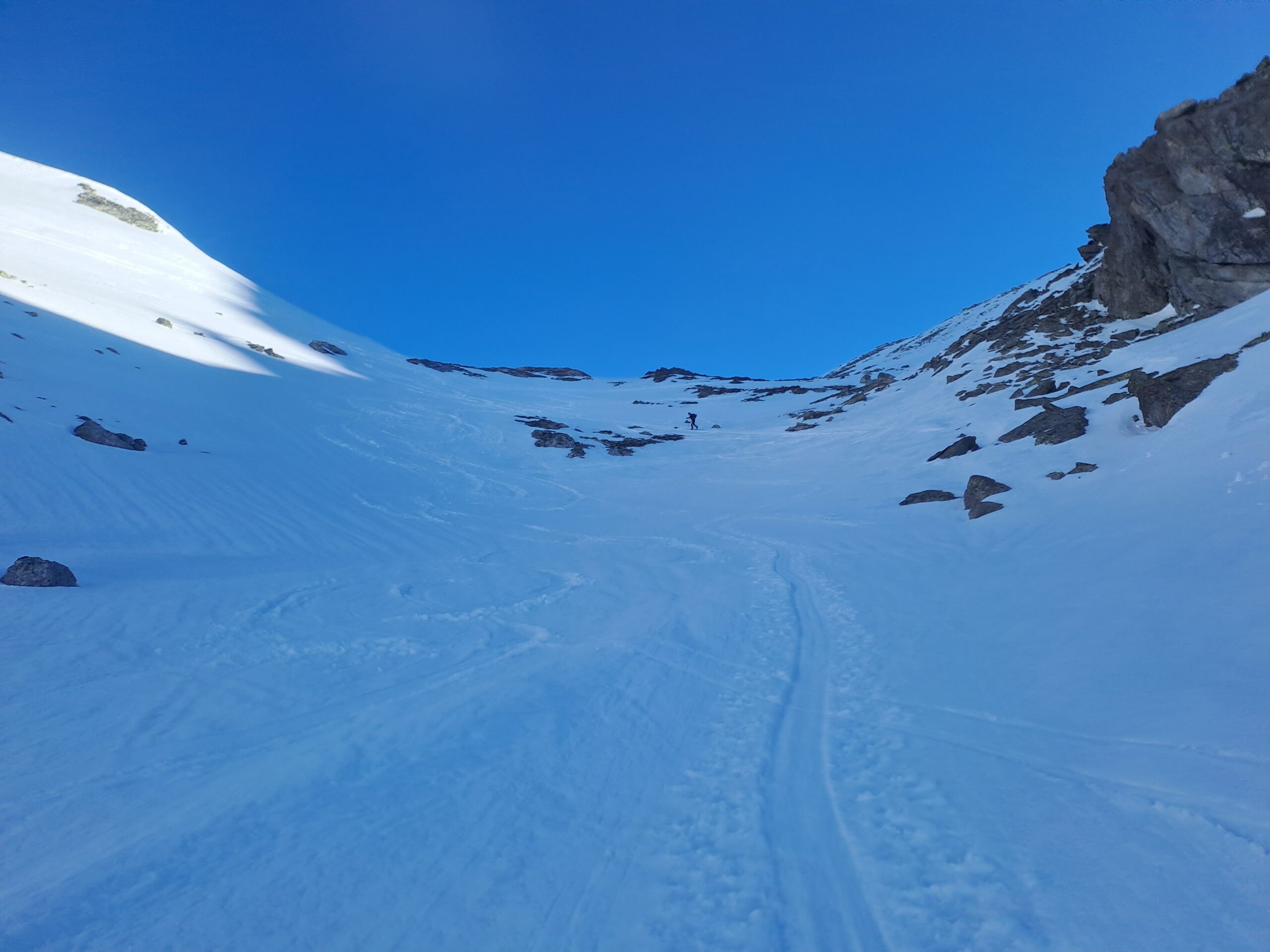
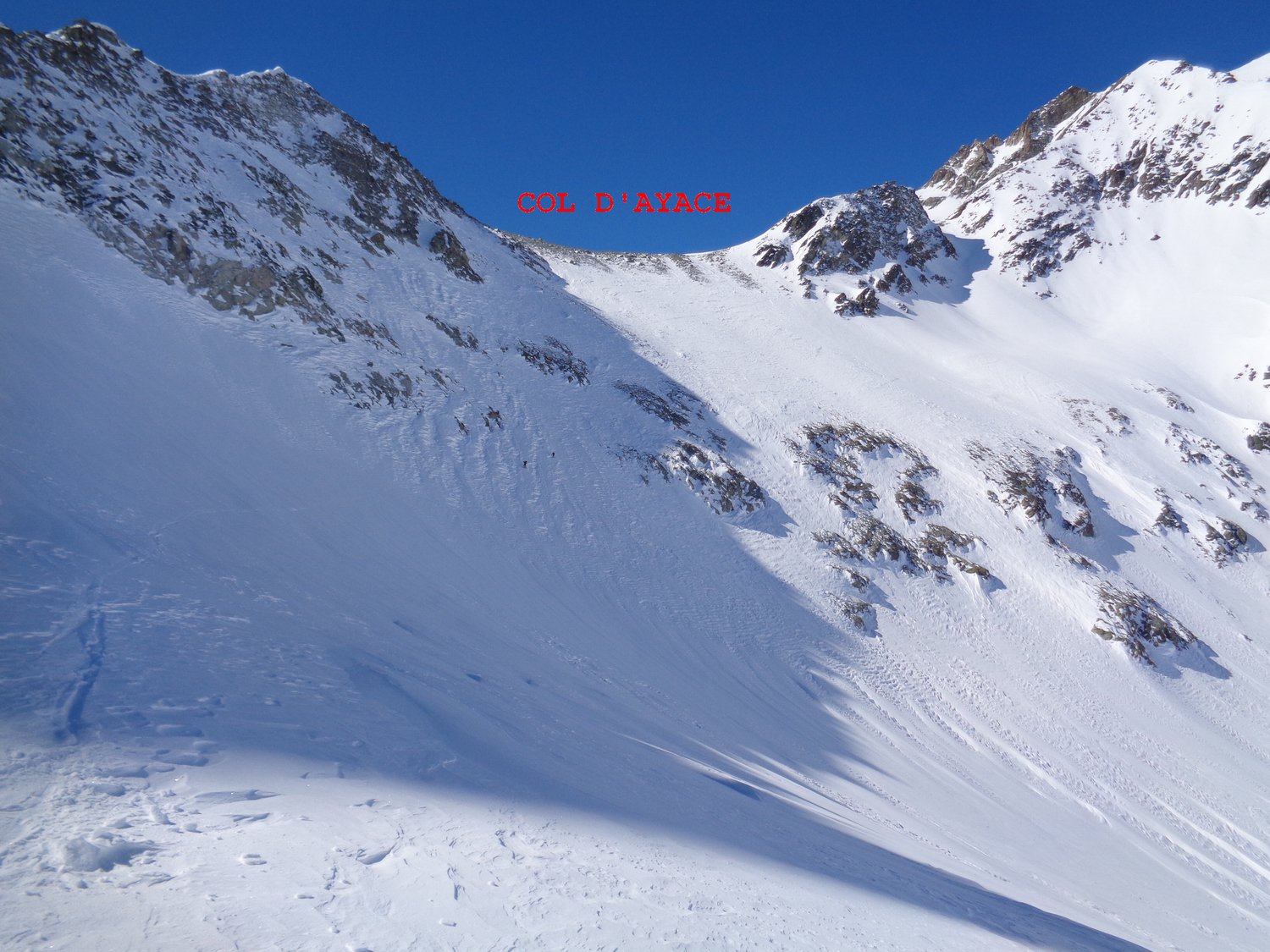
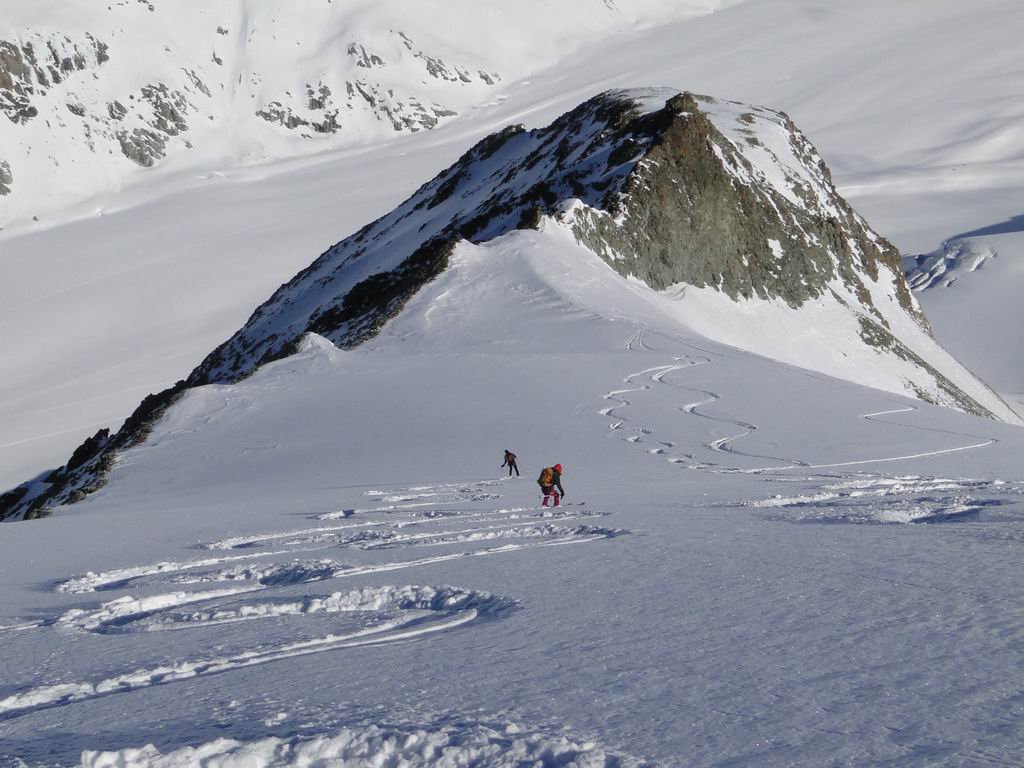
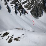
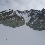
Rimesse le pelli si salgono i morbidi pendii verso il Col d’Oren, giunti al piano glaciale sotto il colle si poggia verso sinistra sin sotto il ripido pendio di 120 m, che si sale con attenzione, da sinistra verso destra, fino alla spalla 3351 della Becca d’Oren O (Epaule Albert Morin).
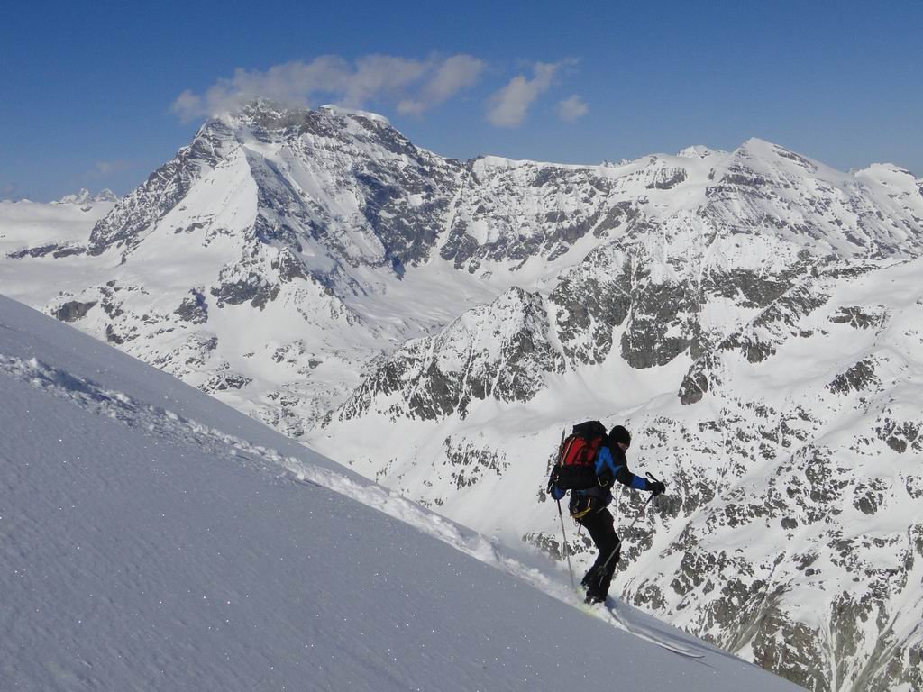
Si scende sul versante Valpelline un primo pendio molto ripido (tratto di sci ripido con primi metri a 50° che subito si smorzano, oppure con picca e ramponi). Si mette piede sul Glacier d’Oren Nord.
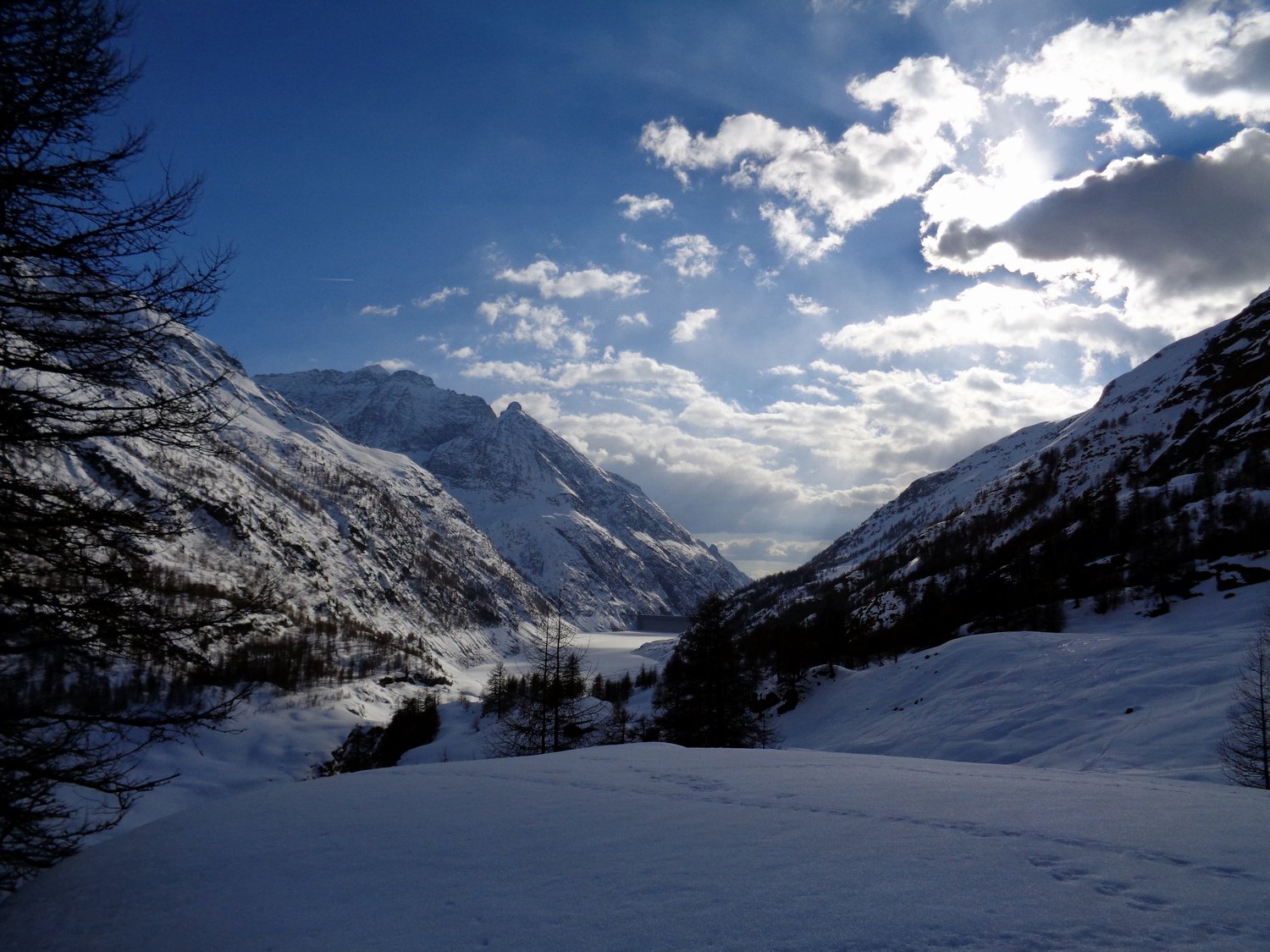
Si scende detto ghiacciaio in ambiente quantomai selvaggio, aspro e grandioso (occhio alle serraccate) fino ad approdare sul fondo della Comba d’ Oren. Sul suo fondo si giunge nei pressi di Prarayer.
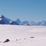
Anche se l' itinerario segue alcuni tratti molto classici e passa nei pressi di un tratto della Chamonix-Zermatt, è tuttavia un percorso di grande solitudine in mezzo a montagne che anche se non sono dei 4000 sono tuttavia grandiose ed imponenti: alta montagna.
La spalla 3351 della Becca d'Oren O è l'unico punto transitabile, scisticamente parlando, nella lunga cresta di confine tra il Colle d'Otemma e la Becca d'Oren Est, prende il nome dal primo noto scialp che ha attraversato detto passaggio.
La spalla 3351 della Becca d'Oren O è l'unico punto transitabile, scisticamente parlando, nella lunga cresta di confine tra il Colle d'Otemma e la Becca d'Oren Est, prende il nome dal primo noto scialp che ha attraversato detto passaggio.
- Cartografia:
- in prevalenza 283 Arolla 1:50000; IGC 1:50000 Monte Rosa Cervino
Nelle vicinanze Mappa
Itinerari
23/04/2026 AO, Bionaz D+ 1250 m OSA, PD- Est
Crête Sèche (Mont) Canale Est da Bionaz
 50m
50m
11/04/2026 AO, Bionaz D+ 1567 m BS Sud
Trouma des Boucs da Ruz
 50m
50m
24/05/2025 AO, Bionaz D+ 2000 m OSA, PD Sud
Epicoun (Bec d’) o Becca Rayette da Ruz, traversata N-S
 50m
50m
10/04/2025 AO, Bionaz D+ 1244 m BS Sud
Crête Sèche (Colle di) da Ruz
 50m
50m
03/01/2024 AO, Bionaz D+ 1270 m BSA Sud
Sabla o Sabbia (Col de la) da Ruz
 50m
50m
07/03/2026 AO, Bionaz D+ 1735 m BSA Varie
Cervo (Monte) da Ruz
 50m
50m
28/02/2026 AO, Bionaz D+ 1174 m OS Est
Sabla o Sabbia (Col nord de la) da Ruz per il canalone Est
 50m
50m
04/03/2026 AO, Bionaz D+ 1748 m BSA Sud-Ovest
Noeud de la Rayette da Ruz
 50m
50m
20/02/2021 AO, Bionaz MS Sud
Chardonney (Colle) da Ruz
 50m
50m
08/03/2025 AO, Bionaz D+ 1751 m OSA, PD+ Nord
Chardoney (Becca) Canale Ovest e traversata
 50m
50m
Servizi
650m
700m
Lac Lexert Campeggio
Bionaz
1.2Km
La Maison d’Antan Albergo
Bionaz
2.6Km
Clé du Paradis B&B
Bionaz
2.6Km
Valentino Albergo
Bionaz
2.6Km
Betemps B&B
Bionaz
3.4Km
Alpe Rebelle B&B
Bionaz
7.9Km
Vecchio Suisse Ristorante
Valpelline
8.5Km
Lievre Amoureux Albergo
Valpelline 9.6Km
9.6Km