 1.6Km
1.6Km

Avvicinamento
 850m
2.9Km
4.5Km
4.7Km
4.9Km
6Km
6.1Km
6.4Km
6.4Km
6.5Km
850m
2.9Km
4.5Km
4.7Km
4.9Km
6Km
6.1Km
6.4Km
6.4Km
6.5Km
1.6Km
1.6Km
1.7Km
3.4Km
4.9Km
6.3Km
8.4Km
8.4Km
8.4Km
8.4Km
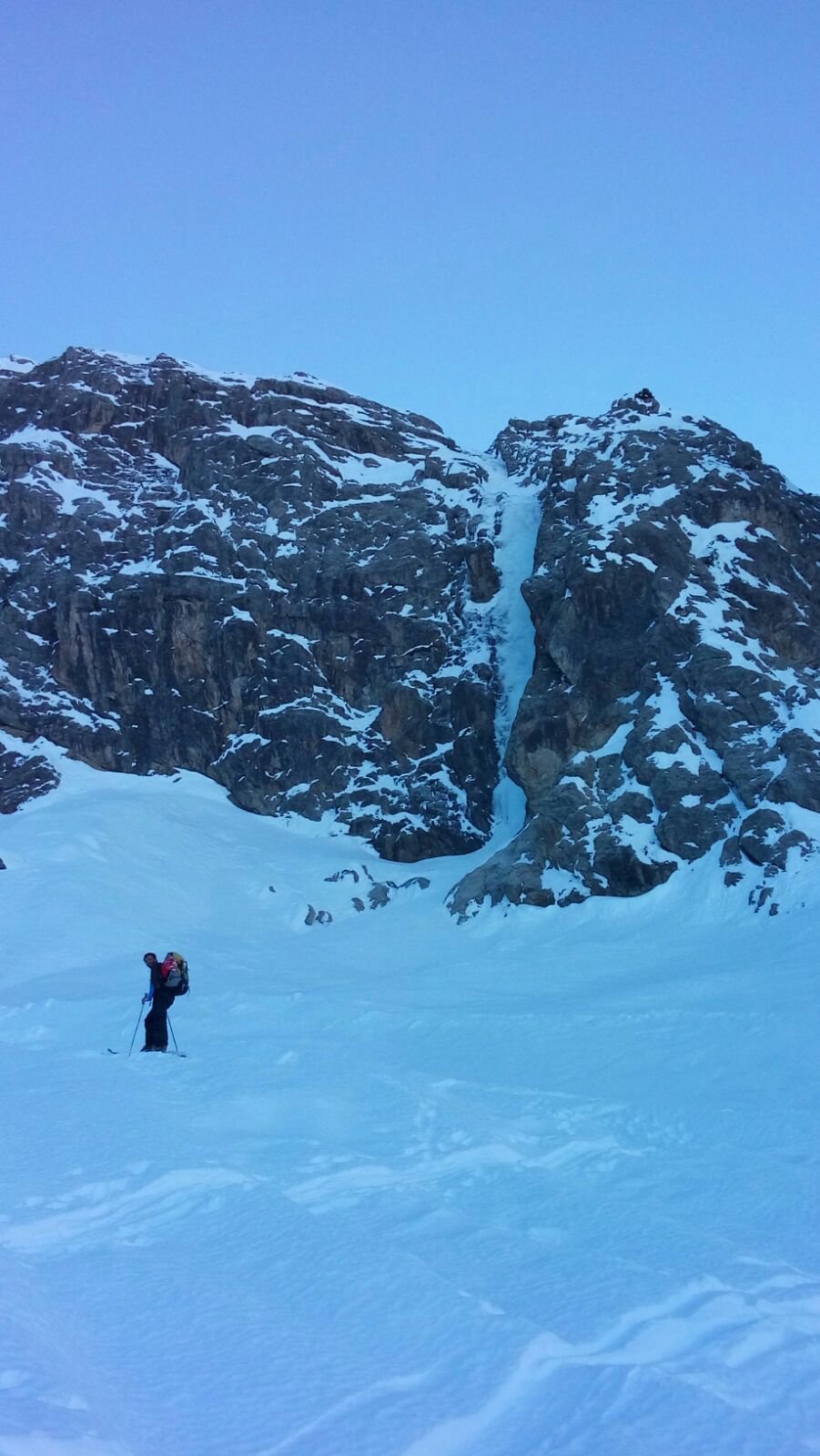
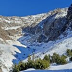
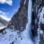
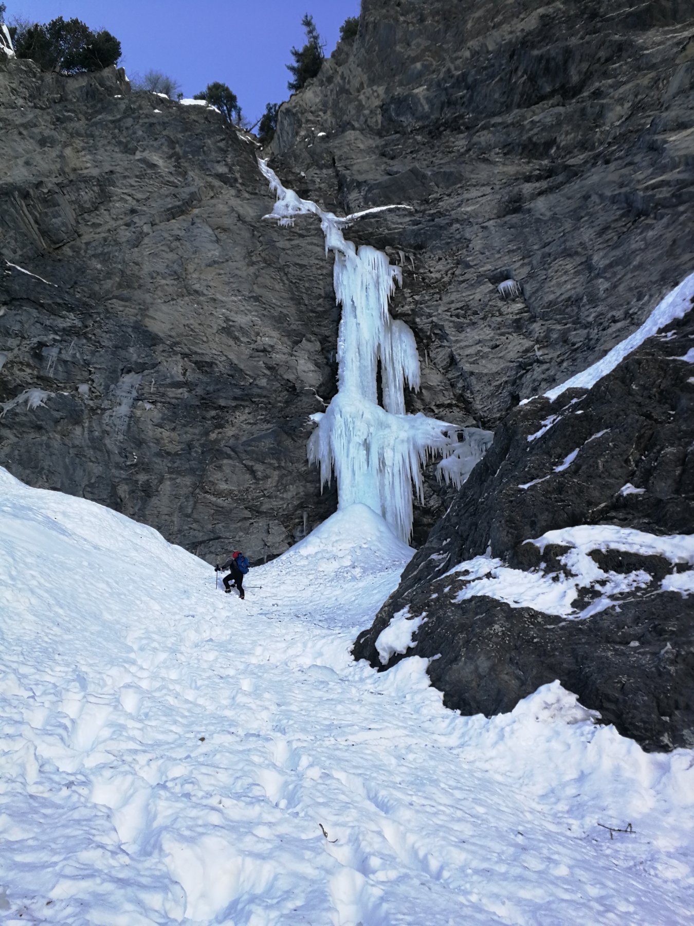
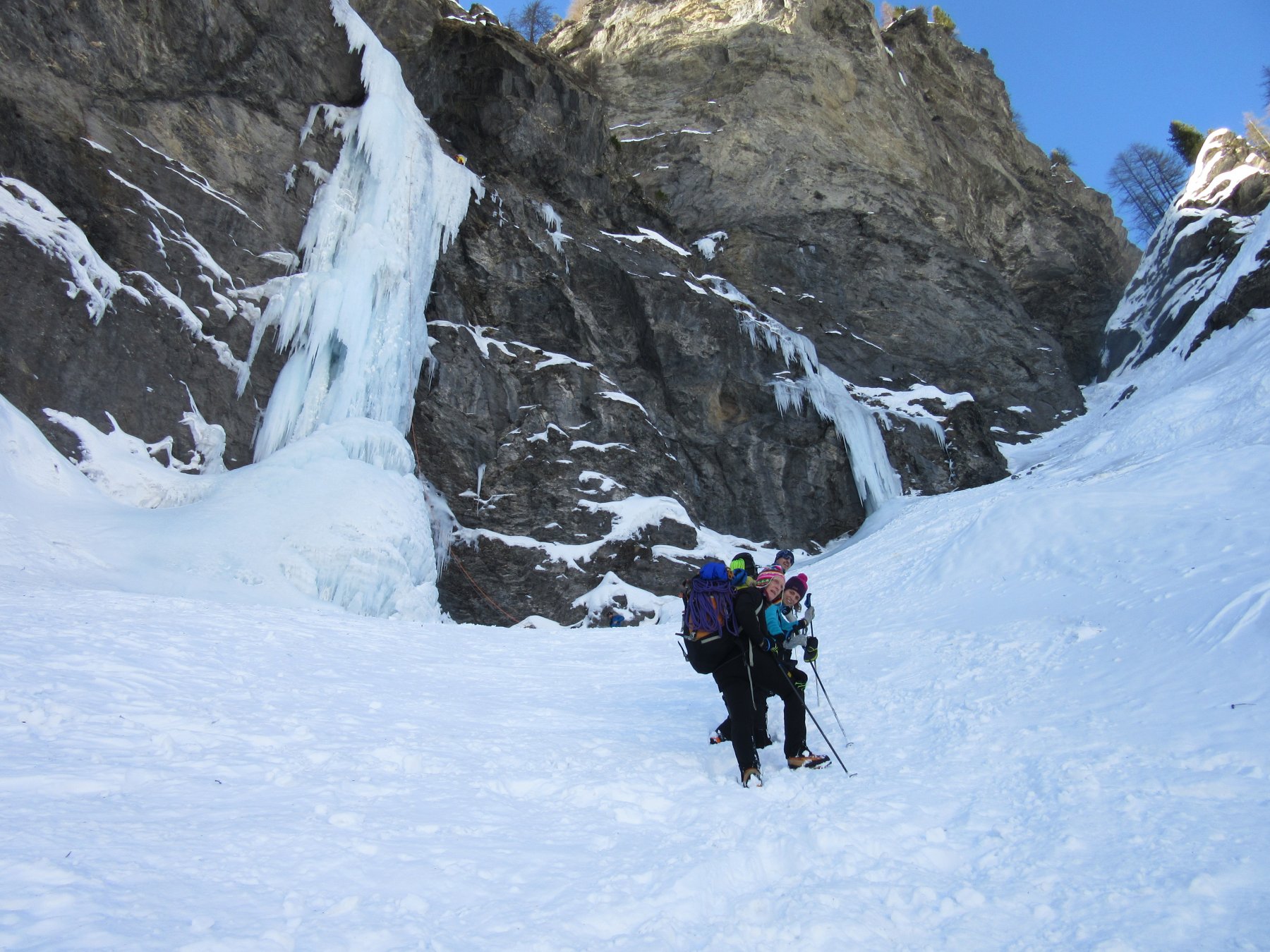
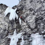
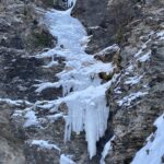
La colata si raggiunge facilmente dalla frazione Ruilles seguendo la pista di fondo sino al poligono militare di Bousson. prima dei tornanti , superata una baracca verde metallica, si sale a sinistra per 100 mt sino alle placche nere dove e' ben visibile la cascata.
Descrizione
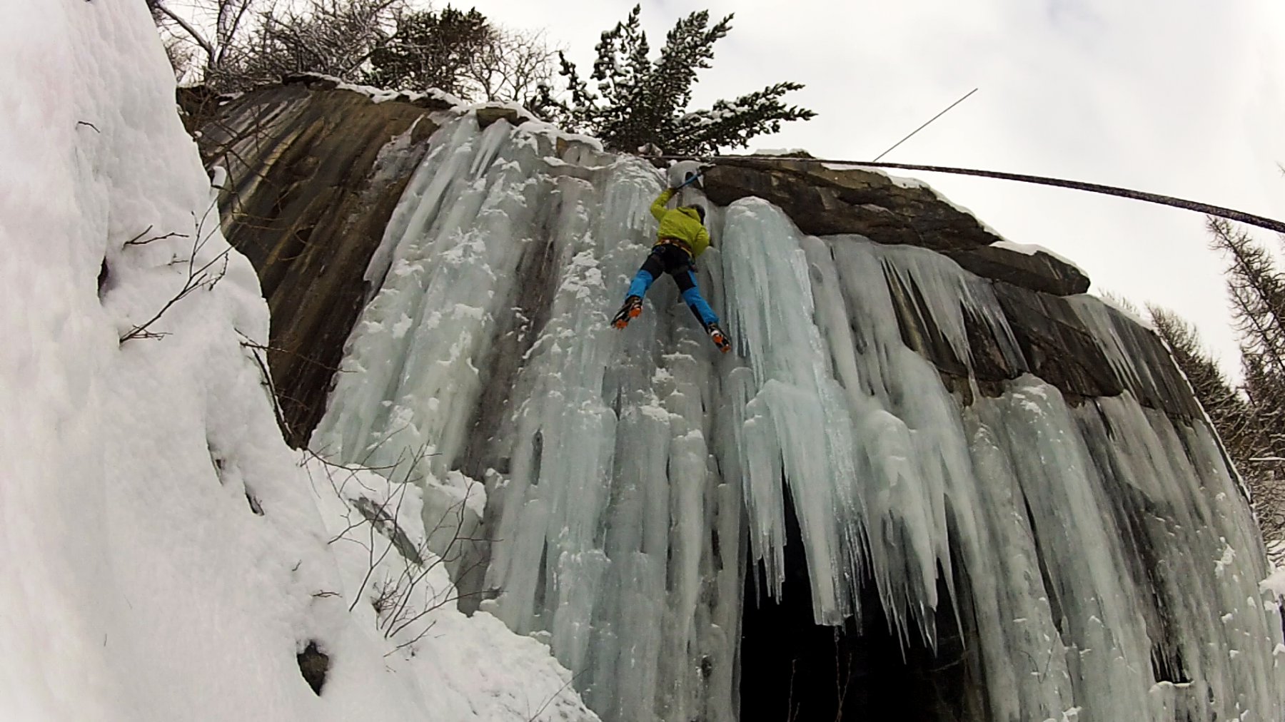
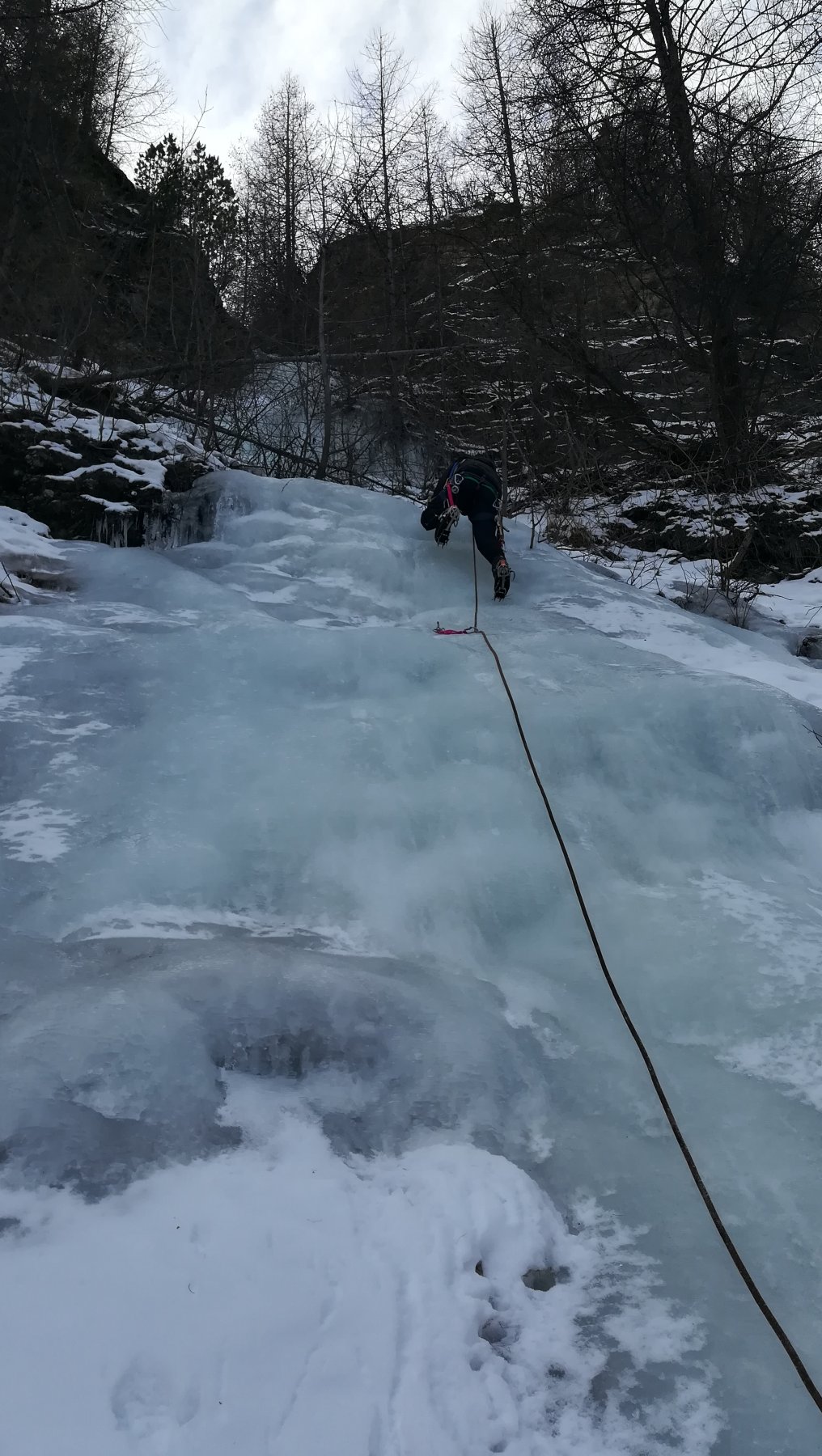
La colata si genera su un monotiro a fianco di una via di piu’ tiri “Voie du l’amitie'”. In base all’innevamento e’ possibile trovare i golfari del tiro come protezione e la sosta su spit per la calata.
Il tiro e’ costante sui 75°/80°.
Si consiglia di concatenare la salita con la vicina o Couloir delle Griserie (o gran cascata di ruilles).
Nelle vicinanze Mappa
Itinerari
10/12/2016 TO, Cesana Torinese 130 m IV, 4 Nord-Ovest
Val Thuras – Boucher (Roc del, Gully)
 850m
850m
06/01/2026 TO, Cesana Torinese 130 m IV, 4 Nord-Ovest
Val Thuras – Thuras (Cascatone di)
 2.9Km
2.9Km
04/01/2016 TO, Cesana Torinese 10 m II, 4 Nord
Bousson – Cava del Marmo Verde (Cascata della)
 4.5Km
4.5Km
27/01/2019 TO, Cesana Torinese 100 m II, 2 Est
Bousson – Iniziazione (Cascata dell’)
 4.7Km
4.7Km
25/01/2020 TO, Sauze di Cesana 180 m III, 4, M3 Nord
Valle Argentera – Effimera Fantasia (Cascata)
 4.9Km
4.9Km
14/02/2026 TO, Sauze di Cesana 130 m III, 5+ Nord
Valle Argentera – L’Altro Volto del Pianeta (Cascata)
 6Km
6Km
26/01/2020 TO, Sauze di Cesana 60 m III, 6 Nord
Valle Argentera – Ice Very Nice (Cascata)
 6.1Km
6.1Km
31/01/2020 TO, Sauze di Cesana 100 m III, 3+ Nord-Est
Valle Argentera – Cascata di destra
 6.4Km
6.4Km
11/02/2023 TO, Sauze di Cesana 60 m III, 5, M7 Nord
Valle Argentera – L’Altro Volto della Luna (Cascata)
 6.4Km
6.4Km
04/01/2024 TO, Sauze di Cesana 190 m III, 4, M4 Nord
Valle Argentera – Peace for Gaza (Cascata)
 6.5Km
6.5Km
Servizi
1.6Km
1.6Km
La Tana degli Orsi B&B
Cesana Torinese
1.7Km
La Crota B&B
Cesana Torinese
3.4Km
La Fontana del Thures Rifugio
Cesana Torinese
4.9Km
Centro Ristorante
Cesana Torinese
6.3Km
Misun La Font Ristorante
Sauze di Cesana
8.4Km
L’Ibarus Rifugio
Cesana Torinese
8.4Km
Piergiorgio Frassati B&B
Cesana Torinese
8.4Km
Casa Cesana Bar
Cesana Torinese
8.4Km

