2.9Km
2.9Km
Note
 700m
850m
1.3Km
1.8Km
1.9Km
2.3Km
2.6Km
2.7Km
700m
850m
1.3Km
1.8Km
1.9Km
2.3Km
2.6Km
2.7Km
2.9Km
2.9Km
5.4Km
8.6Km
9.1Km
9.3Km
9.7Km
9.9Km
10Km
10Km
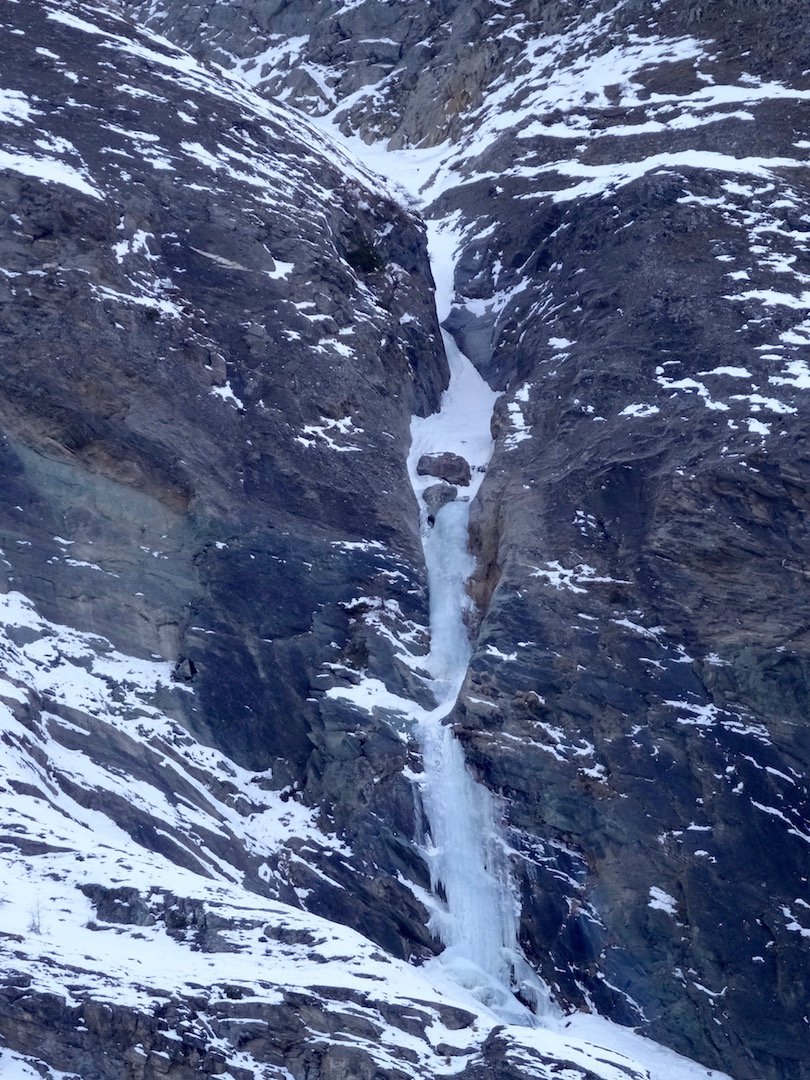
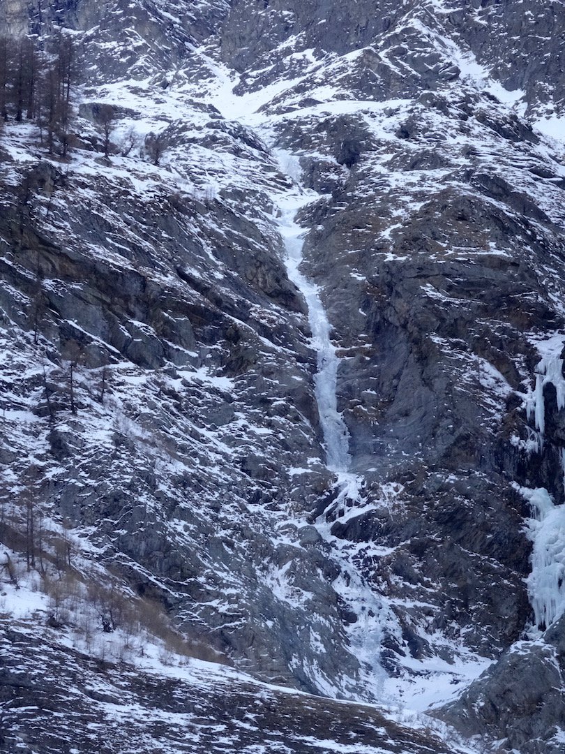
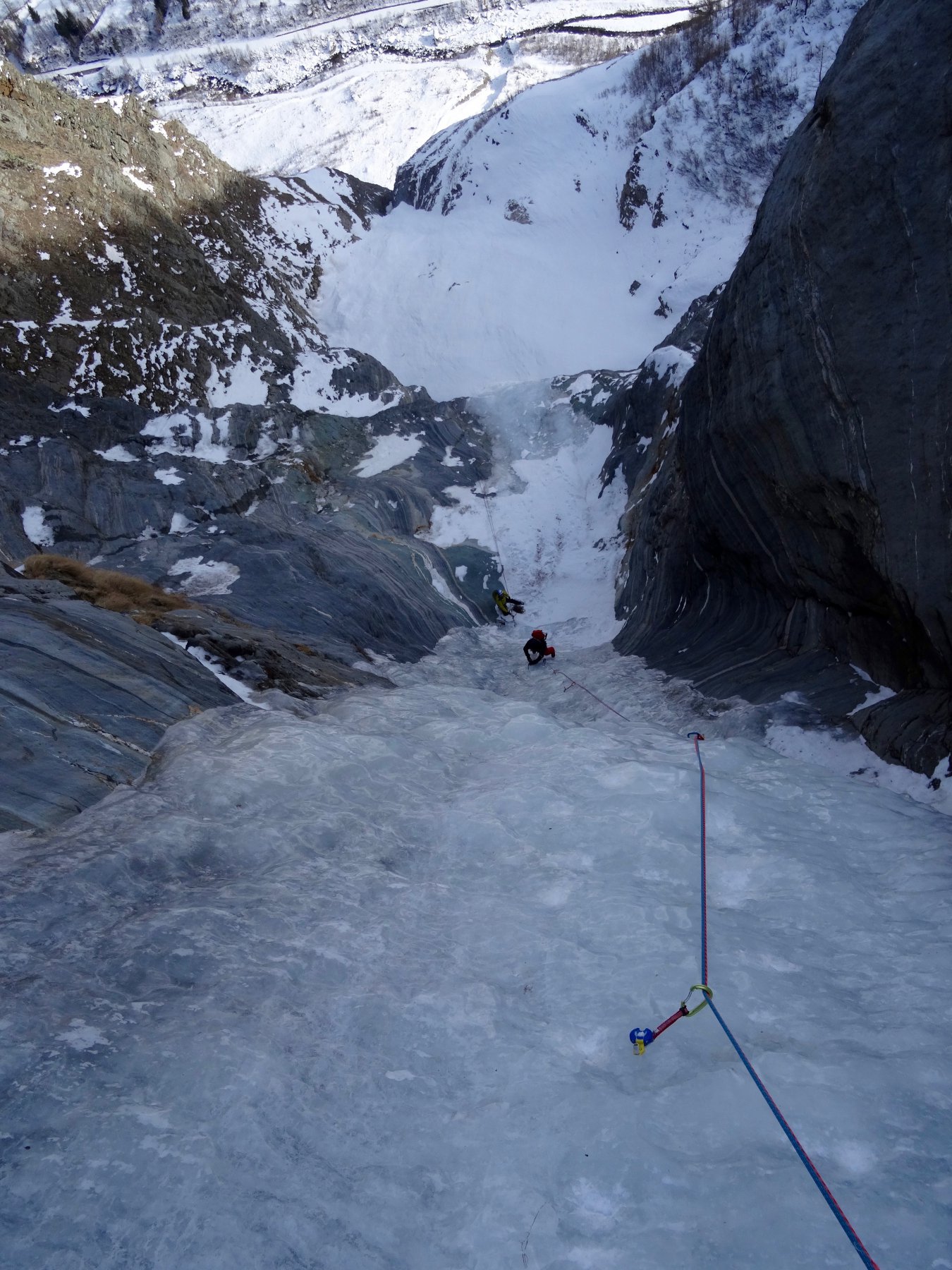
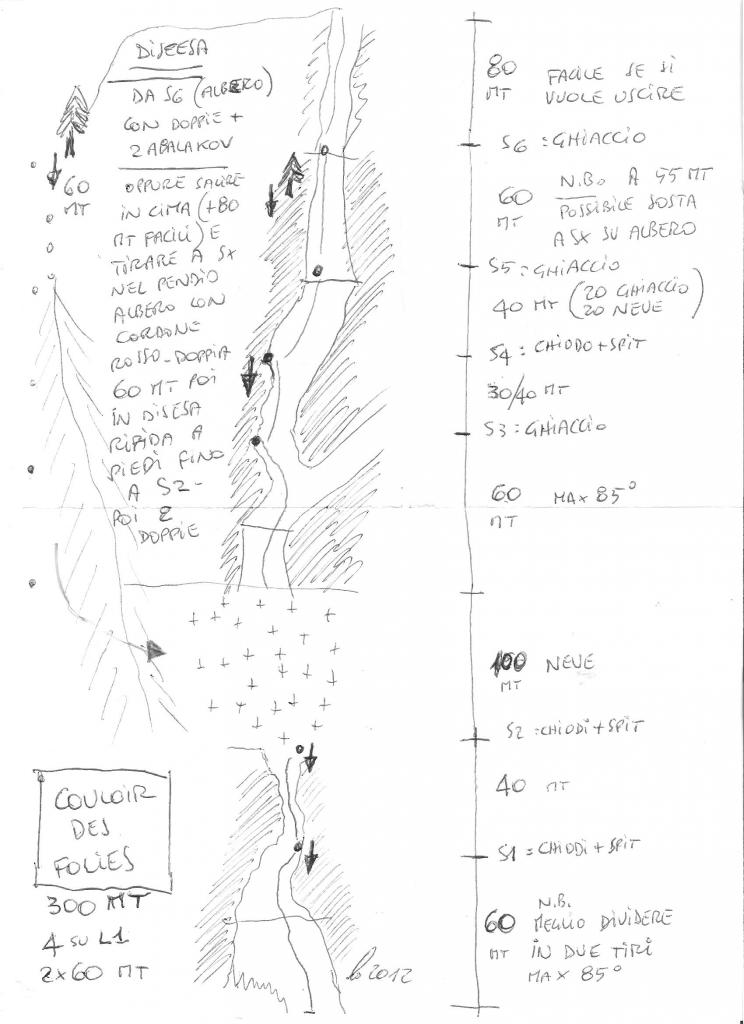
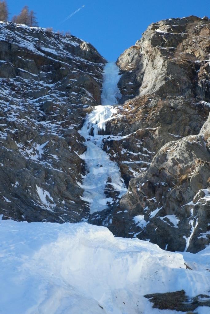
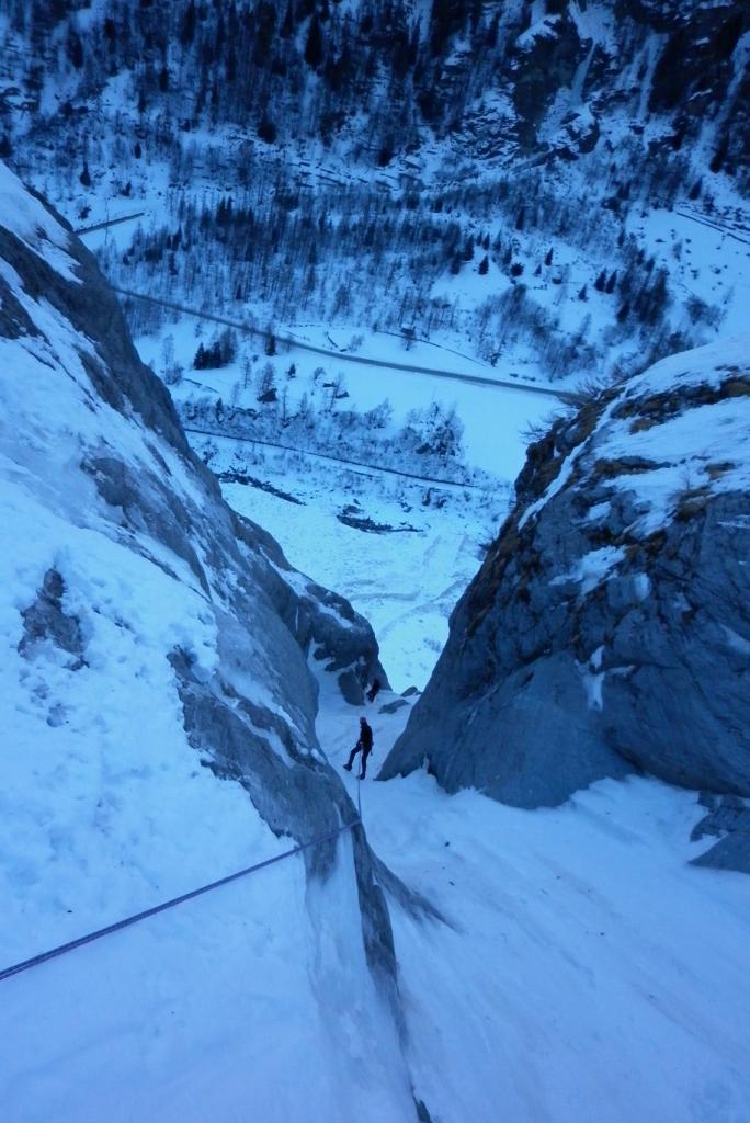
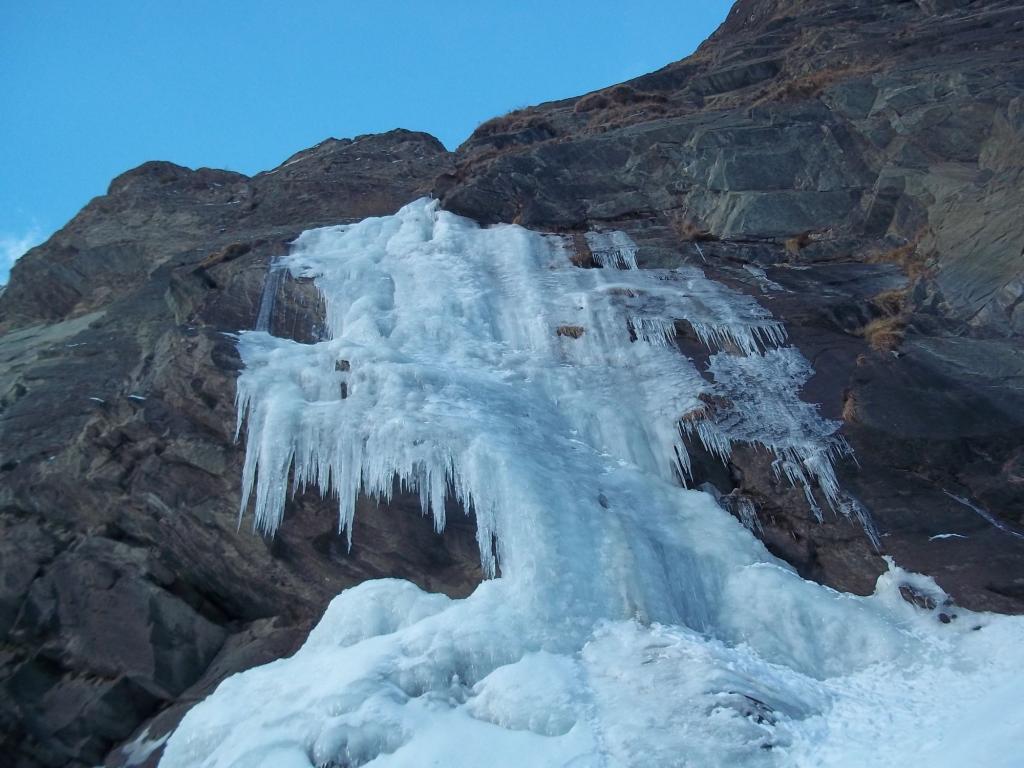
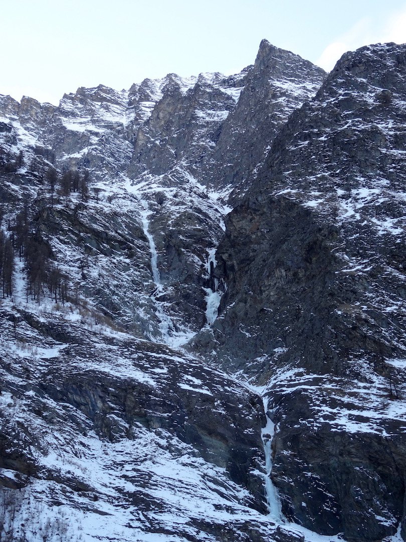
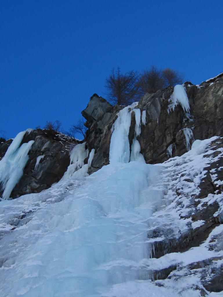
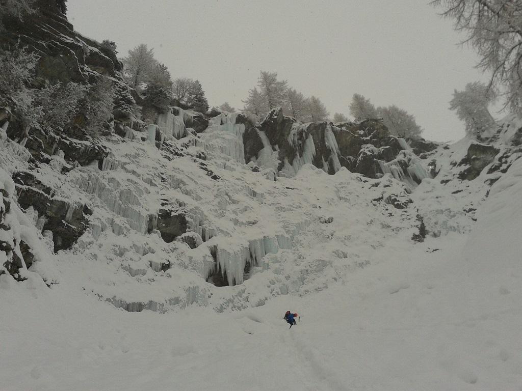
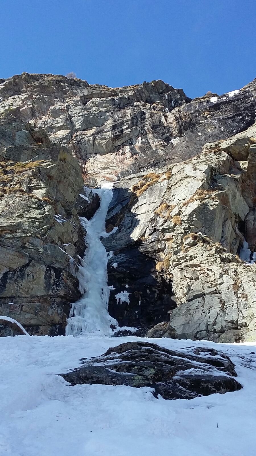
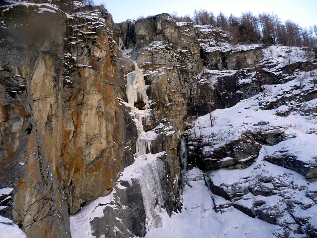
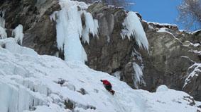
Lungo Couloir incassato tra le roccie che si forma raramente, è una salita di stampo alpinistico che presenta un elevatissimo pericolo di slavine e dunque da salire solo con condizioni di neve ben assestata.
Discesa possibile in doppia con quasi tutte soste attrezzate, meglio portarsi dei chiodi per rinforzarle.
Possibili un paio di abalakov da predisporre.
La salita completa può arrivare a 700 metri di sviluppo, ma molto spesso la parte alta non è in condizioni.
Avvicinamento
Discesa possibile in doppia con quasi tutte soste attrezzate, meglio portarsi dei chiodi per rinforzarle.
Possibili un paio di abalakov da predisporre.
La salita completa può arrivare a 700 metri di sviluppo, ma molto spesso la parte alta non è in condizioni.
Da Rovenaud attraversare il torrente e dirigersi verso l'evidente couloir. La parte bassa del canalone può essere salita o evitata sulla dx rientrando poi nel canalone sotto la cascata.
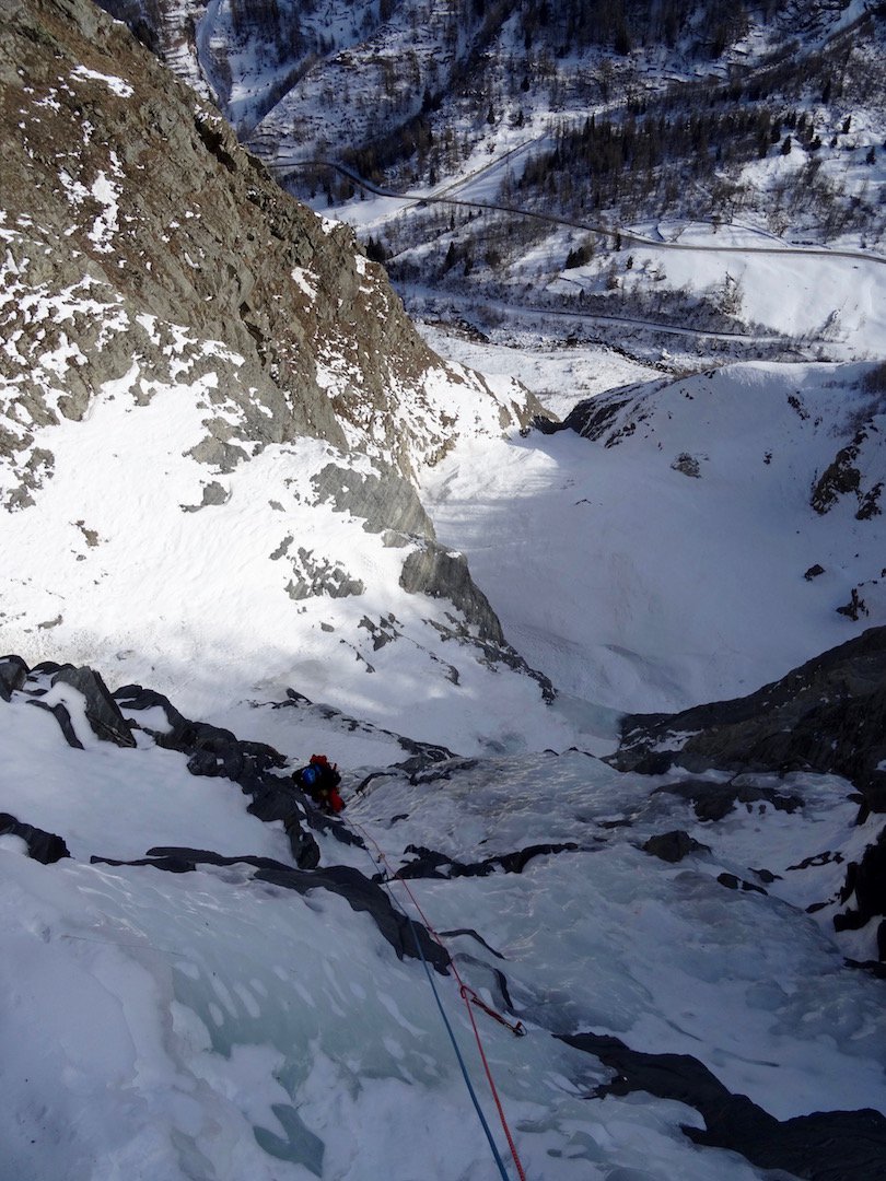
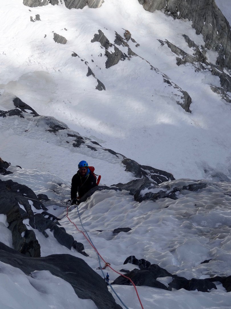
Descrizione
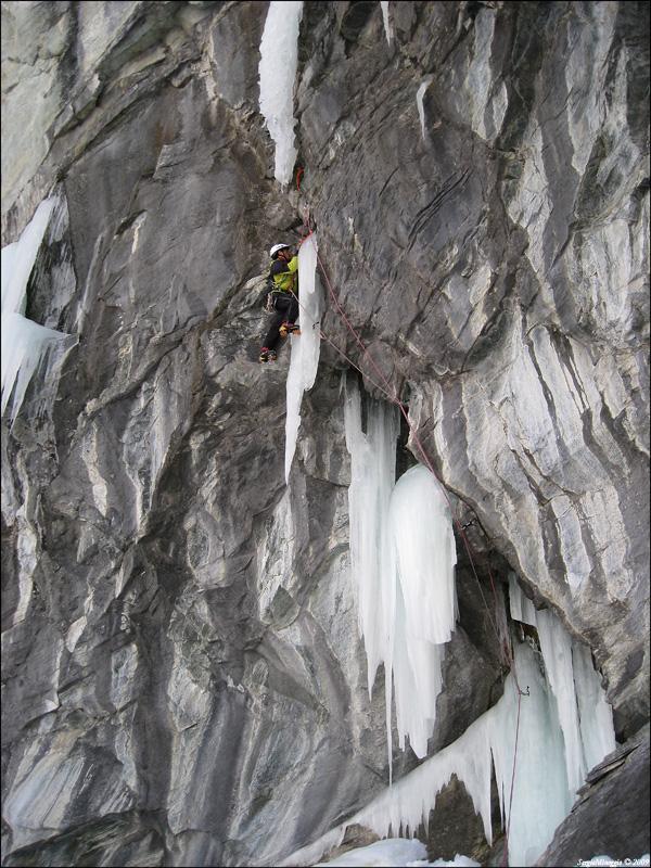
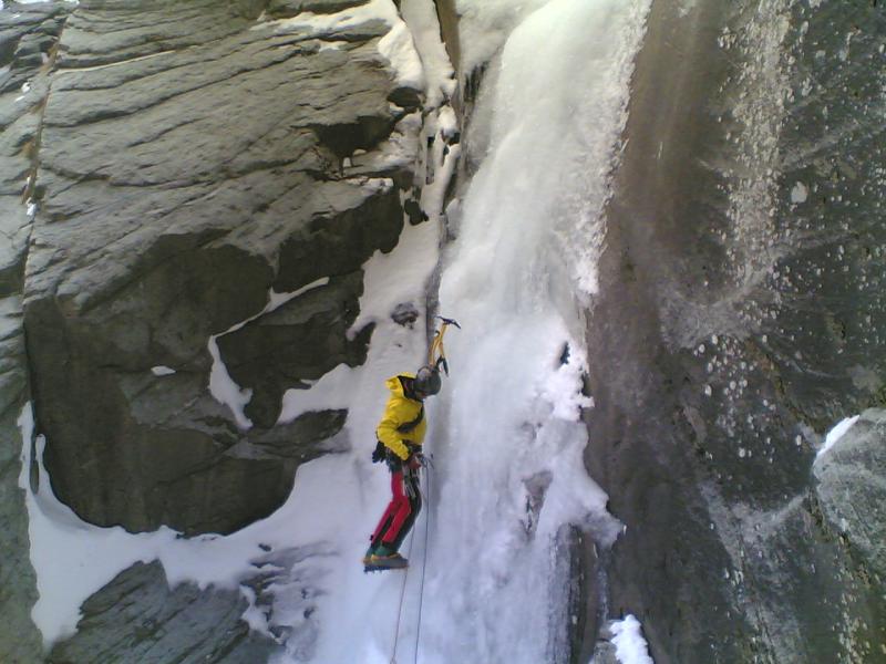
1° tiro 80° – 60 metri, sosta con anello di calata sulla dx. Utile un fried BD n°2 per proteggere un tratto spesso sguarnito di
ghiaccio.
Poi 150/200 metri di pendio nevoso da fare in conserva e si raggiunge il secondo salto.
2° tiro 75° – 60 metri, sosta a sx in un diedrino.
3° tiro 85° poi 70° – 40 metri sosta su ghiaccio.
4° tiro 80° – 60 metri sosta su ghiaccio. Da quì generalmente si scende.
- Bibliografia:
- Matteo Giglio - Effimeri Barbagli - 2014 Tipografia Valdostana
Nelle vicinanze Mappa
Itinerari
08/01/2011 AO, Introd 70 m II, 5+ Ovest
Valsavarenche – Mikado (Cascata)
 700m
700m
24/02/2009 AO, Introd 20 m II, 7 Nord
Valsavarenche – Les Comperes (Cascata)
 850m
850m
13/02/2019 AO, Valsavarenche 90 m II, 4 Ovest
Valsavarenche – Rovenaud (Placche di, Cascata)
 1.3Km
1.3Km
25/01/2004 AO, Valsavarenche 120 m III, 4 Est
Valsavarenche – S’Encorder c’est Sauter (Cascata)
1.7Km
04/02/2004 AO, Valsavarenche 200 m II, 6 Est
Valsavarenche – Saint Ours (Cascata di)
1.7Km
01/02/2017 AO, Introd 120 m IV, 4 Nord-Est
Valsavarenche – Gouloctica (Cascata)
 1.8Km
1.8Km
01/02/2017 AO, Introd 50 m IV, 3+ Nord-Est
Valsavarenche – Ste Gio Già (Cascata)
 1.9Km
1.9Km
20/02/2009 AO, Introd 200 m II, 4+ Nord
Valsavarenche – Fine Fenille (Cascata)
 2.3Km
2.3Km
29/01/2017 AO, Introd 90 m II, 4 Ovest
Valsavarenche – Cohésion Zero (Cascata)
 2.6Km
2.6Km
26/12/2010 AO, Valsavarenche 100 m II, 4+ Ovest
Valsavarenche – Il Fantasma di Ghiaccio (Cascata)
 2.7Km
2.7Km
Servizi
2.9Km
2.9Km
Abro de la Leunna Ristorante
Valsavarenche
5.4Km
Du paradis Rifugio
Valsavarenche
8.6Km
Carillon Bar
Aymavilles
9.1Km
Grande Rousse Albergo
Rhêmes-Notre-Dame
9.3Km
la tana Ristorante
Aymavilles
9.7Km
Gran Paradiso Bar
Valsavarenche
9.9Km
Galisia Albergo
Rhemes-Notre-Dame
10Km
Tanini Ristorante
Rhemes-Notre-Dame
10Km