150m
150m
Note
 50m
50m
50m
50m
50m
50m
50m
1.2Km
1.2Km
1.8Km
50m
50m
50m
50m
50m
50m
50m
1.2Km
1.2Km
1.8Km
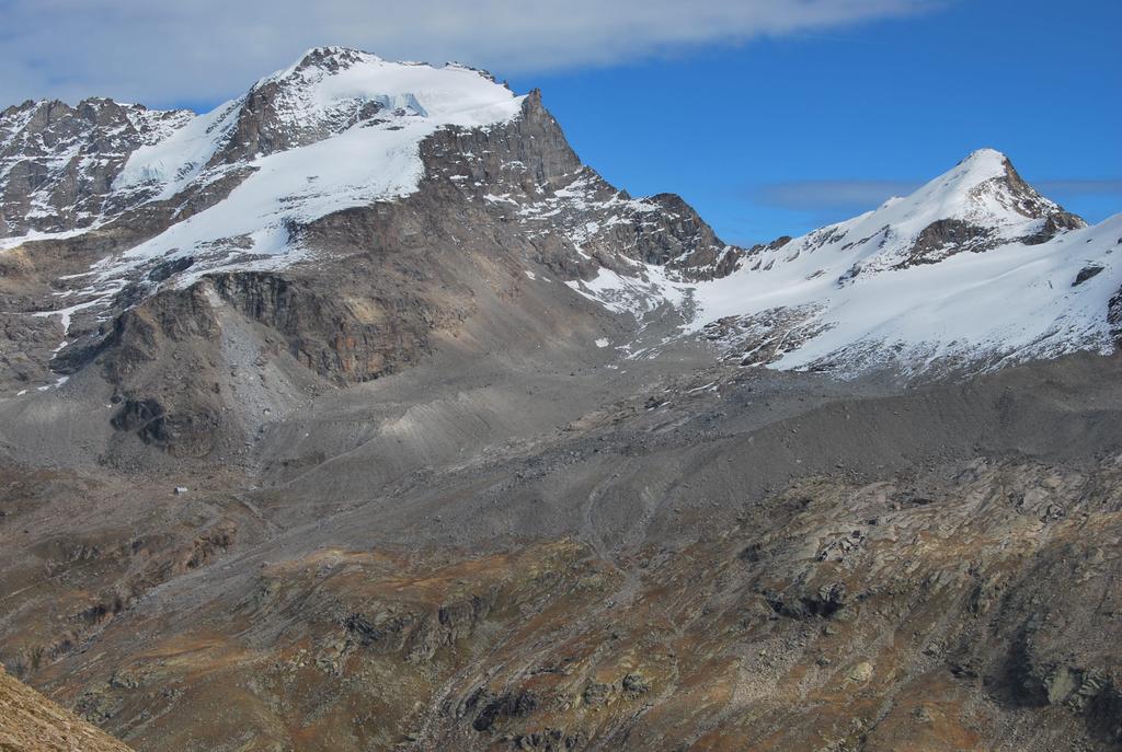
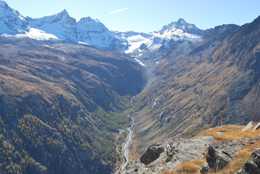
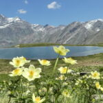
Escursione di grande estensione e che permette di ammirare tutte le bellezze dell’alta Valsavarenche, dalle mulattiere reali alla catena del Gran Paradiso, dai laghi ai valloni del Nampio, Meyes, Nivolet, Seyvaz.
L’itinerario non è mai difficile ed il sentiero sempre ben segnalato; il dislivello non è eccessivo, il valore qui riportato è il dislivello positivo tra Col Manteau ed Eaux Rousses (1123 m) e tra Grand Collet e il fondo valle nei pressi dell’Alpe Taurin (455 m).
Gita sicuramente consigliabile, specie in periodo di bassa stagione, senza affollamento, per meglio godere delle bellezze del parco.
Avvicinamento
L’itinerario non è mai difficile ed il sentiero sempre ben segnalato; il dislivello non è eccessivo, il valore qui riportato è il dislivello positivo tra Col Manteau ed Eaux Rousses (1123 m) e tra Grand Collet e il fondo valle nei pressi dell’Alpe Taurin (455 m).
Gita sicuramente consigliabile, specie in periodo di bassa stagione, senza affollamento, per meglio godere delle bellezze del parco.
.
Descrizione
Dal ponte del Gran Clapey sul torrente Savara seguire a ritroso la strada asfaltata fino all’abitato di Eaux Rousses (1666 m) dove si seguono le indicazioni dell’Alta Via n. 2 per il Col Entrelor. Nel dehor del bar-ristorante prendere subito a sinistra un sentiero, seminascosto e senza indicazioni, che permette di tagliare alcuni tornanti del sentiero n.2, al quale, dopo una salita nel bosco, comunque si ricongiunge.
Proseguire sul sentiero, lasciarsi a destra gli alpeggi di Rondzegoued ignorando il sentiero a sinistra, ed uscire dal bosco.
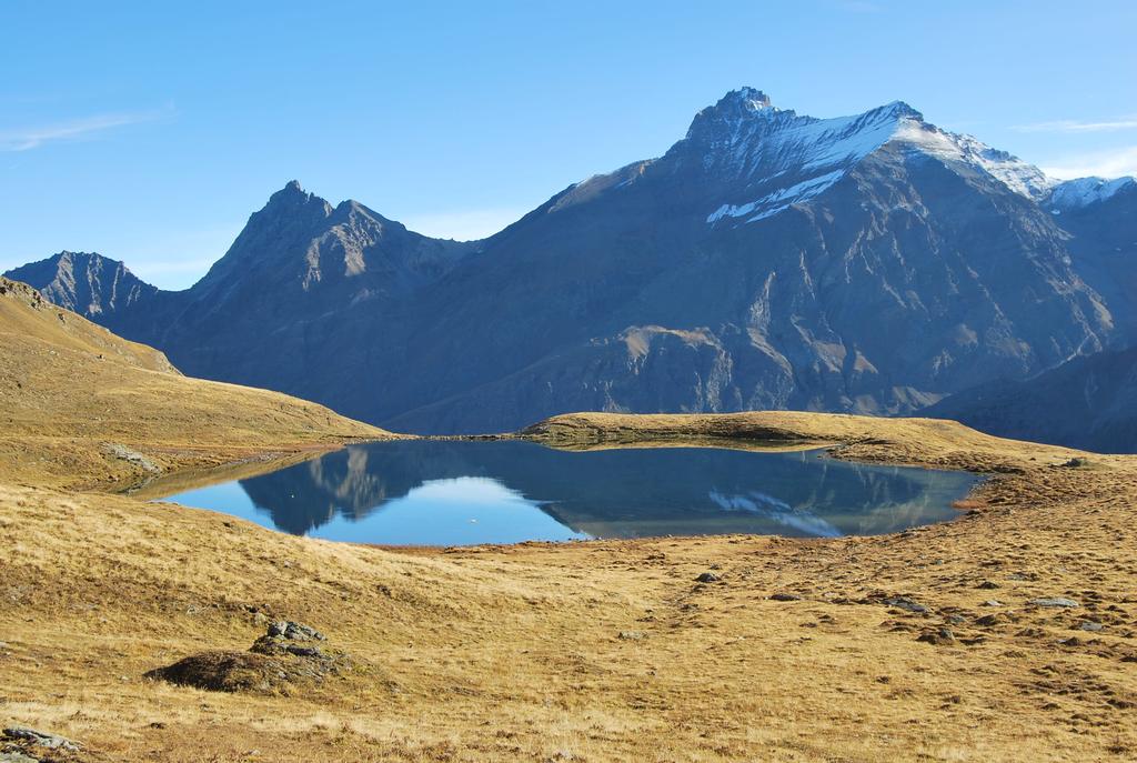
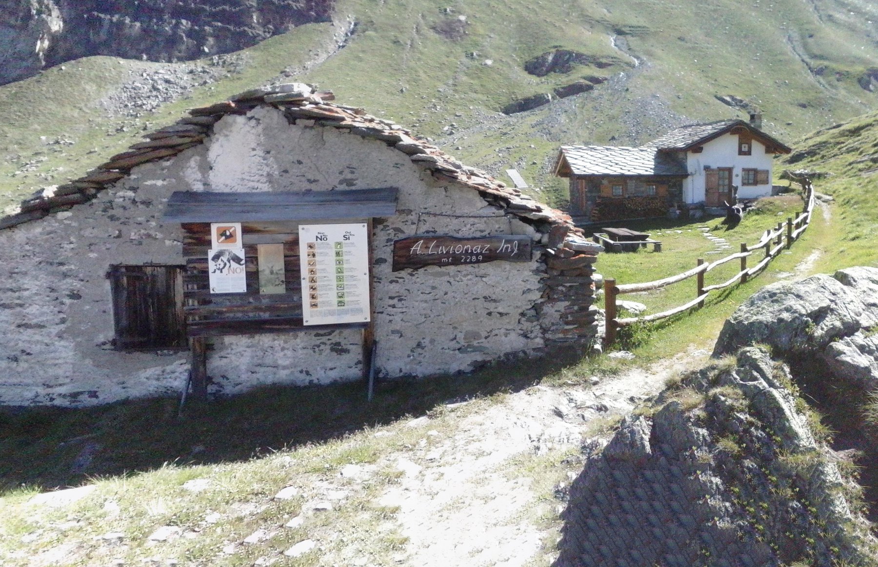
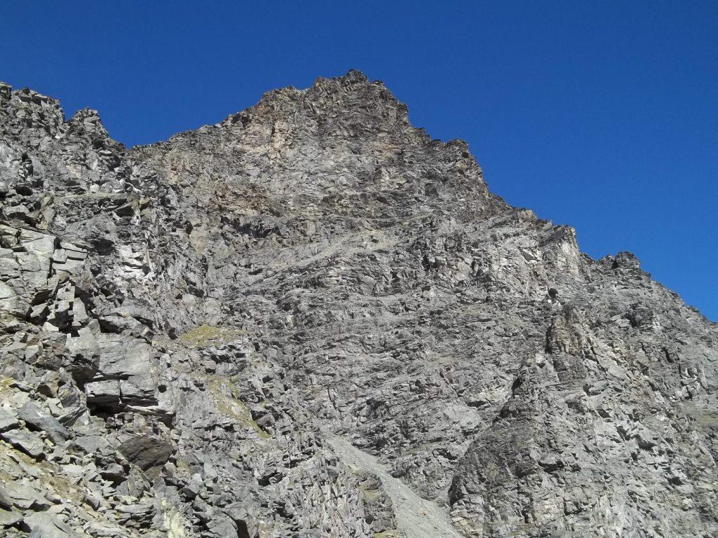
Con alcune svolte il sentiero sale, incrocia il sentiero n. 8 proveniente da Degioz, passa il bivio da cui si diparte il sentiero per la Punta Bioula ed arriva infine alla casa di caccia di Orvieille (2168 m). Salendo si arriva agli Alpeggi di Dijouan poi, aggirato il costone, si entra nel vallone del Nampio; si imbocca un lungo traverso quasi in piano e, sfiorato l’Alpeggio di Lacs inferiore si arriva in vista dei laghi di Dijouan.
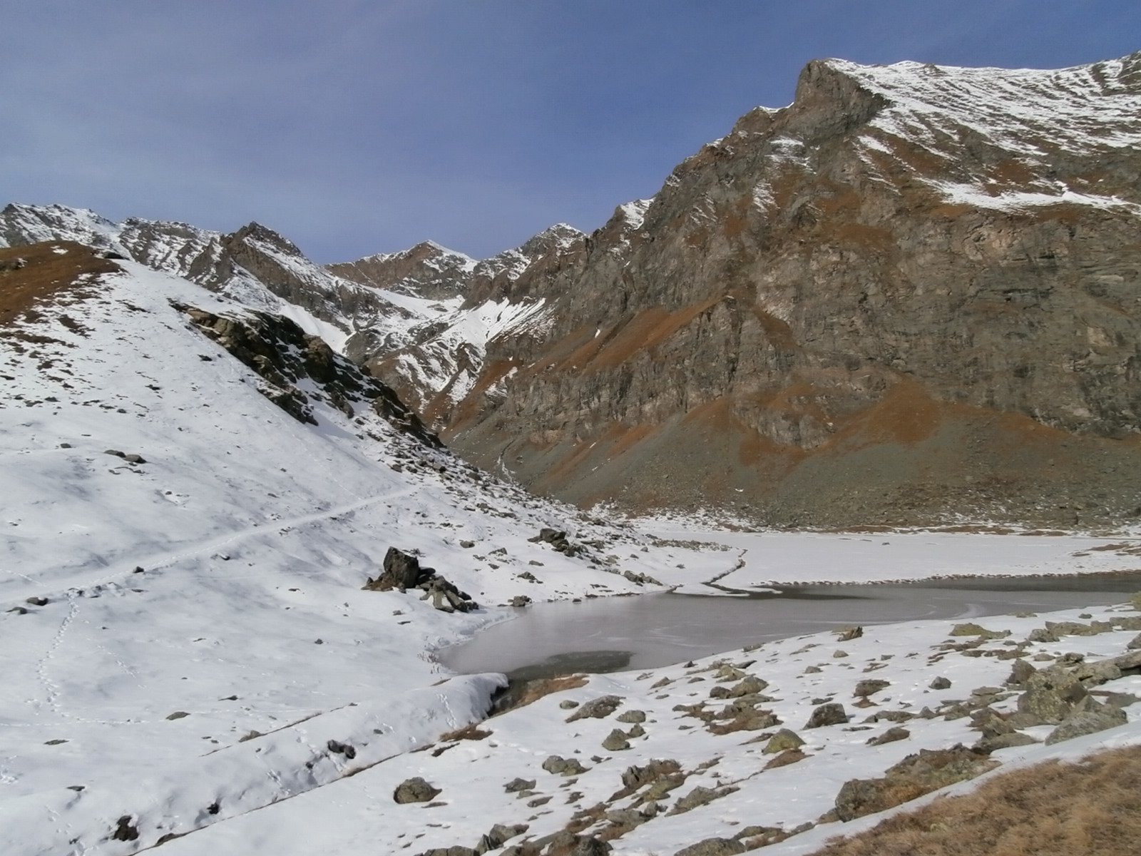
Qui si trova anche il bivio ove occorre seguire l’indicazione per i sentieri n. 6 e 9 che portano in breve, con una bella mulattiera in alcuini tratti lastricata, al Col Manteau (2789 m). Dal Colle si scende nel Vallone delle Meyes e si arriva ad un bivio ove occorre proseguire sul sentiero n. 9 (ignorare il n. 6 che scende a fondo valle) fino ad aggirare il costone ed uscendo così dal vallone. Il sentiero segue ora un tratto in piano, con vista sul Nivolet e sul vallone di Seyvaz, ed arriva in breve in vista degli alpeggi abbandonati di Aouille.
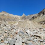
Ad un bivio, segnalato da un ometto, si stacca un sentiero (3D sulla carta) che, non molto visibile e spesso solo in tracce, scende fino agli alpeggi da dove occorre poi proseguire, su traccia non sempre visibile, fino ad incontrare una strada sterrata. Seguire ora la sterrata, direzione SW, fino ad incontrare il bivio ove scende, stavolta ben visibile, il sentiero per l’alpe Taurin (2366), ormai nel vallone del Nivolet. Dall’Alpeggio portarsi e poi seguire sempre il largo sentiero n. 3 per il Colle del Nivolet fino all’Alpe del Grand Collet (2409 m), ove si stacca il sentiero n. 2A per il colle, che si raggiunge in breve su un sentiero sempre molto evidente.
Dal colle si scende sul versante di Seyvaz, si toccano le Alpi di Seyvaz e si arriva infine sul fondo valle dove, seguendo il torrente Savara sulla sua sinistra, si arriva a Pont.
Da Pont si ritorna al ponte del Gran Clapey, o seguendo la strada asfaltata, oppure imboccando, ancora nell’abitato, il sentiero n. 4 che, dopo essersi ricongiunto con il sentiero n. 6 proveniente dagli alpeggi delle Meyes, sbuca nella piazzola-parcheggio in corrispondenza del ponte.
- Cartografia:
- Cartina L’Escursionista, Fg. 9, Valsavarenche - G.Paradiso, Scala 1:25000.
- Bibliografia:
- L. Zavatta – Le valli del G. Paradiso e la Valgrisenche – L’Escursionista Editore
Nelle vicinanze Mappa
Itinerari
15/10/2022 AO, Valsavarenche D+ 1350 m E Varie
Entrelor (Colle di) da Eaux Rousses, traversata a Rhemes Notre Dame
 50m
50m
25/05/2026 AO, Valsavarenche D+ 640 m E Ovest
Levionaz dessous (Alpe) da Eaux Rousses per il Vallone di Levionaz
 50m
50m
27/05/2026 AO, Valsavarenche D+ 900 m E Est
Djouan (Lago) da Eaux Rousses
 50m
50m
15/10/2025 AO, Valsavarenche D+ 1748 m EE Sud-Est
Bioula (Punta) da Eaux Rousses
 50m
50m
08/08/2023 AO, Valsavarenche D+ 1630 m E Nord
Lauson (Col) da Eaux Rousses
 50m
50m
17/08/2025 AO, Valsavarenche D+ 1631 m EEA Varie
Grand Neyron (Passage du) da Eaux Rousses, traversata a Pravieux per il Vallone di Levionaz e Rifugio Chabod
 50m
50m
27/09/2014 AO, Valsavarenche D+ 1800 m EE/F Varie
Rolettaz (Monte) da Eaux Rousses per il Colle di Sort
 50m
50m
23/08/2025 AO, Valsavarenche D+ 1083 m EE Sud-Est
Chandelly (Mont) o Testa della Mentò dal Pont du Grand Clapey per il Col Manteu
 1.2Km
1.2Km
29/06/2026 AO, Valsavarenche D+ 871 m E Sud-Est
Meyes (Vallone di) dal Ponte del Gran Clapey, anello per la Croce dell’Arolley
 1.2Km
1.2Km
18/07/2025 AO, Valsavarenche D+ 1630 m EE Varie
Percià (Punta) da Creton per il Colle di Entrelor
 1.8Km
1.8Km