3Km
3Km
Note
 0m
50m
50m
50m
750m
750m
750m
750m
800m
0m
50m
50m
50m
750m
750m
750m
750m
800m
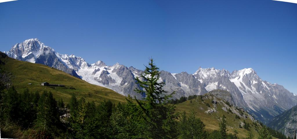
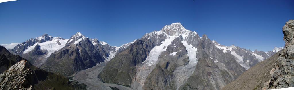
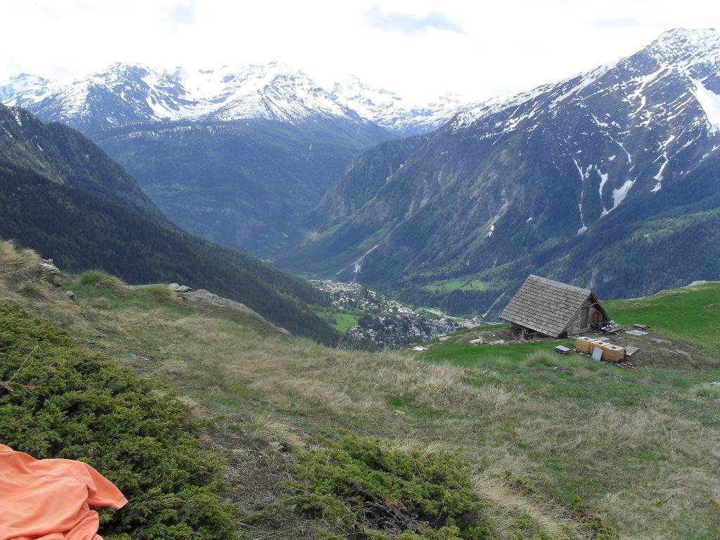
ottimo punto panoramico sul bianco.
Avvicinamento
.
Descrizione
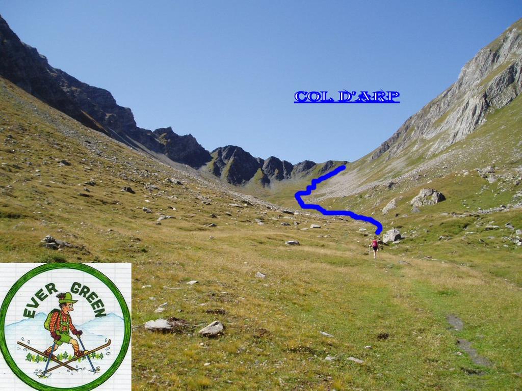
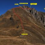
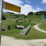
Attraversare dolonne in auto sino ad un ponticello, dove termina la strada. parcheggi a pochi metri prima (attenzione al lunedi’ mattina per divieti). Subito dopo il ponte parte un sentiero contrassegnato con un cartello bianco “arpette”. Dopo pochi metri incominciano i segni gialli con la numerazione 1A. Seguire sempre la numerazione. Superato il bosco il sentiero sparisce e si prosegue su una strada interpoderale, sempre con il n. 1A. Successivamente, all’ingresso del vallone d’Arp, riappare il sentiero che si segue fino al col d’arp, m. 2570, questo collega il vallone di salita con il vallone di youla che sale dalla valle di la thuile. al colle un sentiero sale a dx e con pecorso ascendente porta, in 20/30 minuti al colle youla.
- Cartografia:
- IGC n. 107 courmayeur monte bianco 1:25000
- Bibliografia:
- guida monti d'italia - alpi graie centrali
Nelle vicinanze Mappa
Itinerari
10/08/2013 AO, Courmayeur D+ 1536 m E Varie
Arp (Testa d’) da Dolonne
 0m
0m
12/09/2018 AO, Courmayeur D+ 1440 m E Tutte
Arp (Col d’) da Dolonne, anello per Colle di Youla e discesa per la Val Veny
 50m
50m
26/04/2012 AO, Courmayeur D+ 868 m E Sud
Courba Dzeleuna da Dolonne
 50m
50m
26/07/2024 AO, Courmayeur D+ 1616 m E Varie
Berrio Blanc (Colle del) da Dolonne, anello per Col de la Seigne, Col des Charmonts e Mont Fortin
 50m
50m
12/07/2025 AO, Courmayeur D+ 9300 m E Tutte
Monte Bianco (Giro del) da Courmayeur, giro antiorario (4 gg)
 750m
750m
13/08/2023 AO, Courmayeur D+ 1515 m EE/F Varie
Cormet (Mont) da Courmayeur, traversata a Morgex
 750m
750m
29/06/2025 AO, Courmayeur D+ 2382 m E Varie
Giro del Monte Bianco da Courmayeur a La Fouly
 750m
750m
01/07/2026 AO, Courmayeur D+ 3750 m EE Varie
Tor des Geants/Giro dei Giganti Tappa 1: Courmayeur – Valgrisenche
750m
10/07/2019 AO, Courmayeur D+ 1652 m E Nord-Ovest
Liconi (Testa di) da Courmayeur per la Val Sapin
 750m
750m
19/07/2024 AO, Courmayeur D+ 1131 m EE Nord-Ovest
Chetif (Mont) da Dolonne per Plan Checrouit
 800m
800m