1.3Km
1.3Km

Note
 50m
50m
550m
1.6Km
1.6Km
1.6Km
1.6Km
1.6Km
1.6Km
50m
50m
550m
1.6Km
1.6Km
1.6Km
1.6Km
1.6Km
1.6Km
1.3Km
1.3Km
6.3Km
6.5Km
7.1Km
7.2Km
7.8Km
8.1Km
8.1Km
8.1Km
La parte del sentiero che va da Pian Serpeis all'Alpe d'Attia è in stato di semiabbandono, con alcune piante rotte, bolli scoloriti e crescita di lampone selvatico sul camminamento, quindi può risultare poco agevole seguirla. La classica salita al Colle parte da Ala (vedi descrizione "Punta d'Attia da Ala di Stura").
Avvicinamento
.
Descrizione
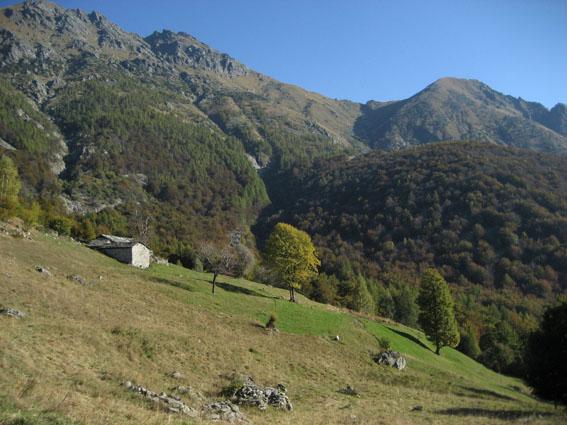
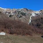
Si parcheggia appena al di sotto del Pian delle Pietre (bivio segnalato sulla destra poco dopo la frazione Cresto, Ala di Stura).
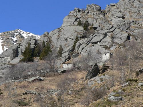
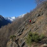
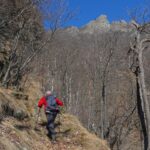
Si imbocca una strada sterrata chiusa dopo pochi metri da una sbarra e la si segue e si passa per il pianoro di Pianfè, quindi si raggiunge Pian Serpeis; da qui, poco a destra delle case si trova nel bosco un sentierino segnalato con bolli rossi, lo si segue fino ad arrivare al di sotto delle antiche baite dell’Alpe Corniele, abbarbicate sotto le rocce in panoramica posizione e si trova il bivio che prosegue a destra verso est, dapprima pianeggiante poi ripido e poi di nuovo a mezza costa (segnalato in bolli rossi e a volte con SB, sentiero balcone).
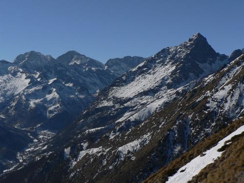
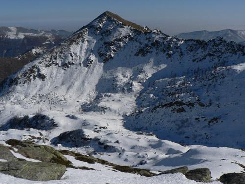
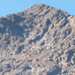
Giunti fuori dalla lariceta all’Alpe d’Attia (1740 m) si prosegue in direzione N-NE per il Colle omonimo, da qui in poi segnalato molto meglio con bolli bianchi e rossi, indubbiamente più frequentato (l’itinerario classico sale direttamente da Ala attraverso il Pian d’Attia).
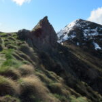
Al ritorno, dall’Alpe d’Attia si scende seguendo l’omino in pietra e i bolli bianchi e rossi fino al Pian d’Attia (1382 m), da dove si cerca di prendere uno dei sentierini nel bosco che svoltano a ovest per ritornare senza dover risalire al punto di partenza.
- Cartografia:
- Fraternali 1:25000 n.8 Valli di Lanzo
Nelle vicinanze Mappa
Itinerari
02/01/2016 TO, Ala di Stura D+ 441 m E Sud
Sarpeis (Pian) da Cresto
 50m
50m
03/04/2026 TO, Ala di Stura D+ 585 m E Sud
Attia (Alpe d’) da Cresto, anello per Pian Sarpeis, sentiero Balcone
 50m
50m
24/09/2023 TO, Ala di Stura D+ 1700 m EE/F Nord-Est
Rosso d’Ala (Monte) da Ala di Stura per il versante Nord
 550m
550m
03/06/2012 TO, Ala di Stura D+ 100 m E Nord
Airal (Pian) da Ala di Stura
550m
31/05/2026 TO, Ala di Stura D+ 1029 m E Sud
Attia (Col d’) da Ala di Stura
 1.6Km
1.6Km
18/01/2022 TO, Ala di Stura D+ 400 m EE Sud-Est
Bouiri dou Servagiu (Grotta) da Ala di Stura per il Roc dou Tchapèl
 1.6Km
1.6Km
24/05/2025 TO, Ala di Stura D+ 1150 m E Sud
Attia (Punta d’) da Ala di Stura
 1.6Km
1.6Km
03/05/2025 TO, Ala di Stura D+ 591 m EE Sud
Tourn (il) da Ala di Stura, anello per Monaviel
 1.6Km
1.6Km
19/04/2022 TO, Ala di Stura D+ 440 m E Nord
Nona (Rocca di) da Ala di Stura
 1.6Km
1.6Km
23/06/2025 TO, Ala di Stura D+ 456 m EE/F Sud-Ovest
Curbassere (Punte delle) da Ala di Stura
 1.6Km
1.6Km
Servizi
1.3Km
1.3Km
corbassera Ristorante
Ala di Stura
6.3Km
Lu Sciale Rifugio
Groscavallo
6.5Km
Setugrino Albergo
Groscavallo
7.1Km
Il Saloon Ristorante
Groscavallo
7.2Km
Il Corvo Reale Ristorante
Chialamberto
7.8Km
Posta Bar
Chialamberto
8.1Km
Val Servin Ristorante
Balme
8.1Km
Les Montagnards Albergo
Balme
8.1Km