 100m
100m
Descrizione
 4.4Km
7.7Km
7.8Km
8.6Km
10.1Km
10.1Km
4.4Km
7.7Km
7.8Km
8.6Km
10.1Km
10.1Km
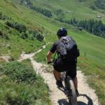
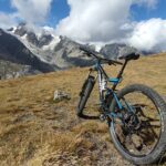
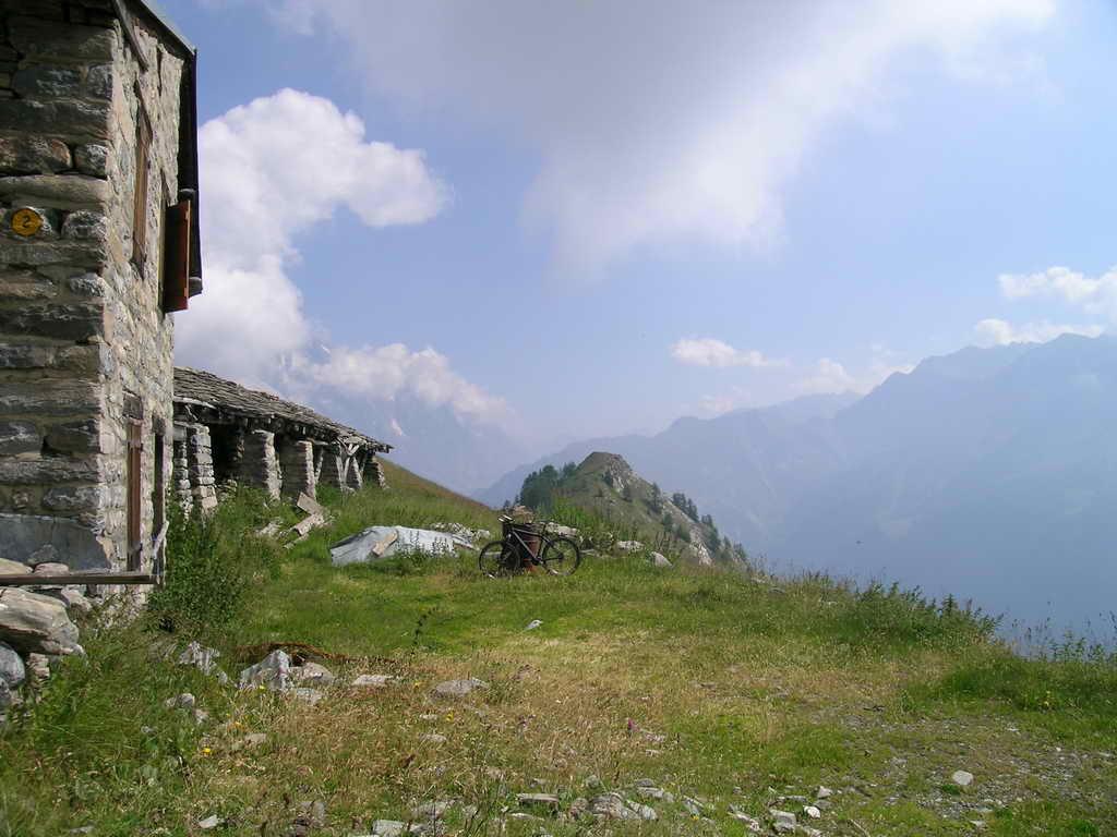
Da PLANPINCEUX continuare la strada asfaltata fino all’ARNUVA.Individuata la caratteristica baita con una mucca disegnata sul tetto, alla sua sx inizia un sentiero marcatissimo che ,ripido e non ciclabile, porta a quota a mt. 1920 nei pressi di una baita.
Seguire alla vostra destra il sentiero e le indicazioni per il Rif. Bonatti, con tratto quasi tutto ciclabile.Dal rifugio Bonatti scendere pochi metri di dislivelo in sella poi al primo bivio prendere a sinistra (indicazioni segnavia n. 28).
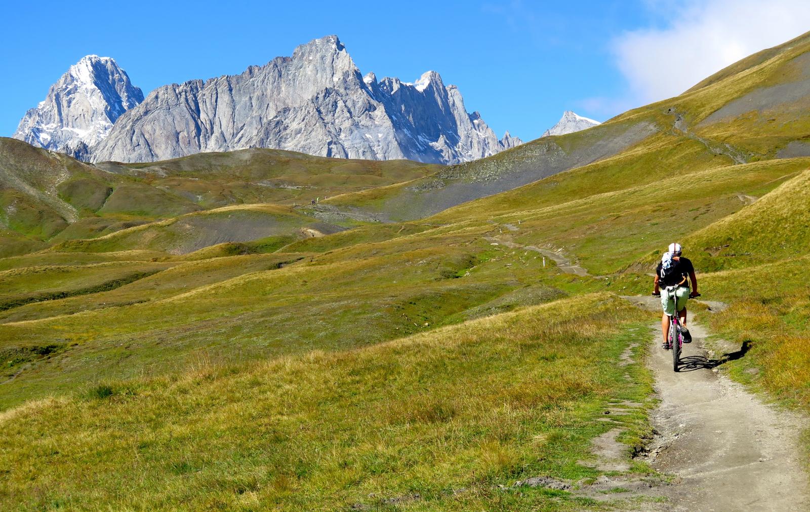
Questo tratto è ottimamente ciclabile ed a mezza costa. Tralasciato il primo vallone che si incontra ( vallone di Malatra’) proseguire sempre in sella fino ad incontrare il successivo vallone di Armina.
Al bivio piegare alla vostra sx( poco sopra di un ponte) ed inoltrarvi nello splendido vallone di Armina ( quasi tuttto ciclabile).
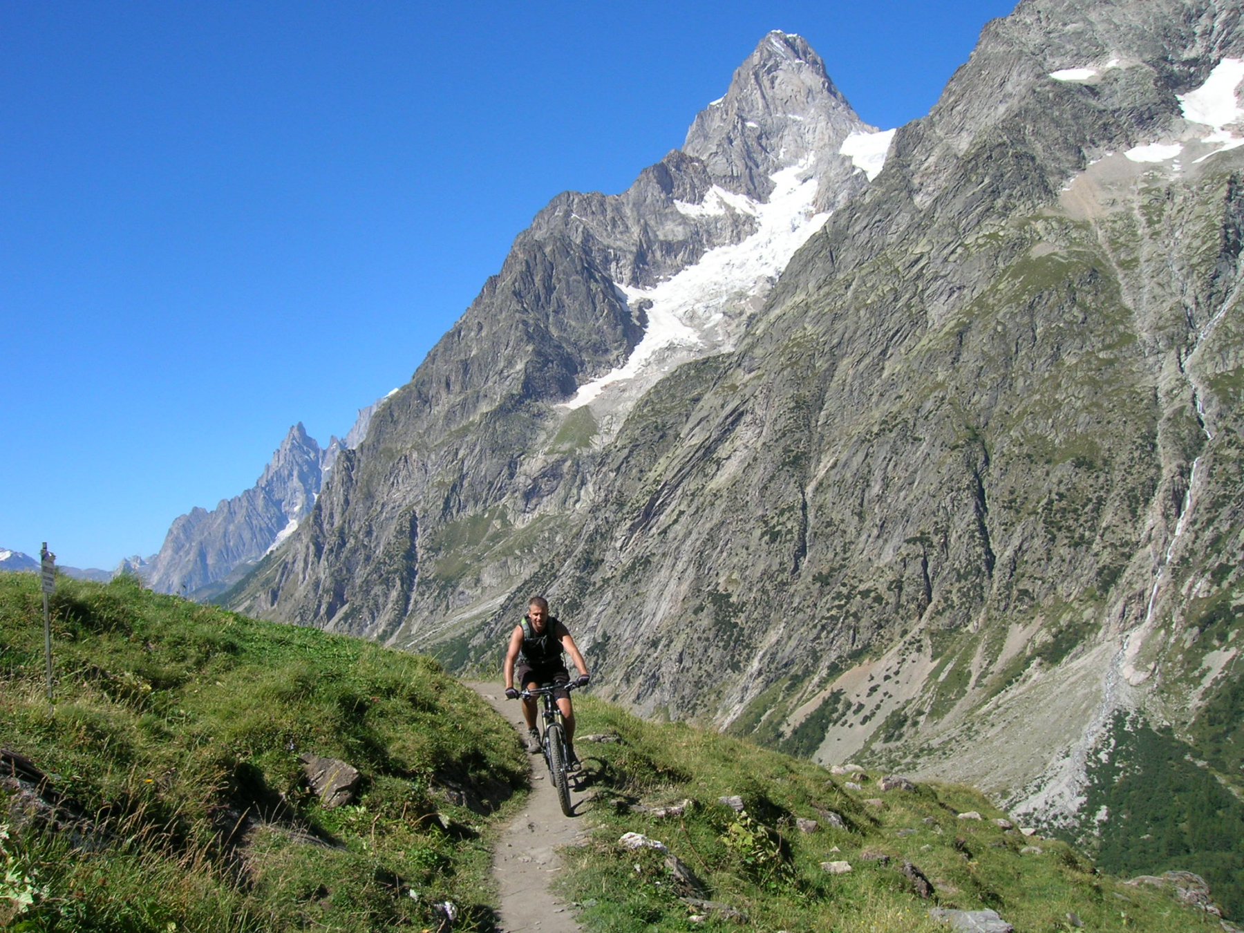
Arrivate alle baite che si individuano al fondo del vallone ,attraversare il rio alla vs dx e imboccare il sentiero che a tornanti,non ciclabile, sale al col Sapin (mt. 2436) Al colle subito alla vs dx inizia un sentiero ripidissimo che , ovviamente non ciclabile, porta alla TESTA DELLA TRONCHE .Splendido panorama su tutta la val Ferret.
Dalla punta inizia ora la discesa su ottimo sentiero che passando sotto le pendici della TESTA BERNARDA, con una continua e dolce cavalcata percorre tutto il ,MONTE DE LA SAXE, fin in vista del Rif. BERTONE.
La discesa alla sellletta sopra il rifugio è per biker esperti.
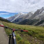
Da questa selletta seguire l’unico sentiero che con altro splendido mezzacosta mozzafiato su Courmayeur, riporta verso la val Ferret fino all’altezza dell’alpeggio Leuche’. Di qui con ancora sentiero tecnico ma ciclabile si perviene alla strada asfaltata nei pressi di Planpiceux, dove siè parcheggiata l’auto
Nelle vicinanze Mappa
Itinerari
24/06/2025 AO, Courmayeur D+ 1110 m MC+, BC, S2 Nord
Elena, Bonatti, Bertone (Rifugi) da Planpincieux, giro
 4.4Km
4.4Km
15/07/2015 AO, Courmayeur D+ 1700 m BC, BC, S0 Tutte
Tour del Monte Bianco (CCW) Tappa 1: Entreves – Champex
 7.7Km
7.7Km
19/07/2015 AO, Courmayeur D+ 1150 m BC, BC Tutte
Tour del Monte Bianco (CCW) Tappa 5: Les Chapieux – Entreves
7.7Km
25/08/2016 AO, Courmayeur D+ 1940 m BC, BC+, S2 Varie
Entre Deux Sauts (Tète) da Entreves, giro
 7.8Km
7.8Km
23/08/2004 AO, Courmayeur D+ 1600 m BC, BC Varie
Fortin (Mont) giro della val Val Veny da La Visaille
8.4Km
08/09/2024 AO, Courmayeur D+ 10000 m OC+, OC+, S5 Tutte
Tor des Geants in MTB
 8.6Km
8.6Km
19/08/2023 AO, Pré-Saint-Didier D+ 2800 m BC, OC, S3 Tutte
Arp e Chavannes (Colli) da Pré Saint Didier, giro
 10.1Km
01/08/2009 AO, Pré-Saint-Didier D+ 1100 m MC, MC, S0 Est
Arp (Alpe) da Pre Saint Didier
 10.1Km
04/08/2006 AO, La Salle D+ 1000 m BC, TC, S2 Sud
Serena (Col) da Morge, giro per Tramoail des Ors, Rantin e Planaval
10.3Km
03/08/2018 AO, Pré-Saint-Didier D+ 3500 m OC, BC+, S3 Varie
Bard, Citrin, Malatrà (Colli) da Prè Saint Didier, giro della Valdigne
10.3Km