 1.8Km
1.8Km
Note
 2.1Km
4.2Km
7.1Km
7.4Km
7.4Km
9.3Km
9.3Km
9.3Km
2.1Km
4.2Km
7.1Km
7.4Km
7.4Km
9.3Km
9.3Km
9.3Km
1.8Km
3.8Km
4.8Km
6Km
6Km
6.2Km
7Km
7Km
7.2Km
7.8Km
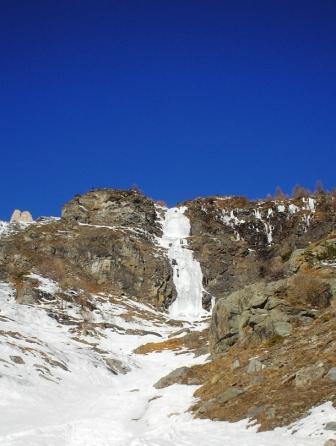
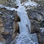
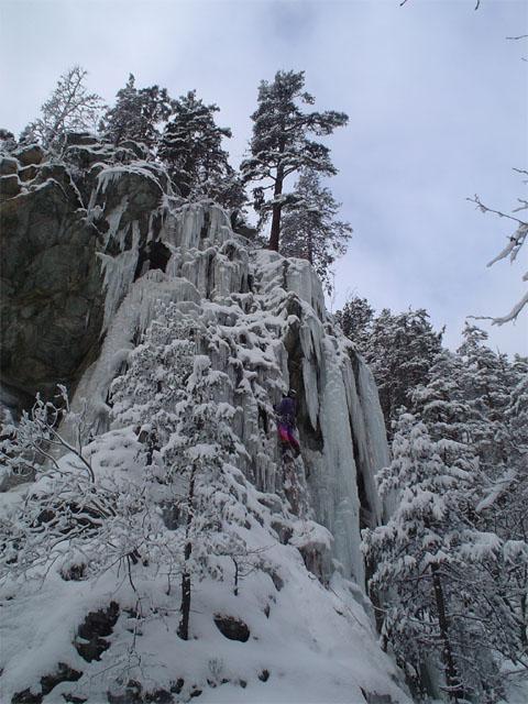
STUPENDA CASCATA ESPOSTA AL SOLE. OCCHIO ALLE SLAVINE QUANDO C'E' NEVE!!
Avvicinamento
,
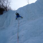
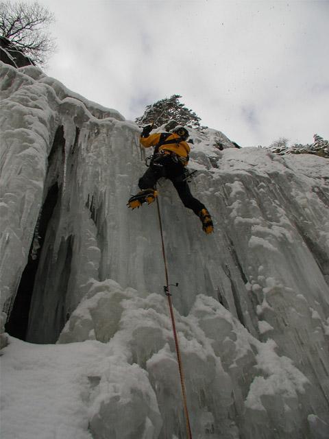
Descrizione
AVVICINAMENTO: STRADA PER FORTI DI PRAMAND FINO AD INCONTARE L’INIZIO DEL VALLONE DEL VALLONETTO. RAGGIUNGERE PER RIPIDI COSTONI L’EVIDENTE CASCATA.
DISCESA: PORTARSI DULLA DX. (FACCIA A MONTE) ATTRAVERSANDO ALCUNI CANALI FINO A REPERIRE UN AMPIO PENDIO CANALE. TENERSI VERSO DX. (FACCIA A VALLE) E RAGGIUNGERE NUOVAMENTE LA BASE.
- Bibliografia:
- G.C. GRASSI
Nelle vicinanze Mappa
Itinerari
27/02/2005 TO, Salbertrand 80 m II, 3+ Sud
Salbertrand – Rio Geronda (Cascata del)
1.8Km
27/01/2017 TO, Salbertrand 11 m I, 2 Sud-Ovest
Salbertrand – Rio Secco (Cascata del)
 2.1Km
2.1Km
07/02/2026 TO, Oulx 55 m II, 4 Nord
Oulx – Gran Bosco di Salbertrand (Cascata del)
 4.2Km
4.2Km
11/04/2022 TO, Exilles 90 m IV, 3+ Nord-Ovest
Exilles (Cascata di)
 7.1Km
7.1Km
13/01/2008 TO, Oulx 110 m II, 2 Sud-Est
Beaume – Due Amici (Cascata dei)
 7.4Km
7.4Km
18/01/2009 TO, Oulx 60 m II, 3 Sud-Est
Beaume – A Fa’ an po’ Sgiai (Cascata)
 7.4Km
7.4Km
23/01/2026 TO, Exilles 30 m I, 2+ Nord
Exilles – Ponte (Cascata del)
 9.3Km
9.3Km
03/12/2015 TO, Bardonecchia 200 m III, 4 Nord
Scarfiotti (Rifugio) – Pencil Magic (Cascata)
9.3Km
10/03/2012 TO, Bardonecchia 100 m III, 3 Nord-Ovest
Scarfiotti (Rifugio, Cascata del)
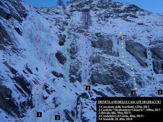 9.3Km
9.3Km
31/12/2015 TO, Bardonecchia 90 m I, 3+ Nord-Ovest
Scarfiotti (Rifugio) – Destinazione Ghiaccio (Goulotte)
 9.3Km
9.3Km
Servizi
1.8Km
3.8Km
Levi Molinari Rifugio
Exilles
4.8Km
Arlaud Rifugio
Salbertrand
6Km
La Quadriglia Ristorante
Exilles
6Km
L’ultima stisa Ristorante
Exilles
6.2Km
Touplan Ristorante
Exilles
7Km
orto del frate Ristorante
Sauze d'Oulx
7Km
paddy mc ginty Ristorante
Sauze d'Oulx
7.2Km
L’Cantun B&B
Sauze D'oulx
7.8Km

