3Km
3Km
Note
 0m
1.9Km
1.9Km
1.9Km
2.1Km
2.3Km
2.6Km
0m
1.9Km
1.9Km
1.9Km
2.1Km
2.3Km
2.6Km
3Km
6.1Km
7.6Km
9.4Km
9.6Km
9.6Km
9.8Km
9.8Km
9.8Km
9.8Km
MATERIALE:
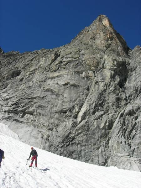
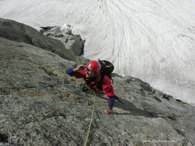
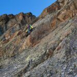
la via è spittata sulle placche, ma occorre integrare con nut e friend medio piccoli nei tiri in fessura.
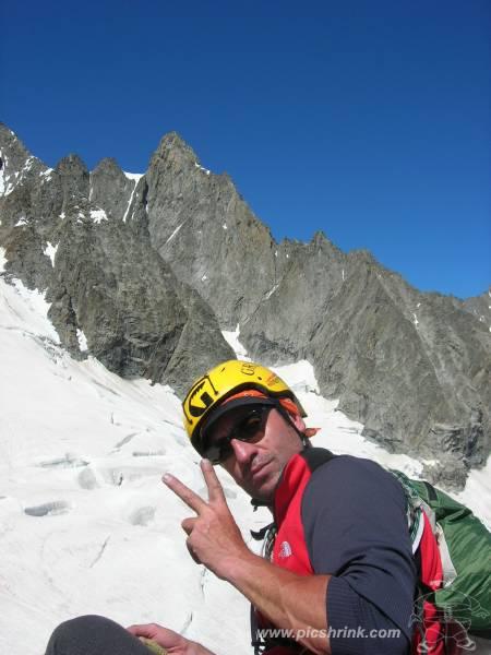
Nel complesso una via piacevole in un ambiente di alta montagna.
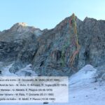
Avvicinamento
la via è spittata sulle placche, ma occorre integrare con nut e friend medio piccoli nei tiri in fessura.
Nel complesso una via piacevole in un ambiente di alta montagna.
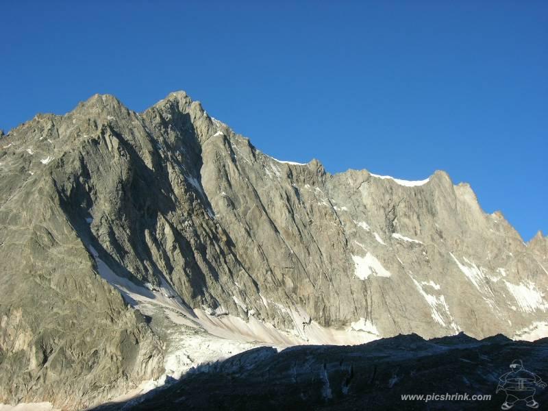
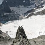
Dal rifugio Dalmazzi (m. 2590) proseguire per l’evidente sentiero che conduce nel bacino glaciale del Triolet, risalire una breve morena, quindi deviare a sinistra, portandosi sul ghiacciaio. Aggirare la cresta sud-est dell’Aiguille Savoie, prestando attenzione ai crepacci, e portarsi sotto l’evidente Torre Rossa (circa 2 h dal rifugio).
Descrizione
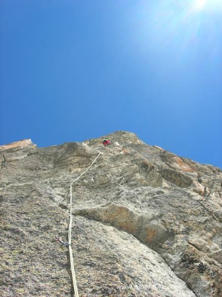
- L1: 6a+ (tiro breve con un singolo passaggio in leggero strapiombo, ben protetto)
- L2: 6a+ (placca e breve tetto, utile qualche friend)
- L3: 6a+ (bel tiro con fessura iniziale, poi una lunga placca in traverso a dx)
- L4: 6a+ (superamento di alcuni tetti a destra)
- L5: 5b
- L6: 6b (fantastico tiro su placche e fessure svase, da integrare con nut piccoli)
- L7: 6a+ (un altro tiro bellissimo in fessure, nut)
- L8: 5c (superare un breve muro giallastro, quindi la sosta. Tiro breve)
Discesa: in doppia lungo la via.
Nelle vicinanze Mappa
Itinerari
26/07/2024 AO, Courmayeur 6b, 6a obbl. Sud
Savoie (Aiguille de) – Favola d’Amore
 0m
0m
14/08/2009 AO, Courmayeur 6c+, 6a+ obbl. Sud-Ovest
Savoie (Aiguille de), anticima cresta SO – Le Meilleur Grimpeur du Monde
350m
23/08/2008 AO, Courmayeur 6c, 6a+ obbl. Sud-Est
Savoie (Aiguille de) – Rose Marie
350m
14/08/2022 Entremont, Orsières 6a+, 5b obbl. Sud-Est
Triolet (Monts Rouges de), Punta Nord – Via Manera
 1.9Km
1.9Km
04/07/2015 AO, Courmayeur 6b+, 6b obbl. Sud-Ovest
Triolet (Monts Rouges de), Punta Nord – Scacco alla Torre
1.9Km
19/08/2019 AO, Courmayeur 6b, 6a obbl. Nord-Ovest
Triolet (Monts Rouges de), Punta Nord – Reglette da Ballo
 1.9Km
1.9Km
06/08/2022 AO, Courmayeur 6c, 6a+ obbl. Sud-Ovest
Triolet (Monts Rouges de), Punta Nord- Le Fond de l’Air
 1.9Km
1.9Km
16/07/2023 AO, Courmayeur 6b, 5c obbl., a0 Sud-Ovest
Triolet (Monts Rouges de), punta centrale – Sulle Tracce del Barba
 2.1Km
2.1Km
11/08/2025 AO, Courmayeur 5c, 5a obbl. Sud-Ovest
Triolet (Monts Rouges de), punta 3327 m – La beresina
 2.3Km
2.3Km
19/08/2021 AO, Courmayeur 6c+, 6b obbl. Sud-Est
Greuvetta (Mont), Parete Est – Tempest
 2.6Km
2.6Km
Servizi
3Km
6.1Km
Lavachey Albergo
Courmayeur
7.6Km
Cabane de l’A Neuve Rifugio
La Fouly 9.4Km
9.4Km
Chalet le Dolent B&B
La Fouly 9.6Km
9.6Km
Majya-Joie Ristorante
La Fouly 9.6Km
9.6Km
Auberge de Maya Joie Albergo
La Fouly 9.8Km
9.8Km
Zanskar Sport Servizi
La Fouly 9.8Km
9.8Km
Edelweiss Ristorante
La Fouly 9.8Km
9.8Km
Supermarché de La Fouly Servizi
La Fouly 9.8Km
9.8Km