 3.9Km
3.9Km


Note
 50m
50m
50m
1.7Km
1.7Km
2.8Km
2.8Km
4.1Km
4.3Km
50m
50m
50m
1.7Km
1.7Km
2.8Km
2.8Km
4.1Km
4.3Km
3.9Km
4Km
4Km
4Km
5.1Km
5.2Km
6.5Km
7Km
7Km
7.4Km
Può capitare di dover lasciare l'auto a Fenils (q. 1340m) o lungo la strada per Pra Claud, qualora essa non fosse interamente agibile a causa della neve, in quel caso contare 250m di dislivello e 2km di spostamento in più.
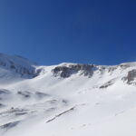
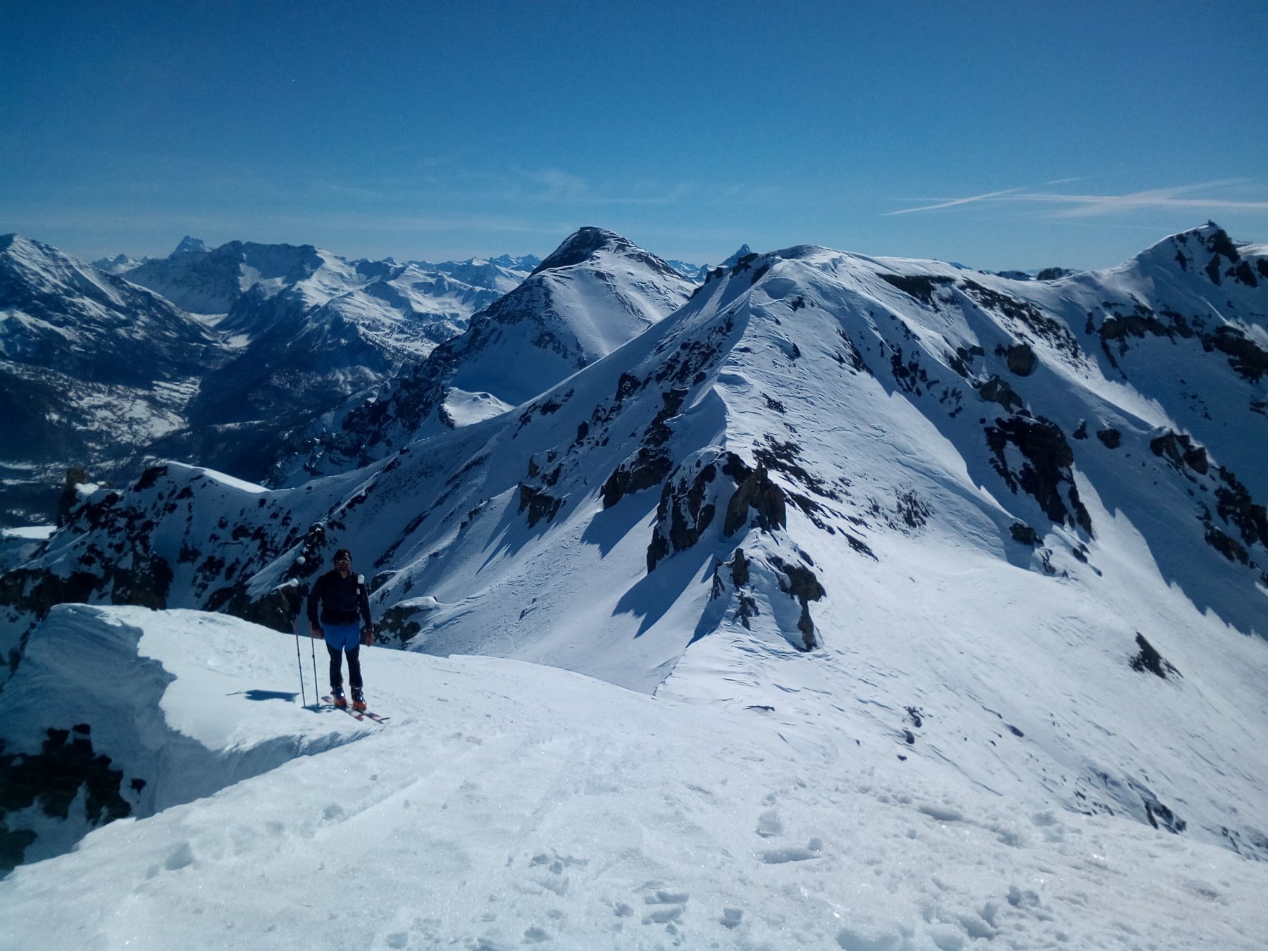
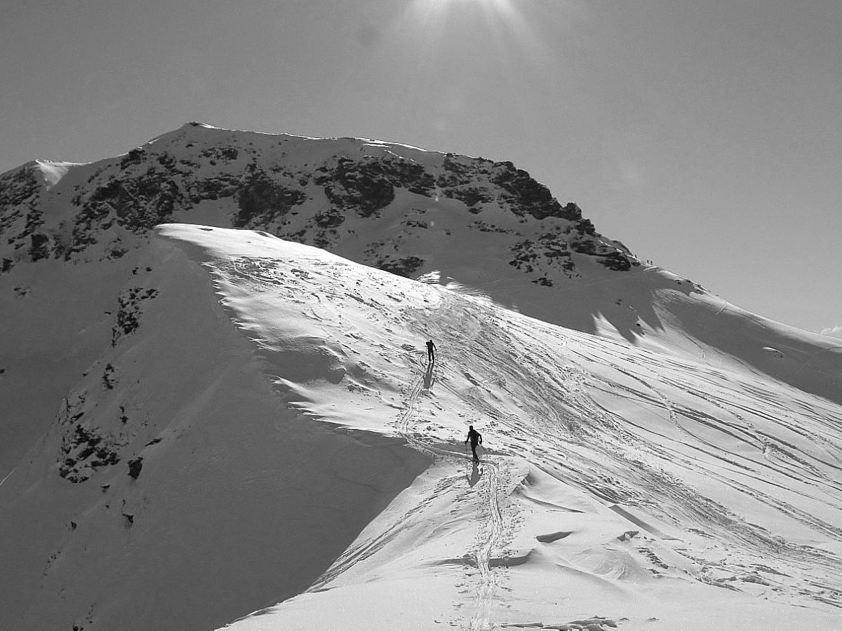
Anello molto remunerativo che attraversa due valloni selvaggi e permette di toccare due cime sopra i 3000m di quota. Dalle vette panorama a 360° con ottima visuale di Queyras e Écrins.
Utili i ramponi per alcuni traversi in salita e per la cresta Charniers-Chalanche Ronde, comunque sciabile se in condizioni.
Avvicinamento
Anello molto remunerativo che attraversa due valloni selvaggi e permette di toccare due cime sopra i 3000m di quota. Dalle vette panorama a 360° con ottima visuale di Queyras e Écrins.
Utili i ramponi per alcuni traversi in salita e per la cresta Charniers-Chalanche Ronde, comunque sciabile se in condizioni.
Dalla SS24 del colle del Monginevro, a circa metà strada tra Oulx e Cesana Torinese, seguire le indicazioni per la frazione di Fenils; attraversare la borgata sulla strada fino al suo confine NO, da qui finisce l'asfalto e la strada diventa di terra battuta (in buone condizioni e generalmente sgombra di neve, è tuttavia consigliato un mezzo dotato di 4x4), seguirla fino in località Pra Claud, dove prima del divieto d'accesso vi è un piazzale per lasciare l'auto (10 posti circa).
Descrizione
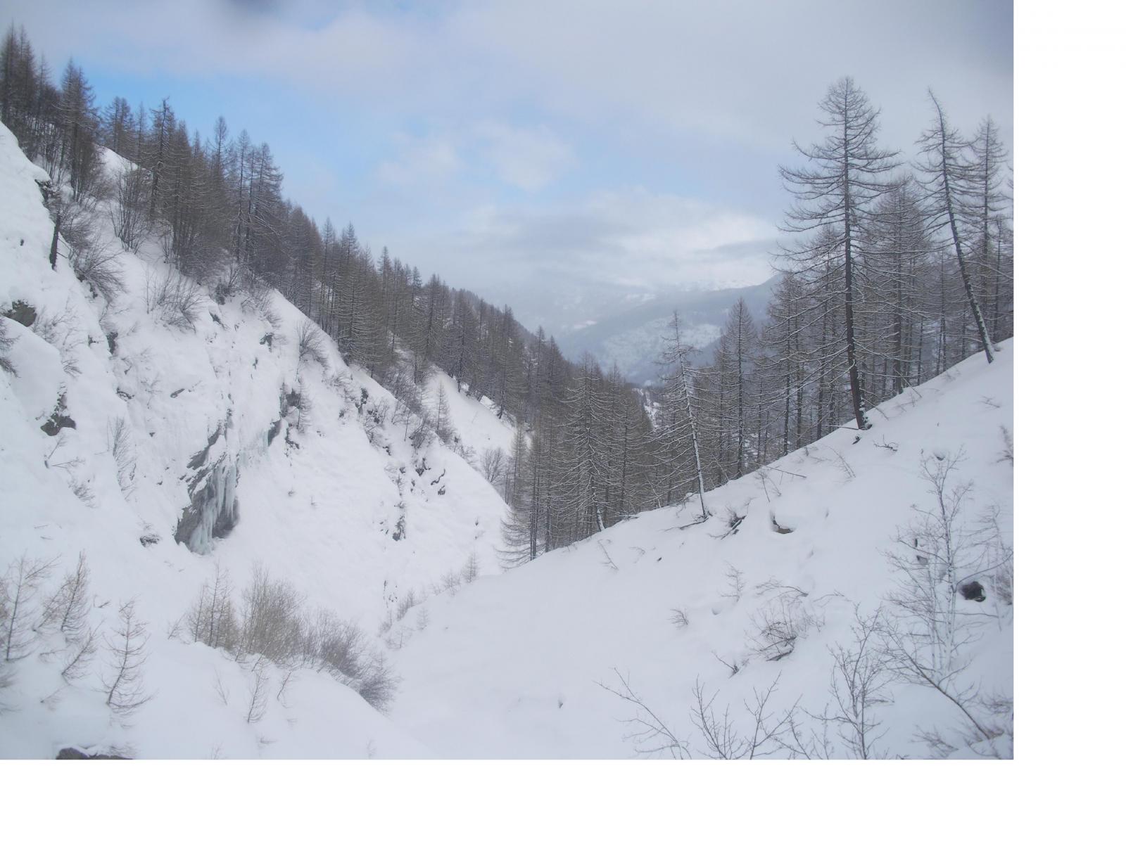
Da Pra Claud seguire la ex carrozzabile dello Chaberton (vedi anche http://www.gulliver.it/itinerario/50905/), possibilità di tagliare alcuni tornanti passando nel bosco. Dopo una decina di tornanti, la strada diviene rettilinea fino alla quota 1940 dove sulla destra si innesta il vallone discendente dalla Chalanche Ronde (che si percorrerà in discesa); immediatamente dopo questo punto vi è un tratto delicato: la strada con un ampio semicerchio doppia un costone, attraversando dei ripidi pendii esposti, spesso solcati da piccole valanghe (a seconda delle condizioni può essere necessario togliere gli sci o mettere i coltelli). Proseguendo si arriva ad un ripiano posto sotto il Pian dei Morti, dove si ha una duplice possibilità:
a) seguire il vago tracciato della strada, che si intuisce salire sulla destra con belle svolte ai piedi delle falesie del versante S della Croce del Vallonetto, per poi traversare verso O con alcuni passaggi esposti e delicati (di nuovo traverso pericoloso, valutare attentamente);
b) oppure piegare a sinistra imboccando l’ampio canale che passando sotto il versante NE dello Chaberton, raggiunge direttamente il Piano dei Morti (più agevole ma soggetto a scariche dai ripidi pendii ai suoi lati).
Giunti in fondo alla conca del Pian dei Morti imboccare verso N il bel vallone (ignorare il primo pendio-canale) ai piedi delle rocciose pareti dei Trois Scies che adduce ad un altro ripiano; da qui si raggiunge la cima degli Charniers (punto più alto dell’itinerario) tramite il ripido e diretto pendio sotto il colletto Scies-Charniers oppure con un giro più ampio, risalire i pendii più a est fino ad un’ampia conca posta tra la cima vera e propria e la quota 3048, detta La Punta.
Dalla vetta degli Charniers seguire poi la cresta sciabile scendendo e risalendo fino alla Punta; da qui si continua sulla la cresta scendendo verso N (spesso cornici sul versante italiano), si aggirano alcune rocce tendendosi sul versante francese e si giunge al Passo dell’Asino, quotato 2987m, da cui in breve per facile cresta sciabile si raggiunge la vetta della Chalanche Ronde, dotata di croce e libro di vetta.
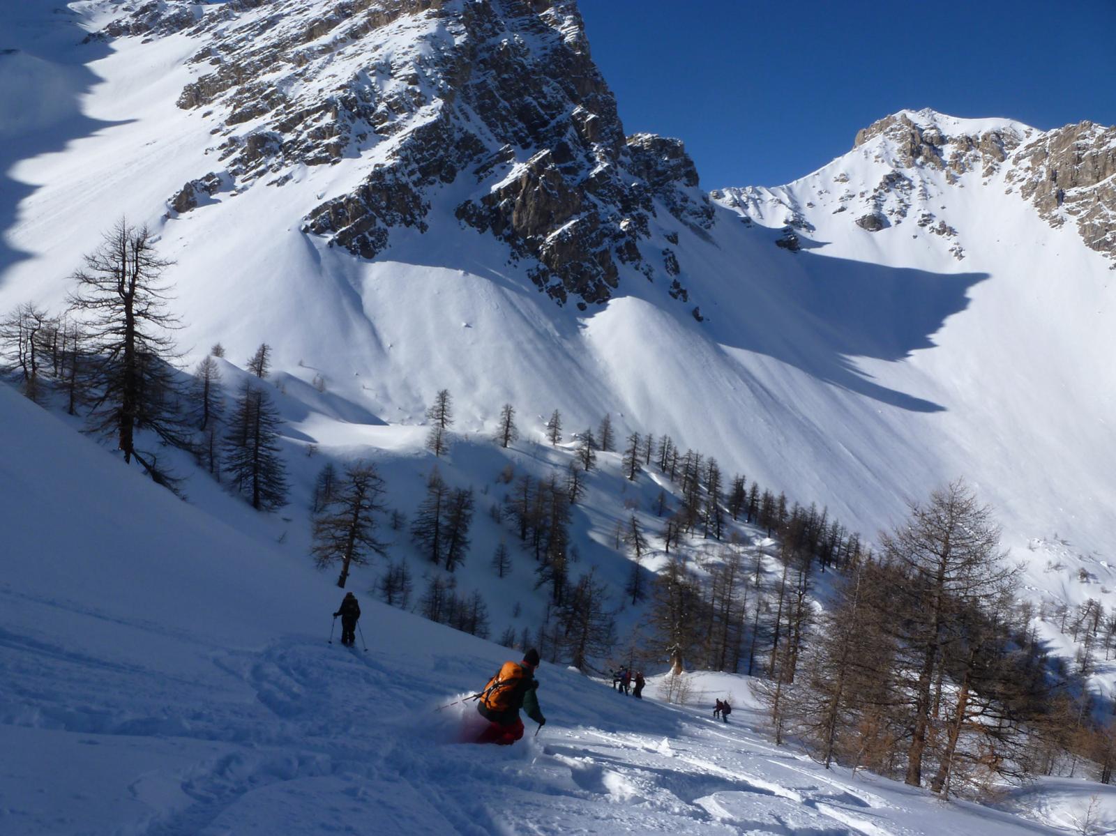
DISCESA: tornare al Passo dell’Asino e imboccare il ripido ma ampio vallone esposto a E, che regala una discesa lunga 700m su bei pendii (nel punto in cui un dosso divide il pendio a metà, tenersi a sinistra); nei pressi del Colletto del Lago un pianoro concede una tregua alle gambe, la valle piega decisamente verso S e si fa più stretta e incassata; con un percorso da bordercross evitando massi e alberi si raggiunge la strada percorsa in salita, alla quota 1940. Da qui sull’itinerario di salita fino all’auto.
- Cartografia:
- Fraternali 1:25000 n.2 Alta Valle di Susa Alta Val Chisone
- Bibliografia:
- Dal Monviso al Colle del Moncenisio - Barbiè, Campana ed. Blu
Nelle vicinanze Mappa
Itinerari
28/03/2021 TO, Cesana Torinese D+ 1474 m BS Sud-Est
Rochers Charniers (Pointe des) da Prà Claud
 50m
50m
25/04/2021 TO, Cesana Torinese D+ 1155 m BS Sud
Lago (Rocca del) da Prà Claud
 50m
50m
11/04/2025 TO, Cesana Torinese D+ 1453 m BSA Sud-Est
Chalanche Ronde (Punta di) da Pra Claud
 50m
50m
31/01/2014 TO, Cesana Torinese D+ 1000 m MS Nord
Sisnieres (Monte) o Cresta Nera da Fenils per il vallone del rio Fenils e la cresta Nord-Est
 1.7Km
1.7Km
12/01/2021 TO, Cesana Torinese D+ 1070 m BS Sud
Gardiol (Punta) da Fenils
 1.7Km
1.7Km
31/12/2019 TO, Cesana Torinese D+ 6000 m MS Tutte
Dormillouse (Cima), Monte Fraiteve, Col des Trois Freres Min da Cesana, traversata a Melezet (4 gg)
 2.8Km
2.8Km
10/03/2024 TO, Cesana Torinese D+ 1380 m BS Ovest
Fraiteve (Rocce del) da Solomiac
 2.8Km
2.8Km
18/04/2025 TO, Cesana Torinese D+ 1000 m MS Nord-Ovest
Fraiteve (Monte) da San Sicario
 4.1Km
4.1Km
08/12/2003 TO, Cesana Torinese D+ 815 m MS Ovest
Platasse (Monte) da San Sicario
4.1Km
07/02/2021 TO, Cesana Torinese D+ 850 m MS Nord-Est
Bercia (Colle) da Cesana
 4.3Km
4.3Km
Servizi
3.9Km
4Km
L’Ibarus Rifugio
Cesana Torinese
4Km
Piergiorgio Frassati B&B
Cesana Torinese
4Km
Casa Cesana Bar
Cesana Torinese
5.1Km
La Chardouse Rifugio
Oulx
5.2Km
L’Eitabl Ristorante
Oulx
6.5Km
La Moretta Ristorante
Oulx
7Km
Guido Rey Rifugio
Oulx
7Km
Dell’Orsa Bar
Oulx
7.4Km


