2.1Km
2.1Km
Note
Storico
 50m
50m
50m
100m
150m
200m
250m
350m
400m
400m
50m
50m
50m
100m
150m
200m
250m
350m
400m
400m
2.1Km
2.1Km
2.2Km
2.8Km
2.8Km
 2.8Km
2.8Km
4.4Km
4.5Km
4.5Km
5.2Km
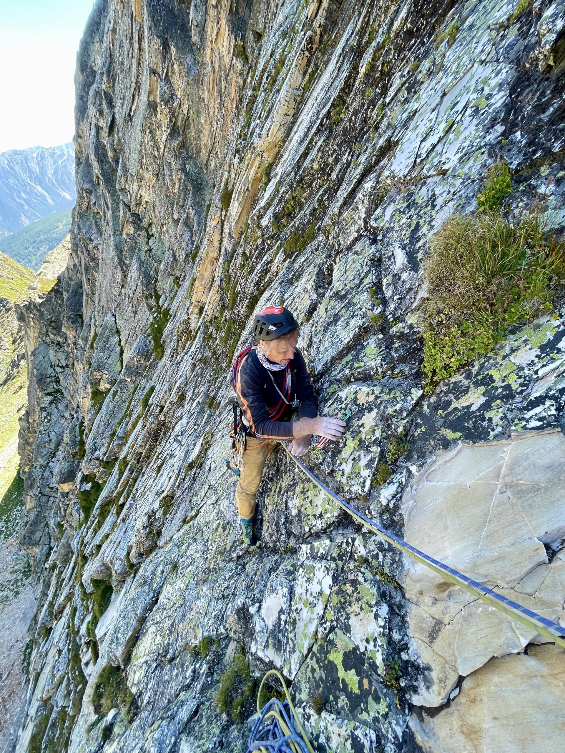
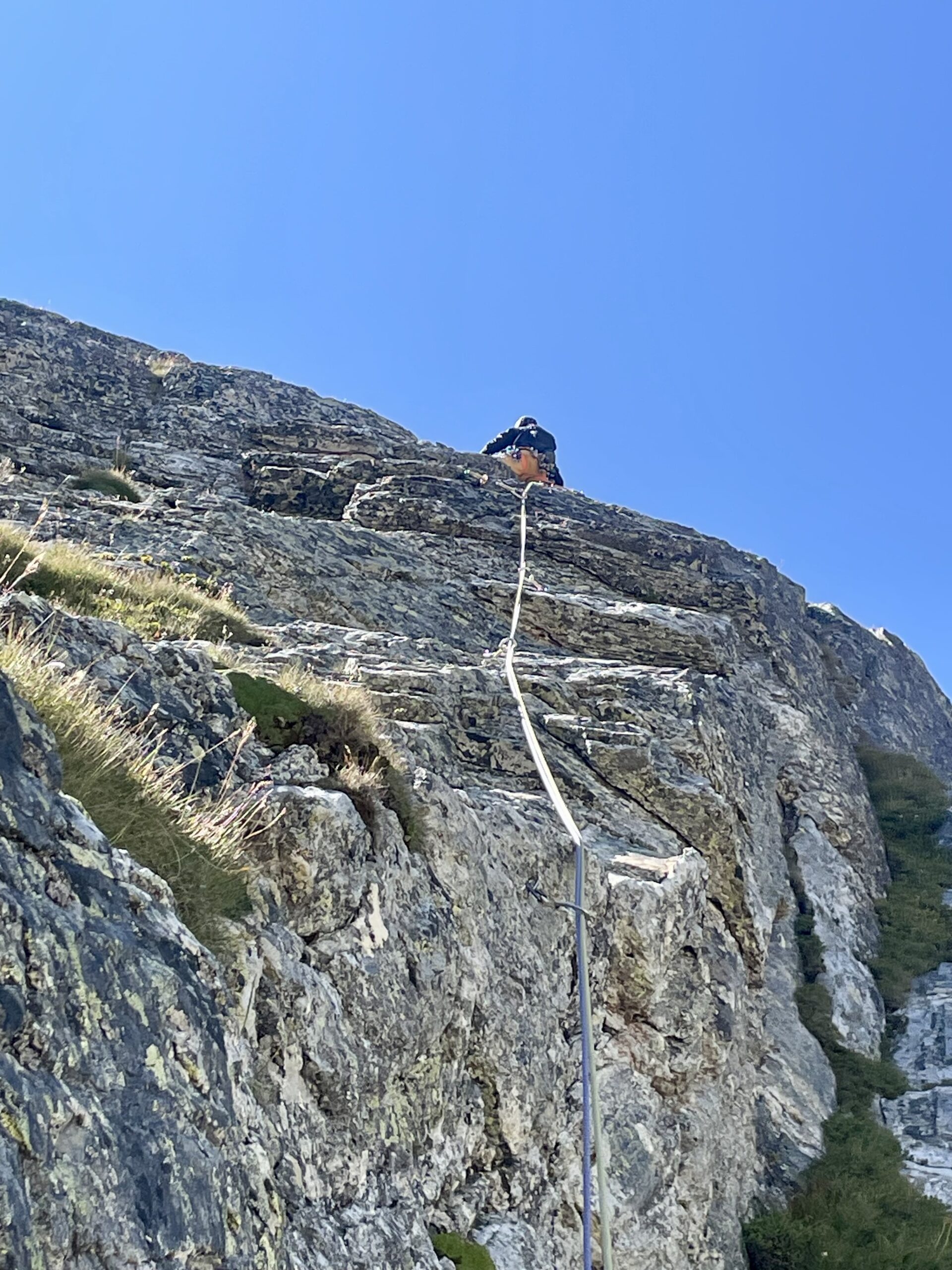
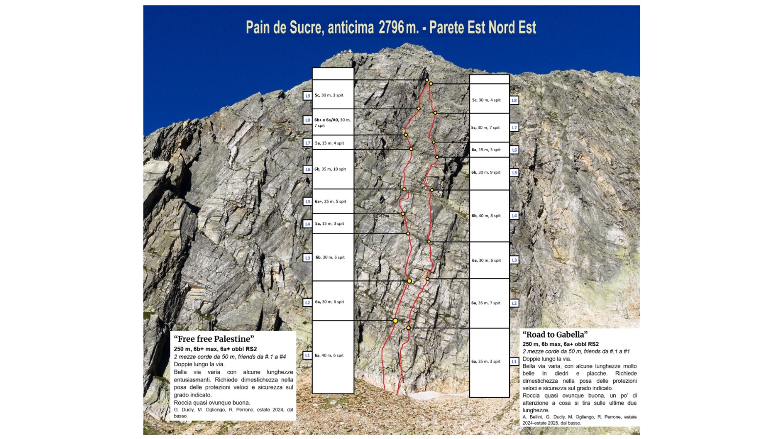
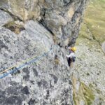
Via che offre un arrampicata varia su placche, muretti e diedri. Un’altra possibilità di arrampicare al fresco sulla parete.
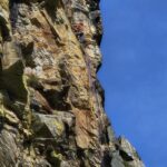
La roccia è quasi ovunque buona ma occorre fare attenzione a cosa si tira sulle due ultime lunghezze.
Materiale necessario: 10 rinvii, friends da .1 a 1, corde da 60.
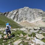
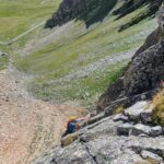
Avvicinamento
La roccia è quasi ovunque buona ma occorre fare attenzione a cosa si tira sulle due ultime lunghezze.
Materiale necessario: 10 rinvii, friends da .1 a 1, corde da 60.
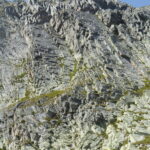
Risalire la Valle del Gran San Bernardo fino a trovarsi al cospetto della caratteristica e strapiombante Tour des Fous. Circa 200 m prima che la strada giri a destra sotto di essa si trova un capiente parcheggio (Parking Gran San Bernardo su Maps). Dal parcheggio seguire la strada per qualche minuto e risalire la comba a S puntando all’evidente parete (ometti).
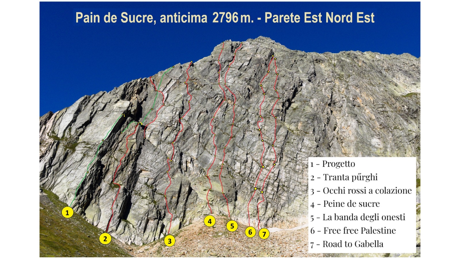
La via si trova una quindicina di metri a destra di quello de “La banda degli onesti” (culmine del conoide), qualche metro a destra di “Free Free Palestine”, nel buco formato tra nevaio e roccia a inizio stagione.
Descrizione
La via si trova una quindicina di metri a destra di quello de “La banda degli onesti” (culmine del conoide), qualche metro a destra di “Free Free Palestine”, nel buco formato tra nevaio e roccia a inizio stagione.
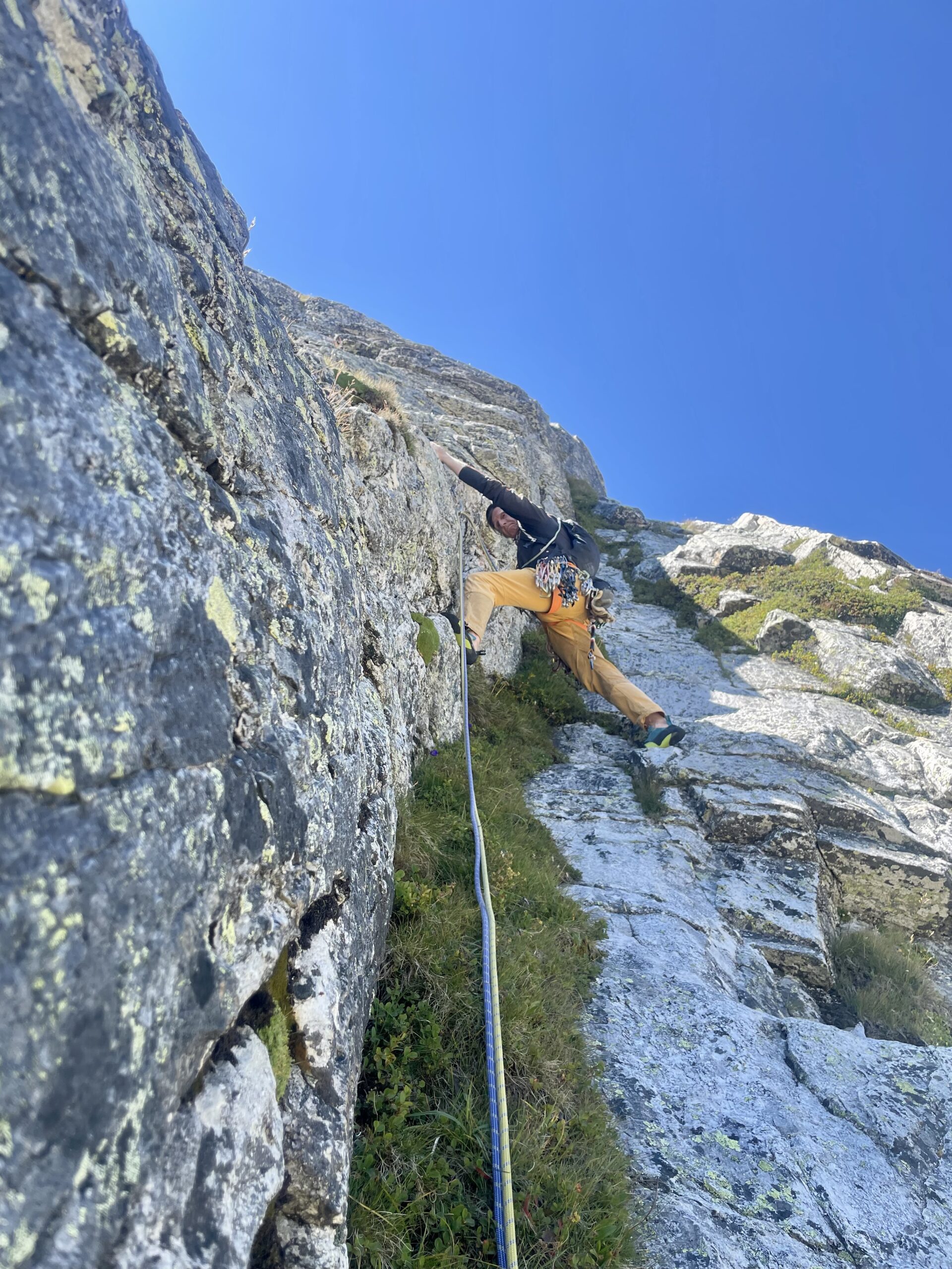
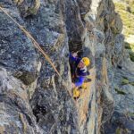
- L1 – diedro iniziale poi tendere a destra. 35m, 6a
- L2 – serie di risalti e muretti fino a sosta appena sotto a piccolo tetto. 35m, 6a
- L3 – ribaltamento e successivo tratto di lame e placche. 30m, 6a
- L4 – salire lo spigolo e seguire le placche verso sinistra. 40m, 6b
- L5 – placca tecnica. 30m, 6b
- L6 – breve tiro su muro per raggiungere la cengia della sosta. 15m, 6a
- L7 – placche su roccia a tratti delicata. 30m, 5c
- L8 – Bella placca, poi risalti e placca finale pochi metri a destra del diedro di “Free Free Palestine. 30m, 5c
Discesa in doppia sulla via.
Via aperta dal basso tra l’estate 2024 e quella del 2025 da Alessandro Bellini, Gianpaolo Ducly, Mario Ogliengo e Rocco Perrone.
- Cartografia:
- L'Escursionista, tavola n. 5 - Gran San Bernardo, Valle di Ollomont.
Nelle vicinanze Mappa
Itinerari
20/06/2025 AO, Saint-Rhemy-En-Bosses 6b+, 6a+ obbl. Nord-Est
Pain de Sucre, anticima 2750 m Parete E/NE – Free Free Palestine
 50m
50m
29/06/2026 AO, Saint-Rhemy-En-Bosses 6a+, 6a obbl. Nord-Est
Pain de Sucre, anticima 2750 m Parete E/NE – La Banda degli Onesti
 50m
50m
12/07/2026 AO, Saint-Rhemy-En-Bosses 6c, 6b obbl. Nord-Est
Pain de Sucre, anticima 2750 m Parete E/NE – Peine de Sucre
 50m
50m
12/07/2025 AO, Saint-Rhemy-En-Bosses 6c, 6b+ obbl. Nord-Est
Pain de Sucre, anticima 2796 m Parete E/NE – Occhi Rossi a Colazione
 100m
100m
18/08/2025 AO, Saint-Rhemy-En-Bosses 6b+, 6a+ obbl. Nord-Est
Pain de Sucre, anticima 2796 m parete E/NE – Tranta Pürghi
 150m
150m
16/08/2025 AO, Saint-Rhémy-en-Bosses 7a+, 6c obbl. Nord-Est
Pain de Sucre, anticima 2796 m parere E/NE – Diamonds and Rust
 200m
200m
29/08/2025 AO, Saint-Rhemy-En-Bosses 5c, 5a obbl. Nord-Est
Pain de Sucre, contrafforti E/NE – Tavolo104
 250m
250m
16/07/2026 AO, Saint-Rhemy-En-Bosses 7a+, 6c obbl. Ovest
Fous (Tour des) – Capitano Nemo
 350m
350m
25/08/2025 AO, Saint-Rhemy-En-Bosses 6b, 5b obbl. Sud
Fous (Tour des) – Via Pierre Atzori
 400m
400m
28/06/2026 AO, Saint-Rhémy-en-Bosses 6b, 6a obbl. Sud-Ovest
Fous (Tour des ) – Grand Hotel Italia
 400m
400m
Servizi
2.1Km
 2.1Km
2.1Km
Albergo Italia Albergo
Saint-rhemy-en-bosses 2.2Km
2.2Km
Du Lac Ristorante
Saint-rhemy-en-bosses 2.8Km
2.8Km
Hospice du Grand-St-Bernard Albergo
Bourg-St-Pierre 2.8Km
2.8Km
Auberge de l’Hospice Ristorante
Bourg-Saint-Pierre
2.8Km
De l’Hospice Rifugio
Bourg-Saint-Pierre 4.4Km
4.4Km
Arp du Jeu Ristorante
Saint-rhemy-en-bosses 4.5Km
4.5Km
Grand Golliat Ristorante
Saint-Rhemy-En-Bosses 4.5Km
4.5Km
Grand Golliat B&B
Saint-rhemy-en-bosses 5.2Km
5.2Km