4.4Km
4.4Km
Note
 50m
50m
700m
2.2Km
2.3Km
4.1Km
4.1Km
4.4Km
50m
50m
700m
2.2Km
2.3Km
4.1Km
4.1Km
4.4Km
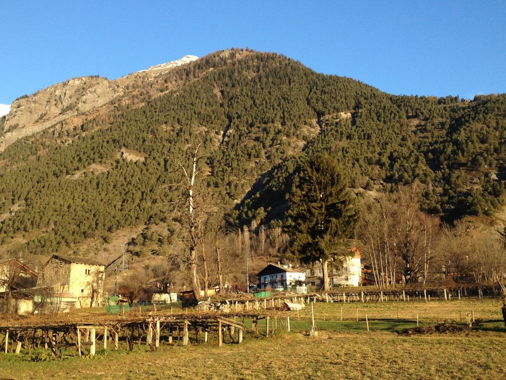
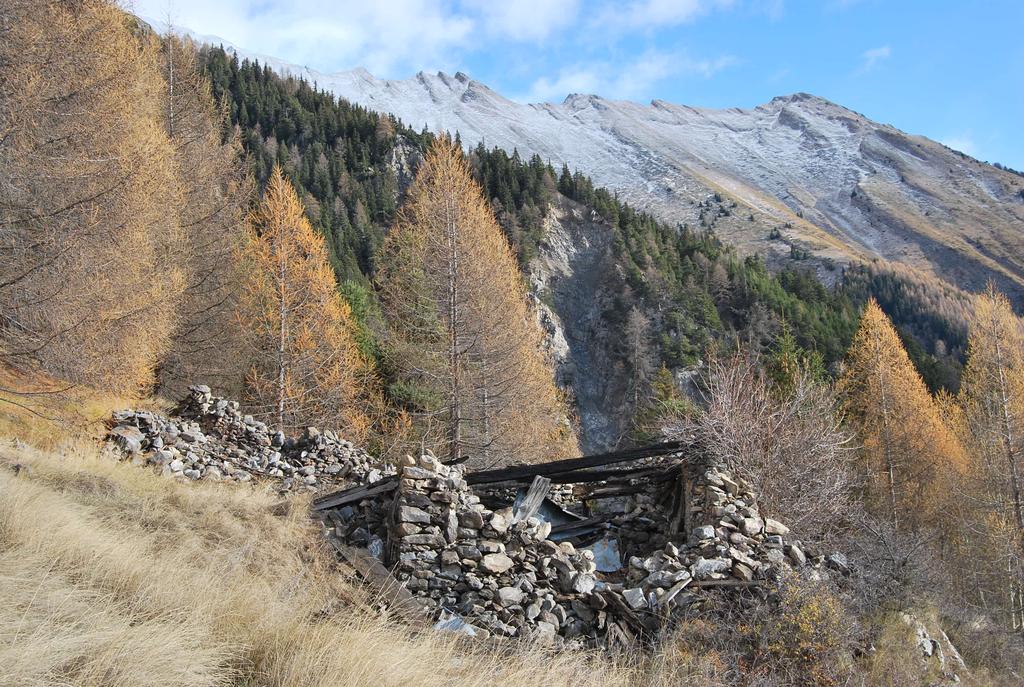
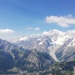
Il Mont de La Lex non è certamente tra i più citati nei percorsi escursionistici, eppure questa vetta nascosta della Valdigne è un eccezionale belvedere sull’alta Val d’Aosta. E’ facilmente raggiungibile lungo il sentiero 3 che da Lavancher porta agli alpeggi di Liconi; paradossalmente lungo questo itinerario non si sale SULLA cima ma si discende ALLA cima, visto che il percorso corre più alto.
Il dislivello positivo è pertanto superiore ai 1000 m; a questi vanno ancora aggiunti vari saliscendi.
Bellissima escursione, qui viene proposto un anello la cui prerogativa è l’attraversamento/risalita dei canaloni, con un divertente tratto tra corde fisse che però non presenta mai pericoli.
Avvicinamento
Il dislivello positivo è pertanto superiore ai 1000 m; a questi vanno ancora aggiunti vari saliscendi.
Bellissima escursione, qui viene proposto un anello la cui prerogativa è l’attraversamento/risalita dei canaloni, con un divertente tratto tra corde fisse che però non presenta mai pericoli.
Seguire la SS26 della Valle d’Aosta fino a Morgex, poi seguire le indicazioni per Villair-Lavachers. Arrivando da Villair, si attraversa l’abitato di Lavancher, si passa la sbarra (chiusa nei periodi a rischio valanga), e alla prima sterrata sulla destra (cartello con divieto accesso) si parcheggia.
Descrizione
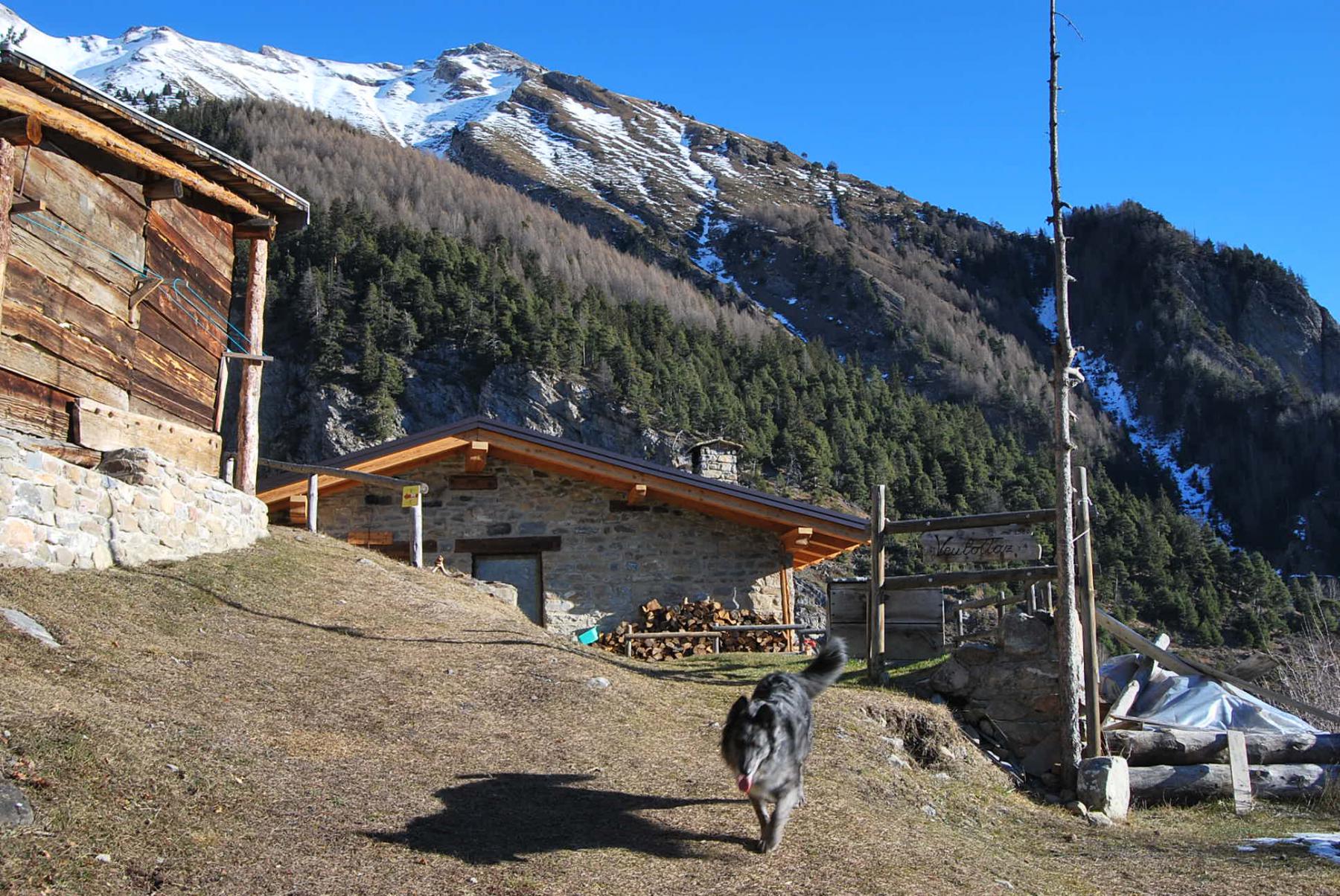
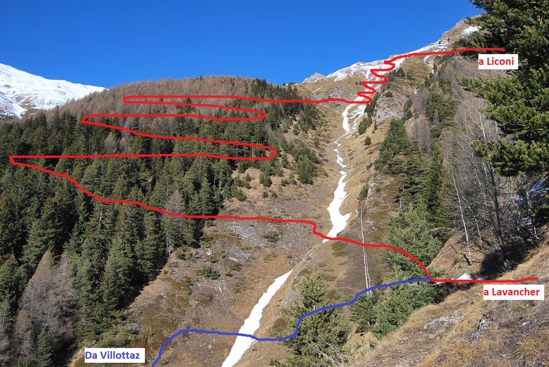
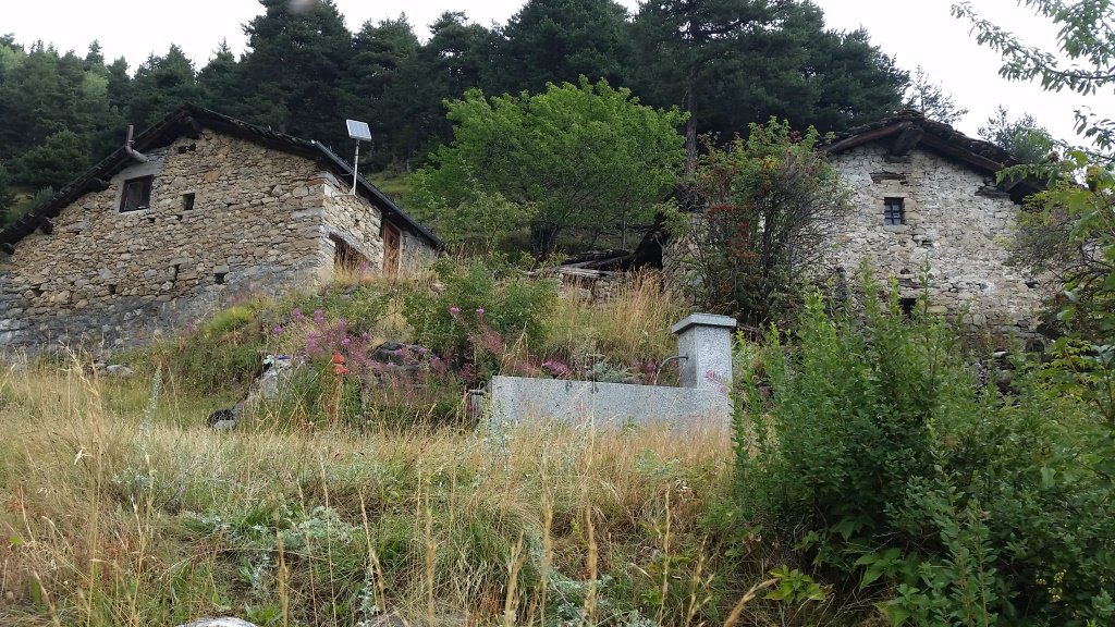
Si parte dalla sterrata che si dirama dalla strada Dailley-Lavancher dove c’è il cartello di divieto (una volta c’era anche una palina segnavia). La strada si snoda con alcune serpentine, la si lascia per proseguire sulla pista sterrata un po’ inerbita che prosegue in direzione Dailley. La pista interseca il sentiero n. 2 che proviene dall’abitato di Dailley e continua ripida fino sul bordo del torrente dove poi termina nei pressi di una costruzione. Qui inizia il sentiero che sale nel fitto bosco ed arriva alle baite ristrutturate di Villottaz (1595 m). Si passano gli alpeggi, dopo l’ultima baita il sentiero si dirama: a sinistra il n. 2 per il Bivacco Pascal, a destra una traccia (oggi ancora segnalata dalle indicazioni del Tour di Liconi) che poco dopo si dirama ancora. Qui occorre prestare attenzione: ignorare la traccia di sinistra più marcata, che però, arrivata sul bordo del canalone, si perde; seguire invece la traccia di destra, molto meno evidente, che scende decisamente fino ad arrivare nei pressi del canalone dove incrocia con il sentiero “3A” (indicazione su masso). Probabilmente questo sentiero si può già incrociare salendo sul n. 2 prima ancora di arrivare a Villottaz.
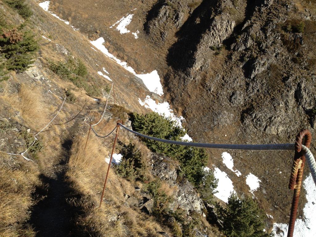
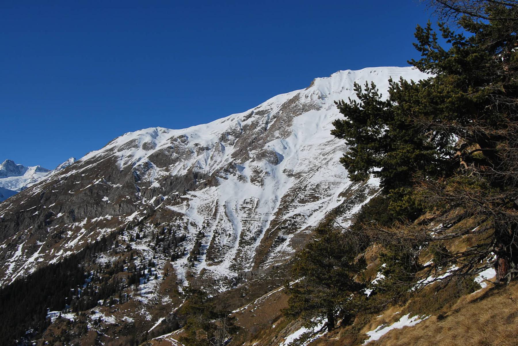
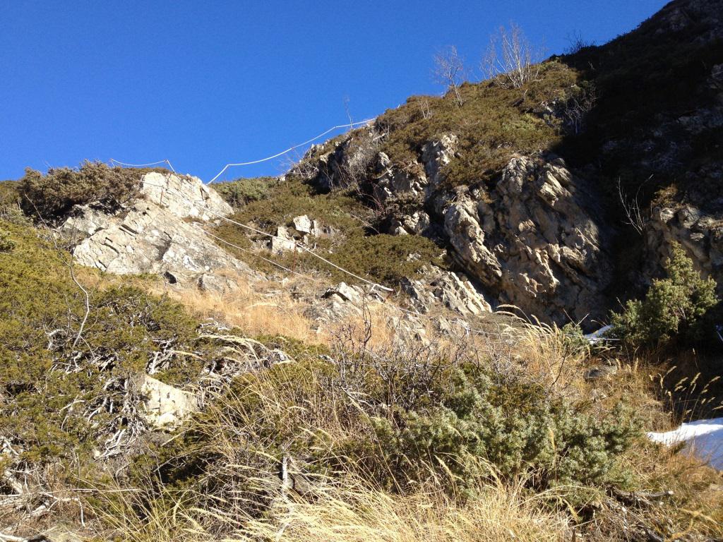
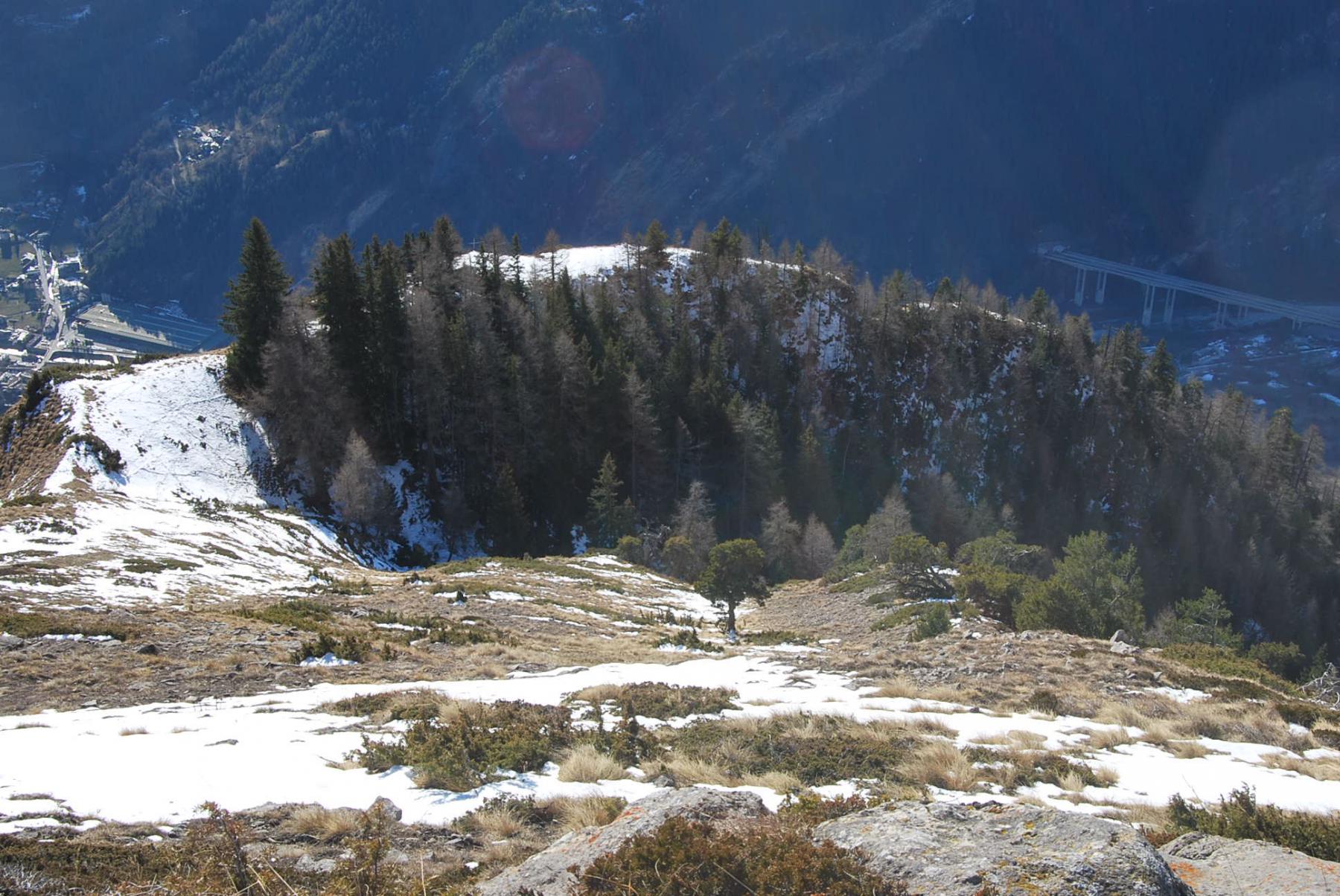
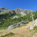
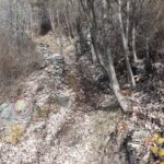
Proseguire ancora verso il canalone, si trovano delle corde fisse (non necessario usarle) che delimitano il lato esposto. Il sentiero ora molto ben marcato scende nel canalone, lo attraversa e risale sul lato opposto, segue un tratto in falsopiano e, attraversato un altro canalone, si congiunge con il sentiero n. 3 che proviene da Lavancher. Il sentiero attraversa di nuovo il canalone, sale con interminabili zig-zag nella pineta e torna a sbucare sullo stesso canalone che ora va risalito con altri zig-zag. Terminata la risalita si prosegue in costa in leggera salita fino ad un punto aperto su tutta la Val d’Aosta; il Mont de La Lex è ora proprio lì sotto, con visibile la croce, e lo si raggiunge con una breve discesa.
Al ritorno seguire lo stesso percorso di salita fino al bivio dei sentieri 3-3A; si prosegue ora lungo il n. 3 che, ben marcato e senza possibilità di errore, riporta a Lavancher scendendo, dopo aver incrociato il Ru du Cotes, sulla sterrata di partenza chiudendo così l’anello.
- Cartografia:
- Valdigne Mont Blanc: Les sentiers-Comunità Montana Valdigne (distribuz. gratuita ai punti informazione).
Nelle vicinanze Mappa
Itinerari
11/12/2015 AO, Morgex D+ 1450 m EE Sud
Drumianaz (Tête de) da Lavancher, anello
 50m
50m
24/10/2020 AO, Morgex D+ 1511 m EE Sud
Cormet (Mont) da Lavancher
 50m
50m
28/05/2022 AO, Morgex D+ 1735 m E Sud
Suche (Tete de la) da Dailley
700m
26/05/2024 AO, Morgex D+ 1905 m E Sud
Liconi (Testa di) da Dailley per il versante sud
 700m
700m
20/08/2007 AO, Morgex D+ 357 m T Sud-Ovest
Chatelard (Chateau de) da Morgex
1.3Km
28/10/2024 AO, Morgex D+ 1270 m E Sud
Charvet (Monte) dalla strada per il Colle San Carlo
 2.2Km
2.2Km
27/11/2022 AO, Morgex D+ 355 m E Varie
Ru des Côtes da Villair, anello
 2.3Km
2.3Km
18/08/2015 AO, La Salle D+ 1350 m EE Varie
Chambave (Colle di) da Grassey per l’Alpe Gran Plan
 4.1Km
4.1Km
26/11/2022 AO, Morgex D+ 322 m E Varie
Liconi (Alpeggi) da Grassey, anello per Villotte
 4.1Km
4.1Km
26/05/2018 AO, Pré-Saint-Didier D+ 664 m E Nord
Arpy (Villaggio) da Pré-Saint-Didier
 4.4Km
4.4Km