1.3Km
1.3Km
Note
 50m
3.6Km
5.2Km
5.2Km
5.2Km
50m
3.6Km
5.2Km
5.2Km
5.2Km
1.3Km
4.9Km
5.8Km
6.1Km
6.2Km
6.4Km
6.7Km
7.9Km
9.4Km
Bella salita con molteplici laghi dai colori stupendi, ciclabilità quasi totale fino ai laghi tranne brevi tratti.
Avvicinamento
Risalire la Val d'Ayas fino a Brusson quindi deviare a destra seguendo le indicazioni per Estoul; una volta raggiunto il paese, continuare poco oltre fino al grosso parcheggio sulla sx.
Descrizione
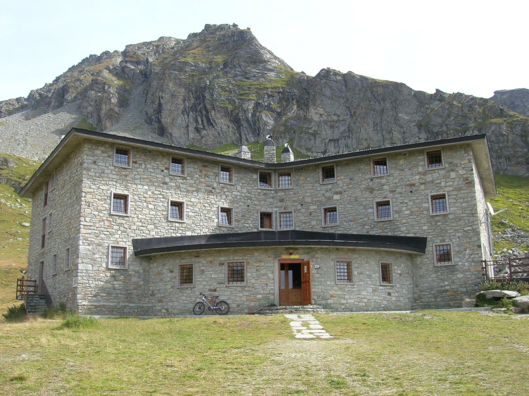
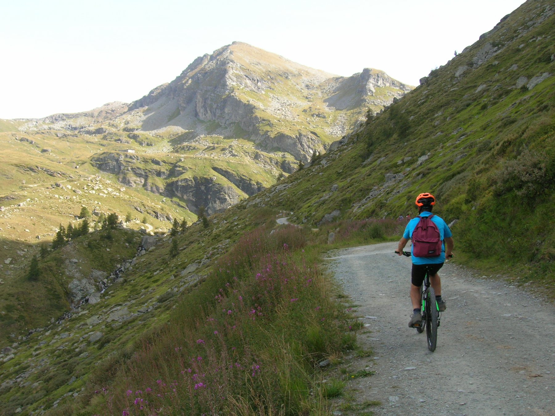
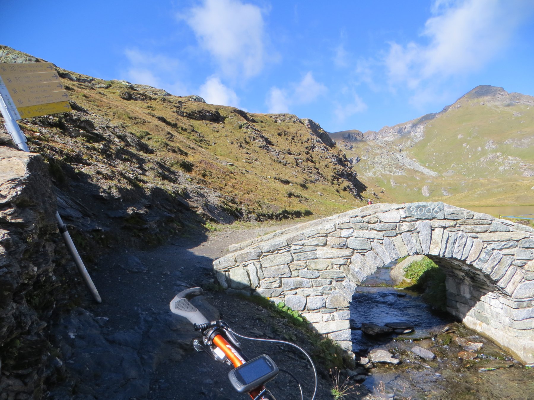
Dal parcheggio di Estoul prendere la bella sterrata (indicazioni Rif.Arp) che con pendenza moderata e brevi strappi molto impegnativi specialmente lungo il tratto finale ci conduce al Rif.Arp m.2420.
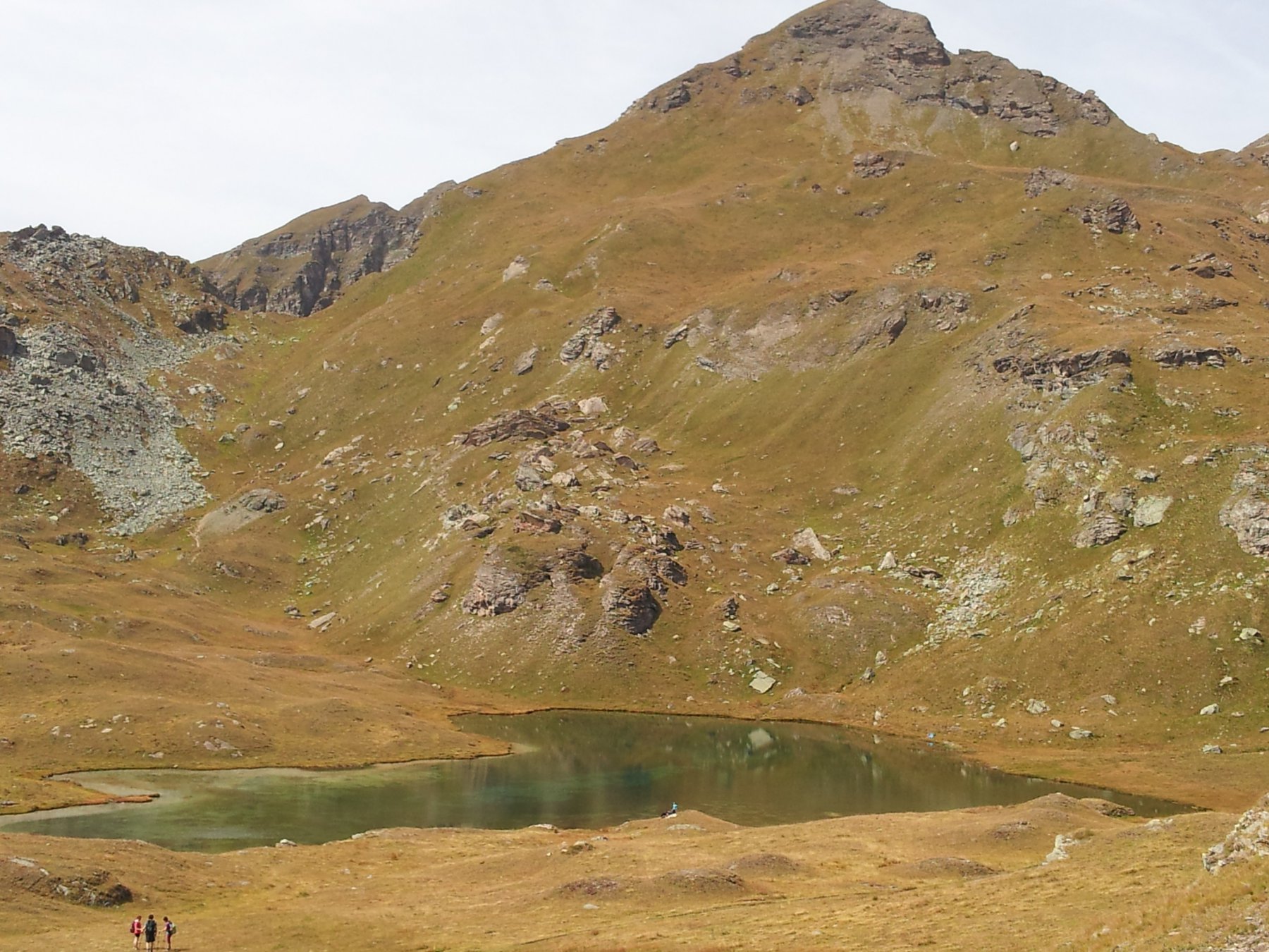
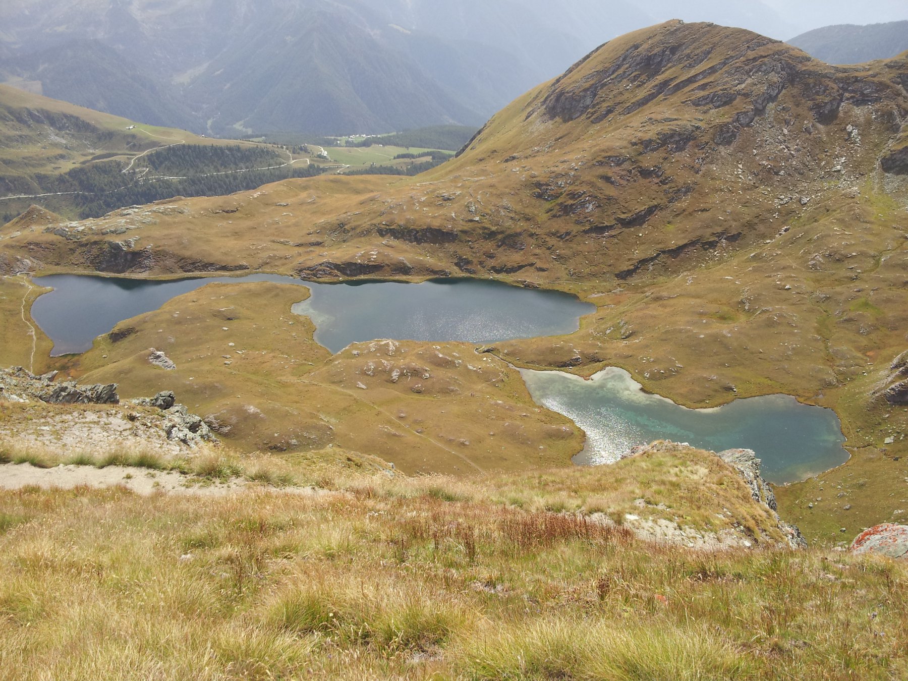
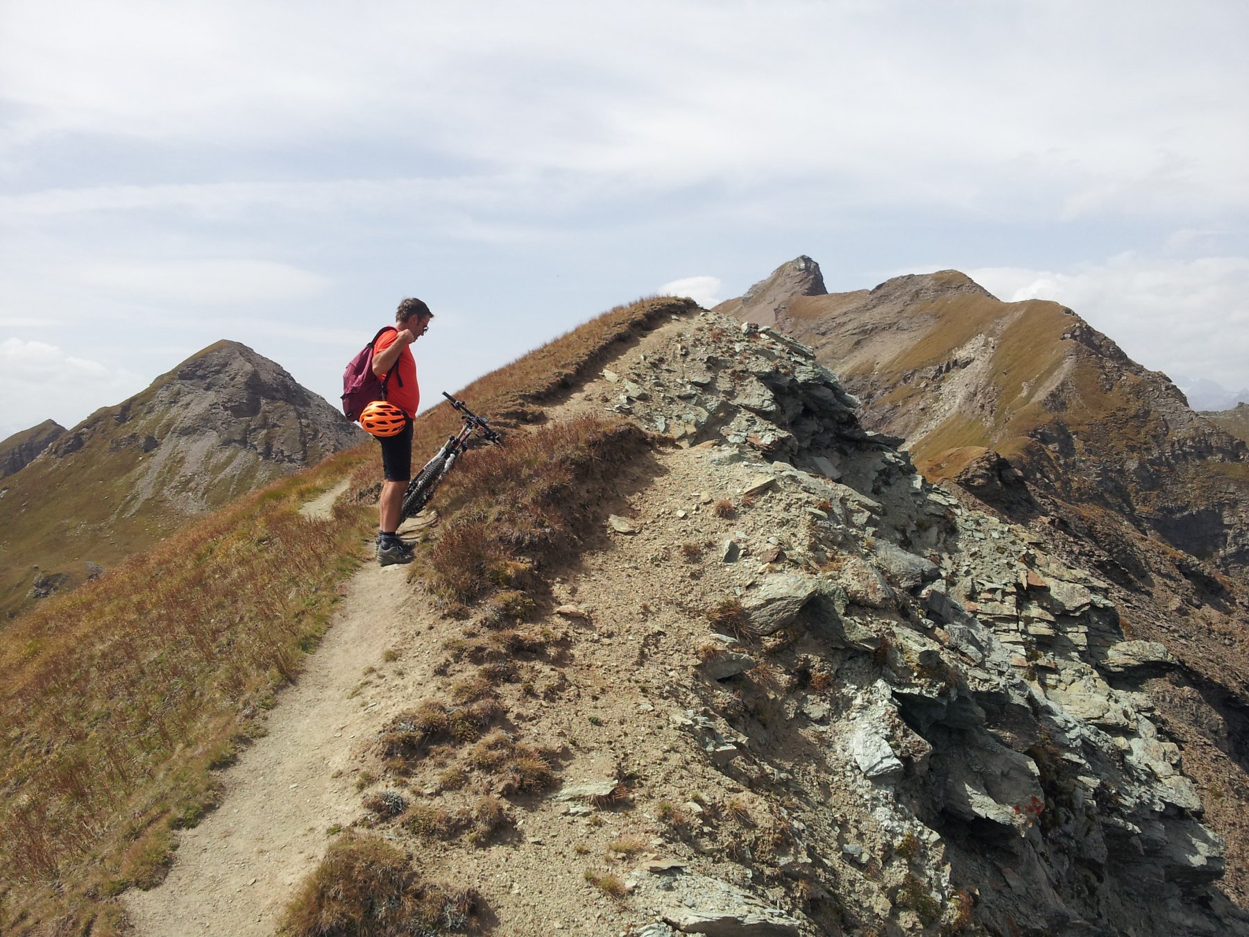
Si prosegue su comodo sentiero a mezzacosta e si raggiunge l’A.Palasina Sup. m.2420; si prosegue a spinta su sentiero (n°105, 40mt di dsl) fino al Lago della Battaglia m.2487 e superato un colletto si arriva in vista del Lago Pocia m.2518 che non si raggiunge ma si devia a destra su sentiero poco evidente fino a ricongiungersi col sentiero 105 (più ripido e non ciclabile); si pedala ancora per poco per lasciare spazio ad un po’ di portage fino al Colle Palasina m.2668 (60mt di dsl) magnifico punto per ammirare il gruppo del M.Rosa.
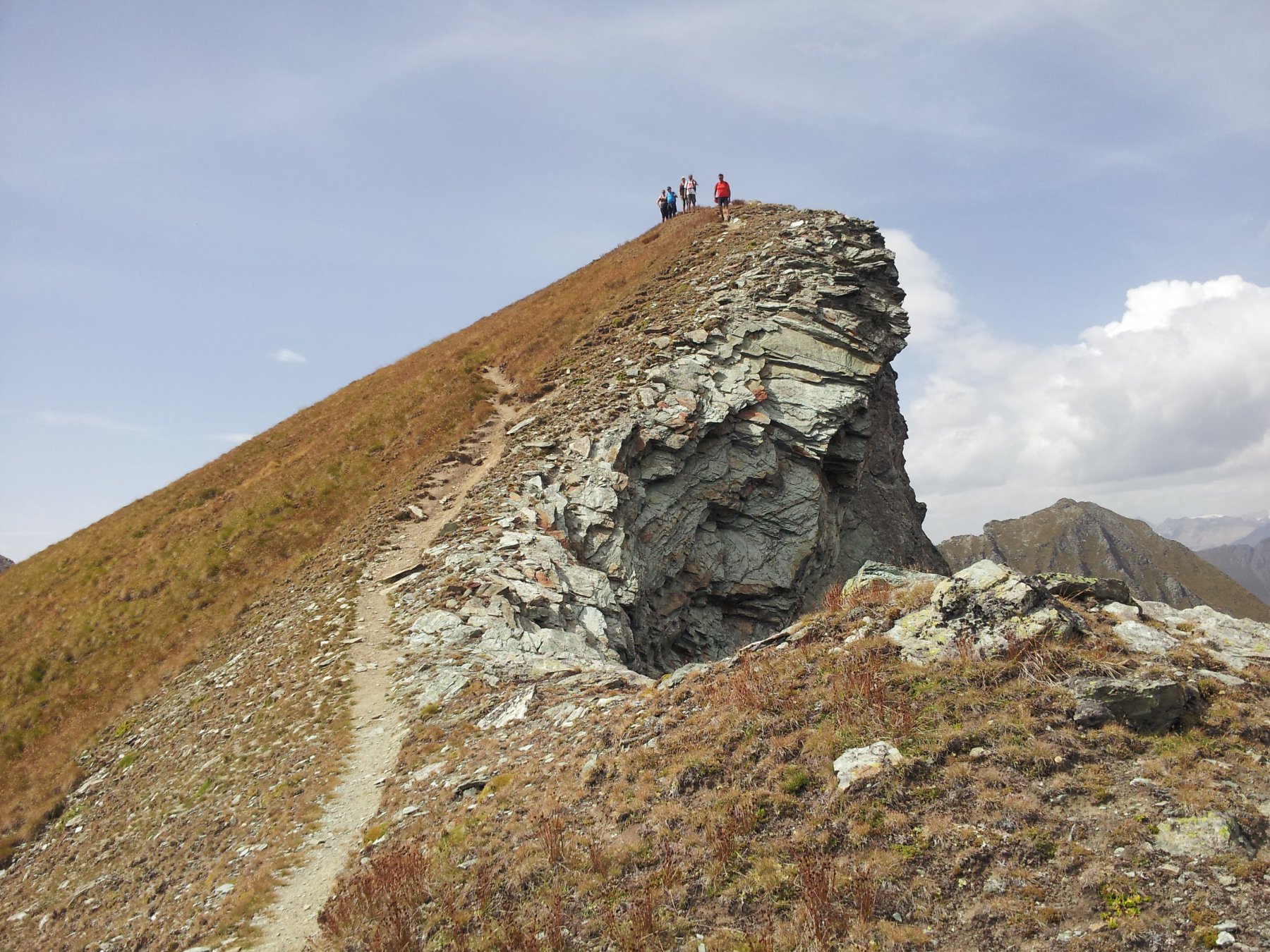
A questo punto si può scegliere se seguire il sentiero che si stacca sulla sinistra oppure seguire la dorsale (più diretta e corta) e ricongiungersi al sentiero principale quasi in cresta (150mt circa di portage).
La parte finale non è difficile ma molto esposta e su cresta alquanto aerea.
DISCESA:
Con la dovuta cautela seguire il sentiero in cresta (S2-S4) che con alcuni tornanti e passaggi esposti ci porta sul più comodo sentiero in basso che va seguito fino al Colle (S2-S4).
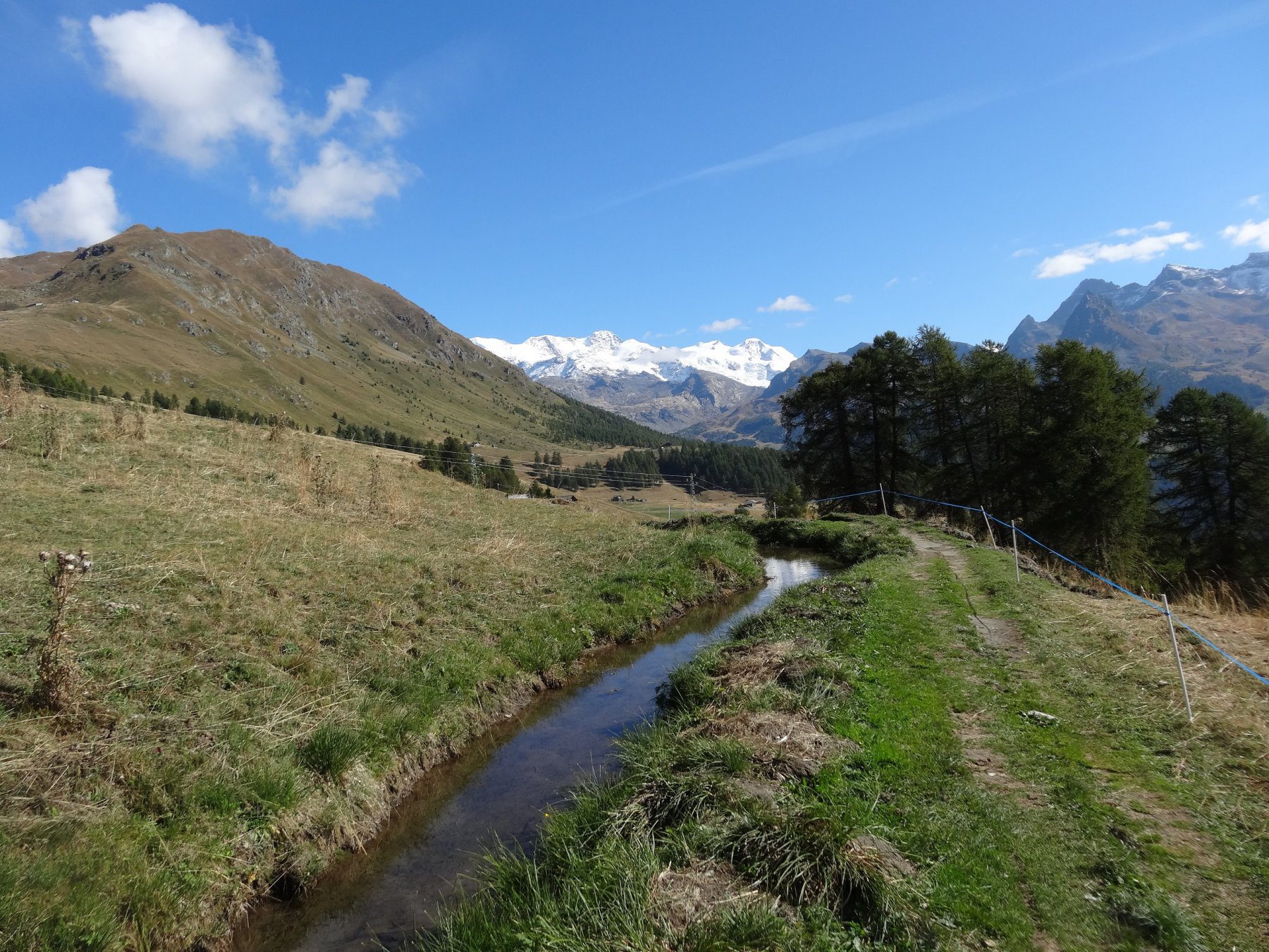
Dal colle si scende verso i laghi con percorso molto tecnico (S4) per poi continuare più facilmente su sentiero molto battuto (S1, passi S2).
Tornati all’A.Palasina Sup. ci sono varie possibilità per tornare alla macchina: seguire la sterrata a ritroso oppure i vari sentieri che la costeggiano e la pista da Dh finale (S2-4).
Nelle vicinanze Mappa
Itinerari
08/10/2023 AO, Brusson D+ 1273 m BC, OC+, S4 Varie
Bussola (Corno) da Estoul
 50m
50m
09/09/2023 AO, Brusson D+ 1380 m MC+, BC, S2 Tutte
Mascognaz, Saint Jacques, Ru Courtod da Arcesaz, Balconata alta Val d’Ayas
 3.6Km
3.6Km
26/07/2024 AO, Brusson D+ 1220 m MC+, BC+, S3 Sud
Palasina (Laghi di) da Brusson, anello
 5.2Km
5.2Km
21/06/2009 AO, Brusson D+ 1000 m MC, BC+, S2 Varie
Ranzola (Colle della) da Brusson, anello
 5.2Km
5.2Km
19/08/2010 AO, Brusson D+ 500 m BC+, BC+, S1 Varie
Tzecore (Col) da Brusson, giro della Testa di Comagna
5.2Km
24/06/2006 AO, Brusson D+ 450 m MC, MC, S0 Varie
Frudiera (Alpi) da Brusson per Graines
5.2Km
18/06/2016 AO, Brusson D+ 1100 m MC, MC, S0 Sud
Arp (Rifugio) da Brusson
5.2Km
07/08/2004 AO, Brusson D+ 2100 m OC, BC, S3 Varie
Palasina (Colle e Laghi di) da Brusson, giro dell’Alta Valle d’Ayas per Mascognaz, Crest, Antagnod
5.2Km
31/08/2024 AO, Brusson D+ 1500 m MC+, BC+, S2 Nord
Grand Tournalin (Rifugio) da Brusson, giro della Val d’Ayas per il Col de Joux e Ru Courtod
 5.2Km
5.2Km
13/08/2017 AO, Brusson D+ 1800 m TC, TC, S0 Nord
Bettaforca (Colle) da Brusson, anello per il Colle Ranzola
5.2Km
Servizi
1.3Km
4.9Km
Le Coin des Melezes B&B
Brusson
5.8Km
Laghetto Albergo
Brusson
6.1Km
Gran Baita Albergo
Gressoney-Saint-Jean
6.2Km
La Grolla Campeggio
Challant
6.4Km
Flying brasserie (Paul Verlaine) Ristorante
Gressoney-Saint-Jean
6.7Km
Kleine bar Ristorante
Gressoney-Saint-Jean
7.9Km
Bìerfall Ristorante
Gressoney-Saint-Jean
9.4Km