8.4Km
8.4Km
Note
Storico
 0m
0m
50m
50m
50m
50m
50m
0m
0m
50m
50m
50m
50m
50m
Bella e non difficile gita al cospetto del Rutor, dopo il rifugio non c'è più sentiero, soltanto tracce, ma il terreno non è particolarmente accidentato almeno fino ai laghi Usellettes.
Avvicinamento
Autostrada Torino-Aosta uscita Morgex, oppure SS26 fino a Prè Saint Didier, dove si prosegue a sinistra per il Colle del Piccolo San Bernardo fino a la Thuile. Raggiunto il paese, attraversarlo e seguire la strada per la località La Joux. Il posteggio, ampio, è a pagamento (5 euro giornalieri). Nei sabati e festivi la strada è transitabile fino alle 9, dopo è presente il servizio navetta.
Descrizione
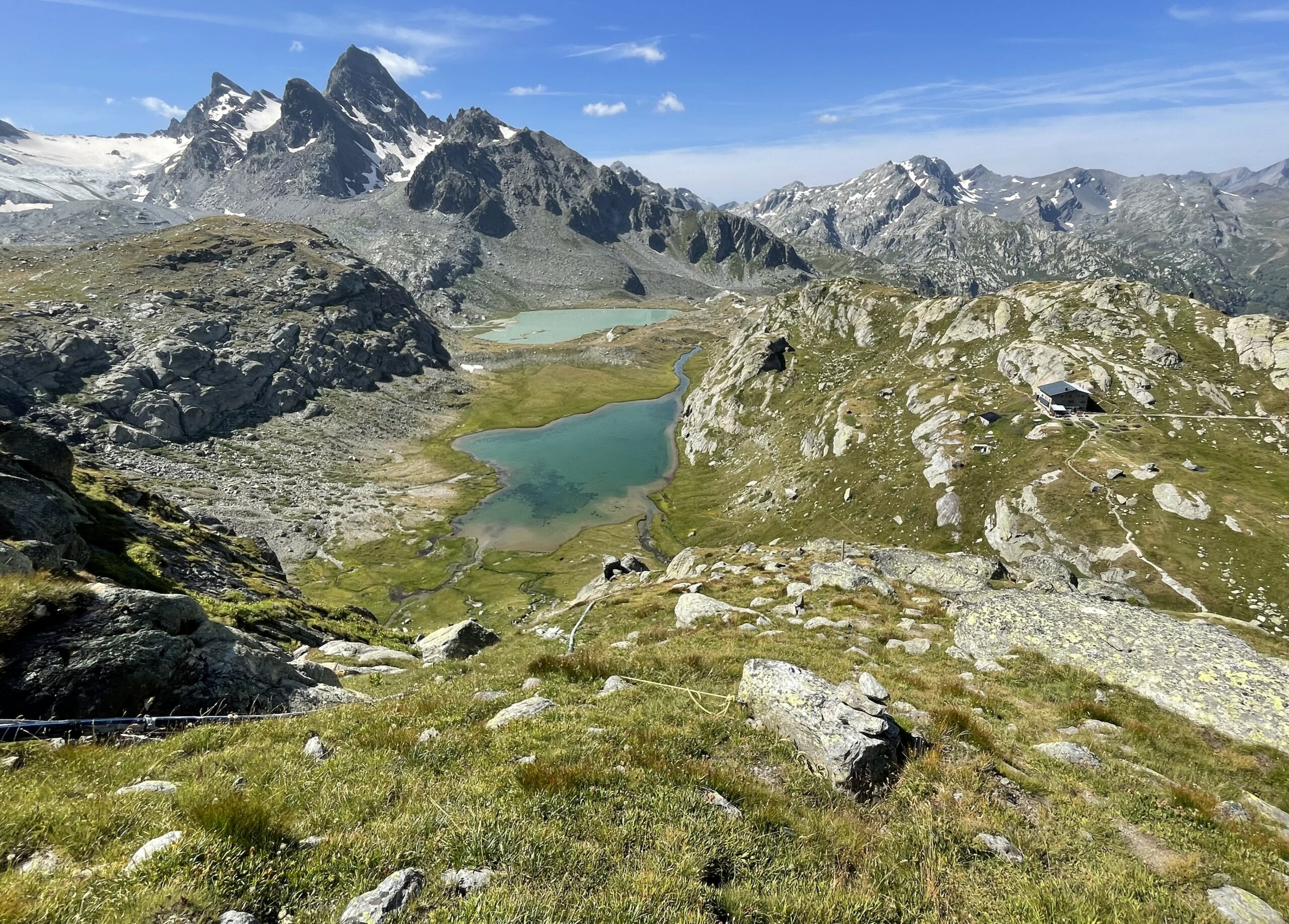
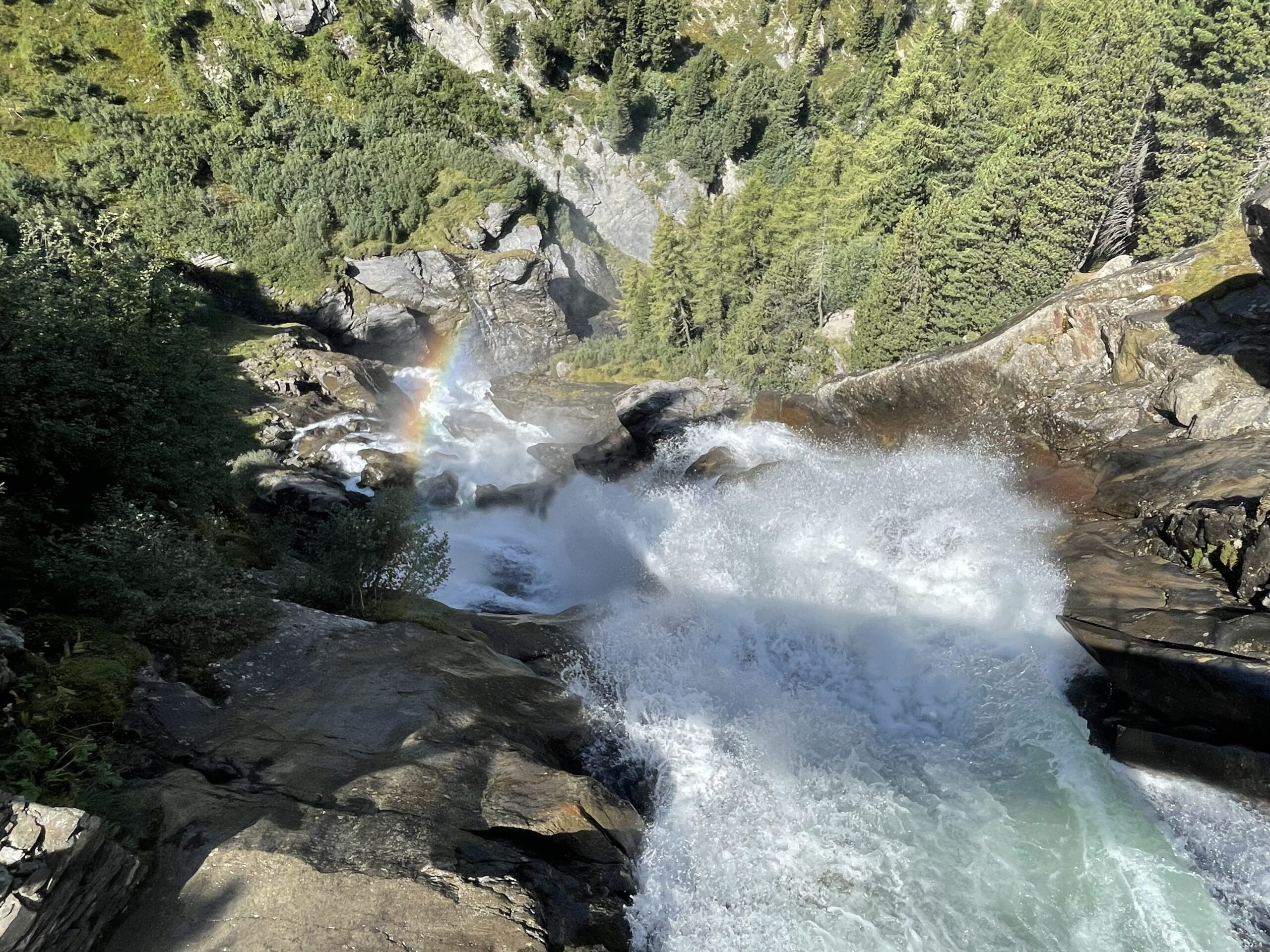
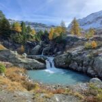
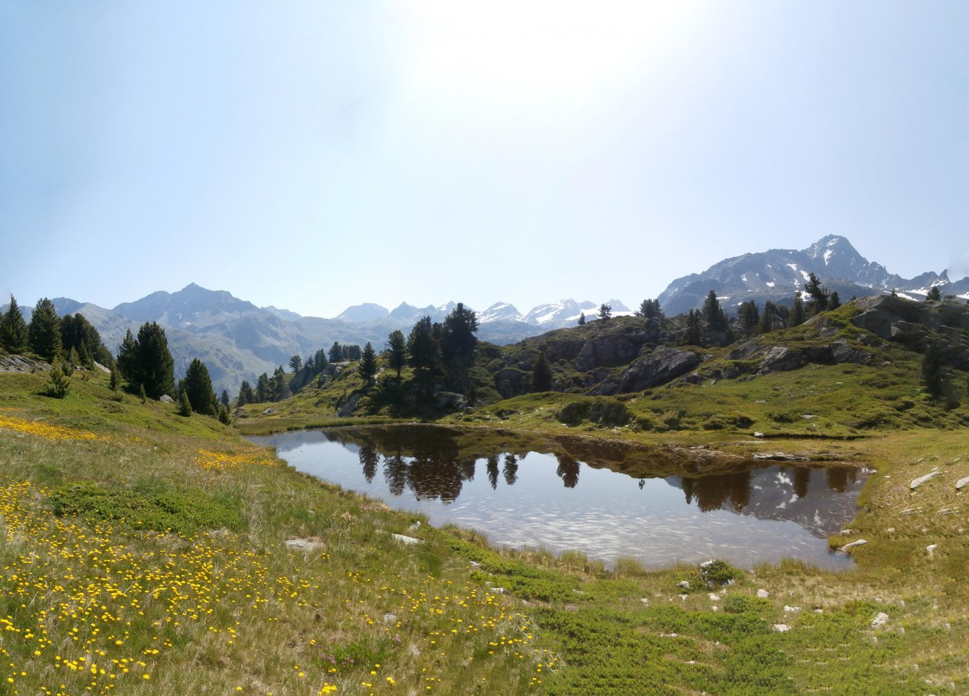
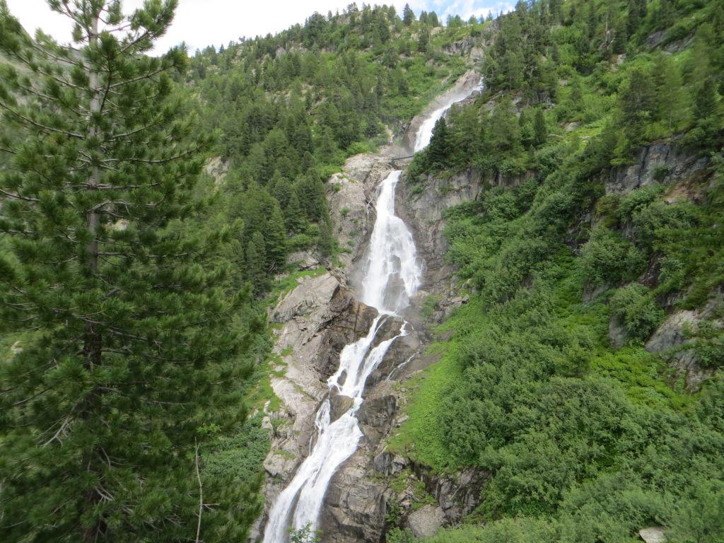
Dal parcheggio di La Joux attraversare subito la Dora sul ponte seguendo le indicazioni del sentiero n.3 e Alta Via n.2 per il Rifugio Deffeyes. La bella mulattiera sale regolare nel bosco, passando nei pressi delle tre cascate del Rutor (brevi deviazioni indicate). Si esce dal bosco a quota 2100 m circa, giungendo al ripiano erboso dell’Alpage du Glacier, con un bel lago (torbiera).
La mulattiera prosegue sul pendio sovrastante, per poi spostarsi marcatamente verso destra entrando in un avvallamento, ed infine si raggiunge il Rifugio Deffeyes 2500 m.
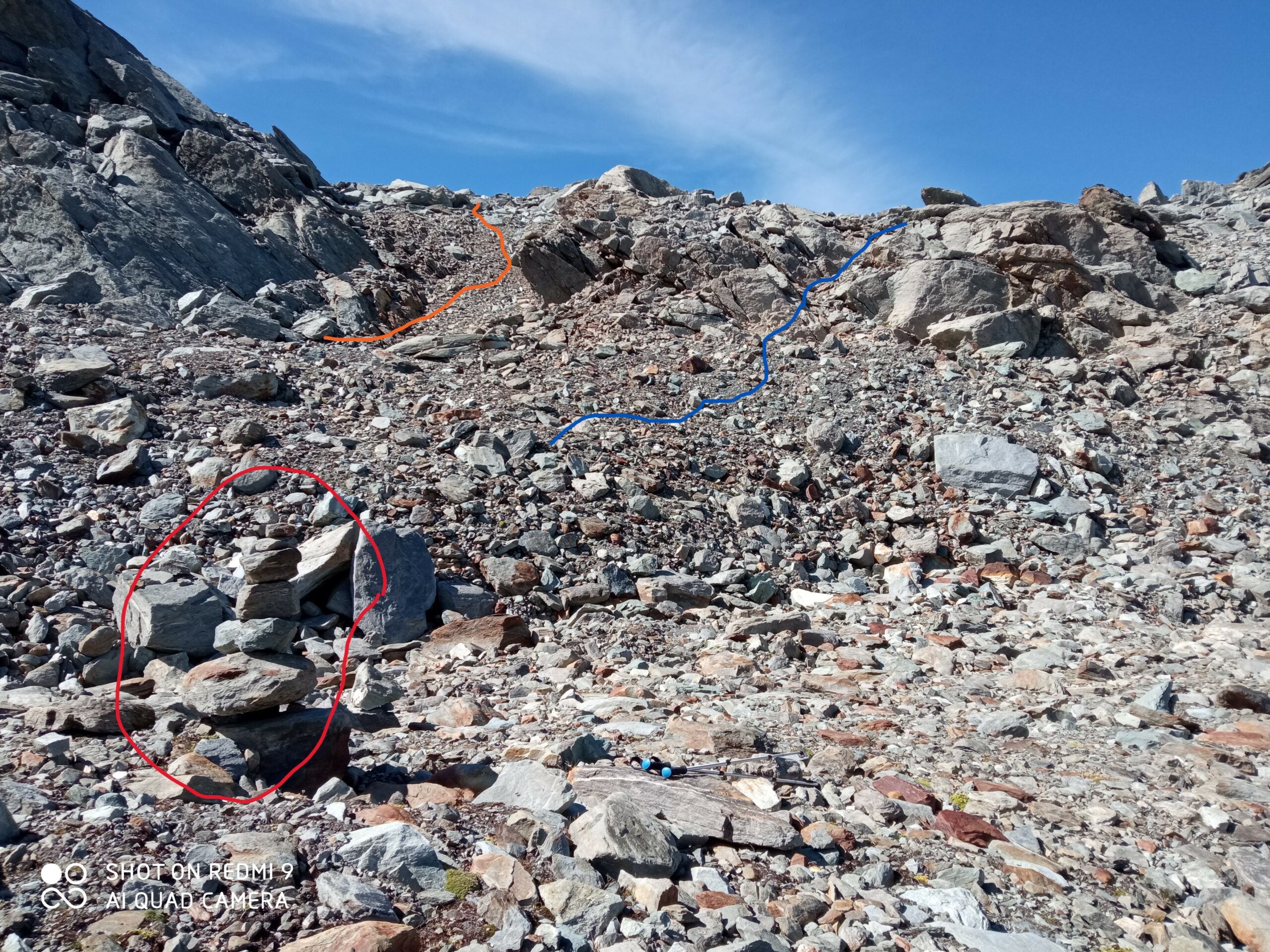
Dal rifugio si scende al ponticello sottostante, dopo averlo passato, si abbandonano i sentieri per il Passo Alto e per il Colle di Planaval, a favore di una traccia non segnalata se non da un ometto, che sale subito a sinistra sul ripido pendio erboso, nelle vicinanze di un tubo dell’acqua per la centralina idroelettrica del rifugio. Questa traccia sale ripida a serpentine portandosi nei pressi del torrente des Usellettes, fino a sbucare su un vasto altopiano erboso.
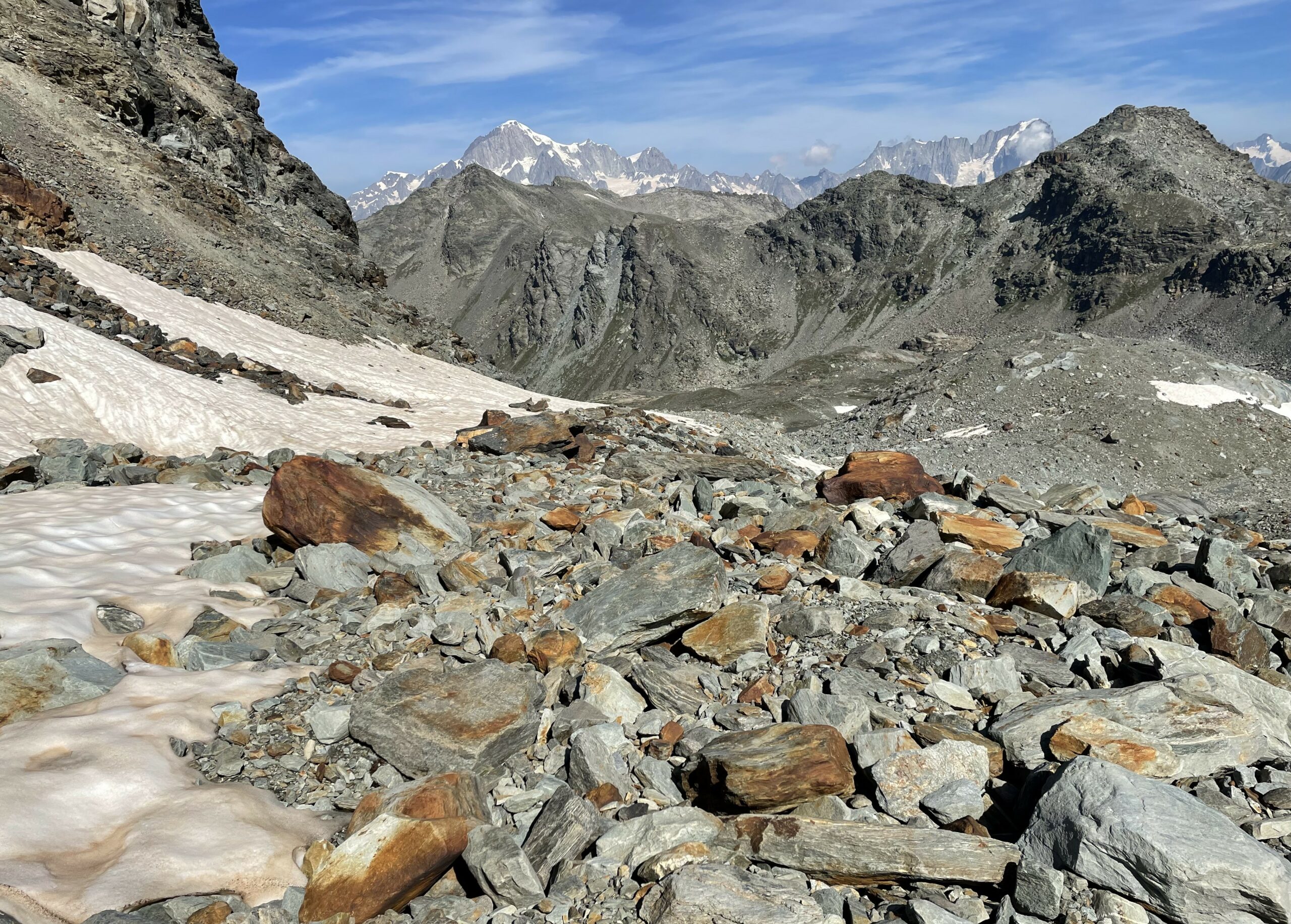
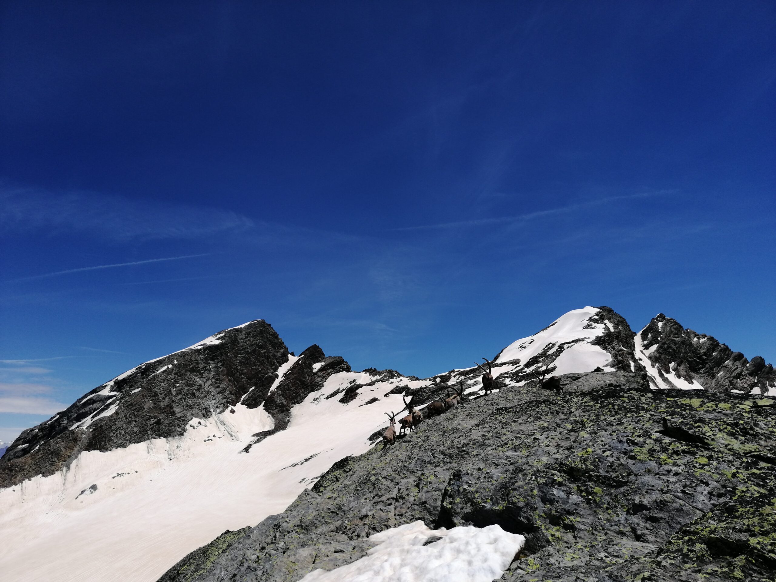
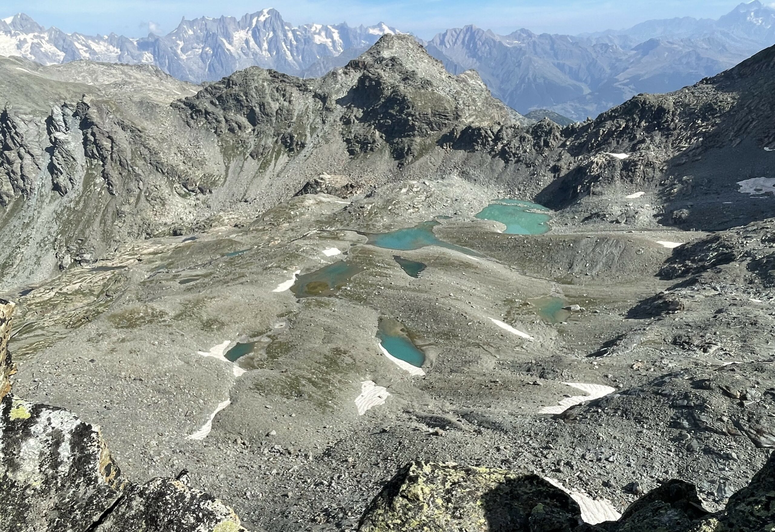
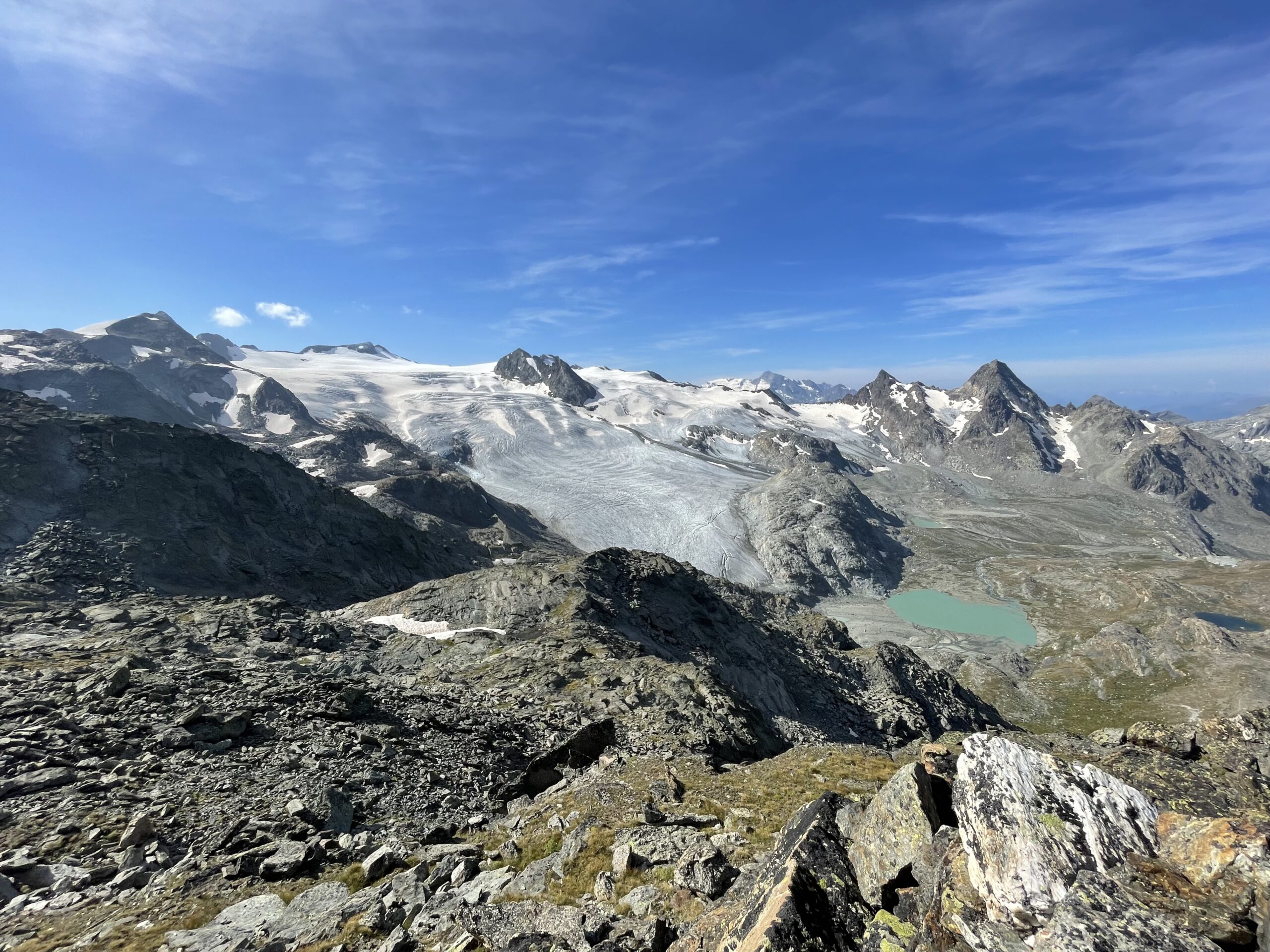
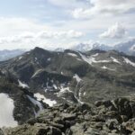
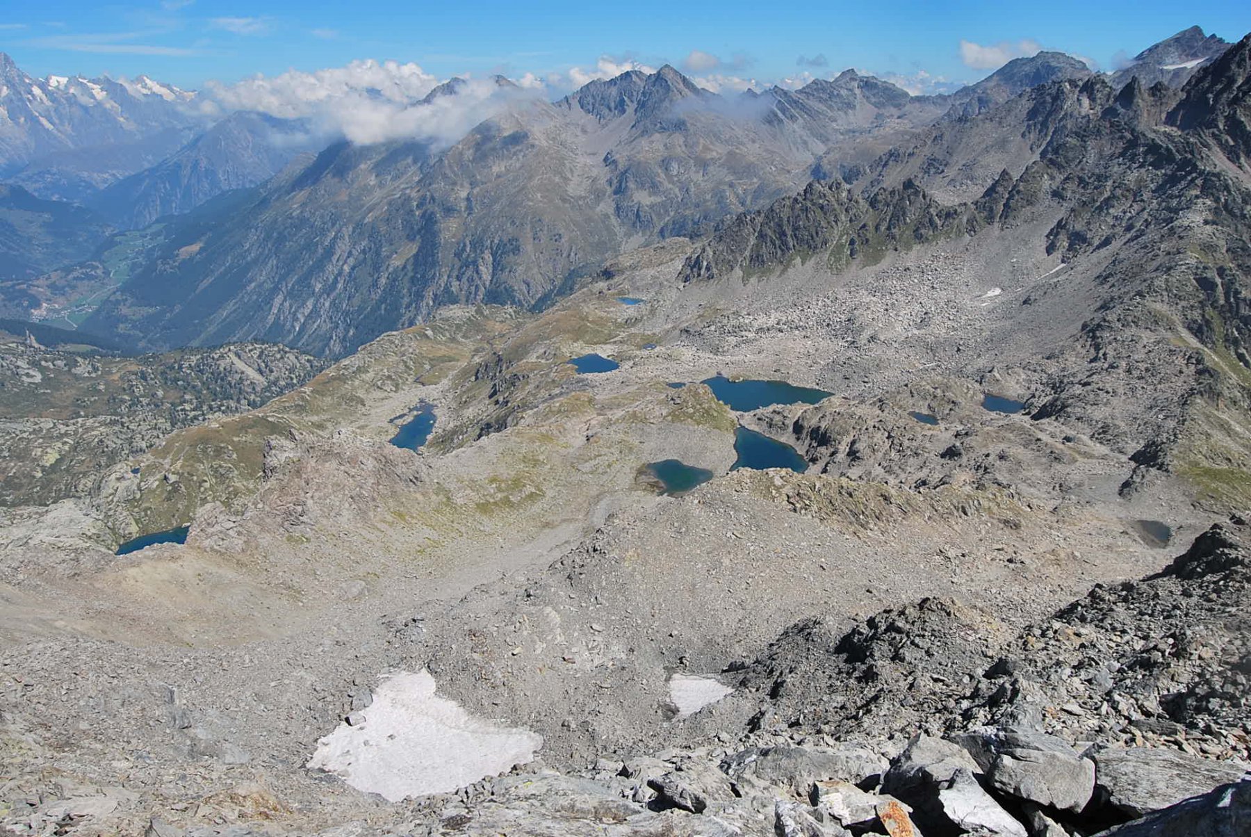
Seguendo gli ometti e restando sempre nei pressi del torrente, non c’è percorso obbligato, si attraversa dolcemente tutto l’altopiano solcato dal torrente fino a raggiungere una prima morena detritica. Qui, seguendo gli ometti, si inizia a deviare progressivamente verso destra, per aggirare il ripido versante nord della Pointe des Invergneures. Si lasciano a sinistra poco più in basso i bellissimi laghi Usellettes 2880 m, salendo per dossi ed avvallamenti fino ad un pendio più ripido, che darà accesso alla conca dove un tempo si estendeva il ghiacciaio des Invergenures.
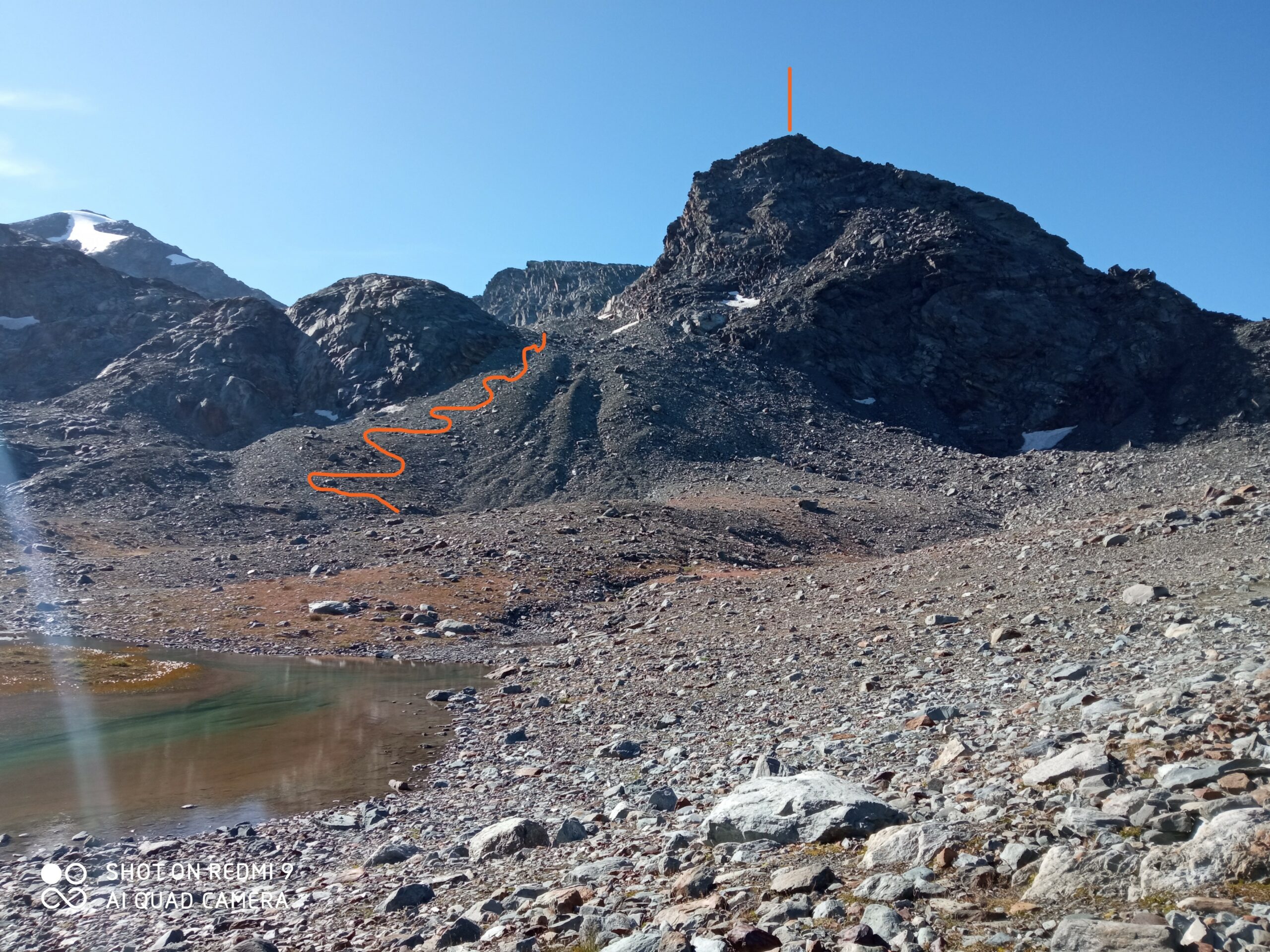
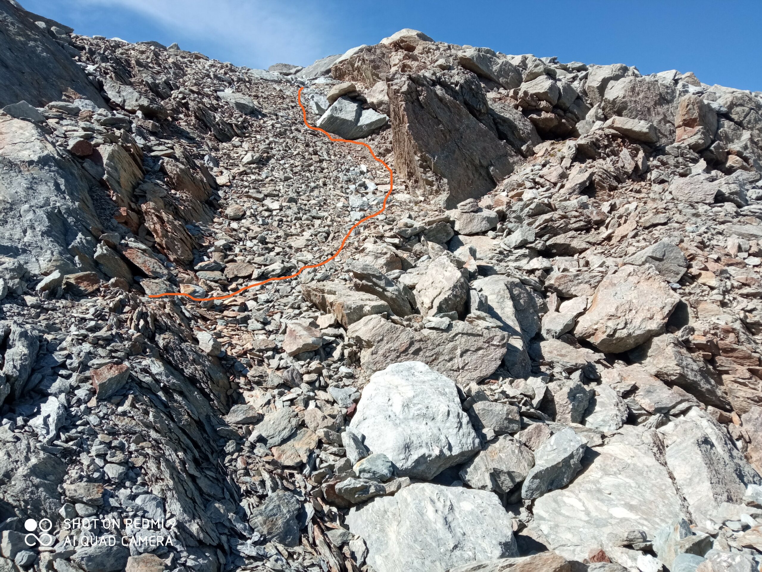
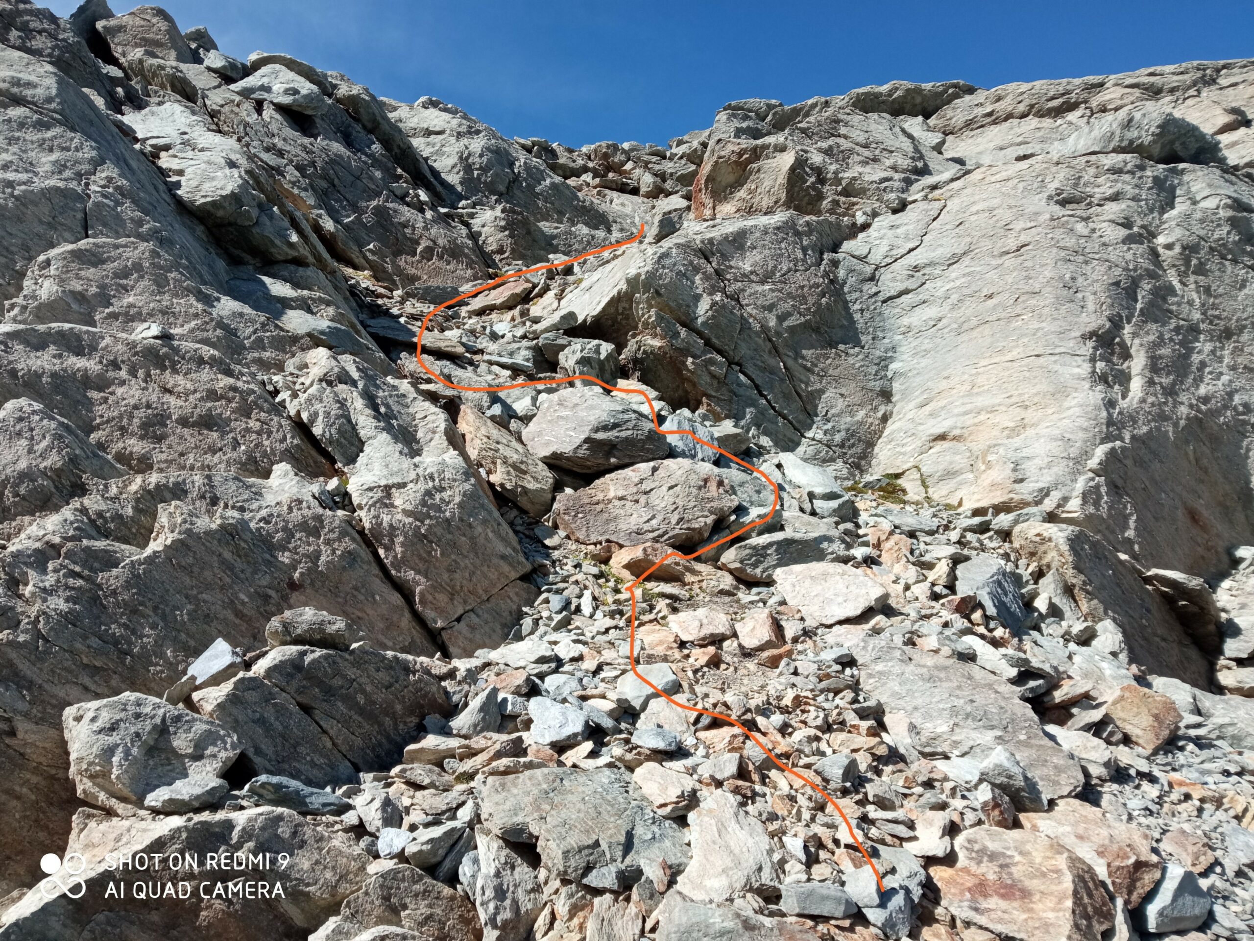
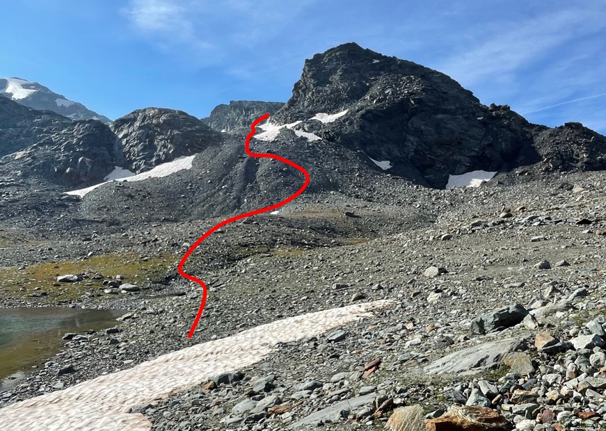
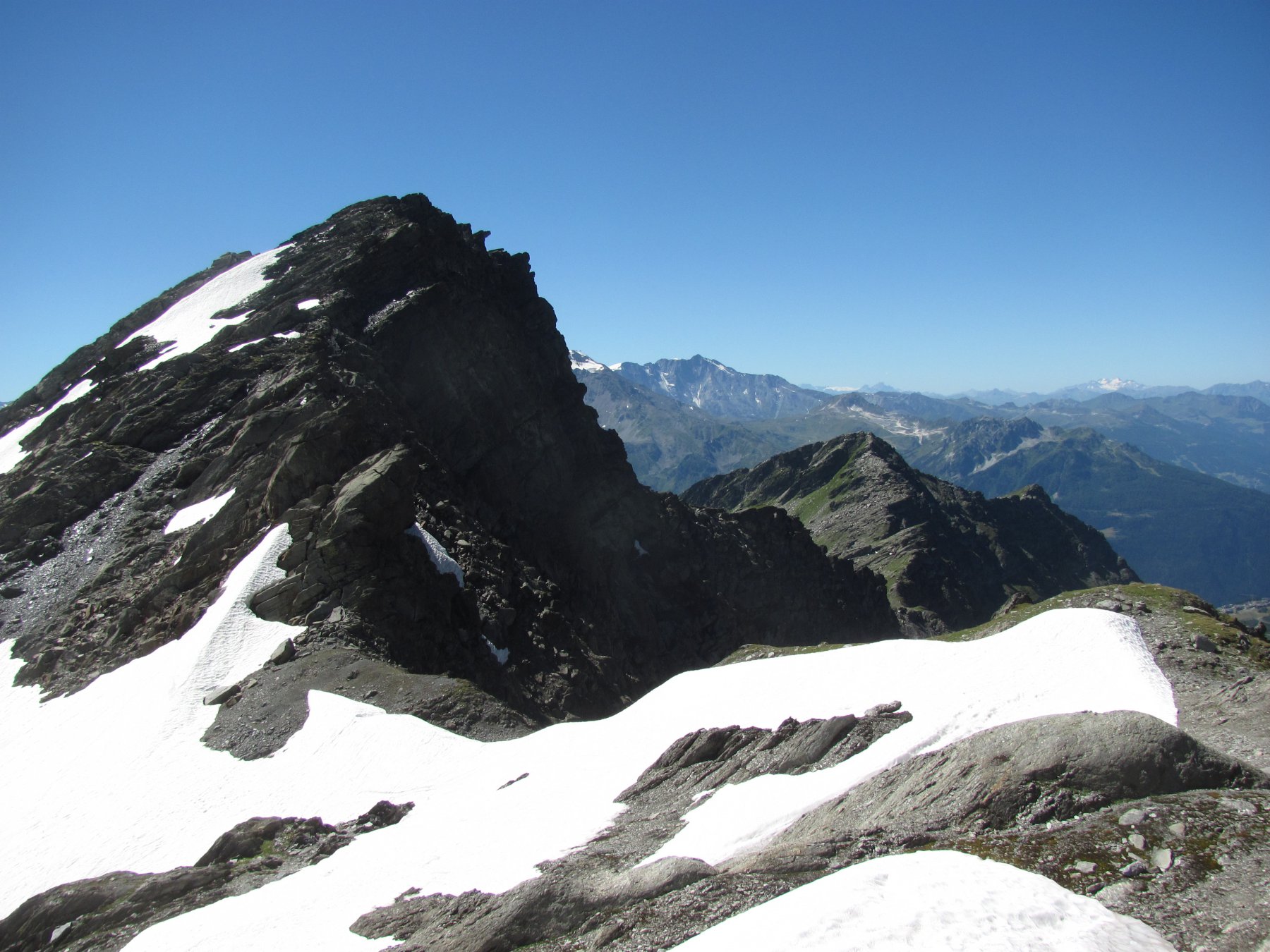
Si sale il pendio abbastanza faticoso ma privo di difficoltà, sbucando così nella conca con un tratto di pietraia. Conviene portarsi subito sul margine destro di essa, arrivando alla base, sulla destra, di una modesta balza rocciosa che si risale con estrema facilità sfruttando alcune brecce (quella centrale è probabilmente la più comoda).
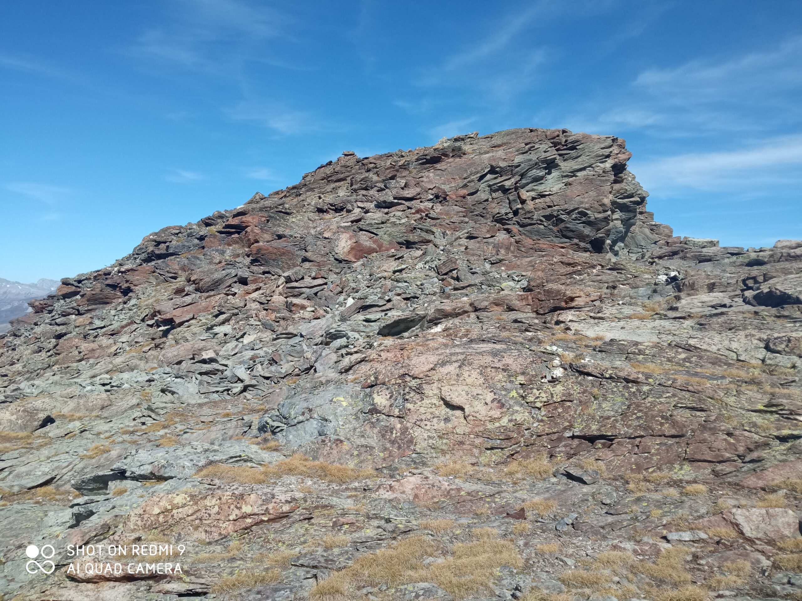
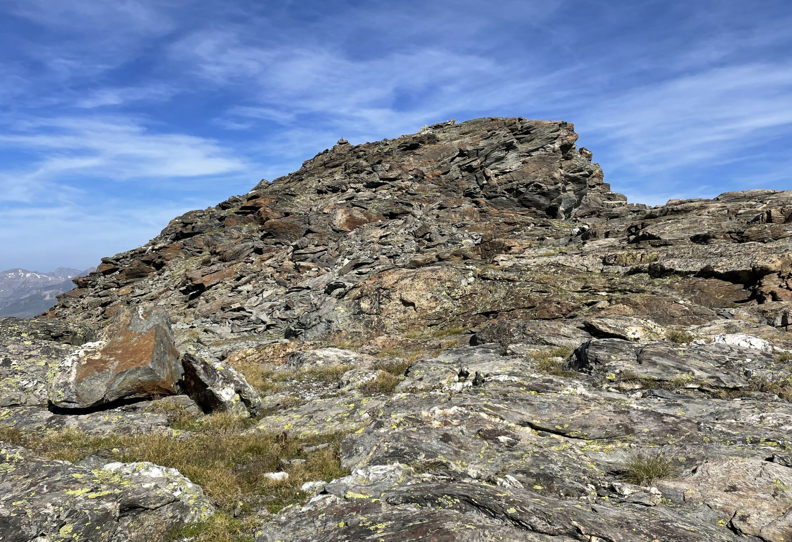
Si arriva ad una sella dove il terreno torna erboso, quindi proseguendo a destra per facili e comodi terrazzi rocciosi, ci si porta sotto la cima, piuttosto aguzza e composta da alcuni massi in equilibrio.
La discesa avviene dallo stesso percorso di salita, con le seguenti possibili deviazioni:
1 . Scendere nella conca dei laghi Usellettes, almeno per vederli da vicino, e poi proseguire per tracce sulla destra fino a raggiungere il sentiero dell’alta via n.2 sotto il pendio per il Passo Alto. Da qui scendere al Rifugio Deffeyes (percorso più lungo)
2. Tornati al rifugio, anzichè rientrare dal percorso di salita, scendere al Lago inferiore del Rutor 2419 m, nella conca sottostante e costeggiarlo sulla sinistra; poco dopo si raggiunge il secondo e bellissimo Lago dei Seracchi 2385 , di un colore grigiastro nel quale si tuffa l’impetuoso torrente che ha origine dal ghiacciaio del Rutor. Al termine del lago, sulla destra, si incontrano dei cartelli indicanti la Joux. Il percorso scende prima a mezza costa, poi più ripido superando una breve paretina rocciosa (attenzione con terreno umido) fino al Plan de la Liere, dovesi incontra il sentiero n.8 proveniente dai Laghi di Bellacomba, e dopo aver attraversato il ponte, ecco il sentiero n.3 dell’andata con il quale si fa ritorno a La Joux.
3. Raggiunta la terza cascata del Rutor, imponente, si può attraversare il torrente sul ponte sospeso (bagnatissimo) e seguire il sentiero del Centocinquantenario, che scende sul versante opposto della Dora rispetto a quello di salita. Inizialmente ripido, nella parte bassa compie dei giri un po’ più ampi allungando un po’ il tragitto (ci sono anche alcune brevi risalita). Ci si può comunque ricollegare al sentiero n.3 in corrispondenza della seconda cascata.
Giovan Battista e Giuseppe Origoni primi salitori noti, il 2/9/1891
- Cartografia:
- 4Land, "Rutor-Sassière, 1:25.000
- Bibliografia:
-
Andrea Greci e Federico Rossetti, vol. 5 "Rutor-Sassière" della collana Vie Normali Valle d'Aosta
Alessandro Giorgetta, Alpi Graie centrali, Guide dei Monti d'Italia CAI/TCI
Nelle vicinanze Mappa
Itinerari
10/06/2025 AO, La Thuile D+ 950 m E Varie
Deffeyes Albert (Rifugio) da la Joux
 0m
0m
14/07/2019 AO, La Thuile D+ 733 m EE Est
Bellacomba (Laghi di) da La Joux
 0m
0m
16/08/2021 AO, La Thuile D+ 1400 m EE Sud
Colmet (Col) da la Joux per la Cobassa
50m
28/09/2006 AO, La Thuile D+ 1051 m E Nord-Est
Louy Blanche (Colle) da La Joux
50m
15/08/2016 AO, La Thuile D+ 1208 m EE Varie
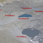
Bella Valletta (Monte) e Laghi di Ponteilles da la Joux
 50m
50m
21/07/2021 AO, La Thuile D+ 1500 m EE/F Varie
Monchette (Monte) da la Joux
 50m
50m
29/09/2019 AO, La Thuile D+ 400 m E Nord
Rutor (Cascate del) da La Joux per il sentiero del Centocinquantenario
 50m
50m
08/08/2025 AO, La Thuile D+ 1400 m EE Varie
Freduaz Meridionale (Monte) da La Joux per il Laghi di Bellacomba
 50m
50m
04/08/2007 AO, La Thuile D+ 1200 m E Varie
Lex Blanche (Col de la) da la Joux
50m
10/10/2023 AO, La Thuile D+ 1315 m EE Varie
Rouges (Dents) o Mont Charve da la Joux per il Col Tachuy
 50m
50m