4.9Km
4.9Km
Note
Storico
 100m
1.9Km
1.9Km
2.5Km
4.1Km
4.1Km
4.1Km
4.1Km
4.1Km
100m
1.9Km
1.9Km
2.5Km
4.1Km
4.1Km
4.1Km
4.1Km
4.1Km
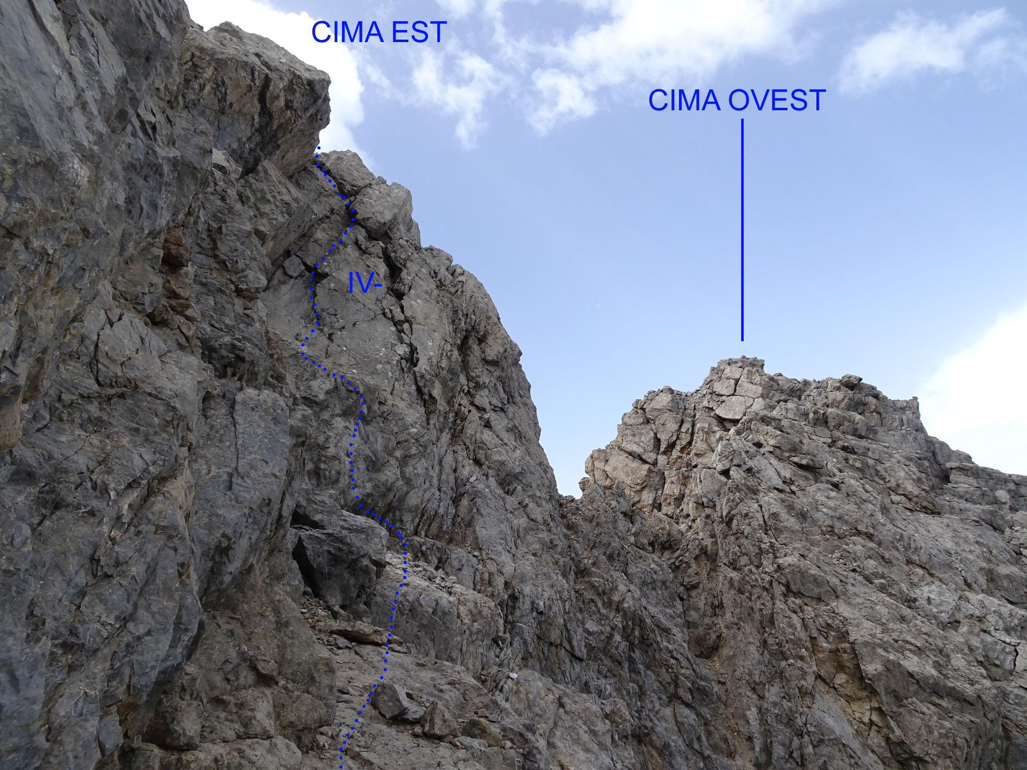
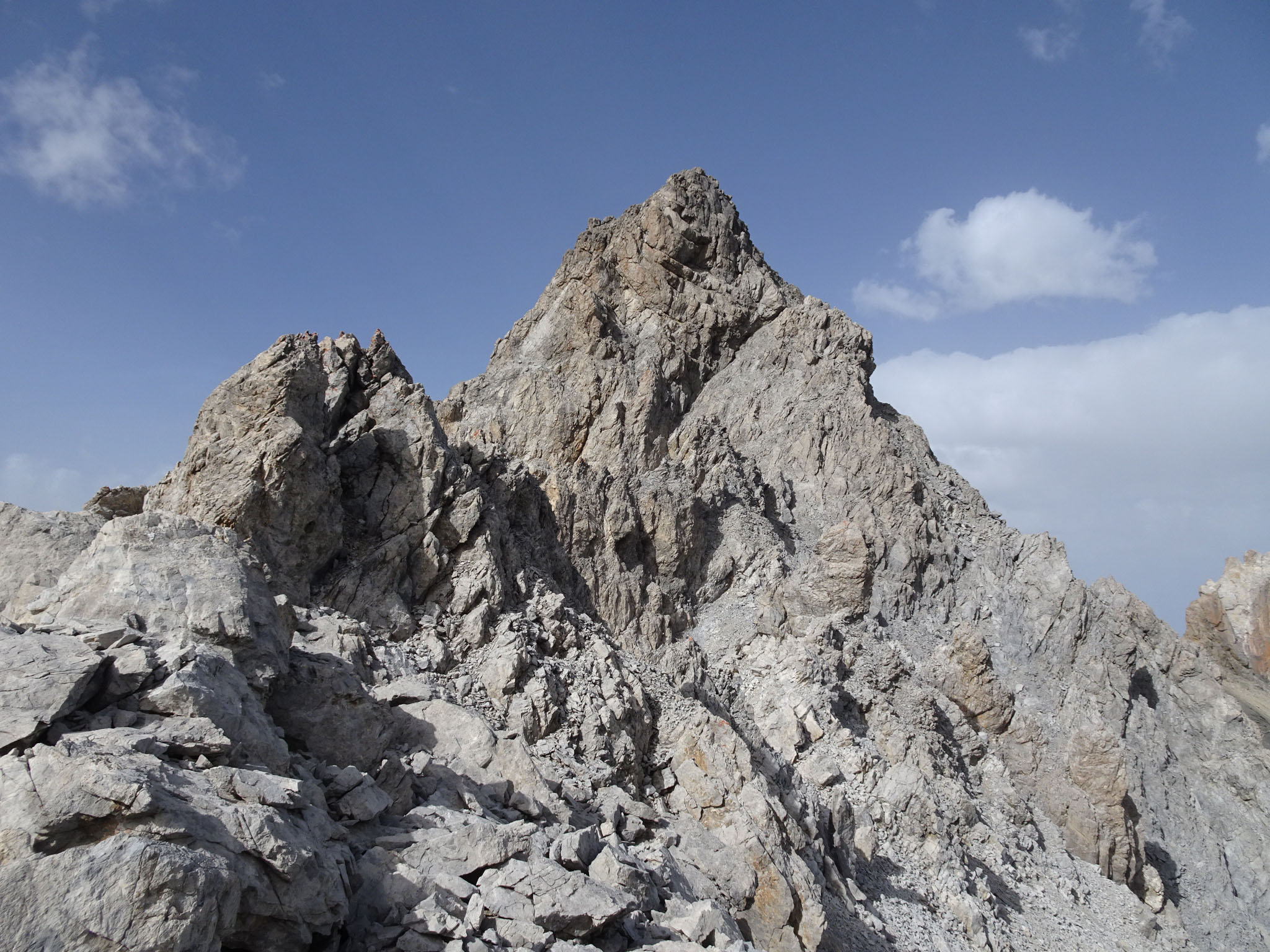
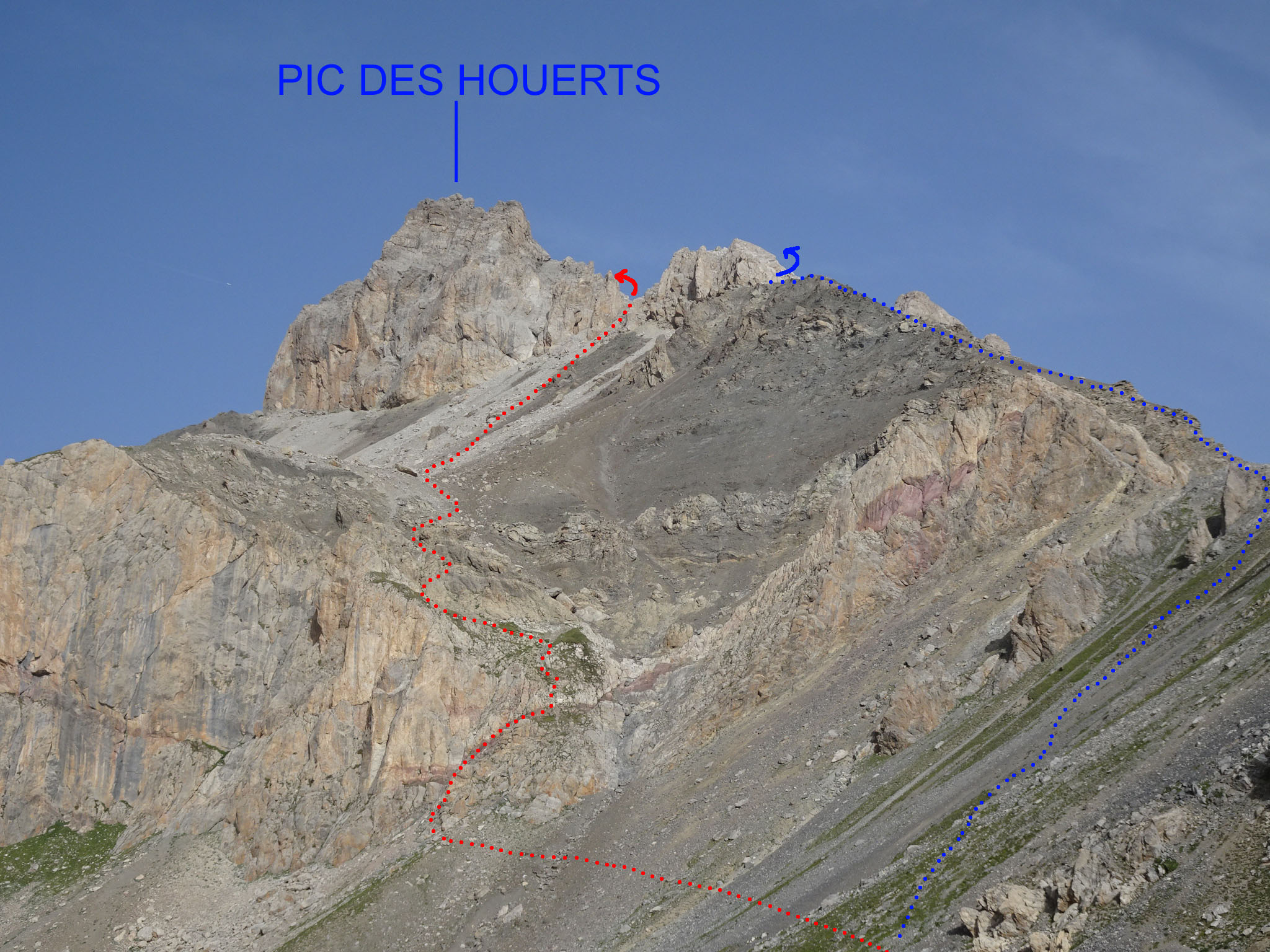
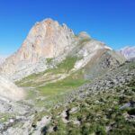
Montagna di roccia calcarea del gruppo della Font Sancte, pochissimo visitata, con vetta bifida: cima est più alta di 2m della cima ovest. Roccia decisamente scadente, che richiede piede fermo e verifica di ogni appiglio.
Si descrivono due opzioni di salita/discesa, che riprendono le uniche relazioni di salite presenti sul web.
Materiale: corda da 30m, nut, friend medi, cordoni da abbandono.
Avvicinamento
Si descrivono due opzioni di salita/discesa, che riprendono le uniche relazioni di salite presenti sul web.
Materiale: corda da 30m, nut, friend medi, cordoni da abbandono.
Cuneo-Colle della Maddalena-St.Paul-strada per Maljasset oppure Torino-Monginevro-Briancon-Col di Vars-St.Paul-strada per Maljasset. Il sentiero inizia 1,5km dopo il secondo ponte (cartello).
Descrizione
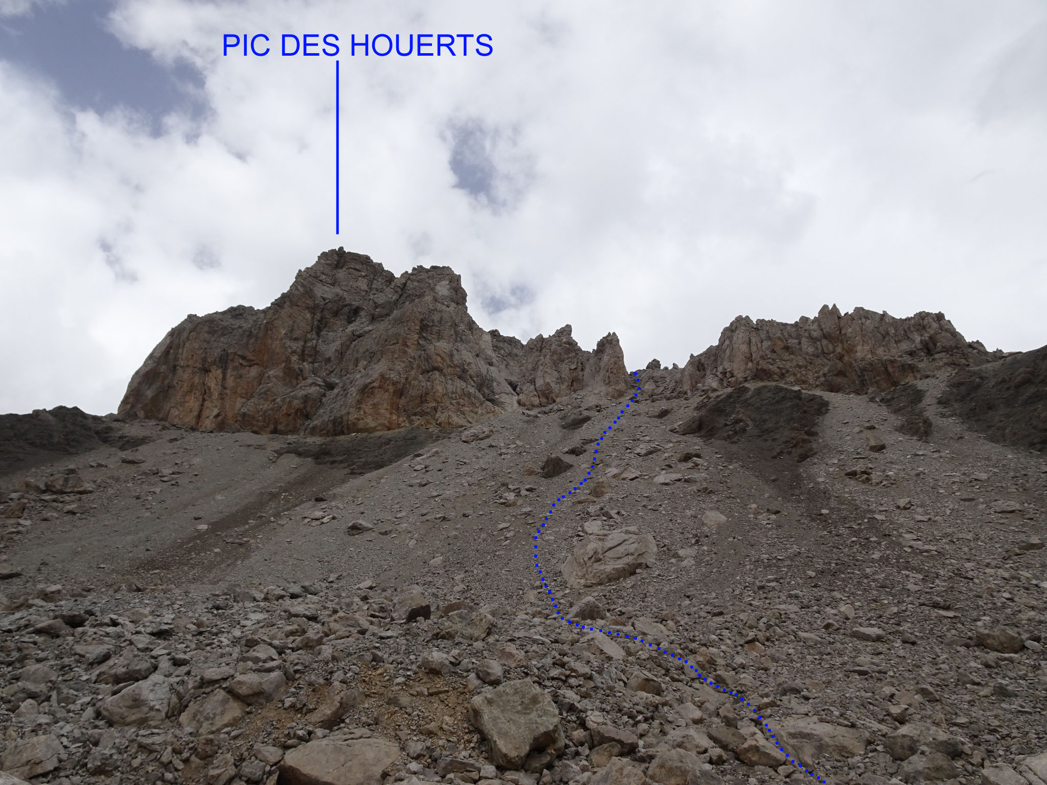
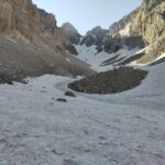
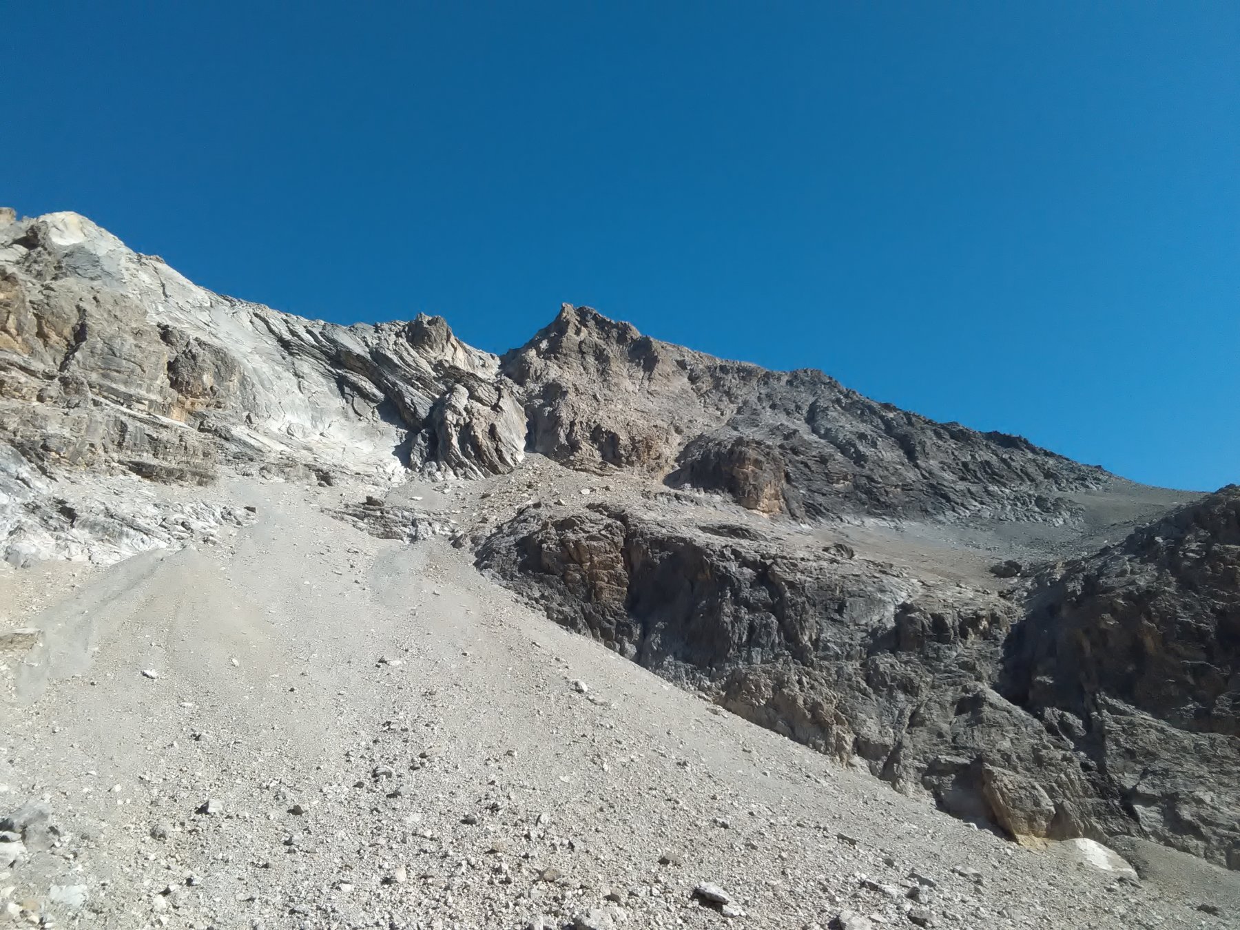
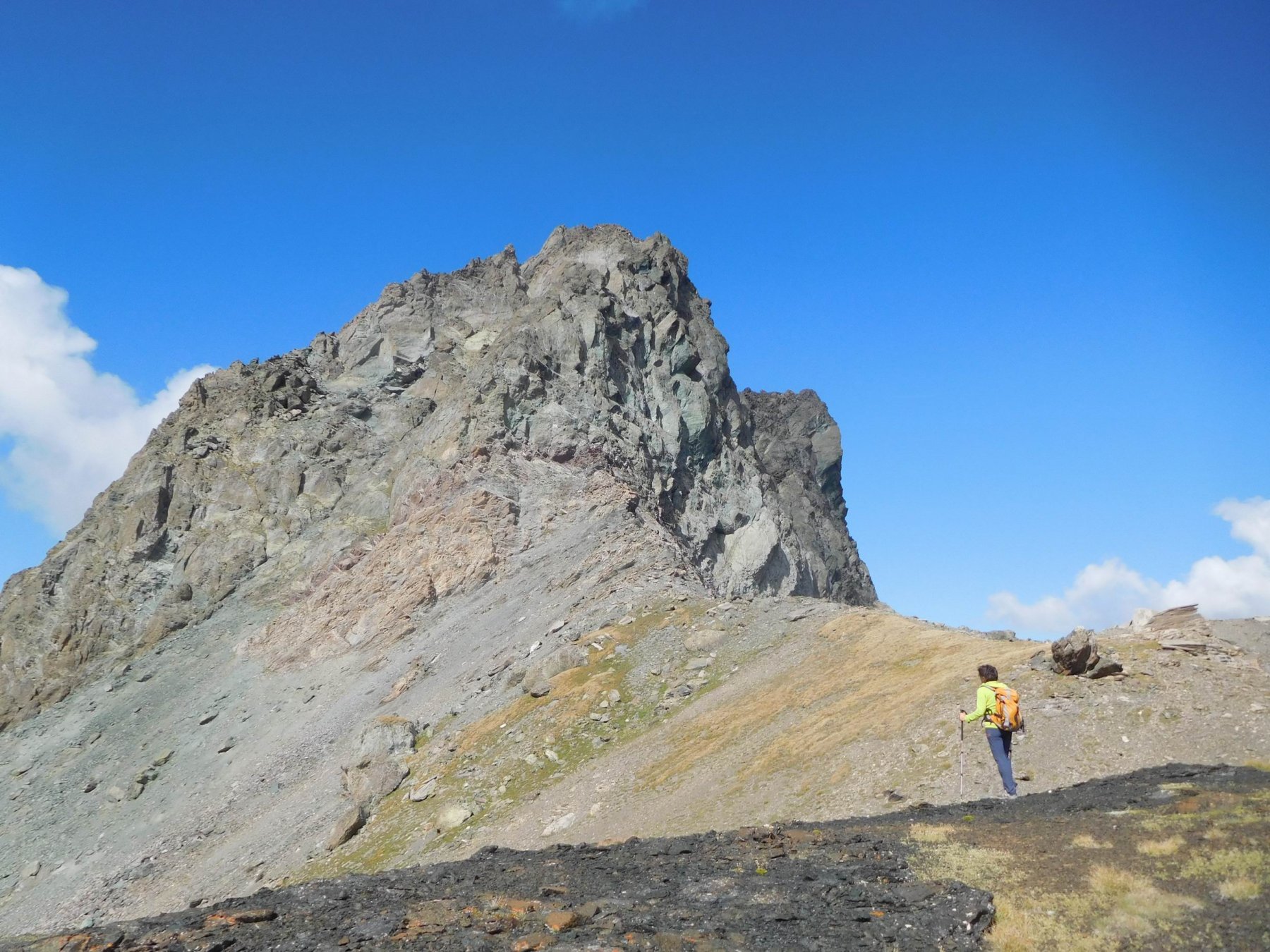
Salire senza errore nel vallone des Houerts in direzione dal colle omonimo. A 2700m circa si trova un bivio e si prende a sx per il Lac Vert. In vista del lago, non scendere verso di esso, ma proseguire per traccia via via più labile verso nord quindi traversare verso sx per ripidi pendii di magra erba e sfasciumi in direzione della meta. Qui si hanno due opzioni:
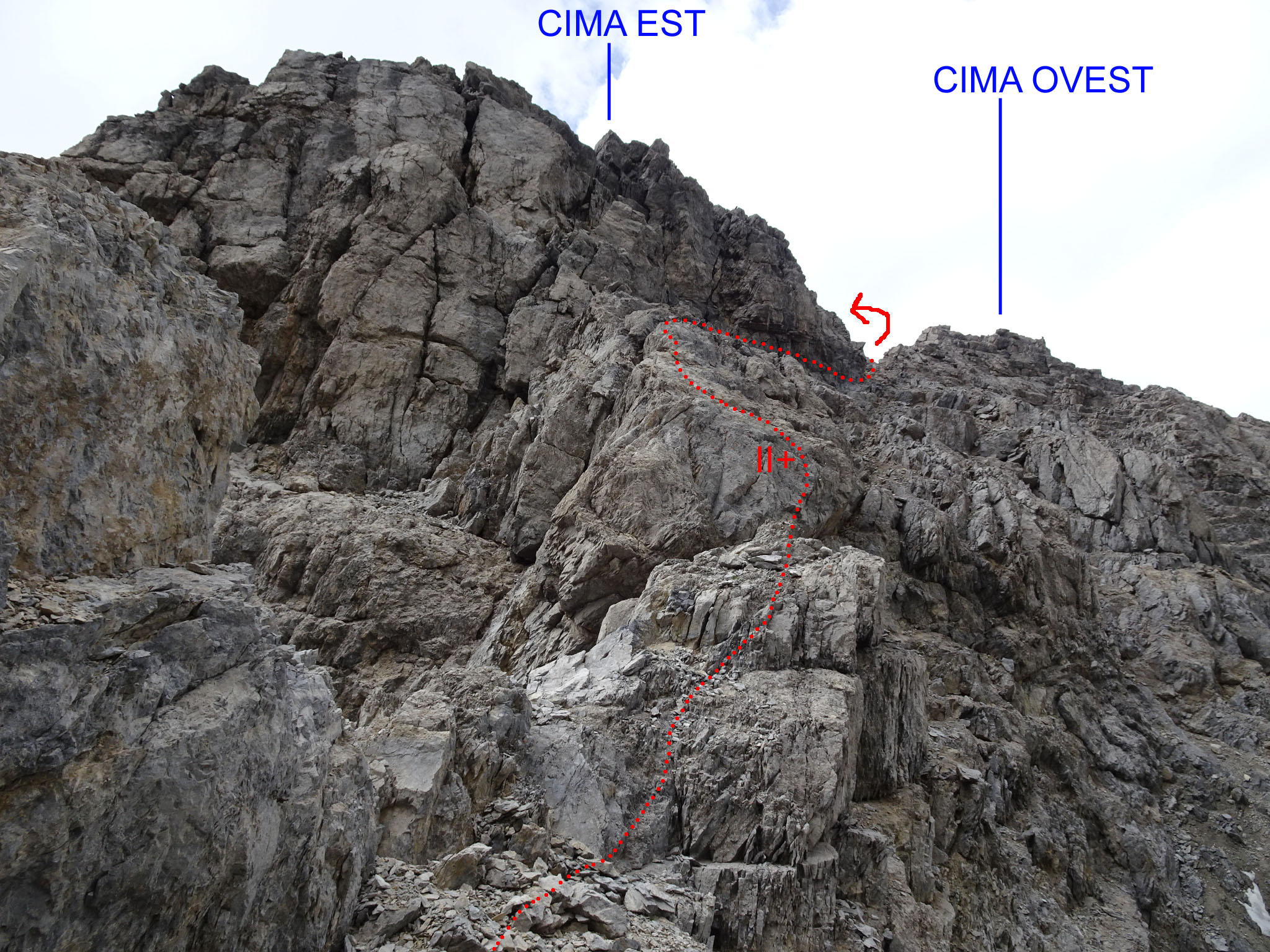
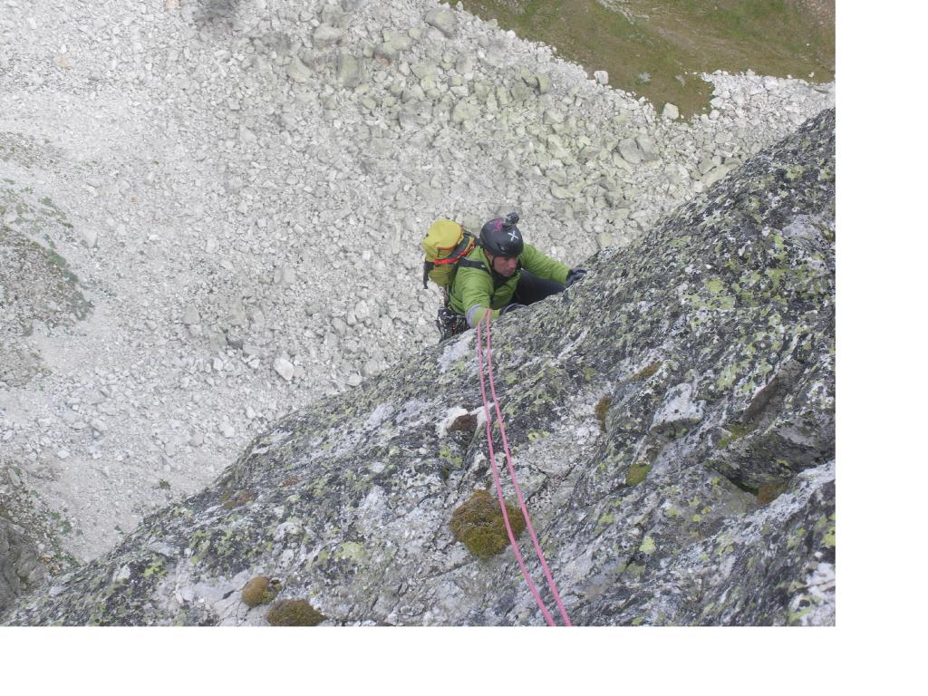
1) salire sulla dx il ripido pendio che porta alla base della cresta ENE del Pic raggiungendo un colletto q. 2897 m. Prendere ora la cresta rocciosa che presenta un primo muretto appoggiato delicato (III) quindi un camino di roccia più sana ma esposto (II+, due cordoni in loco sopra i due tratti). Segue un lungo tratto detritico fino ad una spalla dove si ritrova la roccia, che si aggira lato nord fino ad un colletto a q. 3123m.
2) proseguire a mezzacosta fino a raggiungere un canale detritico che si risale sulla sx (dx-orografica, tracce, ometti) pervenendo ad una conca pietrosa a. 2900m alla base del versante sud del Pic. Si sale quindi verso di esso, per ripidi pendii di sfasciumi instabili puntando al primo marcato canale a dx della cresta ENE. Il canale è breve ma di sfasciumi franosi e fondo terroso e termina al colletto q. 3123m.
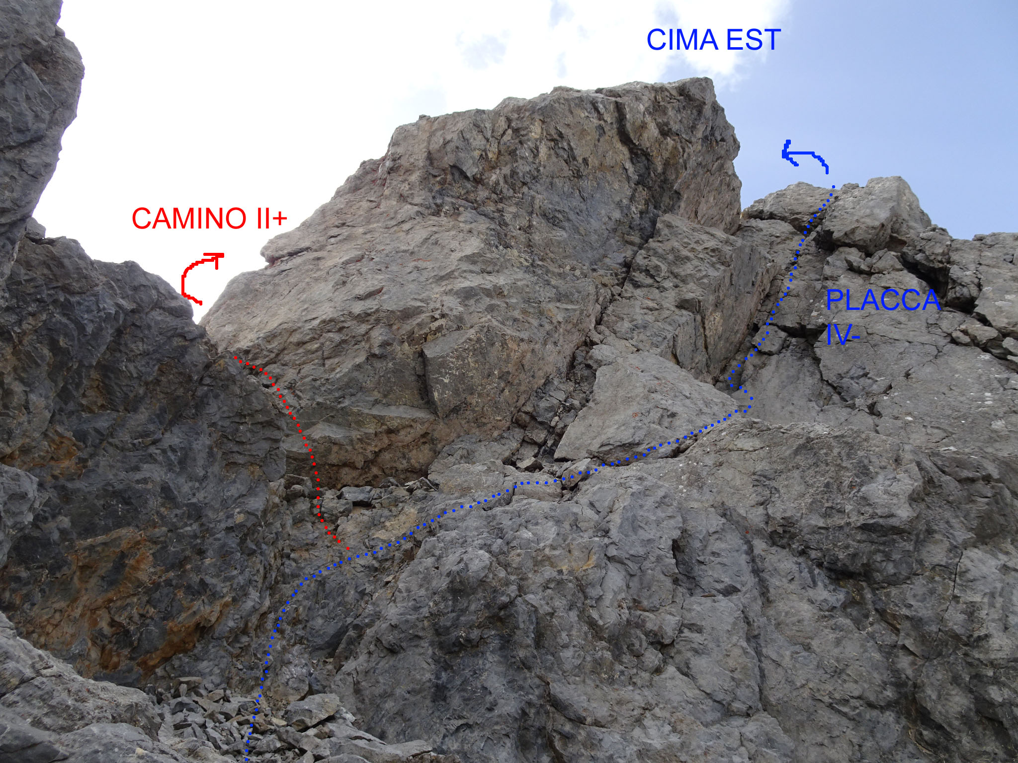
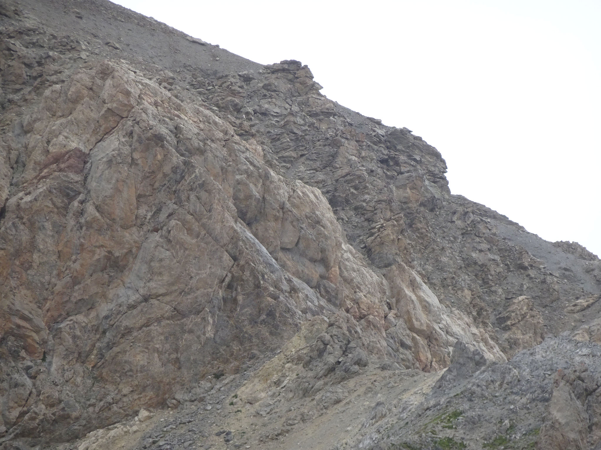
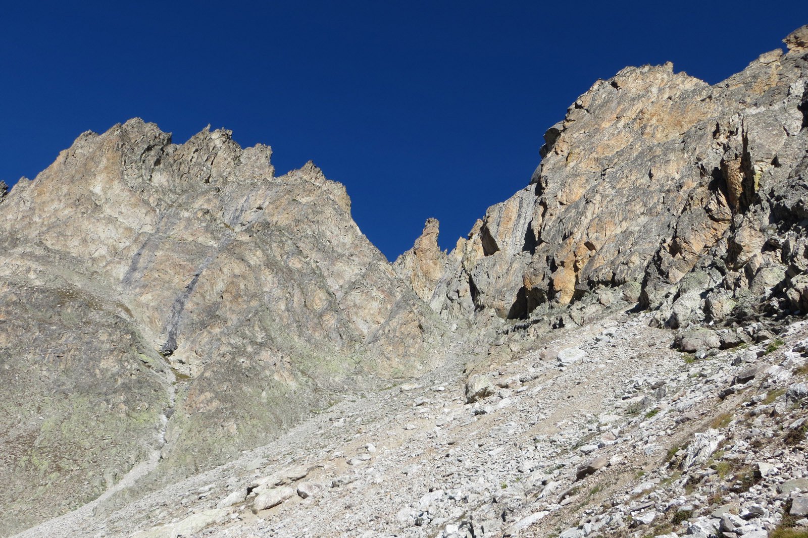
Dal colletto si aggira il tratto di cresta seguente lato nord (ometti, traccia), raggiungendo un secondo ampio colletto di un canale parallelo a quello risalito (ma sbarrato in fondo da un salto roccioso). Si prosegue ora a sx del filo di cresta (sud) fin dove questa termina sotto la parete finale. Si rimonta l’evidente sperone di roccia buona successiva (15m, II+) fino ad un terrazzo (vecchio cordone abbandonato dietro un grosso spuntone – non visibile da sotto) quindi si traversa a dx (nord) e si seguono alcuni ometti, per cenge detritiche un po’ esposte. Quando si giunge in vista della forcella fra le due cime, con un caratteristico arco di roccia, si rimonta verso sx una serie di gradoni e si torna sul filo di cresta. Per gli ultimi metri ci sono due possibilità:
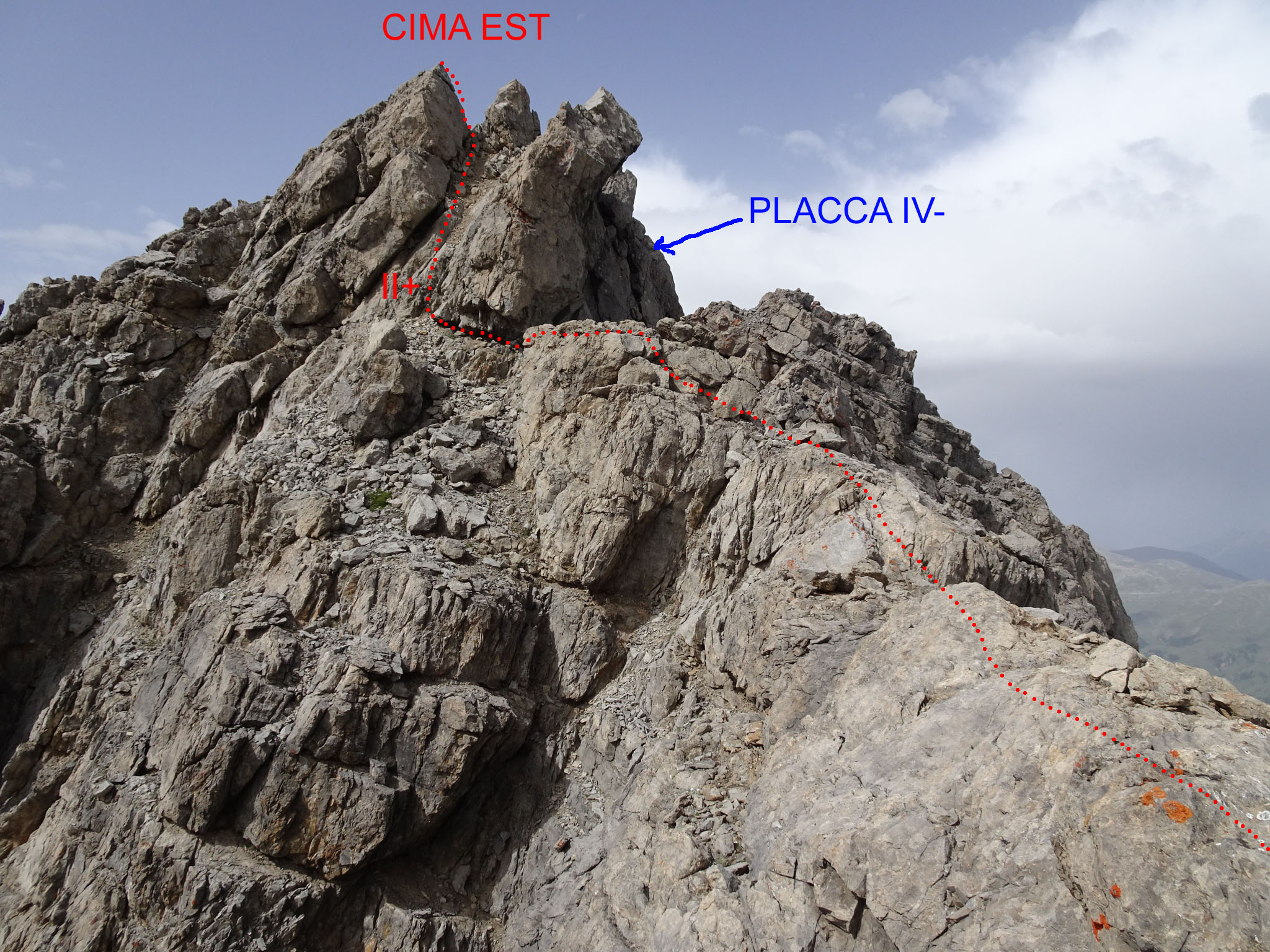
1) proseguire sul filo fino al salto terminale, quindi passare a sx (lato sud), rimontare un camino roccioso il cui fondo è ingombro di detrito (II+) fino in vetta.
2) prendere una cengia lato nord segnalata da ometti, sempre esposta, e raggiungere un terrazzo alla base di una placca fessurata abbastanza verticale. Salire la placca in diagonale da sx a dx (III, un passo di IV-, 15m) e uscire in cresta a pochi metri dal punto culminante. Volendo evitare la placca, dal terrazzo rimontando a sx un gradino si scavalca la cresta e giunge alla base del camino roccioso del percorso precedente.
Discesa da uno dei percorsi di salita. Eventuali doppie nel tratto finale sono da attrezzare e i cordoni del primo tratto della cresta da sostituire.
W.A.B. Coolidge, Christian Almer padre e figlio, 18.7.1881, dal versante N, dal vallone d'Escreins.
- Cartografia:
- IGN 1:25.000
Nelle vicinanze Mappa
Itinerari
22/06/2025 Alpes-de-Haute-Provence, Saint-Paul-sur-Ubaye D+ 1000 m F+ Ovest
Chillol (Tour de) da La Blacherie
 100m
100m
27/07/2024 Alpes-de-Haute-Provence, Saint-Paul-sur-Ubaye D+ 1755 m PD Nord-Ovest
Chambeyron (Aiguille de) da Pont Voutè per il Col Chauvet
 1.9Km
1.9Km
15/08/2020 Alpes-de-Haute-Provence, Saint-Paul-sur-Ubaye D+ 1450 m F Varie
Grand Roche (la) dal Pont Voutè
 1.9Km
1.9Km
14/04/2009 Alpes-de-Haute-Provence, Saint-Paul-sur-Ubaye D+ 1511 m PD Sud
Font Sancte (Pic Nord de la) da La Barge per il couloir sud (en banane)
 2.5Km
2.5Km
05/06/2016 Alpes-de-Haute-Provence, Saint-Paul-sur-Ubaye D+ 950 m AD Varie
Pierre André (Aiguille) Cresta Ovest
 4.1Km
4.1Km
28/09/2019 Alpes-de-Haute-Provence, Saint-Paul-sur-Ubaye D+ 1350 m F Ovest
Peouvou (le) cima sud da Maljassset
 4.1Km
4.1Km
15/06/2008 Alpes-de-Haute-Provence, Saint-Paul-sur-Ubaye D+ 1512 m D+ Nord
Chambeyron (Aiguille de) Couloir Nord da Maljasset
4.1Km
29/08/2019 Alpes-de-Haute-Provence, Saint-Paul-sur-Ubaye D+ 1300 m PD+ Tutte
Pelvat (Pic du) da Maljasset
 4.1Km
4.1Km
16/09/2013 Alpes-de-Haute-Provence, Saint-Paul-sur-Ubaye D+ 950 m PD+ Nord-Ovest
Pierre André (Aiguille) Via Normale per la Parete NO
 4.1Km
4.1Km
09/09/2023 Alpes-de-Haute-Provence, Saint-Paul-sur-Ubaye D+ 1306 m PD+ Ovest
Haute de Mary (Pointe) da Maljasset per il Versante O e Cresta S/SE
 4.1Km
4.1Km