 1.2Km
1.2Km
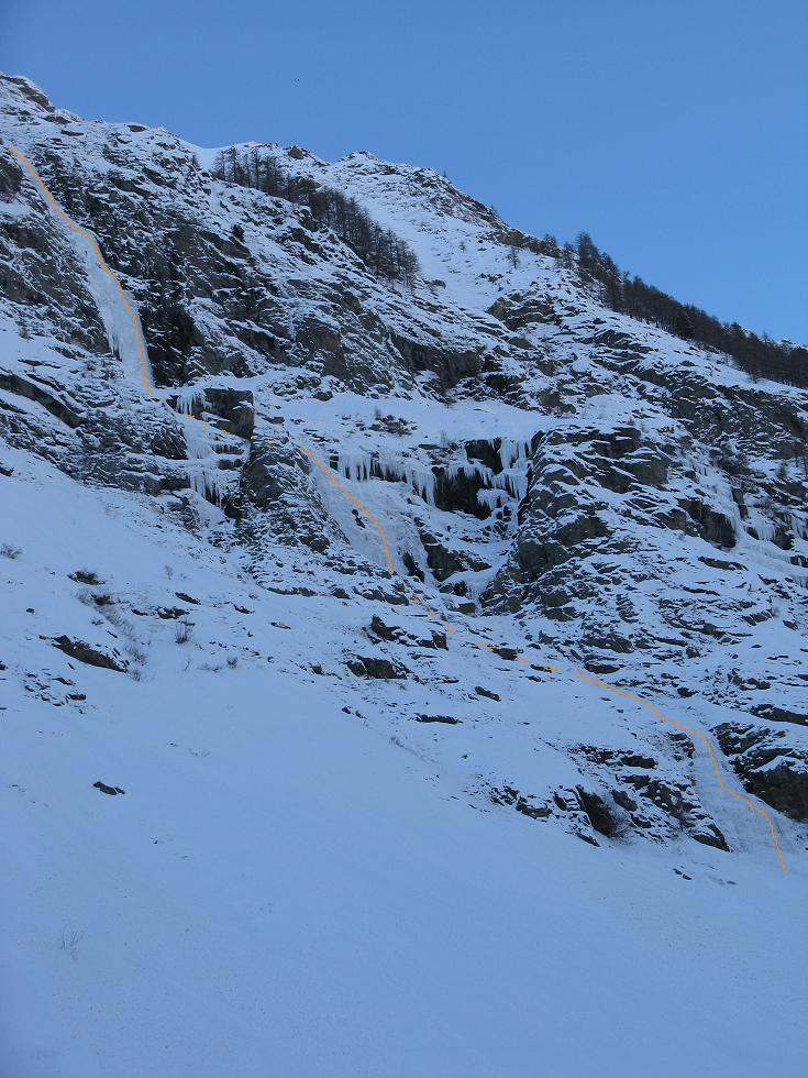
Avvicinamento
 1.7Km
2.2Km
2.2Km
2.4Km
2.4Km
5.8Km
5.8Km
5.8Km
5.8Km
1.7Km
2.2Km
2.2Km
2.4Km
2.4Km
5.8Km
5.8Km
5.8Km
5.8Km
1.2Km
2.3Km
2.4Km
2.4Km
5.8Km
7.5Km
8.8Km
8.9Km
8.9Km
8.9Km
.
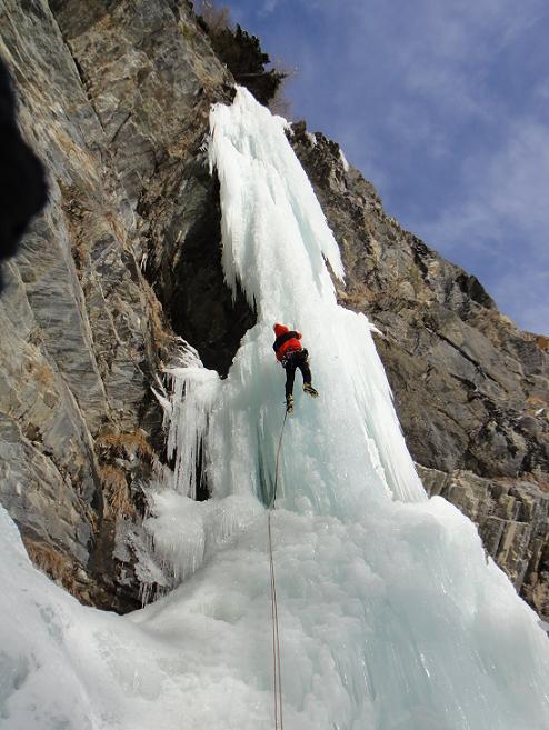
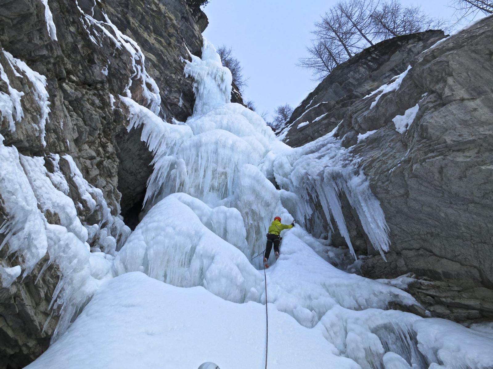
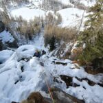
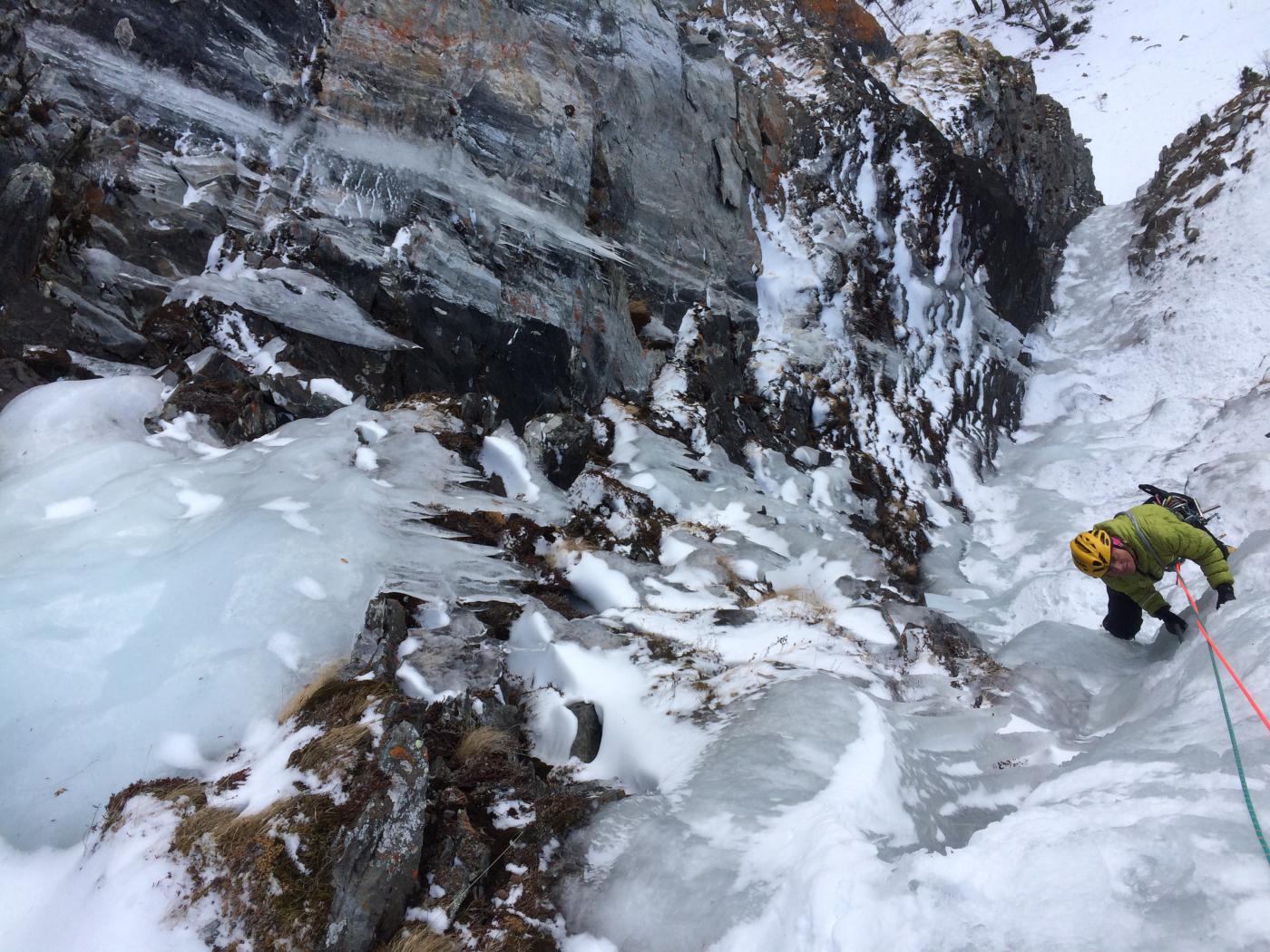
Descrizione
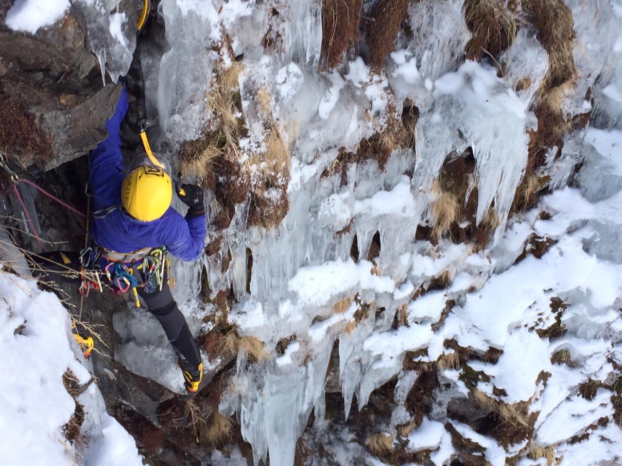
Una prima lunghezza impegnativa sul suo lato sx seguita da due facili (2°) poi una di trasferimento ed infine l’ultima nonchè la più bella di quarto grado.
Le soste al momento devono essere effettuate su abalakov.
La seconda sosta esiste fatta con dei vecchi chiodi da crepa, ma è preferibile una lunulle.
Discesa in doppia sulle soste di salita. (meglio con corde min 60 mt
- Bibliografia:
- Matteo Giglio - Effimeri Barbagli - 2014 Tipografia Valdostana
Nelle vicinanze Mappa
Itinerari
23/01/2011 AO, Rhêmes-Notre-Dame 60 m II, 5 Sud-Est
Rhemes Notre Dame – Chandelle Milena (Cascata)
 1.7Km
1.7Km
13/01/2005 AO, Rhêmes-Saint-Georges 50 m I, 3 Est
Rhemes Saint Georges – Champ Chevalè (Cascata del)
2.2Km
20/12/2020 AO, Rhêmes-Saint-Georges 100 m II, 3 Nord-Ovest
Rhemes Saint Georges – Tears of Rage (Cascata)
 2.2Km
2.2Km
06/02/2012 AO, Rhêmes-Saint-Georges 400 m II, 4+ Sud
Rhemes Saint Georges – Fontana dei Desideri (Cascata)
 2.2Km
2.2Km
19/02/2025 AO, Rhêmes-Notre-Dame 80 m II, 4+ Nord-Ovest
Rhemes Notre Dame – Sogno Realizzato (Cascata)
 2.4Km
2.4Km
08/03/2025 AO, Rhêmes-Notre-Dame 100 m II, 2+ Nord-Ovest
Rhemes Notre Dame – Entrelor (Cascata di)
 2.4Km
2.4Km
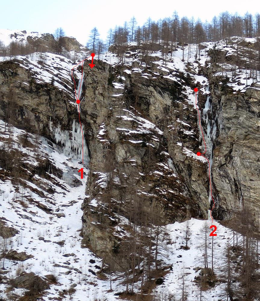
15/01/2015 AO, Rhêmes-Notre-Dame 90 m II, 4, M6 Nord
Thumel – Saint-Étienne (Cascata)
 5.8Km
5.8Km
18/01/2015 AO, Rhêmes-Notre-Dame 40 m II, 4, M5 Nord
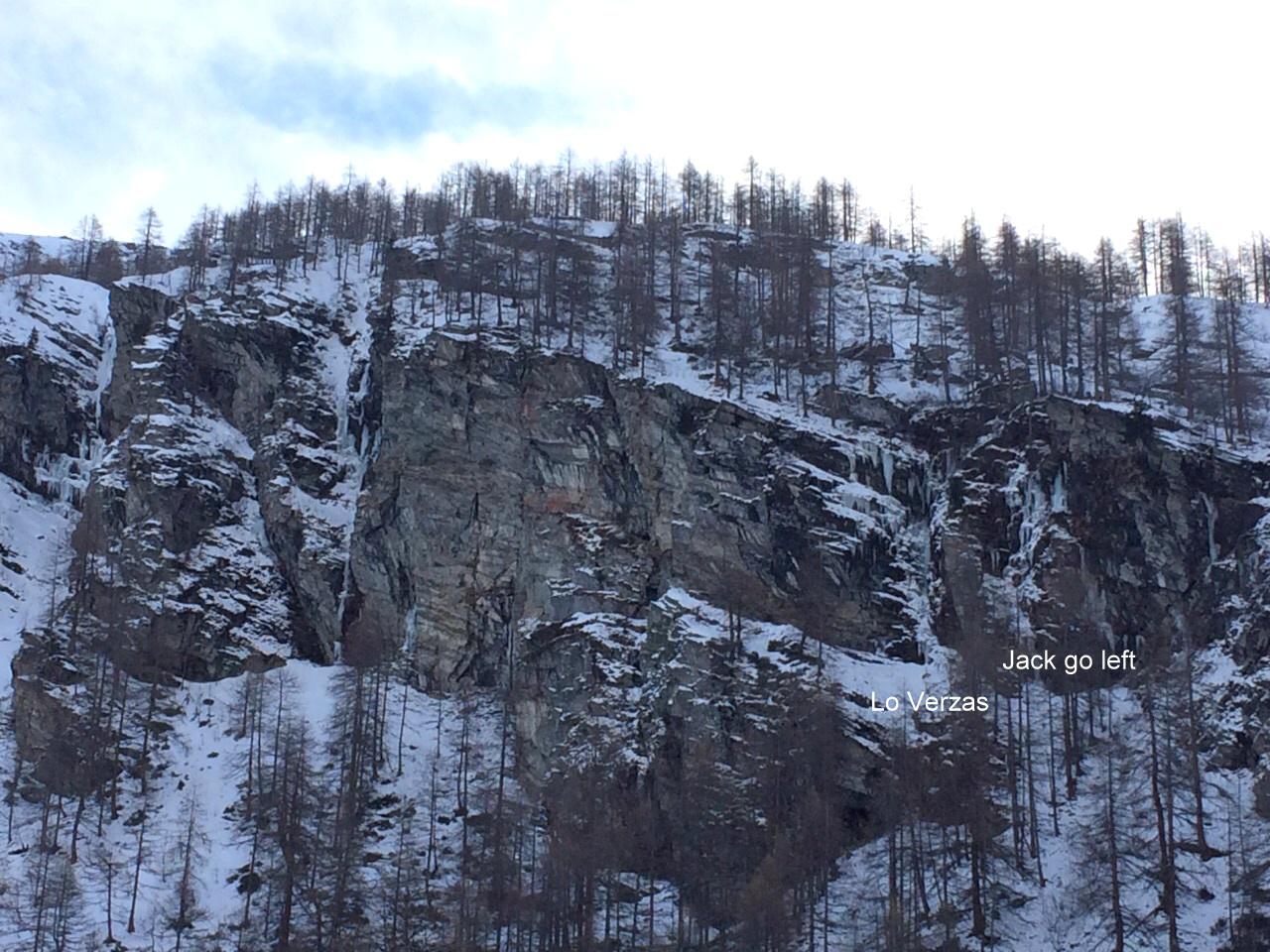
Thumel – Jack, Go Left! (Cascata)
 5.8Km
5.8Km
15/01/2015 AO, Rhêmes-Notre-Dame 80 m II, 4, M5 Nord-Ovest
Thumel – Quaranta (Cascata)
 5.8Km
5.8Km
18/01/2015 AO, Rhêmes-Notre-Dame 60 m II, 4, M6 Nord
Thumel – Lo Verzas (Cascata)
 5.8Km
5.8Km
Servizi
1.2Km
2.3Km
Galisia Albergo
Rhemes-Notre-Dame
2.4Km
Tanini Ristorante
Rhemes-Notre-Dame
2.4Km
Lo Sabot Albergo
Rhemes-Notre-Dame
5.8Km
Benevolo Rifugio
Rhêmes-Notre-Dame
7.5Km
Chalet de L’Epée Rifugio
Valgrisenche
8.8Km
Lo Fourquin Bar
Valsavarenche
8.9Km
La Tana delle Volpi Ristorante
Valgrisenche
8.9Km
Abro de la Leunna Ristorante
Valsavarenche
8.9Km