 3.2Km
3.2Km
Avvicinamento
 150m
150m
3.7Km
4.4Km
4.4Km
6.6Km
6.7Km
150m
150m
3.7Km
4.4Km
4.4Km
6.6Km
6.7Km
3.2Km
4.4Km
4.4Km
4.4Km
7.9Km
8.2Km
8.2Km
8.3Km
8.6Km
9Km
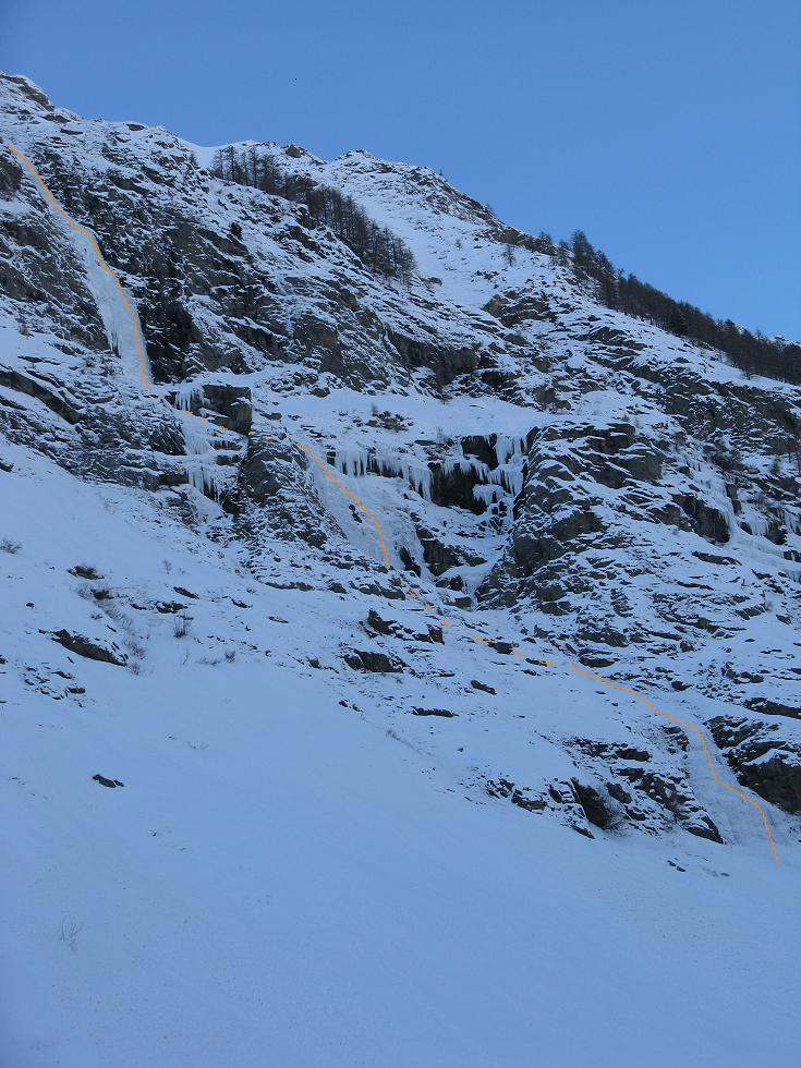
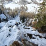
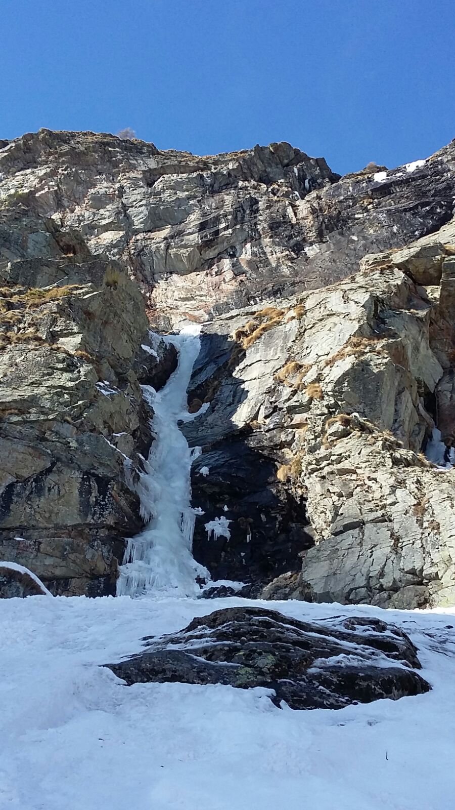
Si parcheggia l'auto prima dell'ultimo paravalanghe prima della fraz. Melignon salendo. La colata è ben visibile arrivando dalla strada. Scendere per scaletta in ferro all'attacco.
Descrizione
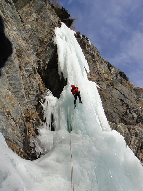
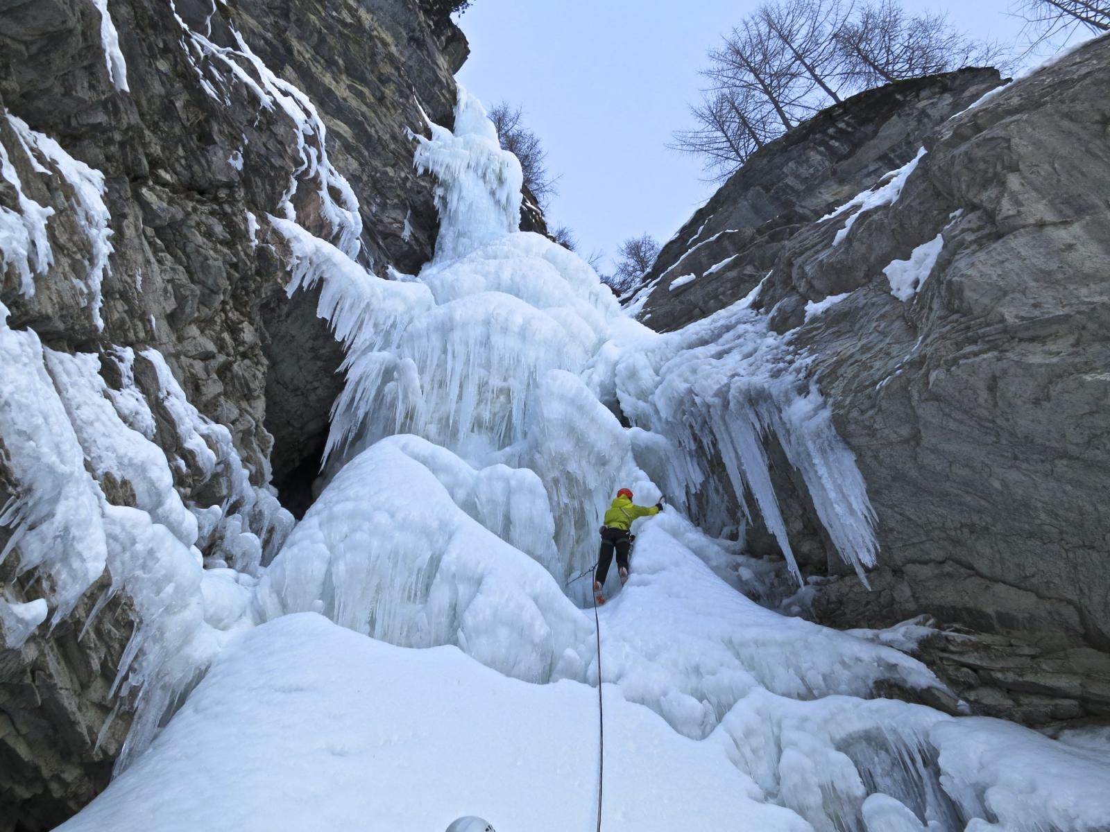
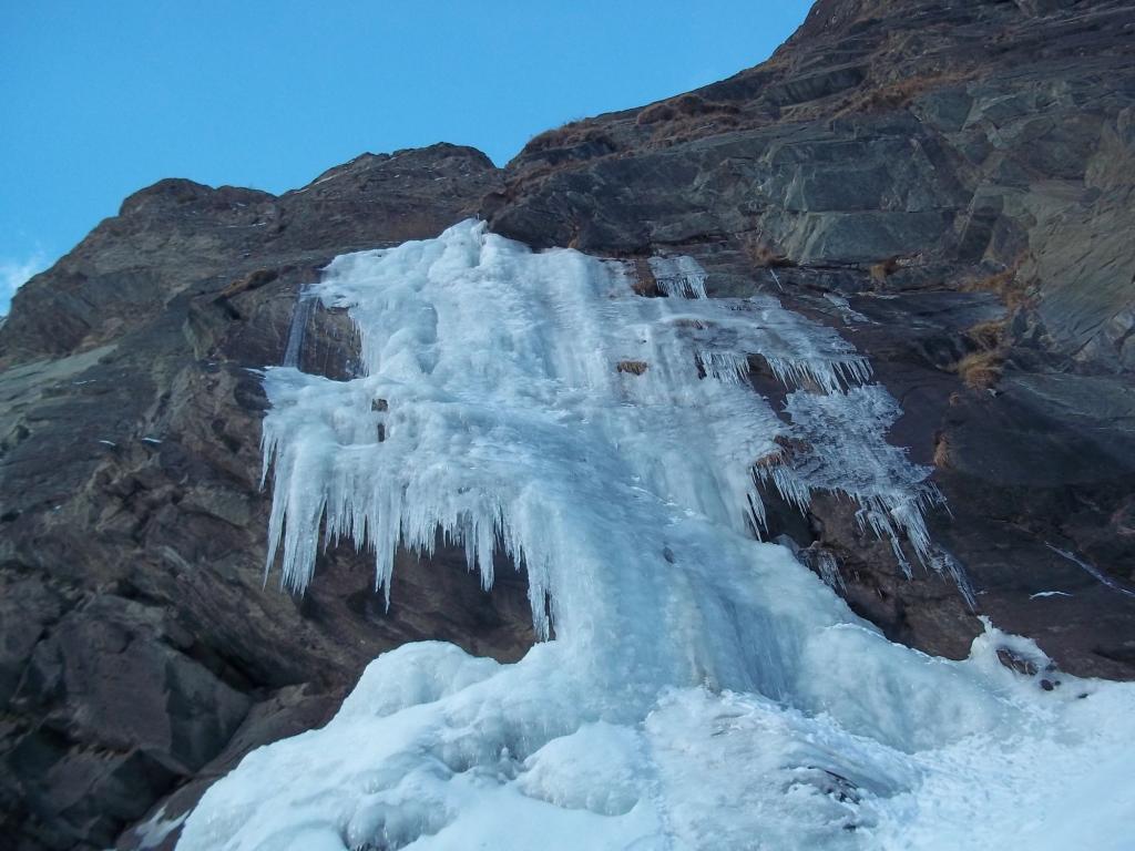
Superare la colata spessa ma sospesa nel vuoto (3) alta ca 15m e proseguire sopra il paravalanghe verso il secondo salto, più facile alto ca 30m.
Discesa per i ripidi boschi sulla sx orografica fino al paravalanghe da cui si giunge facilmente sulla strada.
- Bibliografia:
- Matteo Giglio - Effimeri Barbagli - 2014 Tipografia Valdostana
Nelle vicinanze Mappa
Itinerari
20/12/2020 AO, Rhêmes-Saint-Georges 100 m II, 3 Nord-Ovest
Rhemes Saint Georges – Tears of Rage (Cascata)
 150m
150m
06/02/2012 AO, Rhêmes-Saint-Georges 400 m II, 4+ Sud
Rhemes Saint Georges – Fontana dei Desideri (Cascata)
 150m
150m
21/01/2021 AO, Rhêmes-Notre-Dame 250 m II, 4 Sud-Est
Rhêmes-Notre-Dame – Carré (Goulotte del)
2.2Km
23/01/2011 AO, Rhêmes-Notre-Dame 60 m II, 5 Sud-Est
Rhemes Notre Dame – Chandelle Milena (Cascata)
 3.7Km
3.7Km
19/02/2025 AO, Rhêmes-Notre-Dame 80 m II, 4+ Nord-Ovest
Rhemes Notre Dame – Sogno Realizzato (Cascata)
 4.4Km
4.4Km
08/03/2025 AO, Rhêmes-Notre-Dame 100 m II, 2+ Nord-Ovest
Rhemes Notre Dame – Entrelor (Cascata di)
 4.4Km
4.4Km
01/02/2011 AO, Rhêmes-Saint-Georges 220 m III, 4 Nord
Rhemes Saint Georges – Lupo Alberto (Cascata)
6Km
19/01/2002 AO, Rhêmes-Saint-Georges 220 m III, 4+ Nord
Rhemes Saint Georges (Cascata di)
6Km
01/02/2017 AO, Introd 50 m IV, 3+ Nord-Est
Valsavarenche – Ste Gio Già (Cascata)
 6.6Km
6.6Km
26/01/2017 AO, Valsavarenche 350 m IV, 3+ Est
Valsavarenche – Follies (Couloir des)
 6.7Km
6.7Km
Servizi
3.2Km
4.4Km
Galisia Albergo
Rhemes-Notre-Dame
4.4Km
Tanini Ristorante
Rhemes-Notre-Dame
4.4Km
Lo Sabot Albergo
Rhemes-Notre-Dame
7.9Km
Benevolo Rifugio
Rhêmes-Notre-Dame
8.2Km
Chalet de L’Epée Rifugio
Valgrisenche
8.2Km
Lo Fourquin Bar
Valsavarenche
8.3Km
Abro de la Leunna Ristorante
Valsavarenche
8.6Km
La Tana delle Volpi Ristorante
Valgrisenche
9Km