 2.7Km
2.7Km
Note
 50m
50m
2.9Km
3Km
5.5Km
6Km
50m
50m
2.9Km
3Km
5.5Km
6Km
2.7Km
2.9Km
2.9Km
2.9Km
2.9Km
4Km
4.4Km
5.7Km
5.8Km
5.8Km
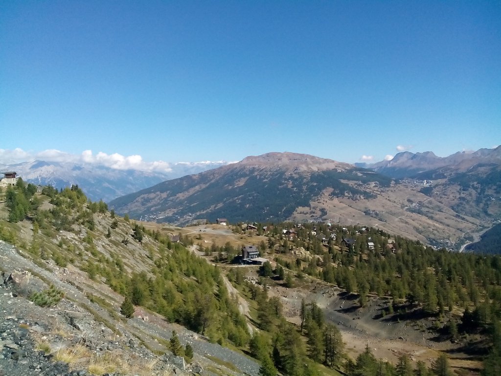
Bell'itinerario in quota, prima parte nei Monti della Luna e poi nell'Alta Valle Gimont e poi una volta sconfinato in Francia nei monti che sovrastano Monginevro, sino al bel lago Gignoux (7 Colori)
Avvicinamento
Raggiungere la Frazione Sagnalonga percorrendo a scelta tre rotabili sterrate, da Cesana Torinese direzione Claviere svoltare a sx dopo primi tornanti nuova variante e proseguire per circa 7 km, da Claviere, pressi Chiesa parrocchiale scendere piste sci e salire dapprima a la Coche e poi a Sagnalonga dopo circa 3,5 km. e da Bousson (Frazione di Casana), seguire dapprima verso Casa Vacanza Santa Giulia e seguire direzione Fonte Dalma e poi Fonte Tana (Casermette), tralasciando la rotabile che arriverebbe al Lago Nero. Circa 7-8 Km.
Descrizione
Da Sagnalonga proseguire su strada sterrata in direzione del sovrastante Colle Bercia, raggiungere il Piazzale Chaberton (Fontana), proseguire sempre su mulattiera in direzione lago dei 7 Colori, una volta arrivati sul crinale con la Val Gimont, proseguire sempre su mulattiera in direzione della visibile stazione di arrivo della seggiovia Col Saurel.
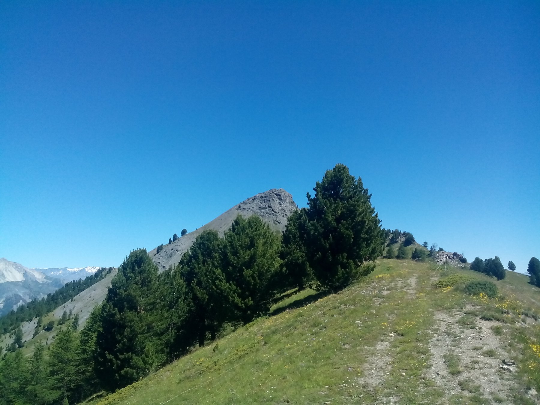
Senza arrivare in cima al Col Saurel proseguire su evidente traccia di sentiero dapprima con buon fondo e nella parte finale poco prima di un rudere di ex casermetta un pò pietroso, sino ad un pianoro da cui si vede chiaramente il Colletto Verde con le piste di discesa del comprensorio Via Lattea.
Tralasciare traccia verso il monte La Plane e risalire la parte finale della pista da sci arrivando così al Colletto Verde.
Da qui proseguire sempre sulla pista da sci sino ad incrociare la seggiovia francese e una volta oltrepassata imboccare traccia di sentiero contrassegnata da pali in legno di grosso diametro che portano al pianoro alla base dei Monti Gimont e Chenalleit.
Da qui tenersi sulla sx e risalire il pendio che porta al Colletto Gimont (prima parte di sentiero non troppo identificabile).
Dal Colletto risalire su erto pendio che con ripidi zig zag porta alla cima della Punta Gimont (Croce in legno e riparo con tavole in legno).
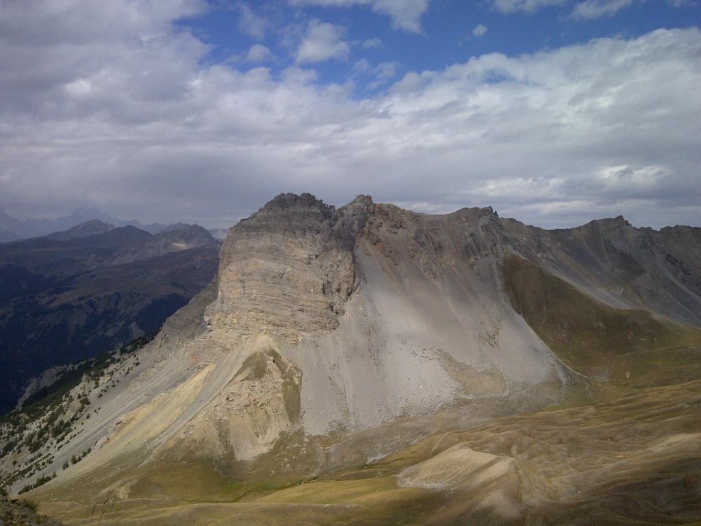
Ampia visuale su Monginevro, il sottostante Lac Gignoux la Val Gimont i Monti della Luna.
Scendendo dalla vetta raggiungere il lago dei 7 Colori su sentiero (prima parte molto ripida e pietrosa)
Nelle vicinanze Mappa
Itinerari
14/08/2018 TO, Cesana Torinese D+ 581 m Tutte
Gignoux (Lago) o dei Sette Colori da Sagnalonga, anello per Capanna Mautino, Colle Bercia, Col Saurel
 50m
50m
15/08/2016 TO, Cesana Torinese D+ 440 m Nord
Rascià (Punta) da Sagnalonga, anello
50m
12/08/2018 TO, Cesana Torinese D+ 800 m Varie
Corbioun (Monte) da Sagnalonga, anello per Colle Begino, Lago Nero, Capanna Mautino, Colle Bercia
 50m
50m
30/07/2016 TO, Cesana Torinese D+ 575 m Varie
Begino e Chabaud (Colli) da Sagnalonga, anello per il Lago Nero
50m
01/08/2010 TO, Cesana Torinese D+ 3256 m Varie
Chaberton (Monte) Marathon Trail des Fortes ITINERARIO NON PERCORRIBILE
 2.9Km
2.9Km
06/08/2025 TO, Cesana Torinese D+ 1383 m Varie
Gimont, Saurel, Corbioun, Fournier (Cime) dal Lago Nero, anello
 3Km
3Km
25/08/2012 Hautes-Alpes, Montgenèvre D+ 800 m Varie
Grand Chalvet (le) da Montgenèvre
 5.5Km
5.5Km
31/05/2005 TO, Cesana Torinese D+ 880 m Sud-Est
Aigliere (Rocca d’) da Fenils
6Km
06/07/2019 TO, Cesana Torinese D+ 2000 m Tutte
Chaberton (Monte) da Fenils, anello ITINERARIO NON PERCORRIBILE
 6Km
6Km
03/08/2008 Hautes-Alpes, Montgenèvre D+ 6032 m Varie
Chaberton (Monte) Skyrace Marathon dei Forti ITINERARIO NON PERCORRIBILE
6.6Km
Servizi
2.7Km
2.9Km
Casa Cesana Bar
Cesana Torinese
2.9Km
L’Ibarus Rifugio
Cesana Torinese
2.9Km
Piergiorgio Frassati B&B
Cesana Torinese
2.9Km
Ottima Scelta Ristorante
Cesana Torinese
4Km
Centro Ristorante
Cesana Torinese
4.4Km
La Fontana del Thures Rifugio
Cesana Torinese
5.7Km
La Crota B&B
Cesana Torinese
5.8Km
da Carlo Rifugio
Cesana Torinese
5.8Km

