50m
50m

Note
 650m
11.1Km
11.4Km
11.4Km
13.6Km
13.6Km
13.6Km
13.6Km
650m
11.1Km
11.4Km
11.4Km
13.6Km
13.6Km
13.6Km
13.6Km
50m
50m
100m
100m
150m
200m
200m
200m
400m
450m
1. L'orientamento di questa gita non è mai banale, nè all'inizio, prima di raggiungere la cresta nord della Dotse, nè al ritorno, dove bisogna stare attenti ad abbandonare la Combe des Fonds al momento giusto ed a raggiungere i pendii sopra Ferret.
2. La discesa dal versante nord della Tete de Ferret è da MR+ (qualche tratto un po' più ripido, nei pendii superiori, in alternativa si può seguire il filo di cresta).
Avvicinamento
2. La discesa dal versante nord della Tete de Ferret è da MR+ (qualche tratto un po' più ripido, nei pendii superiori, in alternativa si può seguire il filo di cresta).
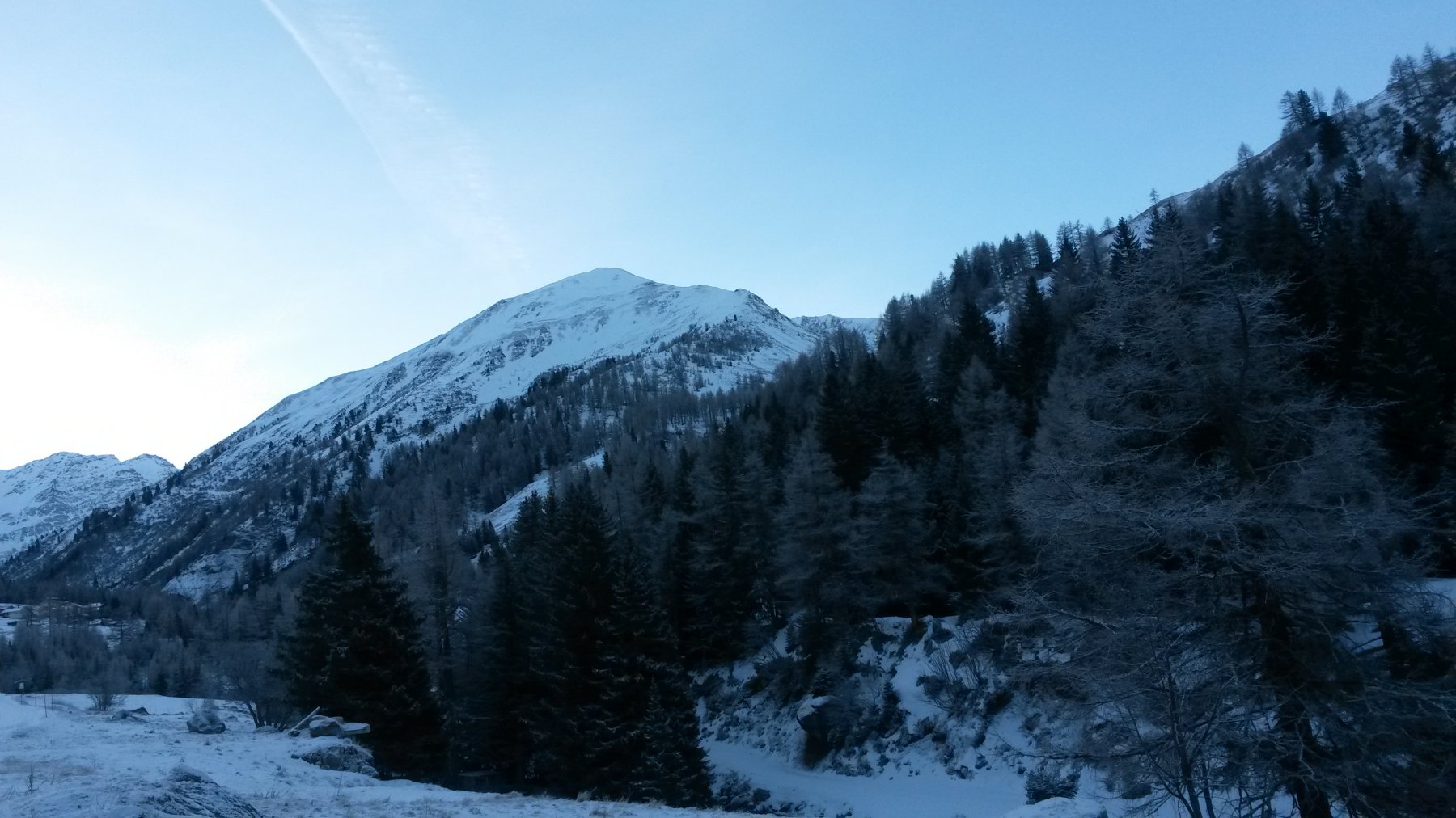
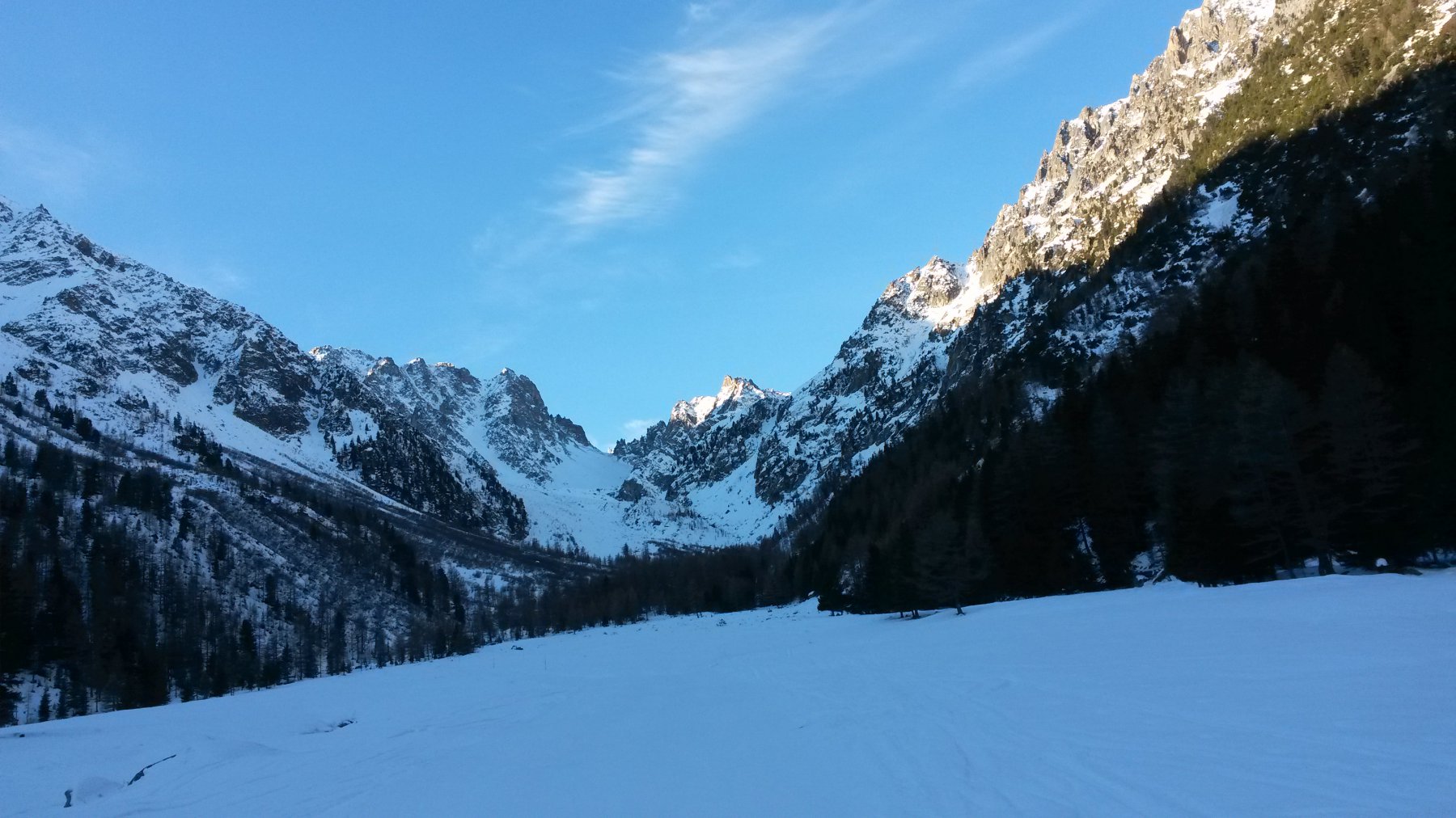
Dal traforo del Gran San Bernardo si scende a Orsieres, dove si svolta a sinistra per la Val Ferret svizzera che si risale fino a La Fouly dove la strada è chiusa in località Le Clou. Piccolo parcheggio sulla sinistra.
Descrizione
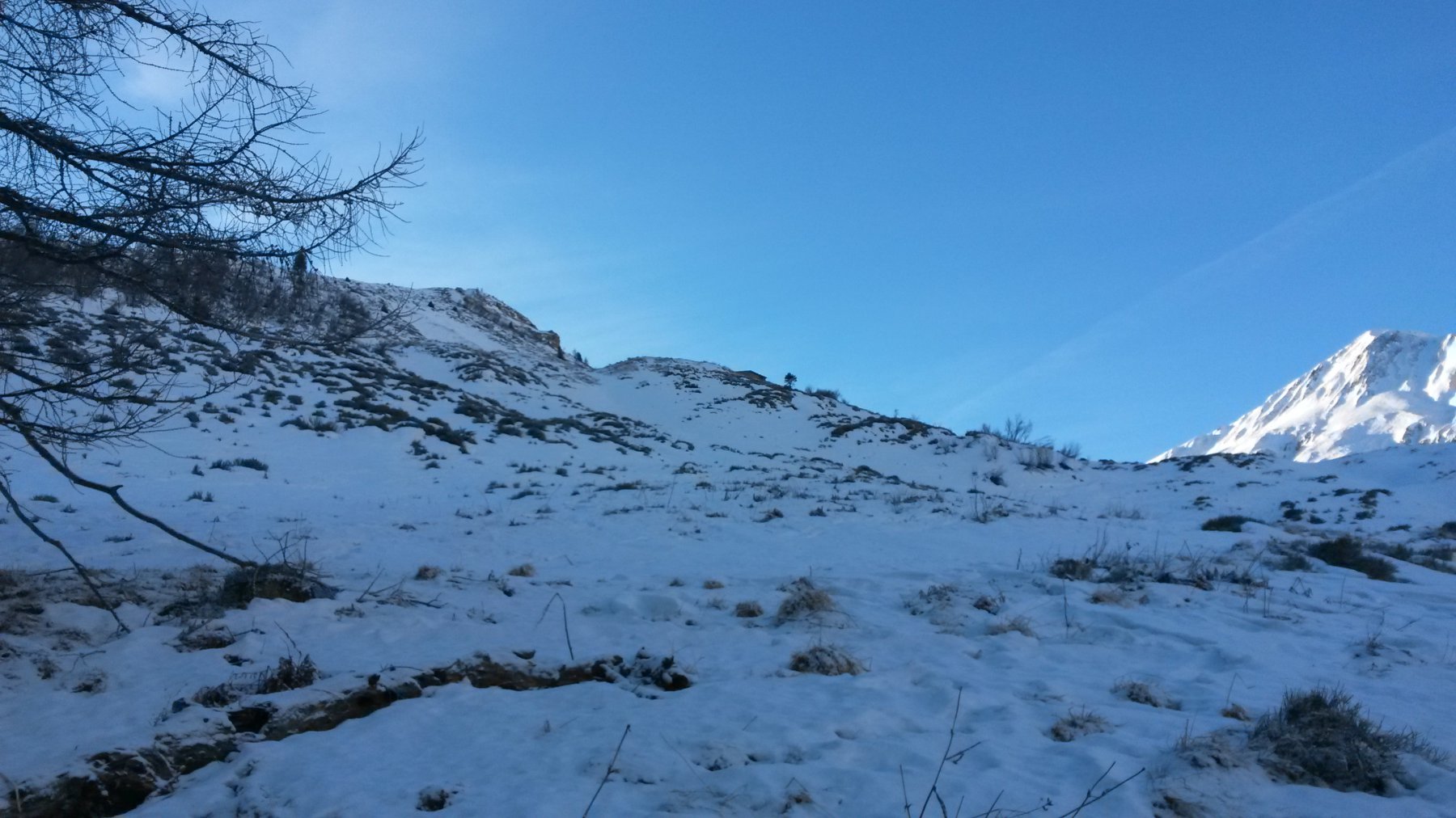
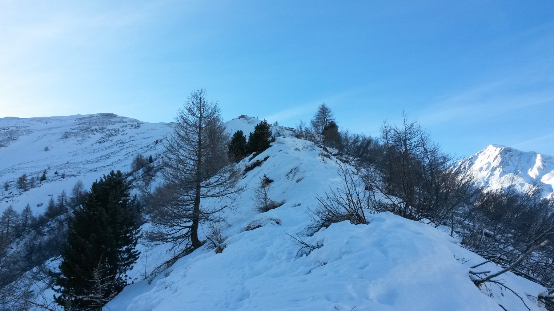
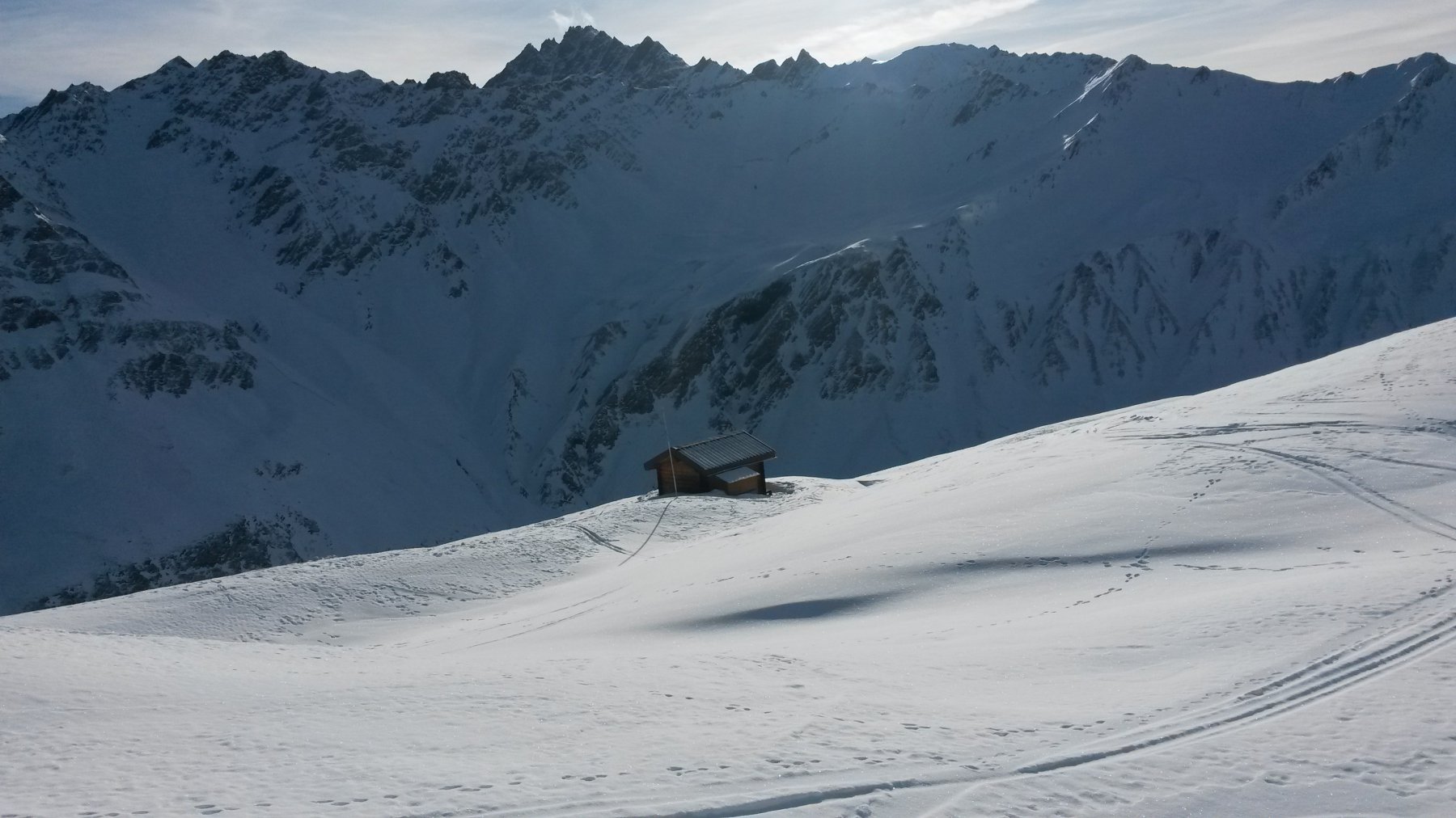
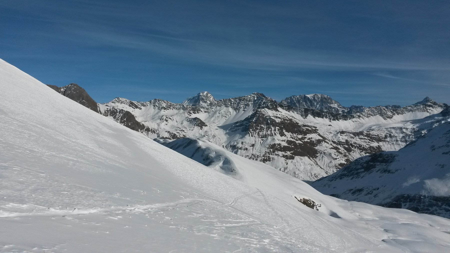
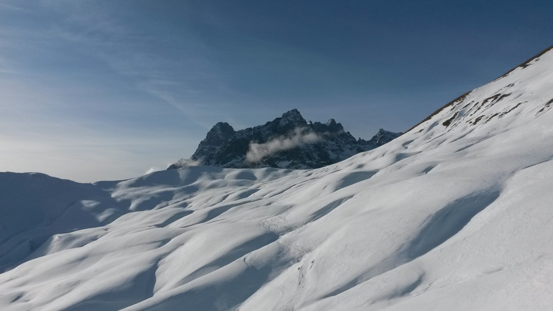
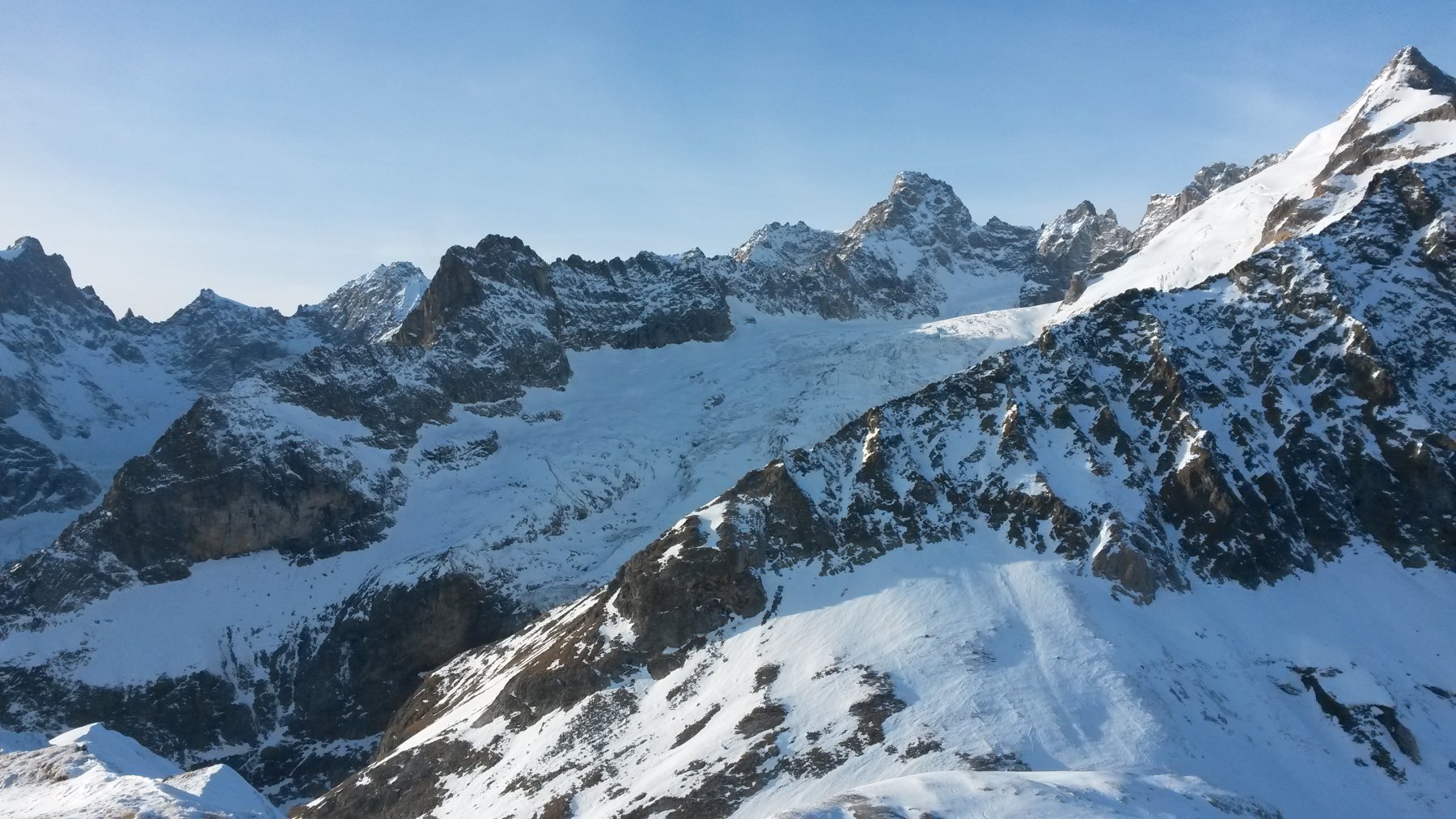
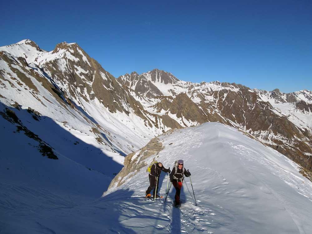
Dal parcheggio di Le Clou si procede lungo la strada per un centinaio di metri o poco più fino alla località Les Granges, dove, per una stradina, si devia verso destra raggiungendo la Drance de Ferret che si attraversa su un ponticello. Da qui si segue la pista di fondo verso sinistra fino a quando, attraversato il torrente Le Merdenson su un altro ponticello, all’altezza di un terzo ponticello da cui (da sinistra) proviene la stradina da Ferret (si intravedono le case della località fra gli alberi), si incontra una la palina segnaletica per Pramplò che indica di salire a destra nel bosco. Dopo un breve tratto fra la vegetazione, le tracce sbucano in pendii aperti in corrispondenza di una palina segnaletica che indica di piegare a sinistra (non c’è Pramplò, ma c’è La Peule, che si raggiungerebbe da Pramplò continuando in costa anzichè salire, come faremo, la cresta della Dotse). Si risale quindi verso ovest pressochè parallelamente al torrente Le Merdenson (che rimane in fondovalle) fino a giungere sui pendii sotto l’alpeggio di Pramplò (quota 1928m)). Da qui si segue il tornante a sinistra (direzione est) e si prosegue brevemente sul percorso estivo per La Peule fino a quando questo svolterebbe a destra (direzione sud) proprio in corrispondenza dell’inizio della cresta nord della Dotse. Saliamo quindi quest’ultima dapprima fra gli ultimi alberelli e poi su visuale aperta (emozionanti vedute aeree) rimanendo quasi sempre sul filo (i rari risalti rocciosi che si possono incontrare a seconda delle condizioni della neve vanno tutti aggirati a sinistra). Dopo una lunga ma non difficile camminata aerea giungiamo sulla cima della Dotse 2492 m, croce di vetta dedicata ad uno sfortunato ragazzo scomparso nell’anno appena trascorso), da cui possiamo già vedere il resto dell’itinerario fino alla Tete de Ferret. Scendiamo comodamente l’ampia cresta sud-ovest (Arete des Planfins) fino ad una fiabesca piccola baita ben tenuta. Da qui, sempre in direzione sud-ovest, inizia la risalita della Tete de Ferret, a cui giungiamo dopo aver ignorato le tracce che proseguono diritto fino al Grand Col Ferret obliquando invece verso destra. Dalla cima grandiose vedute sulla nord del Grand Jorasses, sui ghiaccia orientali del Massiccio del Bianco e sul Mont Dolent, oltrechè sul versante valdostano della Val Ferret.
Per chiudere l’anello, ridiscesi per qualche decina di metri lungo la cresta di salita, svoltiamo a sinistra laddove si stacca la cresta nord della Tete de Ferret. A seconda delle condizioni della neve, possiamo scendere direttamente per tratti di ripidi pendii nevosi alla Combe des Fonds, oppure raggiungere quest’ultima tenendo più o meno il filo di cresta (più lungo ed esposto, ma più sicuro in caso di neve non assestata).
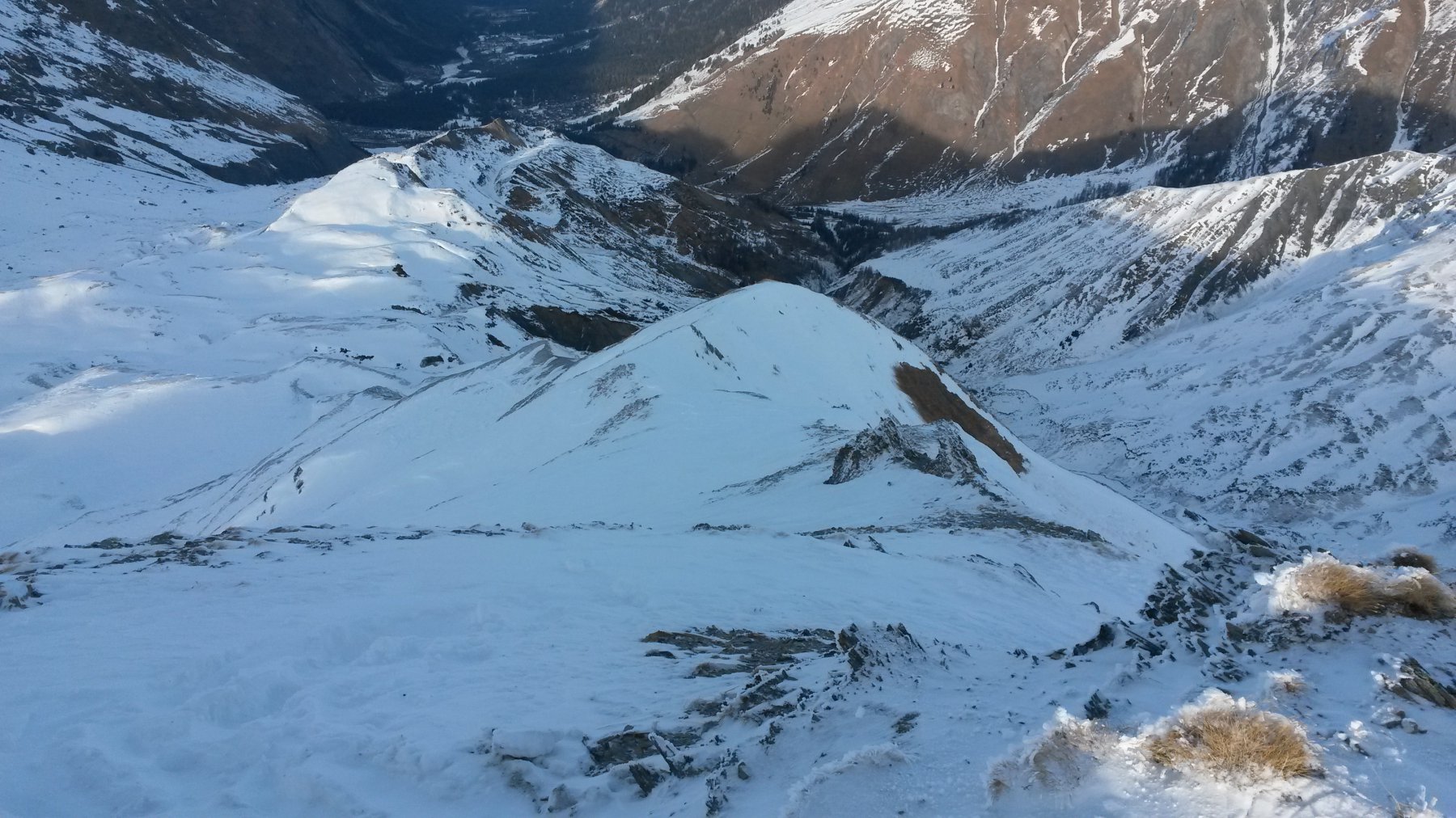
Si segue la comba fino a quota 2150 circa, quando, in corrispondenza di un grosso masso, il percorso di discesa piega decisamente a destra, facendoci raggiungere (dopo qualche traverso un po’ scomodo per le ciaspole) i pendii sopra Ferret che erano visibili già alla partenza. Da qui il resto della discesa fino al ponticello è elementare.
- Cartografia:
- CNS 1:50000 492S - Mont Blanc
Nelle vicinanze Mappa
Itinerari
12/12/2015 Entremont, Orsières D+ 1240 m MR Nord
Angroniettes (Aiguille des) e Pointe de Combette da la Fouly, anello
 650m
650m
27/12/2015 Entremont, Orsières D+ 1396 m BR Nord-Est
Ecandies (Col des) da Champex Lac per il vallone d’Arpette
 11.1Km
05/03/2025 Visp, Bourg San Pierre D+ 550 m MR Varie
Gran San Bernardo (Colle del) da Bourg Saint Bernard
 11.4Km
13/12/2015 Entremont, Bourg-Saint-Pierre D+ 1036 m BR Est
Telliers (Monts) da Bourg Saint Bernard
 11.4Km
16/02/2025 AO, Saint-Rhemy-En-Bosses D+ 877 m MR Nord-Est
Serena (Col) da Crévacol
 13.6Km
19/12/2025 AO, Saint-Rhemy-En-Bosses D+ 400 m MR Nord-Ovest
Arp du Bois da Crévacol
13.6Km
19/02/2023 AO, Saint-Rhémy-en-Bosses D+ 1200 m BRA, PD Ovest
Serena (Testa di), Hugues couloir da Mottes
 13.6Km
24/03/2012 AO, Saint-Rhemy-En-Bosses D+ 1370 m BRA, F+ Est
Tapie (Mont) o Tapier canale Est
 13.6Km
15/12/2013 AO, Saint-Rhemy-En-Bosses D+ 1089 m BR Nord-Est
Serena (Costa di) quota 2739 m da Mottes
 13.6Km
20/03/2022 AO, Saint-Rhemy-En-Bosses D+ 1200 m MRA, PD- Nord-Est
Serena (Testa di) da Crevacol per il Col Serena e la Cresta NO
13.6Km
Servizi
50m
 50m
50m
Auberge des Glaciers Albergo
La Fouly 100m
100m
Supermarché de La Fouly Servizi
La Fouly 100m
100m
Glaciers Ristorante
La Fouly 150m
150m
Hotel Edelweiss Albergo
La Fouly 200m
200m
Auberge de Maya Joie Albergo
La Fouly 200m
200m
Majya-Joie Ristorante
La Fouly 200m
200m
Edelweiss Ristorante
La Fouly 400m
400m
Chalet le Dolent B&B
La Fouly 450m
450m