150m
150m
Note
Storico
 50m
50m
400m
400m
400m
1.6Km
1.6Km
3.1Km
3.9Km
3.9Km
50m
50m
400m
400m
400m
1.6Km
1.6Km
3.1Km
3.9Km
3.9Km
150m
150m
400m
1.8Km
3.8Km
4.1Km
5.9Km
5.9Km
6.2Km
6.3Km
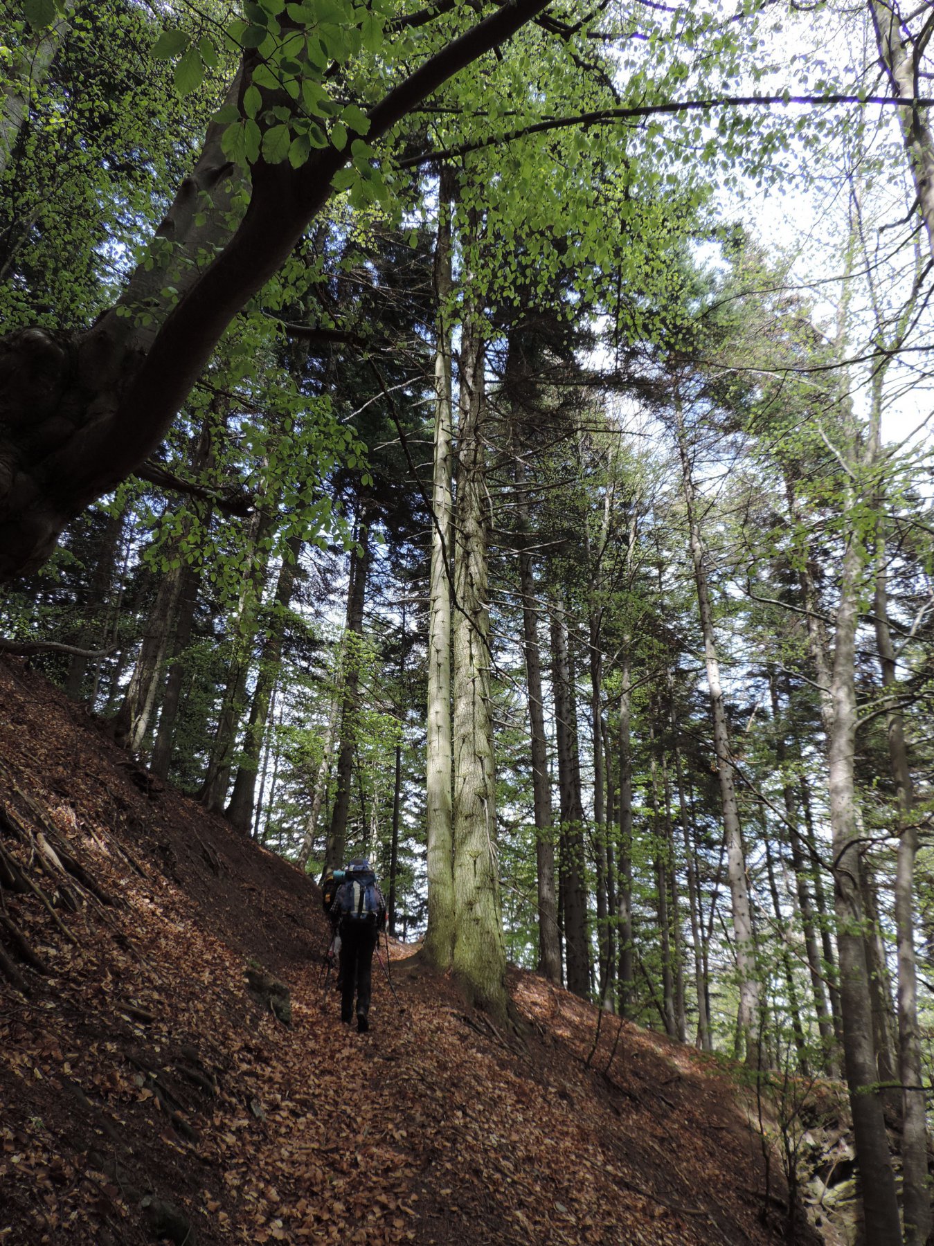
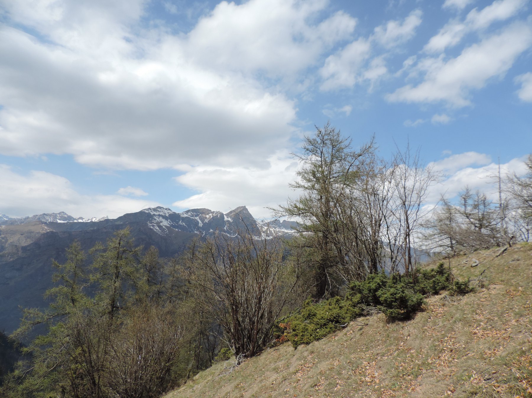
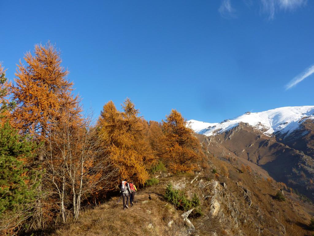
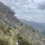
Lunga escursione sulla destra idrografica del Maira. Percorso quasi completamente in un bosco di latifoglie e aghifoglie, abbondantemente segnato con tacche giallo/blu o gialle. In parte inglobato nel GTA si trovano anche i segni biancorossi. Da farsi in mezza stagione, dato che le quote sono basse.
Avvicinamento
Seguire la strada della Val Maira SP422 fino a Bassura (Stroppo). Parcheggiare all'estremità E (vicino alla palina del Bus)
C'è anche un piccolo parcheggio all'inizio dell'itinerario, un 30 metri sulla stradina.
Descrizione
C'è anche un piccolo parcheggio all'inizio dell'itinerario, un 30 metri sulla stradina.
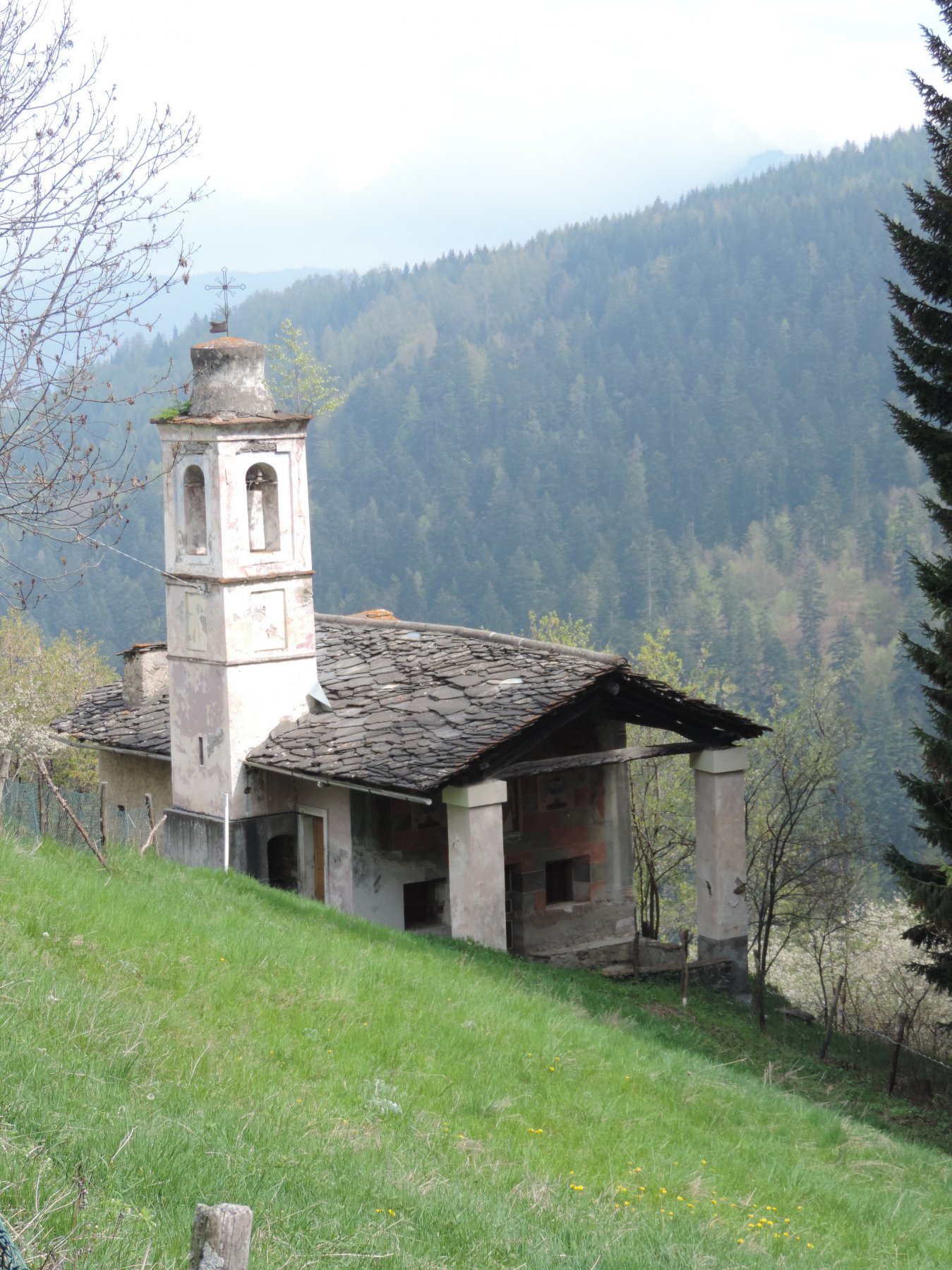
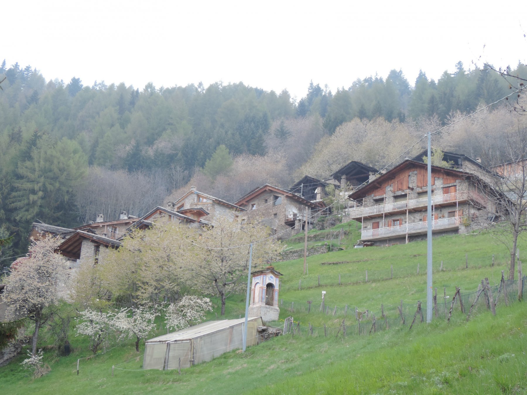
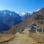
All’estremità E di Bassura si lascia la strada provinciale e si seguono i cartelli per la via Napoleonica.Per una stradina sii attraversa Bassura e si scende ad attraversare il Maira (circa 50 mt di dislivello). Si risale la strada forestale per 350 mt e si prende a destra (palina) la via Napoleonica. La mulattiera sale nel bosco fino a quota 1070 dove incontra di nuovo la strada che ha fatto un lunghissimo tornante a E. La si segue per 500 mt verso W e poi si riprende la mulattiera sulla sx che sale decisa nella Comba Turnoira sempre nel bosco. Tra gli alberi appaiono le borgate di Stroppo e poi la catena Chersogno/Pelvo. Dopo 2,4 km e 530 mt di dislivello si arriva al colle inf. dell’Encucetta, segnato sulle carte a 1601 mt. La via Napoleonica prosegue per Marmora ( 1h di cammino). Si prende invece a sx sul colle (palina) in direzione Palent e con ripida salita sul versante di Marmora si raggiunge il colle superiore (1710) e si ritorna nella comba Turnoira sul versante di Stroppo. La mulattiera prosegue con saliscendi per ca. 1 km per poi salire con uno strappo a quota 1760, discendere rapidamente nella comba del Rio Fiota e continuare in discesa piegando verso NE lungo la cresta che scende dal monte Buch. Diventata ormai una strada, aggira il costone e scende alla borgata Palent (Posto Tappa). Trascurata la rotabile si riprende la mulattiera verso NE che passa a fianco della cappella di S.Magno (mt.1446) e raggiunge le borgate di Maurengo e Aramola. SI segue sempre a sx lasciando a destra prima la rotabile e poi il sentiero per Pessa, raggiungendo la cappella della Madonna (1301). Contornando in alto la Tampa per ca 1 km con saliscendi la mulattiera si affaccia sulla comba del Rio Mezzogiorno, dove discende con ripidi tornanti. Attraversato il rio, si prosegue ancora per 400 mt e si ritorna sulla strada forestale poco a monte del bivio della Napoleonica. Seguendo a ritroso il cammino dell’andata, si discende ad attraversare il Maira e si ritorna al parcheggio.
La "Via Napolenica" è il tratto tra Bassura di Stroppo e Marmora dell'antica Strada dei Cannoni che collegava Casteldelfino con la val Stura e che serviva per il Savoia a muovere le truppe contro i Franco Spagnoli nelle guerre del 1700. Deve il nome al fatto che fu restaurato nel 1810 da un ufficiale francese dell'esercito napoleonico che ne aveva ravvisato una qualche utilità militare
- Cartografia:
- Fraternali 1:25000 n.11
- Bibliografia:
- Le Valli Maira e Grana - Piera e Giorgio Boggia
Nelle vicinanze Mappa
Itinerari
12/05/2020 CN, Stroppo D+ 1250 m E Nord
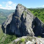
Buch (Monte) da Stroppo
 50m
50m
13/06/2021 CN, Stroppo D+ 1600 m E Sud
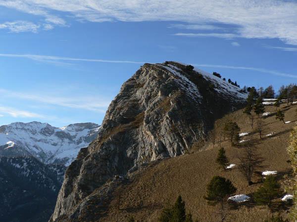
Nebin (Monte) da Stroppo
 50m
50m
24/11/2024 CN, Stroppo D+ 400 m E Sud
Diavolo (Grotta del) da Paschero, anello
 400m
400m
27/06/2024 CN, Stroppo D+ 831 m E Sud
Bettone (Monte) da Paschero e il Monte Betunet
 400m
400m
06/12/2007 CN, Stroppo D+ 781 m E Tutte
Bettone (Colle) da Paschero, anello
 400m
400m
25/02/2024 CN, Stroppo D+ 1250 m EE Sud-Ovest
Nebin (Monte) e Monte Cugulet da Morinesio per la Bassa di Rasis o di Rocciaset
 1.6Km
1.6Km
20/11/2022 CN, Stroppo D+ 1100 m EE Sud-Est
Cugulet (Monte) e Cima Lubin da Morinesio, anello
 1.6Km
1.6Km
03/05/2025 CN, Stroppo D+ 850 m E Sud
Lu Viol dal Geneste da Ponte Marmora, anello
 3.1Km
3.1Km
24/03/2022 CN, Stroppo D+ 700 m E Varie
Castello (Cresta del) da Chiampo, anello per Pessa, Aramola e Colletto
 3.9Km
3.9Km
01/11/2025 CN, Celle di Macra D+ 550 m E Varie
Palent, Curbia, Aramola (Borgate) da Garini per il Sentiero dei Fotografi
 3.9Km
3.9Km
Servizi
150m
150m
Napoleonica Ristorante
Stroppo
400m
La Freidio B&B
Marmora
1.8Km
Alpes d’Oc B&B
Stroppo
3.8Km
La sousto du col Rifugio
Elva
4.1Km
Gentil Locanda Ristorante
Marmora
5.9Km
San Pancrazio – Hans Clemer Albergo
Elva
5.9Km
Dei Ciclamini Ristorante
Macra
6.2Km
Lu Pittavin Rifugio
Marmora
6.3Km