2.6Km
2.6Km
Note
Storico
 1.1Km
1.4Km
1.6Km
3.7Km
3.7Km
3.8Km
6.9Km
7.3Km
7.3Km
8.5Km
1.1Km
1.4Km
1.6Km
3.7Km
3.7Km
3.8Km
6.9Km
7.3Km
7.3Km
8.5Km
2.6Km
3.2Km
3.8Km
4.2Km
4.8Km
6Km
6.1Km
6.1Km
6.1Km
6.9Km
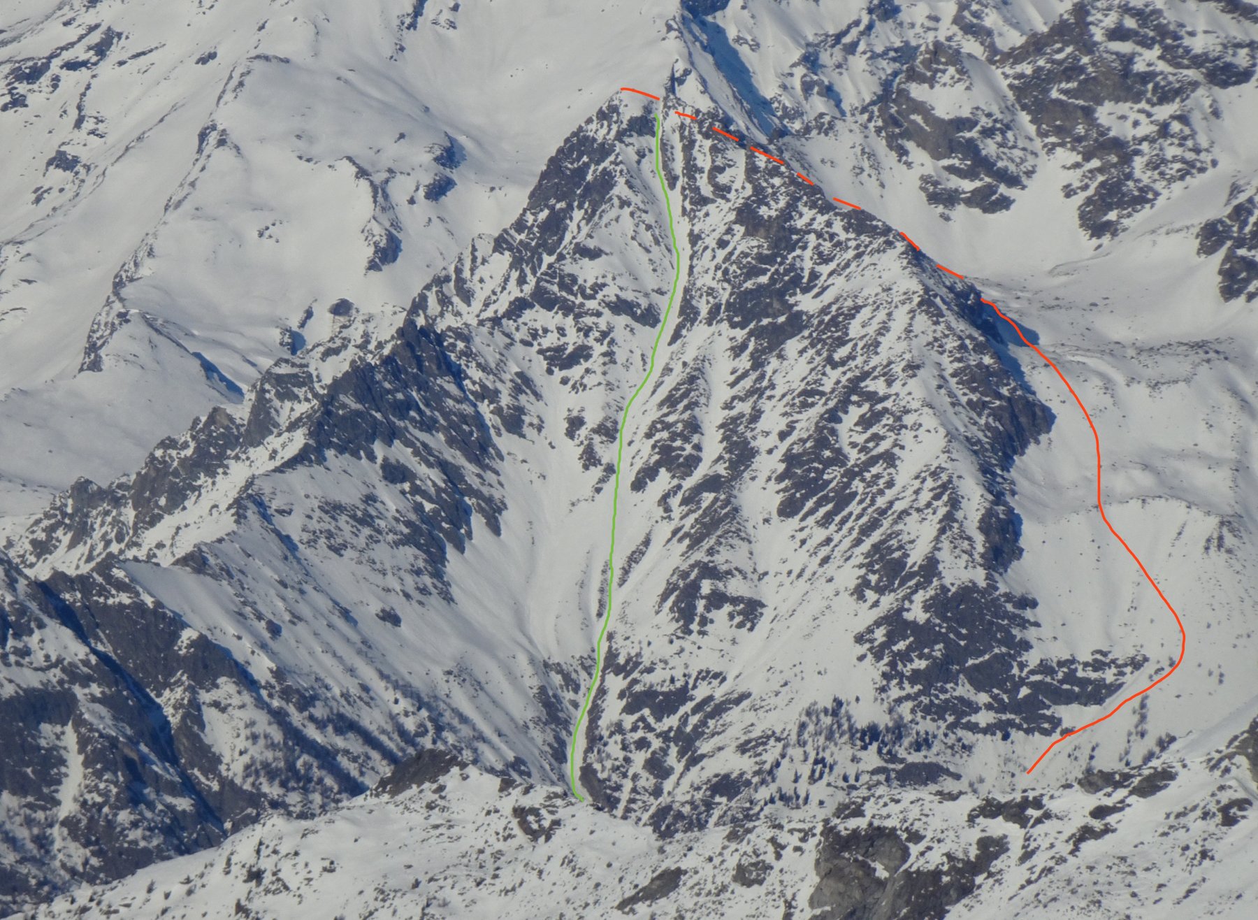
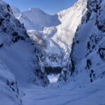
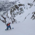
Itinerario di rara bellezza ben visibile dal comprensorio sciistico di Pila, un canale lunghissimo solca l'intera parete sud del mont Berrio (montagna che chiude verso sud la cresta del mont morion).
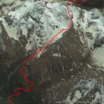
Avvicinamento
Da Aosta si percorre la strada regionale per Bionaz, poco prima di Oyace ci si ferma ad uno slargo sulla sinistra nei pressi di un tornante ( Cartello Chalambé) a quota 1300 nei pressi di una poderale con divieto di transito (posto auto limitato bordo strada)
Descrizione
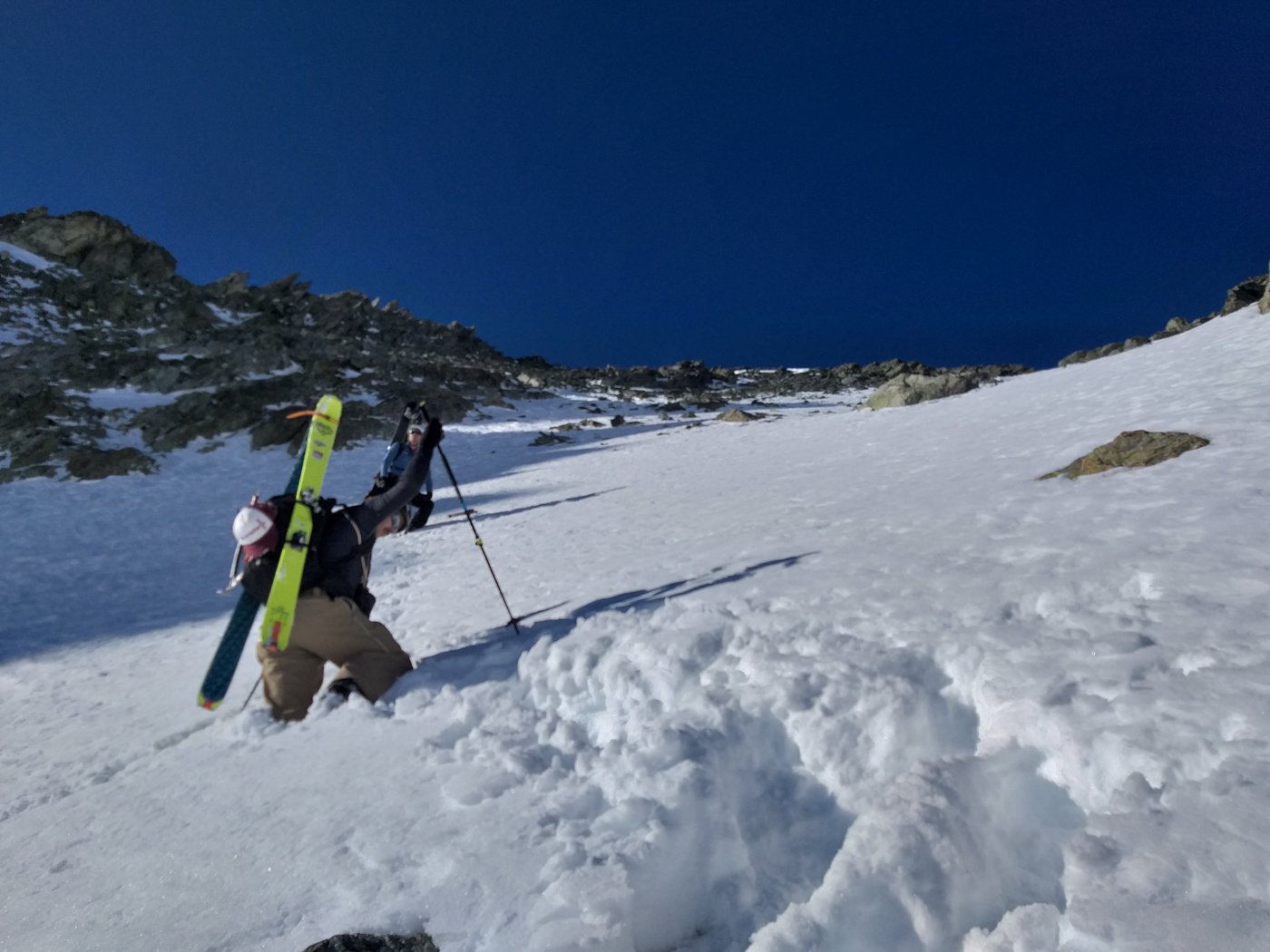
Dal parcheggio auto si segue la poderale fin nei pressi della chiesetta Ss Bernardo e Marco oltre la quale si stacca sulla destra un sentiero ripido nel bosco che passa dapprima dalle baite “Dzon” e poi, vincendo un ripido bosco di larici, sbuca a quota 2200 nei pressi dell’alpe Bruson.
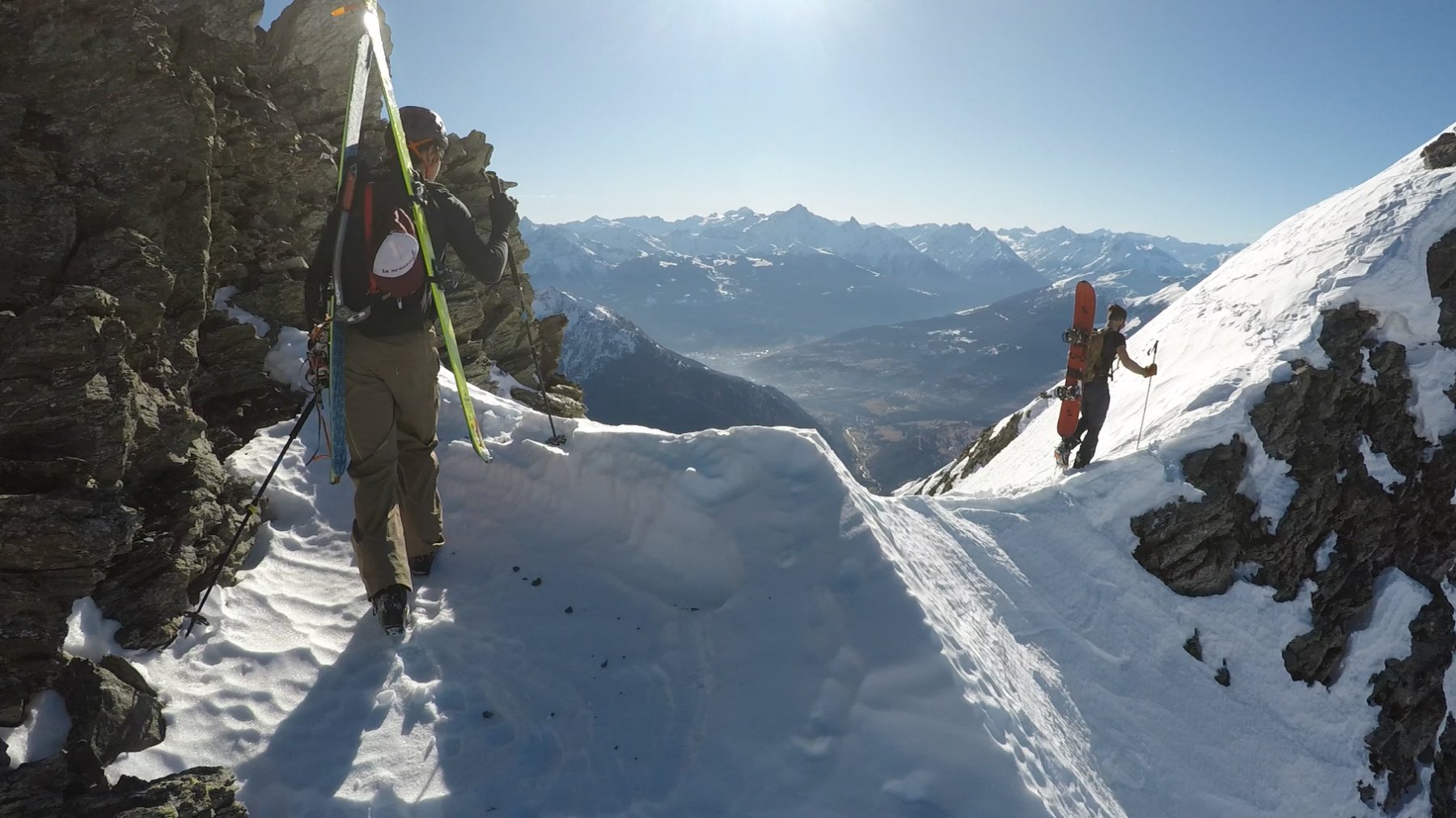
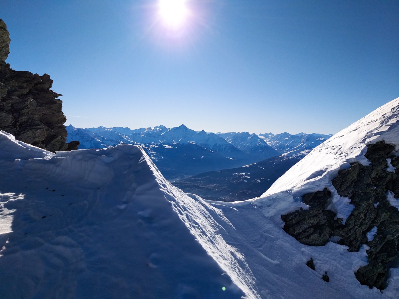
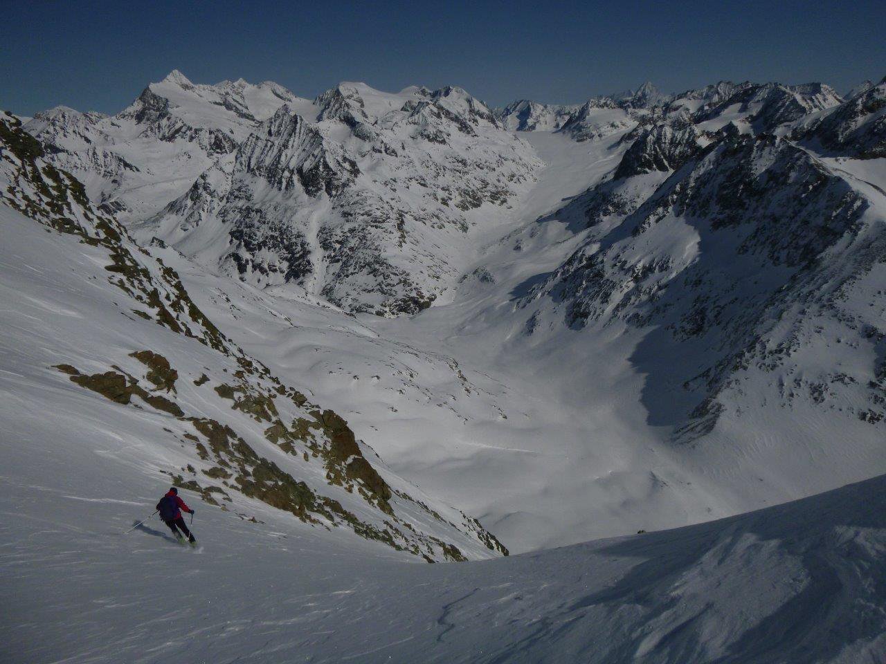
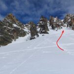
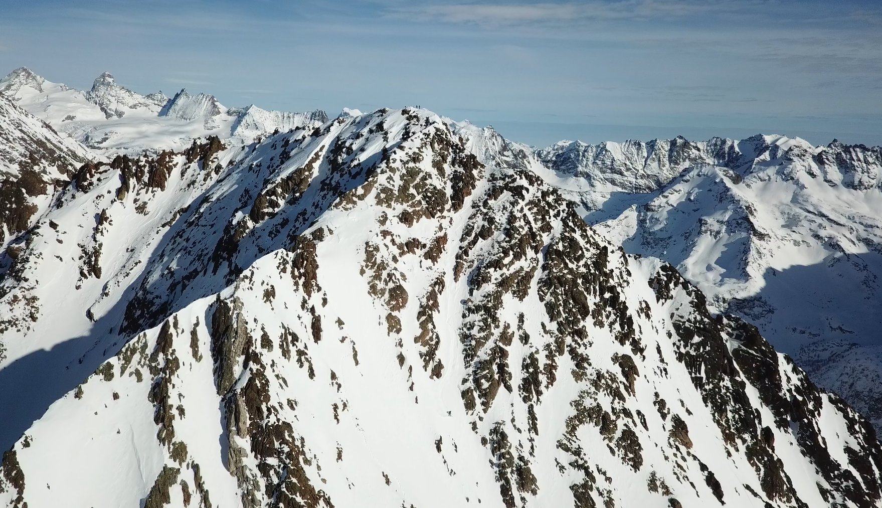
Da qui il canale è già visibile, si affrontano i bei pendii assolati ad est della cima che con pendenza dolce portano alla base della conca Est del monte Berrio delimitata da Pointe Gorret, Punta Fiorio e la parete est del monte berrio che si risale senza itinerario obbligato fino a sbucare ad un colletto molto aereo ed estetico da cui si può vedere l’imbocco del canale sud, da qui in breve in vetta.
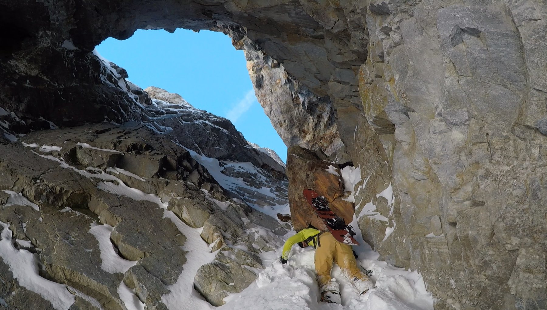
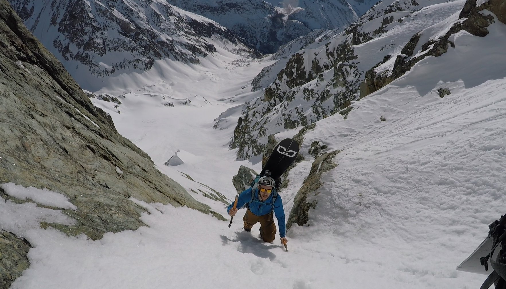
Discesa: si possono fare due curve sulla calotta sommitale (molto esposto) ma conviene traversare subito per entrare nel canale che presenta inizialmente una strettoia e delle pendenze intorno ai 45° per poi ammorbidirsi notevolmente nella seconda sezione.
Arrivati a base canale in base all’innevamento si può tagliare a sinistra per sbucare sui bei pendii che portano di nuovo all’alpe Bruson e di li all’itinerario percorso in salita, oppure seguire la gorgia che rappresenta la prosecuzione del canale fino a quota 1500 circa, dove si trova un sentiero in mezzacosta che porta alle baite Dzon e a ripercorrere il sentiero percorso in salita.
Il nome deriva dal gallo forcello che a fine discesa nei pressi dell'alpe Bruson si è alzato improvvisamente in volo per fuggire alla presenza umana.
Probabile prima discesa in sci e snowboard 11 Gennaio 2020 : Paolo Catalani, Stefano Daniotti, Flavio Migliavacca, Francesco Procacci, Federico Ravassard Nome proposto: la fuga del gallo
Probabile prima discesa in sci e snowboard 11 Gennaio 2020 : Paolo Catalani, Stefano Daniotti, Flavio Migliavacca, Francesco Procacci, Federico Ravassard Nome proposto: la fuga del gallo
- Cartografia:
- L'escursionista 1/25.000 n° 6
- Bibliografia:
- Guida Monti d'Italia - Alpi Pennine vol. I
Nelle vicinanze Mappa
Itinerari
13/02/2021 AO, Oyace D+ 1722 m III, 4.3, E3 Est
Gorret (Pointe) Canale Est
 1.1Km
1.1Km
20/02/2020 AO, Oyace D+ 1700 m II, 5.2, E3 Ovest
Etresenda (Becca de l’) Canale Ovest – Il Mito della Caverna
 1.4Km
1.4Km
16/12/2023 AO, Oyace D+ 1700 m IV, 4.3, E2 Ovest
Aquelou Ovest (Breche d’) Couloir delle Cattedrali
 1.6Km
1.6Km
14/03/2016 AO, Bionaz D+ 1830 m I, 4.2, E2 Nord-Est
Balme (Col de) Canalone NE
 3.7Km
3.7Km
04/01/2020 AO, Bionaz D+ 1700 m 5.1, E2 Est
Esther (Brèche) Canale E, Wild Wild Esther
 3.7Km
3.7Km
07/02/2026 AO, Bionaz D+ 1200 m II, 4.2, E2 Sud-Ovest
Charmantagne (Pic) – Couloir Ale
 3.8Km
3.8Km
18/02/2021 AO, Bionaz D+ 1500 m I, 4.1, E1 Nord-Ovest
Invergnaou (Becca d’) cima Ovest versante NO
 6.9Km
6.9Km
08/02/2020 AO, Bionaz D+ 1600 m 5.1, E2 Sud-Ovest
Chatelet (Becca) Couloir del Sarto
 7.3Km
7.3Km
22/02/2020 AO, Bionaz D+ 1800 m III, 5.2, E4 Sud-Est
Epicoun (Bec d’) o Becca Rayette, anticima est Parete Est
 7.3Km
7.3Km
03/04/2021 AO, Bionaz D+ 1800 m II, 4.1, E2 Varie
Arbières (Becca des) Canale Ovest
 8.5Km
8.5Km
Servizi
2.6Km
3.2Km
Lac Lexert Campeggio
Bionaz
3.8Km
Crête Sèche Rifugio
Bionaz
4.2Km
Vecchio Suisse Ristorante
Valpelline
4.8Km
Lievre Amoureux Albergo
Valpelline 6Km
6Km
Compagnie des Guides de la Valpelline et du Gran Saint Bernard Professionisti
Aosta
6.1Km
Clé du Paradis B&B
Bionaz
6.1Km
Valentino Albergo
Bionaz
6.1Km
Betemps B&B
Bionaz
6.9Km