2Km
2Km
Note
 2.1Km
2.3Km
2.4Km
5.7Km
6.4Km
6.4Km
6.4Km
6.4Km
6.4Km
6.4Km
2.1Km
2.3Km
2.4Km
5.7Km
6.4Km
6.4Km
6.4Km
6.4Km
6.4Km
6.4Km
2Km
2.2Km
2.2Km
2.4Km
3.5Km
3.7Km
4.9Km
5.5Km
5.7Km
5.7Km
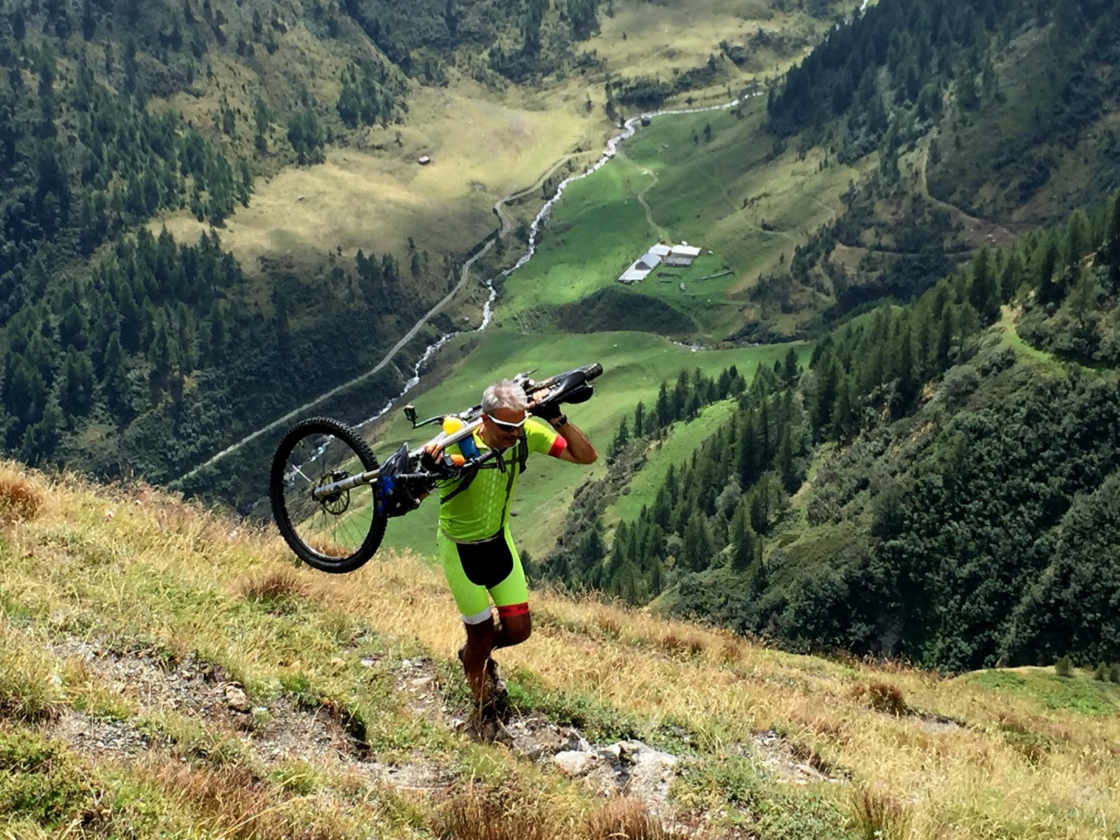
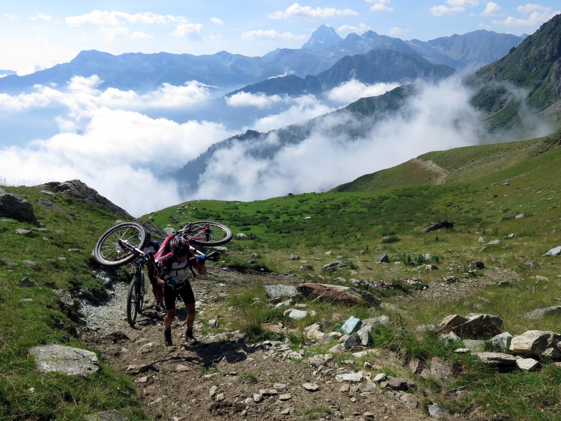
Itinerario originale proposto per la prima volta sulla guida Dal Monviso alla Val di Susa in MTB della CDA, come variante OCA. Nella descrizione originale della guida, ormai datata, veniva già chiaramente citato il limite di utilizzo della bicicletta per il lungo trasporto a spalle di 500m dsl e anche x la poca ciclabilità della prima parte di sentiero dal colle e i passaggi tecnici della mulattiera nella parte inferiore.
A seguito della nostra ripetizione, viene riconfermato l'impegno per la salita al colle (che non è cambiato), la difficoltà tecnica del sentiero che nella prima parte da colle si perde un po nei pendii ripidi e invece dall'Alpe Salza a 1818m si trova la sorpresa di una bella discesa su sentiero e poi mulattiera scorrevole. Il tutto sistemato e mantenuto in straordinario stato dai laboriosi pastori che salgono e lavorano all'alpeggio, a cui riconoscere questo impegno cosi' raro da ritrovare nelle nostre montagne.
Se convinti di effettuare il giro conviene partire da Didiero 1210m anzichè da Rodoretto per evitare la risalita al colletto delle Fontane 1572m a fine discesa.
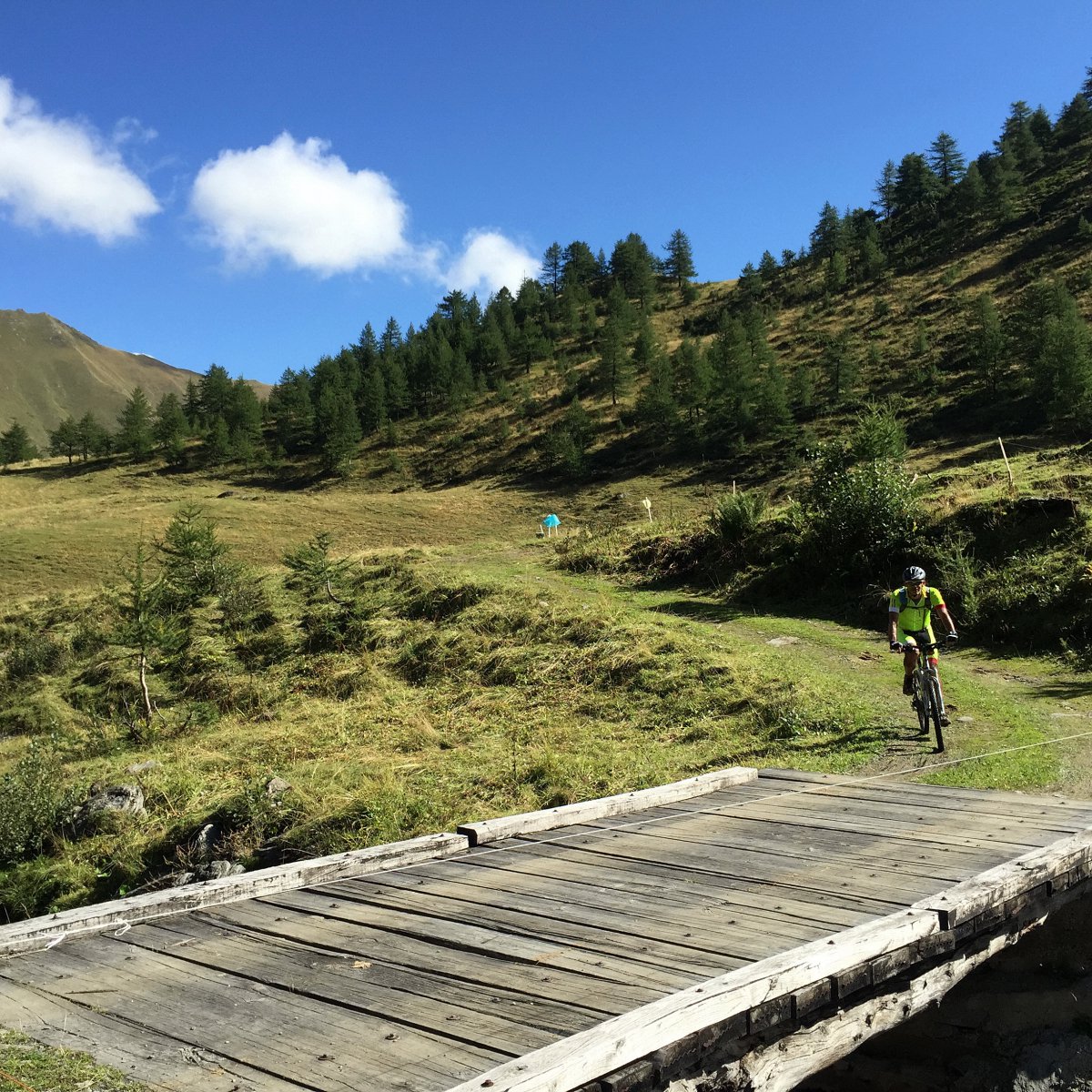
Avvicinamento
A seguito della nostra ripetizione, viene riconfermato l'impegno per la salita al colle (che non è cambiato), la difficoltà tecnica del sentiero che nella prima parte da colle si perde un po nei pendii ripidi e invece dall'Alpe Salza a 1818m si trova la sorpresa di una bella discesa su sentiero e poi mulattiera scorrevole. Il tutto sistemato e mantenuto in straordinario stato dai laboriosi pastori che salgono e lavorano all'alpeggio, a cui riconoscere questo impegno cosi' raro da ritrovare nelle nostre montagne.
Se convinti di effettuare il giro conviene partire da Didiero 1210m anzichè da Rodoretto per evitare la risalita al colletto delle Fontane 1572m a fine discesa.
da Pinerolo con la ex SS 23si giunge a PerosaArgentina da dove si svolta a sx x la Val Germanasca. Superato Perrero, dopo aver seguito un primo tratto della strada che sale a Prali, dopo Perrero si prende a dx dopo il ponte per Massello e poi a sinistra x Salza di Massello Didiero.
Descrizione
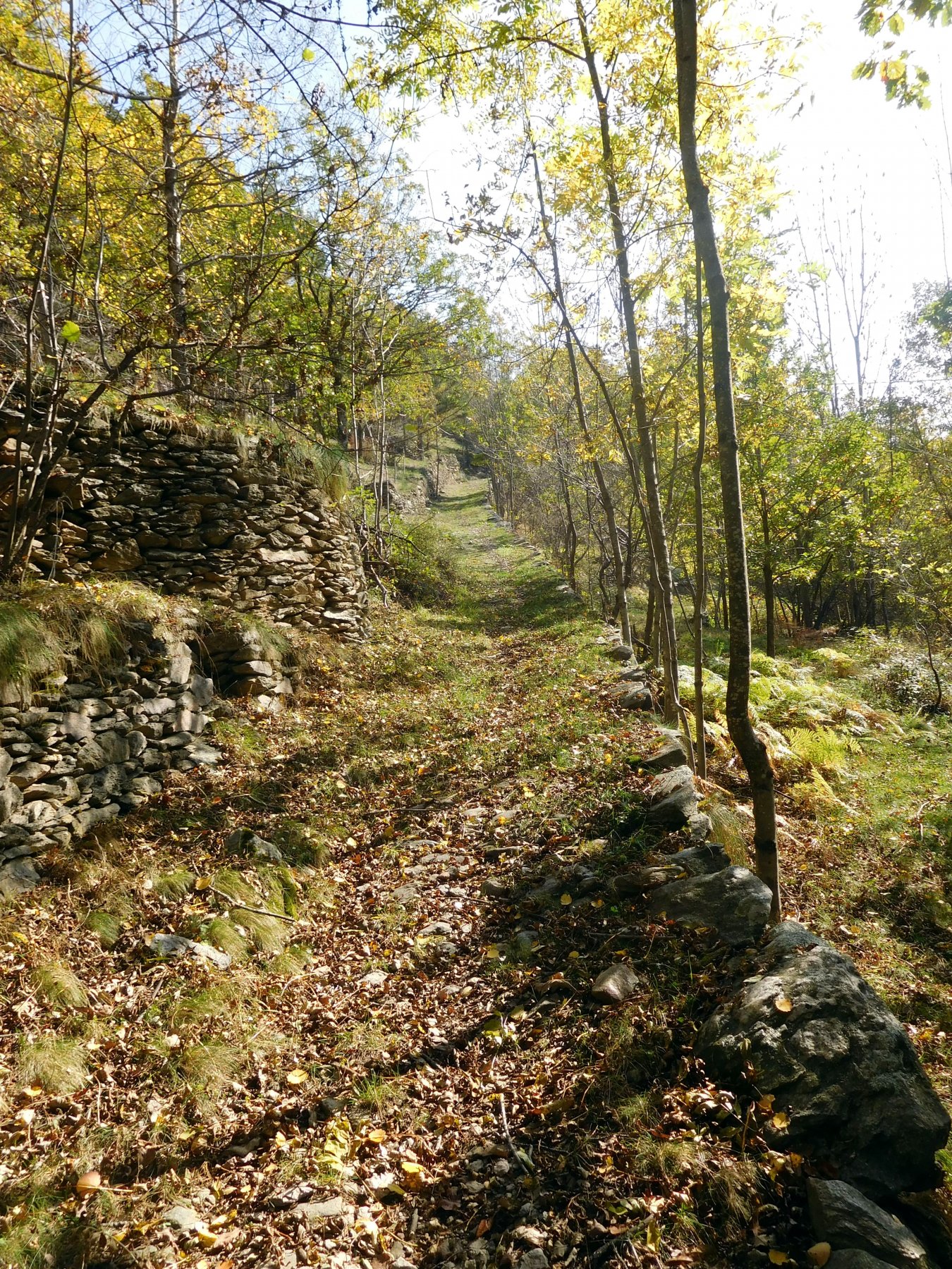
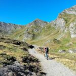
Parcheggiato a Didiero 1210m e attraversato il paese si prende la bella sterrata a sx che sale al colletto delle Fontane 1572m. Raggiunta l’area picnic si può decidere se salire al c.le di Serrevecchio con una parte non ciclabile e una discesa tecnica sino a Serrevecchio o scendere a Fontane e risalire a Serrevecchio.
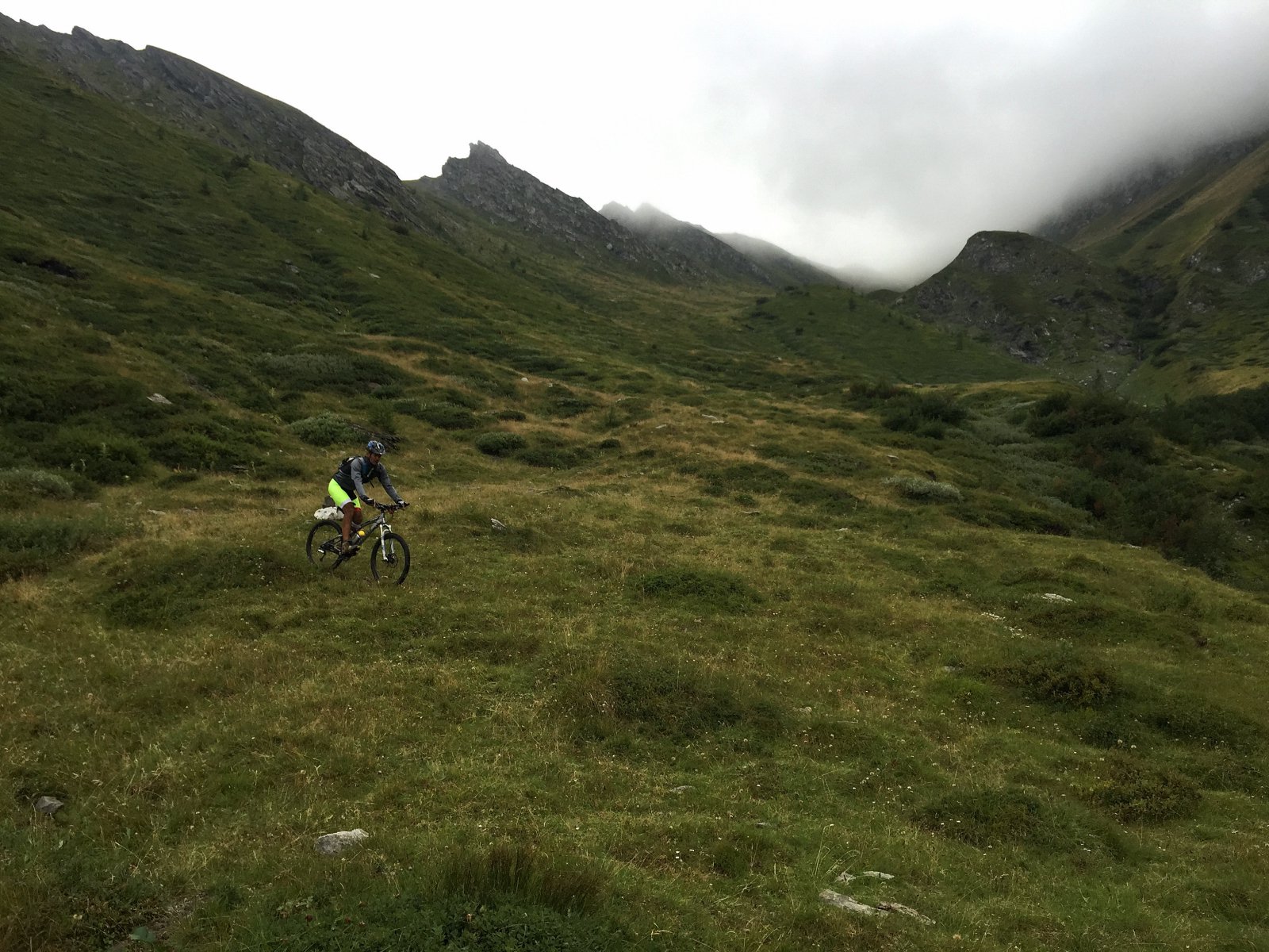
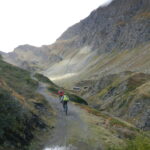
Da qui si scende su sentiero a Rodoretto. Poi su asfalto e successivamente su sterrato si risale all’Alpe della Balma 1710m, che si raggiunge attraversando il torrente su un ponte. Dall’Alpe il sentiero per la salita al colle non è proprio evidente si evidenzia chiaramente + in alto. Poi sino al colle gli infiniti tornati sul pendio prativo.
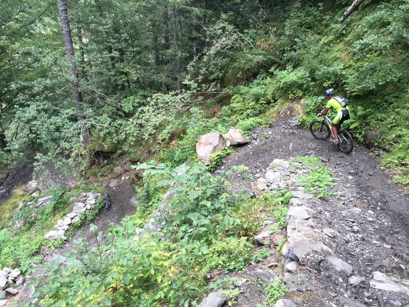
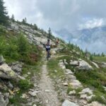
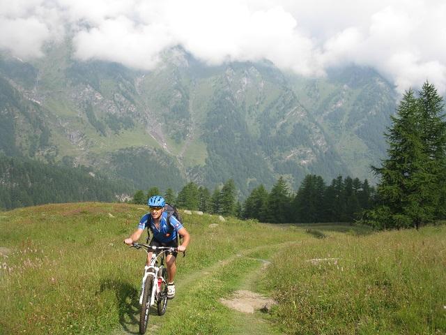
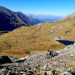
Discesa, da colle subito evidente e non ciclabile poi tenere il lato dx orografica del vallone cercando i passaggi migliori e le tracce di percorso sino a dei piani dove le pascola le mandrie dell’Alpe Salza. nel secondo piano radura si scende a sx e al torrente su sentiero lavorato dalle mucche. passato il rio si risale all’Alpe. Occhio ai maremmani. Da qui prima su passaggi esposti sul lato sx orogr. poi scesi al torrente e risaliti sul lato opposto il sentiero passa a mulattiera con un sezione a tornanti perfettamente ciclabili, poi sterrata sino a Didiero.
- Cartografia:
- IGC 1:50.000 Valli di Susa, Chisone e Germanasca
- Bibliografia:
- Dal Monviso alla Val di Susa in MTB
Nelle vicinanze Mappa
Itinerari
20/10/2018 TO, Massello D+ 700 m MC, BC+, S2 Sud-Ovest
Troncea (Pascoli) da Massello, giro
 2.1Km
2.1Km
03/08/2019 TO, Prali D+ 5600 m OC, OC, S3 Tutte
Rodoretto, Thuras, Croce, Giulian, Balma (Colli) da Rodoretto, giro della Punta Ramiere
 2.3Km
2.3Km
09/09/2015 TO, Prali D+ 2350 m BC+, OC+, S4 Varie
Frappier, Rodoretto, Longia (Colli) da Rodoretto, giro
 2.4Km
2.4Km
19/08/2020 TO, Prali D+ 2650 m BC+, OC+, S4 Tutte
Cerisira (Punta) da Prali, giro del Bric Bucie per Lago Verde, Colle di Valpreveyre, Col Bucie, Alpe Bancet
 5.7Km
5.7Km
02/10/2021 TO, Prali D+ 1200 m OC, BC, S0 Nord-Ovest
Lago Verde (Rifugio) da Prali
 6.4Km
6.4Km
06/07/2025 TO, Prali D+ 1000 m BC, BC+, S3 Varie
Bianca (Rocca) e Lago di Envie da Prali, giro
 6.4Km
6.4Km
19/07/2014 TO, Prali D+ 1580 m BC+, BC+, S2 Varie
Rametta (Passo) da Prali, giro dei 13 Laghi
 6.4Km
6.4Km
28/06/2026 TO, Prali D+ 1500 m BC, BC+, S2 Tutte
Gran Guglia (Colletto della) da Prali, giro della Gran Guglia per il Rifugio Lago Verde
 6.4Km
6.4Km
09/09/2023 TO, Prali D+ 2300 m BC, BC+, S2 Varie
Abries e Valpreveyre (Colli) da Prali, giro per Valpreveyre
 6.4Km
6.4Km
30/07/2022 TO, Prali D+ 1200 m BC, BC, S3 Varie
Abriès (Col d’) da Prali, traversata ad Abries
 6.4Km
6.4Km
Servizi
2Km
2.2Km
Da Piero Ristorante
Salza di Pinerolo
2.2Km
La foresteria di Massello Rifugio
Massello
2.4Km
Da Mafalda Ristorante
Prali
3.5Km
GTA Balziglia Rifugio
Massello
3.7Km
Charlie Bar Ristorante
Prali
4.9Km
Serpillo B&B
Perrero
5.5Km
Nido dell’orso Ristorante
Prali
5.7Km
Agape Rifugio
Prali
5.7Km