3Km
3Km
Note
 50m
50m
2.9Km
2.9Km
4.7Km
5Km
50m
50m
2.9Km
2.9Km
4.7Km
5Km
3Km
3.2Km
3.3Km
4.6Km
5.1Km
7.1Km
8.7Km
8.7Km
9Km
9.3Km
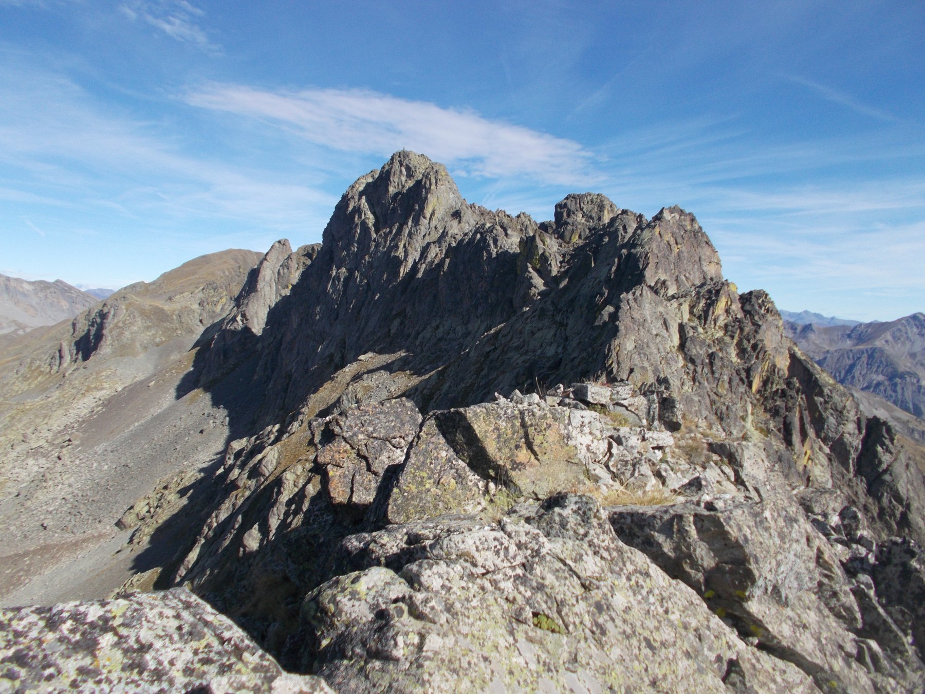
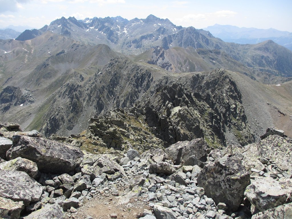
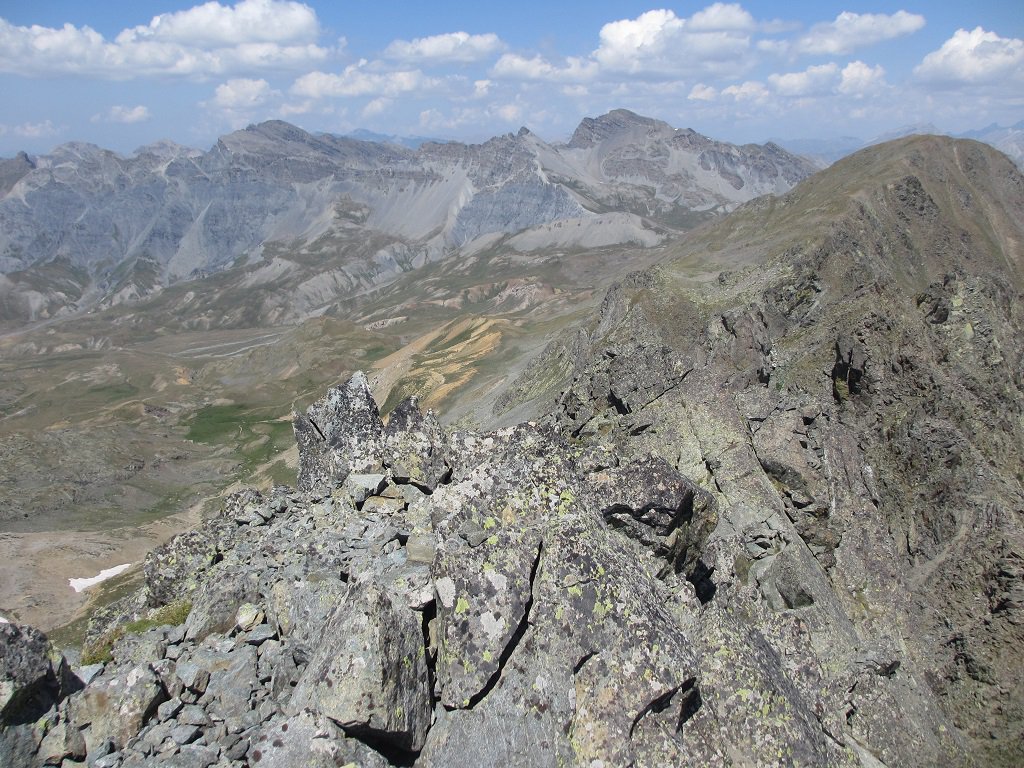
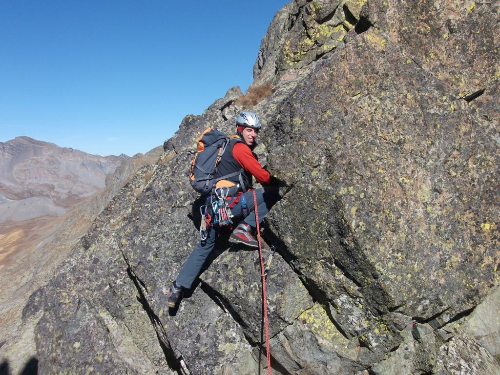
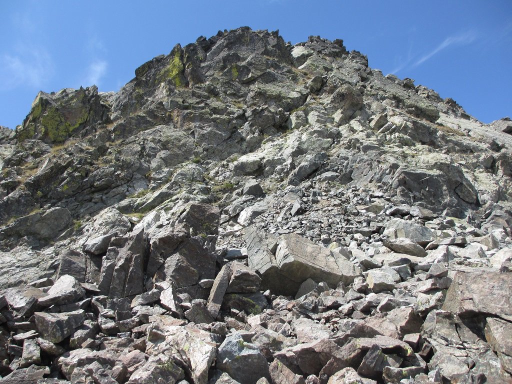
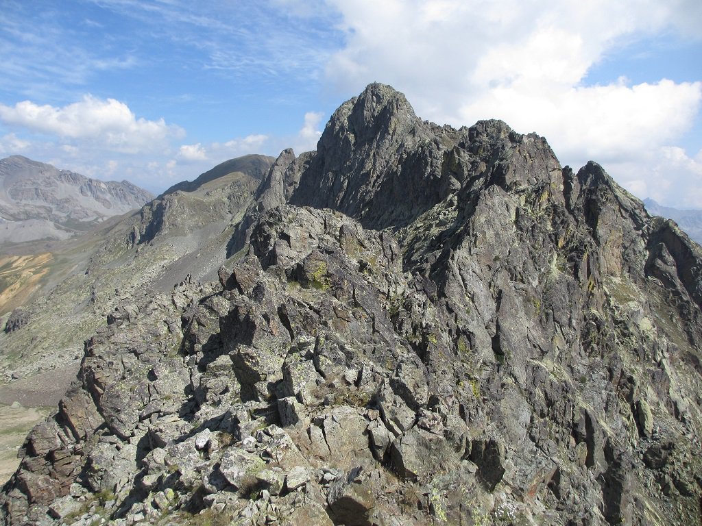
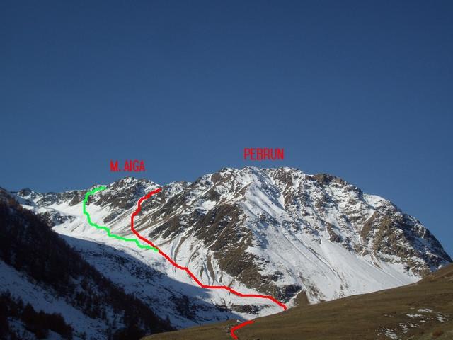
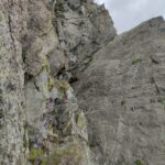
Si staglia come un castello merlato di rocce cristalline grigiastre sullo spartiacque Stura-Tinée. La cresta sud fu scalata integralmente per il suo filo solo nel 1995 dai cuneesi Tommaso e Tarcisio Martini.
Descrizione
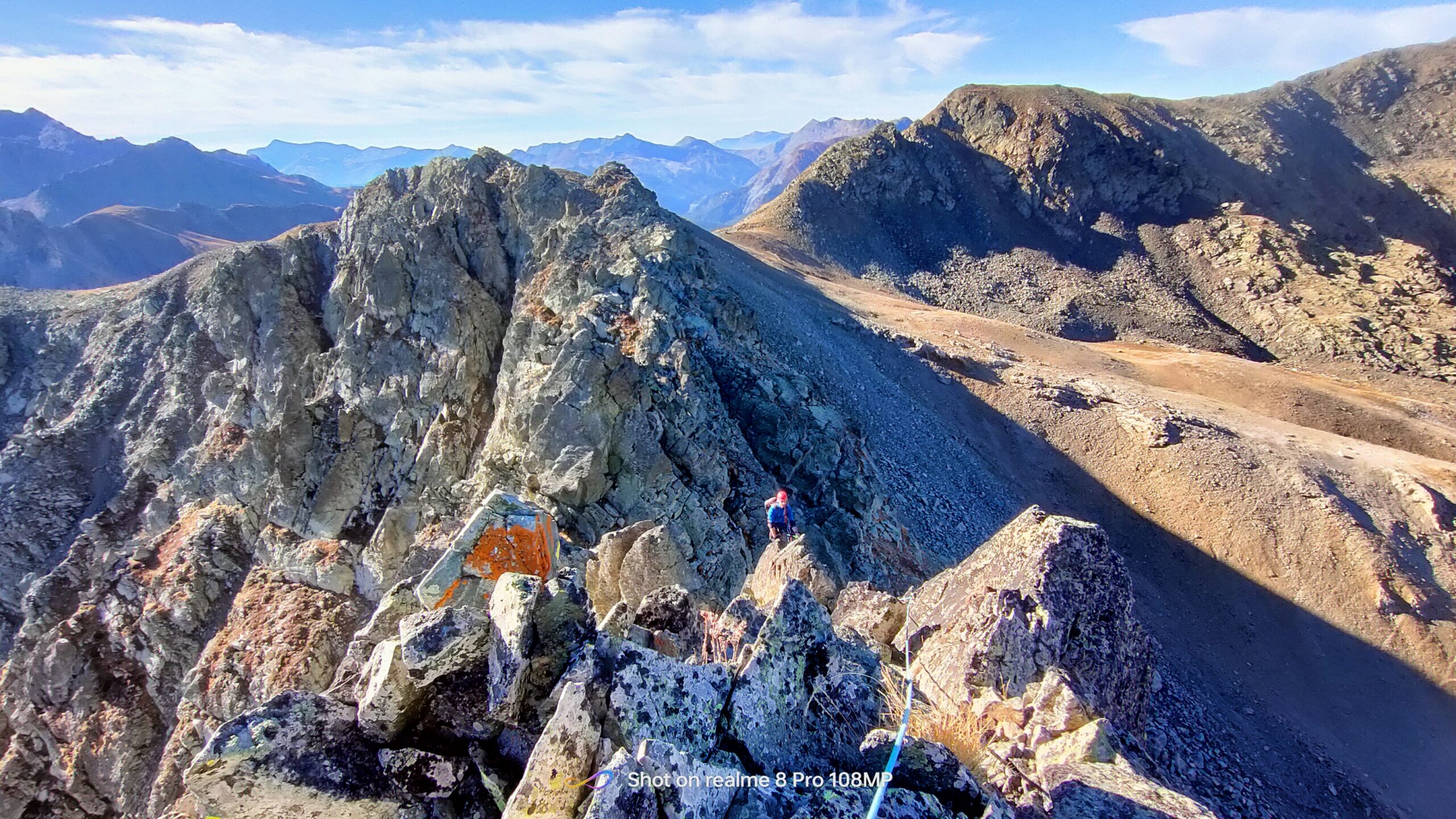
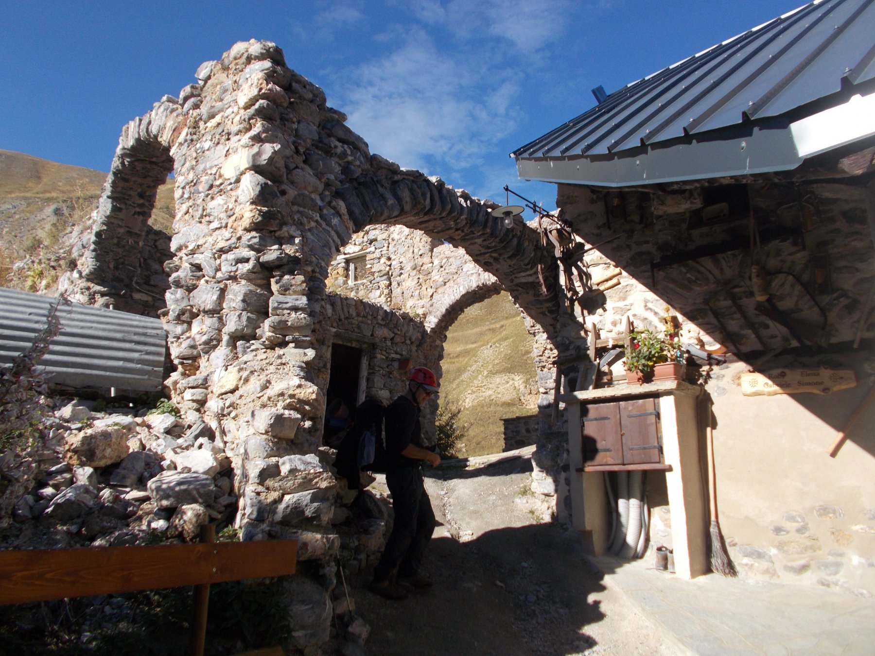
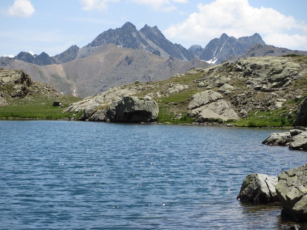
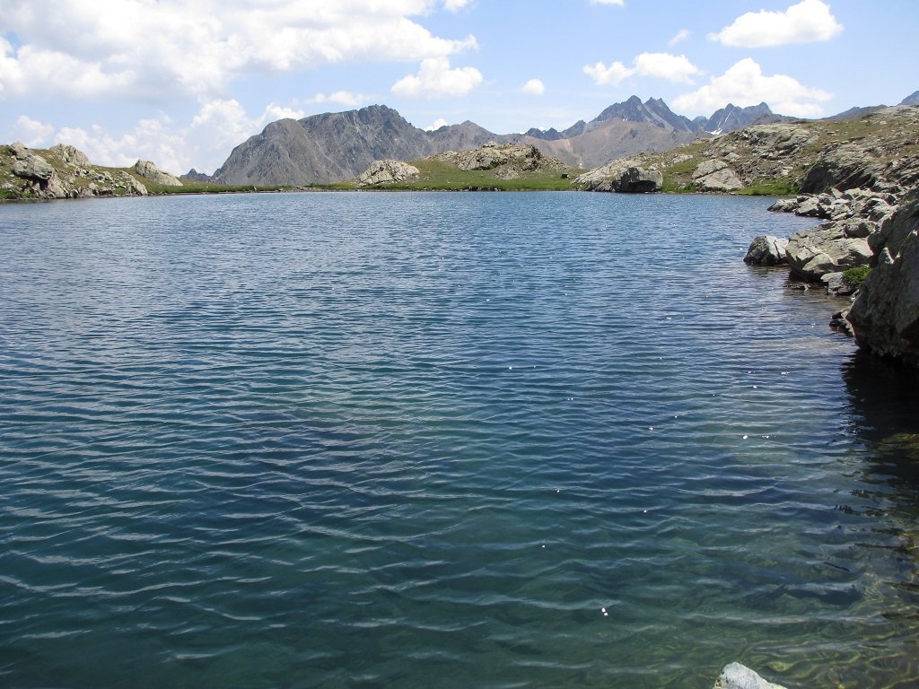
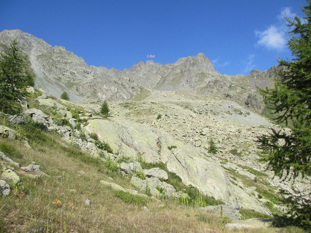
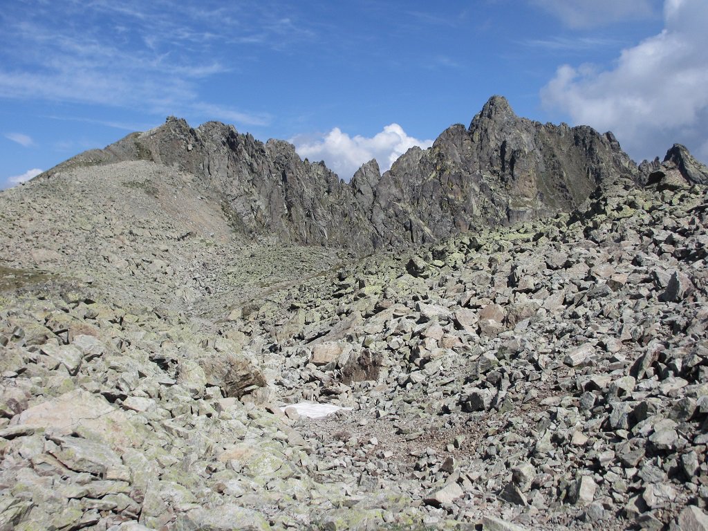
Da Ferrere si segue l’itinerario ben segnalato per il Colle del Ferro(2586 m), poi si continua verso nord ovest sullo spartiacque, lungo un sentiero tra erba e roccette. Contornata una cima detritica sul lato francese si arriva al passo Morgon ed in breve si ritorna in cresta che diventa improvvisamente rocciosa.
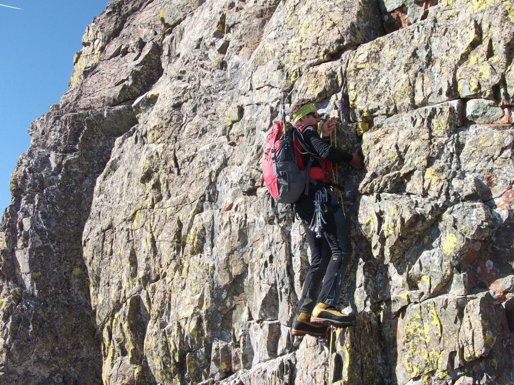
Qui si descrive un percorso sulle tracce dei primi salitori che evitarono lateralmente i tratti più difficili.
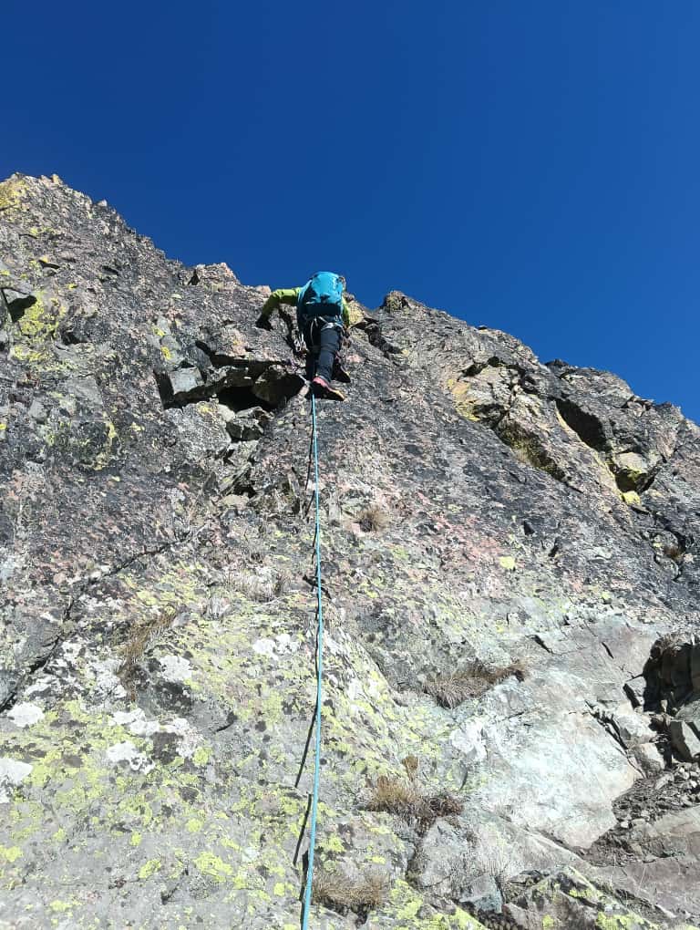
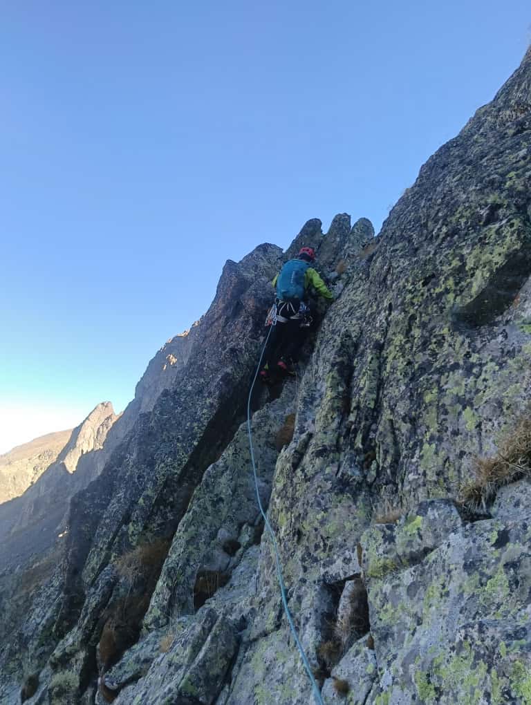
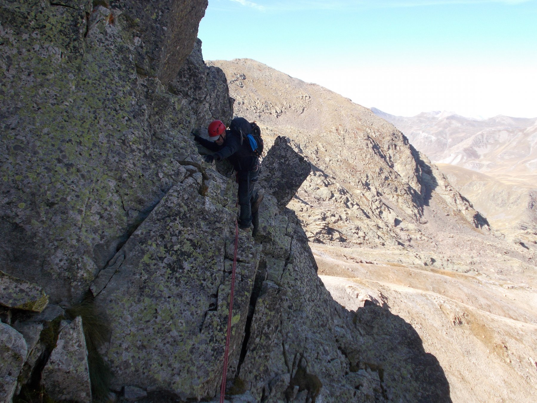
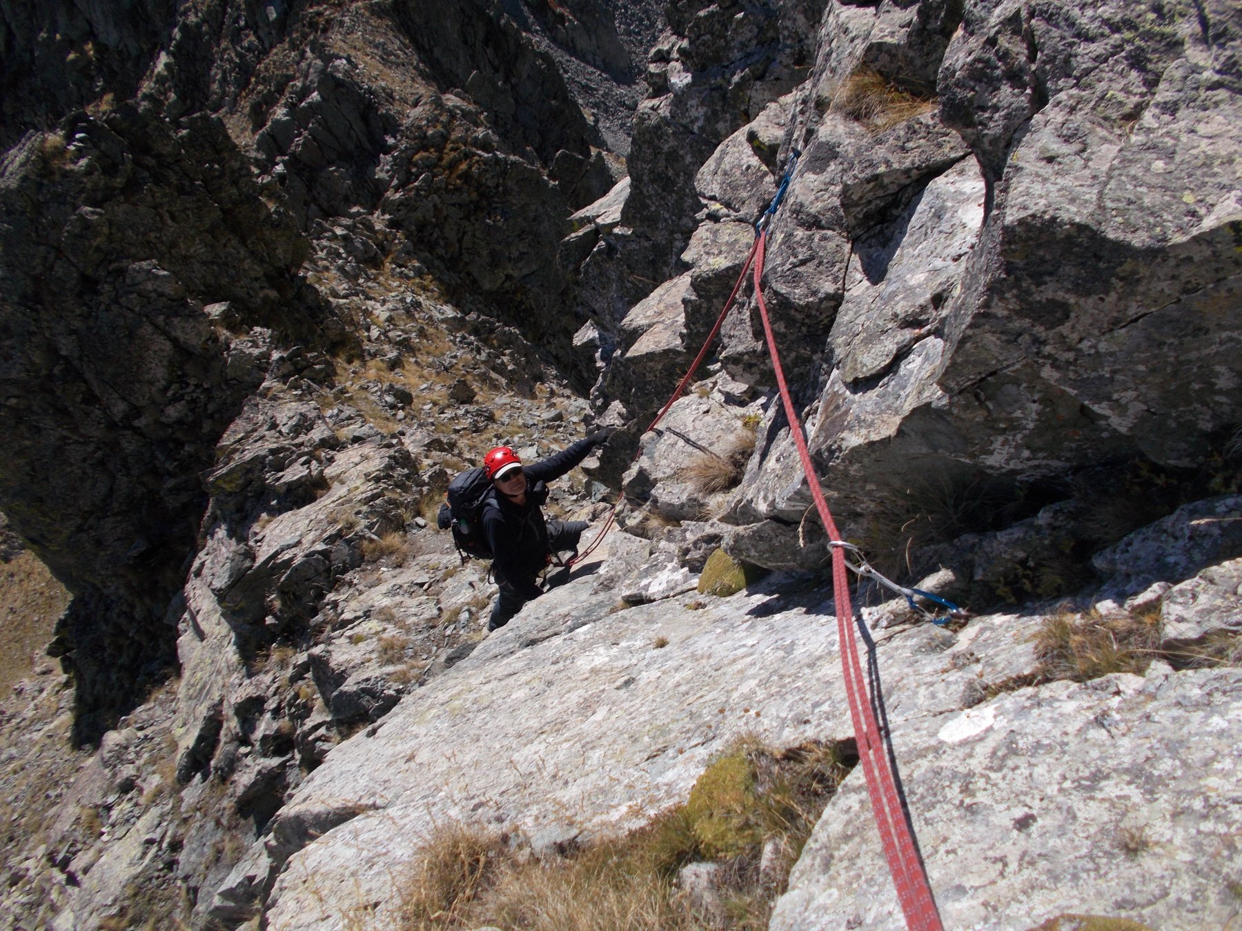
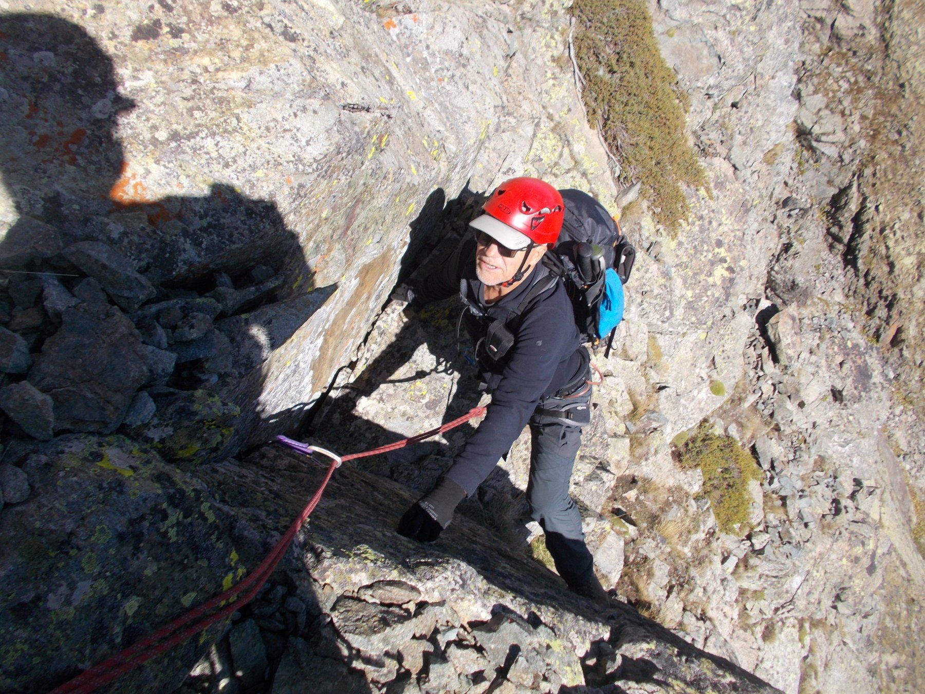
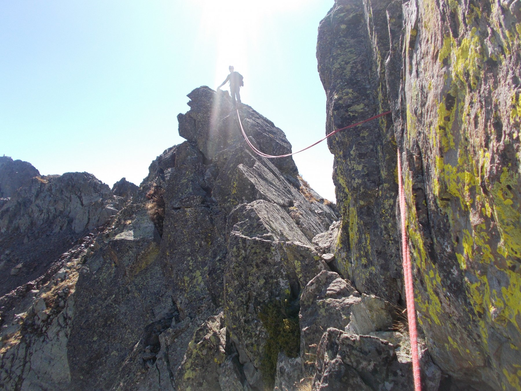
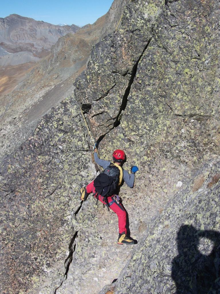
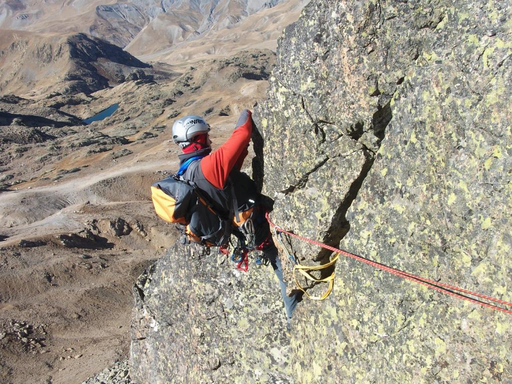
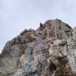
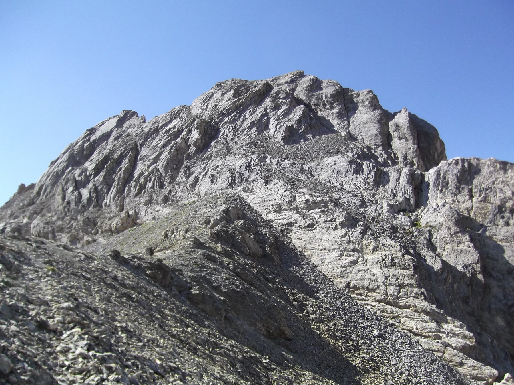
Si superano direttamente vari spuntoni con divertente arrampicata (I e II). Giunti ai piedi di un torrione più verticale, lo si contorna sul lato francese, salendo in diagonale per cornici rocciose e gradoni (II). Si aggira un secondo torrione sempre sul lato francese, poi si scende brevemente, per raggiungere una cengia sotto le balze occidentali della cresta. Seguendo la cengia si arriva in un canale, che si rimonta per rocce rotte fino a riprendere il filo di cresta.
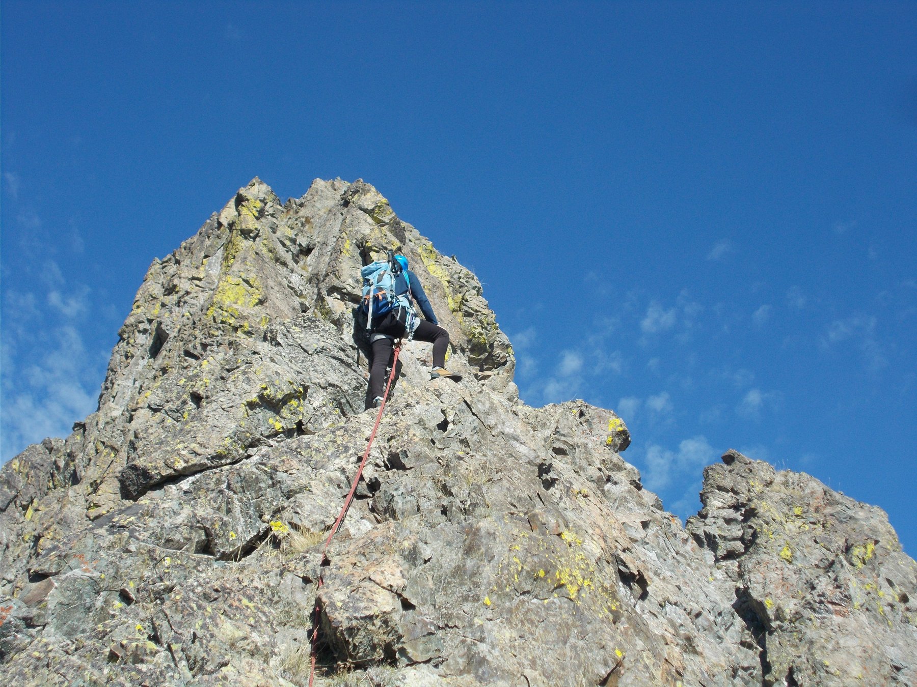
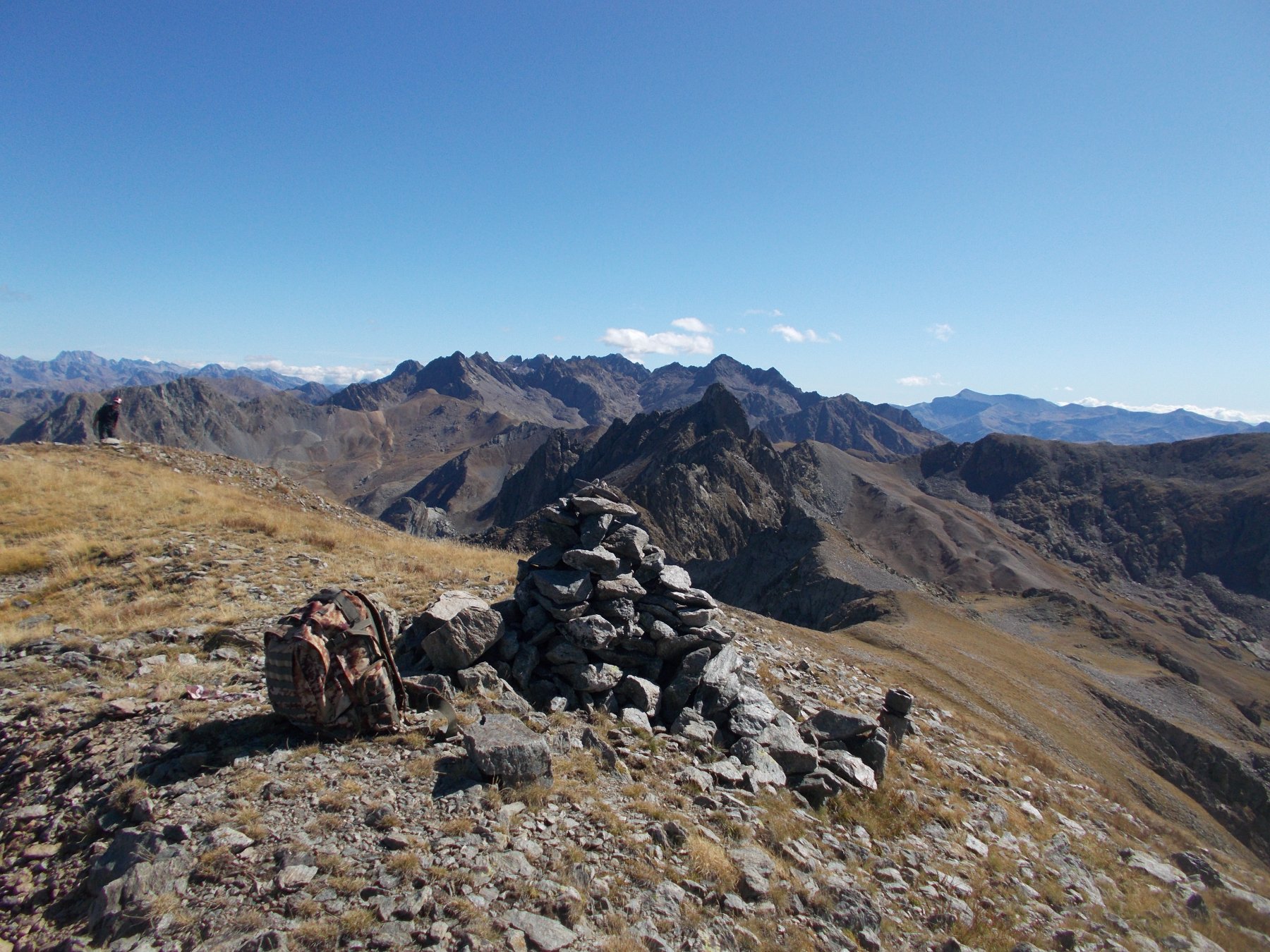
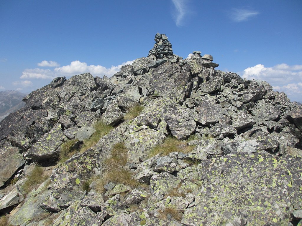
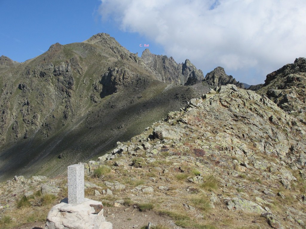
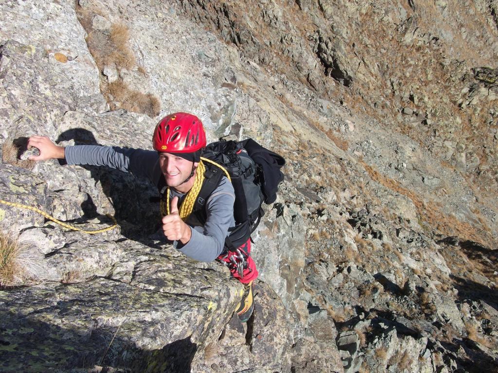
Salendo brevemente sul filo si giunge alla base di un vertiginoso torrione giallastro. Si scende per qualche metro sul lato italiano, poi si taglia orizzontalmente per cenge e lastroni, fino ad incontrare una rampa d’erba e rocce, che sale obliquamente verso dx. Giunti su un terrazzo si supera il soprastante muretto e si guadagna la vetta, sormontata da un ometto di pietre.
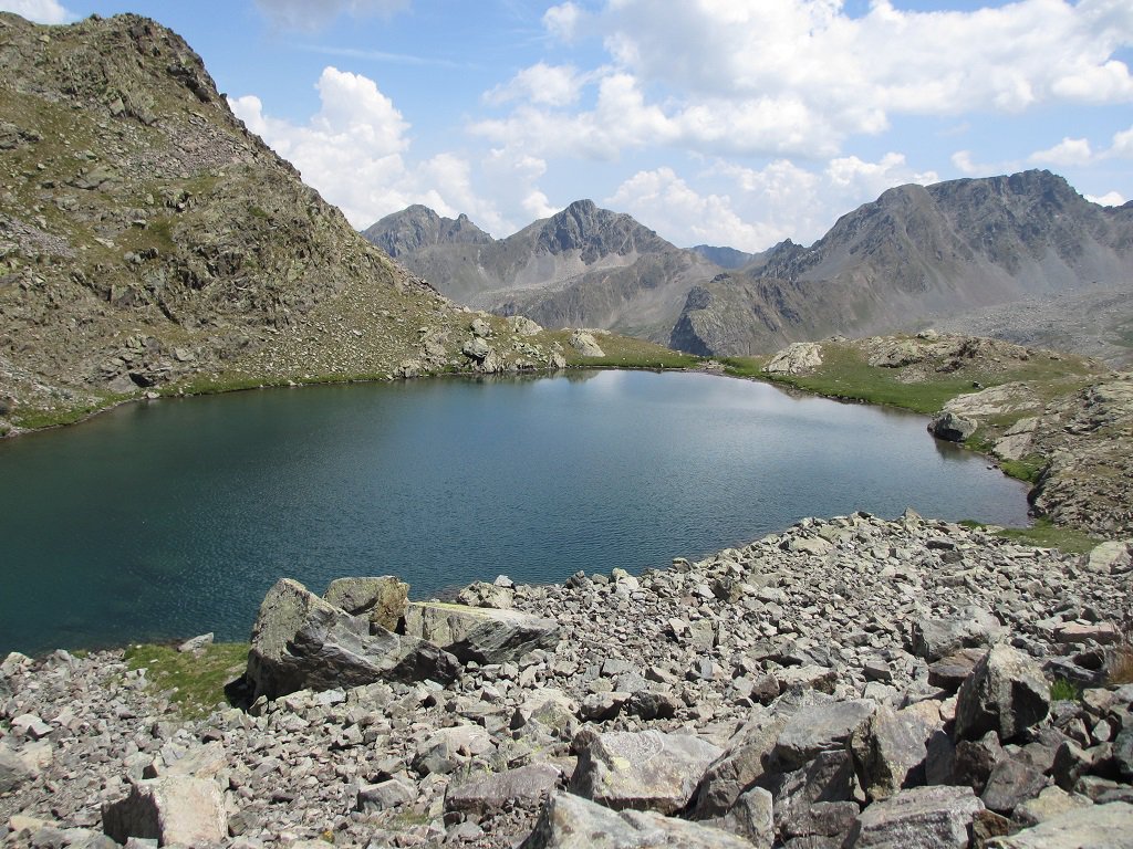
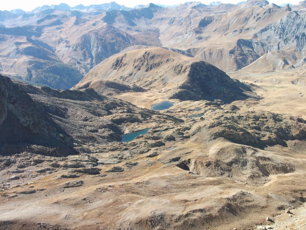
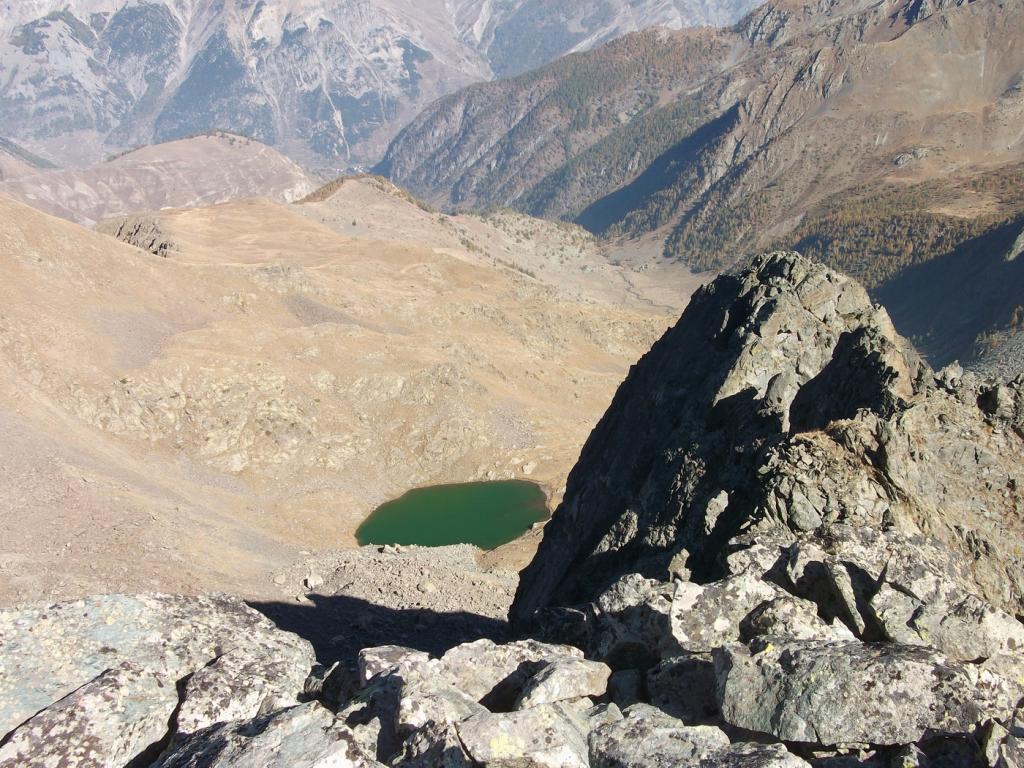
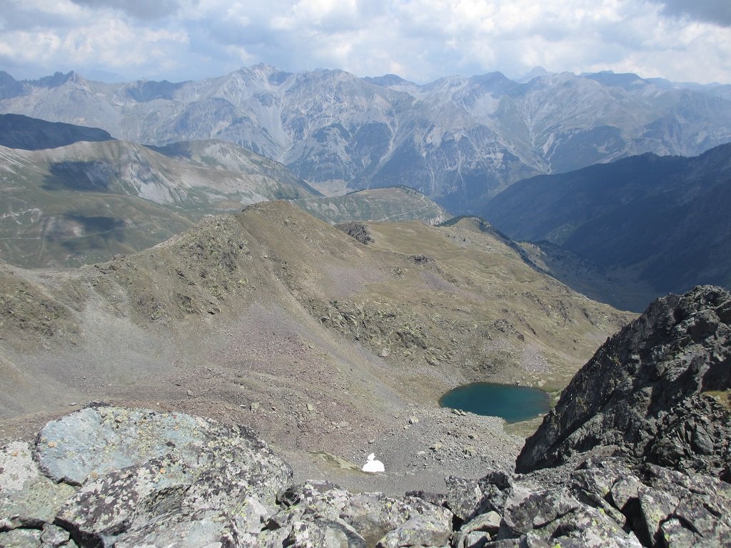
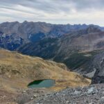
Per la discesa si scende il muretto già percorso in salita e, giunti ad una sella, si prosegue verso nord est per pietraie piuttosto ripide fino al visibile lago del Gorgion Lungo. Qui si svolta a dx e si scende per canalini erbosi fino ad un ripiano prativo. Piegando a sx si raggiunge in breve la mulattiera percorsa all’andata.
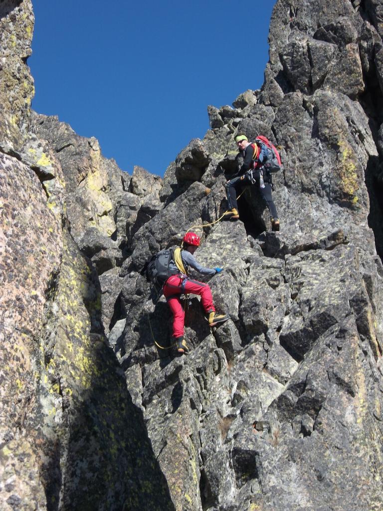
Variante semi-integrale (PD+): si salgono tutti i gendarmi del primo tratto sul filo o leggermente a sx sul fianco ovest (diff. max III+). Alcuni richiedono per la discesa delle brevi calate, evitabili tornando indietro di qualche metro e disarrampicando sul fianco occidentale. Il castello sommitale si sale passando a dx del filo e rimontando delle placche biancastre (III, 2 ch.), aggirando uno spigolo verso dx e tornando quindi sulla cresta sud a breve distanza dal grande segnale di pietre.
- Cartografia:
- IGC 7 Maira Grana Stura
- Bibliografia:
- Nelle Alpi del Sole - Parodi
Nelle vicinanze Mappa
Itinerari
15/10/2023 CN, Bersezio/Argentera D+ 1300 m F+ Tutte
Bal (Cima del), Monte Aiga, Monte Pebrun da Ferrere, anello
 50m
50m
01/11/2009 CN, Bersezio/Argentera D+ 947 m F Est
Aiga (Monte) da Ferrere ed il vallon Gorgion
 50m
50m
26/03/2024 CN, Bersezio/Argentera D+ 1300 m PD+ Varie
Eco (Punta) traversata SO-NE
2.9Km
09/05/2020 CN, Bersezio/Argentera D+ 1302 m F Sud
Servagno (Monte) da Barricate per il Colle Servagno e la cresta SE
 2.9Km
2.9Km
04/08/2024 CN, Bersezio/Argentera D+ 1250 m PD+ Varie
Brancia (Rocca) Cresta SE
 2.9Km
2.9Km
18/11/2024 CN, Bersezio/Argentera D+ 1270 m PD- Sud
Oserot (Monte) da Bersezio per la cresta S/SE dalla Bassa di Terrarossa
2.9Km
18/09/2021 CN, Bersezio/Argentera D+ 1300 m PD- Varie
Bernoir (Punta) Cresta Est
2.9Km
26/03/2024 CN, Bersezio/Argentera D+ 1260 m F+ Sud-Ovest
Servagno (Monte) Canale Sud-Ovest
4.1Km
15/06/2025 CN, Bersezio/Argentera D+ 1175 m F+ Varie
Feuillas (Monte, cima NO) da Argentera per il Colle di Feuillas
 4.7Km
4.7Km
17/08/2024 CN, Pietraporzio D+ 1240 m D Sud-Est
Vallonetto (Monte del), cima sud – Via delle Tre Torri
 5Km
5Km
Servizi
3Km
3.2Km
da Mo Ristorante
Bersezio/Argentera
3.3Km
B&b del Villaggio B&B
Bersezio/Argentera
4.6Km
Archibus Pub Ristorante
Bersezio/Argentera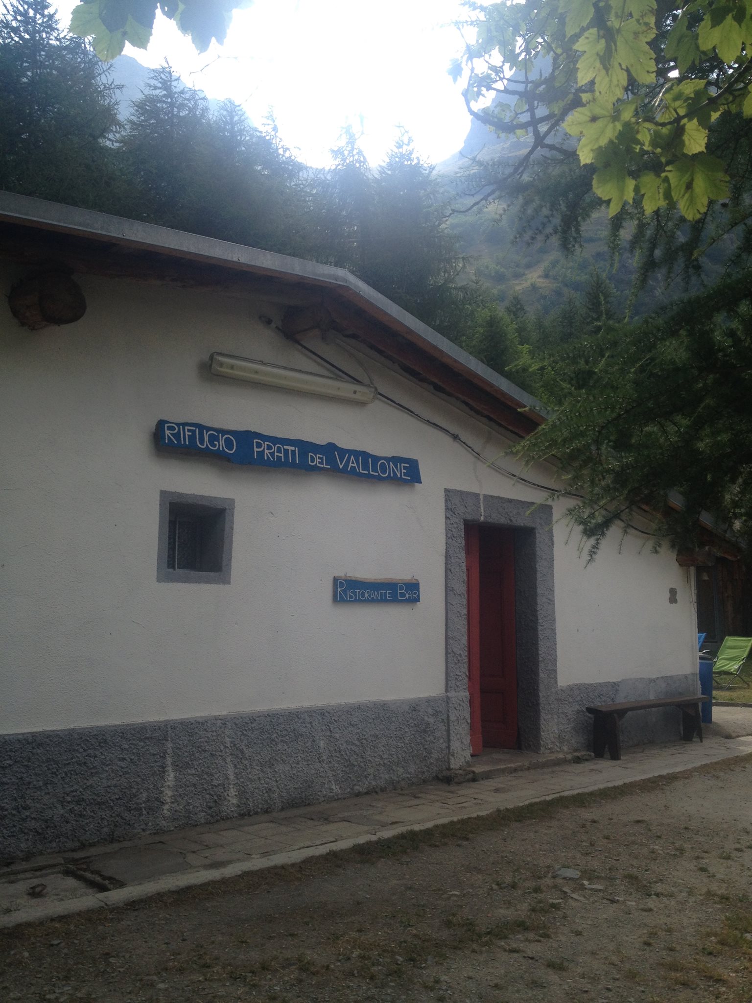 5.1Km
5.1Km
Rifugio Prati del Vallone Rifugio
Pietraporzio
7.1Km
Agri Bistrot Pecora Nera Ristorante
Pietraporzio
8.7Km
Gardetta Rifugio
Canosio
8.7Km
L’Oste d’oc Ristorante
Pietraporzio
9Km
Ostello Centosentieri Albergo
Pietraporzio
9.3Km