 8.4Km
8.4Km
Note
 0m
0m
50m
50m
50m
50m
50m
50m
0m
0m
50m
50m
50m
50m
50m
50m
Sulle carte italiane sono segnalati sentieri sia dal versante Nord sia dal versante Sud. Le carte francesi non segnano nessun sentiero. Le descrizioni dalla guida CAI-TCI non sono esaustive. In effetti non esiste alcun sentiero sui due versanti ma ci si muove su terreno di avventura.
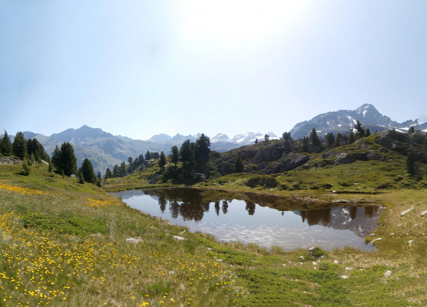
Si raggiunge il rif. Deffeyes col normale sentiero da La Thuile. Dal rifugio Deffeyes si ritorna sui propri passi lungo il sentiero di accesso. Dopo dieci minuti in corrispondenza di un piccolo pilone con indicazioni, si prende a destra il sentiero balcone per Plan Praz ( segnalato e attrezzato per la gara LTT). A un certo punto il sentiero comincia scendere, si incontrano prima gradini di ferro poi catena e cavi. Quando il sentiero comincia a risalire, aggirando un piccolo lago, lo si abbandona e si comincia a salire puntando a sinistra, ai dossi erbosi che delimitano sulla destra orografica, la comba Sorda. Presa un po’ di quota il percorso è evidente: bisogna seguire i dossi erbosi fin sotto il colle che si raggiunge per faticosa pietraia. Rari ometti, nessuna traccia.
Su alcune carte è segnato un sentiero che percorre il fondo della comba Sorda che è occupato da una enorme pietraia, il sentiero non c’è e sconsiglio questo itinerario.
Avvicinamento
Si raggiunge il rif. Deffeyes col normale sentiero da La Thuile. Dal rifugio Deffeyes si ritorna sui propri passi lungo il sentiero di accesso. Dopo dieci minuti in corrispondenza di un piccolo pilone con indicazioni, si prende a destra il sentiero balcone per Plan Praz ( segnalato e attrezzato per la gara LTT). A un certo punto il sentiero comincia scendere, si incontrano prima gradini di ferro poi catena e cavi. Quando il sentiero comincia a risalire, aggirando un piccolo lago, lo si abbandona e si comincia a salire puntando a sinistra, ai dossi erbosi che delimitano sulla destra orografica, la comba Sorda. Presa un po’ di quota il percorso è evidente: bisogna seguire i dossi erbosi fin sotto il colle che si raggiunge per faticosa pietraia. Rari ometti, nessuna traccia.
Su alcune carte è segnato un sentiero che percorre il fondo della comba Sorda che è occupato da una enorme pietraia, il sentiero non c’è e sconsiglio questo itinerario.
in auto a La Tuile e quindi a La Joux
Descrizione
Da la Joux si raggiunge il Rifugio Deffeyes- Dal rifugio Deffeyes si ritorna sui propri passi lungo il sentiero di accesso da La Thuile. Dopo dieci minuti in corrispondenza di un piccolo pilone con indicazioni, si prende a destra il sentiero balcone per Plan Praz ( segnalato e attrezzato per la gara LTT). A un certo punto il sentiero comincia scendere, si incontrano prima gradini di ferro poi catena e cavi. Quando il sentiero comincia a risalire, aggirando un piccolo lago, lo si abbandona e si comincia a salire puntando a sinistra, ai dossi erbosi che delimitano sulla destra orografica, la comba Sorda. Presa un po’ di quota il percorso è evidente: bisogna seguire i dossi erbosi fin sotto il colle che si raggiunge per faticosa pietraia. Rari ometti, nessuna traccia.
Su alcune carte è segnato un sentiero che percorre il fondo della Combassa (da alcuni chiamata Comba sorda che in realtà è più a Nord-Ovest) che è occupato da una enorme pietraia, il sentiero non c’è e sconsiglio questo itinerario.
Nelle vicinanze Mappa
Itinerari
15/08/2016 AO, La Thuile D+ 1208 m EE Varie
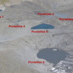
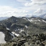
Bella Valletta (Monte) e Laghi di Ponteilles da la Joux
 0m
0m
14/07/2019 AO, La Thuile D+ 733 m EE Est
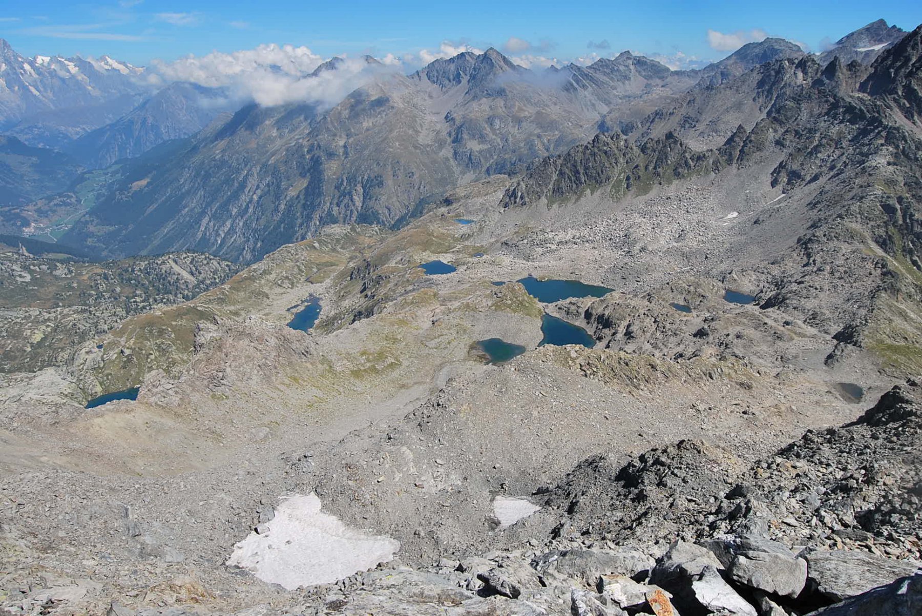
Bellacomba (Laghi di) da La Joux
 0m
0m
07/09/2025 AO, La Thuile D+ 1426 m EE Varie
Invergneures (Pointe des) da La Joux per i laghi Usellettes
 50m
50m
10/06/2025 AO, La Thuile D+ 950 m E Varie
Deffeyes Albert (Rifugio) da la Joux
 50m
50m
21/07/2021 AO, La Thuile D+ 1500 m EE/F Varie
Monchette (Monte) da la Joux
 50m
50m
29/09/2019 AO, La Thuile D+ 400 m E Nord
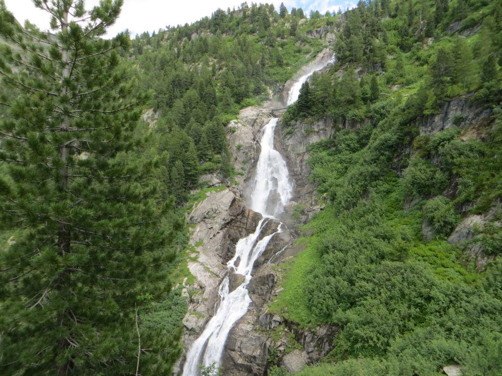
Rutor (Cascate del) da La Joux per il sentiero del Centocinquantenario
 50m
50m
28/09/2006 AO, La Thuile D+ 1051 m E Nord-Est
Louy Blanche (Colle) da La Joux
50m
10/10/2023 AO, La Thuile D+ 1315 m EE Varie
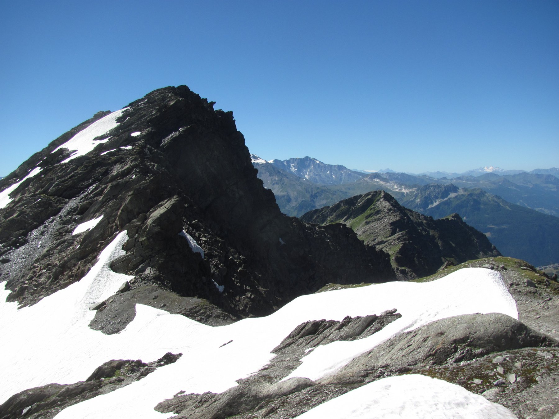
Rouges (Dents) o Mont Charve da la Joux per il Col Tachuy
 50m
50m
08/08/2025 AO, La Thuile D+ 1400 m EE Varie
Freduaz Meridionale (Monte) da La Joux per il Laghi di Bellacomba
 50m
50m
04/08/2007 AO, La Thuile D+ 1200 m E Varie
Lex Blanche (Col de la) da la Joux
50m