1.9Km
1.9Km


Note
 250m
850m
850m
850m
850m
850m
2.1Km
2.1Km
2.1Km
250m
850m
850m
850m
850m
850m
2.1Km
2.1Km
2.1Km
1.9Km
5Km
7.2Km
7.6Km
7.6Km
8Km
8.7Km
8.7Km
9.6Km
9.8Km
Bella camminata a media quota (1600 m) consigliata ad inizio stagione escursionista, quando la neve non permette ancora di salire più in alto. Partendo dal basso è comunque possibile percorrere un discreto dislivello (ca. 1000 m) e poi variare il percorso visti i tanti sentieri presenti in zona.
Nell’itinerario qui descritto si parte da Chatillon e si arriva a Mont Giron, con possibilità di proseguire all’alpeggio di Valmeriana in base alle condizioni; per la discesa sono possibili più alternative.
Sentieri sempre evidenti e ben segnalati ai bivi; da segnalare solo qualche discordanza con la carta L’Escursionista n. 13 (Valle centrale, ed. 2015).
Avvicinamento
Nell’itinerario qui descritto si parte da Chatillon e si arriva a Mont Giron, con possibilità di proseguire all’alpeggio di Valmeriana in base alle condizioni; per la discesa sono possibili più alternative.
Sentieri sempre evidenti e ben segnalati ai bivi; da segnalare solo qualche discordanza con la carta L’Escursionista n. 13 (Valle centrale, ed. 2015).
Raggiunta Chatillon si seguono le indicazioni per la stazione e per Pontey.
Si può parcheggiare alla stazione oppure, proseguendo per Pontey, su una piccola piazzola a destra appena passato il ponte sulla Dora. Il sentiero 5 parte proprio al ponte.
Descrizione
Si può parcheggiare alla stazione oppure, proseguendo per Pontey, su una piccola piazzola a destra appena passato il ponte sulla Dora. Il sentiero 5 parte proprio al ponte.
Attraversando a Chatillon il ponte sulla Dora, quota 450 m ca., si nota subito, in alto sul muro, la palina segnaletica per i sentieri n. 1 (Bellecombe, 1002 m) e n. 5 (Mont Giron, 1461 m, 3h 05).
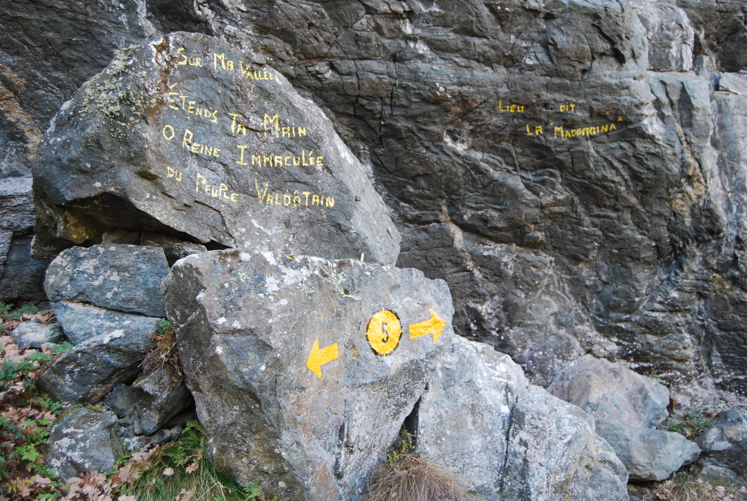
Si sale lungo il 5 che parte subito ripido e incrocia in breve il sentiero 5B da Torin (segnato come 6A sulla carta) e il 5A sempre da Torin; si tocca poi un masso con scritte votive nel luogo detto “La Madonnina” e sempre in ripida salita si giunge all’alpeggio di Gimiod (909 m). Qui dovrebbe esserci un bivio, sfuggito a chi scrive, dal momento che vi arriva un sentiero 5 di ritorno da Mont Giron; comunque sia, proseguendo diritto in salita sul sentiero sempre ben evidente si giunge al torrente Molinaz che si attraversa su un ponte di tavole per ricongiungersi, dopo un breve tratto in discesa, con il sentiero 4 che sale da Clapey (bivio non segnato sulla carta).
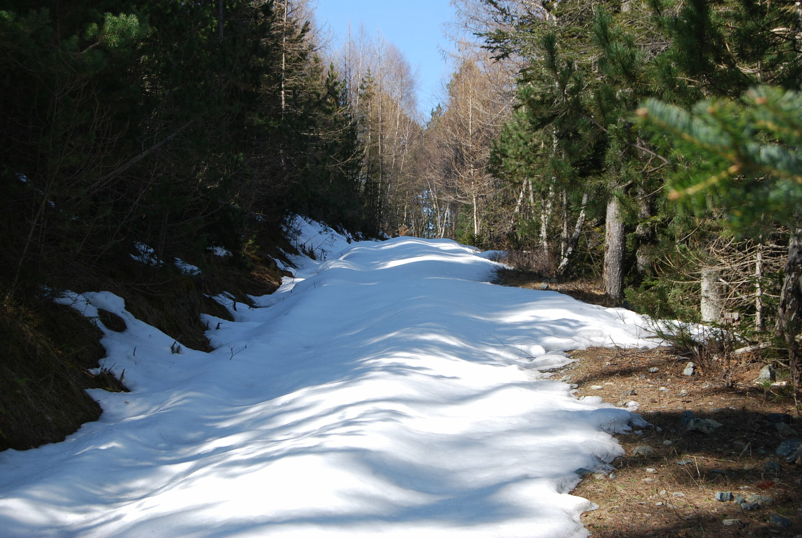
Si prosegue ora lungo il 4 che sale ripido sulla sinistra del torrente; si incontra il bivio per Cloutraz, si supera un tratto con corda fissa (non necessaria con terreno pulito) e si giunge ad un bivio dove si staccano i sentieri 5 per Gimiod e 5A per Cretaz-Chardon e Bellecombe (bivio segnato sulla carta). Proseguendo ancora sul 4 in ripida salita si giunge in vista dell’alpeggio di Mont Giron che si raggiunge con un tratto su prato; sulla strada si trovano le indicazioni per l’Alpe Valmeriana (1795 m, a 55’).
Per la discesa è possibile
– ritornare al primo bivio e seguire le indicazioni per i sentieri 5 o 5A che riportano a Gimiod o a Bellecombe (dopo un breve tratto dalla palina si arriva al torrente, il bivio tra i due sentieri è appena dopo il ponte)
– seguire per Cloutraz al bivio e scendere poi a Chiesanuova di Pontey (sentiero 2)
– proseguire sempre lungo il 4 che scende a Clapey di Pontey tagliando in alcuni punti la strada sterrata.
Nel caso si scelga l’ultima possibilità tenere presente che l’ultima palina, ormai in vista di Clapey, è male orientata; il segnavia indica la strada (o una traccia di MTB) mentre il sentiero “ufficiale” prosegue diritto per poi sbucare sull’asfalto presso il lavatoio (tacca sul muro e bollo 4 sul viottolo che scende).
- Cartografia:
- Carta L'Escursionista, n. 13 Valle Centrale, Scala 1:25000
Nelle vicinanze Mappa
Itinerari
30/05/2025 AO, Châtillon D+ 2035 m E Varie
Barbeston (Monte) da Châtillon, anello per Bellecombe e Alpe Valmeriana
 250m
250m
27/11/2025 AO, Châtillon D+ 1100 m EE Sud
Saint Evence (Cappella di) da Chatillon
 850m
850m
29/10/2022 AO, Châtillon D+ 2400 m EE Tutte
Zerbion (Monte) e Monte Tantanè da Chatillon, anello
 850m
850m
18/02/2022 AO, Chatillon D+ 300 m T Sud
Via Francigena Tappa AO4: da Chatillon a Verres
 850m
850m
26/02/2026 AO, Châtillon D+ 500 m E Sud-Ovest
Cly (Castello) da Chatillon per il Ru Chandianaz e Ru Marseiller
 850m
850m
16/04/2022 AO, Châtillon D+ 600 m E Sud
Cammino Balteo Tappa n.21 da Chatillon a Verres
 850m
850m
07/11/2022 AO, Chatillon D+ 1078 m EE/F Nord
Bec (Monte) da Bellecombe
 2.1Km
2.1Km
05/09/2020 AO, Châtillon D+ 1550 m E Varie
Barbeston (Monte) da Bellecombe, anello
 2.1Km
2.1Km
01/12/2018 AO, Châtillon D+ 400 m T Nord
Mont Ros Désot (Borgata) da Bellecombe
 2.1Km
2.1Km
23/11/2025 AO, Châtillon D+ 550 m E Nord
Praz Garin da Bellecombe, anello
2.1Km
Servizi
1.9Km
5Km
Lavesè Ristorante
Saint-denis
7.2Km
Nigra Albergo
Montjovet
7.6Km
Lo scoiattolo Ristorante
La Magdeleine
7.6Km
Da Vincenzo Ristorante
Montjovet
8Km
Boule de neige B&B
Antey Saint Andrè
8.7Km
Jour et Nuit Ristorante
Torgnon
8.7Km
Mathamel Giorgio B&B
Verrayes
9.6Km
Blanche Neige Bar
Verrayes
9.8Km