 2Km
2Km
Note
 300m
350m
350m
900m
1Km
2.1Km
2.1Km
2.3Km
300m
350m
350m
900m
1Km
2.1Km
2.1Km
2.3Km
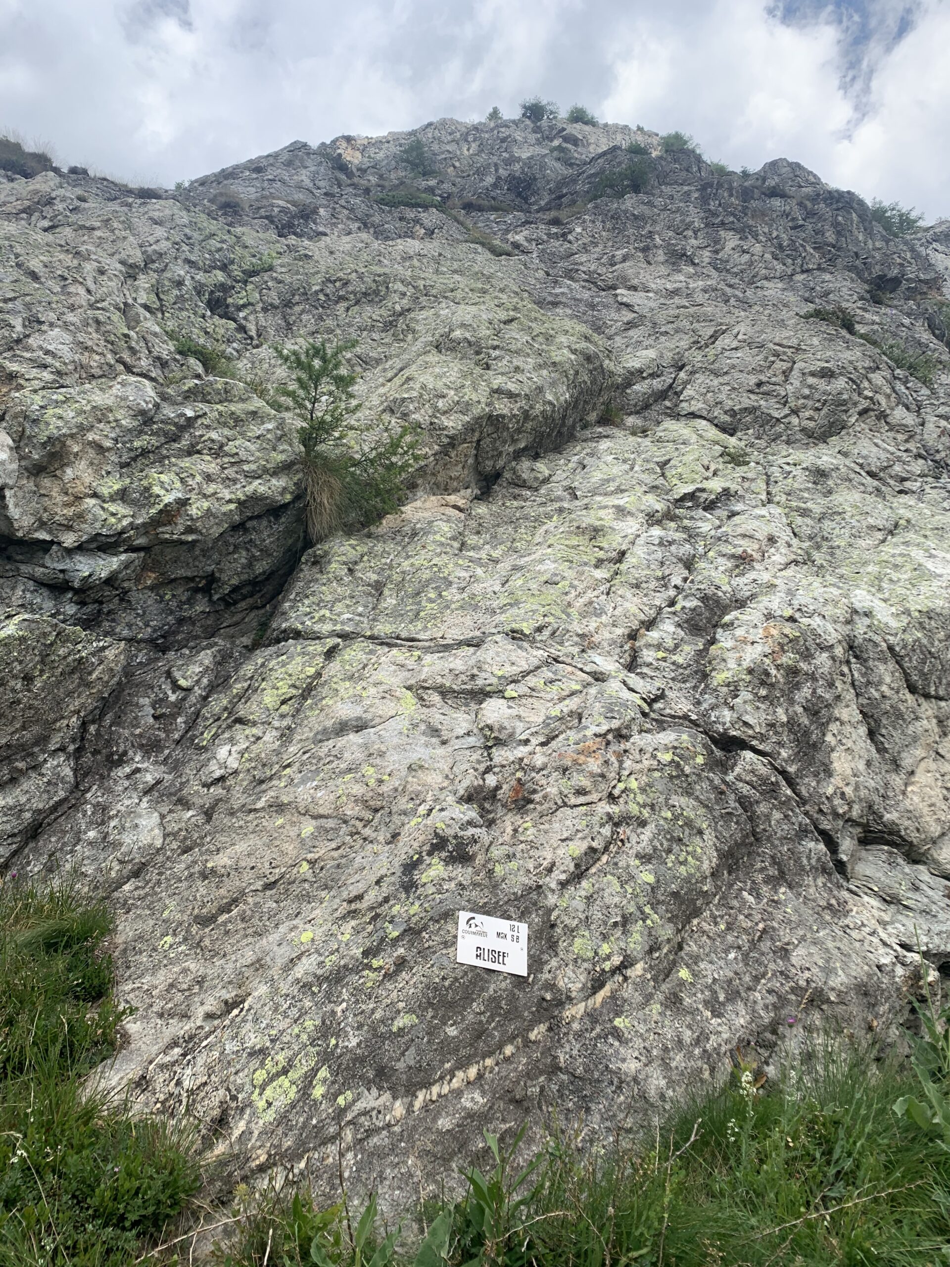
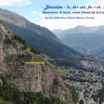
Le difficoltà obbligatoria di 4b e massima di 5a sono quelle indicate nella guida citata in bibliografia mentre nella targa posizionata a inizio via è riportata la difficoltà di 5b. La via è esposta a Sud Est ed è in pieno sole x tutto il giorno; sconsigliata nei periodi più caldi.
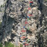
Quasi tutte le soste sono collegate da cordini (alcuni in cattive condizioni) e sono dotate di anello di calata.
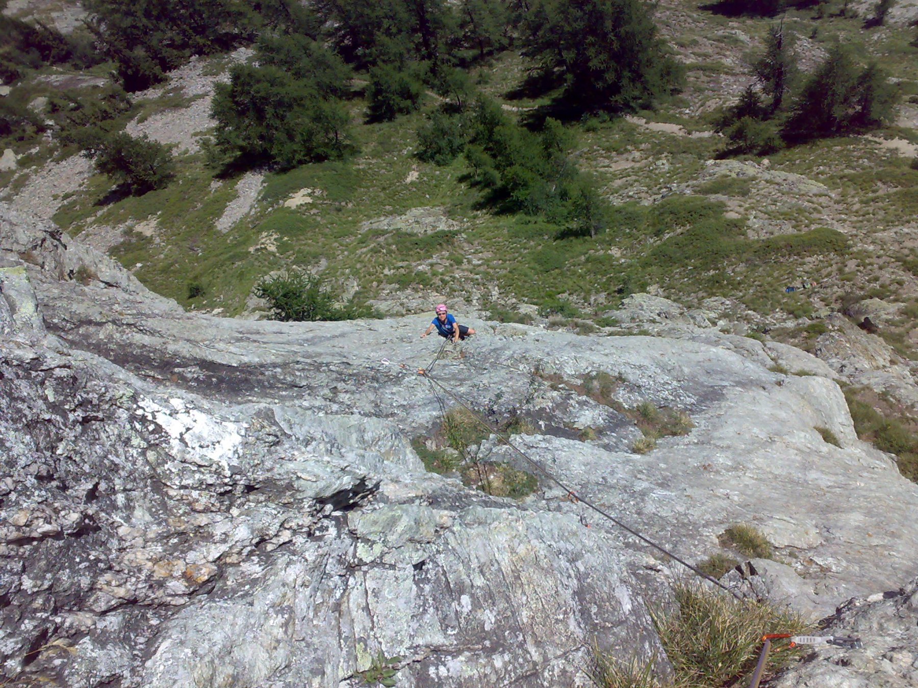
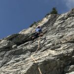
La via è in genere su buona roccia, ma un po' discontinua: alcuni punti sono insidiosi spt x il primo di cordata in quanto si deve camminare su erba o terra. Attenzione anche ai numerosi ginepri (pungono!)
Avvicinamento
Quasi tutte le soste sono collegate da cordini (alcuni in cattive condizioni) e sono dotate di anello di calata.
La via è in genere su buona roccia, ma un po' discontinua: alcuni punti sono insidiosi spt x il primo di cordata in quanto si deve camminare su erba o terra. Attenzione anche ai numerosi ginepri (pungono!)
Da Courmayeur entrare in Val Veny, al primo bivio a sin. (indicazione per Rifugio Monte Bianco). Superare il Rifugio M. Bianco e salire per la strada fino alla sbarra di Prè de Pascal (1902 m)
Di qui prendere il sentiero che sale dietro il piccolo chalet della Scuola di sci, alcune catene ed una scaletta portano alla parte pianeggiante del sentiero rivolta verso Courmayeur, continuare fino ad incontrare altre catene in discesa, scendere e si arriva alla targa che segnala l’attacco della via.
Descrizione
Di qui prendere il sentiero che sale dietro il piccolo chalet della Scuola di sci, alcune catene ed una scaletta portano alla parte pianeggiante del sentiero rivolta verso Courmayeur, continuare fino ad incontrare altre catene in discesa, scendere e si arriva alla targa che segnala l’attacco della via.
- L1-L2: dritto su placca, 4b
- L3 leggermente a sinistra, 4b
- L4 obliquare a sinistra tra erba e sassi; trovato il primo spit piegare decisamente a sinistra (altri 2 spit) fino a una sosta con 2 spit da concatenare; ignorare un cordone in alto; 4b
- L5 ancora leggermente a sinistra 4b
- L6, L7 e L8 dritto sopra la sosta
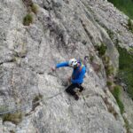
- L9 un po’ discontinuo all’inizio, poi si supera uno sperone più verticale
- L10 la lunghezza chiave; diedro con fessura da fare un dulfer 5b
- L11 e L12 a sinistra fino all’ultima sosta 4c
Discesa: a piedi sul versante Val Veny (dopo aver raggiunto la cima molto panoramica, salendo per prati 150 m. dalla fine della via) e tornando a Pré de Pascal con sentiero+pista sci. Sconsigliata la discesa in corda doppia per l’andamento obliquo della via e la presenza di parecchia vegetazione.
- Bibliografia:
- Massimo Bal - Patrick Raspo, Valle D’Aosta Sport Climbing, 2018, Tipografia Valdostana.
Nelle vicinanze Mappa
Itinerari
08/07/2023 AO, Courmayeur 6b+, 6a obbl. Sud-Est
Chetif (Mont) – Bersagli Mobili
 300m
300m
22/08/2025 AO, Courmayeur 6a, 5c obbl. Sud-Est
Chetif (Mont) – Pierre Navigatore delle Creste
 350m
350m
23/08/2023 AO, Courmayeur 5c, 5a obbl. Nord-Ovest
Chetif (Mont) – 27 Luglio
 350m
350m
04/10/2025 AO, Courmayeur 6a+, 6a obbl. Sud-Ovest
Chetif (Mont) – Incredulix
400m
20/08/2023 AO, Courmayeur 6a+, 6a obbl. Nord-Est
Chetif (Mont) – Madonna dell’Est o Madonnina
 900m
900m
11/08/2022 AO, Courmayeur 6c, 6a+ obbl. Est
Chetif (Mont) – Punta Rovente
 1Km
1Km
06/06/2024 AO, Courmayeur 6c+, 6b obbl. Ovest
Saxe (Mont de la), Pilastro Bertone – Solo per Vecchi Coglioni
 2.1Km
2.1Km
24/07/2025 AO, Courmayeur 6a+, 5c obbl. Sud
Eveque (Aiguille de l’), contrafforti – Impressioni di Settembre
 2.1Km
2.1Km
31/08/2022 AO, Courmayeur 7a, 6b+ obbl. Ovest
Saxe (Mont de la) – Birintite
 2.3Km
2.3Km
04/01/2023 AO, Courmayeur 7a+, 6c obbl. Sud-Ovest
Saxe (Mont de la) – Non Toccatemi il Pilastro
2.4Km