 1.6Km
1.6Km
Note
Storico
 100m
150m
350m
400m
850m
950m
1.8Km
1.8Km
2Km
100m
150m
350m
400m
850m
950m
1.8Km
1.8Km
2Km
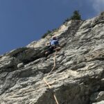
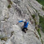
Questa breve e discontinua salita ha il pregio di portare in vetta allo Chétif, balcone naturale sul massiccio del Bianco con vista a 360 gradi.
Necessari una decina di rinvii; per chi ne sentisse la necessità c'è la possibilità (poche) di integrare la buona chiodatura con friend medi e piccoli (casco indispensabile).
La discesa in doppia è possibile, ma francamente vale la pena di arrivare sino alla vetta per guardarsi in giro!!!!
Avvicinamento
Necessari una decina di rinvii; per chi ne sentisse la necessità c'è la possibilità (poche) di integrare la buona chiodatura con friend medi e piccoli (casco indispensabile).
La discesa in doppia è possibile, ma francamente vale la pena di arrivare sino alla vetta per guardarsi in giro!!!!
Courmayeur - Val Veny - Rifugio Monte Bianco - Località Pré de Pascal.
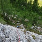
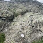
Di qui prendere la traccia che porta alla ferrata dello Chétif, dopo il tratto con le catene si trova una chiara indicazione in bianco con "vie d'arrampicata" e per tracce alla base della parete (30 min). Si individua la scritta "Punta Rovente" e la via parte sullo sperone poco più avanti (traccia di vernice bianca sbiadita).
Descrizione
Di qui prendere la traccia che porta alla ferrata dello Chétif, dopo il tratto con le catene si trova una chiara indicazione in bianco con "vie d'arrampicata" e per tracce alla base della parete (30 min). Si individua la scritta "Punta Rovente" e la via parte sullo sperone poco più avanti (traccia di vernice bianca sbiadita).
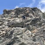
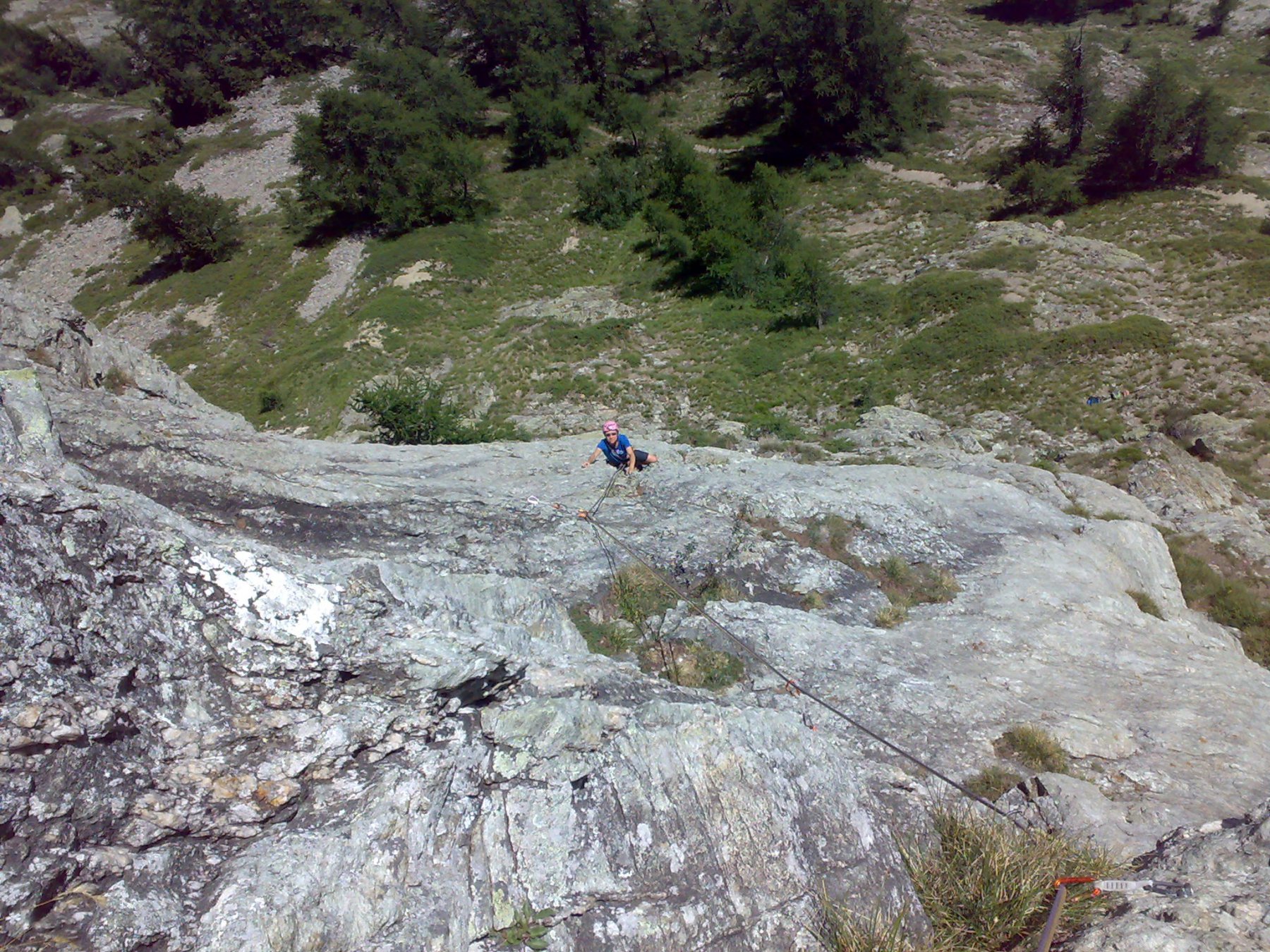
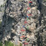
- L1 6a sullo sperone e quindi a dx lungo il diedro
- L2 6a placca
- L3 6a+ prima in fessura e poi in placca con passaggio chiave non proprio protetto al meglio (direi l’unico)
- L4 6a a sx quindi fessura e placca
- L5 5c placca e poi uscita sullo spigolo con difficoltà paragonabili alle precedenti
- L6 5c tiro articolato e discontinuo.
Di qui a sx seguendo alcuni spit sino ad una sosta (eventualmente si può rinviare e proseguire) e quindi per 200 mt circa sino in vetta con passaggi di 2 e 3 e tanta erba !
La discesa per il sentiero con bolli gialli porta alle piste da sci e quindi a Pré de Pascal.
Via aperta da Niccolò Bruni e Gianluca Marra
- Bibliografia:
- Topo Herve Thiviérge - Guide Mont Blanc Vie d'arrampicata
Nelle vicinanze Mappa
Itinerari
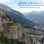
22/08/2025 AO, Courmayeur 6a, 5c obbl. Sud-Est
Chetif (Mont) – Pierre Navigatore delle Creste
 100m
100m
08/07/2023 AO, Courmayeur 6b+, 6a obbl. Sud-Est
Chetif (Mont) – Bersagli Mobili
 150m
150m
02/07/2026 AO, Courmayeur 5c, 5a obbl. Nord-Ovest
Chetif (Mont) – 27 Luglio
 350m
350m
10/08/2024 AO, Courmayeur 5a, 4 obbl. Sud-Est
Chetif (Mont) – Alisee e gli Amici Canterini
 400m
400m
20/08/2023 AO, Courmayeur 6a+, 6a obbl. Nord-Est
Chetif (Mont) – Madonna dell’Est o Madonnina
 850m
850m
11/08/2022 AO, Courmayeur 6c, 6a+ obbl. Est
Chetif (Mont) – Punta Rovente
 950m
950m
06/06/2024 AO, Courmayeur 6c+, 6b obbl. Ovest
Saxe (Mont de la), Pilastro Bertone – Solo per Vecchi Coglioni
 1.8Km
1.8Km
24/07/2025 AO, Courmayeur 6a+, 5c obbl. Sud
Eveque (Aiguille de l’), contrafforti – Impressioni di Settembre
 1.8Km
1.8Km
31/08/2022 AO, Courmayeur 7a, 6b+ obbl. Ovest
Saxe (Mont de la) – Birintite
 2Km
2Km
04/01/2023 AO, Courmayeur 7a+, 6c obbl. Sud-Ovest
Saxe (Mont de la) – Non Toccatemi il Pilastro
2.1Km