3Km
3Km
Note
 0m
0m
0m
750m
750m
750m
750m
750m
850m
0m
0m
0m
750m
750m
750m
750m
750m
850m
L’itinerario per la vetta del Mont Cormet è l’alternativa a quella da Morgex/Dailley e già descritta su Gulliver: partenza da Courmayeur/Pussey e salita via alpeggio di Tirecorne; la traversata aggiunge poi un po’ di emozione con il passaggio del canalone sotto la Tete de la Suche. La discesa avviene sul sentiero classico per il Bivacco Pascal che parte da Dailley
Si suggerisce la traversata da Courmayeur a Morgex / Dailley più che il viceversa per affrontare il Mont Cormet in salita anziché in discesa vista l’imprevedibilità del percorso.
La traversata non è banale, tenere presente che:
- a Tirecorne, nonostante l’indicazione agli alpeggi, trovare il sentiero di salita non è immediato viste le tante tracce di bestiame; però, una volta individuato, il sentiero accompagna fino in vetta, marcato e segnato da radi bolli gialli e ancora dalle residue tacche rosse al minio;
- la salita al Mont Cormet prevede alcuni tratti attrezzati, recentemente installati viste le frane nei canaloni nella zona dei paravalanghe;
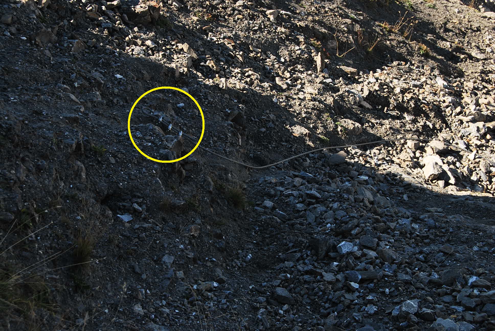
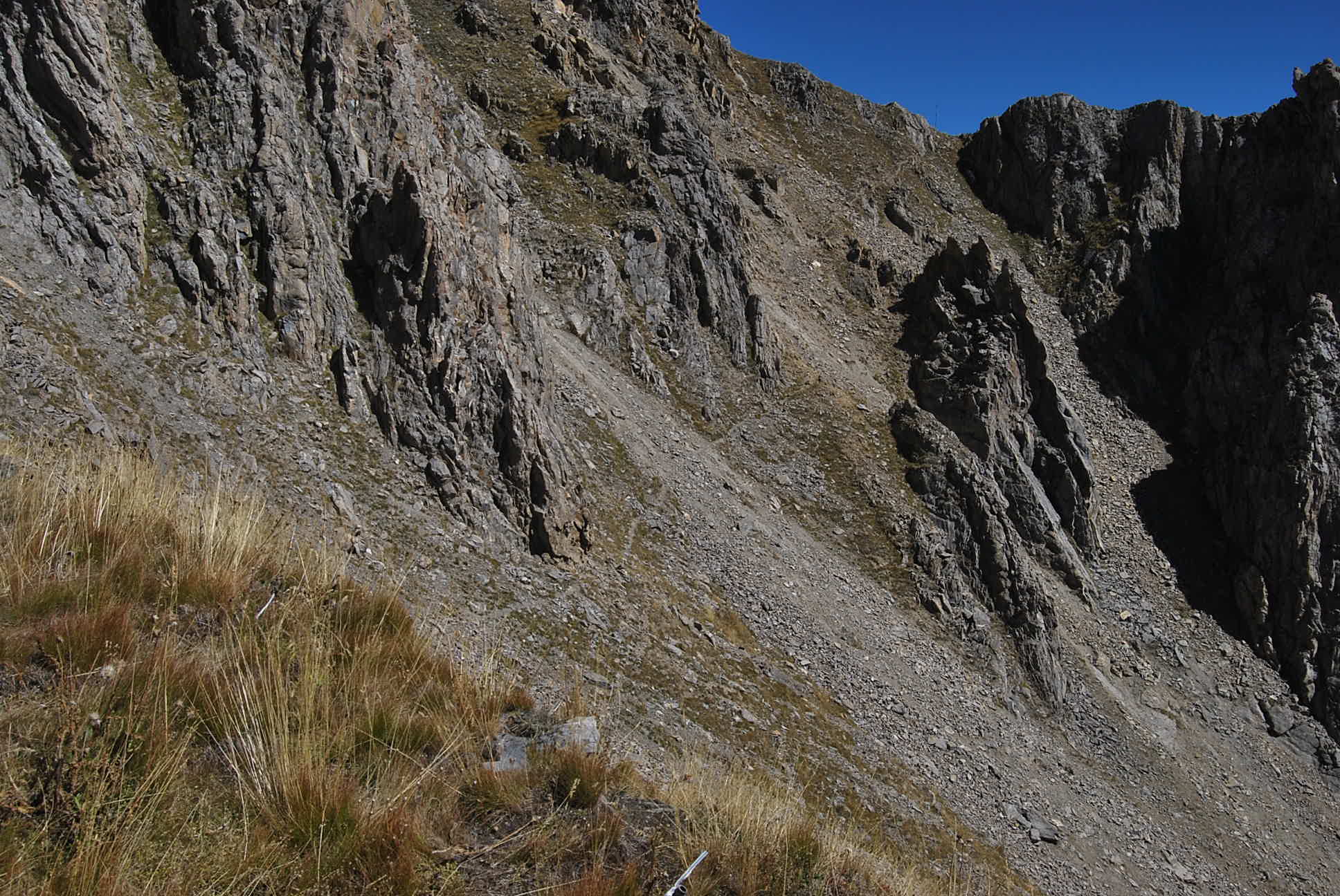
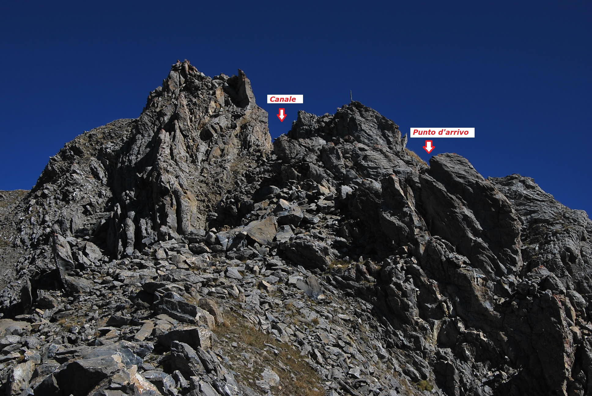
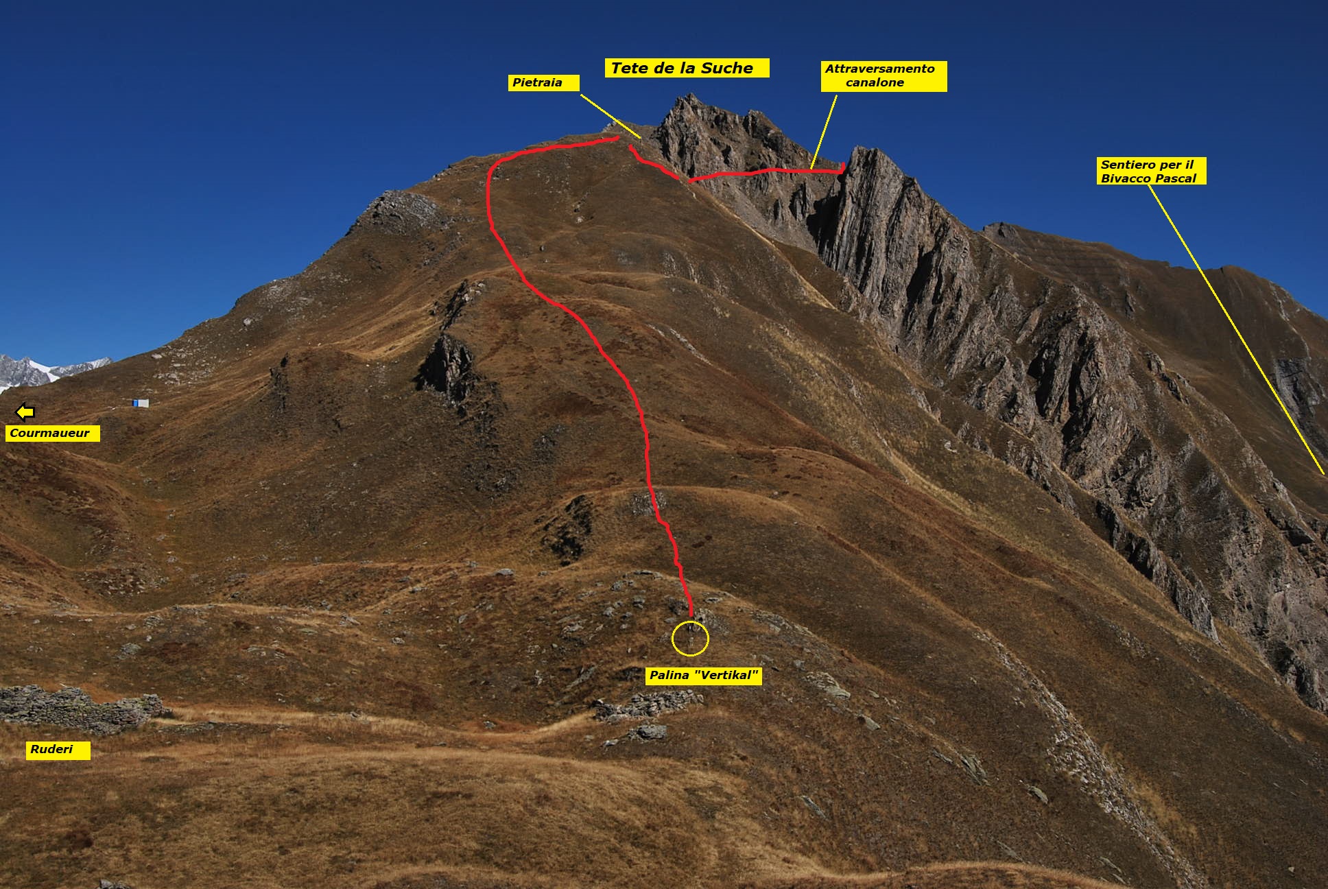
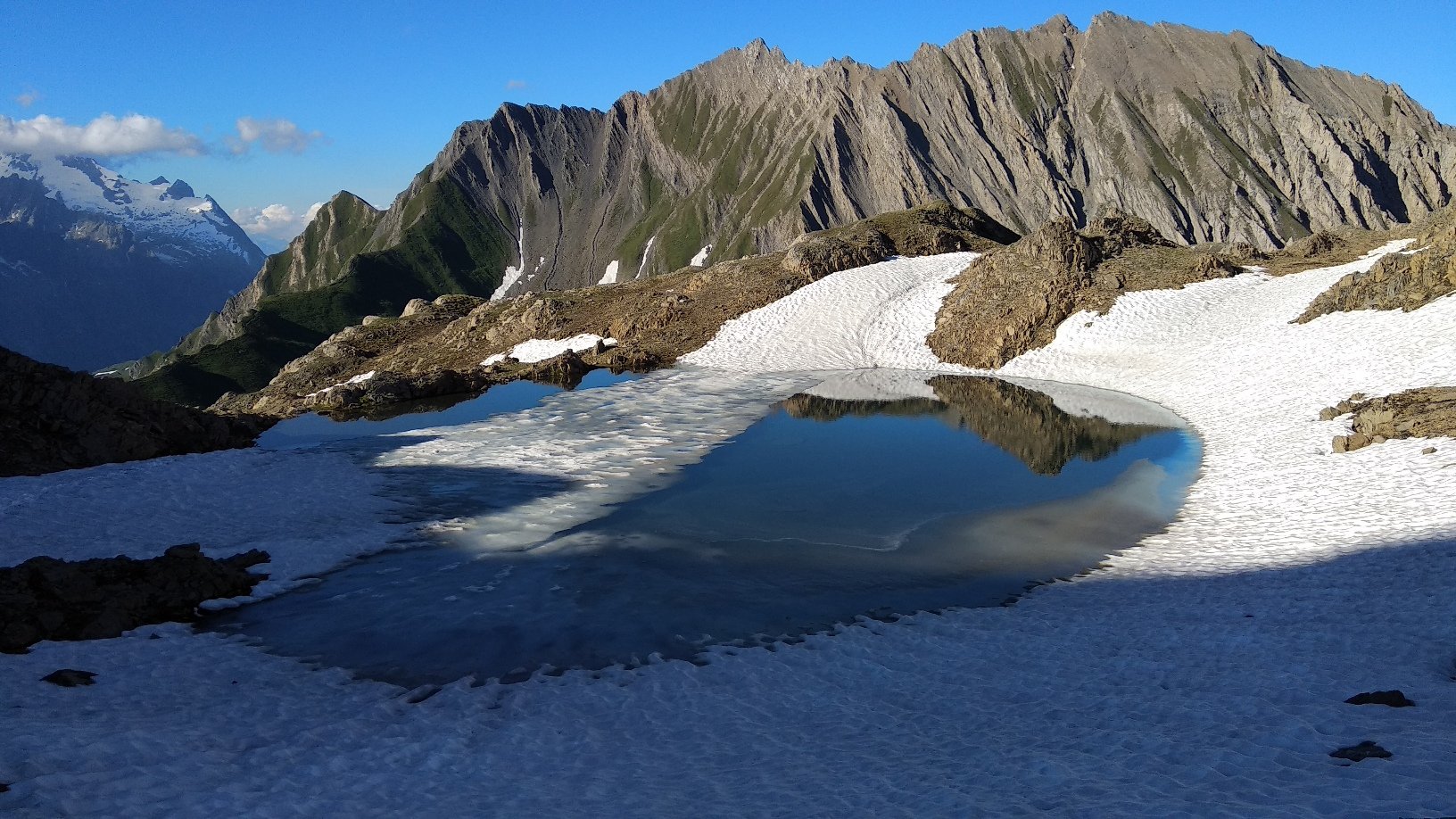
- dalla vetta del Cormet, risalito il panettone erboso verso la Tete de la Suche occorre attraversare il canalone per portarsi sul lato opposto dove – scendendo - si ritrova il sentiero per il Bivacco Pascal; l’attraversamento avviene su un traverso un po’ esposto, sul versante Morgex, da ricercare (possibili indicazioni sul terreno se sono passate competizioni sportive).
Avvicinamento
Si suggerisce la traversata da Courmayeur a Morgex / Dailley più che il viceversa per affrontare il Mont Cormet in salita anziché in discesa vista l’imprevedibilità del percorso.
La traversata non è banale, tenere presente che:
- a Tirecorne, nonostante l’indicazione agli alpeggi, trovare il sentiero di salita non è immediato viste le tante tracce di bestiame; però, una volta individuato, il sentiero accompagna fino in vetta, marcato e segnato da radi bolli gialli e ancora dalle residue tacche rosse al minio;
- la salita al Mont Cormet prevede alcuni tratti attrezzati, recentemente installati viste le frane nei canaloni nella zona dei paravalanghe;
- dalla vetta del Cormet, risalito il panettone erboso verso la Tete de la Suche occorre attraversare il canalone per portarsi sul lato opposto dove – scendendo - si ritrova il sentiero per il Bivacco Pascal; l’attraversamento avviene su un traverso un po’ esposto, sul versante Morgex, da ricercare (possibili indicazioni sul terreno se sono passate competizioni sportive).
Courmayeur può essere raggiunta sia in autobus che in auto lungo la SS26 della Valle d’Aosta.
Descrizione
Dalla via centrale di Courmayeur presso l’Hotel Royal si imbocca la Via Donselli e si raggiunge la località Pussey: la partenza è nei pressi della fontana/edicola votiva. Non vi sono indicazioni, si sale un po’ a tentativi tra sterrate di servizio e sentieri, si arriva comunque in vista della strada asfaltata che sale all’Ermitage e dalla quale si stacca una pista sterrata che finalmente riporta un’indicazione (freccia in legno) per La Suche e Verrand.
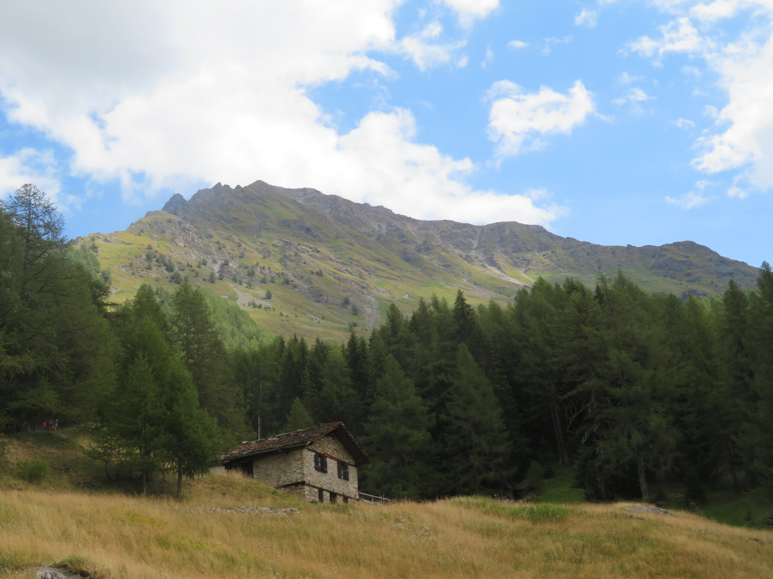
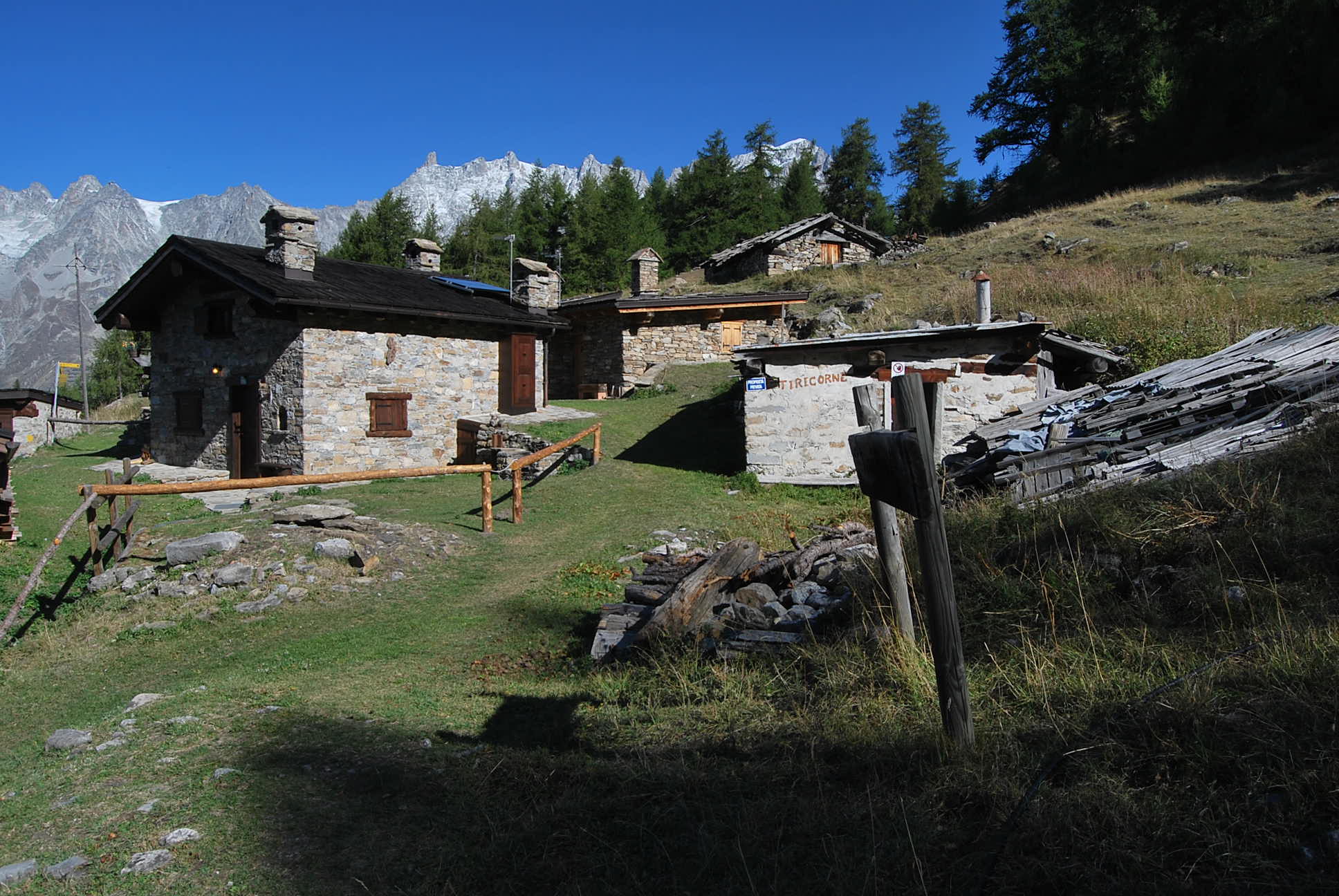
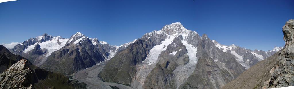
Si sale senza indugi, raggiungendo prima il bivio per l’Ermitage e poi quello per Tirecorne, indicati con le classiche targhe gialle con tempi di percorrenza. Si sale verso Tirecorne, raggiungendo prima gli alpeggi inferiori e quindi quelli superiori con incredibile vista sul Bianco; a Tirecorne vi sono indicazioni per il Mont Cormet ma viste le molte tracce imboccare il sentiero non è sempre immediato; come detto prima, però, una volta trovata la traccia è difficile da perdere, sempre ben marcata e segnata da bolli gialli e residue tacche rosse.
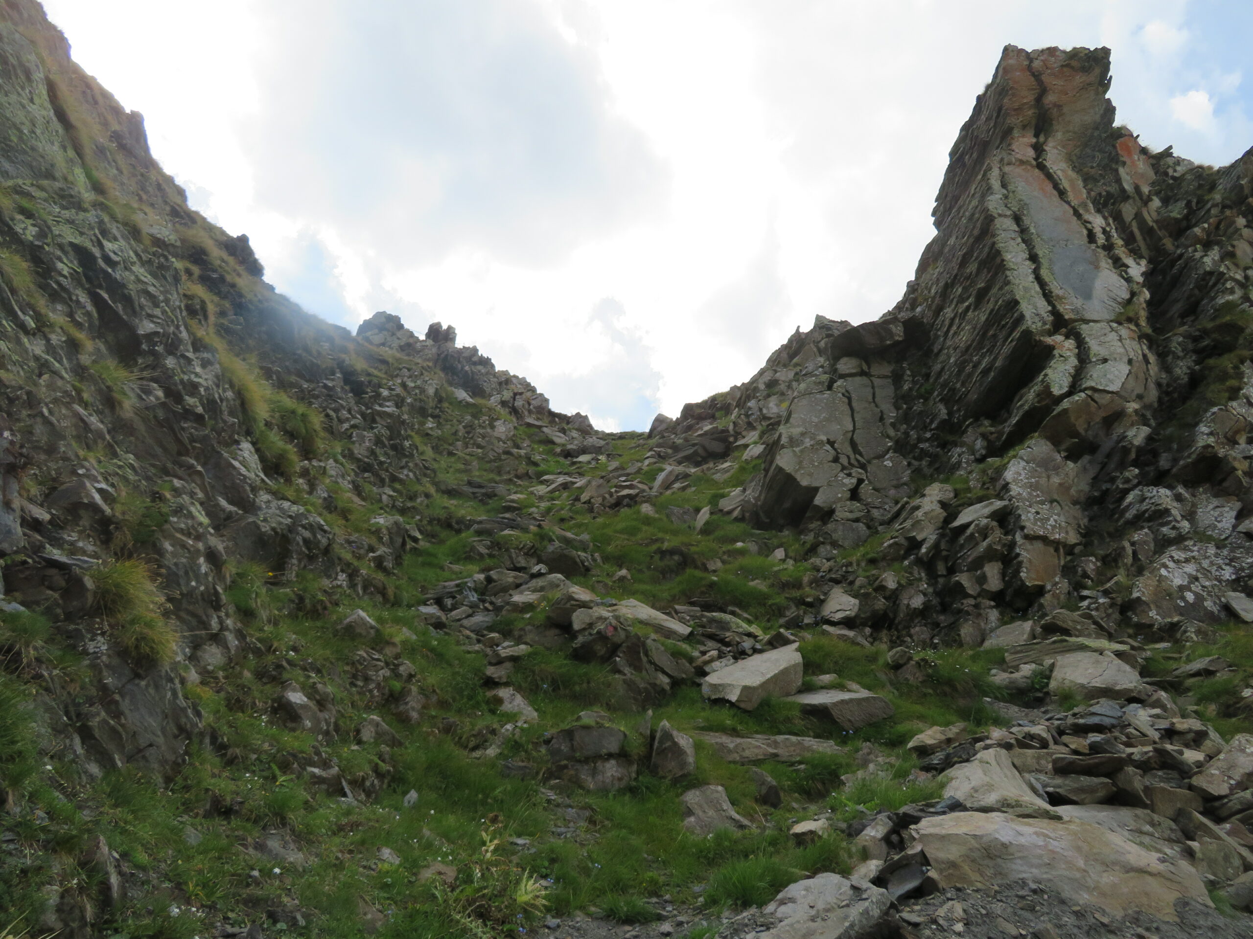
Dall’alpeggio il sentiero esce in piano dalla pineta e poi (a destra salendo) inizia a risalire il versante prativo avvicinandosi ad un primo canalone che viene costeggiato in salita con vari zig-zag fino al suo attraversamento; si attraversa un secondo canalone e ci si avvicina alla zona dei paravalanghe dove, a causa dei pesanti smottamenti, alcuni tratti sono stati attrezzati per gli attraversamenti e non sono comunque mai banali.
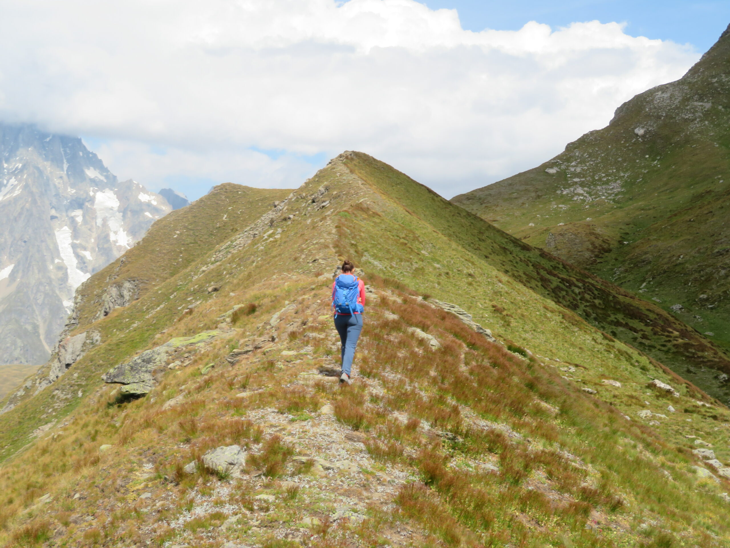
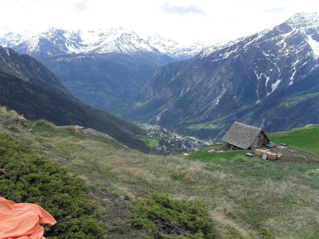
Attraversato questo tratto impegnativo si arriva al camino che sbarca sulla larga vetta, da dove si prosegue sulla cresta erbosa verso la Tete de la Suche; alla partenza presso i ruderi si vede anche un bollo sbiadito giallo/nero su masso però non c’è mai una vera traccia e si sale senza percorso definito. Se si risale alla sommità del panettone erboso si arriva ad una pietraia che collega con la cima della Tete: il suggerimento è di non tentare di attraversarla. Cercare invece, sotto la pietraia e sul “versante Morgex” un traverso che, un po’ esposto, attraversa il canalone. Percorrerlo, è stretto e detritico ma non è mai pericoloso, sull’altro lato si sbarca su terreno erboso; senza percorso definito e cercando le vie di minor pendenza scendere fino ad incrociare il sentiero, ben visibile, per il Bivacco Pascal lungo il quale si scende prima agli alpeggi della Villotta e poi all’abitato di Dailley
- Cartografia:
- Monte Bianco-Courmayeur, Fg. 01, Scala 1:25000 - L’Escursionista Editore
Nelle vicinanze Mappa
Itinerari
01/07/2026 AO, Courmayeur D+ 3750 m EE Varie
Tor des Geants/Giro dei Giganti Tappa 1: Courmayeur – Valgrisenche
0m
10/07/2019 AO, Courmayeur D+ 1652 m E Nord-Ovest
Liconi (Testa di) da Courmayeur per la Val Sapin
 0m
0m
12/07/2025 AO, Courmayeur D+ 9300 m E Tutte
Monte Bianco (Giro del) da Courmayeur, giro antiorario (4 gg)
 0m
0m
29/06/2025 AO, Courmayeur D+ 2382 m E Varie
Giro del Monte Bianco da Courmayeur a La Fouly
 0m
0m
26/07/2024 AO, Courmayeur D+ 1616 m E Varie
Berrio Blanc (Colle del) da Dolonne, anello per Col de la Seigne, Col des Charmonts e Mont Fortin
 750m
750m
26/04/2012 AO, Courmayeur D+ 868 m E Sud
Courba Dzeleuna da Dolonne
 750m
750m
12/09/2018 AO, Courmayeur D+ 1440 m E Tutte
Arp (Col d’) da Dolonne, anello per Colle di Youla e discesa per la Val Veny
 750m
750m
23/06/2009 AO, Courmayeur D+ 1450 m E Nord-Est
Youla (Colle di) da Dolonne
 750m
750m
10/08/2013 AO, Courmayeur D+ 1536 m E Varie
Arp (Testa d’) da Dolonne
 750m
750m
12/08/2025 AO, Courmayeur D+ 1200 m EEA Sud-Est
Chetif (Mont) da Courmayeur per il sentiero attrezzato del Bicentenario CHIUSO PER MANUTENZIONE agosto 2025
 850m
850m