150m
150m
Note
 50m
50m
50m
50m
1.1Km
1.8Km
1.8Km
1.8Km
1.8Km
50m
50m
50m
50m
1.1Km
1.8Km
1.8Km
1.8Km
1.8Km
150m
3.9Km
3.9Km
5.4Km
5.6Km
6.9Km
7.8Km
8.8Km
8.8Km
9.6Km
Itinerario non esattamente logico di circa 18km di sviluppo senza difficoltà tecniche e, meteo permettendo, con splendidi panorami a 360 gradi soprattutto nel percorrere la cresta tra Oilletta e Leysser. Più naturale sarebbe dividere l'anello Punta Oilletta-Leysser dall'ascensione al Monte Rosso oppure, partendo da Vetan, unire il Monte Rosso alla Leysser in modo da limitare discese e risalite, ma per chi ha volontà le tre punte insieme sono una buona soddisfazione. Seguendo l'itinerario descritto: difficoltà E fino al Monte Rosso(roccetta elementare solo tra anticima e cima), difficoltà EE per il traverso dalla base del canale sotto il Monte Rosso al sentiero 13a sotto il Colle Paletta; difficoltà EE dal Colle Paletta ad intercettare il sentiero 19 verso il Lago Leysser ; difficoltà E da Lago Leysser a Lago di Joux.
Avvicinamento
autostrada A5 uscita Aosta ovest, seguire per Courmayeur; poco prima di Cognein (frazione di Saint Pierre) prendere a destra la SR22 per Saint Nicolas e dopo Saint Nicolas tralasciare il primo bivio per Vetan e assecondare il secondo per Vens. Giunti a Vens si può parcheggiare all'inizio del paese e prendere il sentiero 29 da qui(cartelli),. Non è possibile salire in auto a parcheggiare al Col de Joux (multe)
Descrizione
Da Vens salire al Lago di Joux seguire il sentiero 29 ben tracciato e segnato fino alla punta Oilletta. Usciti dalla prima parte boschiva si trova un bivio; il sentiero 29 prosegue diritto (frecce gialle su pietra) mentre sulla destra parte una traccia più ripida, poco più sopra le tracce si riuniscono. Giunti a un piccolo pianoro erboso la scelta triplica: diritta di fronte a noi una marcata traccia risale ripida verso la vetta; il sentiero 29 curva a destra (sempre segni) prendendo la salita in modo più morbido mentre una terza scelta, inizialmente poco visibile, è salire a sinistra verso la cresta dove si trova un’ulteriore traccia. Pochi metri prima della madonnina di vetta, poco sotto una centralina meteorologica, tutte le tracce si riuniscono.
Dalla Punta Oilletta (m.2616) la traccia bollata di rosso prosegue per tutta l’altalenante e semplice cresta passando poco sotto l’anticima della Leysser per poi raggiungere la croce di vetta 2771 m.
Sempre seguendo i bolli rossi si scende il versante nord della Leysser fino al colle Paletta; breve tratto assicurato con cavi metallici utili in caso di terreno bagnato/ghiacciato.
Dal Colle Paletta (m.2707) si prende il sentiero 13 in discesa per il rifugio Mont Fallere; si perdono poco meno di 200m fino a un cartello che ci indica la deviazione per il Monte Rosso (ca m.2530). La traccia molto ben segnata sale fino ad attraversare la parte alta di un canale (in questo traverso fare attenzione verso l’alto a possibili scariche dovute a ungulati) per poi raggiungere la rocciosa ma semplice e piana cresta che porta alla piccola croce di vetta.
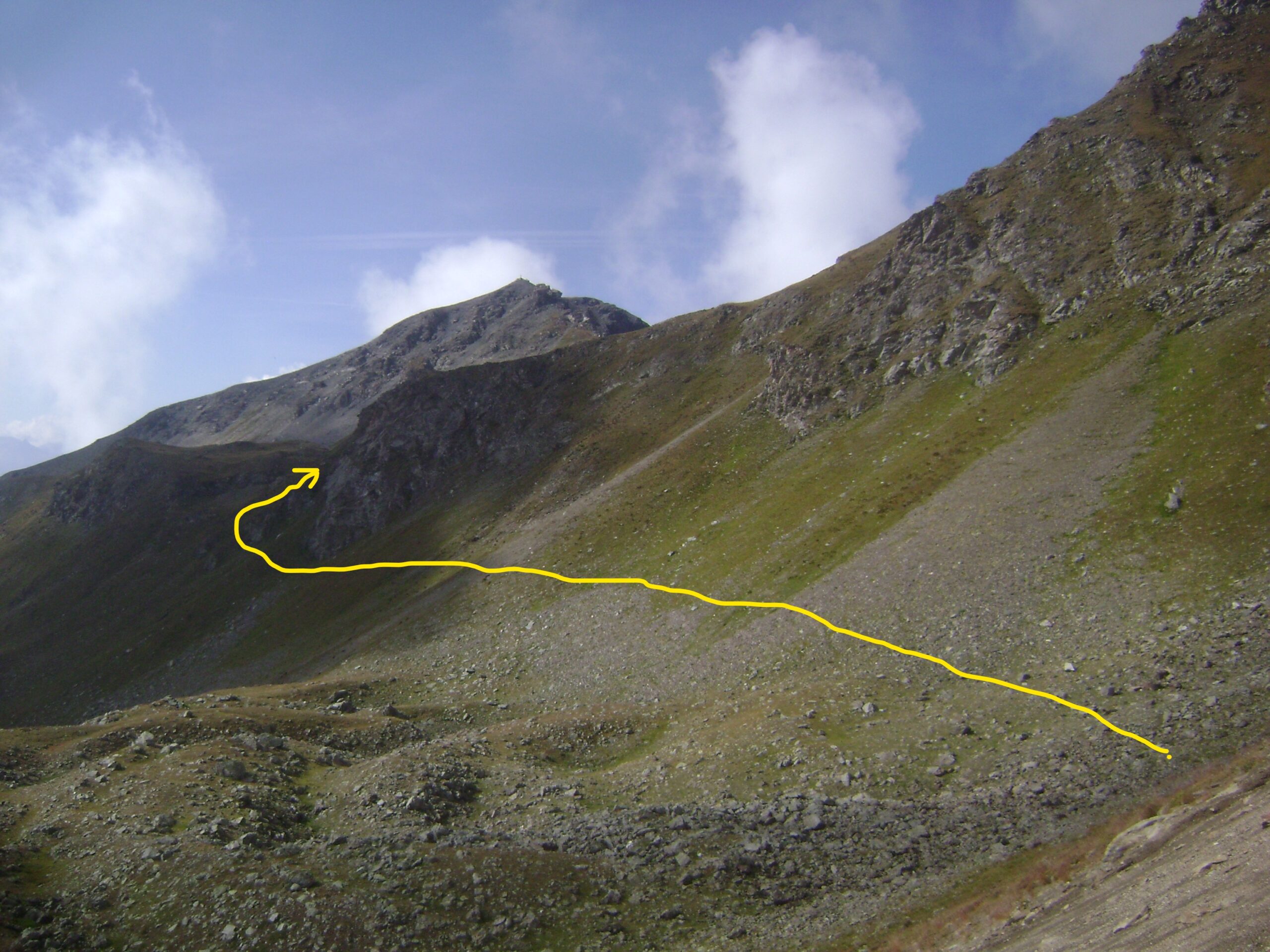
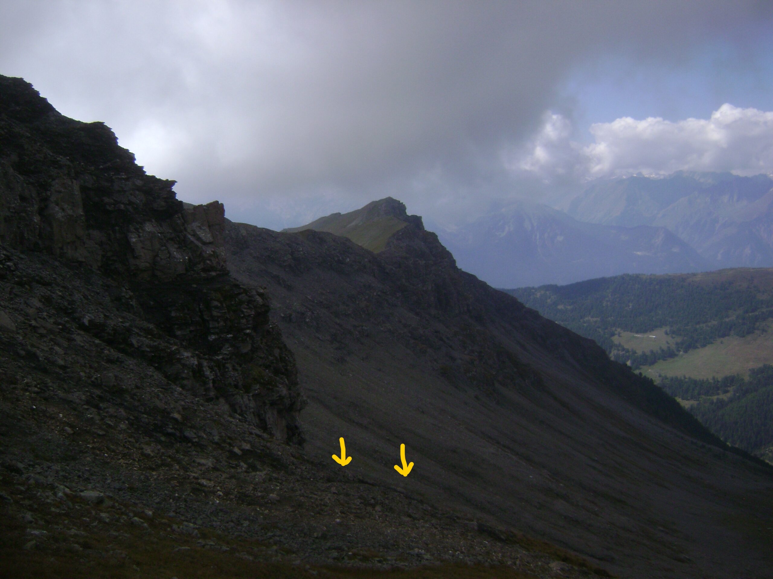
Ritorno fino al Colle Paletta come per la salita oppure variante (da evitare con scarsa visibilità): in discesa ripercorrere il traverso nella parte alta del canale, procedere lungo il sentiero di salita fino al punto in cui il canale da poco attraversato perde pendenza e diventa accessibile; attraversarlo piegando a destra e percorrere a vista un lungo traverso tra erba e semplici pietraie cercando di non perdere quota e puntando le balze rocciose sottostanti il Colle Paletta. Giunti sotto le balze si trova qualche traccia e ometto, prendere la traccia più alta che intercetta il sentiero 13a per il colle.
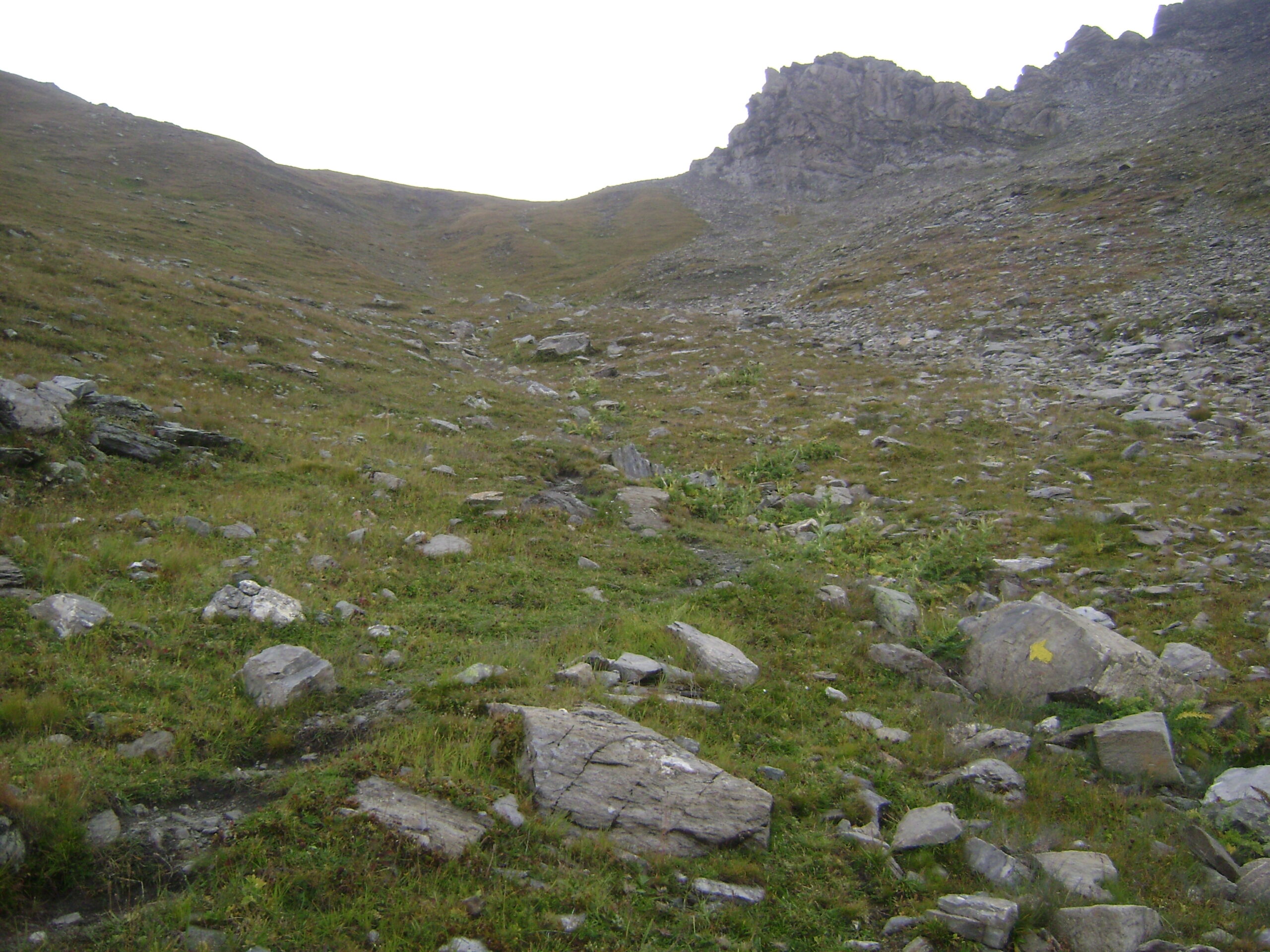
Di nuovo al Colle Paletta scendere dal ripido versante opposto. Tenendosi verso sinistra si intercetta una traccia con qualche segno giallo. Scendere comunque cercando la via migliore, qualche segno aiuta, ogni tanto anche una parvenza di traccia tra erba e fasce di pietre. Quando l’inclinazione diminuisce i segni si fanno più numerosi, la traccia diventata evidente porta ad attraversare una pietraia alla destra di un ampio pianoro erboso, risale brevemente e scende al lago Leysser. Dal lago seguire la traccia 19, prima sentiero poi stradello, fino al punto di partenza.
Nelle vicinanze Mappa
Itinerari
28/09/2025 AO, Saint-Nicolas D+ 900 m E Varie
Dzioule (Punta di) e Bivacco Claudio Bredy Claudio ai Laghi di Dzioule da Vens/Jovençan
 50m
50m
07/06/2026 AO, Saint-Nicolas D+ 877 m E Sud
Aquiletta (Punta) o Ollietta da Vens
 50m
50m
29/06/2026 AO, Saint-Nicolas D+ 1200 m EE Tutte
Leissè o Leysser (Punta) da Vens, anello per il Lago Leysser
 50m
50m
02/06/2023 AO, Saint-Nicolas D+ 1100 m EE Sud-Est
Serena (Testa di) da Vens/Jovençan per il Vallone di Vertosan e il Bivacco Bredy
 50m
50m
22/07/2024 AO, Avise D+ 150 m T Sud
Freney (Cascata di) da Cerellaz
 1.1Km
1.1Km
29/11/2025 AO, Avise D+ 500 m E Nord-Ovest
Saint Nicolas da Avise
 1.8Km
1.8Km
13/02/2023 AO, Avise D+ 1184 m E Varie
Cammino Balteo tappa n.15 da Avise a Introd
 1.8Km
1.8Km
30/04/2024 AO, La Salle D+ 862 m E Varie
Court de Bard da Vedun, anello
 1.8Km
1.8Km
29/07/2023 AO, Avise D+ 1050 m E Varie
Bredy Claudio (Bivacco) ai Laghi di Dzioule da Vedun
 1.8Km
1.8Km
15/08/2012 AO, Avise D+ 400 m E Sud
Joux (Col de) da Vedun, anello
1.8Km
Servizi
150m
3.9Km
Atanor Ristorante
Arvier
3.9Km
Beau Sejour Albergo
Arvier
5.4Km
Notre Maison Albergo
Saint Pierre
5.6Km
Vetan Ristorante
Saint-Pierre
6.9Km
Le Vieux Noyer B&B
Saint-Pierre
7.8Km
Lo Foo Ristorante
La Salle
8.8Km
La Jolie Bergere Albergo
La Salle
8.8Km
Paramont Albergo
Arvier
9.6Km