1.8Km
1.8Km
Note
Storico
 50m
50m
100m
100m
150m
400m
400m
400m
400m
400m
50m
50m
100m
100m
150m
400m
400m
400m
400m
400m
1.8Km
1.8Km
1.9Km
2.4Km
2.4Km
 2.5Km
2.5Km
4.5Km
4.6Km
4.6Km
5.3Km
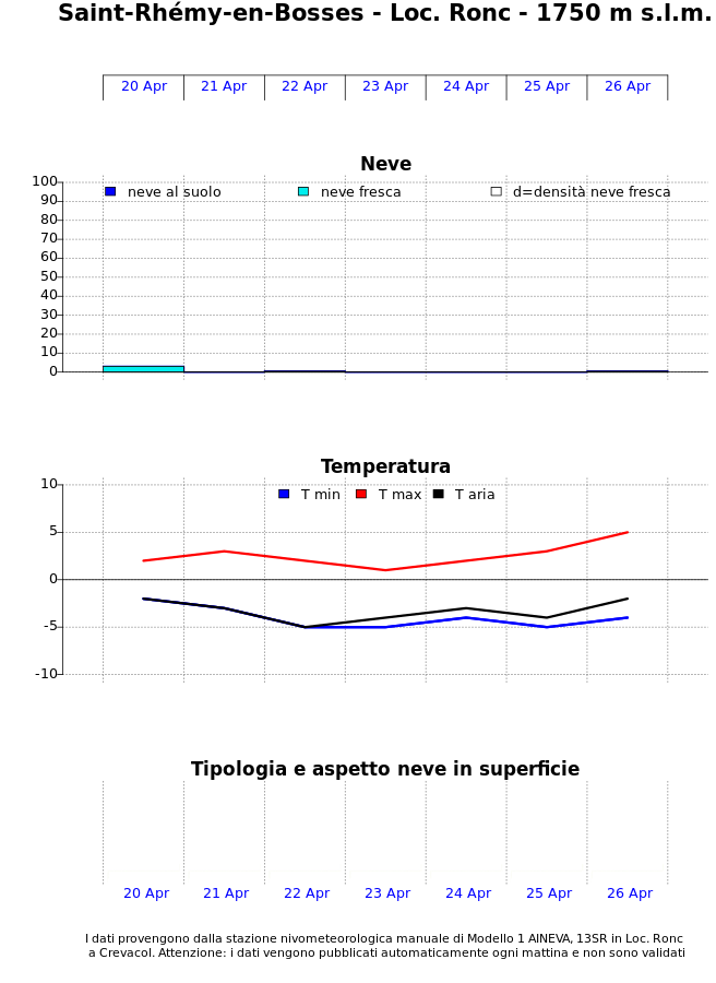
materiale: rinvii, camme dal 0.3 all 1, i corda da 60m o mezze corde
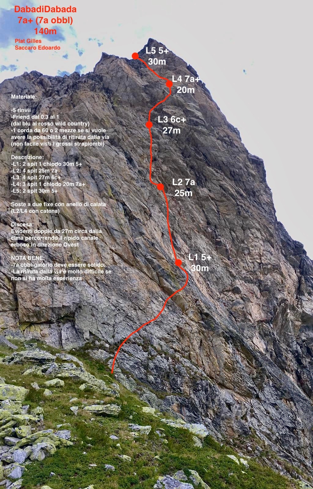
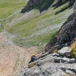
La ritirata in doppia è resa difficile dalla parete strapiombante
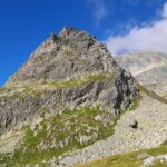
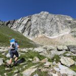
Avvicinamento
La ritirata in doppia è resa difficile dalla parete strapiombante
Seguire la strada statale SS27 che porta al colle del Gran San Bernardo e parcheggiare in prossimità dell’alpeggio “Lo Baou”.
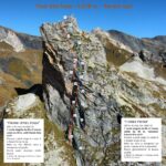
L’evidente torrione di roccia (“Tour du fou”) si trova ad una 15ina di minuti a piedi dalla strada e la linea “DabadiDabada” (ometto di pietre alla base) si trova nella parte strapiombante (Ovest)
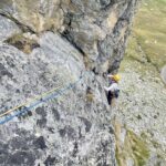
Descrizione
L’evidente torrione di roccia (“Tour du fou”) si trova ad una 15ina di minuti a piedi dalla strada e la linea “DabadiDabada” (ometto di pietre alla base) si trova nella parte strapiombante (Ovest)
- L1: 2 spit 1 chiodo, 30m – 5+
- L2: 4 spit , 25m – 7a
- L3: 4 spit , 27m – 6c+
- L4: 3 spit 1 chiodo, 20m – 7a+
- L5: 2 spit, 30m – 5+
Gilles Plat e Edoardo Saccaro, 2020
Nelle vicinanze Mappa
Itinerari
19/07/2026 AO, Saint-Rhémy-en-Bosses 6b, 6a obbl. Sud-Ovest
Fous (Tour des ) – Grand Hotel Italia
 50m
50m
16/07/2026 AO, Saint-Rhemy-En-Bosses 7a+, 6c obbl. Ovest
Fous (Tour des) – Capitano Nemo
 50m
50m
25/08/2025 AO, Saint-Rhemy-En-Bosses 6b, 5b obbl. Sud
Fous (Tour des) – Via Pierre Atzori
 100m
100m
13/07/2026 AO, Saint-Rhemy-en-Bosses 6c, 6a+ obbl. Sud-Ovest
Fous (Tour des) – Cumba Freida
 100m
100m
17/08/2025 AO, Saint-Rhemy-En-Bosses 6a, 5a obbl. Nord
Fous (Tour des), sperone nord – Tous Fous
 150m
150m
18/08/2025 AO, Saint-Rhemy-En-Bosses 6b+, 6a+ obbl. Nord-Est
Pain de Sucre, anticima 2796 m parete E/NE – Tranta Pürghi
 400m
400m
20/06/2025 AO, Saint-Rhemy-En-Bosses 6b+, 6a+ obbl. Nord-Est
Pain de Sucre, anticima 2750 m Parete E/NE – Free Free Palestine
 400m
400m
12/07/2025 AO, Saint-Rhemy-En-Bosses 6c, 6b+ obbl. Nord-Est
Pain de Sucre, anticima 2796 m Parete E/NE – Occhi Rossi a Colazione
 400m
400m
29/06/2026 AO, Saint-Rhemy-En-Bosses 6a+, 6a obbl. Nord-Est
Pain de Sucre, anticima 2750 m Parete E/NE – La Banda degli Onesti
 400m
400m
16/08/2025 AO, Saint-Rhémy-en-Bosses 7a+, 6c obbl. Nord-Est
Pain de Sucre, anticima 2796 m parere E/NE – Diamonds and Rust
 400m
400m
Servizi
1.8Km
 1.8Km
1.8Km
Albergo Italia Albergo
Saint-rhemy-en-bosses 1.9Km
1.9Km
Du Lac Ristorante
Saint-rhemy-en-bosses 2.4Km
2.4Km
Hospice du Grand-St-Bernard Albergo
Bourg-St-Pierre 2.4Km
2.4Km
Auberge de l’Hospice Ristorante
Bourg-Saint-Pierre
2.5Km
De l’Hospice Rifugio
Bourg-Saint-Pierre 4.5Km
4.5Km
Arp du Jeu Ristorante
Saint-rhemy-en-bosses 4.6Km
4.6Km
Grand Golliat B&B
Saint-rhemy-en-bosses 4.6Km
4.6Km
Grand Golliat Ristorante
Saint-Rhemy-En-Bosses 5.3Km
5.3Km